Argentière Glacier Hike, a Beautiful Glacier in the Mont Blanc Massif, France
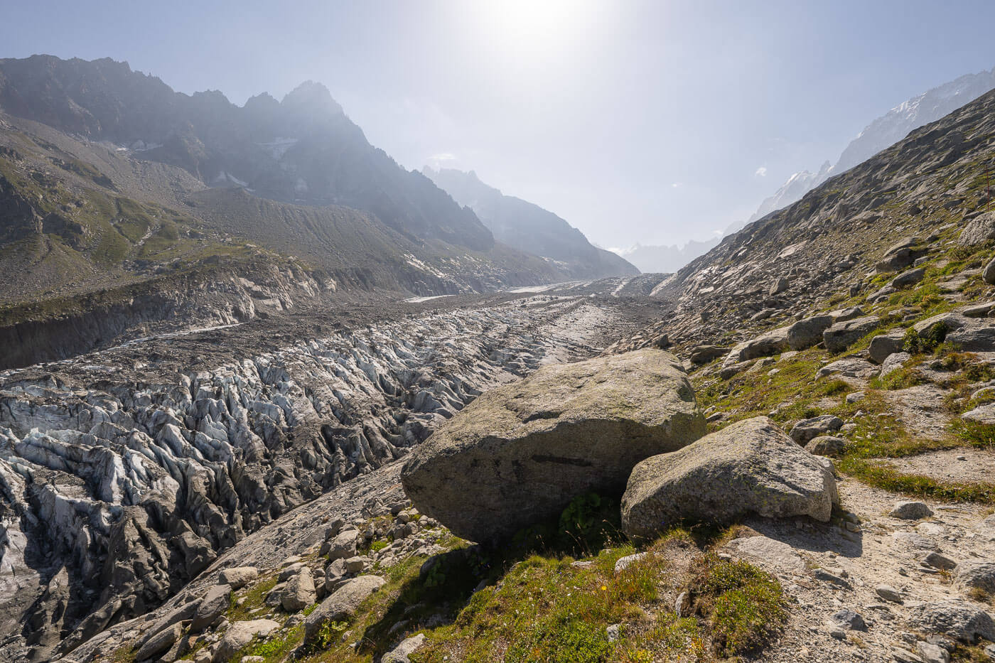
The Argentière Glacier (Glacier d’Argentière in French) is a stunning hike in the Mont Blanc massif near Chamonix, leading to one of the region’s most beautiful glaciers. While the glacier is technically divided into two sections—one at an altitude of about 1,250 m and another at around 1,900 m—it’s the front of the upper glacier that makes this hike truly unique.
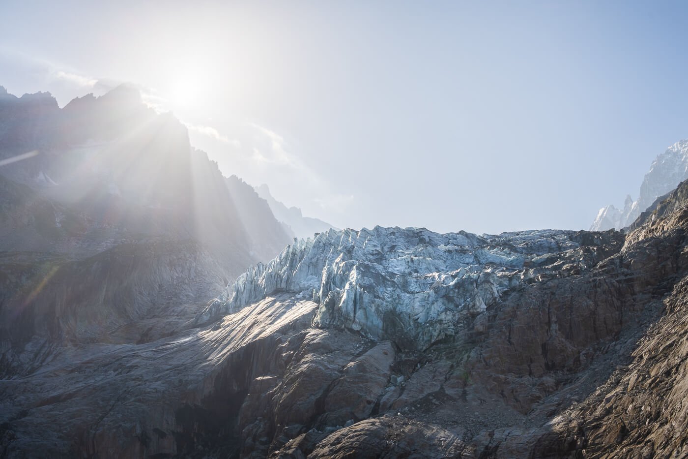
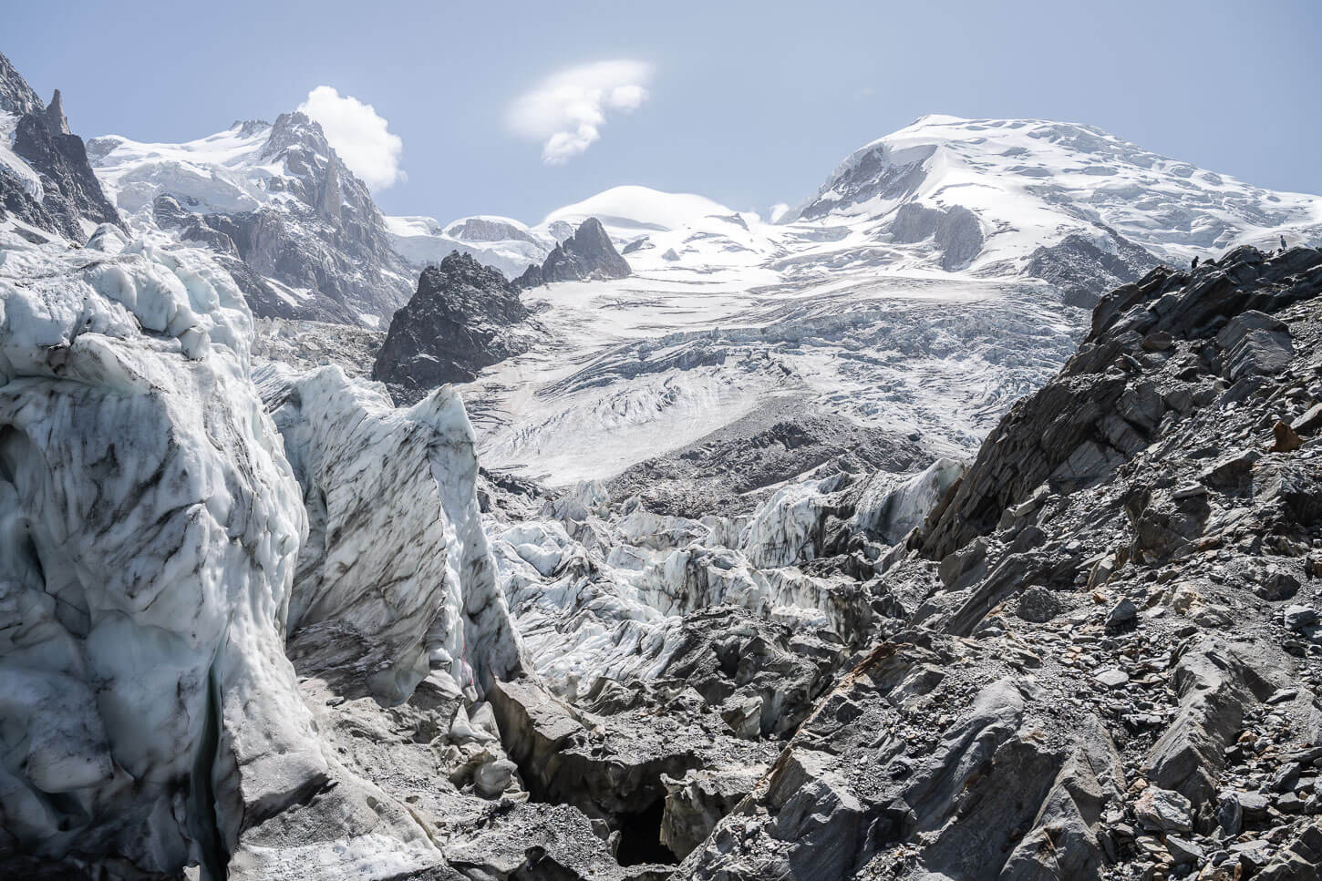
Glacier d’Argentière.
Beautiful seracs with an almost marble-like texture, changing color with the shifting light, seem to perch atop the huge cliff that separates the upper and lower parts of the glacier. This is truly a stunning sight, even in a region with no shortage of beautiful glaciers.
The Hike to the Argentière glacier, with more than 1,100 meters of total elevation gain within 5.5KM, is rather tough on the legs. However, you’ll be rewarded for the effort by the unique sight of the glacier. The stunning glacier front is quite close to the trail, and a sight to behold.

Table of Contents
Overview of the Argentière Glacier Hike & Map
As mentioned in the intro, this is one steep trail. If you do the hike clockwise, as I did, the elevation gain is considerable. It’s 1,160m in 5.5km. It’s less demanding the other way around, and the elevation gain would be spread across almost twice the distance.
Likewise, going back downhill, it’s quicker to follow the steepest, shortest trail than to take the longer one. If you do, I recommend bringing hiking poles; the steepest part of the trail is actually a gravel road for the most part, and it would be fairly easy to slip on the fine gravel you’ll find on that road.
Apart from that, the trail does not offer any real challenge, so it’s suitable for anyone who can complete that distance/elevation gain. Also, while this is a summer to mid-autumn hike, weather and snow permitting, a backcountry ski track follows the same trail.
Do note that when I hiked this trail, there were some construction works in the area around the trailhead and one of the cable car stations on the mountain. So the real trail may differ a bit once the works are completed, or during weekdays if there are construction works going on. Always follow the trail marks.
| Max Altitude | 2,340 m |
|---|---|
| Distance | 14.0 KM |
| Elevation gain | 1,160 m ↑ / 1,160 m ↓ |
| Hike time | 04:30/ 05:30 Hours |
| Hike Difficulty | Moderate – with a tough elevation gain |
Here is the map of the hike. You can download the GXP file for free from the activity linked below.
How to get to the Argentière Glacier Trailhead and Parking
The trailhead is easily accessible, ans it is in the middle of the beautiful little town of Argentière.
- Driving Directions: If you are coming from the North, you’d have to head either to Geneva or Martigny. From Geneva, you will need to cross the border into France. Then, take highway A40 toward Chamonix and the route N205, until Chamonix. From Chamonix, you can continue to Argentière. It’s about 15 minutes from Chamonix to Argentière. From Martigny, you’d have to drive through mountain passes, toward Forclaz/Col des Grands Montets. From Italy, you’d have to drive through the rather expensive Mont Blanc tunnel, or you can drive through the San Bernardo tunnel and then go to Martigny, and follow the road to Forclaz/Col des Grands Montets from there.
- Parking: There are several parking areas in Argentiere. The easiest place to park the car is the Parking de Grands Montets, which is rather big and has a dedicated section for Vans/Campers.
- Public Transport: The Argentiere train station is the best place to stop at if you are planning to use public transportation. Either by train or by bus.
The Argentière Glacier Hiking Trail
If you decide to follow this loop the same way I did, clockwise, you’ll have to tackle a relentlessly steep gravel road. The trail does cut the road from time to time, but that isn’t much of a relief. From time to time, I turned back to watch the valley, and I could see the houses in Argentière getting farther and farther away, but mostly vertically.
This is approximately 2.5 kilometers, as the trail enters a detour through the forest, where it continues to climb at a gentler pace. After another 1.5 kilometers, you’ll find yourself in front of the Lognan hut (Chalet Refuge de Lognan).
To continue, you can walk around the hut to the side opposite where you came from, where all of a sudden you’ll catch the first view of the glacier right in front of you. I stopped in my tracks as I wasn’t expecting such a view already. The glacier is still quite distant, but it sure makes an impression.
If the child had been open when I visited, I would have surely sat for a short break to enjoy a coffee and a croissant, and just look at the glacier.
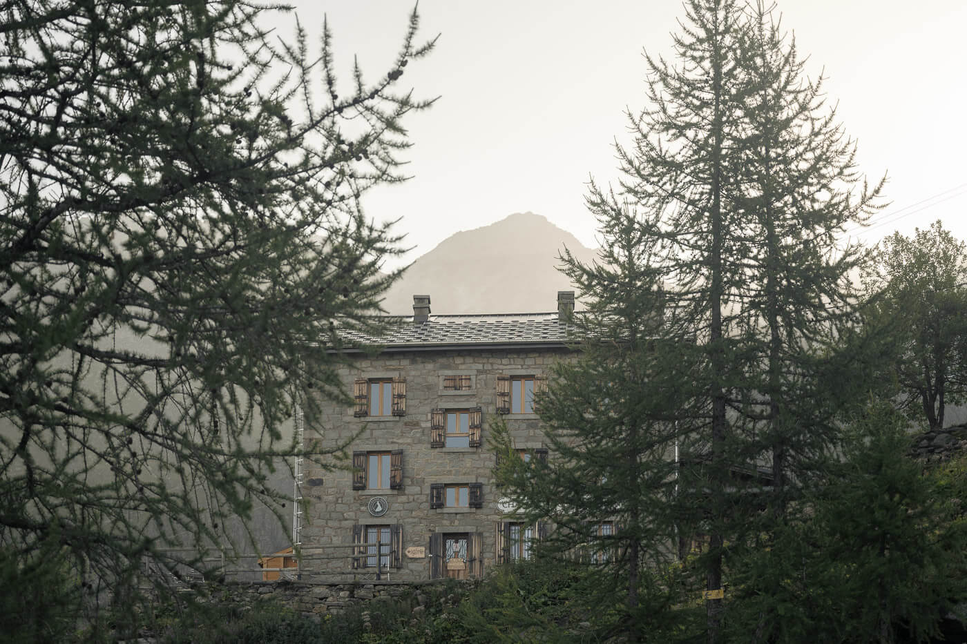
Chalet Refuge de Lognan.
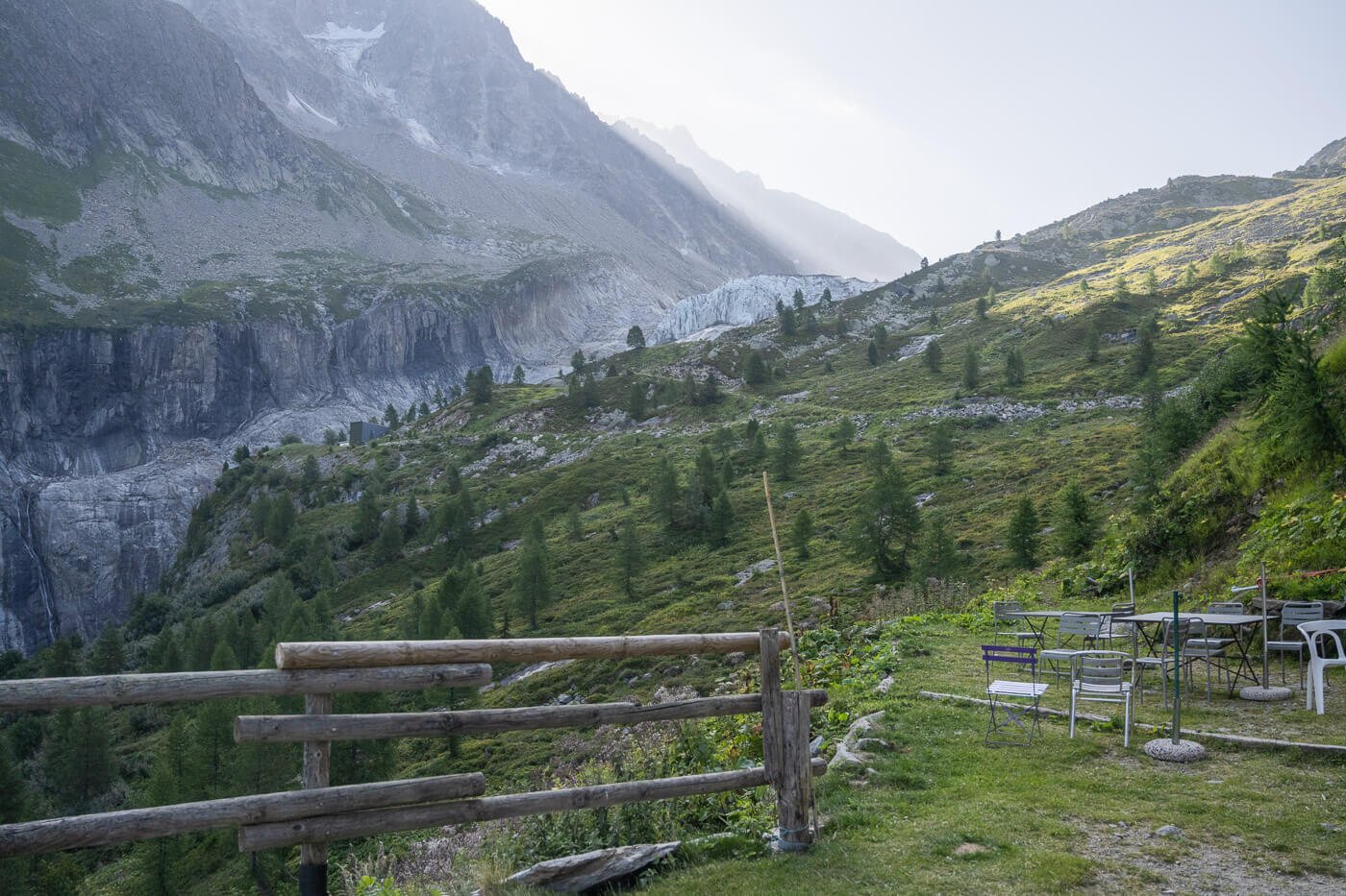
First view of the glacier, behind the Chalet Refuge de Lognan.
The Glacier Front and its Seracs
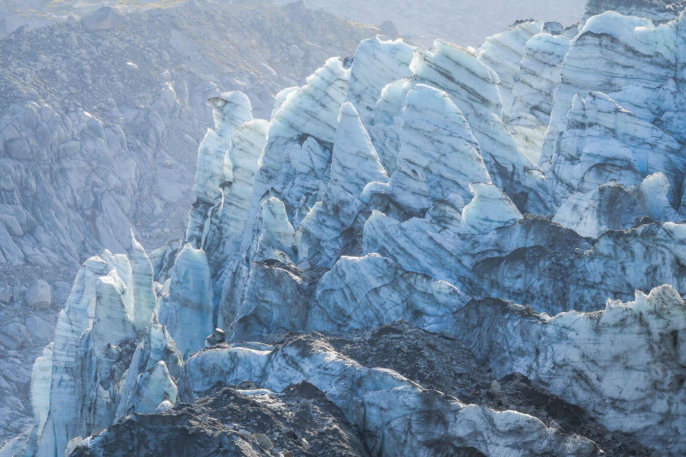
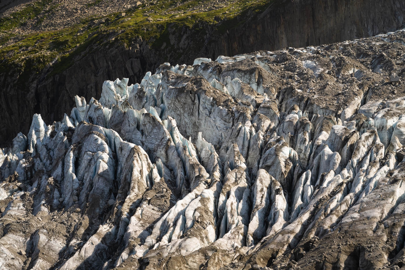
From the hut, take the narrow trail that follows the glacier valley uphill. Here, it’s a short walk on a trail that connects with another gravel road. From here, you’ll soon reach a wide area, also used for Helicopter landing. This is where you’ll probably find the best viewpoints of the Argentière glacier front. These are truly some amazing views of all the seracs that look almost like white marble, with all the texture from the dust and rocks that fell on top of the glacier through the years.
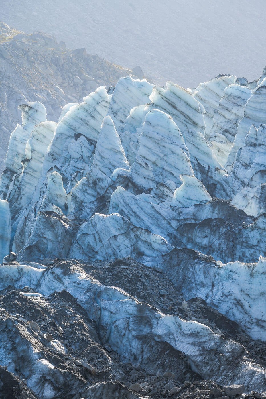
The seracs have a texture that reminds one of white marble.


The trail then continues further uphill on a relatively steep but slippery trail with a lot of loose rocks. Hiking poles would be of help here, especially if you are planning on returning via this section instead of doing the whole loop.
Glacier d’Argentière Point de Vue
The trail gets closer and closer to the glacier front until you reach a steep section with lots of loose rocks that will lead you to a junction, where a few trails meet.
One is the gravel road that you would have to take to hike back down to Argentière. Another trail follows the glacier closer and leads to the Refuge d’Argentière hut, a trail that requires walking on the glacier, so only for those who have those skills. The other is the trail that leads to the “Point de Vue” – literally, Viewpoint. This is the endpoint of this hike.

Le Point de Vue is the endpoint of the hike.


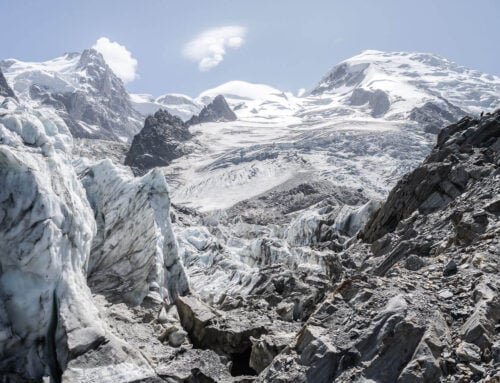
Here you’ll have to follow the trail atop a morainic deposit to the marked “Le Point de Vue” where you have a better perspective of the whole Argentière glacier, as well as all the other peaks of the Mont Blanc Massif that surround the Argentière glacier.
You can’t see the whole glacier as it stretches far beyond what the eye can see from the Point de Vue. However, that gives you a good sense of how big the glacier really is.
View from “Le Point de Vue”

To head back, the trail mostly follows another gravel road, for about the first ..KM downhill. I could not resist passing by the glacier front on the way back, as it is only a short detour. I’m glad I did, as by that time, the sun completely lit the glacier.

Once back on the gravel road, you’ll pass by two huts at one point, and here the trail enters the forests. From here, it keeps descending in the forest on a more gentle gradient until reaching the town of Argentière again.
Argentière Glacier Photos and Photography Tips
Purely from a landscape photography perspective, the Glacier front is the main attraction. such as a beautiful natural formation, is fun to photograph too.
I choose to hike to the glacier in the morning to catch some backlight and the sun hitting the glacier. The idea was to catch the glacier so that I would have the warm light of the sun hitting the top of the glacier, while the rest was still in the shadow. The hope was that it would give a nice contrast between the cold, blue tones of the glacier in the shadow and the warmer tones of the sunlight, as the sun rose behind the beautiful mountains that tower above the glacier.

However, I think this would be good for later in the afternoon or even sunset, as the light of the afternoon golden hour hits the glacier, which faces west. I will likely be back to test that myself at some point in the future.
I mostly used my 24-70 lens, but also my 70-200. I’d recommend having a longer lens here, as it allows for capturing the smaller and beautiful details and textures of the various seracs of the glacier. A very fun thing to do. I also spent quite a lot of time just looking at the glacier through my telephoto lens. Such was the beauty of this glacier.


Argentière Glacier Video
Here is a short video with impressions of the Argentière Glacier taken during my hike.
Where to stay
While Chamonix is only a short drive away, and a very popular, vibrant town to stay at, Argentière has its own charm; the charm of a mountain village rather than that of a town in the mountains. Still, there are good bars and restaurants – and boulangeries. So if you prefer a small mountain town with a little more character, I’d recommend Argentière. If you prefer the town vibe, go for Chamonix.
Also, if you want to camp, there is a campsite in Argentière, apart from the already mentioned Parking de Grands Montets where it is possible to spend the night. – and there are a few more in Chamonix too.
Leave A Comment