Hiking in Italy, Pizza, Pasta and Hiking Trails. An Introduction
Italy, renowned for its art, cuisine, and history, probably isn’t the first destination that comes to mind when it comes to Hiking. Sure, Pizza, Pasta, and the usual stuff. I know, and before you say anything, I’d like to point out that I am Italian :).
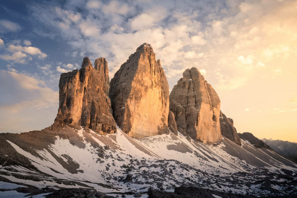
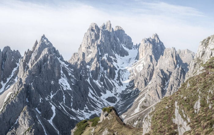
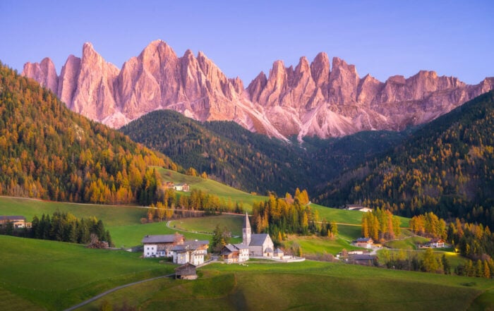
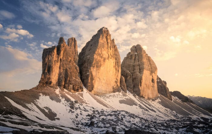
Le Tre Cime di Lavaredo at sunset, Dolomites.
Still, Italy has a long hiking and mountaineering tradition. Also, Italy is the only country that encompasses the whole arch of the Alps. That’s a lot of mountains. And trails. Not only that, but the whole Apennine mountain range stretches from Liguria to Calabria, more than 1200km. Even in the Apennines, some mountains are almost 3,000 meters high, like the Gran Sasso d’Italia (2.914 m).
For starters, more than 75% of the terrain in Italy is Mountains, and there are more than 160,000 KM of hiking trails. Only about half of them have been properly tracked by CAI (Club Alpino Italiano), and some of them are full of history, which adds another layer to the experience of being in nature.
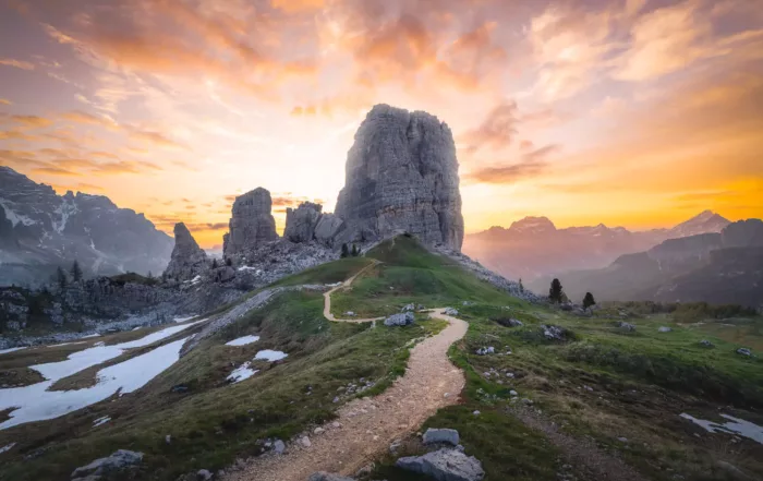
Hannibal crossed the Alps to get to Rome. Many trails in astonishingly beautiful places like the Dolomites still show remnants of WWI and WWII, even in places like Le Tre Cime di Lavaredo or Le Cinque Torri.
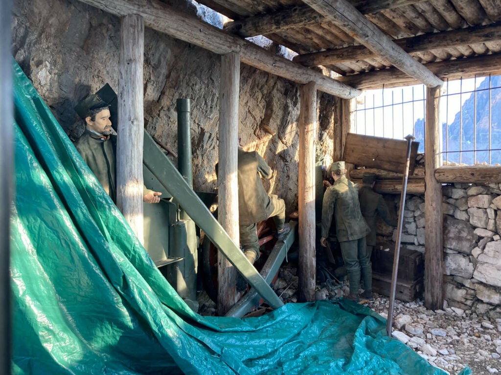
Open-air WWI museum at le Cinque Torri in the Dolomites.
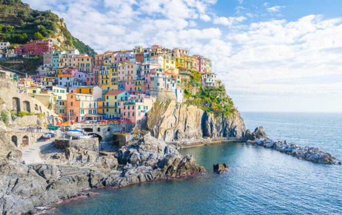
Then the hills, like Tuscany and its rolling hills. The Islands, too, like Mount Etna in Sicily or Sardinia. Or the coastal walks, like le Cinque Terre or the Sentiero degli Dei on the Amalfi coast. Or the Volcanoes and Geothermal areas.
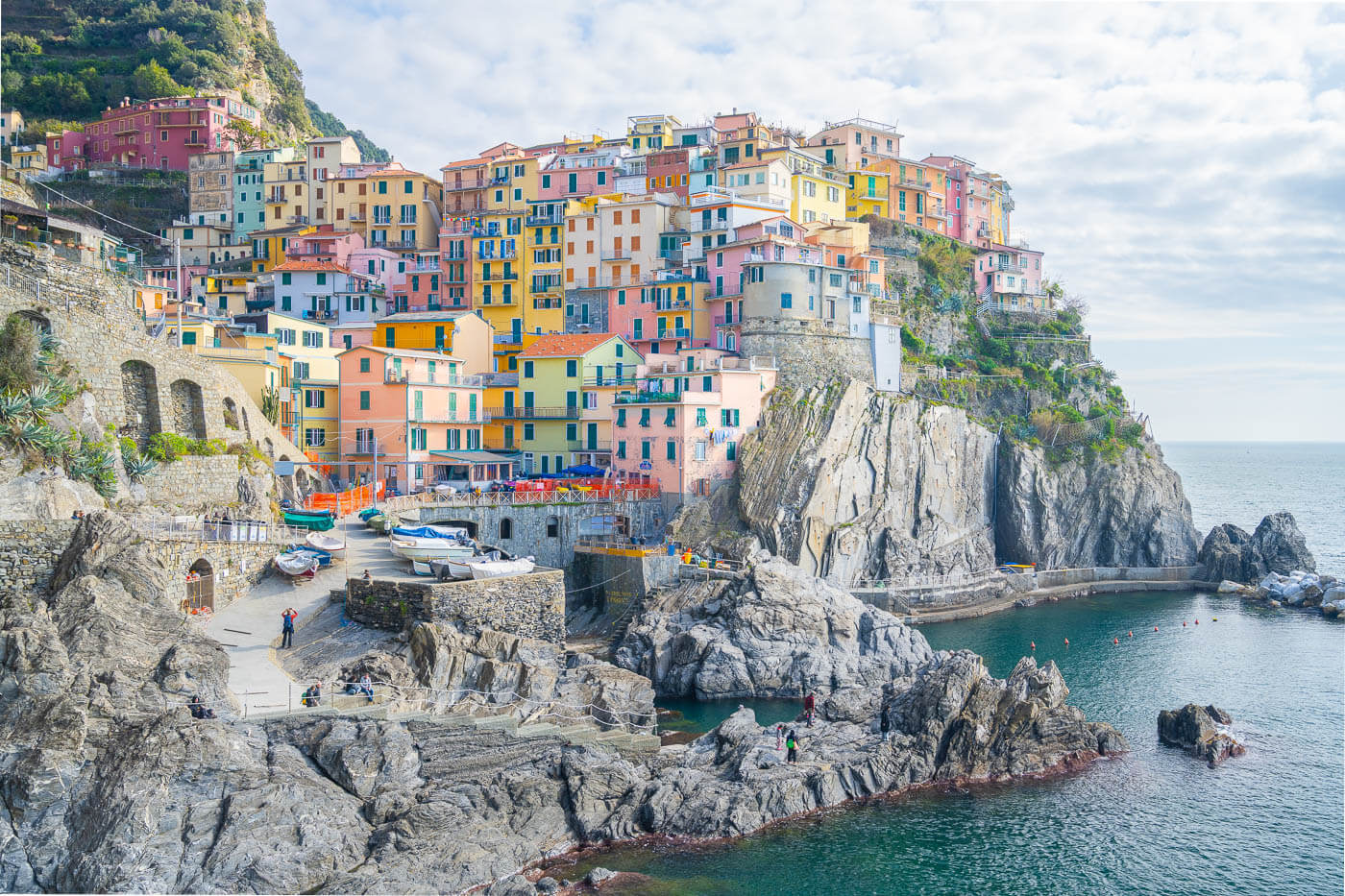
Manarola, one of the Cinque Terre villages.
And what about the Epic, 7000 km+ long “Sentiero Italia“? As an Italian, hiking the full length of that trail is a dream of mine.
Anyway, all of this is to say that there is no shortage of unique landscapes in Italy. Needless to say, this goes great with both hiking and landscape photography, also considering the many hidden gems Italy hides.
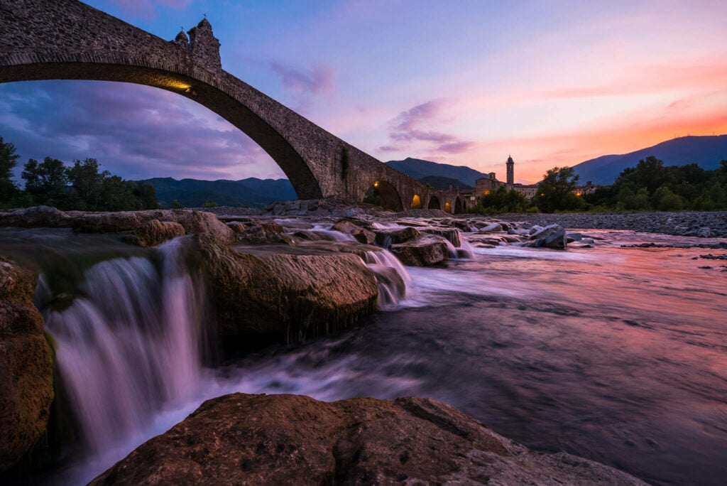
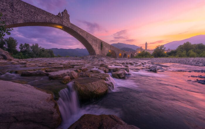
The Ponte Gobbo along the Trebbia River (Hunchback Bridge) in Bobbio, Emilia Romagna.
Italy – Hiking and Photo Locations Map
Here is a map of the best locations I have visited so far. I am in the process of adding more, so check back. Each spot on the map will link to the original hike report/post, where you can find a downloadable GPX file and many photos of each location.
Best time to visit Italy for a hiking trip
To many, that will be summer. Summers used to be a great season for mountain lovers in Italy up until a decade ago or so. By that I mean, that while most people flocked to the Italian beaches, not so many used to visit the mountains in summer. This has changed in recent years, especially after Covid, and more and more people plan to head to the mountains each year.
Also, more and more people head there to escape the warmth of summer, at least at night. If you don’t mind the crowds, summer is still a great time to go though. Just be mindful of the warmth, even at high altitudes, and the possible late afternoon thunderstorm. Even possibly snow, above a certain altitude. So yes, if you are planning on hiking high-altitude trails, you should be ready for everything.
If, instead, you enjoy a more relaxed experience, I’d recommend visiting in very late spring late spring/early summer, or late summer, into mid autumn. While you’ll still find plenty of people along the trail, the most popular locations, like the Dolomites for instance, won’t be nearly as crowded as at the peak of the high season, which is July and especially August.
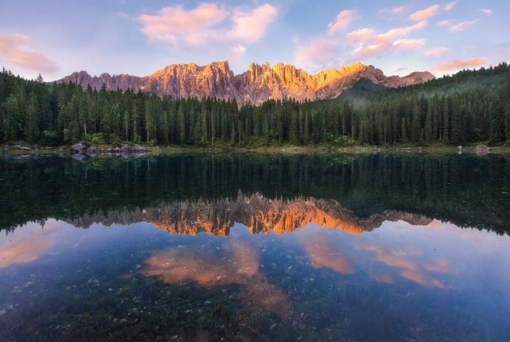
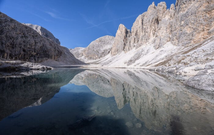
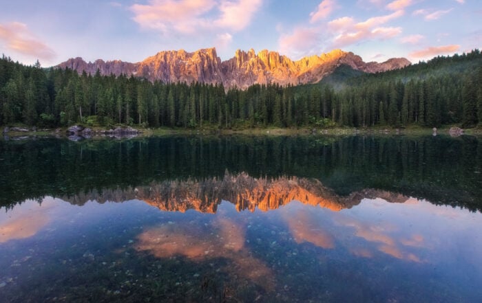
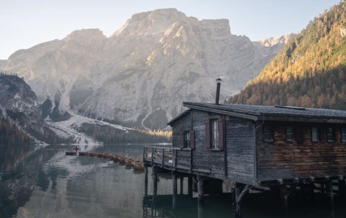
Lago di Carezza, or Carersee; sunrise on an early summer morning. incredibly, no one was around.
Walking the Italian “Sentieri” – or Hiking trails – and difficulty levels
Sentiero is the Italian name for the trail. Sentieri, trails. Easy. Typically, these are marked with red-white-read trailmarks. Most of the time, either painted on rocks, trees, or even on hold huts. Those markets are white and red because they easily stand out from the surrounding environment, making it easier to sport and recognize them.
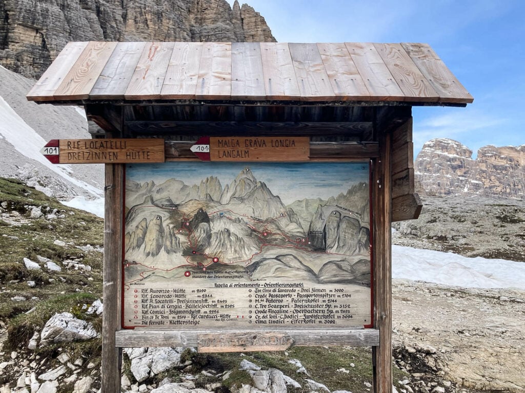
Also, like in Switzerland, hiking trails are categorized based on different difficulty levels. Not all the trails are marked with such categories. Most, are not. However, you should be familiar with them to know what you are getting into if you see these on the trail.
- T: Turistico – easy walking route. usually below 2,000 meters of altitude. these trails still require decent fitness, but there are no exposed or difficult sections.
- E: Escursionistico – hiking trails of medium difficulty. These may involve moderately exposed areas, but they are still safe to hike.
- EE: Experienced hikers. Difficult trails for experienced hikers. They may involve exposed passages, scrambling up some sections, but no glacier crossings or passages above crevasses.
- EEA: Trails for experienced hikers, special equipment needed: these are not necessarily Vie Ferrate, but they still require some sort of safety or climbing equipment.
- EAI: Escursionismo in Ambiente Innevato. Winter hiking trails; these trails require either snowshoes or crampons or just some form of microspikes. Unfortunately, there isn’t a more granular categorization for winter trails, so check the conditions and topo map before heading out.
Note that this categorization does not include Alpine trails, meaning all those trails that require special climbing equipment. It does not include Vie ferrate either and those do have their difficulty levels:
- EEA – F: (ferrata Facile). Easy Via Ferrata
- EEA – PD: (ferrata Poco Difficile). Literally, “not very difficult”
- EEA – D: (ferrata Difficile). Difficult
Hiking Maps of Italy
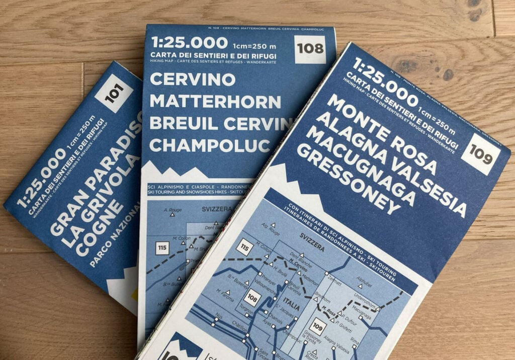
Unfortunately, there isn’t an official, comprehensive digital map of all the hiking trails in Italy. As far as I am aware, not even an attempt has been made yet. There is, however, a comprehensive cartography of all the hiking trails and mountain huts available from the “Istituto Geografico Centrale“, or “Central Geographical Institute” of Italy.
The maps are extremely good and constantly kept up to date. You can purchase them on their site, some are also available on Amazon. Alternatively, if you are heading to the Eastern side of the Alps or the Dolomites, consider the Tabacco Maps.
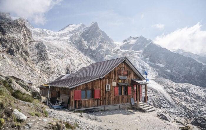
The Rifugi (Huts)
Along with hiking, Italy also has a great tradition of mountain huts, like everywhere in the Alps. Mostly, but not only, bunk bed accommodations, the Rifugi are a great way to spend one or more nights in the mountains.
Manned or unmanned, you can find a map of all the huts and bivouacs in Italy on the CAI website. The website is in Italian, but works ok with Google Translate. Also, a great occasion to taste some real Italian mountain food!
Best hikes and Photography locations in Italy
With the basics covered, here are the latest posts on the best hikes and photography locations in Italy!