The Brienzer Rothorn Hike – Switzerland
There are several different ways you can hike up to the Brienzer Rothorn, but whichever trail you choose, you are in for spectacular views and perhaps Ibex sightings!
The Brienzer Rothorn hike was close to the top of my “To Do Hikes” list when I moved to Switzerland. This is for two main reasons: first, the spectacular views over the lake and second, its accessibility. At 2,350 meters above sea level, it is not exactly a stroll to get up there, but compared to other trails deep in the Alps, this one is usually accessible earlier in the season. This makes it a great choice if you are itching for a hike after a long winter.
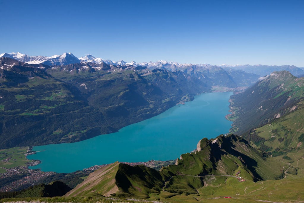
Bright sunny days offer great views of the lake and the surrounding alpine landscape
I hiked up there twice from different sides, but there are several other trails you can take from other starting points. Additionally, you can take cable cars or a cogwheel train to some intermediate stations and hike the remaining parts. Or you could, for instance, take the train/cable car up and hike your way down.
This post will show you the two trails I hiked and provide the resources to plan your hike. Whichever way you choose, I highly recommend doing the ridge walk I’ll describe later. Not if you are afraid of heights, though!
How to get to the Brienzer Rothorn & Outline of the Hike
Before getting into the details, my main focus here will be describing the hike from Brienz to the top of the Brienzer Rothorn. This is the “Option 1” hike below.
I will also provide the details on the Hike from the other side, the Sörenberg cable car station, but if you only have one day, I recommend starting in Brienz, as the views are better from that side.
- Getting there: you can easily reach Brienz by car or by train. The town of Brienz is relatively small, but there are several small parking lots where you can leave the car and walk to the trailhead. I parked my car here, the closest parking space to the trailhead I had found.
- Start of The Hike: From Brienz, you will see several different trail signs and initially, you will either have to follow the ones for Planalp or the Muelibach waterfall.
- Photography & Scenery value: Scenic views, Wildlife, and a spectacular lake surrounded by an alpine landscape.
- Difficulty: Hard, easy if taking the train up. Medium from the Sörenberg cable car station, but still physically demanding.
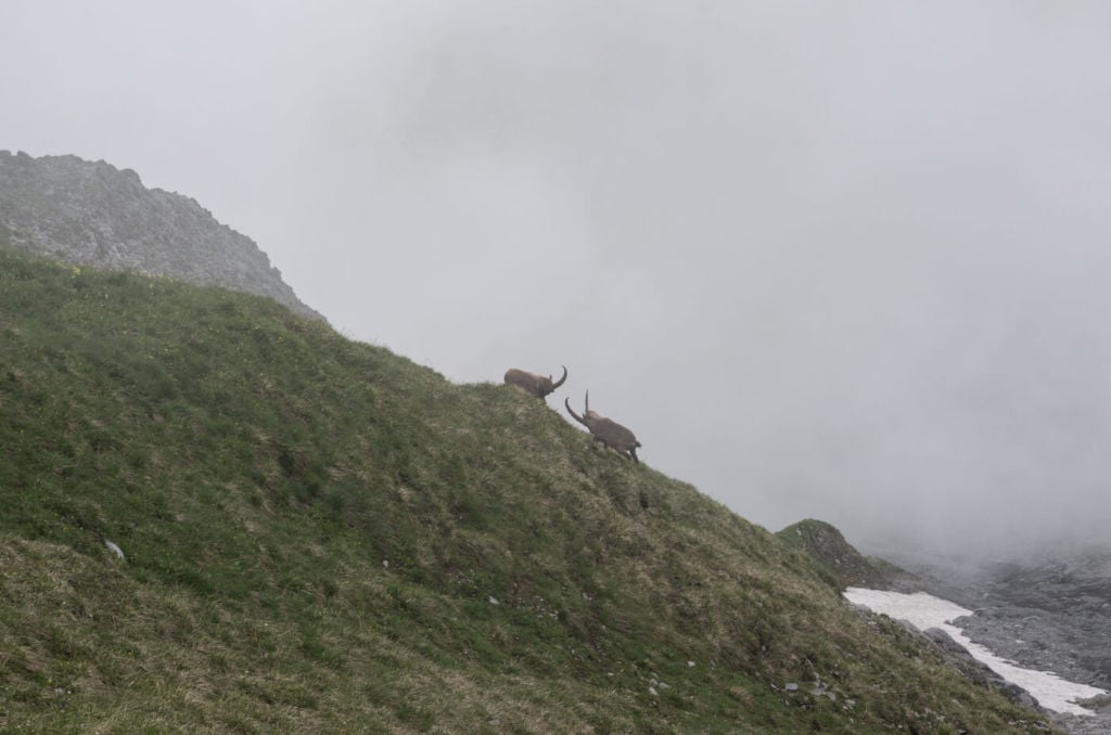
- Tip: Late spring seems to be when the Ibex are most active.
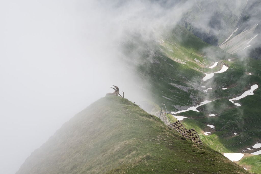
The real owners of the mountain.
The Brienzer Rothorn Trail
Option 1 – From Brienz
This is a trail I plotted myself and is not one of the official direct hiking trails but a combination of different ones. I chose this route because I wanted to see as much as possible of the landscape, view the spectacular Muelibach waterfall and do the ridge hike to the west of the Brienzer Rothorn. It is mostly a combination of trails 3,4,5 on the Hiking trails map.
It is a strenuous hike at 22+ Km and 1700+ Mt elevation gain, and it’s doable only if you are a very fit hiker.
If you still want to do this but consider the hike too long, I would advise either taking the Cogwheel train to the Planalp station and starting the hike from there, or you could take the train to the top and hike your way down.
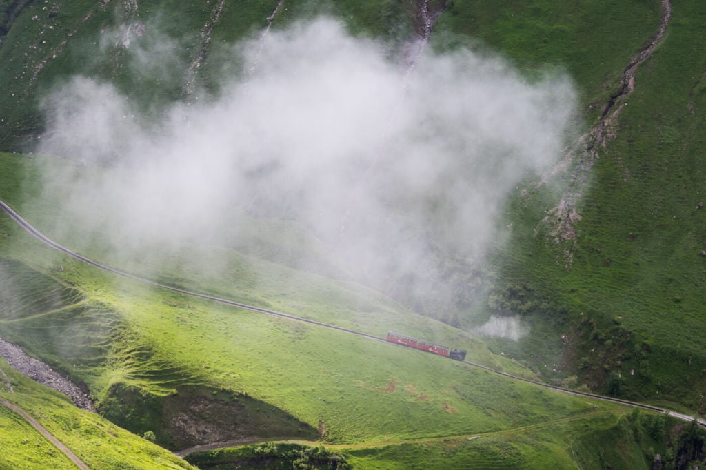
The Cogwheel train on its way up.
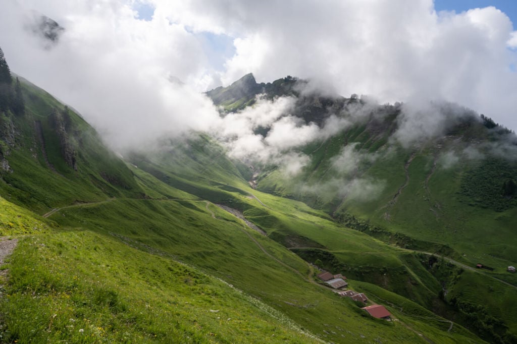
The first part of this trail is mainly on a narrow paved road which turns into gravel at times until you reach the Planalp station. From the Planalp station, keep following the dirt road up. This will lead you to the ridge hike and then to the top of the Brienzer Rothorn.
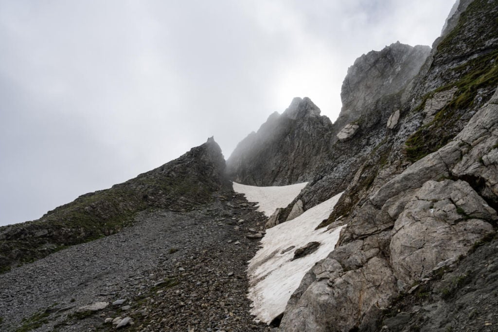
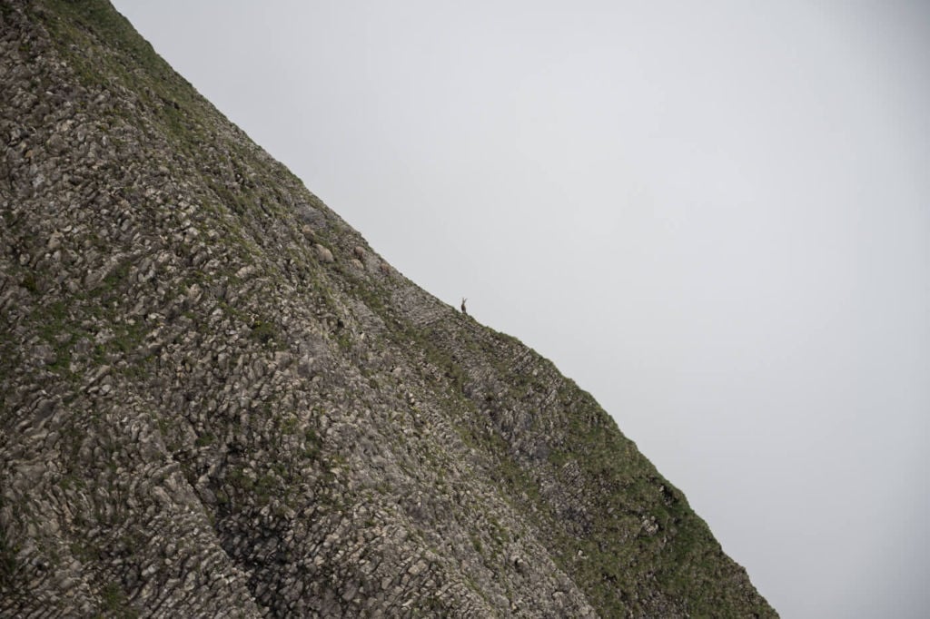
Part of the Ridge trail on the Brienzer Rothorn hike. This section is rather steep and on loose rock.
The ridge hike can also be done on your way down if you take the cogwheel train on the way up. The path is narrow, steep in places but never too exposed. This makes it a pretty fun hike from the mountain station.
| Distance | Ascent | Duration |
|---|---|---|
| 22,7 Km | 1.730 Mt | 7/8 Hrs |
Option 2 – From Sörenberg
This second option starts at the Sörenberg cable car station. From there, you will see trail signs pointing toward a narrow paved road and a small farm. Keep going until the road turns into a gravel road. The hike will continue on this road for most of the trail.
Once you reach the Cable Car mountain station, you will have to turn into a moderately steep path that reaches the top of the Brienzer Rothorn.
| Distance | Ascent | Duration |
|---|---|---|
| 14,1 Km | 1.060 Mt | 4.30/5 Hrs |
Photos and Photography Tips for the Brienzer Rothorn Hike
When I planned my second hike to the Brienzer Rothorn, I plotted the route that I thought would give me the most in terms of photos, and it sure delivered! Fantastic landscapes, Wildlife, and Ridge trails. Not to mention the cool cogwheel train.
The first stop on the way up is the Muelibach Waterfall – a spectacular 147 mt. tall waterfall.
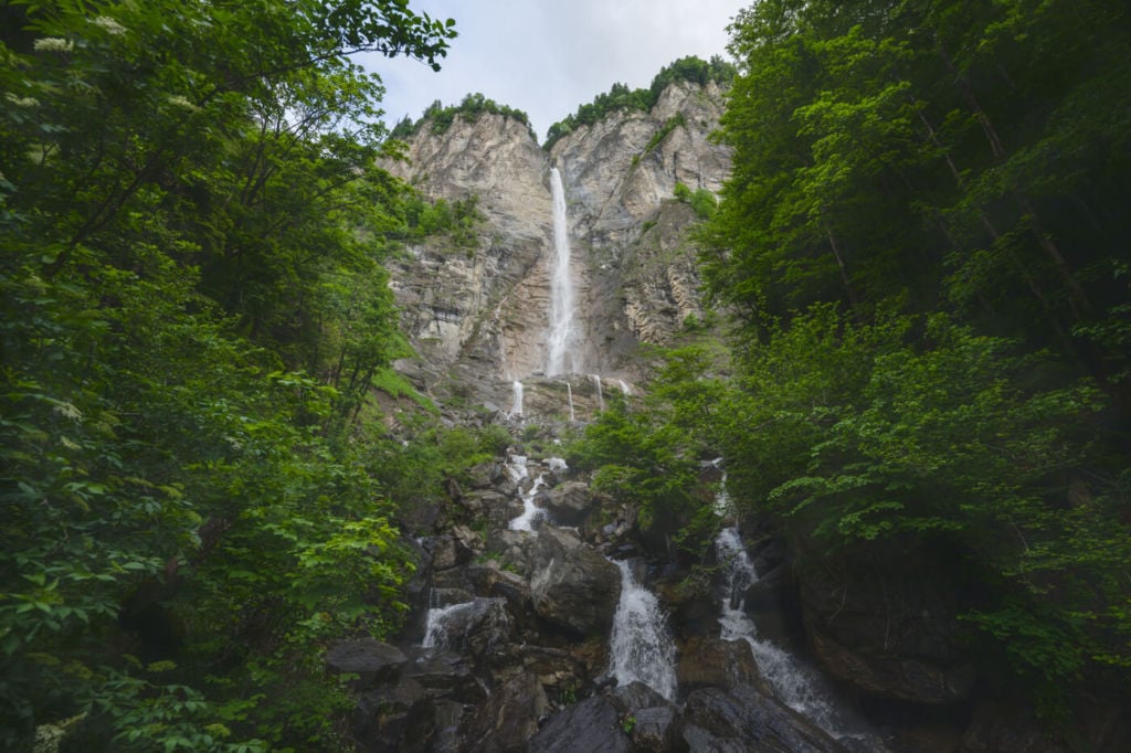
The spectacular Muelibach waterfall
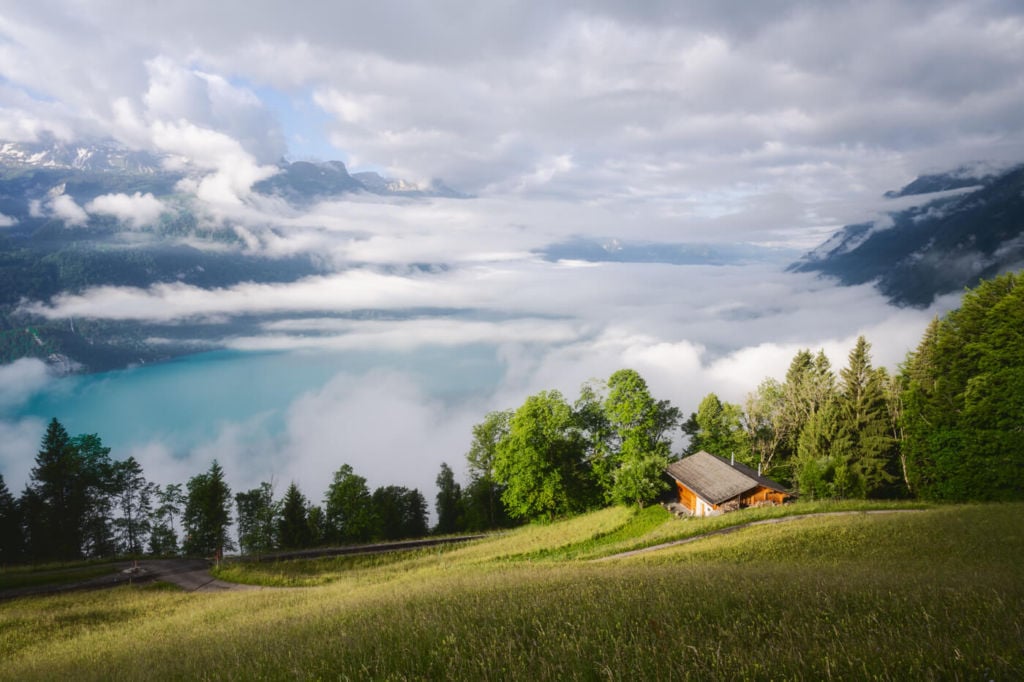
On the way up, before reaching the Planalp station, there also is a great vantage point over the lake and the landscape below:
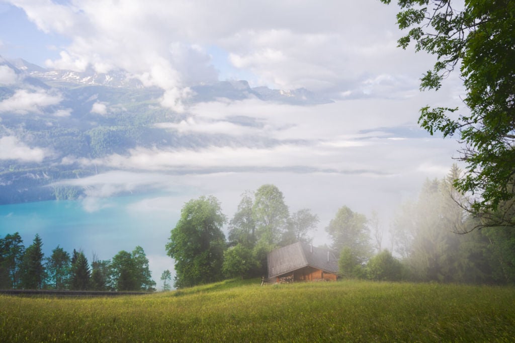
Early morning light on the lake.

After the Planalp station, there are some great views of the Brienzer Rothorn and its green pastures.
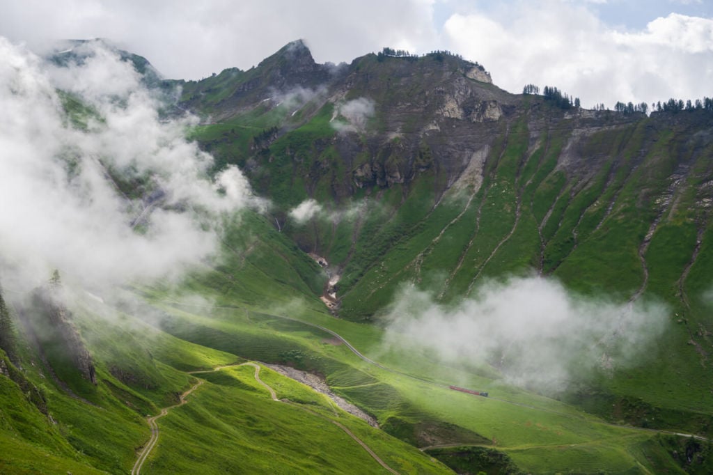
The cogwheel train going up the Brienzer Rothorn.
Next, is the ridge hike. Although never too exposed, this part does require one to be careful, but the views are epic.
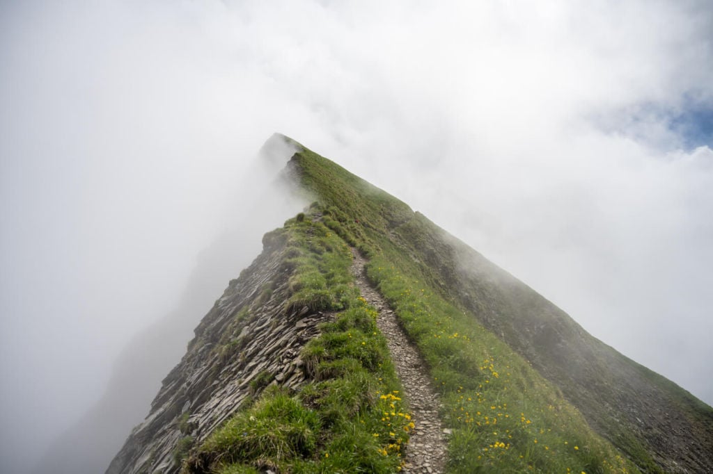
Part of the Ridge trail.
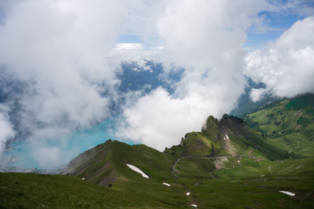
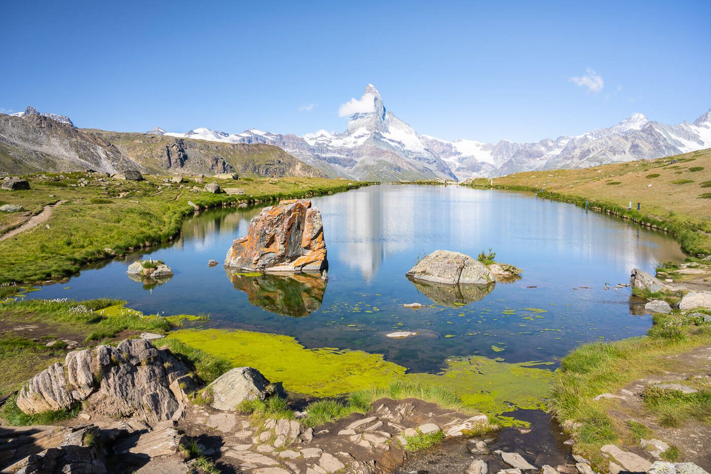
When you reach the top, the panoramic view will speak for itself.
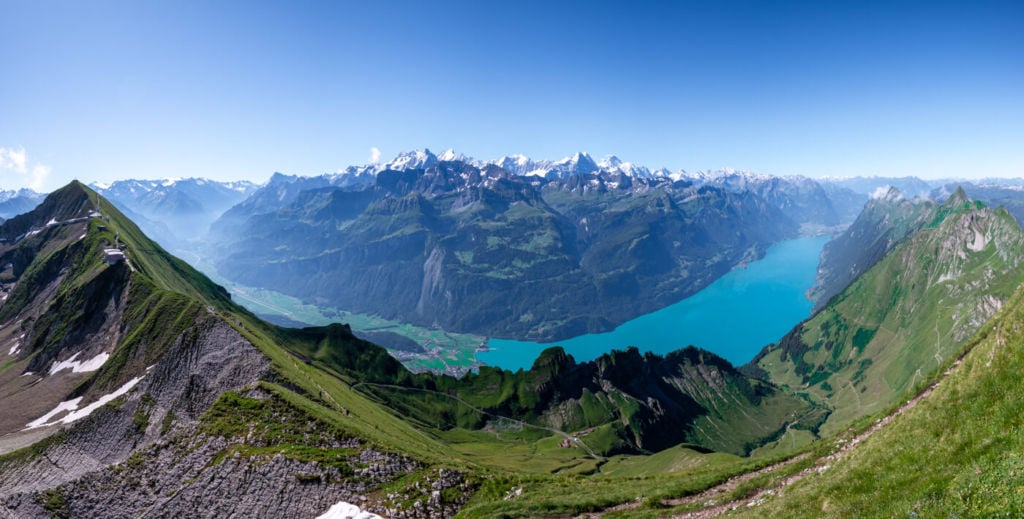
Panoramic view from the top of the Brienzer Rothorn
In terms of lenses, bring everything you have. Ultra-wide will be useful on the ridge hike, as well as longer lenses. If you are into wildlife, you will most likely want to bring something longer than 200 mm too.
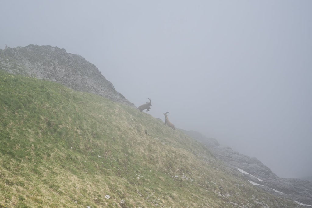
Ibex on the Brienzer Rothorn Hike
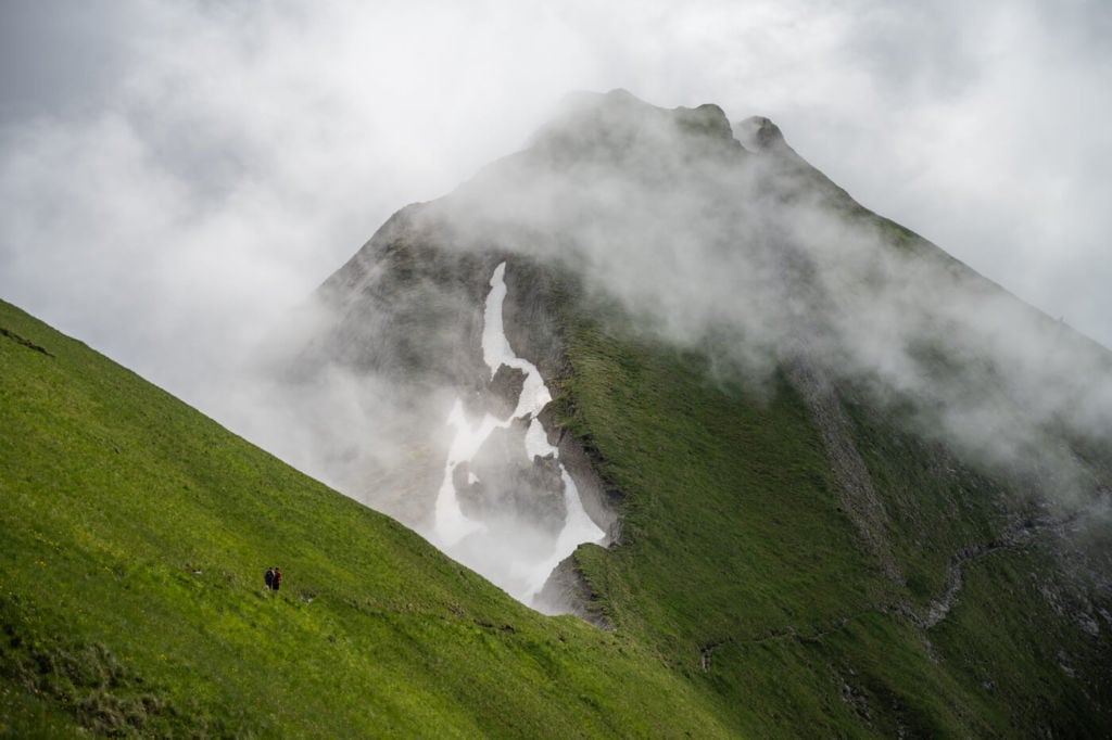
It was like an Ibex festival when I hiked up there in late spring. I had an unexpected encounter on the ridge trail, with ibex coming up from the opposite side, and they were just 2/3 metres away.
I also saw a fight between two Ibexes, loudly smashing their horns against each other. Saw a herd chilling on the crease and some other isolated Ibex roaming around.
Late spring seems to be one of the best periods to sport them up there.
A fight between Ibex – Standoff
Attack!
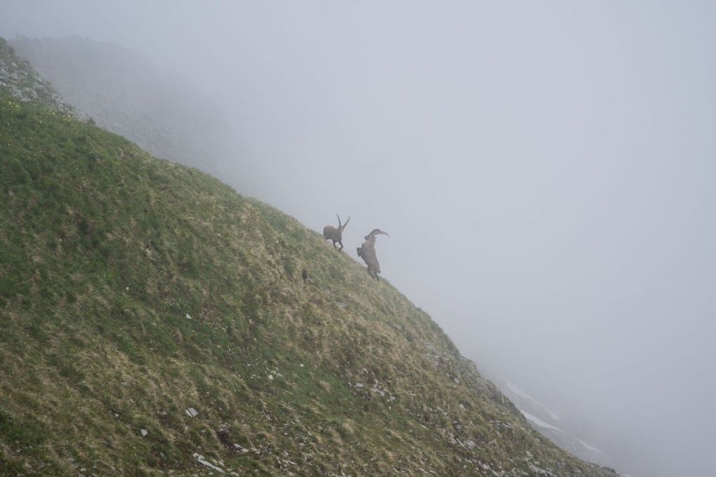
Counterattack!
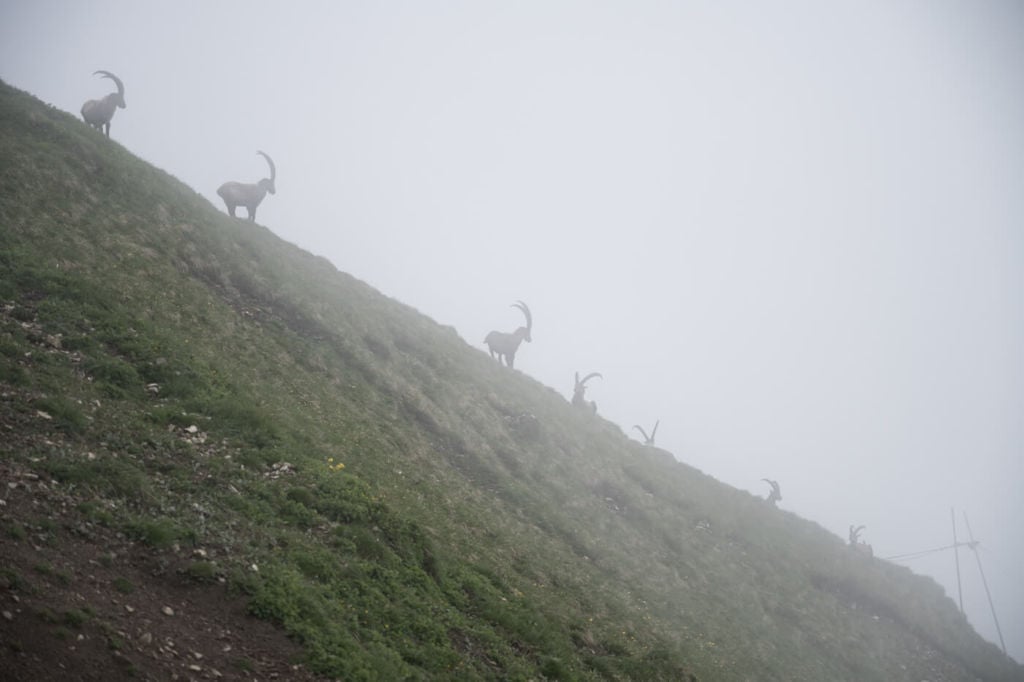
More peaceful Ibex chilling on the crest.
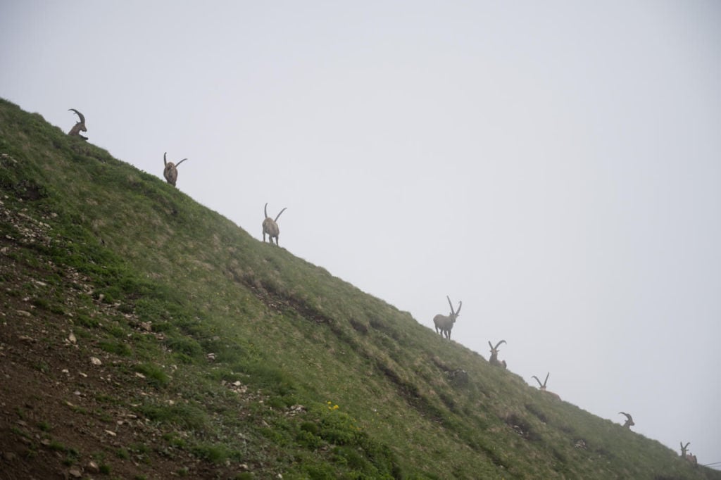
Horns Parade
Wandering Ibex
Video of the Brienzer Rothorn Hike
Here is a video of this hike. More like a series of impressions along the trail, but hopefully, it can give you a good idea of what to expect:
Map of the Brienzer Rothorn Hike
Option 1 – From Brienz
This is the long and demanding hike I kept mentioning earlier. It offers the best photographic value if you are fit enough for it.
Option 2 – From Sörenberg
This is the hike from the other side and the first one I did.
Where to Stay
It is possible to spend the night on top, as there is a Hotel there. Alternatively, Brienz offers several different accommodation types. Alternatively, you can consider Interlaken as a base to explore the nearby area further.
Additional Resources
- check out this other amazing hike nearby, the Augstmatthorn Hike.
- Check out my main Switzerland page for more info and PhotoHikes in Switzerland.
- Location of the Brienz Rothorn Bahn
- Map of the Brienzer Rothorn Hiking Trails
Have questions, comments or feedback? Let me know in the comment section below.


Nice place….
It is indeed – the small town of Brienz is also very nice.
how long is the whole hike?
Hi Francis,
This particular hike was a 22,7 KM roundtrip from Brienz (option 1 in the post). There are a couple of other options, however. One is from Sörenberg, a 14 KM roundtrip (option 2). The other one is taking the train from Brienz to Planalp and hiking to the top from there and it essentially takes 10 KM off option one. This option is a 12km roundtrip but still a 1,000m elevation gain.
Hi
Thank you for your lovely post
Could you please let me know how long it would take just to hike down after we take the train up?
Hi Askar,
Thanks, glad you enjoyed it! It took me about 2:30 hours to hike down from the Brienzer Rothorn to Brienz, at a moderately fast pace – as I stopped to take in the views on my way up. At a more leisurely pace, stopping here and there to enjoy the views, it would probably take between 3:00 to 3:30 hours.
Could you do this hike in early spring / late winter with microspikes?
Hi Tom – that isn’t feasible or safe. Depending on snow conditions, there may be avalanche risk. The ridge part would be impossible to get to.
Hi Marco,
Great post, thanks.
I am looking to do this end of February. Do you think it would be possible with the conditions? What would they be like explicitly?
I am experienced, having done Mt. Fuji etc. in the winter. People in my group aren’t as much but in good shape.
Thanks,
S
Hi Sam, on a rare snowless winter like we had a couple of years ago, and with the right equipment, maybe from Sorenberg. Not this year though, as there’s plenty of snow and it’s avalanche terrain. In winter it’s only possible to get there with the cable car from Sorenberg.
An alternative option may be the Turren-Schonbuel snowshoe trail (trail 799) which gives you good views of Lake Brienz. I did it earlier this year and it’s a nice one.
Another option may be a snowshoe tour to the Augstmatthorn from Alp Lombach. It’s an unmarked trail I have planned to do too, and you can see it in the Swiss Topo app. Still requires to assess snow conditions. for safety.
Thank you Marco!! Too bad, maybe we will try again in a couple months.
NP! Btw some of the trails from Brienz were destroyed by a landslide last summer. Best to check for any closed trail on that app (Swiss Topo) before heading out, and to consider alternative options – since there ar a few different trails.
Hi Marco,
Is there an official hike route from Planalp to Brienz Rothorn? I can’t see anywhere online that shows this.
Hi Alex, yes, there are two possible routes, it’s the trails #3 and #5 in this map: https://brienz-rothorn-bahn.ch/wp-content/uploads/2024/02/brb_wanderkarte_rz.pdf
You can also do both of them in a loop. Trail #5 is the most difficult of the two. It’s the same trail you can find on the Komoot map embedded in the post. I just hiked up from Brienz, but passed by Planalp on the way out and on the way back. You can download the track for free from that Komoot activity. Just to let you know, part of trail #5 on the way up may have changed course since.
Thank you Marco – Very Helpful!