The Augstmatthorn Hike
The Augstmatthorn Hike probably is one of the most popular around Lake Brienz, along with the Brienzer Rothorn, the Hardergrat, and the Harder Kulm Hikes. And for good reasons; the views of Lake Brienz and the Alps around it are truly spectacular.
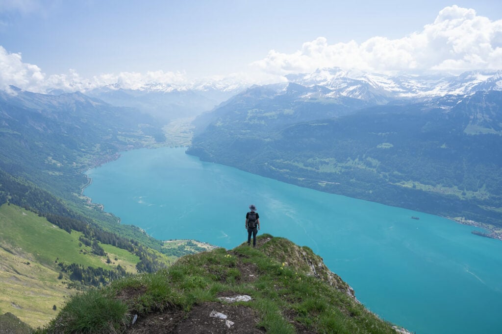
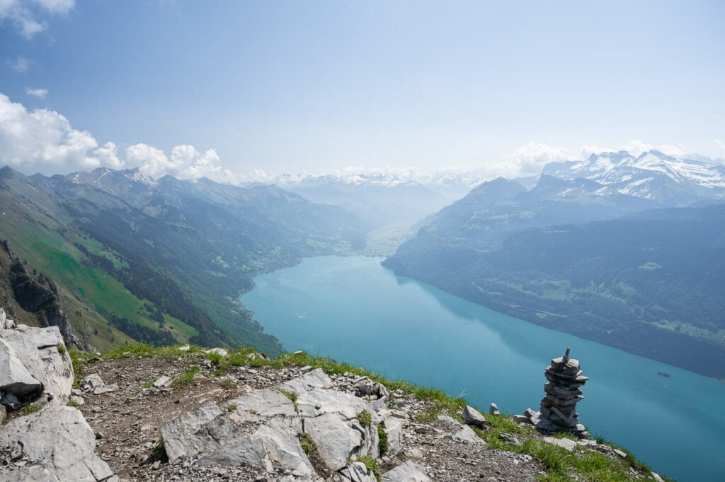
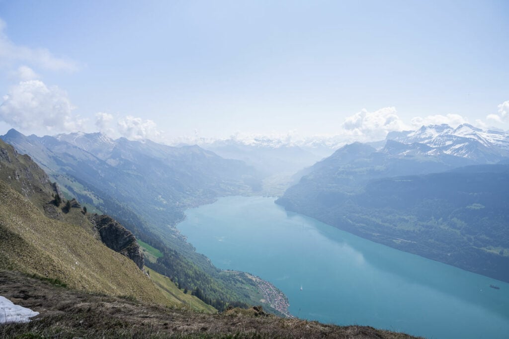
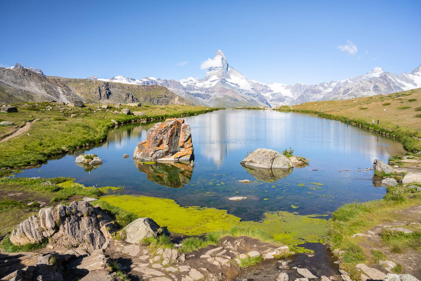
View of the Brienzersee from the Augstmatthorn
Located in the Emmental Alps, the Augstmatthorn (2,137 m) offers fantastic views of Lake Brienz (Brienzersee) and the Bernese Oberland. On a clear day, the panorama from up there is breathtaking. You’ll even be able to see the summit of mountains like the Eiger and the Jungfrau.
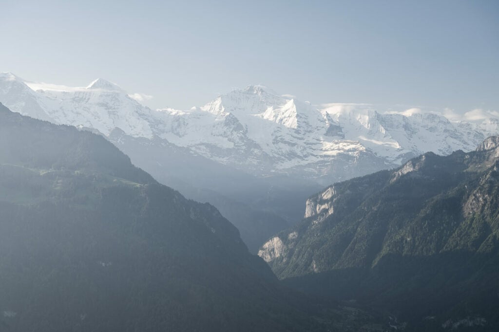
The Jungfrau, the tallest mountain in the centre.
Like most mountains in Switzerland, there actually are several different ways you can possibly hike up the Augstmatthorn. My hike report is based on the longest option, the hike from Interlake/Unterseen. This is a very long and strenuous hike, at 25km+ and 1600m elevation gain.
However, I’ll also include a couple of shorter/easier hikes to the Augstmatthorn for those who still want to enjoy the fantastic views without having to spend a whole day on the trail.
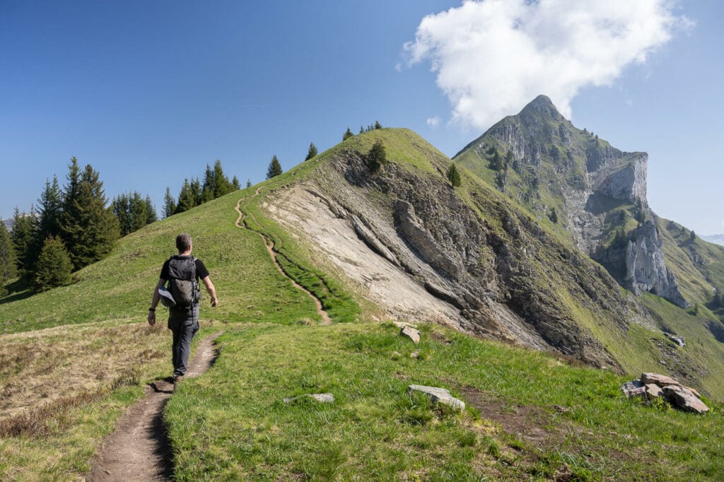
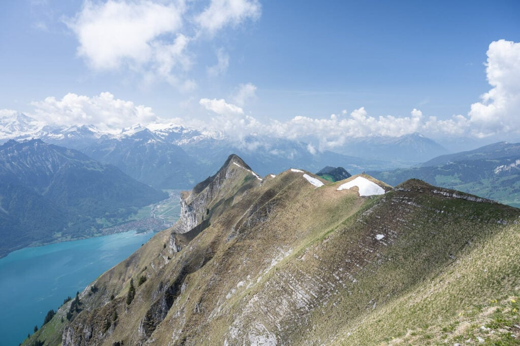
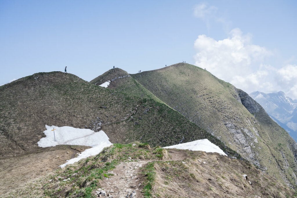
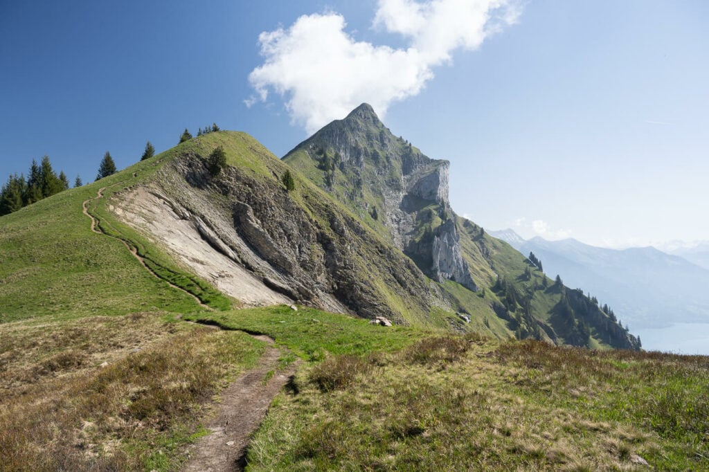
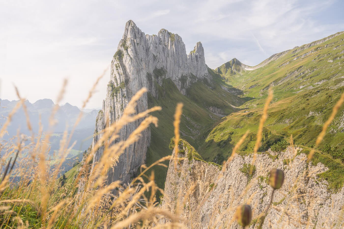
The ridge trail to the Augstmatthorn with Mount Suggiture in the background.
Table of Contents
Overview of the Augstmatthorn Hike
This is the long version of the hike I mentioned above. It can be started starts either in Interlaken or Unterseen. It is a full-day hike and while it is long and strenuous, there are no exposed or particularly difficult sections.
It’s generally possible to do this hike from late May until October, depending on the snow level, so check the conditions before heading out.
Also note: if you prefer, there is a funicular that runs between Interlaken and the Harder Kulm. You can then start the hike from there. This will save you about an hour each way.
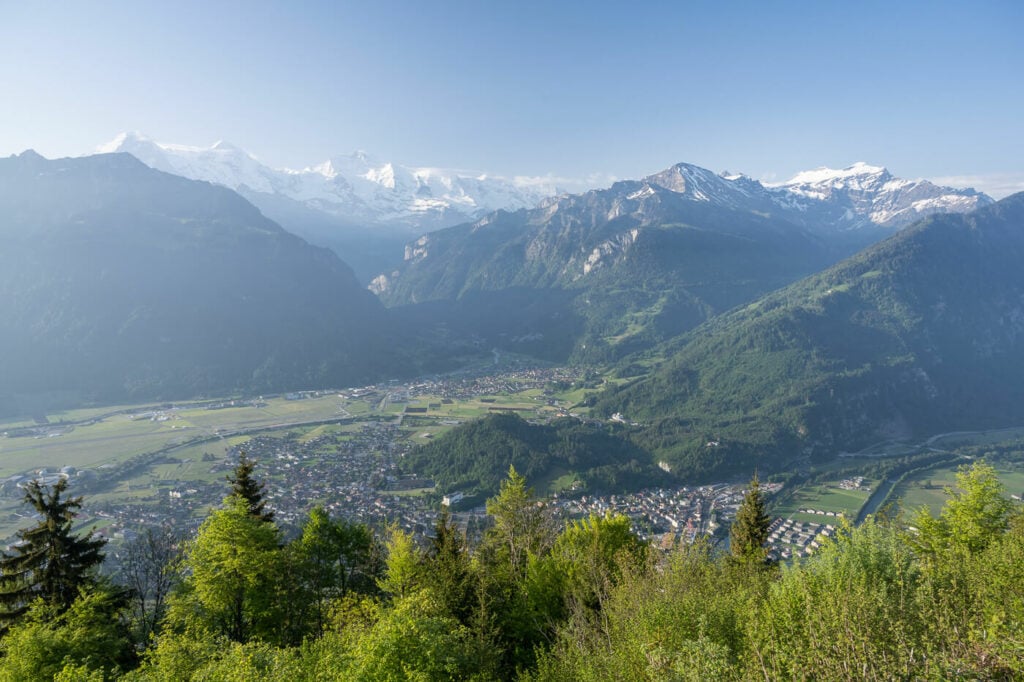
Early morning view of the Bernese overland Alps from the trail to the harder Kulm.
Still, if you can, I’d recommend starting the hike early in the morning before the funicular opens. You will be able to enjoy the early morning light and the fantastic views from the Harder Kulm without the crowds.
| Max Altitude | 2,137 m |
|---|---|
| Distance | KM |
| Elevation gain | ↑ / ↓ |
| Hike time | 8:30/ 9:30 Hours |
| Hike Difficulty | Hard |
Augstmatthorn Short Hike
If you are looking for a much shorter or easier way to get to the Augstmatthorn, you can also start the hike much closer to the summit, at the parking area in front of the Jägerstübli Lombachalp restaurant. From there it takes about 2 hours each way.
You can also reach this trailhead by public transport, with PostBus 107. The stop is Habkern, Lombachalp Roteschwand.
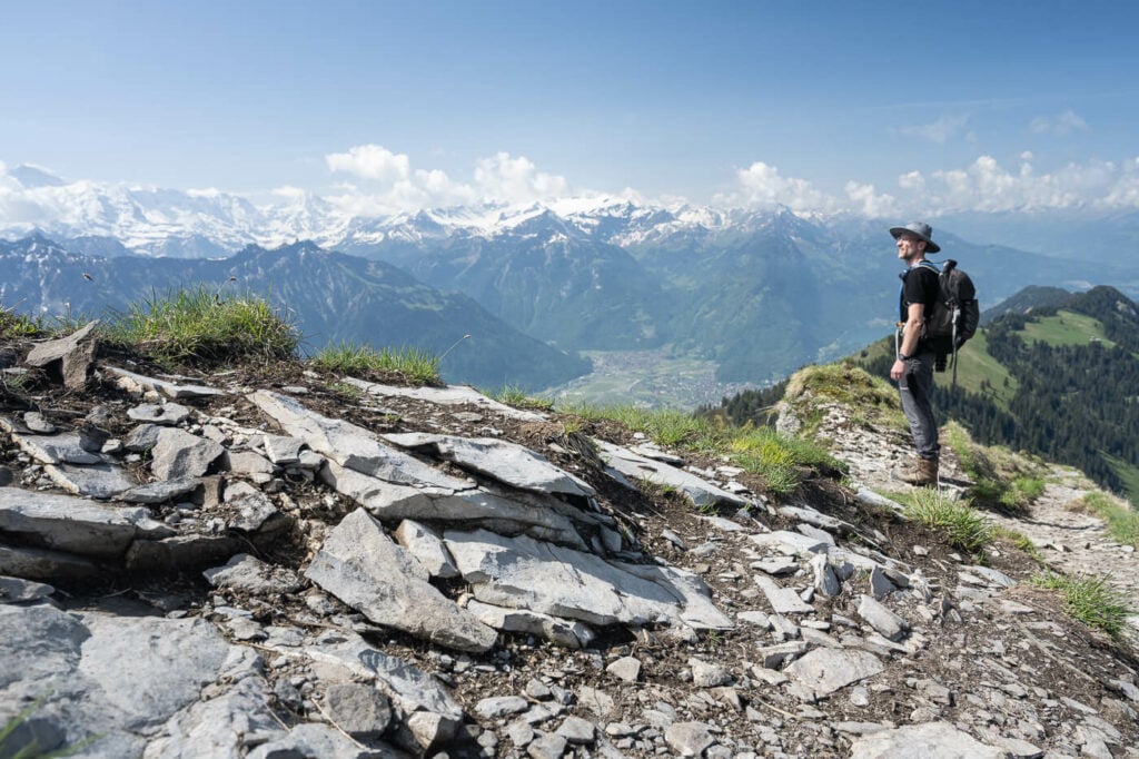
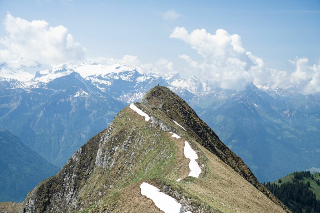
The beautiful Ridge Trail views from the Augstmatthorn summit, looking West.
How to get to the Augstmatthorn and Parking
For the long version of this hike, you can either start it from Interlaken or Unterseen. I started it from Unternseen as I was camping there. it’s a good option as I left the car at the campsite and just walked to the trailhead.
- Driving Directions: while you can’t drive directly to the trailhead, you’d have to drive to either Interlaken or Unterseen
- Parking: if you are spending a few days in the area, then you are likely to have parking included. Otherwise, you’d have to find one of the several paid parking areas in Interlaken.
- Public Transport: Interlaken is well connected with other cities in Switzerland as it is a major tourist location. You can take the train to the Interlake train station and from there, it’s about a 10 minutes walk to the trailhead by the Harder Kulm funicular.
Watching the Panorama from the summit of the Suggiture.
The Augstmatthorn Trail
This trail can actually be split into two main sections with two main points of interest. The Harder Klum first, relatively easy to reach early in the hike, and the Augstmatthorn second.
The Harder Kulm Hike
The first part of the hike consists of reaching the Harder Kulm from either Interlaken or Unterseen. This is a relatively steep hike in the forests that will lead you to the western side of the ridge, the Harder Kulm. It is a very popular location that can also be reached with a funicular from Interlaken.
The Harder Kulm Viewing Platform.
The Harder Kulm is a very popular attraction that also has a bar and a restaurant. It tends to be very crowded on sunny days. If you want to hike ups there, as I did, do it at sunrise. You’ll be able to enjoy the view without the crowds and I can guarantee you it’s worth it. The Harder Kulm is essentially where the long ridge trail to the Augstmatthorn starts.
View from the harder Kulm, in the early morning, about 6:20 AM. 27th of May 2023.
The Harder Kulm to Augstmatthorn Hike
The first part of the trail goes through the forest and the condition of the trail is rather poor, to be honest. There are lots of exposed, slippery tree roots. Some sections can be extremely muddy. Also, you can tell this trail gets a lot of traffic.
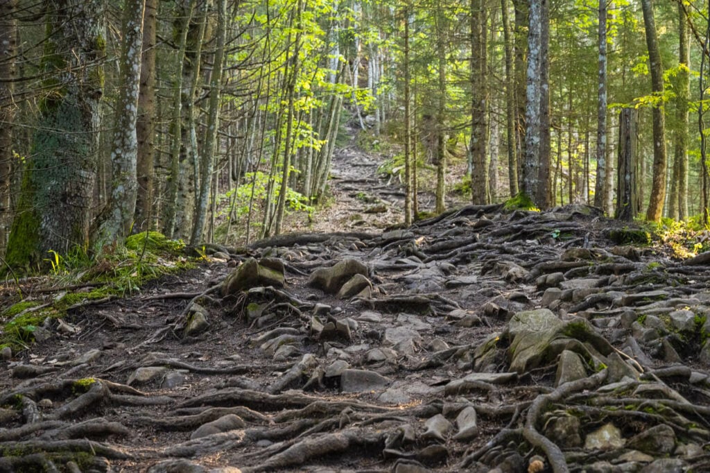
Part of the trail a in the forest between the Harder Kulm and the Augstmatthorn.
It will take about an hour/hour and a half to emerge from the woods and have open views on either side of the mountain. From here, the elevation gain is slow, the trail is in much better conditions and you’ll gradually get better views of Lake Brienz too.
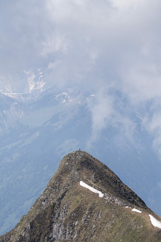
Before reaching the Augstmatthorn, you’ll have to get on top of another mountain, the Suggiture, 2085m. This will be the first, steep peak you see on the trail. You may actually think it’s the Augsmatthorn, but it’s not. It’s the Suggiture.
View from the top of the Suggiture toward Brienz (East).
You’ll have to get on top of it in order to reach the Augsmatthorn. It’s well worth it and the views are fantastic. From the summit of the Suggiture, you’ll be able to see the Augsmatthorn summit too. Your next stop.
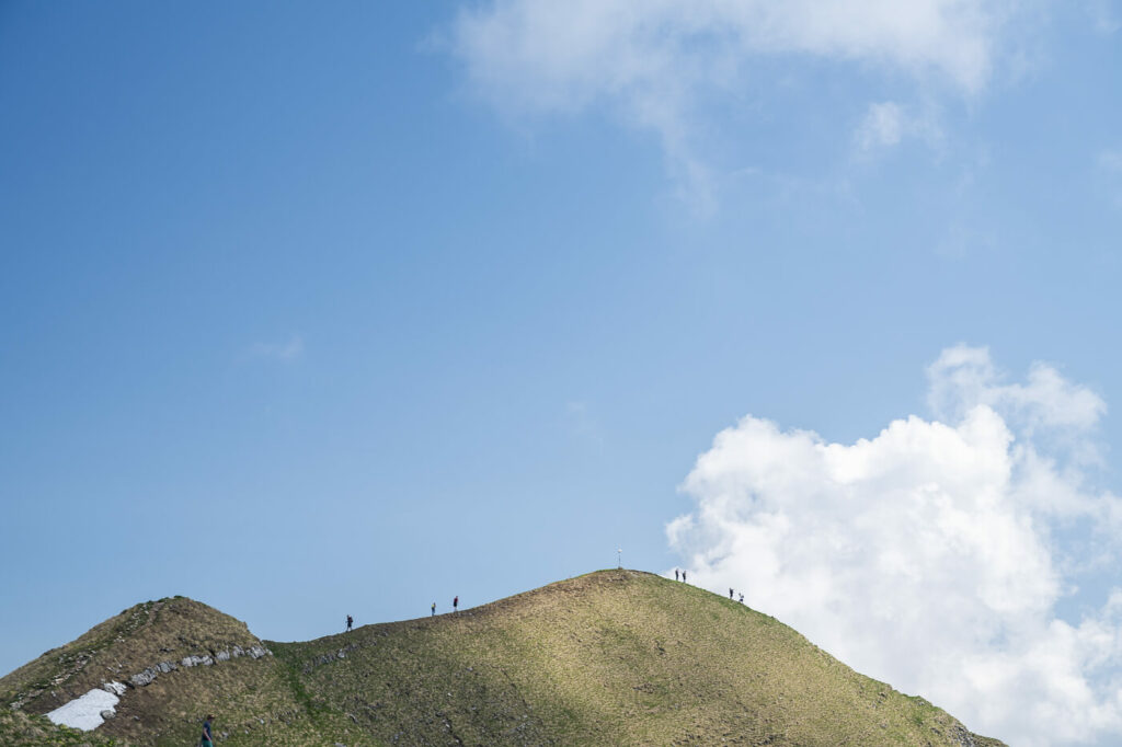
It’s only a short, scenic ridge hike away from there, 20/30 minutes. The summit may be relatively crowded, it’s a popular location after all. Still, you should not have a problem finding a spot to sit, relax and soak in the views!
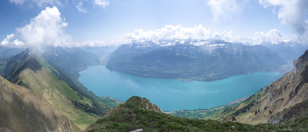
Panoramic view of the Brienzersee from the top of the Augstmatthorn.
The Augstmatthorn Hike Photos and Photography Tips
If you manage to be at the harder culm for sunrise or shortly after, congratulations! You can get fantastic sidelight on the Alps of the Bernese Oberland in from of you. The views from up there are simply spectacular.
View of the Brienzersee from the Augstmatthorn.
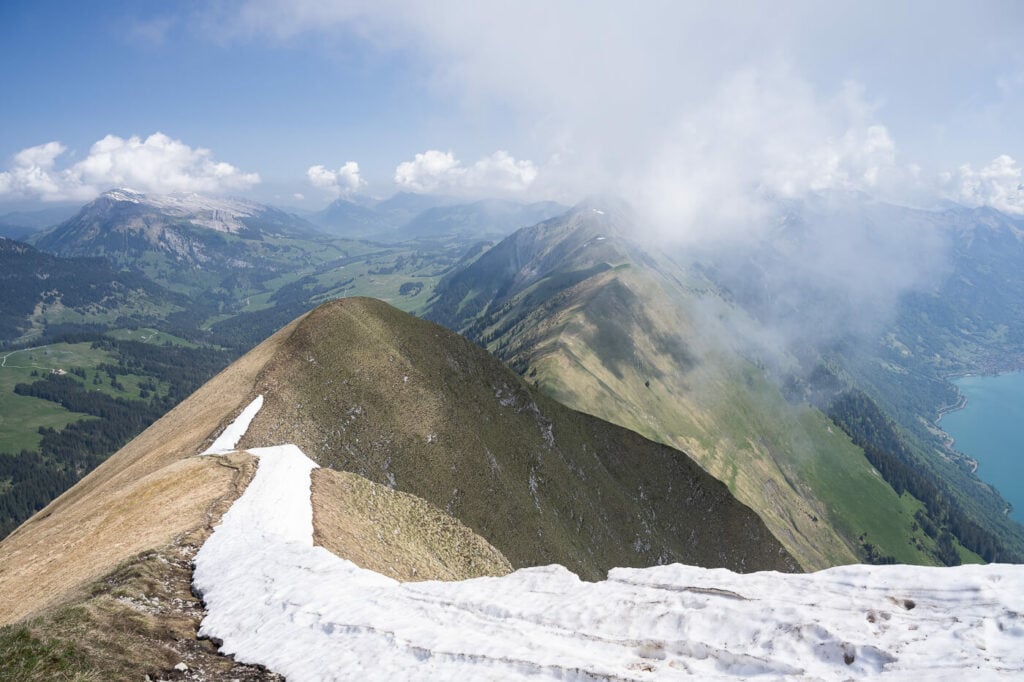
The next best sport for photos is the ridge between the Suggiture and the Augsmatthorn. The views of Lake Brienz and the Bernese Overland are again, spectacular. Gerald speaking, the whole ridge fi very beautiful.
Also, I’ve had quite some fun trying to include the silhouettes of other hikes on the ridge trail, for both sense of perspective and to add a more dynamic feel to the photos.
Lone Hiker on the Suggiture Summit
Hikers heading to the summit of the Augstmatthorn, seemingly in a procession.
I shoot almost entirely with my 24-70mm lens, as it covered most needs. Some shots were taken with a 70-200. Do bring a telephoto lens. This is an Ibex area and with a bit of luck, you’ll be able to spot and photograph them. I did not see any on my hike there but saw several of them on another hike on the same ridge to the Brienzer Rothorn. I even saw an ibex fight on that day!
Lake Brienz (Brienzersee). View from the Augstmatthorn summit.
Hiker summiting the Suggiture
Lake brienze again, from the Suggiture
The Suggiture, a very beautiful mountain in its own right,
Hikers on top of the Augstmatthorn
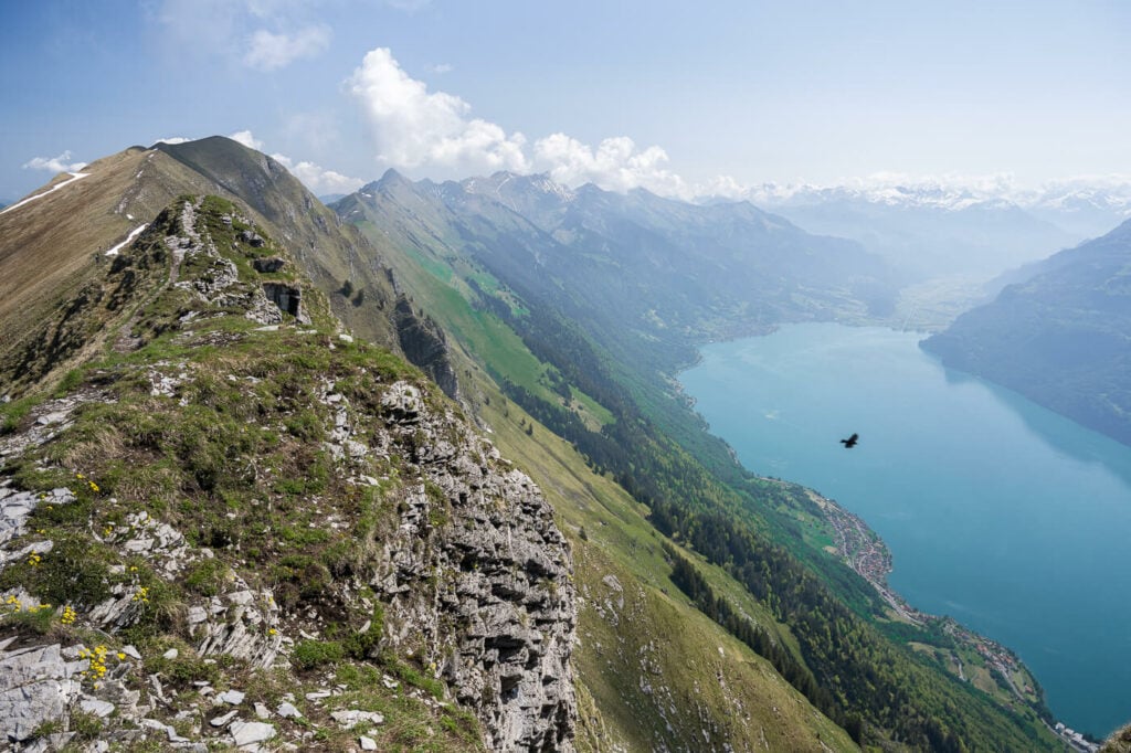
The ridge trail part of the Hardergrat trail, towards the Brienzer Rothorn
Lastly, flying drones is not possible here as this is a Natural Reserve.
Video of the Hike
Here is a “silent hiking” Video of my hike to the Augstmatthorn.
Map of the Augstmatthorn Hike
Here is the map of the trail, from Unterseen.
Where to stay
There are no huts in the area, and camping on the Augstmatthorn is not allowed as this is a Natural Reserve. Interlake offers several Hotel or Hostel accommodations, as well as campsites.
Unterseen, west of Interlaken, is also a very popular camping option.
Additional Resources
- Check out the main Switzerland page for more hikes and an overview of Hiking in Switzerland.
- If you are in the area, you may also want to check out the Brienzer Rothorn Hike, which is part of the same ridge.
- Website of the Harder Kulm funicular railway.


Leave A Comment