Hike to Fløya and Djevelporten, Svolvær, Lofoten, Norway
The Hike to Fløya (590 m.a.s.l) and Djevelporten is a moderately challenging but rewarding hike with fantastic views and a fun day on the trails. Djeveleporten in particular, which means the Devil’s Gate, is a rather unique attraction – a rock solidly wedged between two cliffs. Still, the views from Fløya are worth the hike by themselves too. Definitely a must-see.
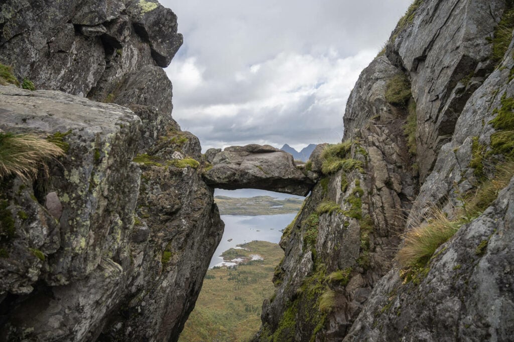
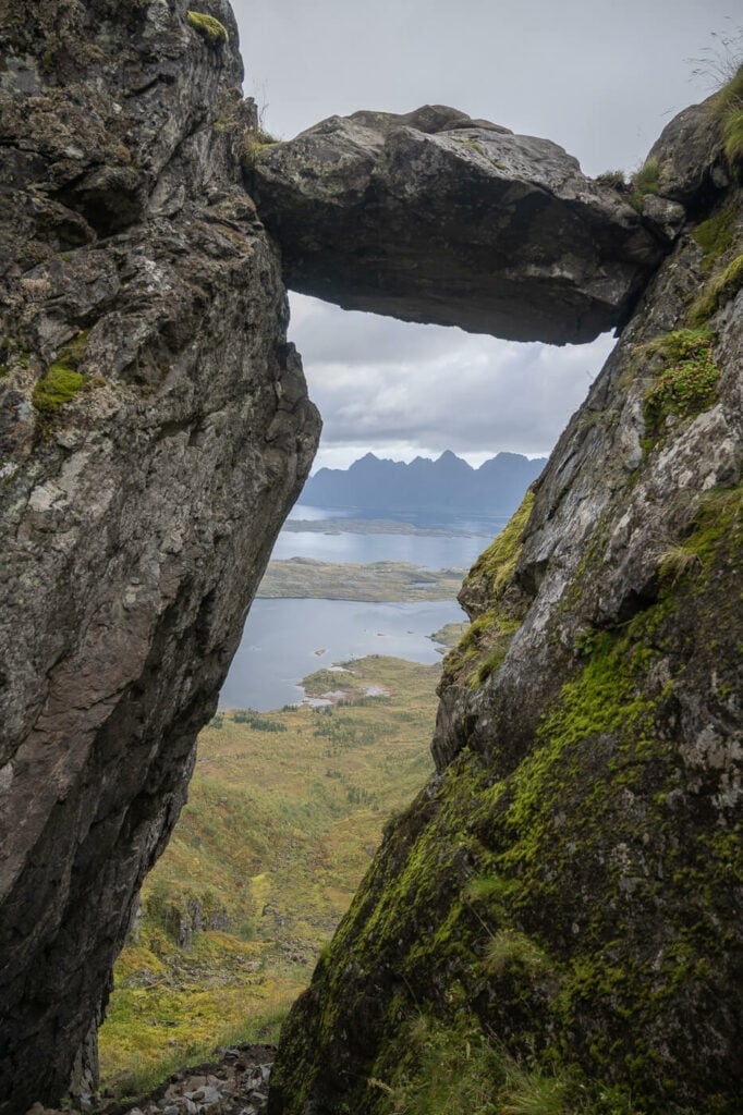
The iconic wedged boulder of Djevelporten
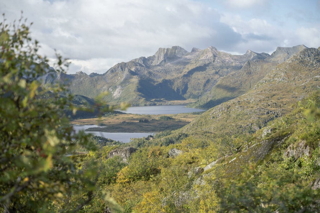
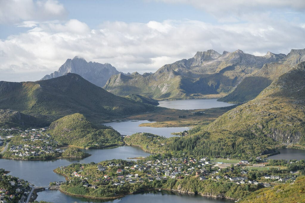
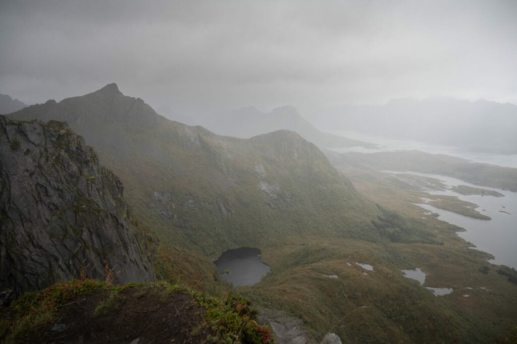
One of the many beautiful views on the Hike to Fløya
Located in Svolvær and the Vågan municipality on Lofoten’s Austvågøya Island, this is a high-traffic area due to travelers arriving by ferry or driving along road E10 – or Kong Olav Road – to or from the southern Lofoten Islands.
So no surprise this is a very popular hiking trail and attraction. Personally, if there’s only one hike or activity you can do in Svolvær, I’d highly recommend this hike. You can do it in half a day, and then go to your next stop or activity.
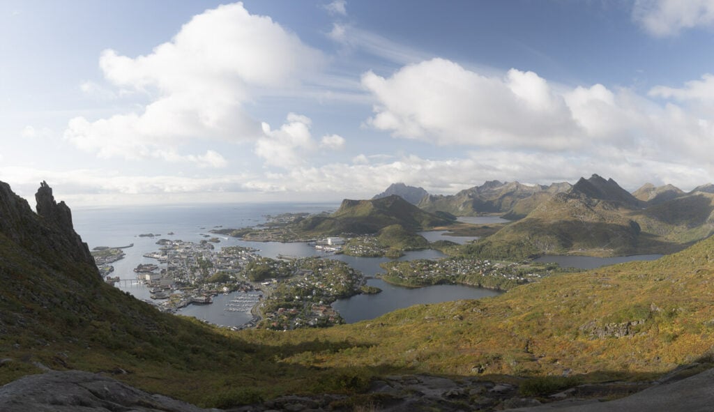
Panoramic view from the trail.
Table of Contents
How to Get to the Fløya and Djevelporten Trailhead
The trailhead to Fløya and Djevelporten is right outside the town of Svolvær and very easy to reach by car – or by foot if you arrive with the ferry but without a car.
There is a large parking area right by the trailhead (click here for directions on Google Maps). While driving there it will almost feel as you you are driving into someone’s driveway, but keep going, there’s a large parking area ahead.
Parking is paid, and you can pay using the EasyPark app.
If you arrived in Svolvaer with the Ferry, you can also walk from the Ferry Dock in less than 30 minutes.
The trailhead is also easily accessible if you are traveling through the Lofoten by Bus. The bus stop is Svolvær øst, served by bus line 300.
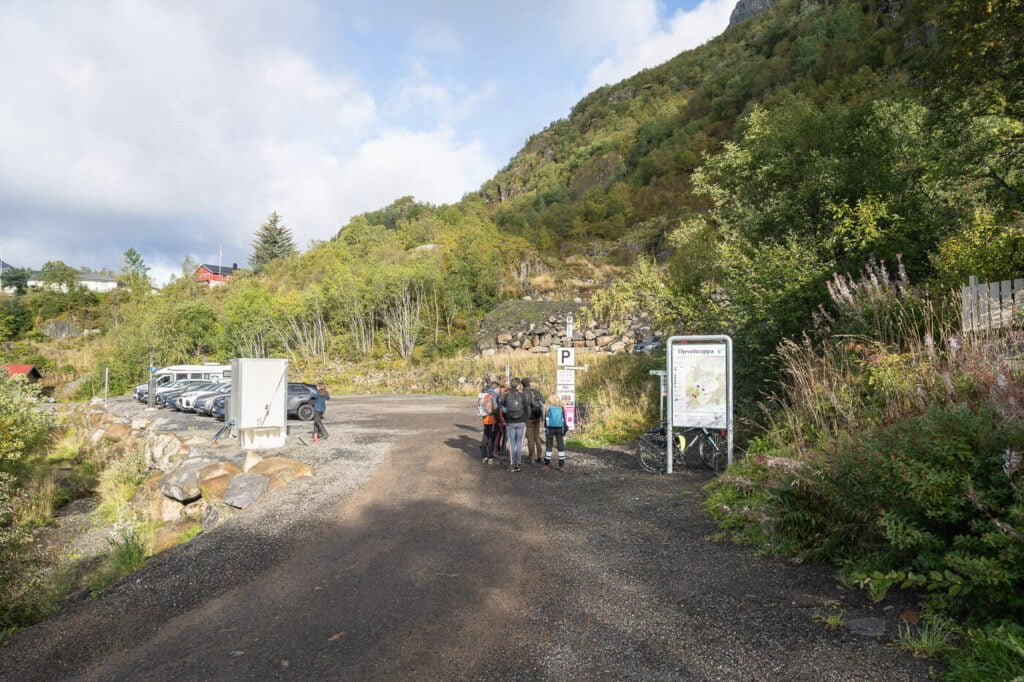
The parking area at the trailhead.
Fløya and Djevelporten Hiking Trail
You can, of course, only hike to Fløya or Djevelporten but combining the two doesn’t add much time compared to hiking only one trail, about 30 minutes and the extra views are worth it.
If you are planning to Hike to Djevelporten only, the out-and-back hike up should take less than an hour. From there, it’s another 20 minutes to get to Fløya.
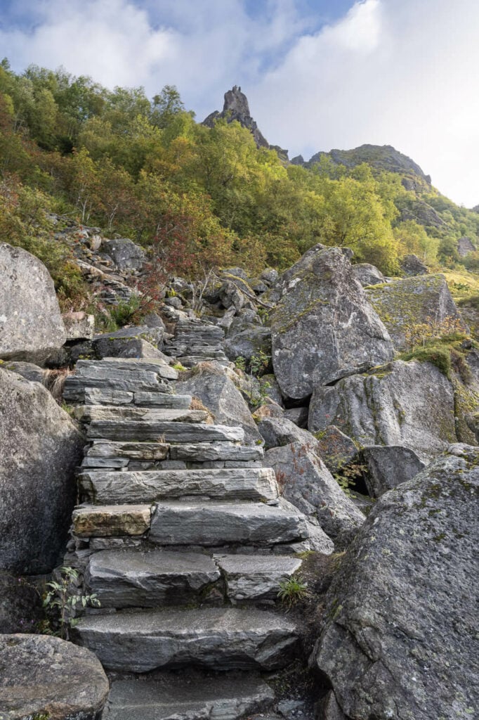
Djeveltrappa – or the Devils’ stair, actually built by Sherpas, pave the first part of the hike.
Hike Time
In total, the hike to both is a little over 4km (4.18 km) with an elevation gain of 620m, and the total hiking time it took me to visit both was 1:43 hours.
Hike Difficulty
Moderate. The hike isn’t too long, and the elevation gain isn’t excessive, but there are some moderately difficult passages on slippery bare rocks.
Here is the map of my hike to both. you can download the GPX file for free from this activity too, if you wish to do so:
Note though: you can’t hike to the very top of Fløya, that’s a small climbing effort. I’ll get into the details below.
Djeveltrappa – or the Devil’s Stairs
The trail starts with what they are now called the Djeveltrappa, or Devil’s Stairs. Construction began in 2019 and the stairs are kind of an attraction in themselves.
Built by Sherpas, the Djeveltrappa makes for an easy first part of the hike. Not only that, but I think they fit into the landscape nicely, they offer a few resting points as well as some fantastic views of the city and the surrounding landscape.
The Djelvetrappa fit nicely in the surrounding landscape.
After the first part of the hike, the middle section becomes a little more difficult. Here you have to navigate through bushes over slippery, flat boulders.
Nothing too difficult, but be careful if wet. The main problem here is the maze of trails and detours along the more difficult passages. It can be quite confusing to navigate this part, but all the trails will ultimately converge sooner or later.
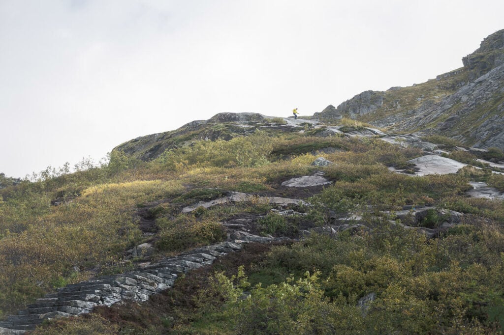
The middle section of the trail after the first part of the Djeveltrappa requires a bit of navigation on tricky terrain.
Anyway, you’ll find signs along the way and you have the option to visit either Fløya or Djevelporten first and then close the hike in a loop.
I visited Djevelporten first.
Getting to Djevelporten
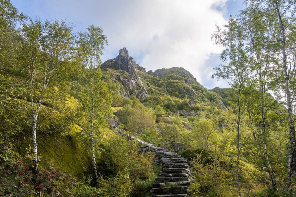
After the middle section, there’s the last part of the stairs, which will bring you to Djevelporten. It’s worth stopping for a moment here to soak in the fantastic view of the Landscape around Svolvær.
There are also a few stone benches you can sit on to catch your breath or just enjoy the views a little longer.
Then, continue to Djevelporten which is now just a couple of minutes up the mountain.
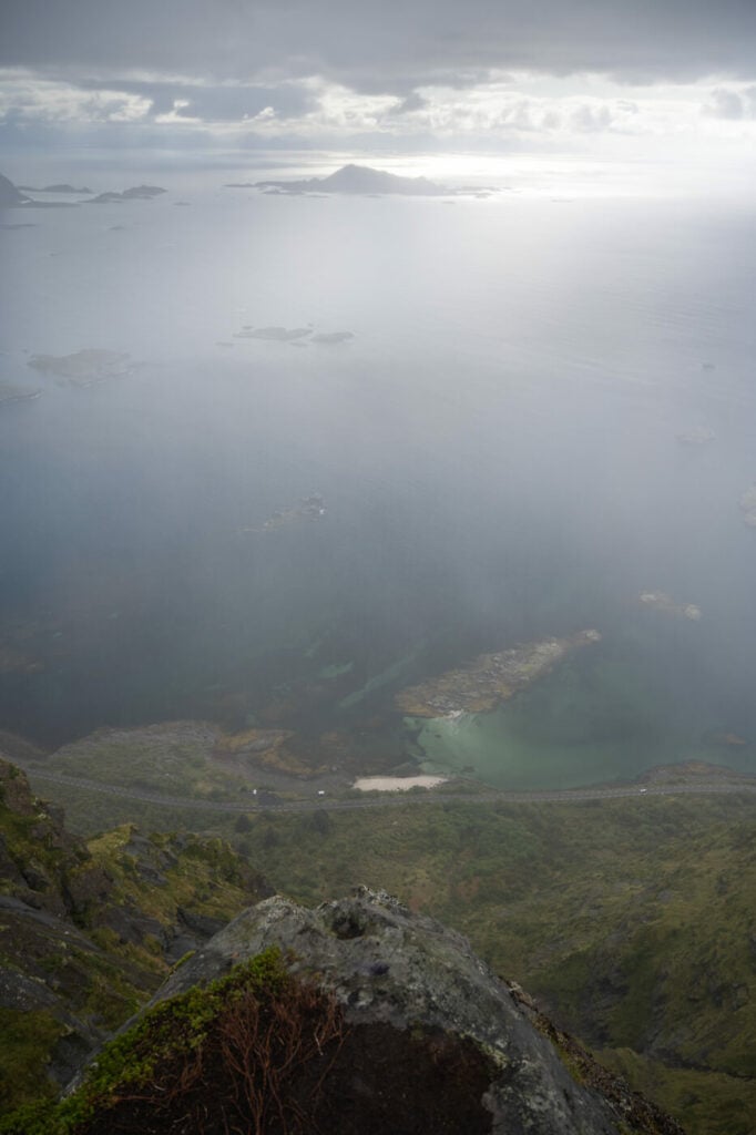
The last bit of the trail to Djevelporten offers panoramic views of the landscape around Svolvaer.
As you walk up the last bit, you may stumble upon Djevelporten quite unexpectedly. It’s smaller than you may expect it to be. It really is a rather narrow crack in the mountain and I almost walked past it, when I suddenly realized “there it is!”.
It is amazing to see how that boulder is wedged in between the two walls of rock. You can walk down, but be careful as there is a cliff with no protection under the rock. Same if you decide to get on top of the wedged rock. You can scramble up the right-hand side of the cliff and on top of it.
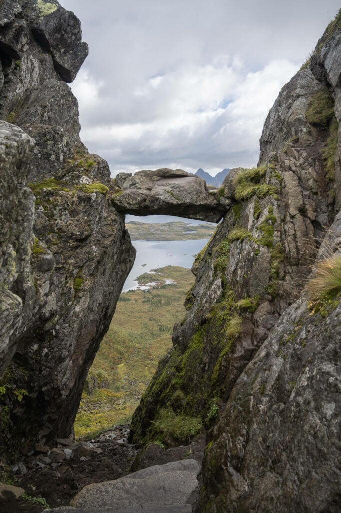
Djevelporten. You can scramble up the right-hand side to get on top of the boulder, but as you can see it’s quite steep and exposed.
From Djevelporten you can either go back the same way or continue to Fløya.
Hiking from Djevelporten to Fløya
If you want to get to Fløya, the trail continues up the side of the mountain, as a sort of ridge hike toward the summit of Fløya. The commenting trail takes about 20 minutes to hike and requires some minor scrambling here and there until you are just below Fløya’s summit.
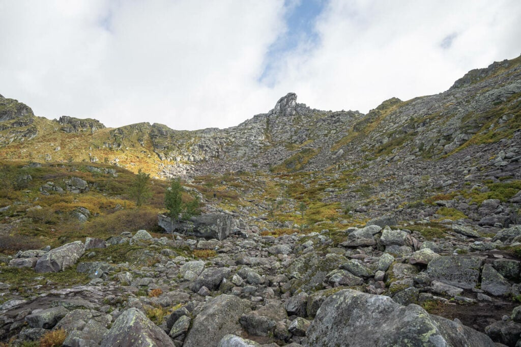
Floya is the summit in the middle. The connecting trail from Djevelporten is just below the ridge on the left.
Here things become a little tricky. The last three or four meters of altitude gain to get up to Fløya’s summit is a rather technical passage, more akin to climbing than scrambling. This section is also completely exposed, with big, point rocks.
For this reason, you should attempt it only if you have at least some minor climbing experience, and absolutely avoid it in wet/rainy conditions.
Those are the same conditions I met while there. I just got below the summit, but it was unsafe to climb on either side. Not many places for a good foothold and only narrow ledges.
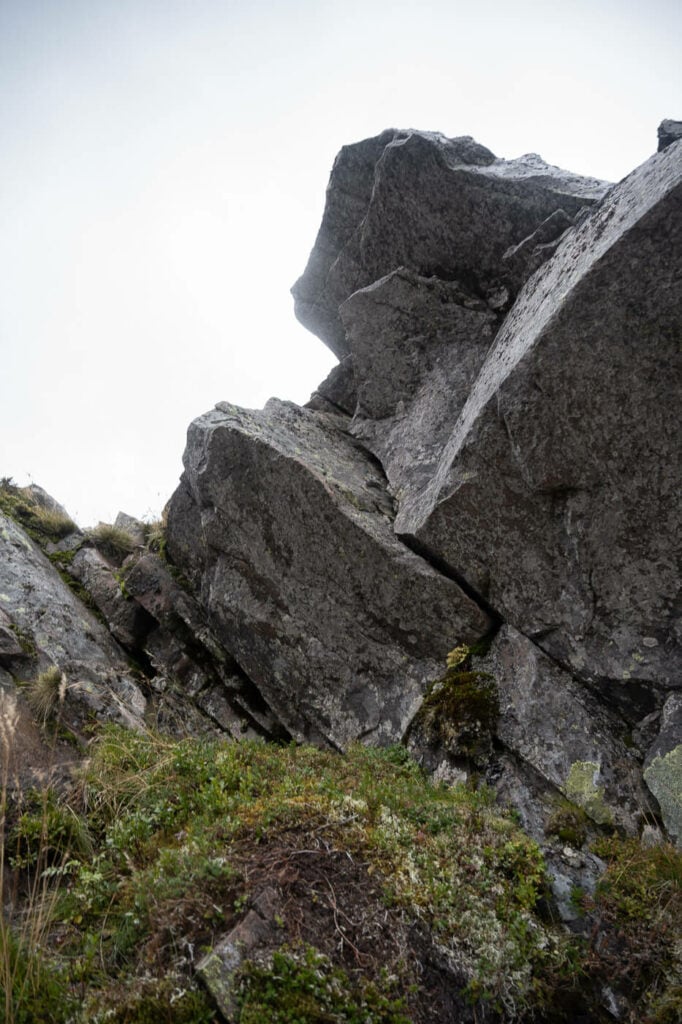
Approach from the northern side.
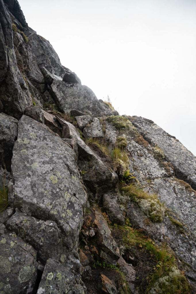
Approach from the southern side.
Fløya viewpoint, without climbing
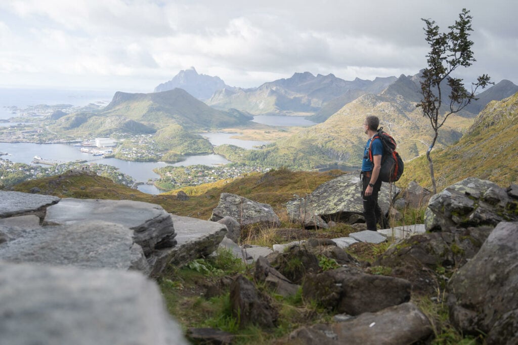
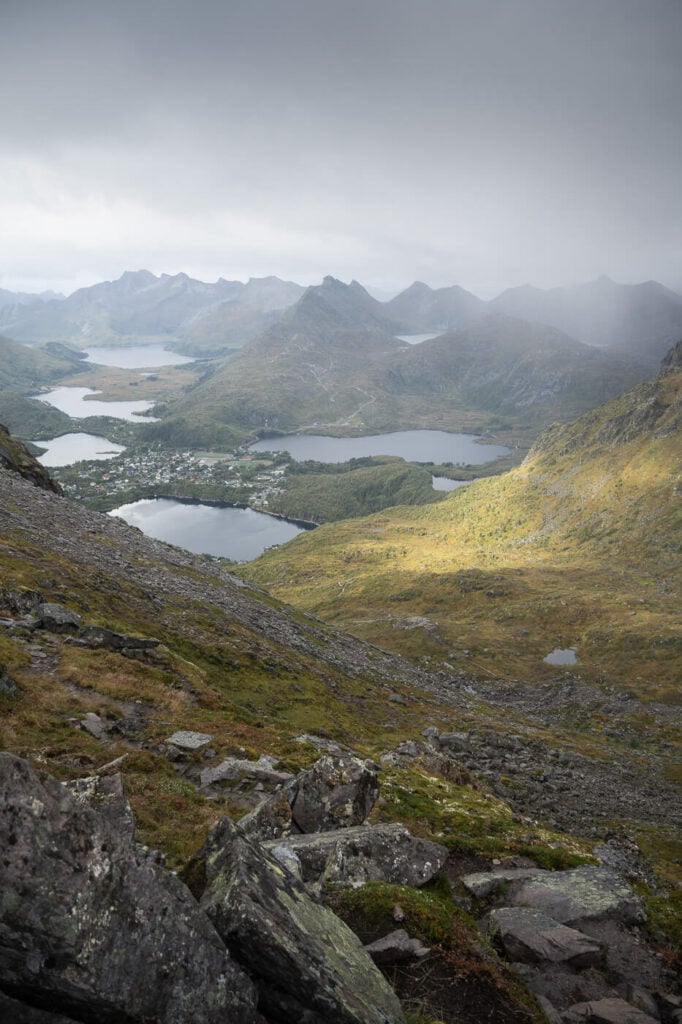
The good news is that you can still experience the fantastic views around the summit without having to climb it. If you take the trail from Djevelporten, you first have the views to the north of Fløya’s summit, with the top of the mountain to your right.
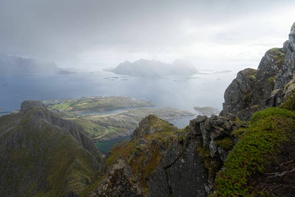
Panoramic view just north of Floya’s summit
From there you can hike to the opposite side and around the summit, toward Svolvær where the views open up to the east and the south.
So essentially you get the same views as from the top, but from two different viewpoints on either side of Fløya’s summit – and without the risks a climbing effort entails.
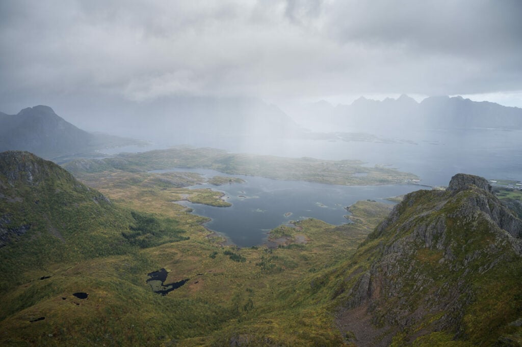
View to the East, just below the summit.
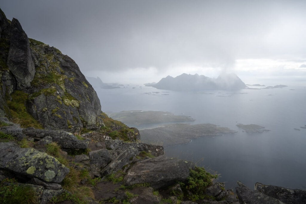
View to the south of Floya’s summit
Then you can hike back down the side of the mountain and the trail will ultimately converge into the Djeveltrappa.
What About Svolværgeita?
I haven’t mentioned it yet, but there is another point of interest; Svolværgeita. The reason why I did not mention it, is because getting up to Svolværgeita requires climbing with proper gear, so it’s not a place you can hike to.
I thought I’d add this note just for completeness. You can still get close to it if you want to, and the detour from the trail is about 500m each way.
However, if you want to climb it, you should talk to and hire a local climbing guide.
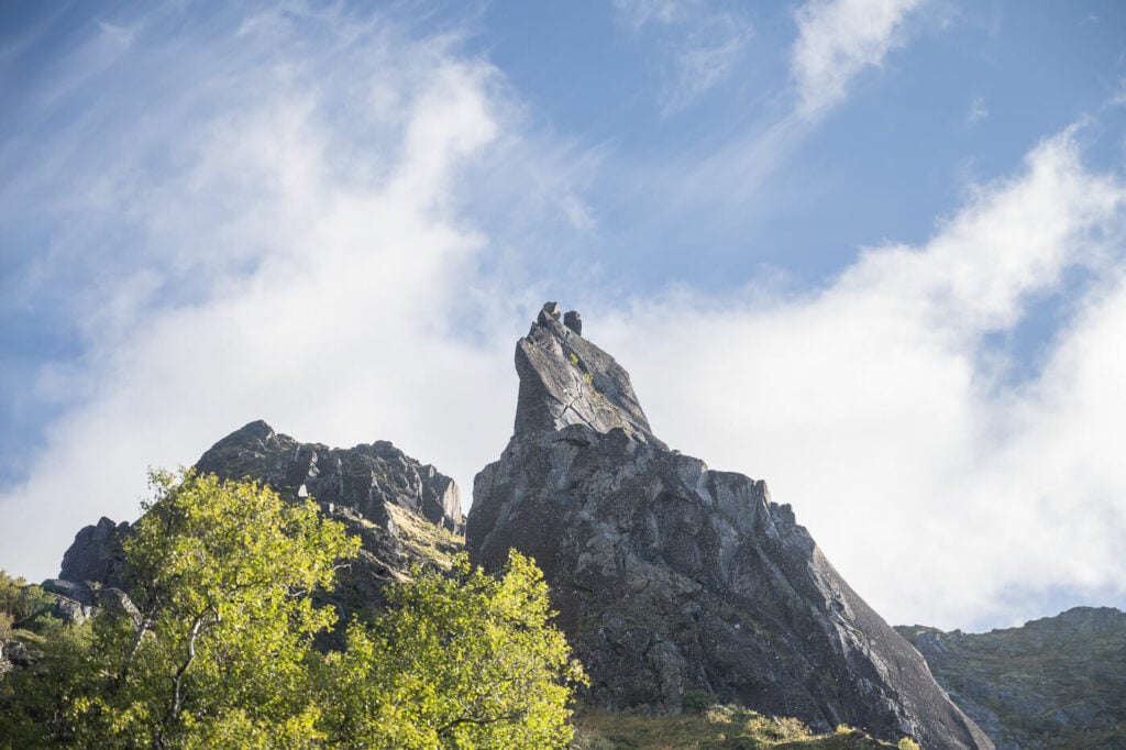
Svolværgeita.
Fløya and Djevelporten – Photos and Photography Tips
If you made the effort to hike to Djevelporten to take the classic photos standing on the wedged boulder, good news; it isn’t particularly difficult to get up to the boulder – but keep in mind: it is very exposed with no sort of protection.
Getting there requires scrambling up the rock to your right, though you may have to queue up if you want to get that shot, especially in Summer.
View through Djevelporten
While I took the photos of that boulder, I passed on the classic photo standing on the boulder. I’m more in on the hike because of the views that the area around Djevelporten offers.
I was surprised by how good the views are. Despite the presence of a relatively large town, the landscape is incredibly beautiful, with mountains, lakes, and dramatic cliffs all around.

Even with a medium telephoto lens, there are plenty of details to isolate in the landscape. I took all the photos with a 24-70mm lens which was plenty flexible for this location and never felt the need for wider or longer lenses.
I did this hike on a September morning and had great light hitting the coast from east/southeast the whole morning. That is when it wasn’t raining :)! Even then I enjoyed shooting in rainy/stormy conditions. To me, this is a perfect combination of weather elements and the conditions I have the most fun shooting in.


That was to say: If you’re doing this for landscape photography, I’d recommend doing this in the morning, especially from late spring to early autumn.
Where to stay
Svolvær is a town of almost 5,000 souls, which makes it the biggest in the Lofoten. This means there are also plenty of accommodations to choose from, ranging from Rorbuer to Hotels and guesthouses or campsites.
Booking.com
On the other hand, if you prefer to stay closer to nature, there are plenty of spaces to choose from in the surroundings of Svolvær, within the limits of Allemannsretten.
Additional Resources
- If you are planning to visit the Lofoten, here are my tips to plan a trip to the Lofoten Islands.
- Here is another great hike with fantastic panoramic views on Austvågøya: the hike to Festvågtinden.
- Check out the main page on Hiking in Norway to discover more beautiful hikes


Leave A Comment