Hike to Røyken (and Ramnan), Easy Hike with Scenic Views, Andøya, Norway
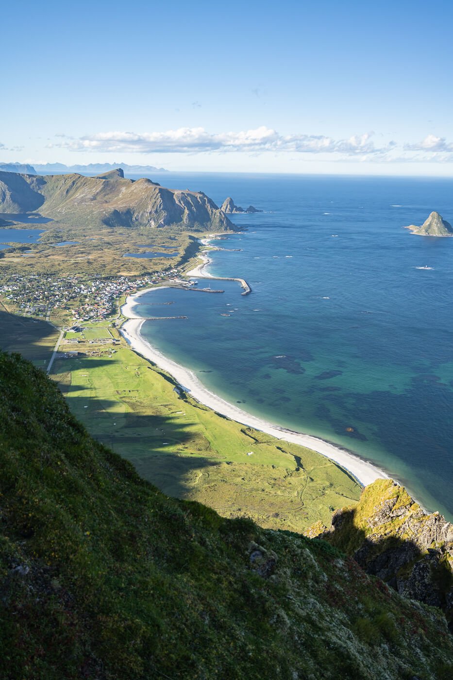
The Hike to Røyken is one of the many scenic hikes on the northern part of the island of Andøya. And, like all the other ones, it offers fantastic views of the coastline and beaches of the Island, especially Bleikstranda, which is the long, white sand beach in Bleik.
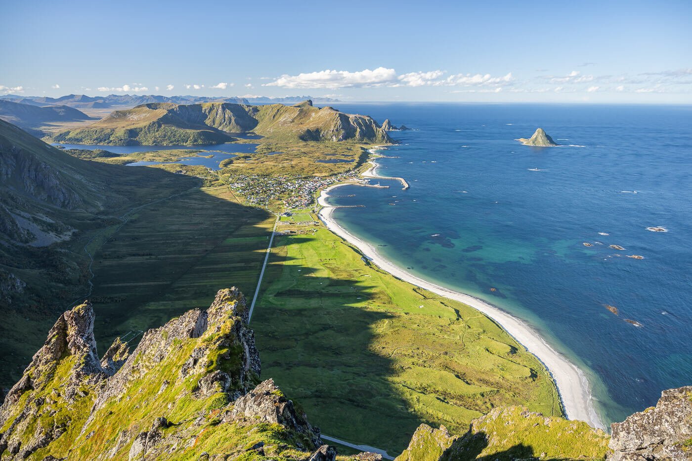
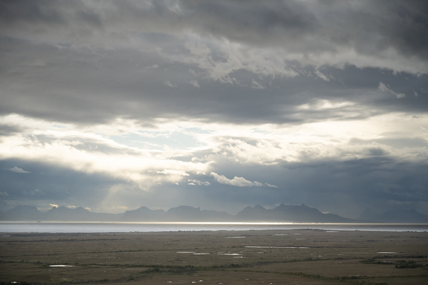
Bleikstranda, from Røyken.
Also, probably one of the easiest mountain hikes near Andenes. Still, the second half is quite steep, all the way to the summit. Considering its short duration, you can combine it with another hike in the area on the same day if you can fit it into your schedule.
If you have never seen Røyken, it’s that towering mountain above Bleik. The one you can see from everywhere in town, and a mountain that shows some bizarre-looking cliffs toward the coast.

Røyken, top right, viewed from Bleikstranda.
Table of Contents
Overview of the Røyken (and Ramnana) Hike & Map
This is an easy hike. Part of it is on a gravel road, and part is on a relatively steep trail. Nothing requires scrambling or even the use of your hands, but it can be slow going.
The gravel road is a private service road that belongs to the Space Center. Employees of the center drive up and down the road quite often, so pay attention. Wear reflective clothing or a lamp at night.
Other than taking, if you don’t include Ramnan – a nearby mountain, the hike is less than 4km, so you could easily combine it with another hike in the area, for instance, Måtinden from Baugtua.
| Max Altitude | 468 m |
|---|---|
| Distance | 6.1 KM |
| Elevation gain | 600m ↑ / 600m ↓ |
| Hike time | 01:30/ 02:00 Hours |
| Hike Difficulty | Easy |
Here is the Map of the Hike. You can download the GPX file for free from the activity linked below.
How to get to the Røyken trailhead and Parking
The trailhead is located between Andenes and Bleik, so it is easy to reach by car and public transport.
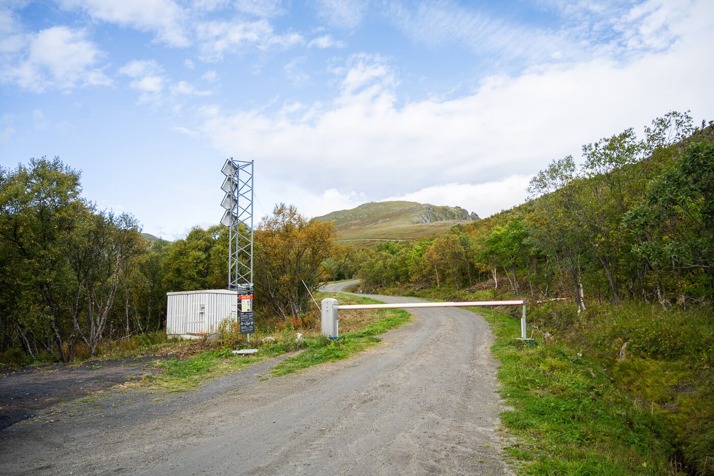
- Driving Directions: The trailhead is located along Road 58. If you are arriving from the mainland, the trailhead will be on your left, right before reaching the Bleik-Andenes crossroad. If you arrive in Andenes by the ferry from Gryllefjord, Road 82 will be the first one to your left just after the Andenes Camping. And, if you are arriving from Bleik, it will be the first one to tour right after the Space Center. However, best to follow the directions to the trailhead parking area (linked below), because it is easy to miss the gravel road where the parking area is.
- Parking: Parking is available by the trailhead, right by the gated entrance. the parking is called “Bjørndalen utfartsparkering“
- Public Transport: Toften is the closest. us to, right outside Andenes. Less than a 10-minute walk to the trailhead from there.
The Røyken Hiking Trail
The trail starts at the parking area right where the road is closed. And, for the first twenty or so minutes, you’ll walk on the road. You’ll then come across a trail to your right, heading up the mountain. The trail is marked by a signpost, so you can’t miss it.
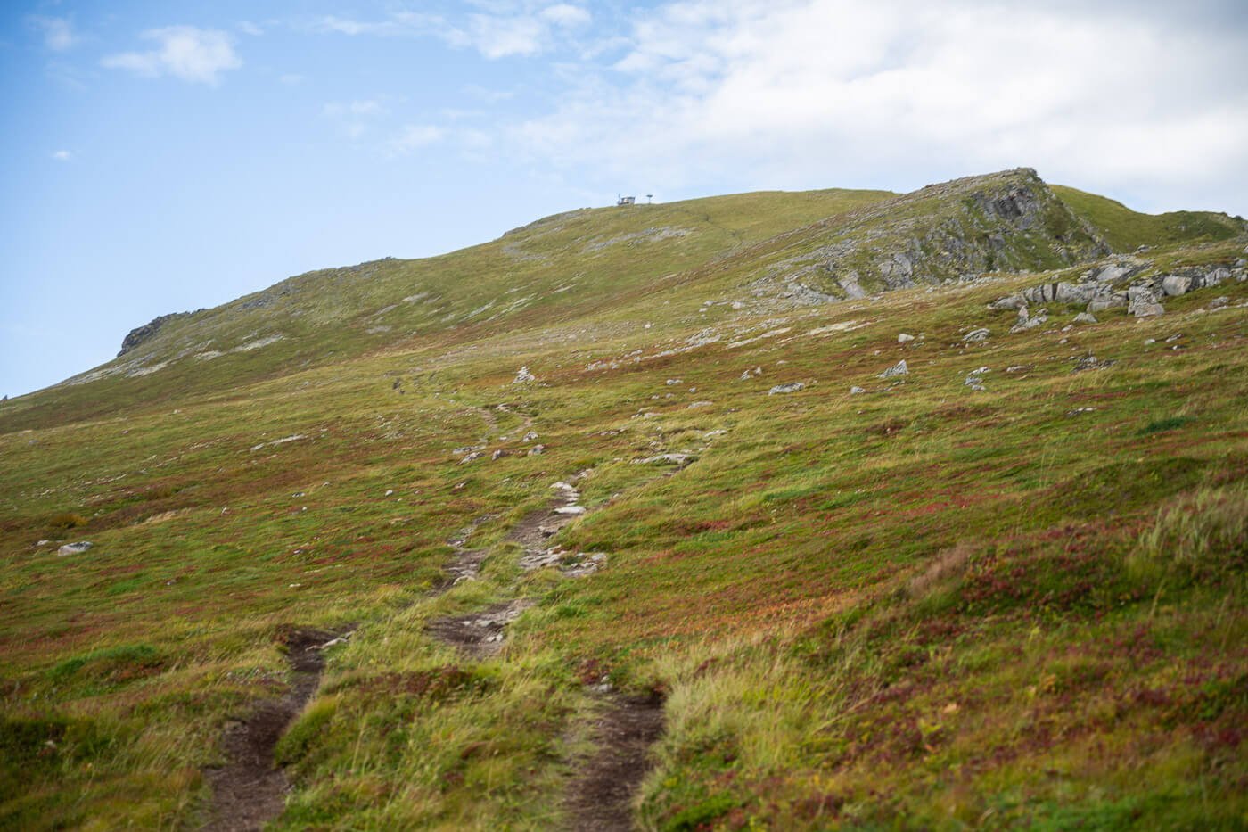
However, as soon as you start ascending, you’ll notice a few trails crisscrossing each other on the way up. that may be confusing as to where to go, but you can follow the general direction toward the hut at the top of the mountain in front of you.
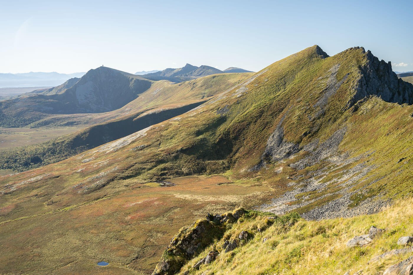
That’s Røykens’ summit. If you want to make a slightly longer detour walk toward the ridge to your right, there are some nice views toward the coast
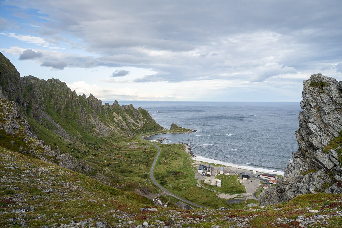
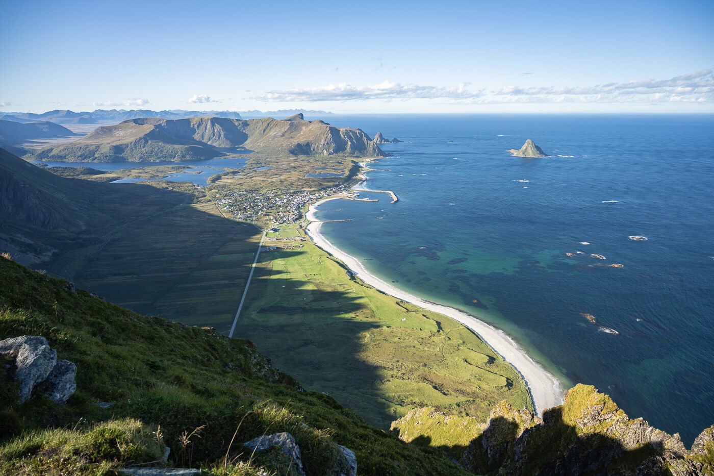
From here onwards the views open up mostly toward the north and the west, revealing panoramic views of the jagged coastlines of Northern Norway’s fjords. these are the views at about halfway throught the climb up to the summit.

Andenes
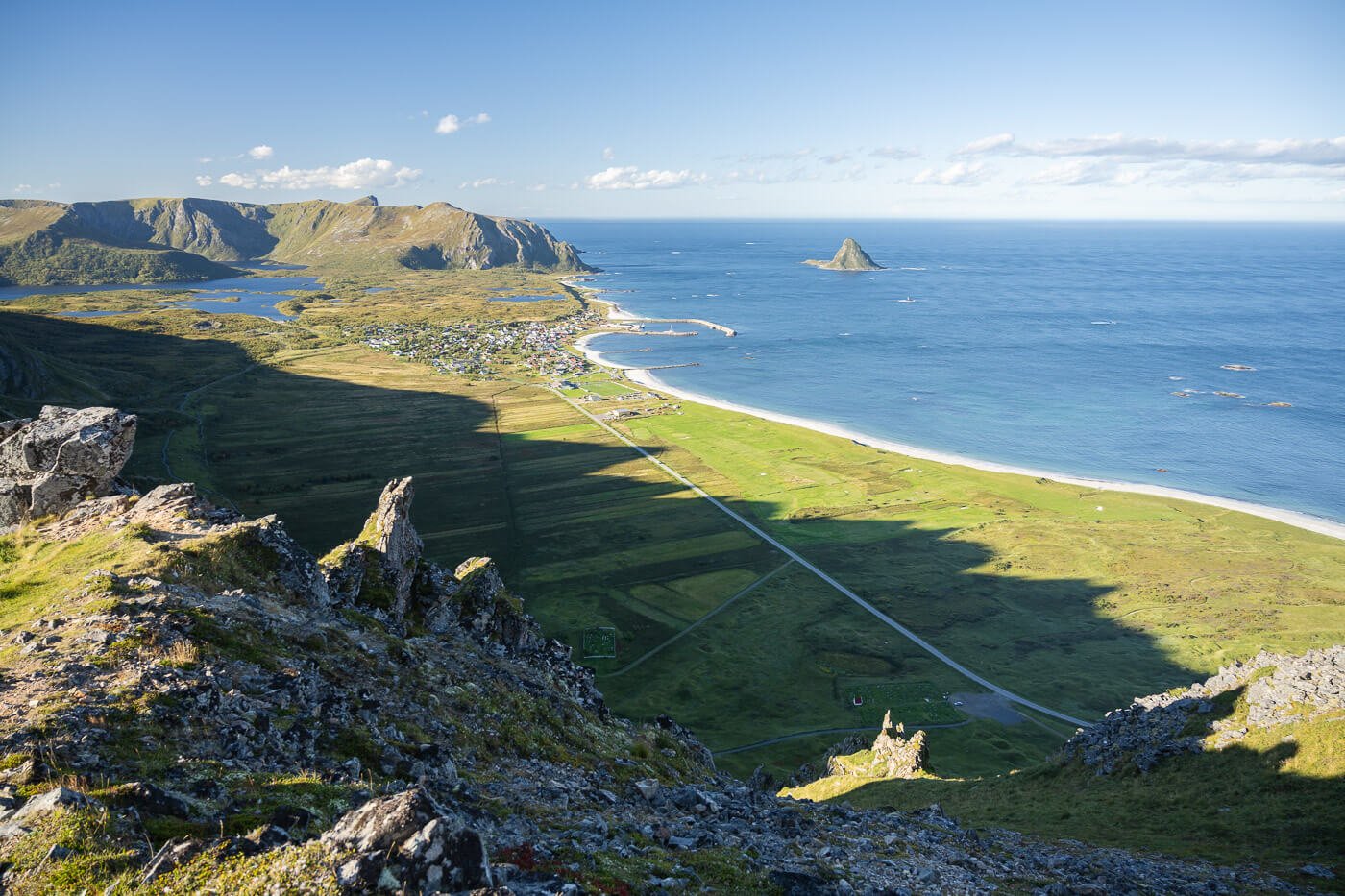
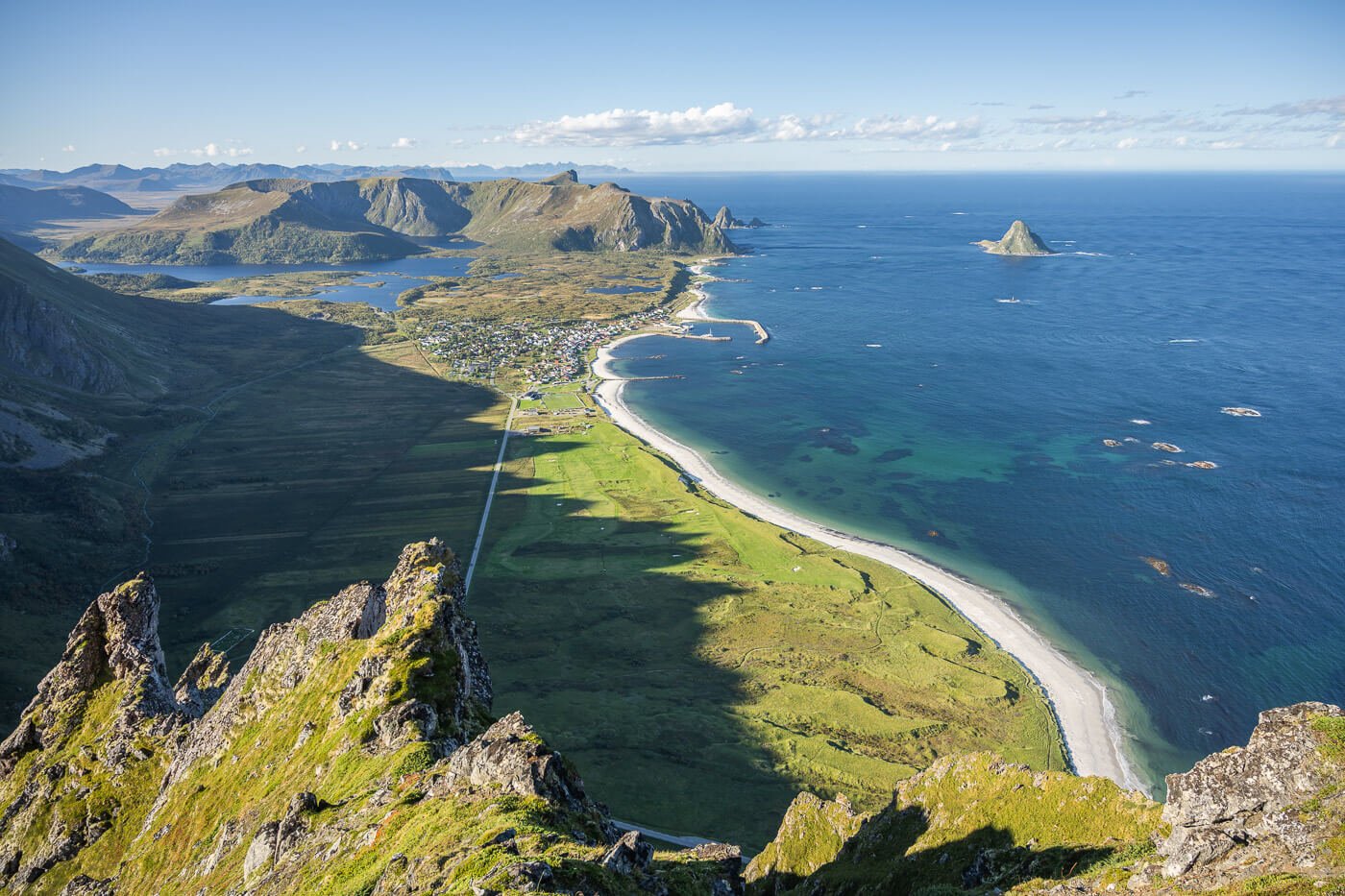
As mentioned earlier, there’s a hut on top of the mountain, and an antenna, that belongs to the Space Center. Once you reach it, the views will open up on the other side of the mountain too, revealing the almost vertical drop and the fantastic view of Bleikstranda.

The hut at the top of the mountain.
View from the top of Røyken
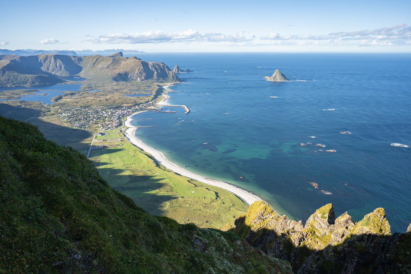
There are a few different viewpoints around the summit, but the view does not change much – the foreground a little.
At this point you can either go back the same way, take a slightly different trail or continue onwards toward Ramnan, which is the mountain right next to it.
From Røyken to Ramnan
If you want to continue the hike, you can also reach a nearby mountain top – Ramnan – in less than thirty minutes. While I did not plan on going there, I did nevertheless. Because, why not?

Ramnan
Admittedly, such a built-upon mountain does not usually entice me – Still, since it was such a short walk,
While the views are nice, they are not as good as the ones from Røyken. Not bad, but not as good. there is, however, a nice viewpoint in between the two peaks that makes for a great viewpoint.

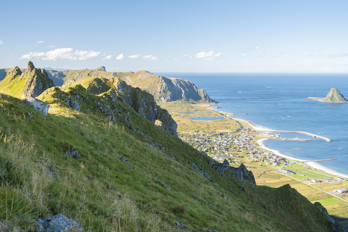
There are a few good viewpoints between Røyken and Ramnan too.
The top Ramnan, apart from being relatively crowded with workers, offers nice views, but nothing better than what you can get from Røyken.
So unless you really want to view Ramnan too, or if you have to choose between the two, I’d recommend to just hike to Røyken, as it offers the better views.
Røyken Photos and Photography Tips
This hike is good for sunrise, sunset, and the northern lights. With such a wild, open view toward the south, you get good lighting conditions throughout the day, except for the middle of the day on a sunny day perhaps.
From a landscape perspective, the view of the coast and the beach (Bleikstranda) is the main highlight. What I think makes it good is the combination of elements, such as the beach and the road that can work as leading lines, and the stacks that can work as foreground objects.
If I had to pick a time of the day, though, it would be sunset. I’d wait until twilight to catch the glimmering lights of Bleik shining under the warm, fading twilight colors. Well, why didn’t I do it?
I initially planned to hike up to Røyken to see the northern lights at night, but after two hikes on the same day for more than 20 km and 1,500m elevation gain, I could not bring myself to do this as a third hike on the same day, without compromising the trip for the following days.
Instead, I opted to do it in the early morning, the day after, right before leaving Andoya. But that is a plan I have not given up on yet, and I’ll surely be back some time in the future to shoot sunset and the northern lights from up there.
Anyway, drones are not allowed up there – it’s private ground belonging to the space center and there are plenty of antennas/instruments on the mountain (and the Andenes airport is nearby).
Where to stay
The trailhead is so close to Andenes that you can almost walk right up to it from there, so it makes sense to stay there if you are spending the night in the area.
Bleik is another good option. A little further south, but everything is so close in this area that it does not make much of a difference.
The Closest campsites are the Andenes Camping and Bleiks’ Midnattsol Campsite.
Additional Resources
- Do not miss Måtinden if you are on the Island of Andøya.
- Check out more Hikes in Norway, with Maps!


Hi! I noticed that there aren’t any photos showing up in a lot of your pages on Northern Norway? I’d love to see them especially as I’m planning a trip as well!
Hi Joanna, thanks for letting me know. It looks like there was some weird caching issue. You should see the images now, but let me know if you don’t. Happy reading!
Yeah I see them now! Thanks for the prompt reply :)