Måtinden Hike – Best Hike in Andøya? Vesterålen, Norway
The Hike to Måtinden is perhaps the best hike on the Norwegian Island of Andøya. It has all the ingredients you would expect from a location in northern Norway; White sand beaches, crystal clear waters, beautiful mountains with steep cliffs, and just an overall breathtaking landscape.
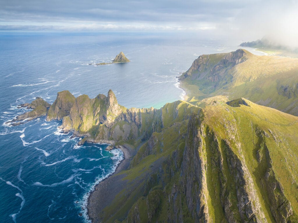
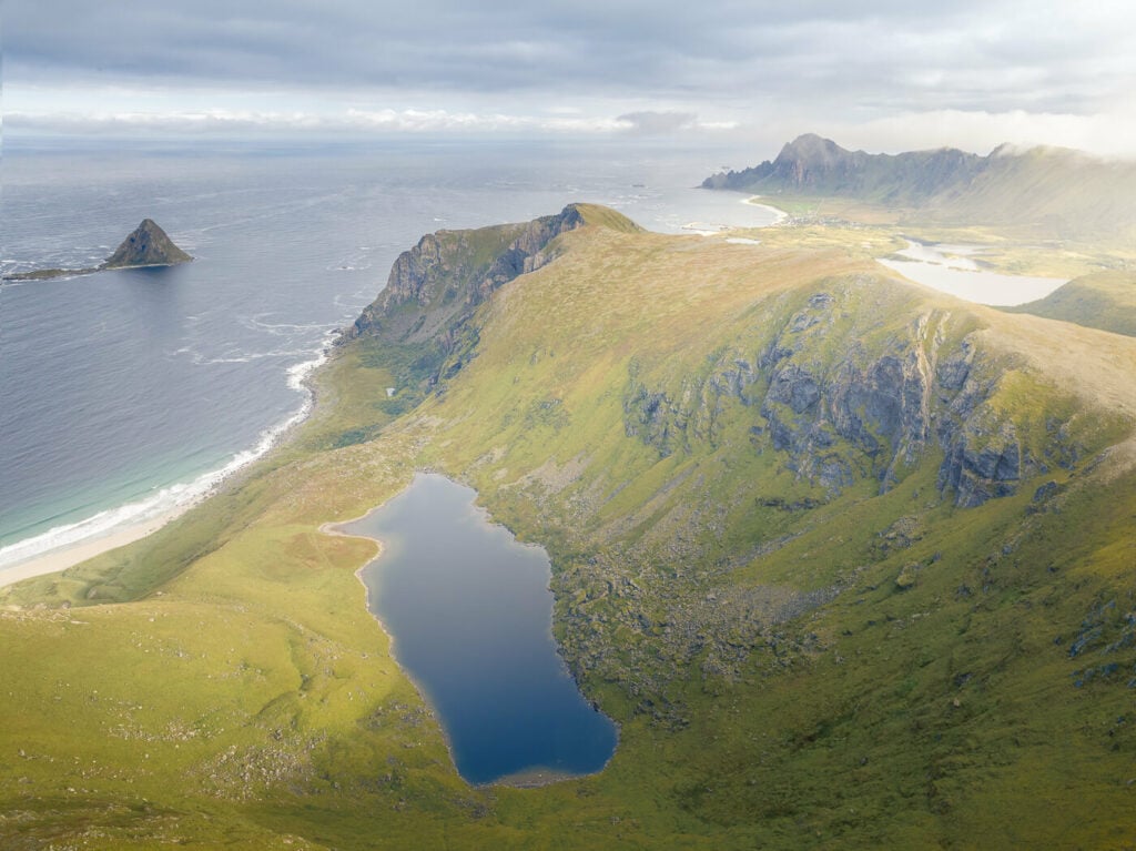
Måtind, Drone View. the summit is in the centre on the right.
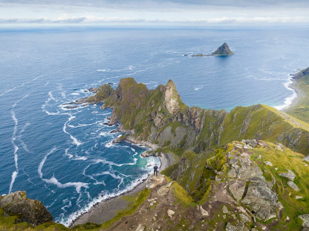
Of all the features though, my favorites are by far the beautiful and somewhat bizarre sea stacks and cliffs along the coast. They really are pretty unique, even by Norwegian standards. And I haven’t mentioned the Høyvika or Otervika beaches yet.
The best part: the Måtind hiking trail isn’t as hyped as other ones in Northern Norway, so it won’t be as crowded. Still, the panorama from Måtinden looks like straight out of a Nordic fairytale.
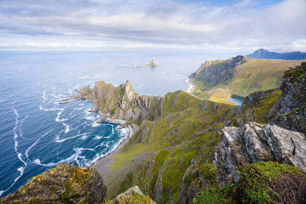
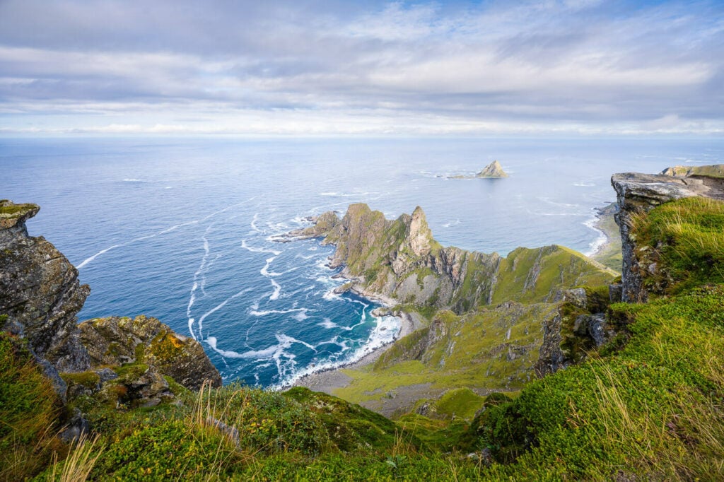
View from the summit toward Bleik.
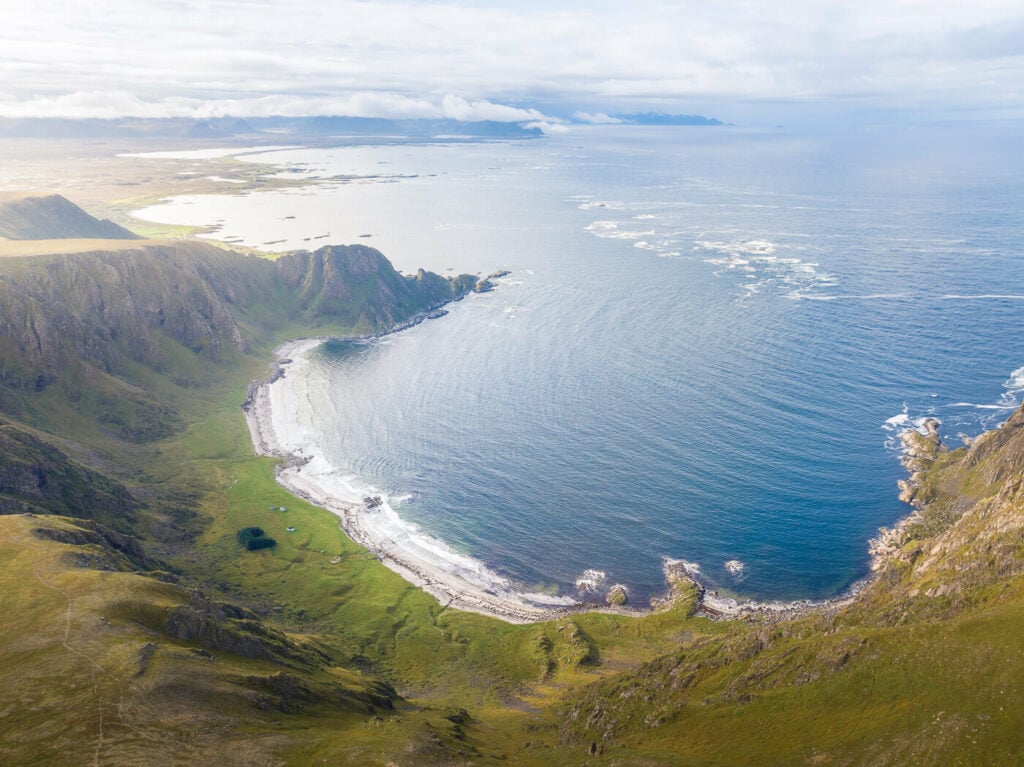
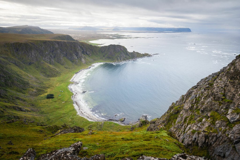
Høyvika beach. definitely one of the best “beach views” in Norway.
To me, this is definitely the best and most scenic hike on the Island of Andøya. I can see myself coming back for more in the near future as this location and its trails deserve to be thoroughly explored.
Table of Contents
How to get to Måtinden and Parking
Getting here will take some time. Located on Andøya Island on the Vesteralen Archipelago, the drive will take about 5/5 hours from Tromsø, or 3-4 hours from either Svolvær or Evenes Airport. No worries though, it’s going to be a scenic drive.
- Driving Directions: The Baugtua trailhead to Måtind is easily reachable by car from either Stave or Bleik. The drive is about ten minutes from each, as it is located right in the middle.
- Parking: there is a very wide, free parking lot at the trailhead. Easy to reach with any car.
- Public Transport: Bus 874 between Andenes and Risøyhamn runs between
Tip: in summer there is a ferry running between Gryllefjorden on the Island of Senja and Andenes, which is just a short drive away from Bleik. This is usually an option from mid-May to early September. Click here for the schedule.
I personally really enjoyed the drive; I arrived here directly from Senja and it took a little over five hours.

Overview & Map of the Måtinden Hike
There are actually a number of ways you can hike to the top of Måtinden. On this occasion, I hiked from the Baugtua trailhead, the shortest one, and it’s an out-and-back hike.
| Max Altitude | 408 m |
|---|---|
| Distance | 8.58 KM |
| Elevation gain | 530 m ↑ / 530 m ↓ |
| Hike time | 02:30/ 03:00 Hours |
| Hike Difficulty | Easy/Moderate |
Here is the map of the Hike. you can download the GPS file from the Komoot activity linked below:
However, you can also hike to Måtinden from either Stave or Bleik and combine it all in one mega hike. For instance, you could include Måtinden in a hike from Bleik to Stave or vice versa. It will be a one-way hike, but you can plan to catch bus 874 running between the two villages. That way, you will get all of the best views of this magic stretch of coast.
Måtind’s summit in the center of the image. Otervika is the beach to the left.
The Måtinden Hiking Trail
The trail is sparsely marked but easily visible at all times, except for a rocky section in the middle of the first climb. Even there, it is still easy to follow.
Initially, the trail is relatively but relentlessly steep, nothing that requires scrambling though. Also, while this part of the hike is a bit of a leg burner, it is quite short and once you reach the top of the climb, you will find a sort of plateau with few uphill sections.
Once you are up on the plateau you can follow a couple of trails. One in the middle of the plateau another one closer to the northern ridge of the mountain that leads to another summit called Nonstind, I followed the latter as it provide great views of the coast around Bleik. It’s a little longer, but worth the views.
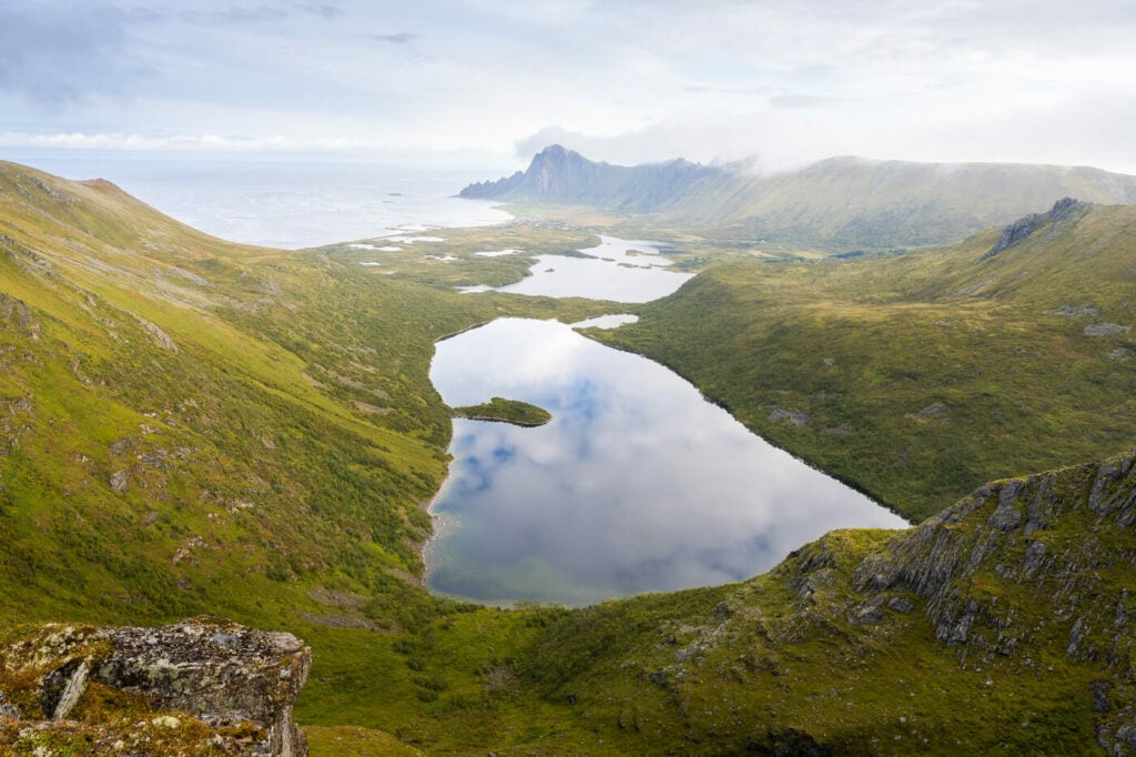
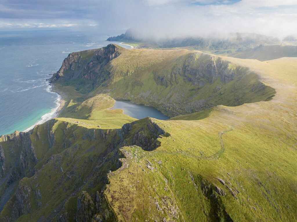
Breiddalsvatnet
From here you will see the summit, a wide, somewhat rounded, rather anonymous-looking peak. It actually does a great job of hiding the beautiful coastline. So prepare for your jaw to drop as soon as you’re on top of it!
I can definitely recommend walking around the summit a bit, especially to get the views of Høyvika south of Måtind’s summit. This is one of the best beach views in Norway.
The jaw-dropping view from the summit.
Høyvika, an extremely scenic beach. View from just below the summit.
The Måtinden Hike Photos and Photography tips
The views from the coast are spectacular at any time of the day, but if you are doing this hike to take landscape photos, be aware the coast will be in the shadows during the central parts of the day.
So you may want to do it early in the morning or, even better, for sunset. The sun will set right in front of the cliffs, so it will provide direct, warm light on them. Sunrise and the mornings will generally provide good sidelight.
Otervikvatnet and Otervika beach.
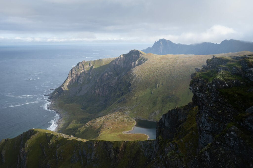
In addition to the stunning cliffs and sea stacks, you can also get good views of the small lakes around Måtind, like Otervikvatnet and Breiddalsvatnet. Also, the already mentioned beaches of Høyvika and Otervika.
You would definitely need an ultra-wide lens and a medium to long zoom lens. I used all the ranges between 14mm and 70mm. Provided you comply with local regulations (EEA ones) you can fly a drone here. This will add even more perspective to the already stunning views. It’s fun to fly and look at the cliffs from all the possible perspectives.
The beautiful and somewhat bizarre coastline.
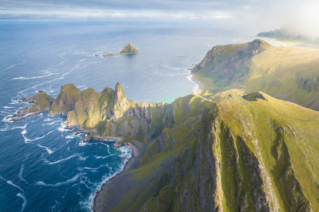
Måtind, view from the summit.
Last but not least, you may also be able to catch some beautiful Amanita Muscaria on this trail. If you are into mushroom photography, fall is the best season to find them, though they are quite common all across Norway.
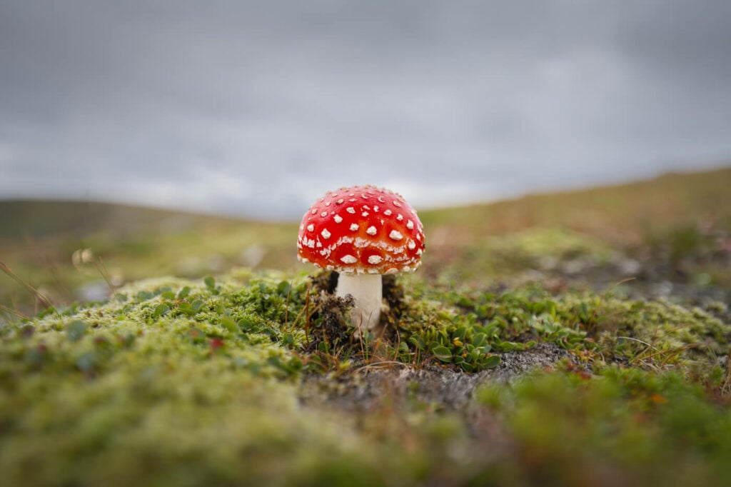
Amanita Muscaria – a toxic and relatively common mushroom in Norway. Found on the trail.
Video of the Hike
Here is also a video of this hike, with a final drone footage:
Where to stay
Most of the accommodations can be found in Bleik, but there is also a basic campsite in Stave. Also, Andenes also offers plenty of choices.
I stayed at the Midnattsol Camping Bleik, which is right on the scenic Bleik sandstrand. It’s a great location for either sunset or some northern lights when the skies get dark. Additionally, it offers both camping and some cottages. The cottages are stunning!
Additional Resources
- Check out more Hikes in Norway
- Also, check out this challenging but rewarding coastal hike to Otervika. You can also reach Matinden from there. And you can also hike to Høyvika, which I’d highly recommend.
- Discover the Best Hikes in Andøya
- A bit of a fun fact. There is a space center just north of Bleik, the Andøya Space Center, which also includes a Visitors centre. This is a good place to visit if you happen to be here on a rainy day.


Leave A Comment