Hike to Festvågtinden, Lofoten Islands, Norway
Located in the beautiful little town of Henningsvær, the hike to Festvågtinden is one not to be missed. It is a relatively short hike, at less than 3km in total and 540 m of elevation gain, but it surely offers fantastic views of the Austvågøya and Vestvågøya islands. Apart from that, Festvågtinden is just a beautiful mountain!

View of the trail to the top of Festvågtinden
If you are on a road or hiking trip in the area, I’d highly recommend stopping here for a quick hike and maybe a coffee and cake stop in one of the town’s cafes. Additionally, Henningsvær really is a nice little town worth a visit in itself. Also, a nice place to just stroll around for a bit, even if you are not here for hiking.
The Festvågtinden Hike trailhead is just outside town. You would actually pass by it before reaching Henningsvær and from there, it’s just a five minutes drive. Now let’s get into the details.
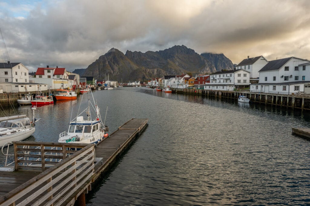
Henningsvær, the town center. Festvågtinden is in the background.
Table of Contents
Overview of the Festvågtinden Hike
At a total elevation gain of 541m, the hike is moderately difficult. However, depending on fitness levels, it may be a bit of a leg burner.
| Max Altitude | 541 m |
|---|---|
| Distance | 2.89 KM |
| Elevation gain | 500↑ / 500↓ |
| Hike time | 01:40/2:00 Hours |
| Hike Difficulty | Moderate |
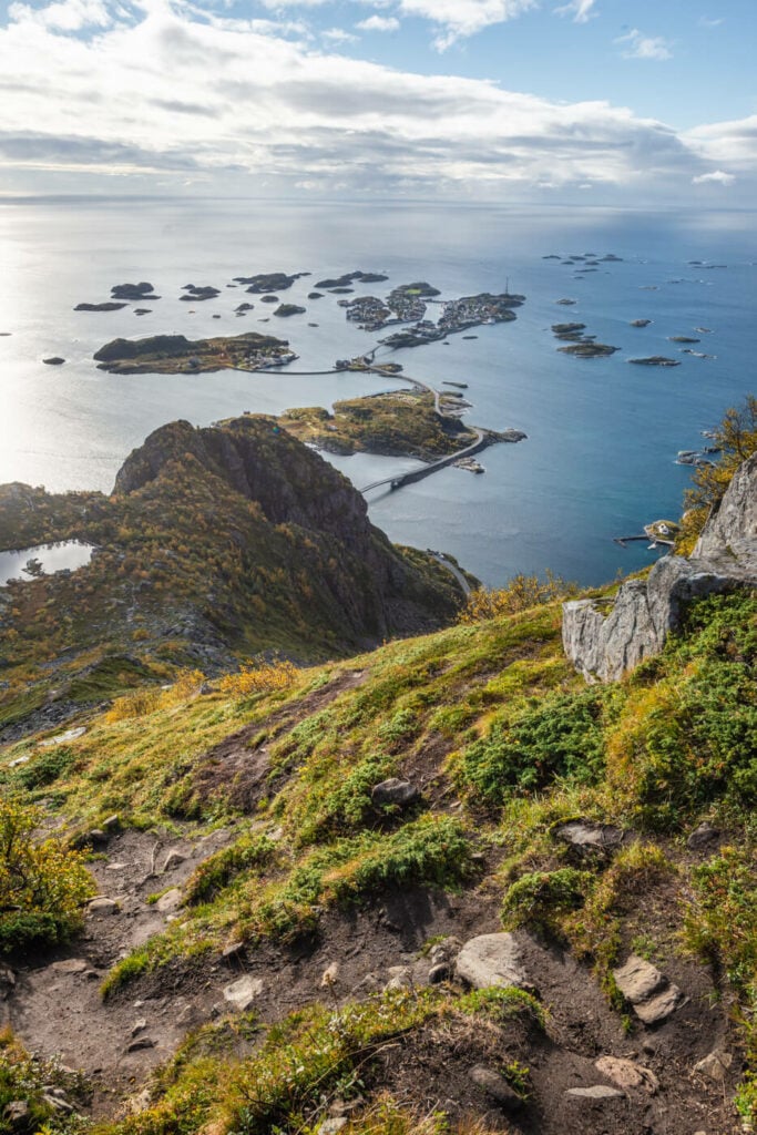
View of Henningsvær from the trail up to Festvågtinden.
How to get to Festvågtinden and Parking
- Driving Directions: getting to Henningsvær requires taking a short detour from the E10 King Olaf’s road. turn onto road 816 when you see the sign and keep following the road until you reach this small beautiful tactic arctic town.
- Parking: parking is available on the side of the road. You can park the car there. The trailhead is just a short distance across the road. You can’t miss it.
- Public Transport: the best option is line 743 goes from Svolvær. Generally speaking, however, bus connections in the Lofoten are not great, but doable if you have a lot of time available and are not in a hurry.
The Festvågtinden Trail
The trail starts immediately by the side of the road, and it is rather steep right from the beginning. There are no flat areas until you are almost on top of the mountain. On sunny days, you will also likely sport rock climbers making their way up the vertical cliffs of this mountain. This is also a very popular rock climbing location if you are into it. If you, like me, are not into it, you’ll probably be wondering how the heck they can manage the climb up that vertical wall and you’ll probably be happy just to be on a regular, albeit steep hiking trail :).

The steep trail up
Back to the trail; as you almost reach the top, the trail will turn left into a flattish area that will lead you to the summit. There are quite a few boulders you would need to negotiate your passage with, but nothing too difficult. Once you’ve passed this boulders section, you will be on the top of Festvågtinden. While the summit is a relatively narrow and rocky place, it’s possible to walk around to admire the views in all directions.
This is a place that may be crowded during the day, so I’d recommend planning a hike for sunrise, sunset, or during midnight sun if you are here in that season.
The Festvågtinden Hike Photos and Photography tips
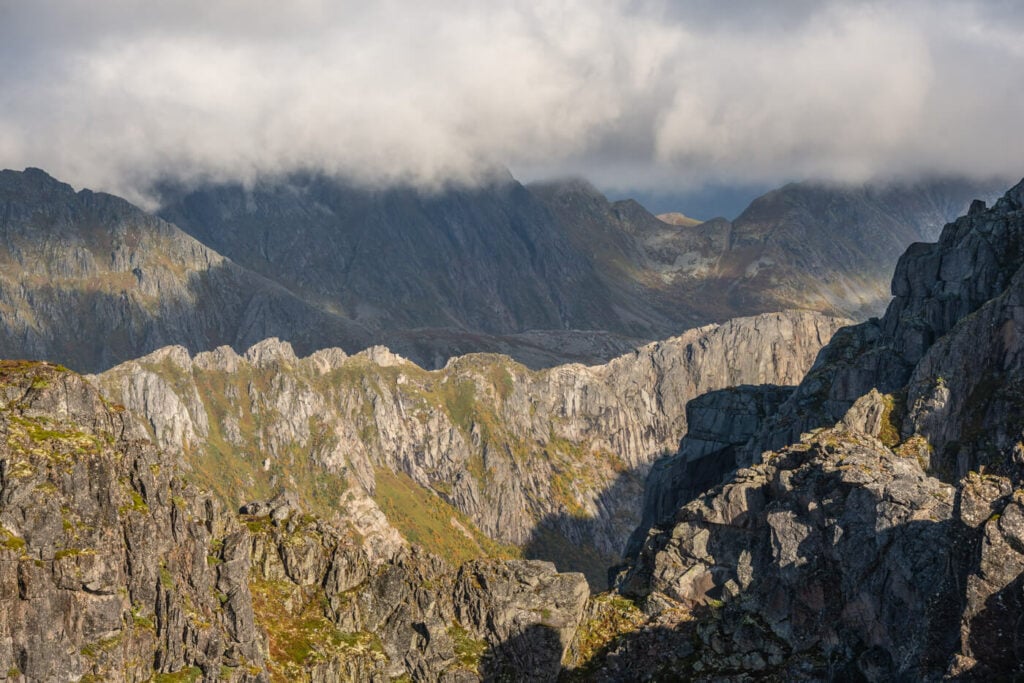
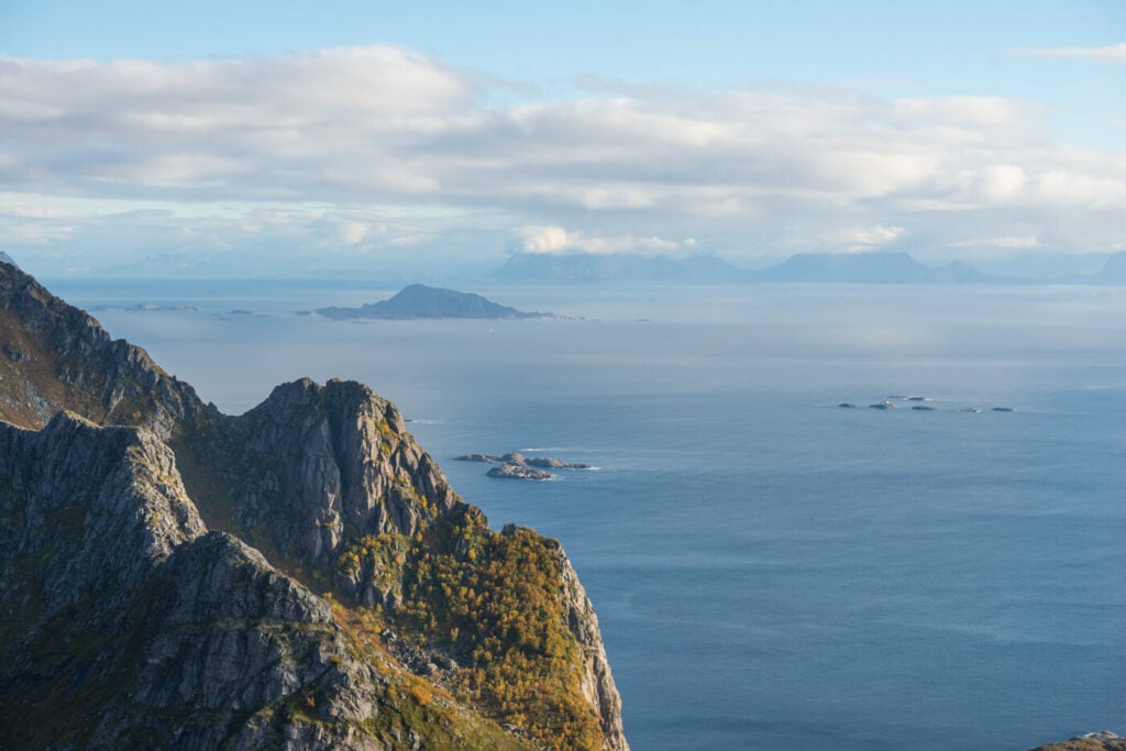
The summit provides fantastic 360 degrees panoramic views of the surrounding mountains and Islands. A telephoto lens will come in handy. The views are wide open in any direction. on a clear day, you could see a good part of the Lofoten Islands. A telephoto lens will provide the opportunity to capture several different compositions and subjects from the same spot.
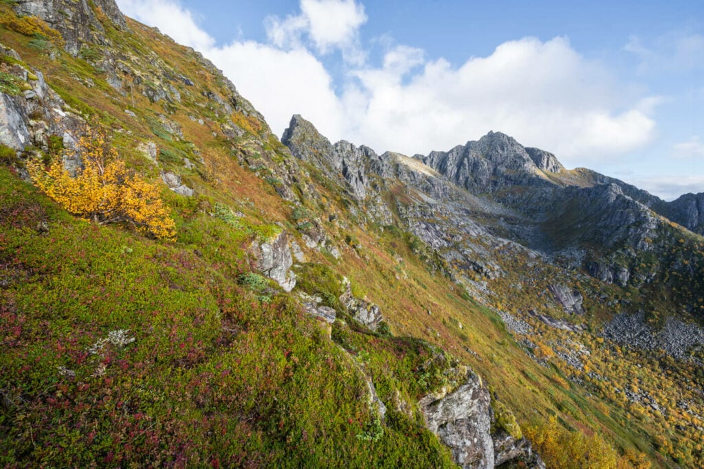
On the other hand, a wide angle may not get too much use here. Or at least not from the top. Since the views are wide open, there is not much that could be used as a foreground and the farther-away mountains will appear too small with a wide-angle lens. Still, the way up offers good opportunities to use one and to include some vegetation or rocks for your foreground.

Henningsvær, in the nice early morning light
View opposite from the photo above
200mm shot of some of the beautiful mountains around festvågtind
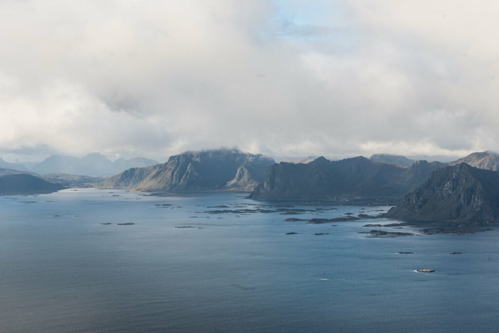
Beautiful morning light with a view toward the southern part of the Lofoten Islands
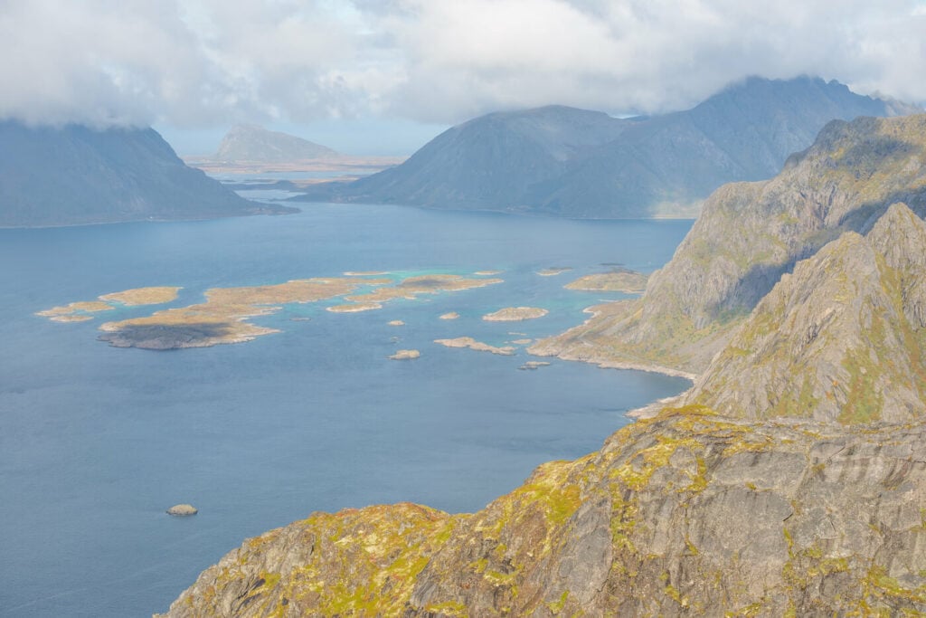
View from the Summit to the west

A nearby summit
Even changing light on the eastern side of the Lofoten Islands

another 200mm shot of the Mountains to the south
Map of the Festvågtinden Hike
Where to stay
Henningsvær would be the most obvious choice. It’s a beautiful small town with nice cafes and restaurants. The town is built on a few small islands and it’s a great place to just go for a stroll and explore. Otherwise, this location can easily be included in any itinerary to or from the southern tip of the Lofoten.
Additional Resources
- Be sure to check out this other great Austvågøya, the hike to Fløya and Djevelporten.
- Planning a trip? Here are my tips to plan a trip to the Lofoten Islands.
- Check out the main page on Hiking in Norway for more Photo Hikes and inspiration.


Leave A Comment