Djúpá River Canyon Hike (with Gufufoss and Bassi Waterfall) – Iceland
The hike to the Djúpá River Canyon is a bit of a “secret” hike to a canyon with waterfalls in the south of Iceland. It’s also hidden in plain sight of the main tourist circuit of Iceland; Route 1. This means that despite being a rather hidden location, it’s quite an easy one to get to too.

The waterfall Gufufoss on the Djúpá River.
No signs mark this location, and you can’t see it from the road.
This is the sort of place you are likely to have all to yourself if you decide to visit it. Also, places like this are one of the reasons why I keep going back to Iceland, year after year. I keep finding new ones and with each new trip, I always come back with the discovery of a few new places I had not planned on visiting.
That’s how I got to this rather unknown place on the south coast of Iceland, and found out about Bassi (also referred to as Nafnlausfoss or Bassi Fossinn sometimes), Gufufoss (please note, this is not to be confused with the other Gufu waterfall in the east of Iceland), and this beautiful, small canyon along the Djúpá River.
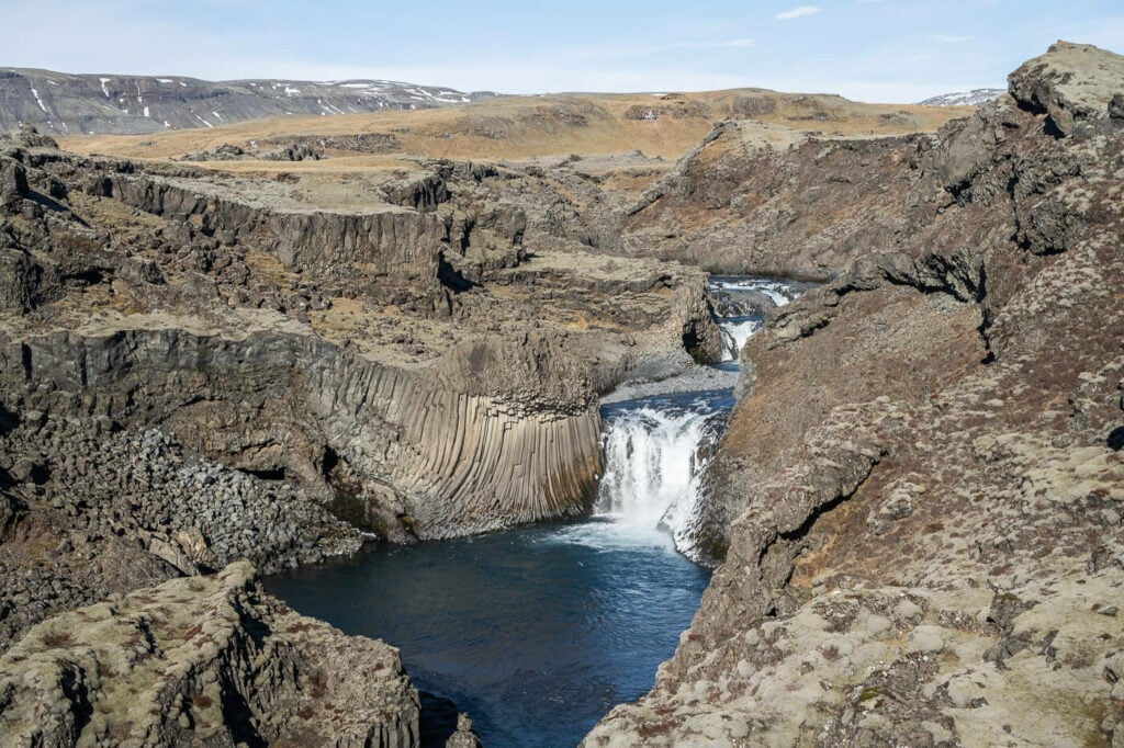
The Bassi Waterfall
Anyway, there isn’t a wealth of information available online on this trail or this location in general – even on the Nat.is website there is only a small entry. So I thought I’d do a full post and here’s the full report, and how to get there.
How to get to the Djúpá River Canyon
Access to Djúpárdalur and the trailhead for the Bassi and Gufufoss waterfalls is easy. Very Easy. As mentioned above, the trailhead is in a rest area on Route One.
To be precise, this is the rest area from where you can hike into this beautiful little Canyon. It’s called “Kálfafell Parking”.
The trailhead can be reached in less than half an hour from Kirkjubæjarklaustur – and it is just about 5 minutes south of Mount Lómagnúpur.
If you have already been to Iceland, chances are you stopped here already. If you did, you probably also wondered what could have the landscape possibly hidden from view. I did too – and the last time I stopped here for a break, I ventured out into the landscape.
Hiking to the Bassi Waterfall and Gufufoss & Map
This is a rather easy and short hike, with some relatively steep sections. However, none of them require scrambling.
Here are the details and the map of this Hike:
| Max Altitude | 115 m |
|---|---|
| Distance | 3.92 KM (out and back) |
| Elevation gain | 80-100m ↑ / 80-100m ↓ |
| Hike time | 01:00/ 01:15 Hours |
| Hike Difficulty | Easy, with some steep sections |
For some reason, the recording shows more than 500m in elevation gain; that is definitely an error. I would estimate the total elevation gain to be no more than 80-100m, which is the value I used in the table above.
From the Parking area to the Bassi Waterfall
As you leave the small rest area on the side of Road 1, you can follow any of the poorly visible trails that follow the river in the general upstream direction.
For most of the hike, The trail is pretty much non-existent. You will only see occasional traces of it here and there.
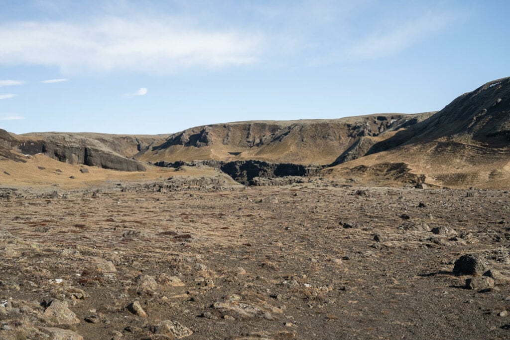
As you leave the parking/rest area, head toward the general direction of the river.

As you approach the monitoring station (visible on the right-hand side), follow the faint trail uphill.
You should pass by a monitoring station right by the river, and from there, the uphill section of the trail begins.
The trail isn’t very hard here, but it is steep in places. At the highest point, you’ll get the first view of the first waterfall, Bassi. Bassi is a relatively small waterfall surrounded by beautiful somewhat contorted basalt columns. From other sources I found online, it should be about 10 meters high.

It isn’t possible to get close to the Bassi waterfall, it’s too deep into the gorge. The two photos below were takewn at a focal lenght of 70mm, to give you an idea.
On the other hand, you get some good views both from the trail and the ridge above it.

First view of the Bassi Waterfall.

Closest position to Bassi. Taken at 70mm on a full-frame camera.
From the Bassi Waterfall to Gufufoss
From the Bassi Waterfall, keep following the river upstream. Again, you can follow a poorly visible trail that sometimes disappears.
Soon enough, you should also hear the roaring sound of another waterfall – the second one on this hike, Gufufoss. It should take about 20 minutes to get from the Bassi waterfall to Gufufoss.
This is the first full view of the waterfall:

First full view of Gufufoss from the trail.
Now, granted I visited in the Icelandic winter, I had access to two viewpoints. one close to the riverbed and one above it.
Water levels were relatively low in winter; the Djúpá River is of glacial origins (Síðujökull Glacier) so during the thawing season the water volume will be higher – as well as after rainfall. That is to say, only the upper viewpoints may be accessible at certain times of the year.
Unlike the Bassi Waterfall, it is easy to reach Gufufoss’ lower viewpoint.


It is also easy to reach the upper viewpoint. From there you’ll have a direct view of the water falling into the gorge below. Be careful and assess the conditions of the rocks before getting too close to it, it’s completely exposed.
I was lucky enough to catch a small rainbow to:


Gufufoss faces south, so it should be decently lit on sunny days. However, I am looking forward to coming back in the summer and perhaps visiting with some moodier conditions. A bit of fog and low-hanging clouds would be on my “wish list”; I think these conditions would make for some nice images too.
To close this post; this is an out-and-back hike so you will need to backtrack your steps to the rest area on the ring road. The view is nice enough on the way back too!

Leave A Comment