The Lómagnúpur Hike, South Iceland
Mount Lómagnúpur is one of those landmarks that just can’t be missed; a huge, beautiful wall of rock along the Ring Road, that stands out even from miles away…and surely some of you may have wondered if it is even possible to hike up there? As a matter of fact, yes it is! You can hike all the way to the top of that seemingly inaccessible rock. The summit isn’t actually at the top of the rock facing the Ring Road but a few km behind it. But no worries, you can also get to the top of the rock face.
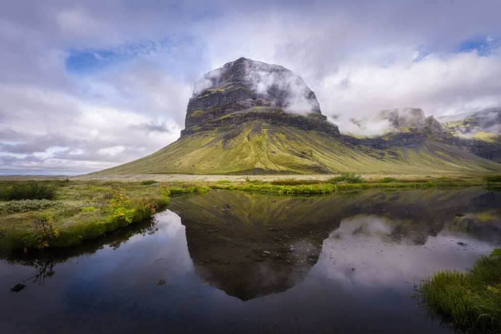
Lómagnúpur, mirrored in one of the puddles at its base.
First off, the hike isn’t easy. It took me a good deal of time spent on route finding and navigating using the GPS topo map. The trail is unmarked and only visible here and there. So be prepared for that. Apart from that, a hike to Lómagnúpur is sure to provide you with an amazing full-day hiking adventure.
Lastly, I unfortunately don’t have many photos to show in this post. Just before reaching the summit, a thick fog engulfed the mountain. I kept going and hiked in a thick wall of fog for a few hours, hoping it would open up a bit. It didn’t.
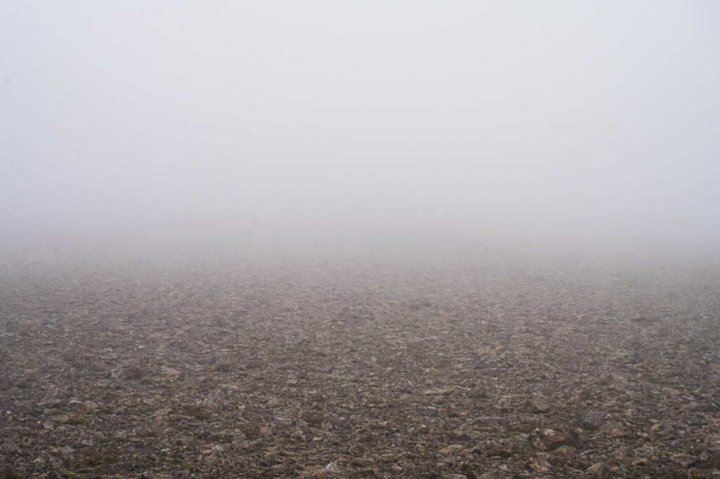
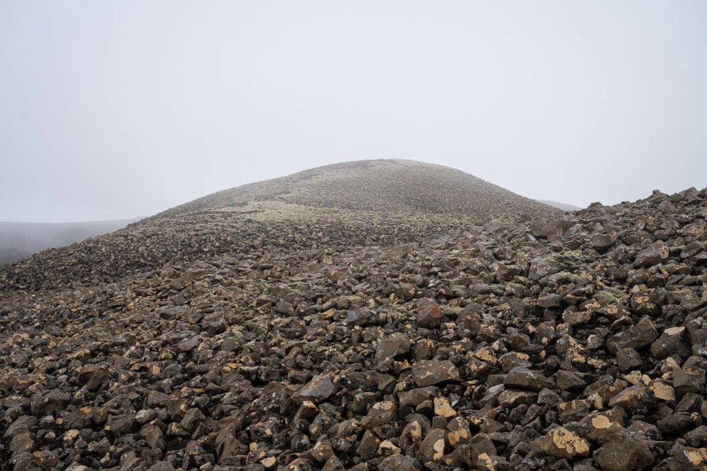
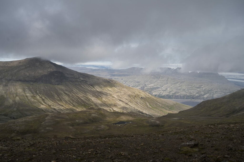
Here is what much of the landscape looked like during the hike at the top of the mountain.
Occasionally, the fog would birefly open up and reveal the beautiful landscape around Lómagnúpur.
The fog prevented me from seeing much of the landscape. So be advised I don’t have many photos to show. Still, I hope you can find this post useful if you are planning to hike up there.
Going to Iceland? Blue Car Rental Discount!
As a reader of The Photo Hikes, you get a 5% discount on your car rental when booking with Blue Car Rental through this website. The discount will be automatically applied to the booking through the following link
Table of Contents
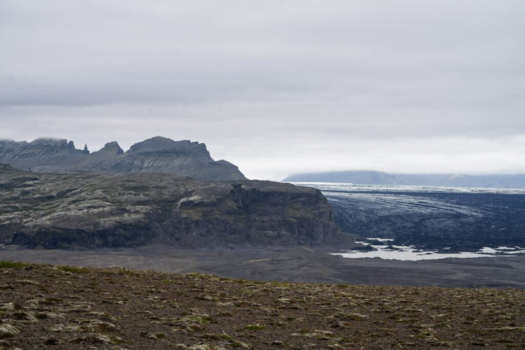
View toward the Haoldukvisl glacier
Overview of the Lómagnúpur Hike
Please note the total distance is based on my own hike, which includes some detours due to route finding. That took quite some time and the distance added up. Without all the route-finding detours, the hike will probably be 3-4 km shorter. Likewise, the total hike time will be considerably shorter, at least a couple of hours. Hopefully, my route-finding efforts will help you save some time though :)
| Max Altitude | 763 m |
|---|---|
| Distance | 18-20km KM |
| Elevation gain | 1,200m ↑ / 1,200 m ↓ |
| Hike time | 05:30/ 06:30 Hours |
| Hike Difficulty | Hard |
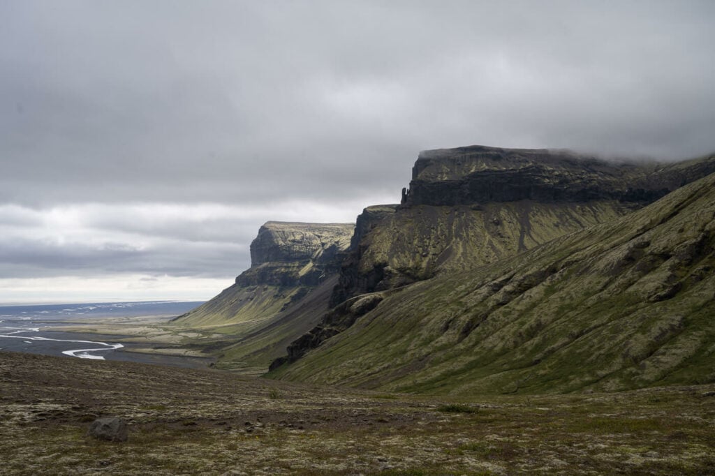
The beautiful cliffs close to the trailhead.
How to get to the Lómagnúpur Trailhead and Parking
- Driving Directions: From Road 1 (the ring road) turn into the Lómagnúpur parking area on the side of the road. You will see a gravel road heading toward the river and away from Lómagnúpur. The road is generally suitable for any car with a decent clearance like a Duster or a Jimny. There are however a few roads cross-crossing each other, but all should ultimately lead to the parking area next to the Hvita River. Don’t try to cross the river!
- Parking: you can park at the end of the road next to the Hvita River.
- Public Transport: none, at the time of writing, not even paid tours.
The Lómagnúpur Trail
From my research when I was planning the hike, I discovered one trail from the west side which apparently requires climbing, and two possible routes from the east side. Since I’m no climber, I went for the trail on the east side.
On that side, I found two trails, both circling around Lómagnúpur to climb it up on its north side, to then walk all the way across the mountain onward to its top to the side facing the ring road. I only found a GPS track of one of the two trails, taking a shorter route through what seemed a steep but doable section. This turned out to be a mistake, as we’ll see.

Believe it or not, this is the trailhead. Can you see it in between the bushes?
Hiking to Lomagnupur’s summit
The trailhead is quite difficult to spot because it is hidden by some thick bushes. I only noticed it when I returned to my car at the end of the hike. I did not see it on my way up, so I climbed the steep slopes above the river. If you find yourself in the same situation, turn back and look harder for the trailhead, it’s much safer and quicker. Anyway, here’s the trailhead. You can use this photo to practice so you can spot it once you get there :).
Back to the trail; The first part is actually quite easy, even if the trail is only partly visible. You would need to hike up to a ridge where you will find an old broken fence. You’ll need to hike past it and get on the other side.
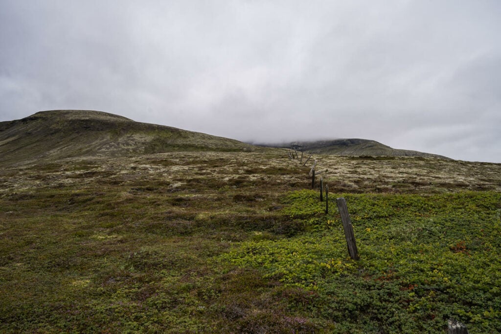
an old fence along the trail.
Here I’d recommend not gaining too much altitude and hiking closer to the river instead. I have tried to hike up as much as possible following an older trail, but that turned out to be unsafe. I’m not sure if there was a recent rockfall, but there are too many unstable rocks to climb over safely, so I had to turn back and follow the river all the way up to the other side of the mountain. I’d recommend following the river from the beginning instead, to avoid ending up in the same troubles I ran into.
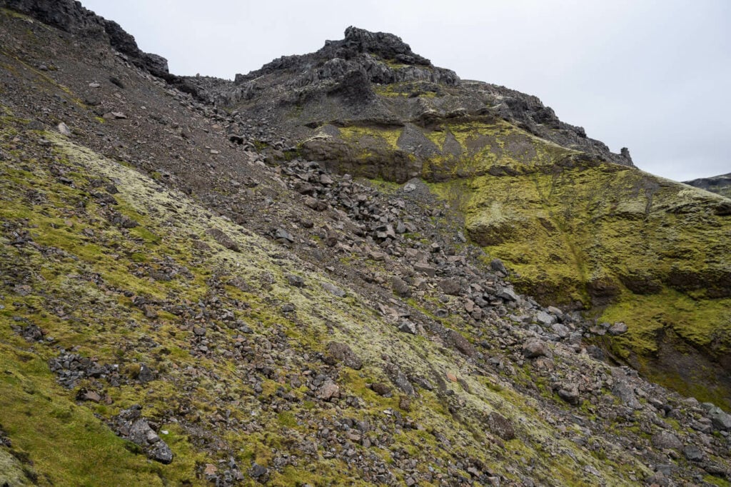
There is (or was) a trail up this slope. I’d recommend avoiding it as it is steep and there are many unstable boulders.
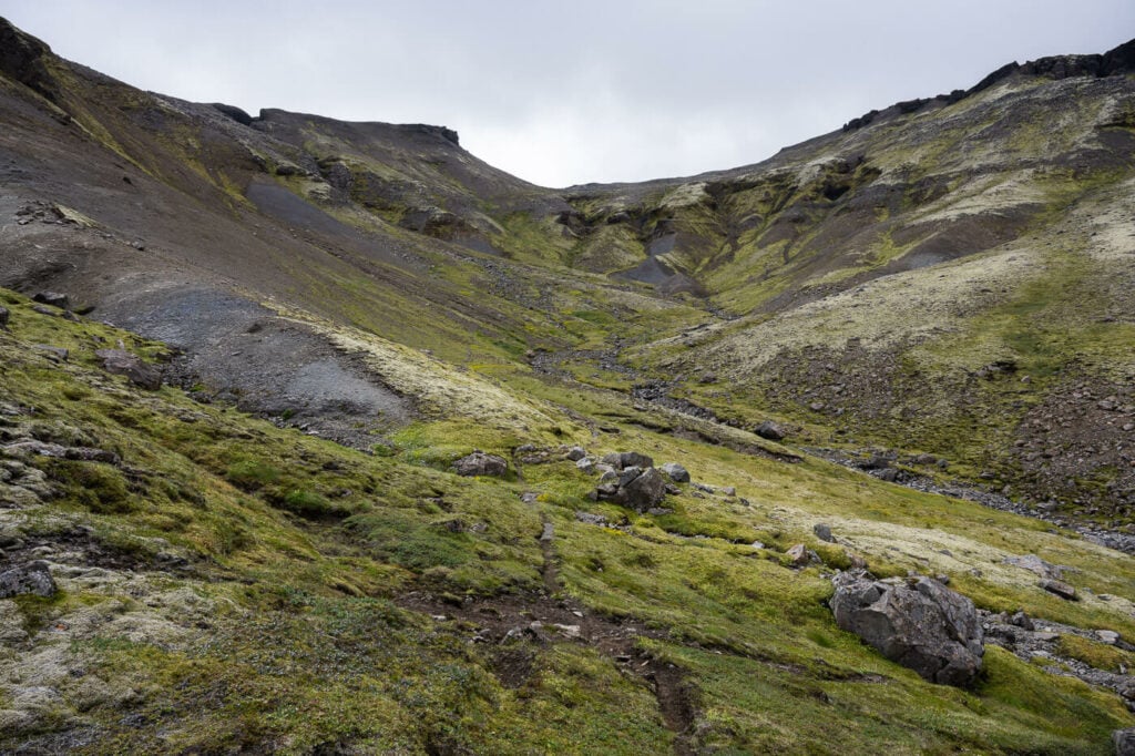
Hike up the pass in the middle of the image instead. Then turn left.
The trail gets a little steeper as you approach the plateau at the top of Lómagnúpur. Once you’ve reached the highest the hardest part of the hike is behind. A big cairn marks the summit of Mt. Lómagnúpur.

After a while, you will see the Cairn marking Lomagnupur’s summit.
From the Summit to the Cliffs
Once you’ve hiked up the mountain, it’s just a long walk all the way to the part of the mountain facing the ring road. Probably about 3 km. There’s a system of cairns you should be able to follow. I wasn’t able to because I was surrounded by a thick fog, but you should be able to see them from afar on a clear day.
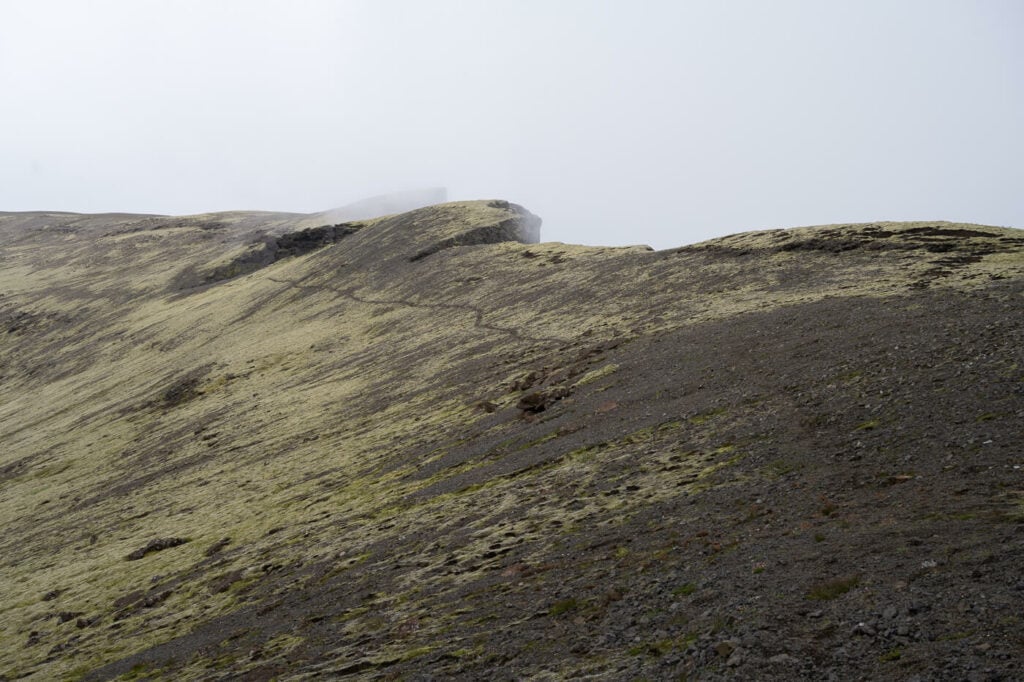
Here is what much of the landscape looks like for most of the trail at the top of the plateau.
It’s a very alien-like and barren environment up there. It’s not a particularly difficult hike but there are lots of rocks that make progress slow sometimes. No visible trail until you reach the side of the mountain just before the cliffs on the ring road. Here you will spot a narrow trail. You are now close to the cliffs.
If you’ll make it all the way there, enjoy the views! I could not because of the fog, but I’ll take it as the perfect excuse to hike Lómagnúpur again.
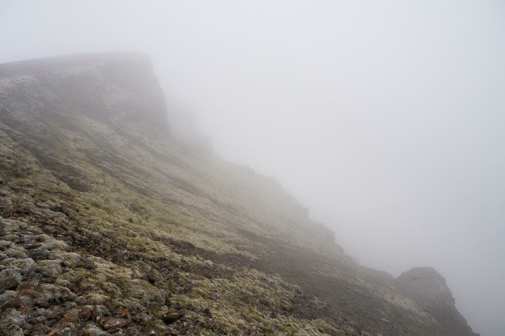
The narrow trail before the summit. Almost there.
The view from the top of the rock face. Yikes!
Video of the Hike
Here is also a short video of this foggy hike. You can still see some of the fantastic landscape, despite the fog.
The Lómagnúpur Hike Photos and Photography Tips
Well, I surely wish I had more photography tips. Even though I love photographing in the fog, there wasn’t much to photograph this time. What I can say is you’d need a telephoto lens. Lómagnúpur is a tall, relatively isolated mountain, so you’d want that extra reach to capture the fine details in the landscape and to isolate the main features, especially the Haoldukvisl glacier and the Hvita river.
Still, from the little I could see the views appear to be really breathtaking. This hike actually left me wanting more, to see and photograph more of the beautiful landscape that was hidden behind the curtain of fog I found myself in. However, the landscape is truly beautiful even before reaching the top, so there are going to be plenty of sights worth a shot.

Obviously, you may also want to take the classic photo of this beautiful mountain reflected in one of the puddles at its base. To do that, you can just park in the rest area by the bridge and walk around to find the most suitable one. Beware though; there can be storms of midges!
Anyway, I am looking forward to getting up there again on my next trip and fully enjoying the views. An take some more photos.
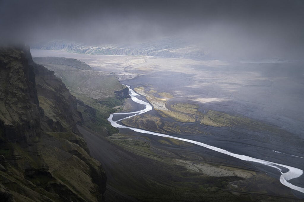
The Hvita River, during one of the infrequent breaks in the fog.
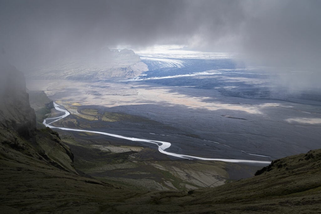
Another view of the Hvita river, with the Haoldukvisl glacier in the background.

View of the eastern side
Map of the Lómagnúpur Hike
Here is the map of my hike. Much of it involved route finding, so it is considerably longer than what it would normally be.
Where to stay
The closest accommodations may be found in either Kirkjubæjarklaustur or in the Skaftafell National Park area.
Additional Resources
- More hikes nearby: The beautiful Svartifoss, The Kristínartindar Hike, or the unique Fjaðrárgljúfur Canyon.
- Check out more Photo Hikes in Iceland here.
- Here is a link to the official Visit South Iceland Lomagnupur page.


Leave A Comment