Hike to Kristínartindar – Skaftafell, Iceland
The Kristinartindar summit lies within the Skaftafell National Park in Iceland and the hike to reach the peak is a long and strenuous one. At 1,126mt altitude, it is not a small mountain by Icelandic standards. Great rewards await on top, though!

View from the top
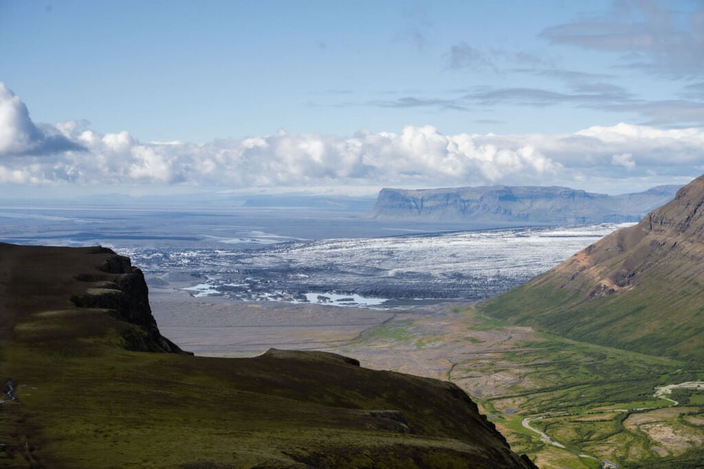
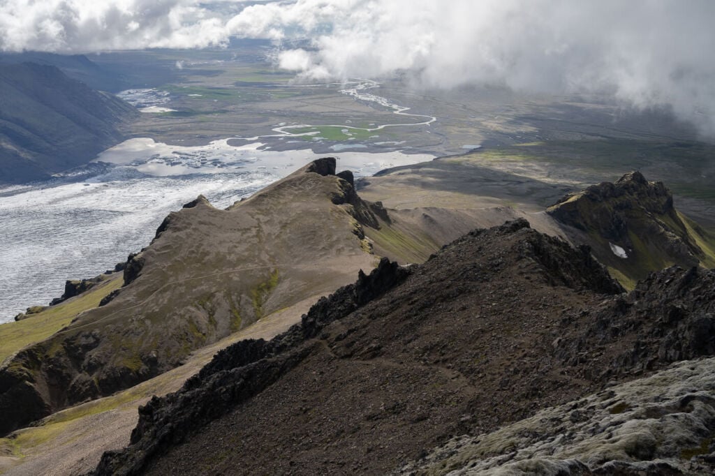
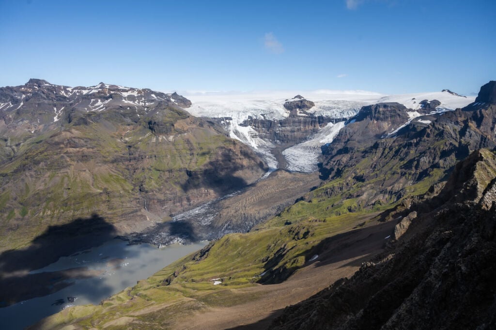
The views from the narrow and summit are incredible. Two glacial valleys, one on each side of the summit, and a view of the tallest waterfalls in Iceland: Morsárfoss (sometimes referred to as Morsárfossar – plural). Also, once you get to a higher elevation, the views over the plains to the south and the east are so vast it’s mind-boggling. It’s almost like looking at a short-term weather forecast or a 3D atlas up close.
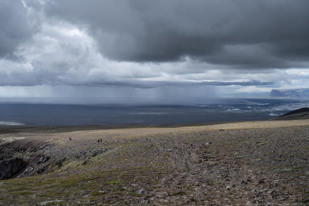
Weather front and rain moving through the landscape
In addition, there aren’t many places where you can see an entire river – and by “entire”, I mean from its glacial source to the sea.
The river born from the glacial tongue is visible all the way to the sea on a clear day.
Also, this is a circular hike; the hike I’m describing here starts at the visitor centre and goes up Kristinartindar on the Morsádalur side, to return via the Skaftafellsjökull side. You can, however, hike this trail counterclockwise or go up and down the same way. I’d recommend hiking up the Skaftafellsjökull side if you want to return the same way.
This is a hike I thoroughly enjoyed, and I would definitely recommend it to anyone in the area looking for a full-day hike.
Kristinartindar, the mountain on the left.
Outline of the Hike to Kristínartindar
- How to get to Kristinartindar and Parking: Kristinartindar is within the Skaftafell National Park, which is on a side road of Road 1, the ring road. Unless you are camping there for the night, you would need to pay for parking. If you camp, you get free parking until midnight the day after. At least, this was the case in 2022). If you are looking for car rental options, I can definitely recommend Blue Car Rental for cars and CampEasy for Camper Vans.
- Start of the Hike: The Skaftafell Visitors Center.
- Photography & Scenery value: this hike goes through a variety of landscapes, from the lowlands to the alpine scenery of the top and the glaciers surrounding it.
- Hike Difficulty: Hard. Long and strenuous hike. The last part of the hike goes over rocky terrain, with loose rocks and a few moderately exposed sections.
- Tip: despite the difficulty, this is quite a popular hike. If you want to enjoy the summit without anyone else around, I’d recommend starting the hike early in the morning. Also, you can easily include the beautiful Svartifoss waterfall in your itinerary instead of hiking there on another occasion. Svartifoss is worth a visit.
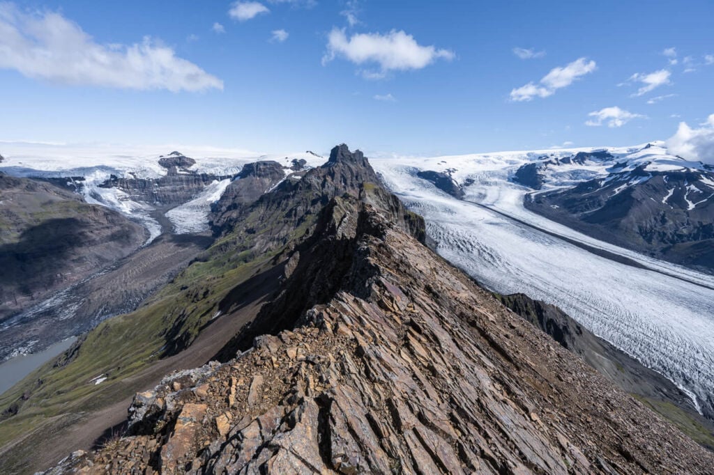
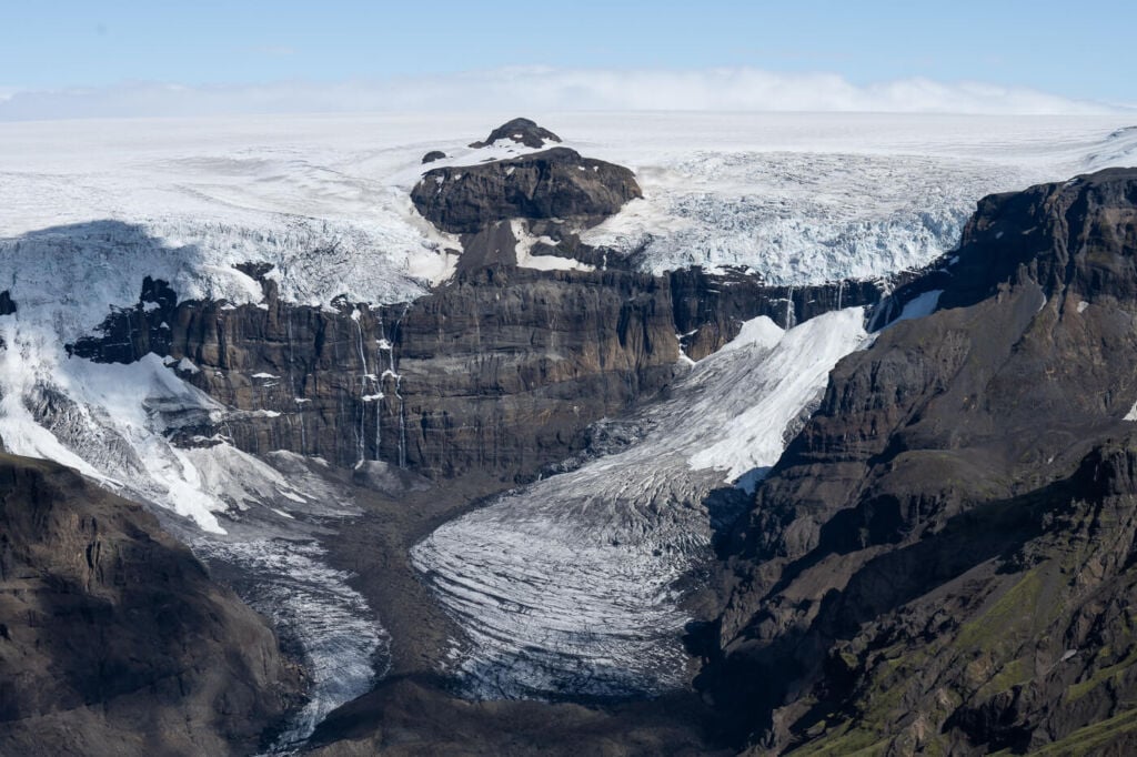
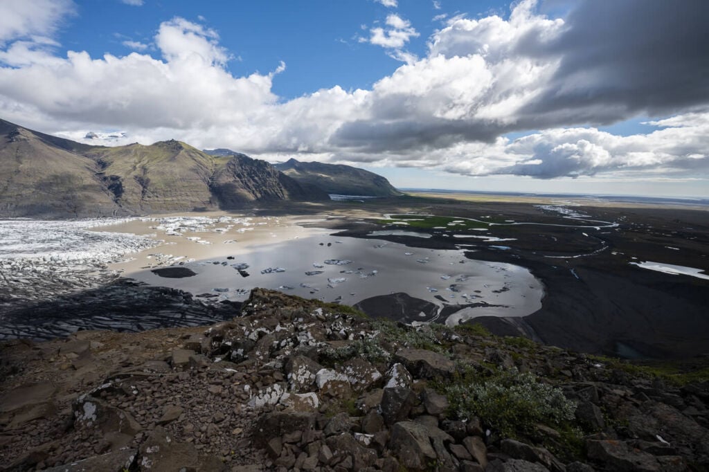
View from the Summit. Morsádalur is on the left and Skaftafellsjökull is on the right.
Hiking Up Kristínartindar
| Distance | Elevation Gain | Hike Time |
|---|---|---|
| 19.2 Km | 1,120 m | 7:00/ 8:00 Hrs |
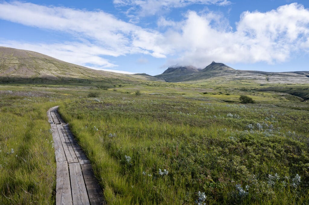
The hike starts from the Visitor’s center and initially, the trail is the same for several different hiking destinations. Because of this, you could potentially include detours to other points of interest, such as the beautiful Svartifoss.
The trail is broad and easy to follow in the first part of the hike. Part of it goes through some bushes, and it can be muddy. Soon enough, you will reach an area clear of vegetation where you will also find a sundial, showing the direction of other points of interest. From here, there is only one trail to the top of Kristinartindar.
The top of the mountain will be visible, and it will look deceivingly close. It will probably take a couple of hours to get to the top. In case you missed it, you could also find some more mud here.
Kristinartindar, on the left, engulfed in clouds.
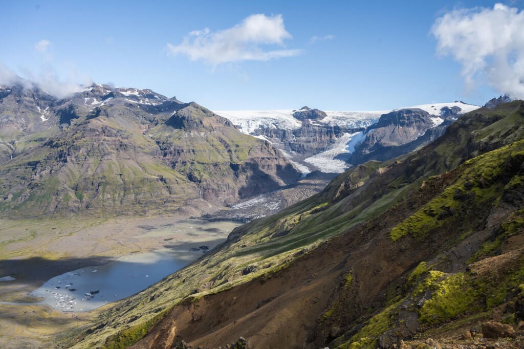
The trail here will gain elevation slowly, and as you approach the cliffs over Morsádalur, the views will gradually open up, revealing the plains to the south and Morsádalur. You will also get glimpses of the glacier and a view of the tallest waterfall in Iceland, Morsáfoss.
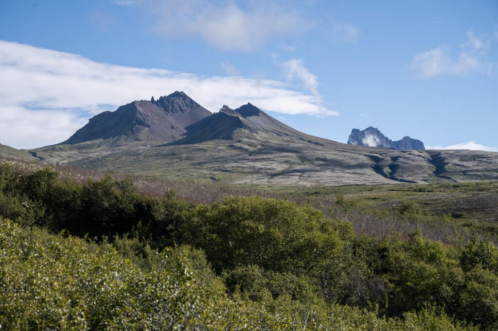
Lómagnúpur viewed from the trail to Kristinartindar.
First glimpse of Morsáfoss
The trail will then turn to the right on the side of the mountain until you reach an unmarked trail to your left. Follow it until you reach a small saddle, where the trail splits again. To the left for Kristinartindar and to the right for Skaftafellsjokull, which is also the same trail to take to get back to the Visitors centre.
From the saddle, you can already get a good idea of how the last part of the trail will be. Steep with lots of loose rock and a couple of moderately exposed passages.
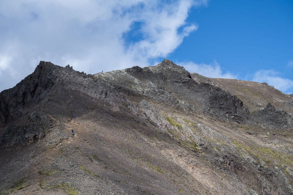
the last part of the trail leading up to the summit.
This is the part of the trail that will require the most effort. On the other hand, the summit is now quite close, and it won’t be long before you reach the top. Enjoy the views!
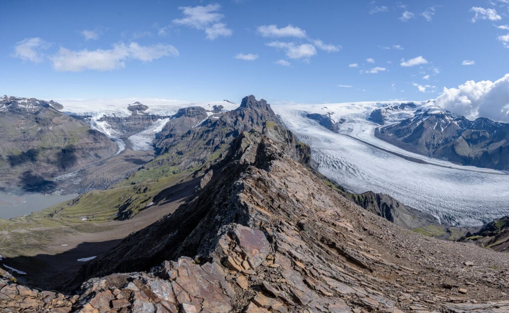
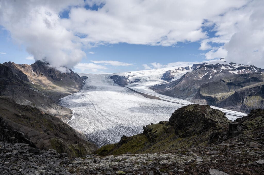
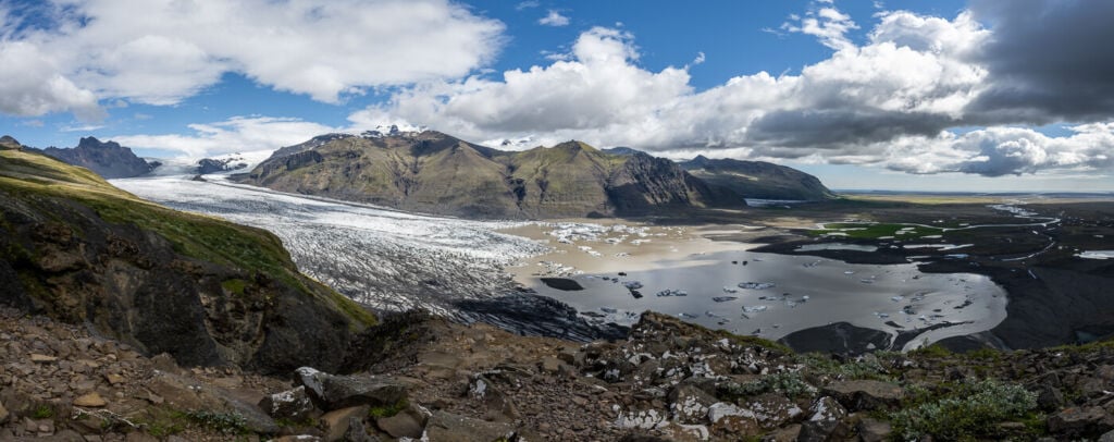
Panoramic view from the top of Kristinartindar
Return – Hiking to Skaftafellsjokull
From the top of Kristinartindar, you will first need to head back to the small saddle. Once you’ve reached it, take the trail to your left. That’s the scenic route back, as it follows Skaftafelsjokull for most of its length. You will already have great views over the glacier from the saddle, but they will also improve as you get closer.
View of the trail from the summit of Kristinartindar.
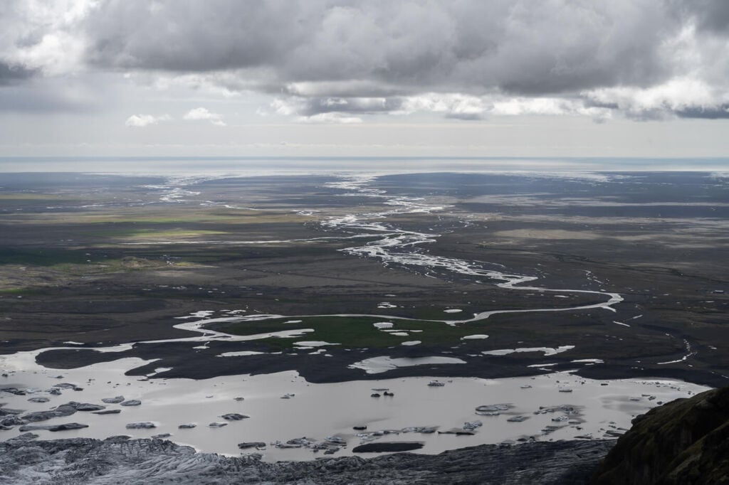
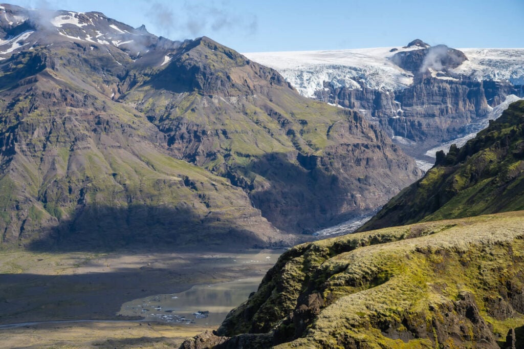
Stick to the visible trail to prevent damage to the vegetation. As you hike down, there will be plenty of different vantage points to soak in the views. The vastness of the landscape in front of you here is rather mesmerizing. As you keep hiking down, you’ll get closer to the glacier until you reach its end over the glacial lagoon that has been forming at the end of the glacial tongue.
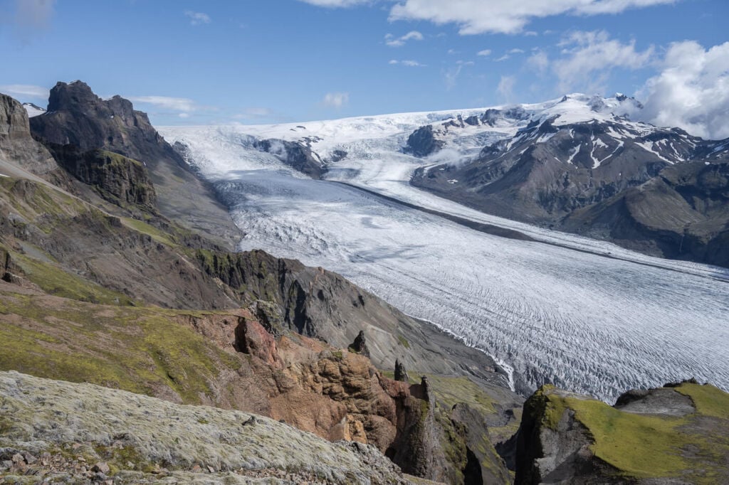
The upper part of Skaftafellsjökull
From here, there are a couple of trails that will lead you back to the campsite and visitors centre. Should you want to, you can include a detour to Svartifoss on the way back too.
This was definitely one of the hikes I enjoyed the most on my last trip to Iceland. While it is a hard hike, it is also very rewarding in terms of landscape and scenery.
Photos and Photography tips for the Hike to Kristínartindar
If you start the hike on the Morsádalur side as I did, you will reach the first great point of view halfway up to the summit of Kristinartindar. Essentially, when you are close enough to the edge of the cliffs on that side to see the glacial valley below. The views here are spectacular.
The top is a ridge separating two glacial valleys, and there’s plenty to point your camera at up there. A tele lens will come in handy if you plan to take photos of Morsafoss. It’s indeed the tallest waterfall in Iceland, but it still is quite a way away :)!
View from the Summit.
The waterfall Morsárfoss (228m), captured at 200mm from the top of Kristinartindar.

Detail of some colorful mountains on the Morsádalur side of the summit.
Morsadalur viewed from the top of Kristinartindar
On the way back, you’ll have plenty of fun shooting the glacier from the different vantage points along the trail. This part is also where you get some of the best views of the vast alluvial plains. However, it’s pretty challenging trying to capture and render such vastness on camera, but it’s fun shooting nonetheless.

Hikers (can you spot them?) watching the landscape and the glacier.
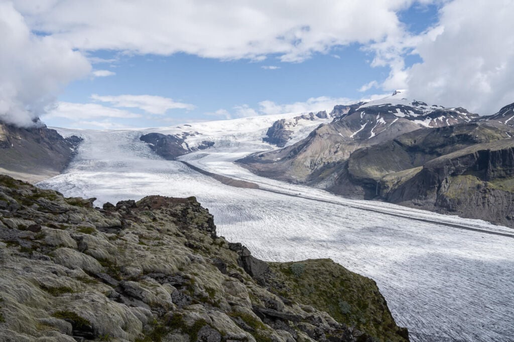
Views of the glacier from the trail.
I also captured several panoramas, as the Skaftafellsjökull glacial tongue is enormous, even at 14mm you will need multiple frames to fit it in one image!
Panoramic view of the glacier

Panoramic view of the glacial tongue and its lagoon.
the lagoon at the end of the glacier’s tongue.
Bring anything from 14mm to 200 or beyond. I used all the focal lengths on the top of Kristinartindar. This is a national park; flying drones here is not permitted unless you have obtained special permission from local authorities.
Video of the Kristinartindar Hike
Here is a video I took during the hike. Nothing fancy, just a first-person view of the trail and the landscape with some music. Check it out to get a feel for the trail.
Map of the Hike to Kristínartindar
Here is the map of the hike. If you need a GPS track, you can download the .GPX file from the Komoot activity.
Where to Stay
The Skaftafell Park camping is the closest option if you are in a tent or camper/campervan. I stayed at the Skaftafell camping and can recommend it. Definitely, good facilities and plenty of space, though there may be relatively long queues for the showers at the end of the day. There’s a bonus, though. You get free parking included until midnight of the day after if you stay overnight (this was in 2022).
Additional Resources
- Check out more Photo Hikes in Iceland here.
- If you are visiting Skaftafell, don’t miss this beautiful Waterfall, Svartifoss. Alternatively, for another full-day adventure, you may want to check out the Lomagnupur hike.
- Discover the best hiking books and guides on Iceland.
Car or Camper Van Rentals
I can definitely recommend two companies here:
- Cars: Blue Car Rental, which is the largest Car rental company in Iceland, and for good reasons. Free Cancellation, Unlimited mileage, 24-hour break assistance, SCDW, CDW, TP, and GP insurance are included in the price. Blue Car Rental is also located within walking distance of the Keflavik Airport, so you can be on your way to explore Iceland right away. I’ve always been happy with my rentals there, which is why I’m happy to recommend their services here on my blog.
- Camper Vans: CampEasy. With CampEasy, you can rent 2WD or 4×4 campers alike. With a raised Chassis, larger tires, and extra insurance with reduced liability for river crossing, their 4X4 campers are the best choice for your trip into the Highlands. Their Website also provides extensive information about roads you can take and instructions on river crossings. Perfect choice for a hiking holiday in the highlands!
These are my two favorite companies in each respective rental area, which I why I am happy to recommend both here. If you also like this blog, booking through them is a great way to support it. I’ll get a small commission fee at no additional cost, so you can essentially support the running costs of this blog for free too.


Thank you so much for all these, utterly stunning photos, names & narratives. Really appreciate your, self evident talent in setting up your shots, sometime with individuals providing a great sense of perspective & resonance with the huge ‘majestic’ landscapes depicted.
I am Icelandic on my mothers side. I lived there for a period of 5 years [from 1965-1970]. I worked as a drill hand on a rig devoted to finding hot water, for domestic & industrial use. I saw a good deal of the country during my time there, your beautifully artistic depictions of Iceland’s stunning natural environments have a deeply visceral place in my heart.
Thank you, once again. Best wishes, Magnus.
Hi Magnus,
Thanks for stopping by and leaving your comment, much appreciated! I’m flattered and glad you enjoyed the hike reports on my blog, especially considering how long you spent living there.
I try to do my best to show the beauty of this country and to share my passion for it, and knowing people do enjoy the blog posts gives a good boost to keep going, as the site is barely 6 months old.
Thanks again for your visit and for sharing your experience!