Hafrahvammagljufur Canyon Hike, East Iceland
Hafrahvammagljufur is a canyon you can only hike to deep in the highlands of Iceland. And, while you do need a 4WD vehicle to get there, the canyon is relatively easy to reach.
It just takes a long time and a scenic drive through the typically endless and desolate, but beautiful, landscape of this corner of the highlands.
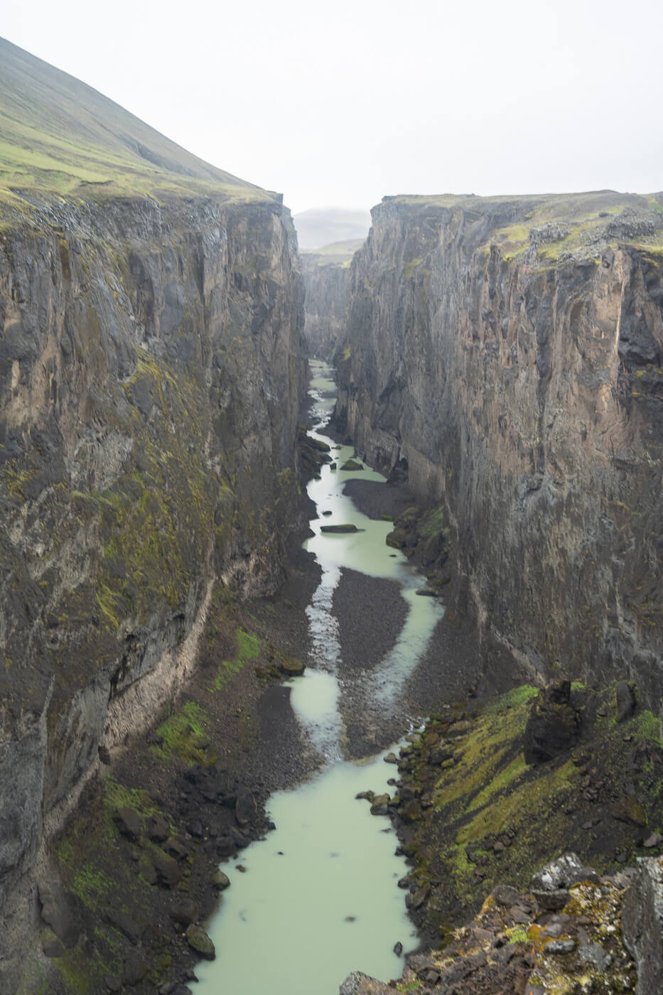
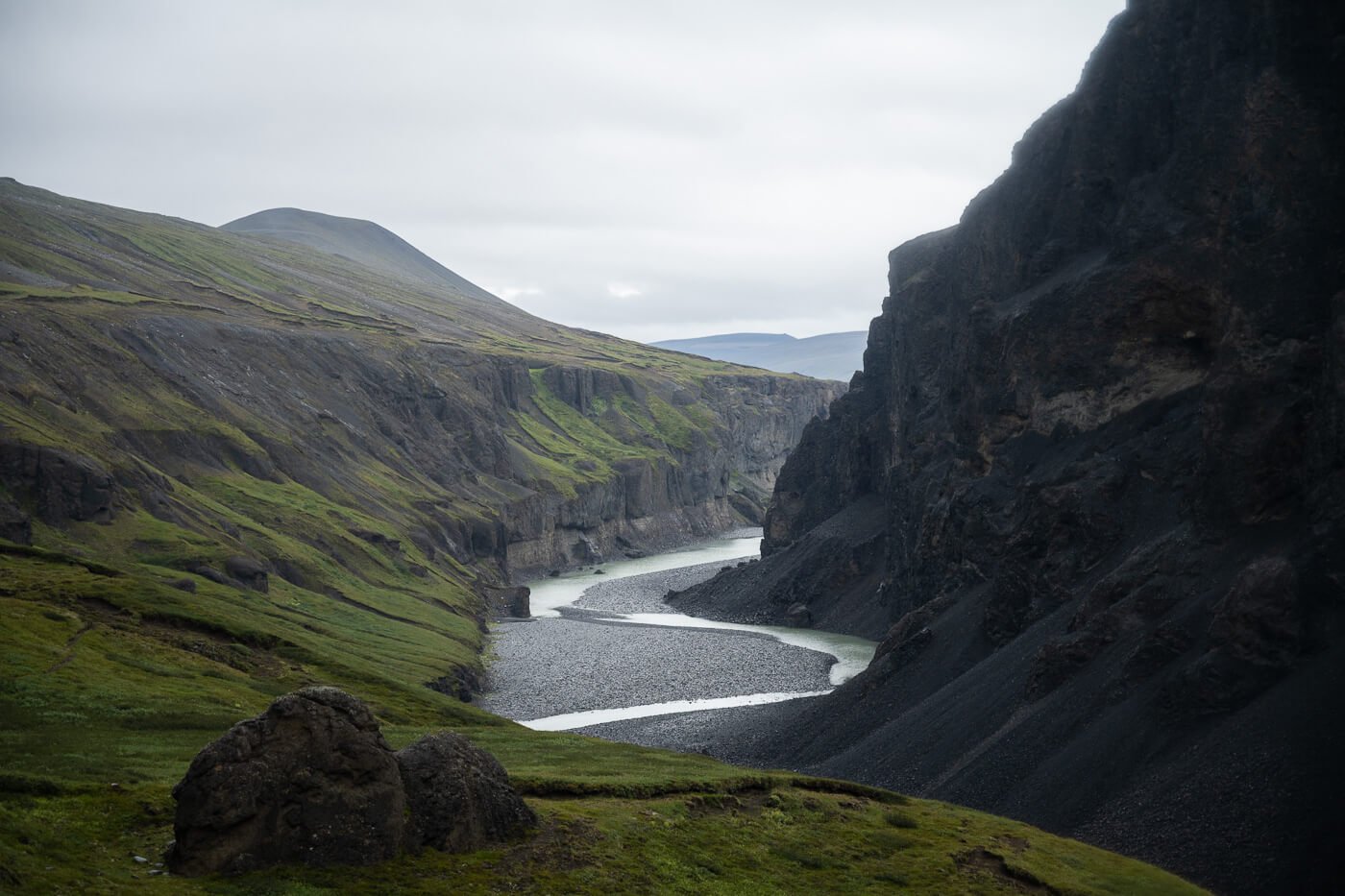
View from the main observation deck.
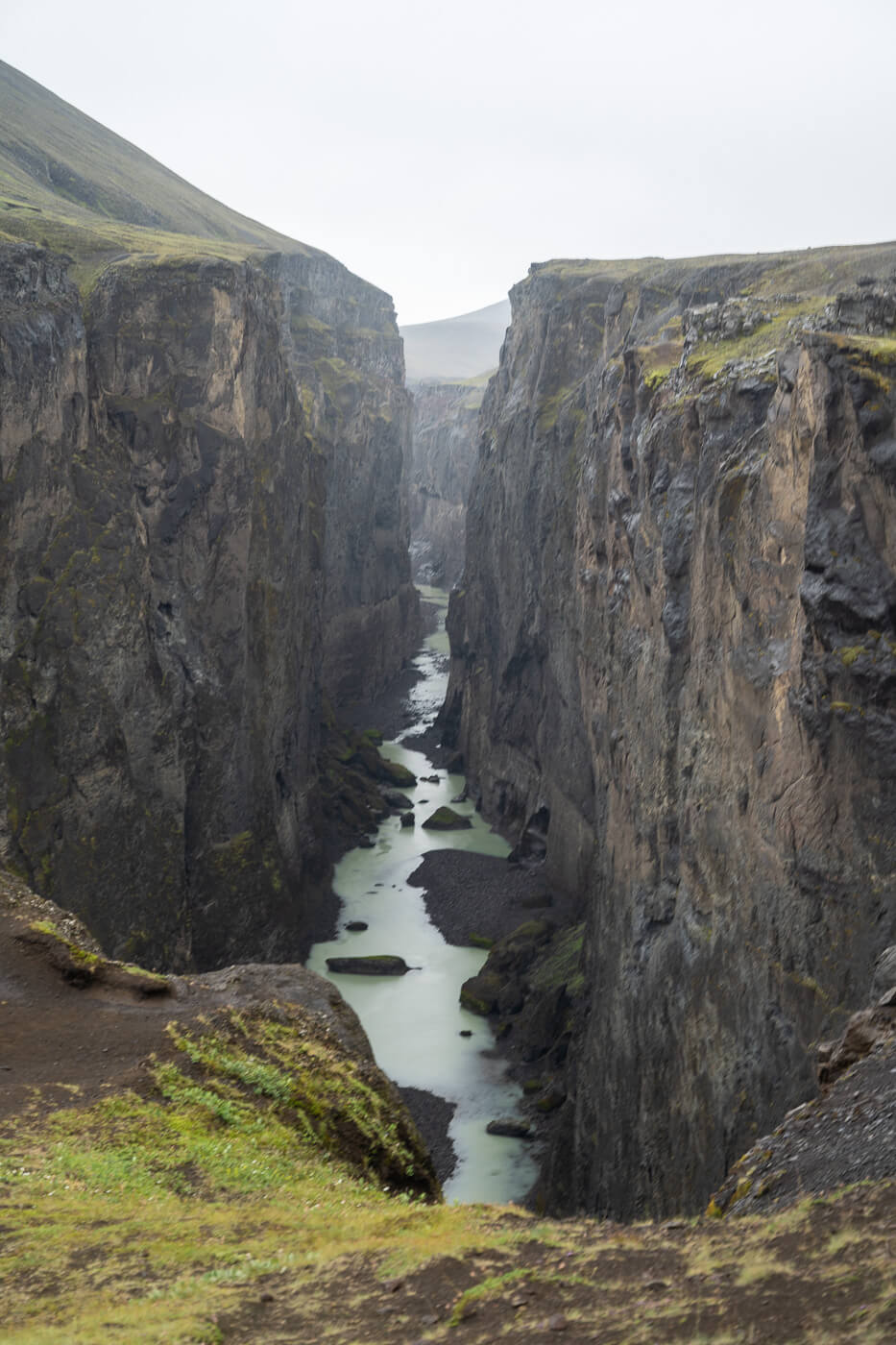
A stunning canyon, 8 km long and 200 meters deep at its highest point, opens up as if the earth had suddenly cracked. Inside the canyon, the Jökla river flows downstream. From the Kárahjúkar power plant, a mega structure that caused quite some controversy, you can already see the top part of the Canyon’s walls and it’s a mighty sight already.
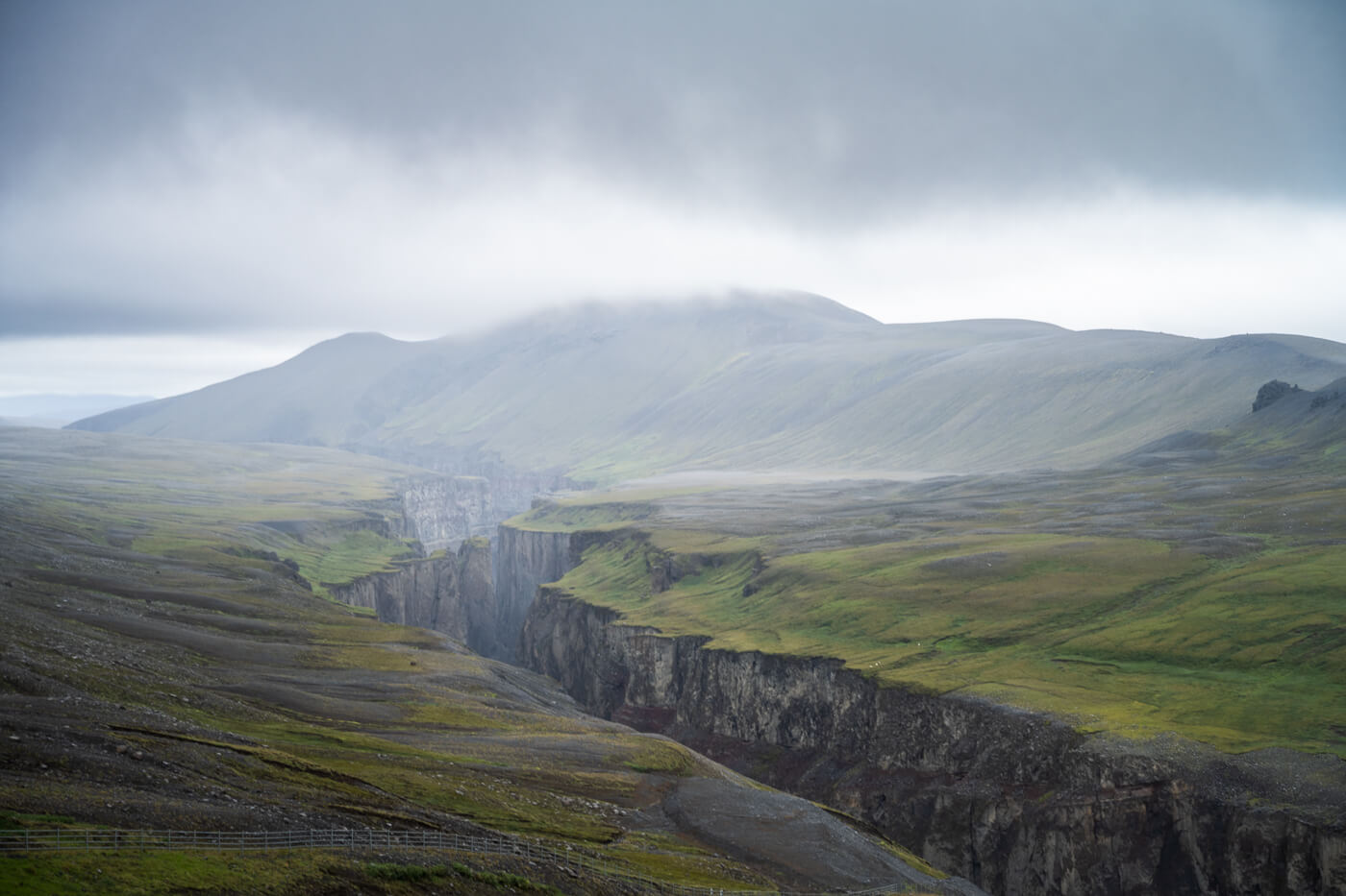
View from the Kárahnjúkar Dam.
Hafrahvammagljufur is still a location that sees a few tourists each year, mostly due to its remoteness. This also means you can still get a taste of how visiting Iceland was before tourism exploded – fantastic landscapes and no one around.
And, in places like the Hafrahvammagljufur Canyon, that makes for a unique experience.
Going to Iceland? Blue Car Rental Discount!
As a reader of The Photo Hikes, you get a 5% discount on your car rental when booking with Blue Car Rental through this website. The discount will be automatically applied to the booking through the following link
Table of Contents
Overview of the Hafrahvammagljufur Canyon Hike & Map
This short hike to Hafrahvammagljufur is easy; it is mostly a walk on well-maintained trails with the addition of some infrastructure like observation decks and steps in some parts of the trail.
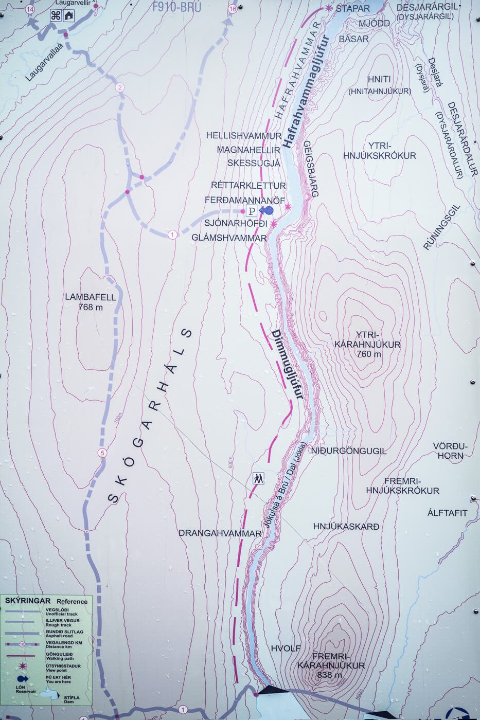
Map from the info board at the Dam.
As you can see from the photo above, there appears to be a trail following the Dimmugljufur canyon downstream from the Kárahjúkar power plant all the way down to Hafrahvammagljufur. However, while it was drawn on a map, I could not find any signs or trails heading in that direction from the dam. Or perhaps access was closed when I visited.
Just wanted to mention it, as that may be an option to consider if you are driving a regular 2WD car.
| Max Altitude | 569m |
|---|---|
| Distance | 2.73 KM |
| Elevation gain | 160m ↑ / 160m ↓ |
| Hike time | 00:45/ 01:00 Hours |
| Hike Difficulty | Easy |
Here is the map of this short hike. You can download the GPX file for free from the activity below, should you wish to do so:
"Ready to explore more? Discover my curated list of the 17 most spectacular canyons in Iceland. With free GPX Files!"
DISCOVER THE BEST CANYONS IN ICELAND →
How to get to the Hafrahvammagljufur Canyon trailhead and Parking
You can reach the Kárahjúkar power plant in any 2WD vehicle, so if you want to explore this area, you can park your car on the far side of the dam, where there’s a visitors center.
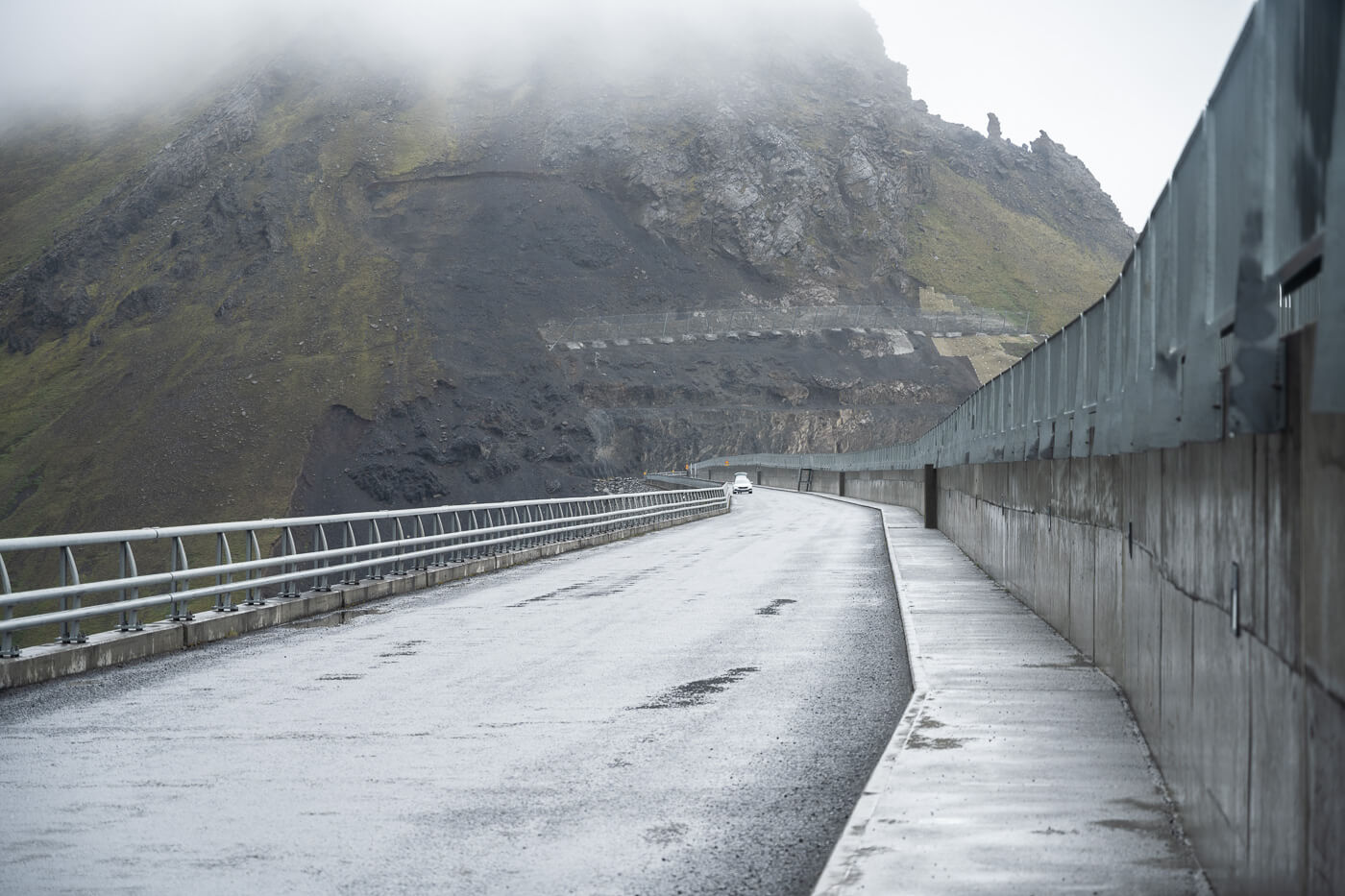
The road across the Kárahjúkar dam.
However, to get to the Hafrahvammagljufur trailhead, you’ll need a car suitable for the highlands. Most of the track is easy to drive, apart from the last part after the crossroad. It’s a steep drive down a dirt track, with big rocks on the way.
- Driving Directions: There are technically two ways to get to the trailhead. I can only speak for one, which is the one from Laugarfell and the Kárahjúkar power plant. It is also the one I’d recommend. However, both options require driving on F-Road F910 from opposite directions. I took the route that goes from Egilsstaðir to Hengifoss and from there to Laugarfell. Then, instead of turning into Laugarfell, you can continue following the paved road (Road 910) until you reach the Kárahjúkar power plant. Cross the dam, then keep driving up the hill onto road F910 (F-roads vehicles only). After about 20 minutes, you’ll come to a crossroads. with one lonely sign pointing to Hafrahvammagljufur. Follow that sign, which means take the first turn to your right down the steep, rocky track. Drive carefully, as there are big stones on the track, so low-clearance vehicles may bottom out in places. The other road also requires driving on road f910 from the opposite direction. From what I gather, that’s a more difficult road to drive with river crossings and one that requires higher ground clearance. You can access it by driving onwards from Stuðlagil.
- Parking: There is a relatively large, flat parking area at the end of the steep, downhill road.
- Public Transport: absolutely zero for several kilometers in any direction.
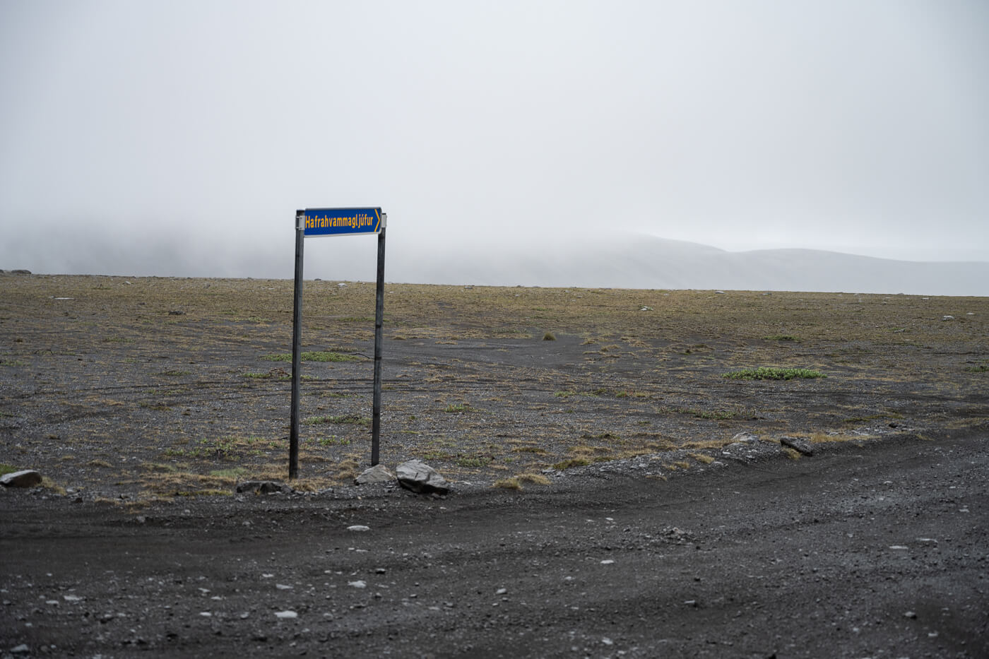
Hafrahvammagljufur’s road sign. Road signs in the highlands always look like a bit of a minimalistic installation.
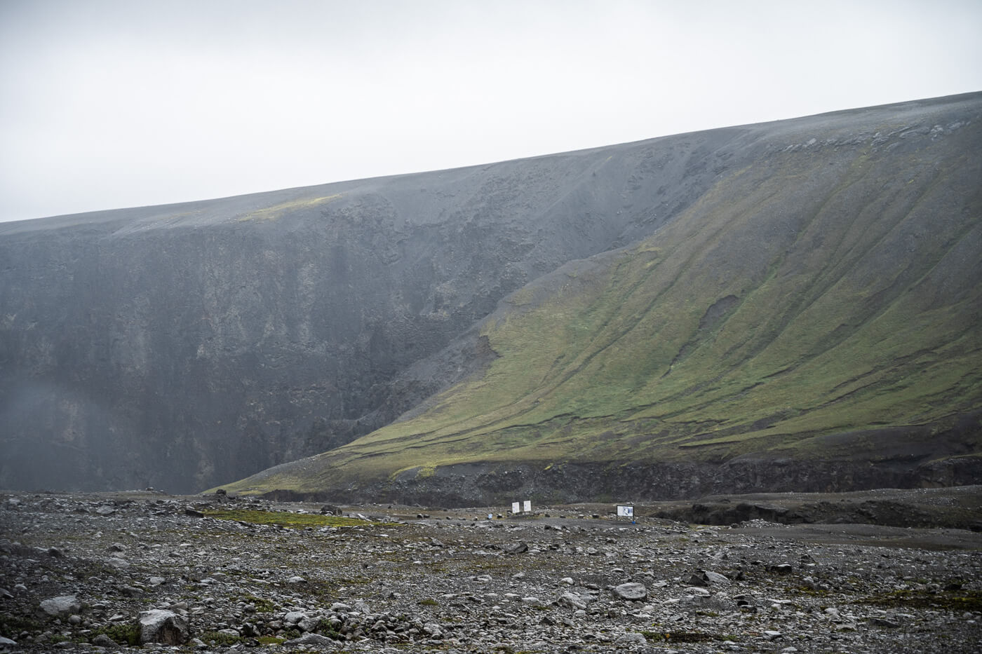
The parking area and its info boards viewed from the access road.
The Hafrahvammagljufur Hiking Trail & the Magnahellir Cave
From the parking area, you can already see the upper part of the canyon’s walls. You can already feel the scale of the canyon from there, too.

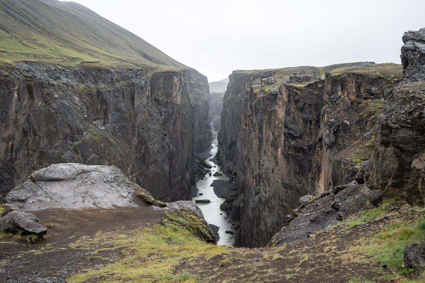
Initially, the trail follows an old track downhill for about ten, fifteen minutes. The trail is fully signposted so it’s easy to follow. It takes about ten minutes or so to hike the first viewpoint of the Hafrahvammagljufur canyon. Here, you can peek into the canyon, in all of its length and all of its depth.
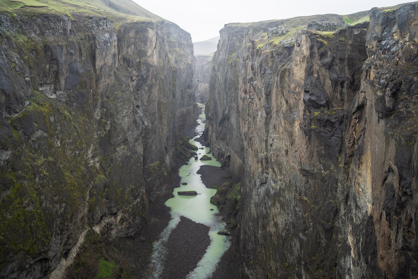
You’ll probably spend some time here but don’t stay there too long like I did, because there is another viewpoint with an observation deck and an even better view into the canyon just a short walk further down the trail.


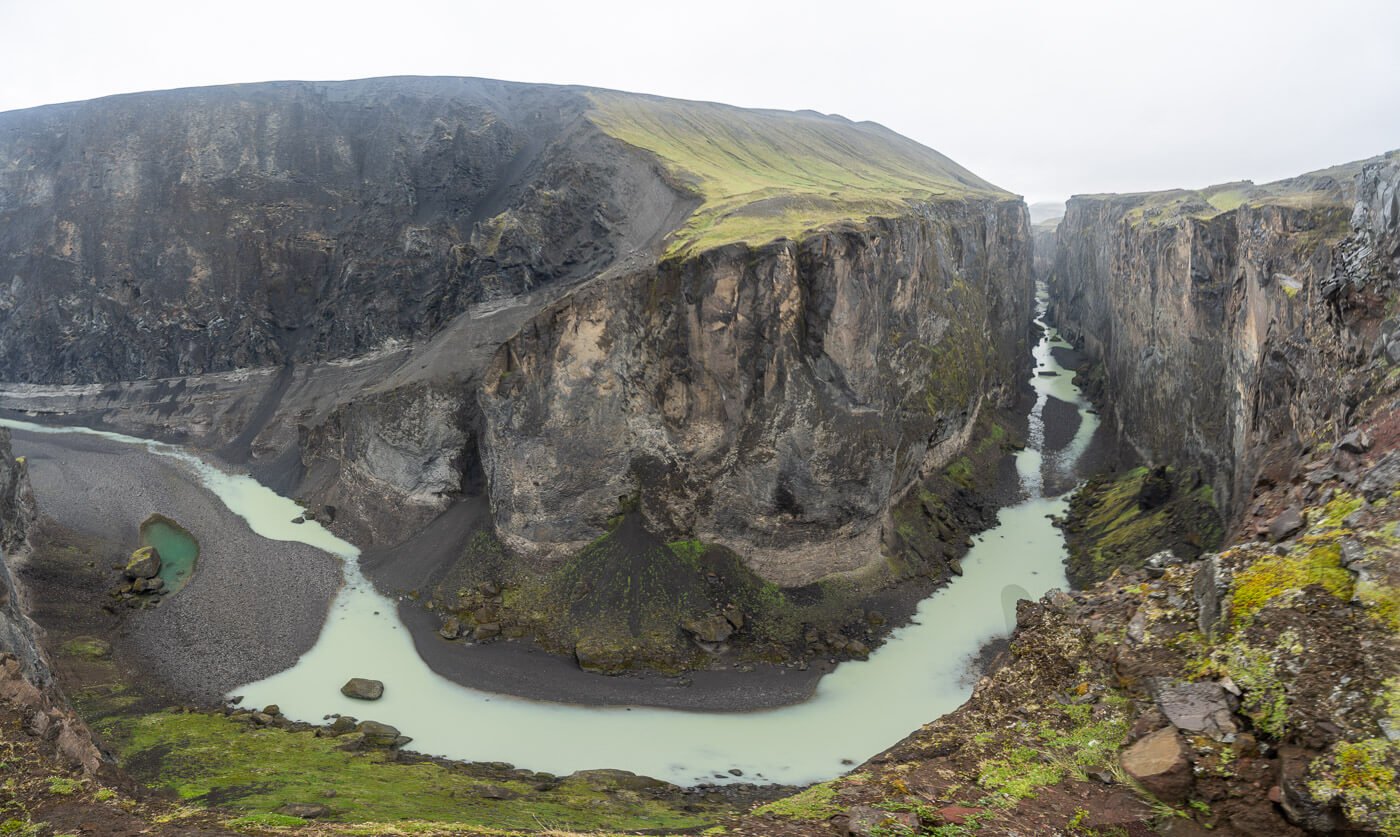
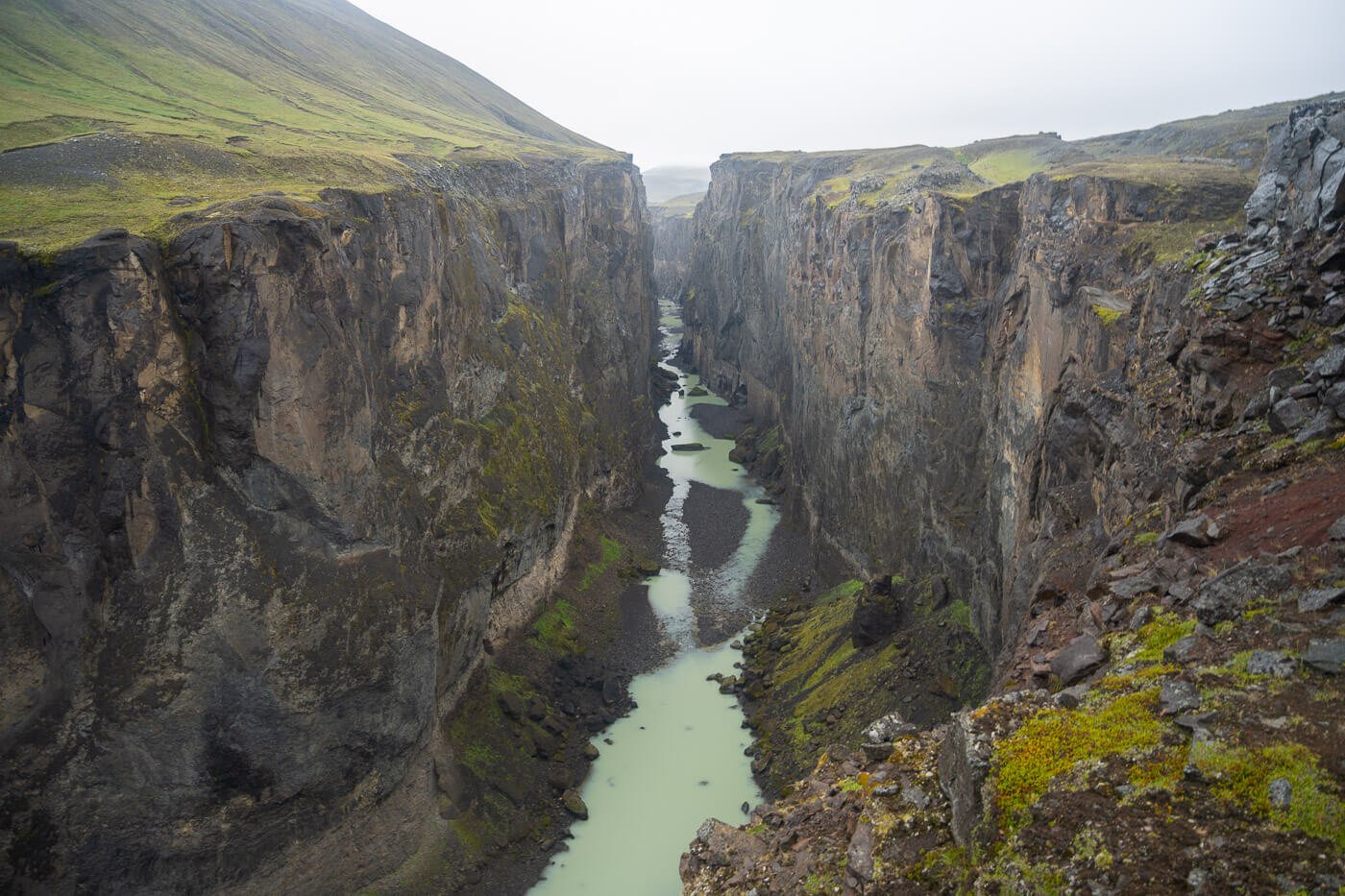
180 degrees panoramic image of the Hafrahvammagljufur’ Canyon.
The observation deck is a rather wide platform right at the top of the cliff, so it provides amazing views of the canyon straight down to its bottom. From the platform, the trail then continues to follow the canyon downstream.
The Magnahellir Cave
The last stop on this short trail is the Magnahellir Cave. the cave, per se, isn’t particularly big or beautiful, but it does have some historical and folkloristic significance. However, the view of the landscape is quite stunning. For me, it was also a welcome break from the horizontal rain and the strong winds that brought it.
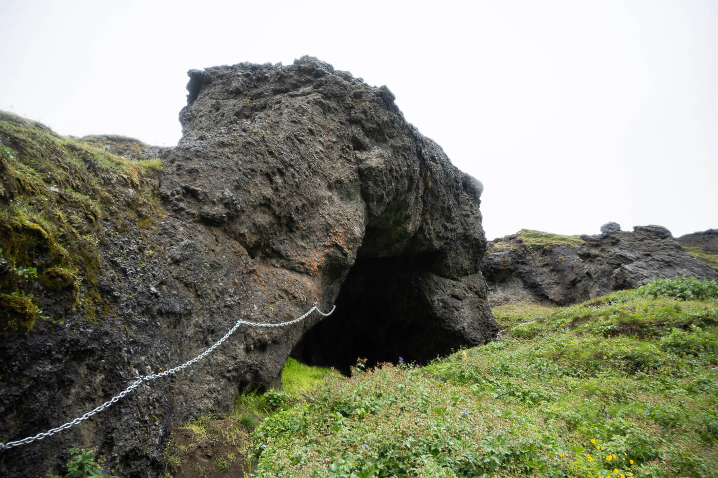
Entrance of the cave
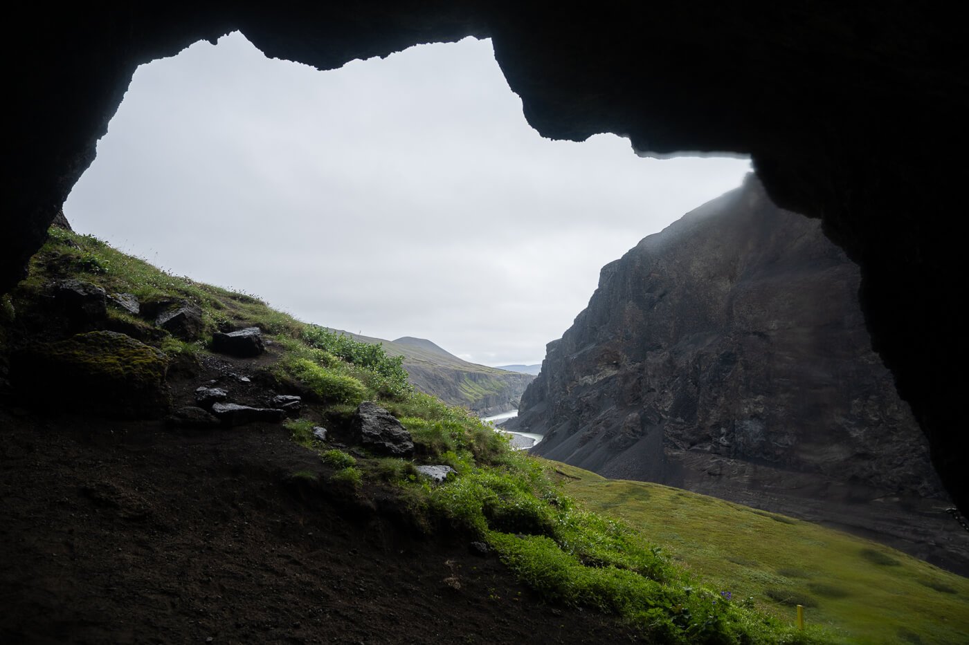
View from inside.
The cave takes its name from Magni, the first farmer who used the cave as shelter when his sheep were grazing in the area. So you can say that with the rain and wind, I really got to experience the cave in the best possible way too. You’ll find a logbook in the cave if you wish to sign it, and a lantern.
From the cave, you can then loop back uphill. However, there should also be a trail that leads down into the Canyon. Not a safe choice in case of rockfall and discharges from the dam, which is something visitors are warned about at the beginning of the hike to the Hafrahvammagljufur canyon, too.
The area around the cave also provides some fantastic views of the northern part of the canyon.
Hafrahvammagljufur Photos and Photography Tips
I did not have much luck in terms of photo opportunities; I am lucky I was able to visit as well. I drove all the way from Laugarfell in thick fog and rain, but by the time I got to Kárahjúkar, the fog rose a bit, enough to show the landscape around the Canyon. Phew!
I was actually hoping for some “darker” conditions rather than sunnier ones, so I was kind of happy with these conditions.
Anyway, it was still raining horizontally, due to the strong winds, so I spent a limited time there because the weather, in typical Icelandic fashion, was going to get worse.
So I dropped off the car with my camera and 24-70 lens zipped into my rain jacket. I did not bring any other sense, as even attempting to change the lens in this weather was going to be futile. Even if I was going to swap lenses inside the backpack, some water was likely going it get in.
All of this is to say the photos you see here were all taken with a 24-70 lens, mostly because I had no other option, but I would recommend going wider if you can.
The Canyon is huge and barely fits into the field of view of a 24mm lens, full frame. So a bit wider will come in handy.

Where to stay
This place, while relatively accessible, is remote. My tip would be to stay at Laugarfell. A beautiful, cozy hut, seemingly in the middle of nowhere, with natural hot pools and absolutely stunning landscapes. It’s also the trailhead for the Waterfall Circle Hike, which I cannot recommend enough.
I stayed there myself the night before heading to the Hafrahvammagljufur Canyon. So it’s a great option to either stay there the night before or after the visit to the Canyon, considering how remote this area is. Also considering exploring it is time well spent.
Alternatively, there are a few other campsites and guesthouses around Lagarfljót, the big lake south of Egilsstaðir, or Egilsstaðir.


Leave A Comment