Ásbyrgi Canyon Hike – A Stunning Horseshoe Canyon, Iceland
Ásbyrgi is a rather unique, and beautiful, horseshoe-shaped Canyon in Northern Iceland, with several different viewpoints you can only hike to.
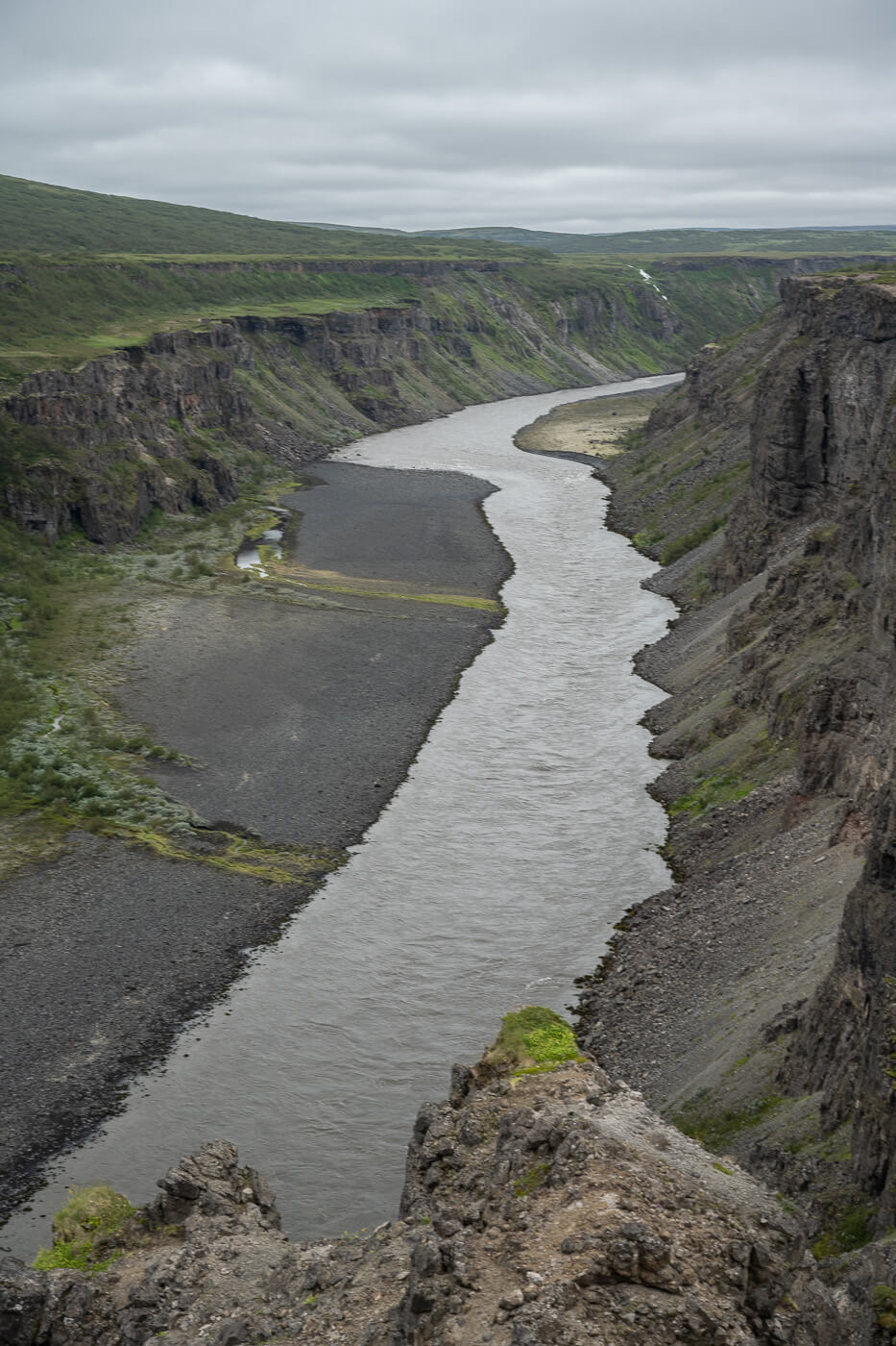
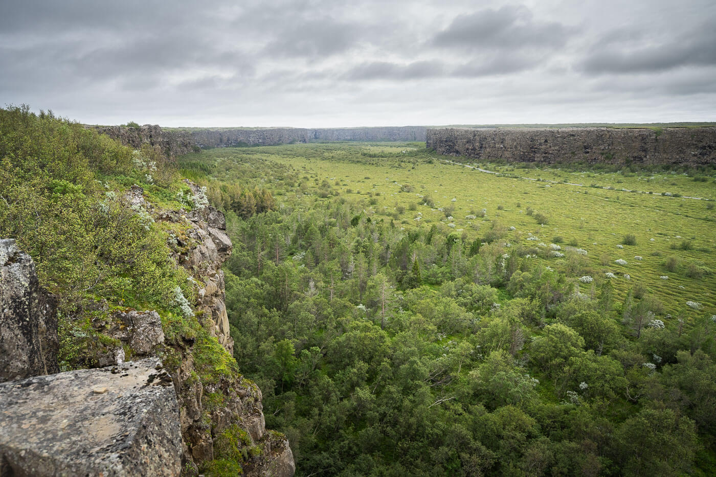
Arguably the best and most scenic viewpoint is the one at the far end, at the top of the cliffs, overlooking the vast expanse of the canyon below. Its size is almost mind-boggling.
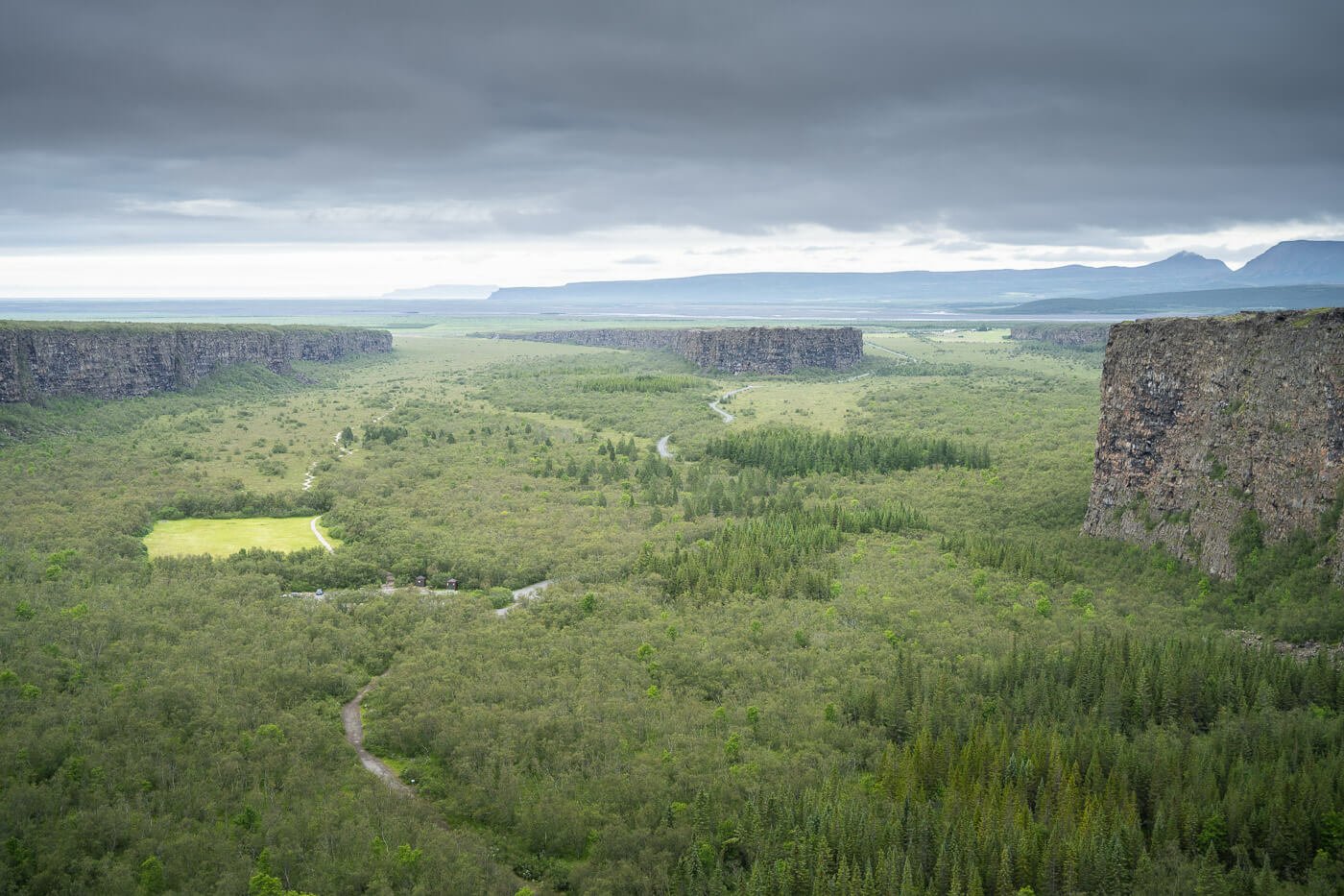
View of the Canyon from the upper viewpoint.
The Ásbyrgi Canyon is part of the Vatnajökull National Park and is 3.5km long and about 1km in width, while the cliffs are up to 90 meters high. Quite an impressive sight from every angle you look at it. It’s also part of the so-called “Diamond Circle”, and one of its main attractions.
The Canyon’s origins are quite interesting too. Science says it formed after two catastrophic flooding events of the Jökulsá á Fjöllum river. The first was about 10,000 years ago and the second one about 3,000 years ago.
Jökulsá á Fjöllum and Jökulsárgljúfur – the same river that created the Ásbyrgi Canyon and now flows to the east, can be visited on the same hike.
However, legend has it that Odin’s flying horse, Sleipnir, landed one of its eight hoofs in the canyon, and that’s how the horseshoe-shaped canyon came to be.
Regardless, it’s a place of unique natural beauty and, if you ask me, worth the detour from the Ring Road. It’s not as crowded as other major attractions, and the landscape is amazing for a hike or some landscape photography.
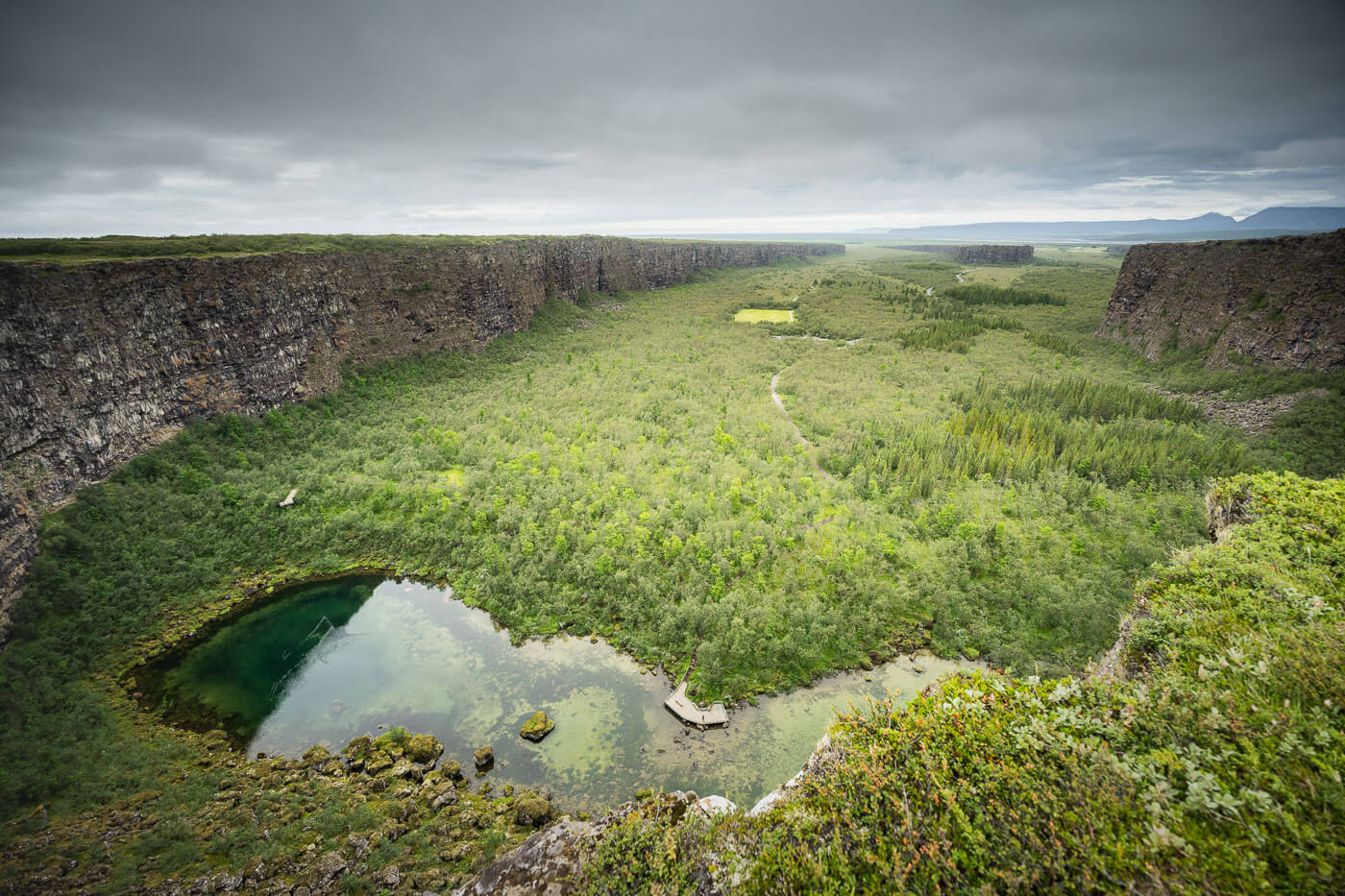
Table of Contents
Overview of the Ásbyrgi Canyon and Kúahvammur circle Hike with Map
There are several different hiking options to get to the main viewpoint and several different trails around the Canyon. There are easy options, like short walks to various viewpoints, and longer, more demanding hikes.
Here is a photo of the trails and the maps I found at the Visitors center. These are the best overviews I found anywhere, although I also found the map to be a bit of a confusing maze:
 List of hiking trails, from a board on site. |
 Map of the same trails |
|---|
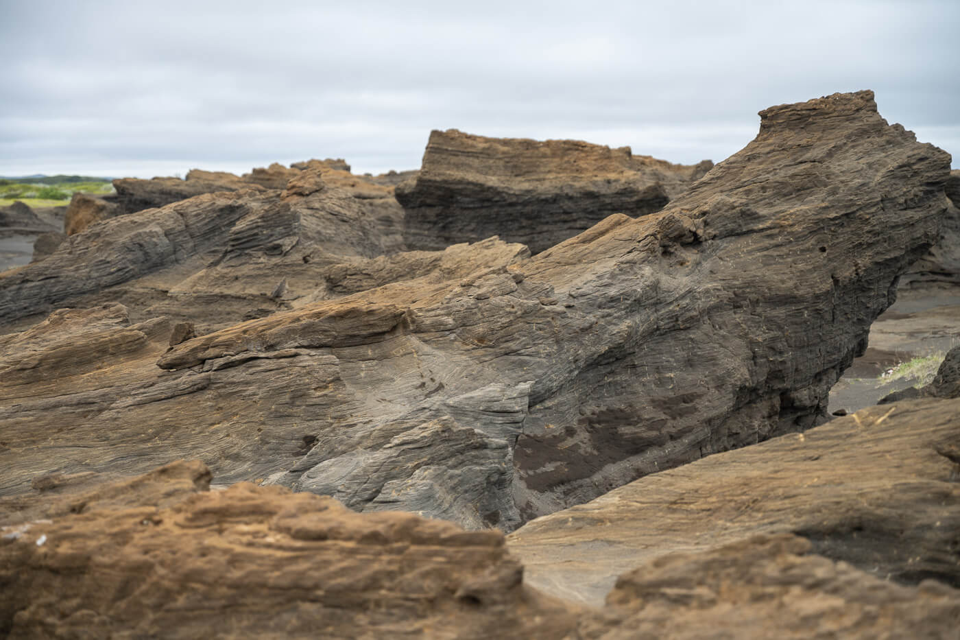
I chose one of the longest options, which corresponds to trail A8 (Kúahvammur circle). So I took the longer route through the Jökulsárgljúfur canyon, then I crossed what seemed to be an old washout plain, where there were several rock formations of unusual shapes, before visiting the main viewpoint above the Canyon.
It’s a loop trail so you can of course do it both ways, and I opted to keep the best for last, which is the viewpoint above the canyon. So I did the hike clockwise.
Here are the details of that hike:
| Max Altitude | 153 m |
|---|---|
| Distance | 13.6 KM |
| Elevation Gain | 190 m ↑ / 190 m ↓ |
| Hike Time | 03:00/ 04:00 Hours |
| Hike Difficulty | Moderate |
Here is the map of the loop hike. Note that if you just want to hike to the main viewpoint above the Ásbyrgi Canyon, you can. follow this route in reverse from the campsite, and do it as an out-and-back hike of 8km in total.
"Ready to explore more? Discover my curated list of the 17 most spectacular canyons in Iceland. With free GPX Files!"
DISCOVER THE BEST CANYONS IN ICELAND →
How to get to the Ásbyrgi Canyon trailhead and Parking
Getting to the Ásbyrgi Canyon requires a relatively short detour from the ring road, especially if you are planning a visit to Dettifoss, it’s working considering taking a detour to Ásbyrgi. It is also a relatively short drive from Húsavík if you are in that area.
- Driving Directions: From Akureyri, you can follow Road 85 through Husavik. It takes approximately two hours, excluding any sports along the way. From the Ringorad, you can take Road 862 to Dettifoss West, and continue onwards from there. From Dettifoss West it takes about forty minutes. You can technically also drive Road 864 from Dettifoss East when it’s open. Be aware it is a rough road that may not be suitable for cars with low ground clearance. Lastly, if you are driving the Arctic Coast Way from the East, you’ll pass by Ásbyrgi.
- Parking: Parking is available by the Visitors Center, and of course, at the campsite if you are staying there.
- Public Transport: No public transport to Ásbyrgi. The best you can do is take a bus from Akureyri to Húsavík and join a tour from there. Or join any Diamond Circle tours offered in the area. Ásbyrgi is part of the so-called, Diamond Circle, a route that includes the best sightings in north Iceland.
The Ásbyrgi Canyon Hiking Trail (Kúahvammur Circle)
The trail starts at the visitors’ center, or the campsite if you are staying there. You can do it in both directions, but I chose to do it clockwise to save the best for last – the view of the Ásbyrgi canyon from the cliffs.
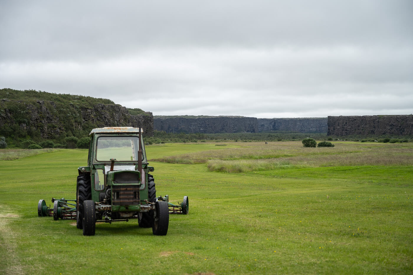
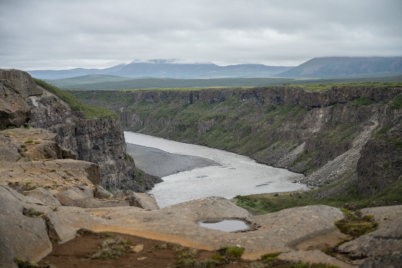
View of the canyon at the beginning of the hike, close to the Visitors center
From the Camping/Visitor Center to Jökulsárgljúfur
Initially, the trail crosse a long, rather flat grassland for about 4/5 KM. It’s a densely vegetated area, with tall grass in summer. At some point, I had weed up to my chest!
There also are a lot of birches in the area, and definitely it is one of the “greenest” hikes I have done in Iceland, in terms of grass and trees.

The area – and the trails – are often covered in dense vegetation.
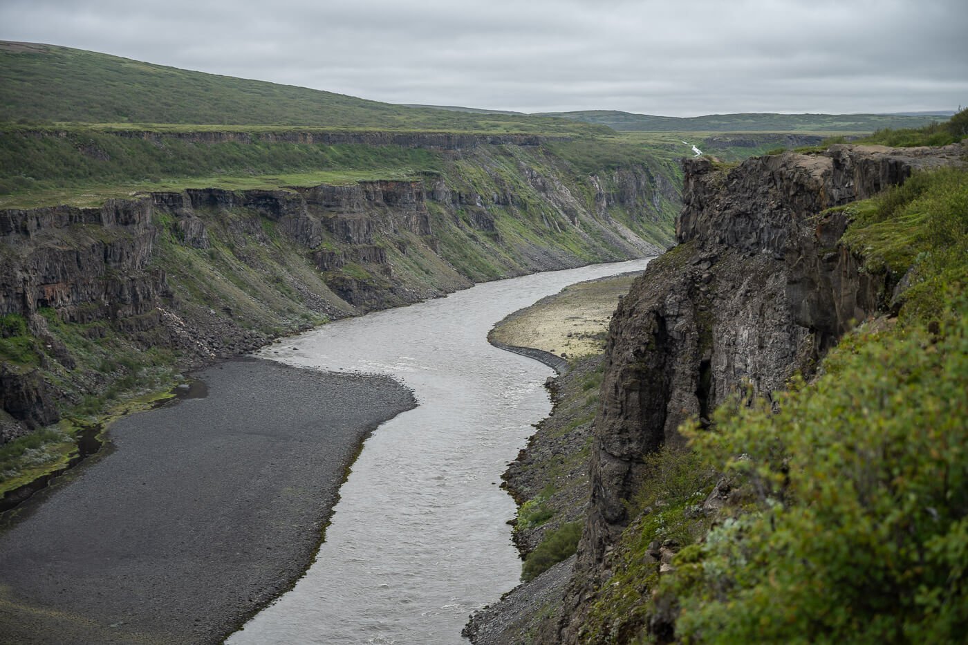
The trail continues like that for about 4/5km, following the river Jökulsá á Fjöllum upstream at a distance, until it reaches the banks of the river, on a cliff a few dozen meters above it.
The views of the river and its Canyon, called Jökulsárgljúfur, are stunning and worth the trip to this viewpoint. Several kilometers upstream, the same river falls into the mighty Dettifoss.
One of the viewpoints above Jökulsárgljúfur
From Jökulsárgljúfur to the Ásbyrgi cliffs viewpoint (and back to the campsite)
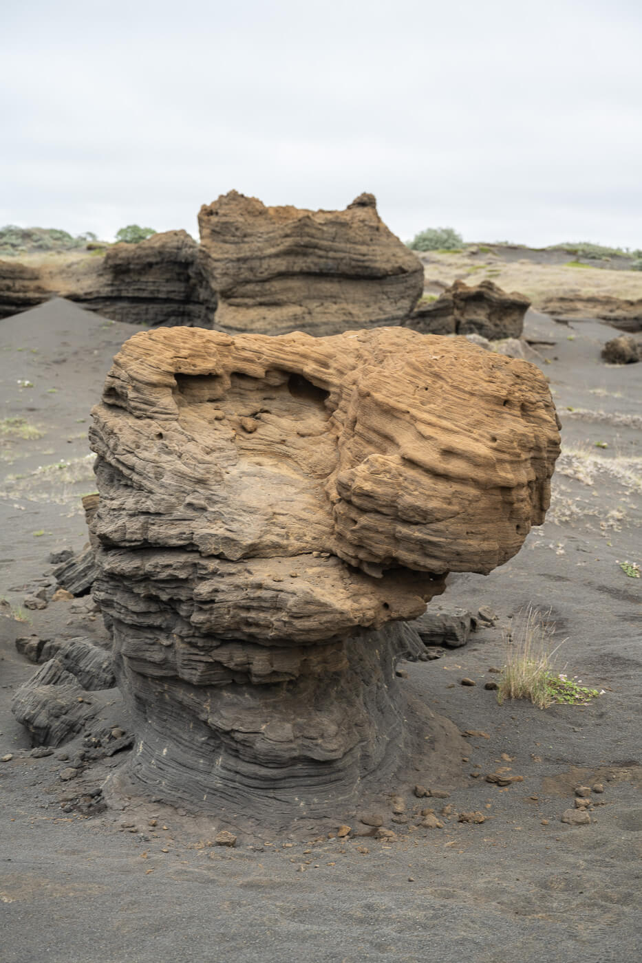
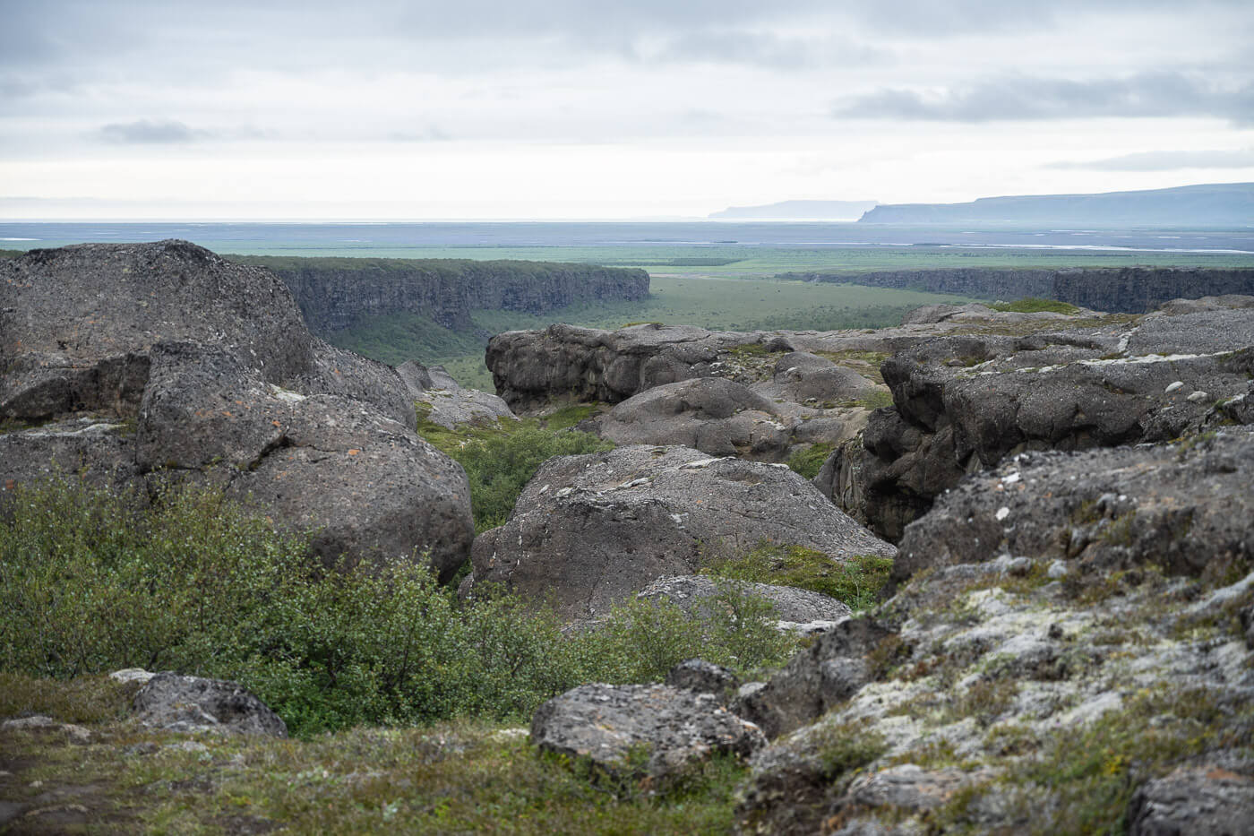
From the Jökulsárgljúfur Canyon viewpoint, the trail continues mostly flat ground. Before reaching the main viewpoint above the Canyon, the trail passes through an area with rather interesting rock formations of different shapes and sizes.
Most of them have rather complex and intricate textures. One has to wonder, how they came to be and what forces shaped them.
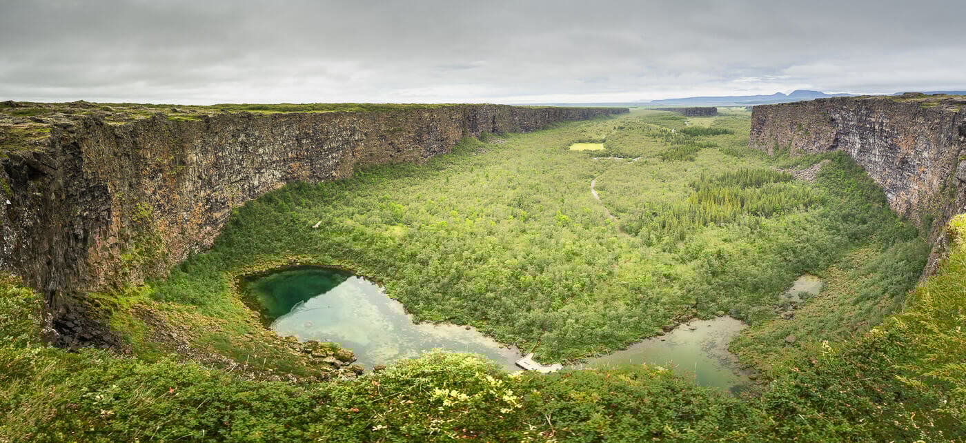
Then, after a little more hiking, you’ll start to see the further edges of the Ásbyrgi Canyon. The viewpoint isn’t marked but you’ll sort of stumble upon it.
It is a whole stretch of the trail at the top of the cliff, that offers the best view of the Canyon. there is no observation deck, so the viewpoint is completely exposed.
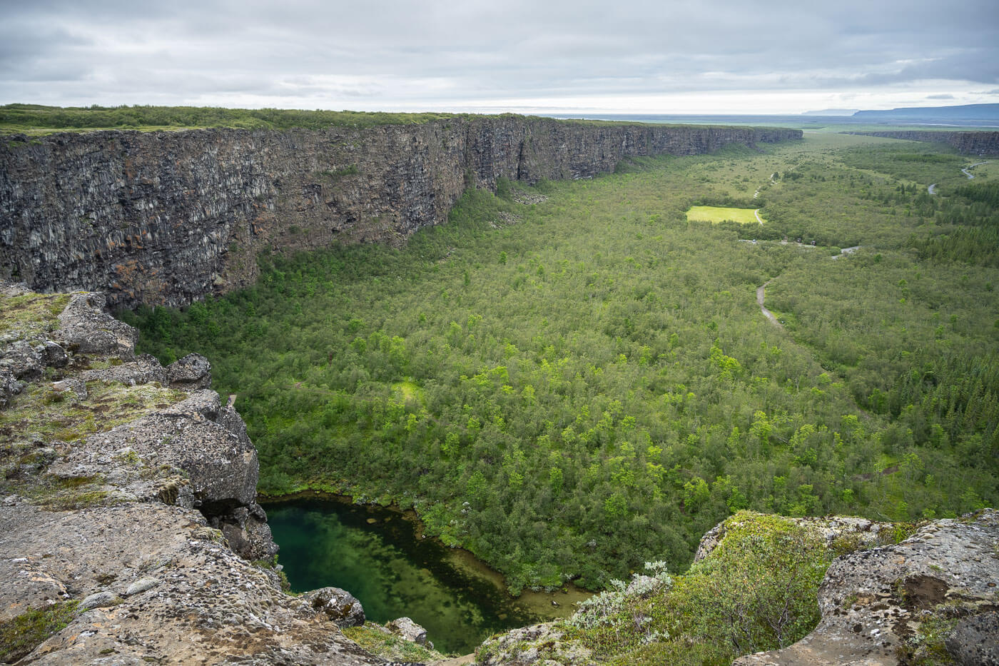
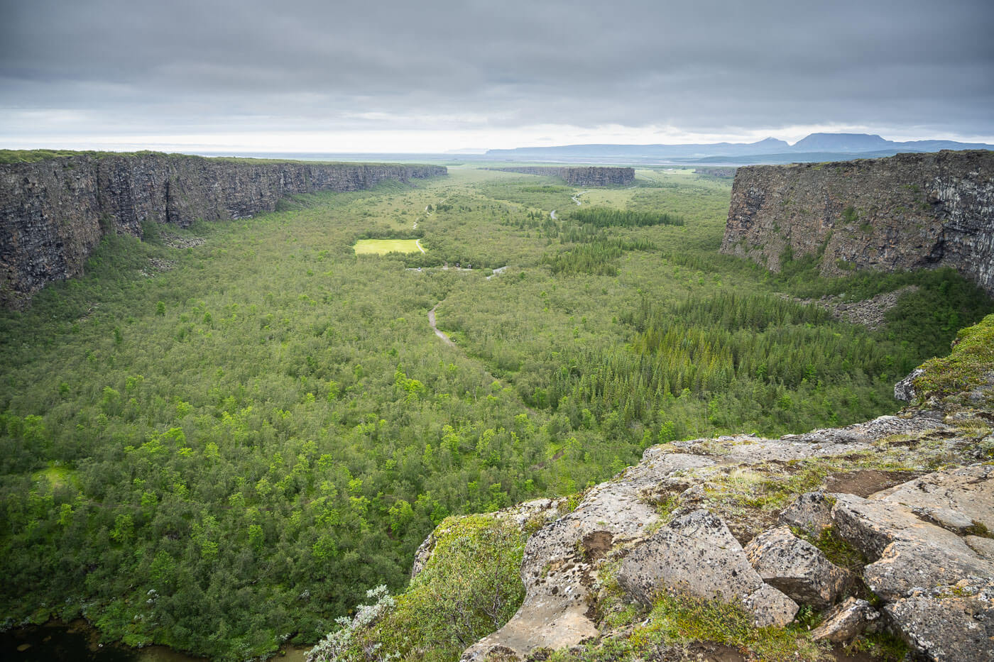
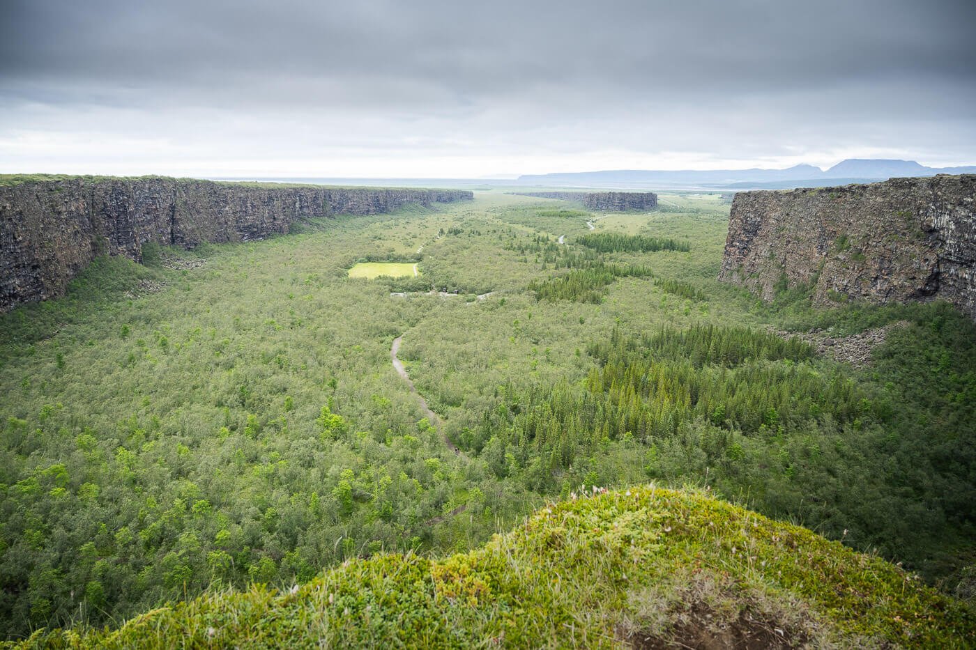
You can see the clear waters of the little lakes below you and every single minute detail of the vast landscape ahead of you. the vastness of it is kind of dazzling. I spent a good half an hour or more looking at the landscape from the top of the canyon.
The sound is also incredible. I could hear every single word from hikers down in the canyon below, at the foot of the cliffs.
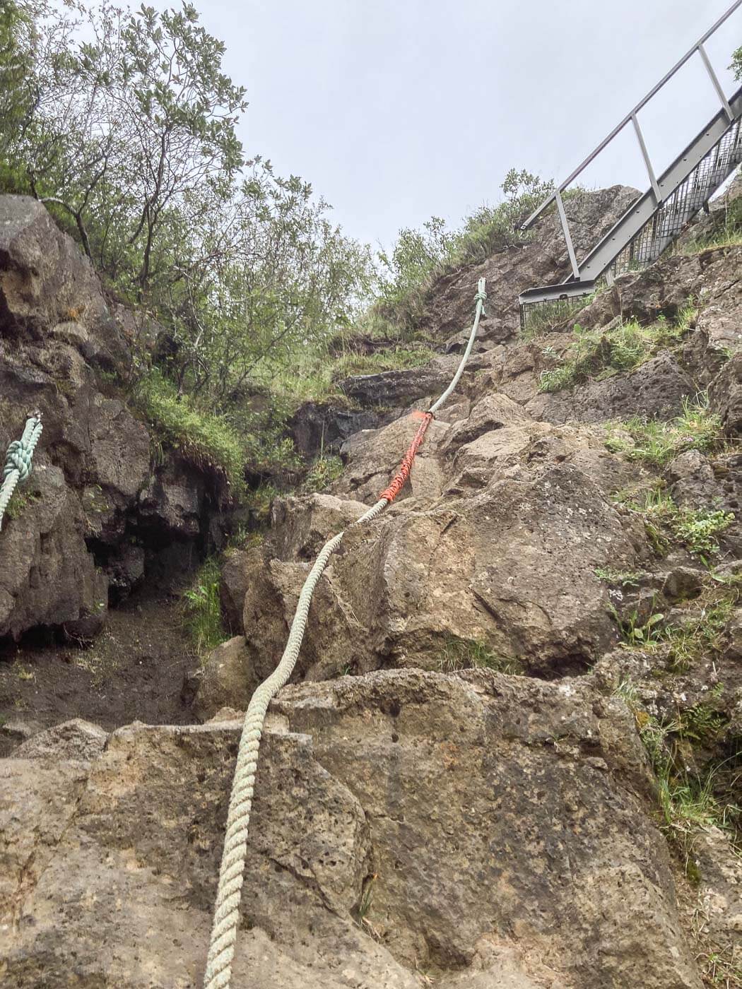
From the viewpoint, the trail follows the edge of the Canyon northward, toward the campsite. Initially, it gradually loses elevation quite gently, but at some point, you sort of have to climb down through some stairs with the help of a rope. It isn’t as steep as it looks like and the descent, although steep, it’s quite easy.
Once you’ve reached the bottom of the canyon, it is a flat, easy walk back to the Campsite or the Visitor’s center.
Ásbyrgi Canyon Photos, Photography Tips and Viewpoints
The canyon is huge! bring the widest lens you have. You can try to make panoramas, as it barely fits in a 14mm frame (full frame). Here is a comparison between a Panorama made with four vertical 14mm frames, and a single frame at 14mm underneath it.
Panoramic image.
14mm frame full frame)
At 24mm instead, you’d be able to capture just the other walls of the canyon.
24mm frame.
One of the downsides is that the canyon faces the north, so it does not get much good light in summer. That would probably be better later in the season, late September or early October when the days are shorter and the sun rises/sets closer to the north.
The Ásbyrgi Canyon is part of the Vatnajökull National Park, and while you do not need to seek permission from the authorities of the park, you still need to follow both the rules of the park and the regulations of the Icelandic Transport Authority. More info here.
If you are planning a trip to Iceland for the second half of September/early October, that may be one of the best times to visit the Ásbyrgi Canyon and catch its beautiful fall colors.
I haven’t managed to visit at that time of the year myself but it is on my list of things to do and places to visit again.
Video of the Hike
Here is a short video of the hike I made when I visited.
Where to stay & Camping in Ásbyrgi
The campsite is huge, I visited in early August and it was nowhere near being complete. Easy to find a quiet corner. I stayed there in my tent too and would stay again. Quite popular among Icelanders too. You can self-check in using the Parka app too. Do note the campsite is open only between the 15th of May to the 15th of September.
Otherwise, there are some guesthouses in the area, but for a location with more facilities, I would recommend Húsavík – a charming little town to spend the night at.
Additional Resources
- Official Ásbyrgi page on the Vatanjkull National Park Website
- For another nearby hike, do not miss these mighty waterfalls: Dettifoss, Selfoss, and Hafragilsfoss.
- Or, check out more Hikes in Iceland here.


Leave A Comment