Dettifoss, Selfoss and Hafragilsfoss East and West, North Iceland
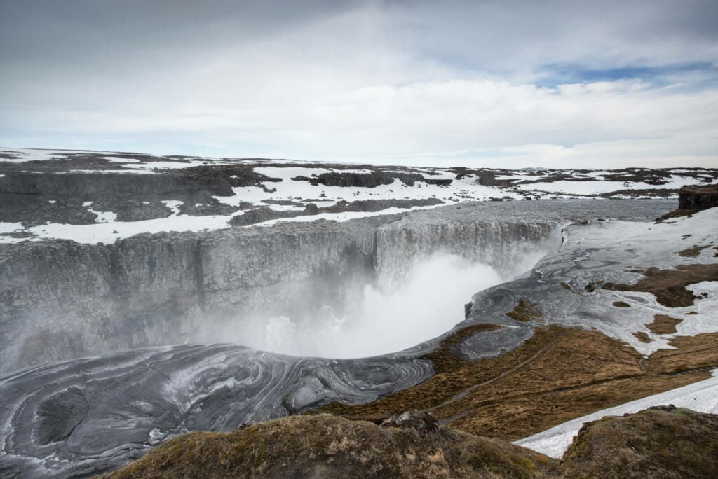
No doubt Dettifoss, Selfoss and Hafragilsfoss are some of the most impressive and powerful waterfalls in Iceland. Dettifoss is the most powerful in all of Europe, with a mighty water flow of 193 cubic meters per second.
That, combined with the thundering sounds of the waterfall, makes it a rather magnetic experience to watch Dettifoss. It’s hard to take your eyes off of it when standing in front of such an impressive waterfall.
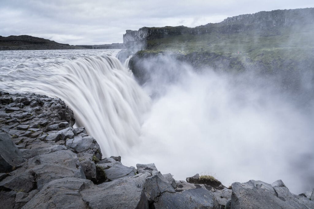
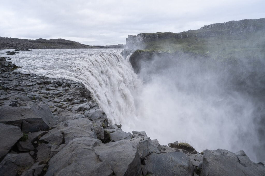
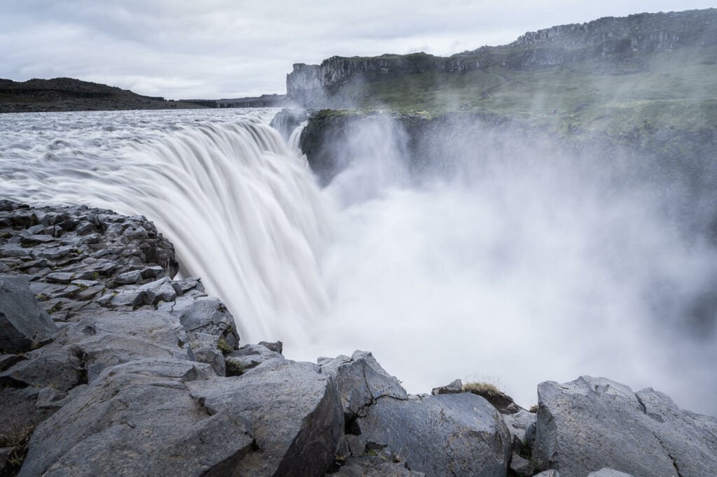
Dettifoss, East Side.
What’s best about this location is that all of the waterfalls are within hiking distance from each other, making it a trio of waterfalls that you should not miss. Both the East and West Sides offer great views of Dettifoss and the other two beautiful waterfalls, Selfoss and Hafragilsfoss.
This is a must-stop location in the north of Iceland, so make sure to add it to your itinerary because this is one location you should not miss. And I have not even mentioned the amazing Jökulsárgljúfur, the beautiful Canyon where the Jökulsá á Fjöllum river flows, forming the Epic Dettifoss, Selfoss and Hafragilsfoss.
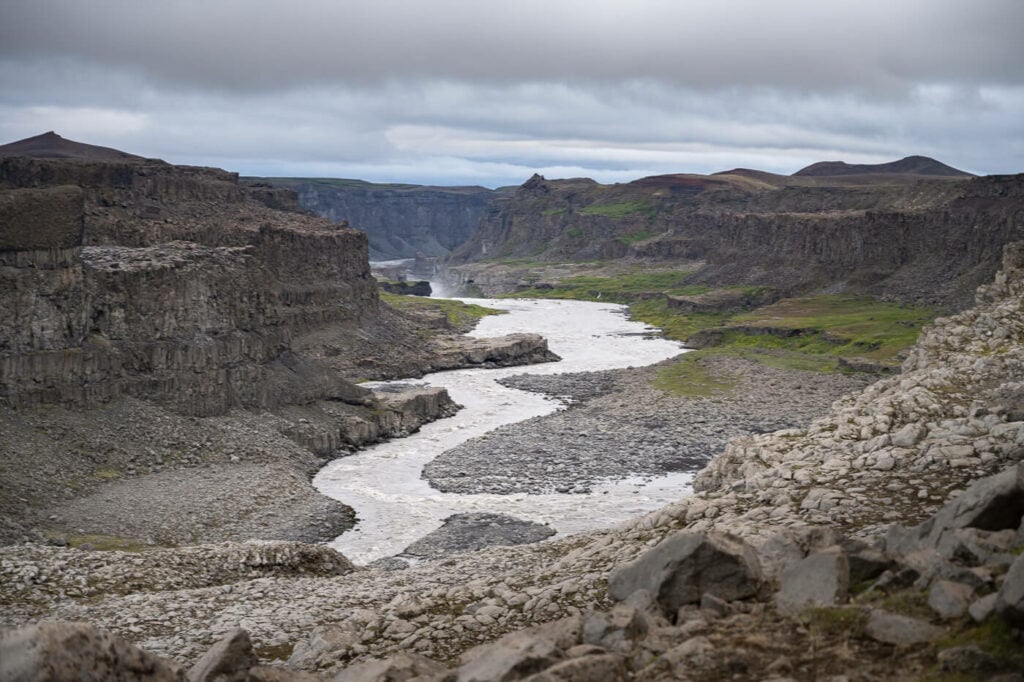
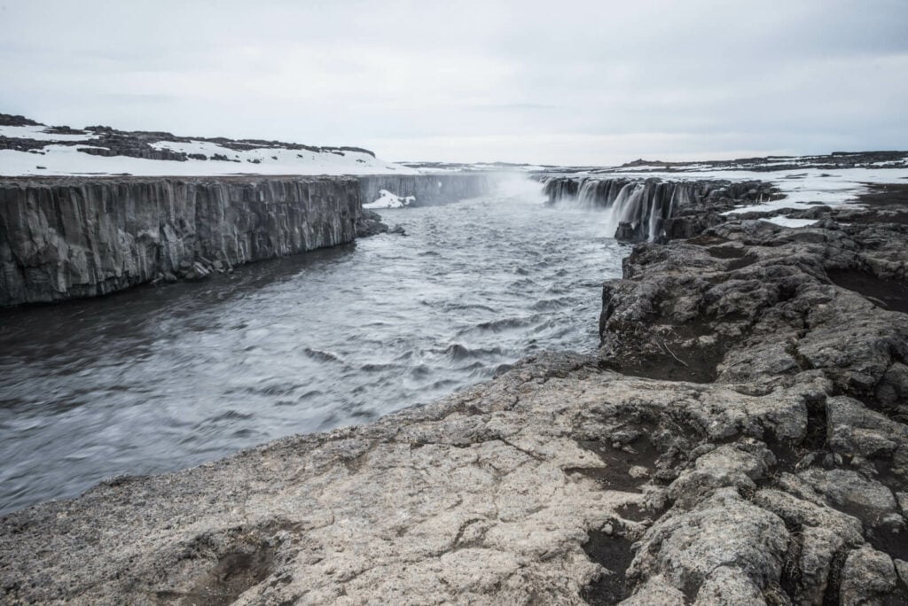
Jökulsárgljúfur, the beautiful canyon home to Dettifoss, Selfoss and Hafragilsfoss.
But which side should you visit? Well, both are equally beautiful in my opinion, but there are pros and cons to each side.
For instance, the West side is easier to reach, and at least Dettifoss and Selfoss are usually viewable year-round. This means it’s also more crowded. The Eastside is a little more remote and harder to reach on a beaten dirt road. This also means fewer people, if you enjoy the silence of the Icelandic landscape like I do.
Purely in terms of Landscape Photography, though, I’d say the East side had the edge.
Anyway, let’s get into the details!
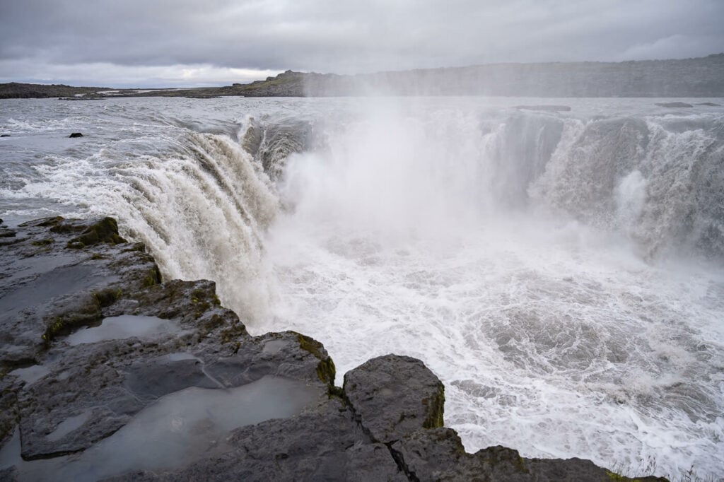
Approaching Selfoss on the East Side.

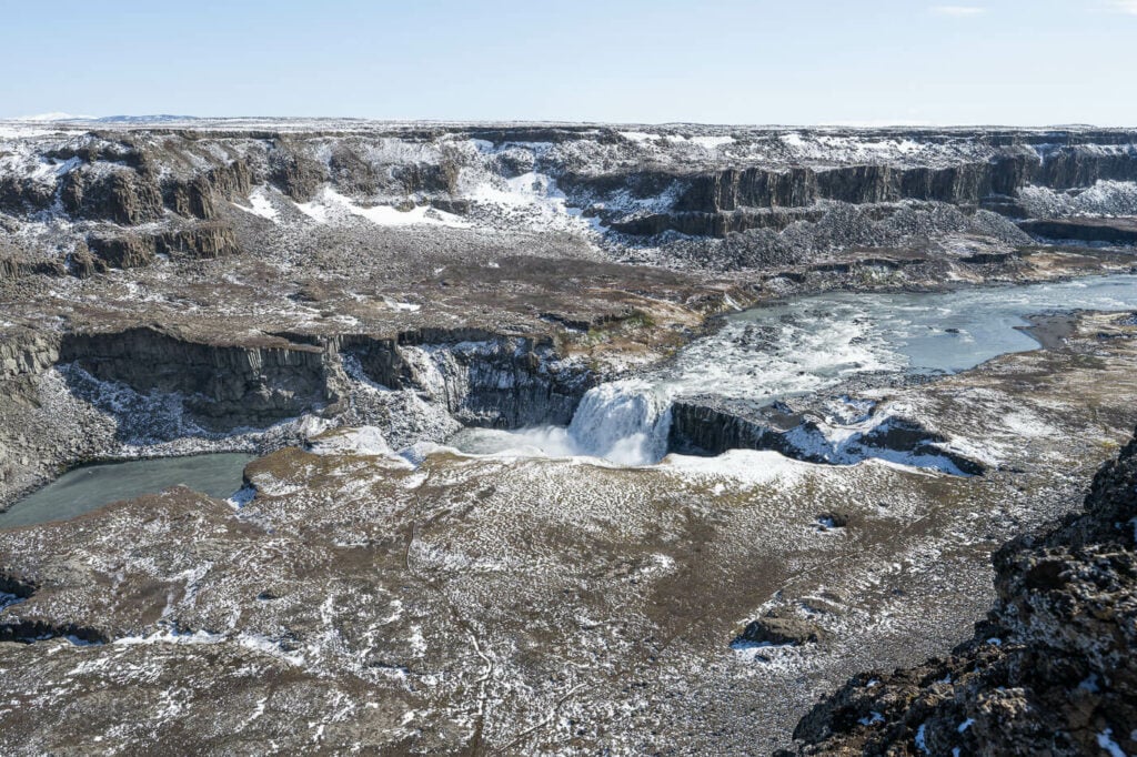
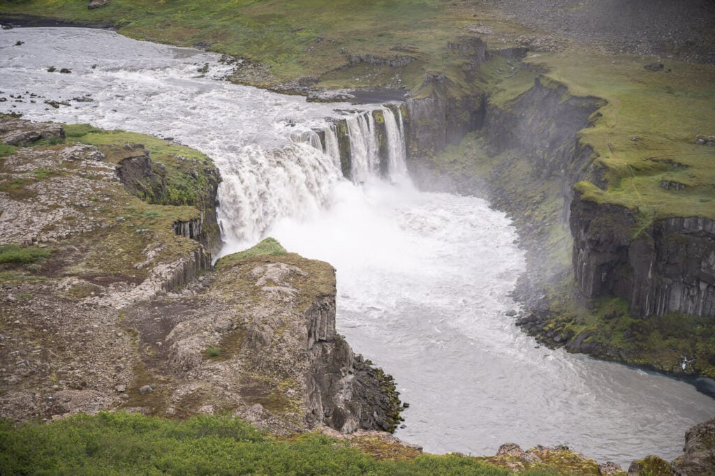
Hafragilsfoss, East Side.
Going to Iceland? Get a Car Rental Discount!
As a reader of The Photo Hikes, you get a 5% discount on your car rental when booking with Blue Car Rental through this website. The discount will be automatically applied to the booking through the following link
Table of Contents
Overview of the Dettifoss, Selfoss and Hafragilsfoss East and West Hikes & Map
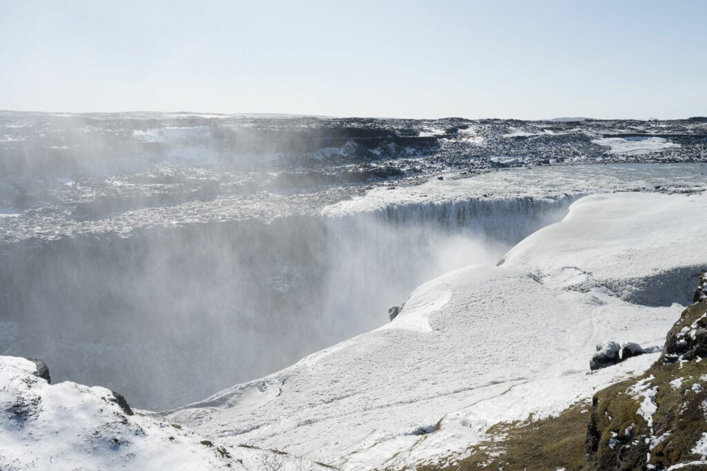
Dettifoss West is usually accessible all year round, even in winter, but the areas you can get to are limited due to snow and ice. Also, it may not be possible to get to Hafragilsfoss from either side in winter as the paths are usually closed. On the East side, the road is typically closed all winter until early June.
So if you want to do both hikes, you should be able to do the full west side hike from early June onwards, and the West side one maybe a couple of weeks later, but that depends on road and trail conditions. This hike will then be possible into early autumn, and until conditions permit.
Also, Dettifoss is right in between Selfoss and Hafragilsfoss, so you’d pass by it twice at least. Lastly, you can also drive the Hafragilsfoss viewpoints on both sides if you prefer not to hike all the way there to save some time.
| Max Altitude | 350 m (East and West) |
|---|---|
| Distance | 7.24 KM (East) – 10.1 KM (West) |
| Elevation gain | 100 m ↑/ 100m ↓ (East) – 120 m ↑/ 120 m ↓ (West) |
| Hike time | 02:00/ 02:30 Hours (East and West) |
| Hike Difficulty | Easy (East and West) |
Here is the map of the hike on the West side:
Here is the map of the hike on the East side:
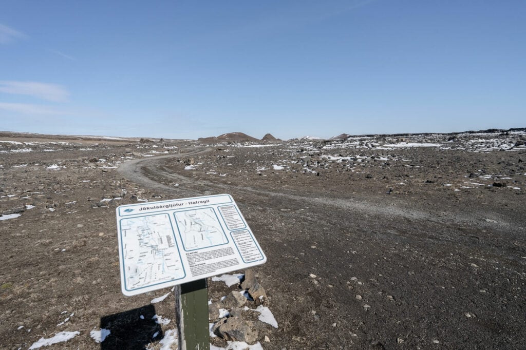
How to get to Dettifoss, Selfoss, and Hafragilsfoss and Parking
Located along Route One, or the Ring Road, you can access the East side by taking Road 864 (Hólsfjallavegur) and Road 862 (Dettifossvegur) for the West Side. The drive to Dettifoss takes about two hours from either Akureyri or Egilsstaðir, depending on which side of the Ring Road you are coming from.
As mentioned above, the West side (Road 862) is the most visited one as it is also the easiest one to access. The road is fully paved. Still, it may become impassable in winter when a storm hits. The East side is harder to access. Road 862 is a rough gravel road. While it is not an F-road, and 2WD passenger cars can access it, carefulness is required. There are large and deep potholes, so if you are planning to visit in a car with low clearance, take it slowly. It’s a long and bumpy ride.
Also, Road 864 is impassable throughout winter and it can close as early as October to reopen in June. Always check road conditions on Road.is before heading there.
- Driving Directions: West, Road 862: to get to the west side, you can just follow the road signs to Dettifoss along the main road, the Ring road. After turning onto road 862 keep following it for about 25 KM. At times, it will feel like you’re heading nowhere. After a while, though, you will see signs pointing to the parking area. East, Road 864: this one is kind of easy to miss, as it is also a few KM away from the other road. There aren’t any obvious “Dettifoss” signs. Keep following the dirt road past the few guesthouses you’ll pass by. After a while, you’ll see the parking area to your left.
- Parking: Free parking is available on either side. Both parking lots are furnished with Toilets.
- Public Transport: not really a public transport-friendly location. While Strateo Bus 56 stops at Jökulsá á Fjöllum along the ring road, there is no transportation to Dettifoss. The distance from the ring road to Dettifoss on Dettifossvegur (Road 862 is about 25 km), so it is a very long one. Probably better to join a tour if a car is not an option for you.
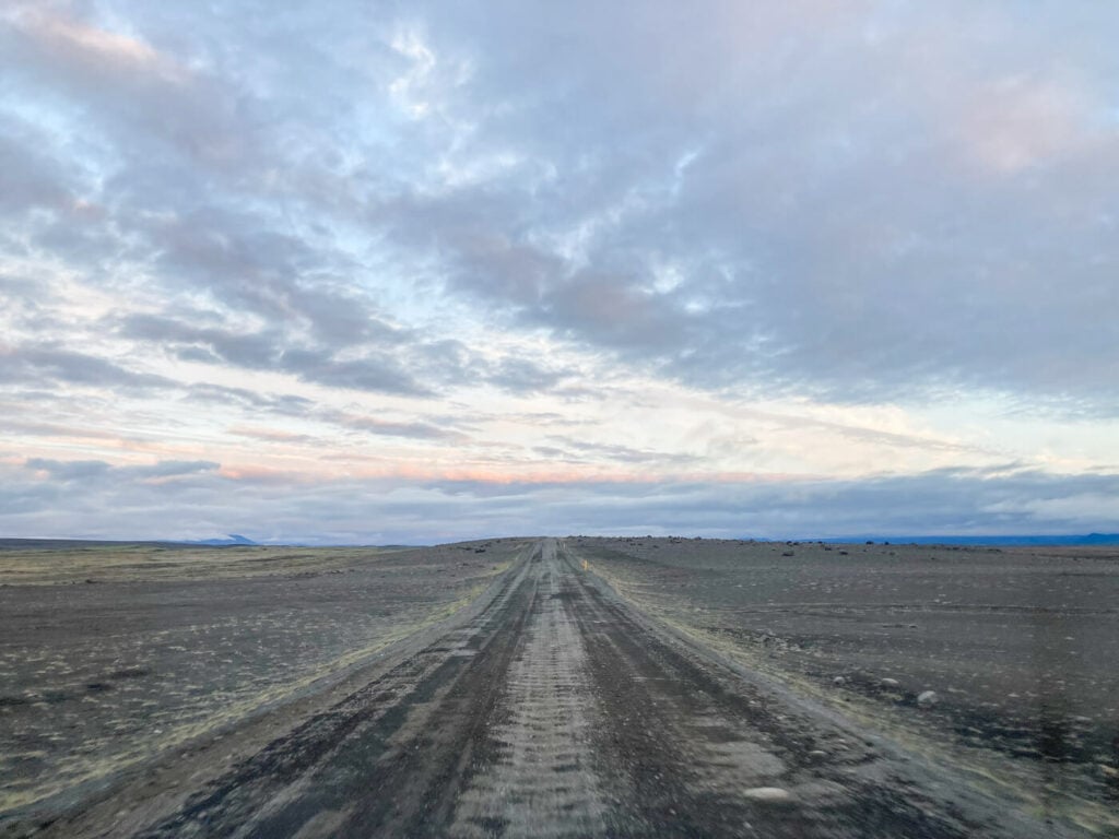
Hólsfjallavegur or road 864, Dettifoss East Side. a road to drive slowly if in a normal 2WD passenger car.
The Dettifoss, Selfoss and Hafragilsfoss Hiking Trail – East and West
The walking paths to Dettifoss and Selfoss are well-marked and easy to follow on both sides. Less so for Hafragilsfoss, but it is still easy to get there.
Dettifoss West Side trail
The Dettifoss West side trail is the one with more infrastructure. Paths are fully marked, and there are a couple of observation decks overlooking Dettifoss. As you leave the parking area, you can either walk to Dettifoss or Selfoss First. You can reach Dettifoss in less than ten minutes and Selfoss in less than 20.
View of Dettifoss from the main observation deck on the West Side.

Another one of the main Dettifoss viewpoints on the West Side
On the West side, you can easily do either Dettifoss or Selfoss first, and then visit the other one. Depending on the wind, the water spray from Dettifoss can be very intense on the West side so be ready for that! From Dettifoss, the hike to Selfoss on the West side is flat and well-marked. Essentially, it is a hike on the wider riverbed of the Jökulsá á Fjöllum River.
Approaching Selfoss on the West Side.
Selfoss West Side.
Next, to get to Hafragilsfoss, you’d first have to go back to Dettifoss. From there, you can reach Hafragilsfoss in two ways. If the road is open, you can drive up to the West Side viewpoint. Otherwise, you can hike there too, and there are two different trails here too.
The first one follows the road, more to less, all the way up to Hagragilsfoss. The second one follows the canyon downstream and allows you to get much closer to Hafragilsfoss. However, while the former is already open from the end of May/Beginning of June, the lower trail to Hafragilsfoss is typically open only later in the season, because of all the ice and thawing ground.
Road to Hafragilsfoss
Hafragilsfoss from the West Side panoramic viewpoint.
Dettifoss East Side trail
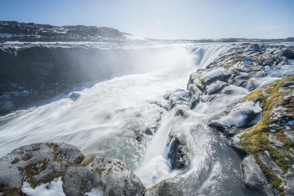
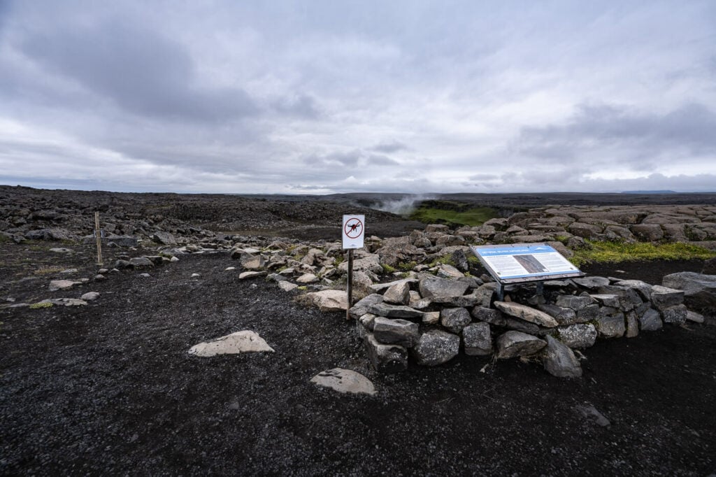
On the Eastside, the hike to Dettifoss is shorter. A well-marked path will lead you down to the observation deck, which is just a very wide, rocky area delimited by a rope. It is forbidden to step over the rope both to protect the environment and for safety reasons, since the area is completely exposed. Still, the view of Dettifoss is extremely impressive, and you can feel its power.
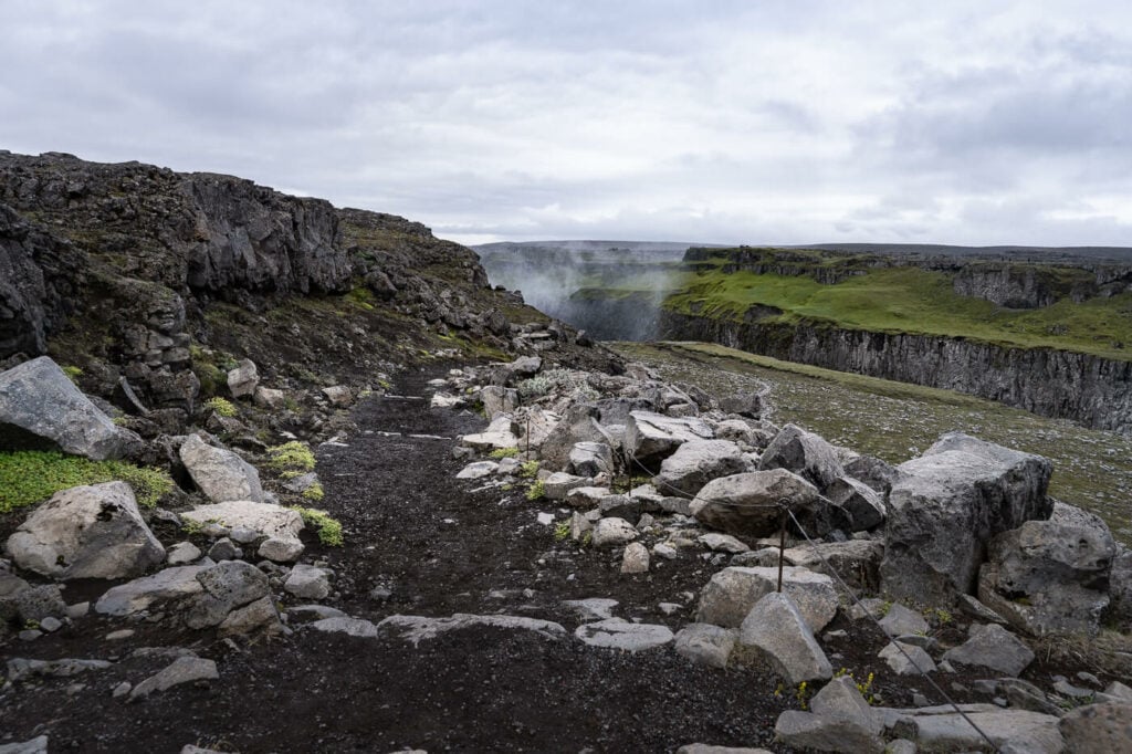
Dettifoss-Selfoss East Side Trail Head. That vapor in the distance is where Dettifoss is.
The trail is nicely maintained despite the location being a little more remote than the West side.
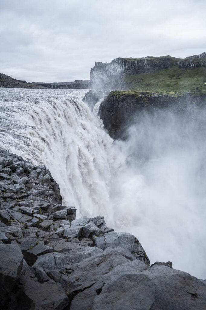
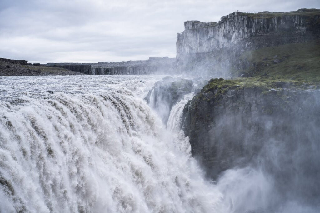
Dettifoss East Side
From there, Selfoss is the easiest waterfall to reach. Again, the trail is well marked with yellow trailmarks. The Hike from Dettifoss to Selfoss is a little over 1km, but it is rather slow going.
The terrain is very rocky, and white it is essentially flat, you may still need to help yourself around big boulders with your hands. You can get extremely close to Selfoss, so practice caution because the area is very wet and can be slippery in places. And sure, Selfoss isn’t as powerful as Dettifoss, but it surely is a mighty waterfall too. It’s the same river after all.
Approaching Selfoss on the East Side.
To get to the next waterfall, Hafragilsfoss, you would then need to go back again to Dettifoss. From Dettifoss to Hafragilsfoss, the hike is almost 3km, so that’s the part of the trail that will take most of your time. Again, if you prefer, you can drive up to the Hafragilsfoss viewpoint too, along the same Route 864. The panoramic views of Hafragilsfoss are epic. It’s one of those places you can’t help but wonder what kind of forces took to create such a landscape over the ages.
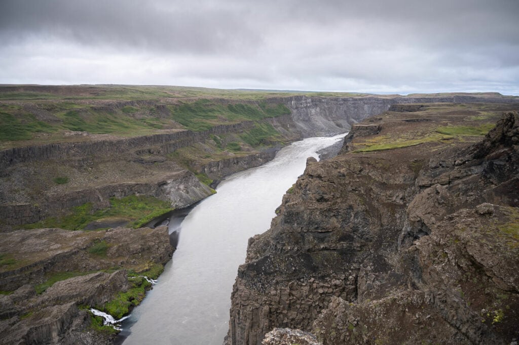
Jökulsárgljúfur, watching the canyon toward the north.
Hafragilsfoss, East Side.
Dettifoss, Selfoss and Hafragilsfoss Photos and Photography Tips
As I mentioned in the intro, I think the east side is better for landscape photography. Not only is the view of each waterfall more scenic, but you essentially face them directly. Less so on the West side, as the canyon partially obstructs the view of the waterfalls.
Also to consider, there is generally less water vapor, especially at Dettifoss. Anyway, the first tip is to make sure you bring a cloth to the filters or front element of the lens, and you may need to use it a few times.

I would not say there is a definitive best time of the day to visit Dettifoss and the other waterfalls. Both sides can be good for sunrise or sunset if the sun is out. In such cases, it’s good to be out for 1-2 hours before and after sunset to catch the golden light. All the waterfalls essentially face north, and in the summer, the sun sets and rises closer to the north anyway.
So which lenses should you bring to Dettifoss? Despite Dettifoss being huge, you won’t need an ultra-wide because you can’t get too close to it. If you have seen those photos of people standing a few steps from the Waterfall, those shots are not possible without stepping over the cordoned-off area. That’s actually forbidden, for environmental protection and safety reasons. Anything in the range of 18 to 50mm can be good for Dettifos.
You may want to have an ultra-wide lens for Selfoss; while you can use a mid-range zoom to capture it from the trail, you can get very close to it. So an ultra-wide makes sense. On the other hand, you will need a lens with a longer reach for Hafragilsfoss, from either side.
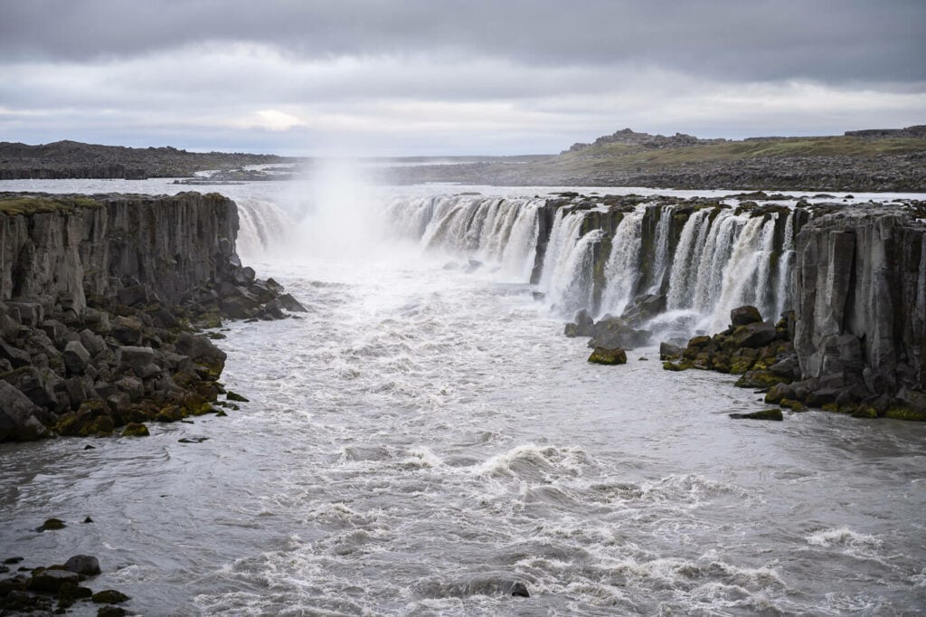
Selfoss, East Side


Hafragilsfoss, West Side

Hafragilsfoss, East Side
Lastly, flying drones at Dettifoss, Selfoss, or Hafragilsfoss is not permitted at all. Since the area lies within the boundaries of the Vatnajökull National Park, flying drones here is only possible with special permission from the Park. You can get such permits only for research or filming projects (source), but not for recreational use.
Video of the Hike and the Waterfalls
Last but not least, here is also a video showing all of the waterfalls from their main viewpoints on both the West and East sides.
Where to stay
There aren’t a lot of accommodations in the area, but there are a few, like the Grímstunga Guesthouse, Grímsstaðir Guesthouse, or the Holssel Road 864. It makes total sense to stop here if it is your last location of the day, or want to spend the night in a very quiet area with a sort of remote “lunar landscape” feel to it. I stayed at the Grímstunga Guesthouse, and I can recommend it. You can also camp at Grímstunga in case you are bikepacking or on a long-distance hike and passing by.
Otherwise, depending on your general direction of travel, you may want to stop at the beautiful and charming small town of Akureyri or the Myvatn Area. If you are traveling in the opposite direction, you can consider Egilsstaðir to visit some of the amazing waterfalls in the East of Iceland.
Additional Resources
- If you want to visit some more epic waterfalls, check out Dynjandi, The Skogafoss Waterfall Way, Haifoss, Gullfoss, or Glymur.
- Do not miss Aldeyjarfoss either.
- Check out more Hikes in Iceland here.
- Also, discover the best hiking books and guides on Iceland to plan your next hiking trip.


Leave A Comment