Fossárdalur and Múlafoss, a beautiful Waterfall Hike in East Iceland
The hike to Fossárdalur and Múlafoss is one that I ignored for too long. I passed by it several times in well over a decade, telling myself “It’s just another waterfall”.
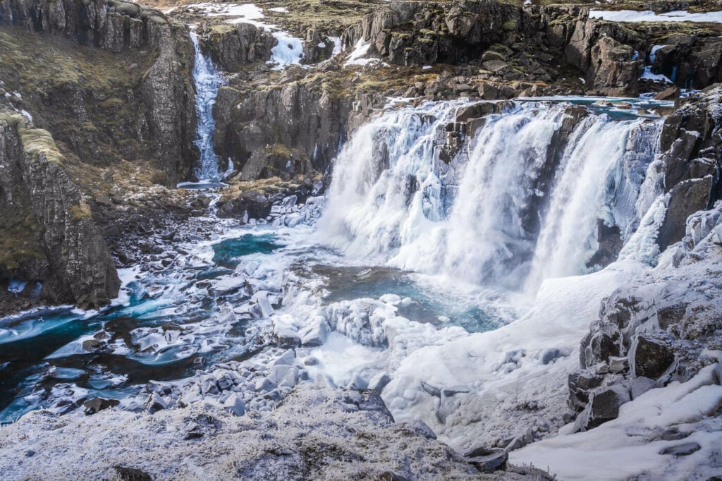
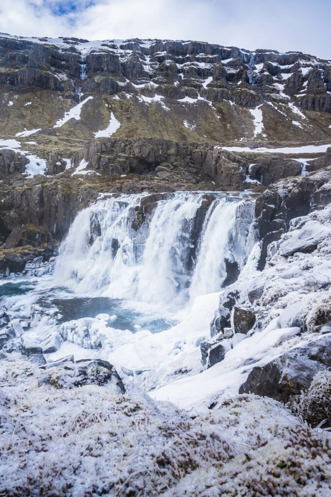
Múlafoss, the last waterfall on the Fossárdalur hiking trail.
Well, I’m happy to say I was wrong.
First of all, there are four waterfalls on this hike, not one. Second of all, Fossárdalur, the valley where the waterfalls are, is a beautiful, quiet valley worth visiting in itself. Third, the last waterfall on this hiking trail, Múlafoss, it’s very beautiful in its own right and, for me, it was worth the hike.
So that’s already three good reasons to visit. If you are looking for a beautiful hike to a hidden gem off the beaten path, then you have a fourth reason not to skip it.
Fossadalur – the name means “Waterfall-River-Valley”
Table of Contents
Overview of the Fossárdalur and Múlafoss Waterfall Hike & Map
The hike to Fossárdalur and Múlafoss is relatively easy. Even if the out-and-back hike is almost 10km, you are hiking on a dirt, mostly flat, road for 95% of the hike. So you can walk quite fast for most of the trail.
Under normal conditions, it should be possible to do the Fossárdalur and Mulafoss hike even in winter. By that, I mean no snow or adverse weather conditions. I did it in March myself, with little to no snow on the path and it was absolutely worth it.
| Max Altitude | 170 m |
|---|---|
| Distance | 9.38 KM |
| Elevation gain | 360m ↑ / 360m ↓ |
| Hike time | 02:15:00/ 02:45 Hours |
| Hike Difficulty | Easy/Moderate |
Here is also the map of this hike; should you wish to do so, you can download the free GPX file from the activity below.
How to get to Fossárdalur and Múlafoss and Parking
The trailhead is easily accessible from the Ring Road, not long after Djúpivogur and before the deviation to the Öxi Pass.
- Driving Directions: from Djúpivogur, keep driving for about 15km on the ring road. Before reaching the far end of the fjord, you’ll see a road going up the side of the hill to your left. Take that road – you’ll also see some signs mentioning the campsite. While driving up the road, you can make a quick stop to view the first waterfall Nykurhylsfoss. From there, keep driving uphill for another 5 minutes or so, until the end of the dirt road.
- Parking: Free parking is available by the trailhead. Note: please do not drive further than the designated parking area by the campsite.
- Public Transport: no good public transport options to get here.
If you are looking for car rental options, I can definitely recommend Blue Car Rental (with 5% discount through the link) for cars and CampEasy for Camper Vans.
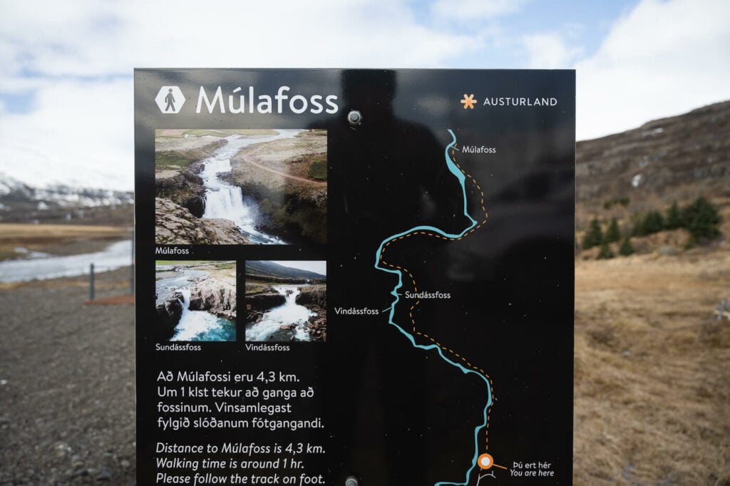
The info board by the Mulafoss trailhead.
The Fossárdalur and Múlafoss Hiking Trail
The first waterfall in Fossárdalur, Nykurhylsfoss, is right by the side of the dirt road that leads to the trailhead. You can visit it as a quick stop. There is an observation deck, and the walk to get there takes about two minutes literally.
Nykurhylsfoss
I believe you could start the hike from the re too should you wish to do so. I did not because, by the look of it, it’s about an additional 3 km each way.
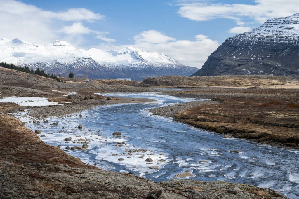
Anyway, once you reach the trailhead, you can start walking right up the dirt road in from of you. The trail loosely follows the Fossá River upstream all the way up to Múlafoss.
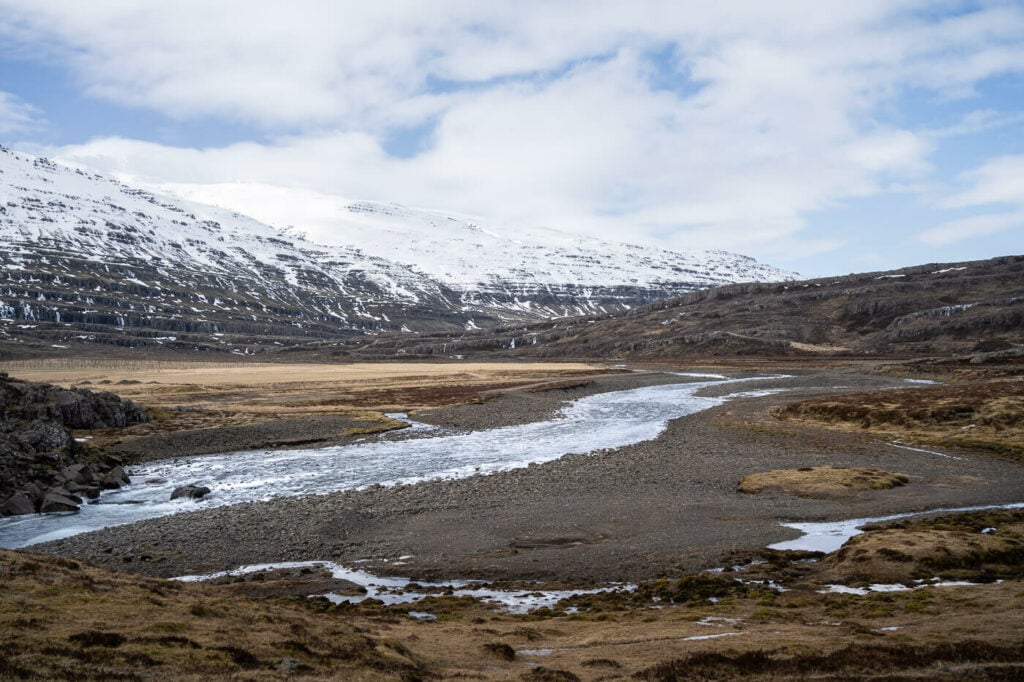
Fossárdalur and the Fossá river.
Finding the first two waterfalls requires a bit of off-trail navigation.
The first one will be about thirty minutes into the hike, and the second one is not too far from there. They are not easy to see from afar, but you can hear them and partially guess where they are by the morphology of the terrain around them.
The first one you will come across is Vindásfoss. It’s a waterfall with two different steps, ending in a narrow passage through two walls of levigated rocks.
Vindásfoss
The upper part and the first step of Vindásfoss.
The lower part of the Vindásfoss waterfall.
Following the river upstream for another 10-15 minutes, you will come across the second waterfall, Sundássfoss. You can only get a good view of this waterfall by standing on top of the rock by the river.
This is because the water has carved its way deep into the rock, so it falls into a very small and narrow gorge. Be very careful here, the wet rocks can be slippery.
Still, you can get a good sense of how the water carved its path through the rock here, patiently digging its way into the rock.
The upper part of Sundássfoss.
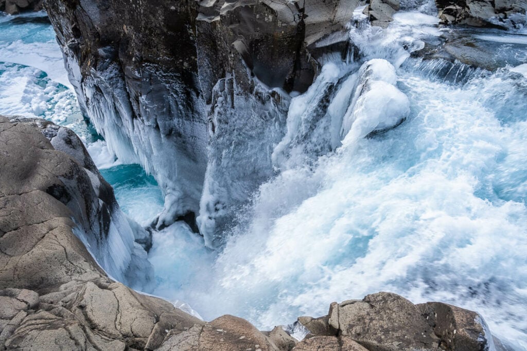
Sundássfoss.
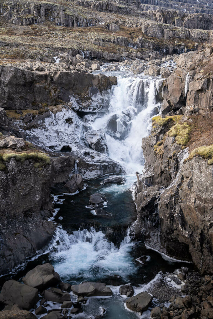
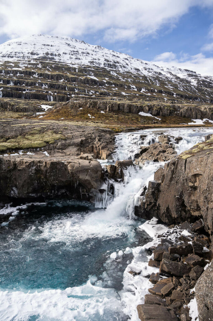
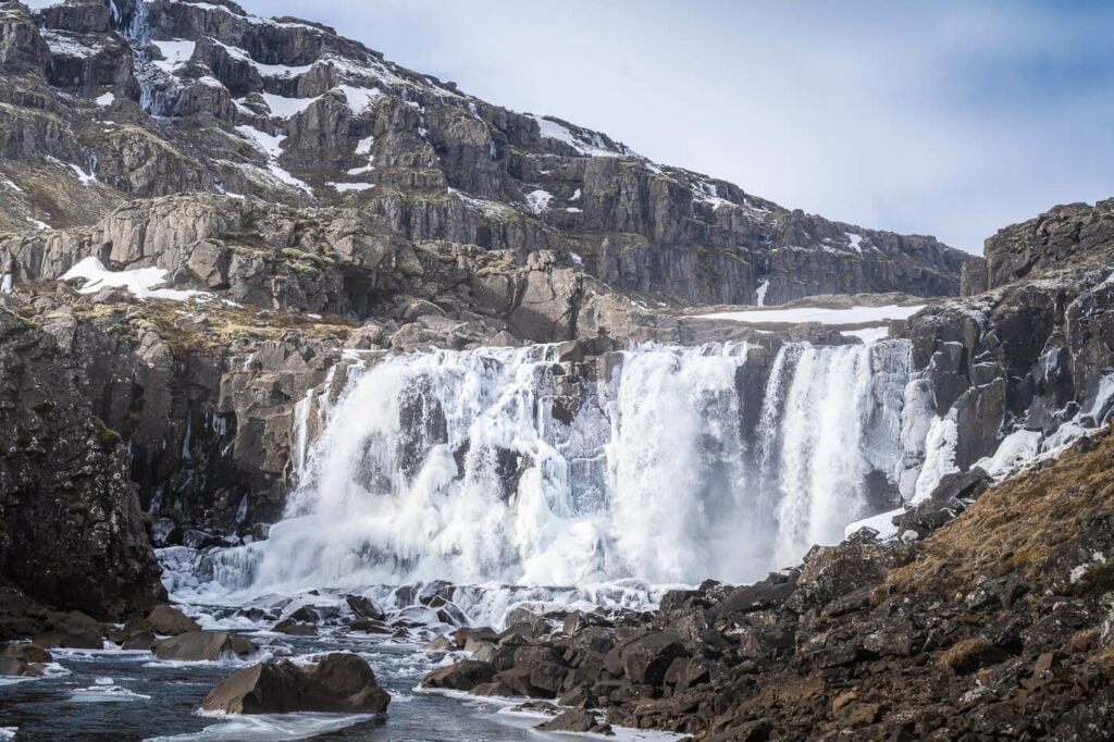
Now back to the trail and onto the third waterfall, Múlafoss, probably the nicest one of the four waterfalls along the river. Again, you can’t see it from afar, until you have it pretty much right in front of you.
You can both walk right down to it on the river bed and above it, following the hiking trail.
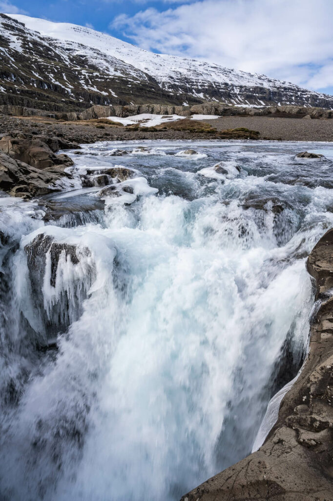
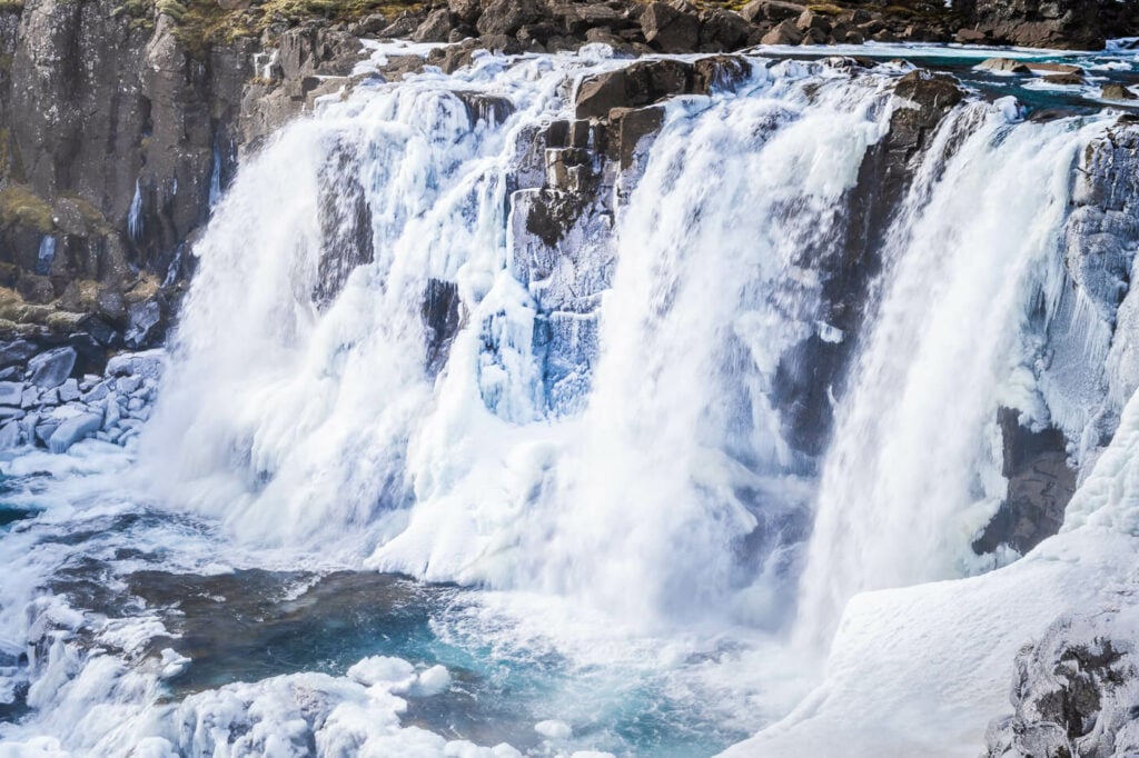
I first walked on the riverbed but I could not get too close to it. It was winter and to much ice around it to be able to safely get close to the waterfall.
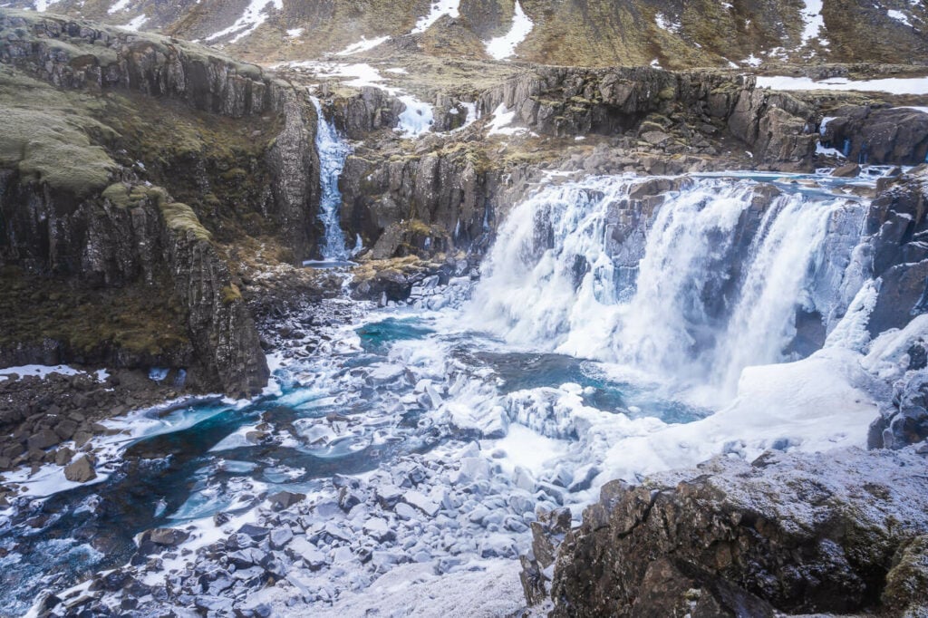
Múlafoss
Again, Múlafoss viewed from the lower viewpoint on the river bed.
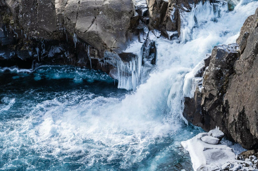
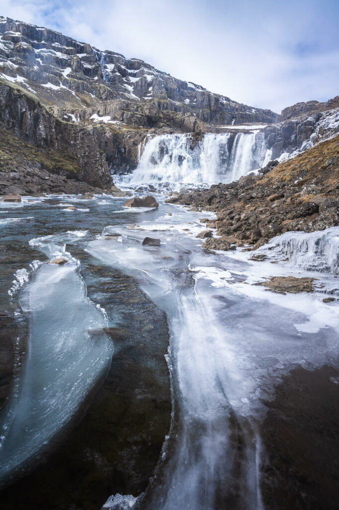
Then, I walked back to the main trail to an upper viewpoint right above the waterfall. Both the lower and upper viewpoints offer great views of the waterfall, so I’d recommend doing both.
I spent some time here just enjoying the landscape while listening to the sound of falling water. The ice around the waterfall, even though it prevented me from getting too close, definitely added another layer of beauty to this location.
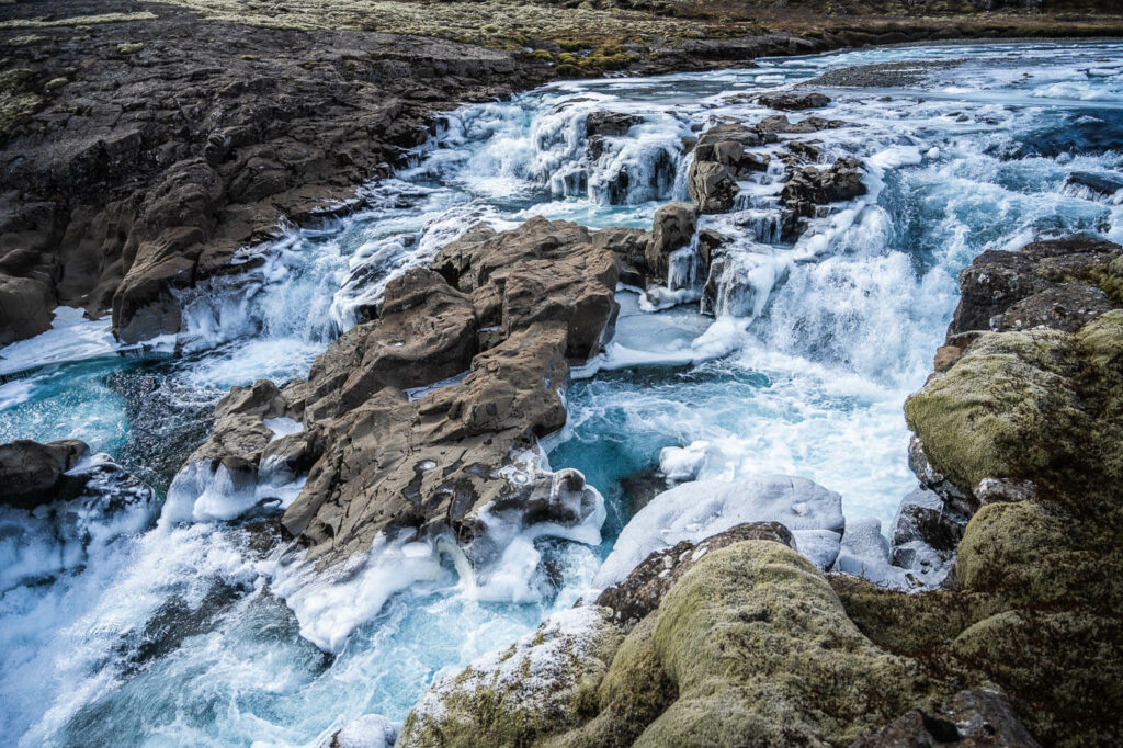
Múlafoss upper viewpoint above the waterfall.
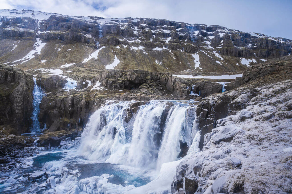
Múlafoss
From here, you can turn back, with the views of the beautiful Fossardalur Valley right in from of you. Or, perhaps, you could try to explore the valley further upstream. I have not been there, but there likely are a few more waterfalls upstream.
The Fossardalur and Mulafoss Hike Photos and Photography Tips
Photographically speaking, I think Mulafoss is the most photogenic waterfall of the four in Fossardalur. I can’t tell exactly how tall it is, and neither I could find definitive information, but it is also the tallest of the four.
That is to say, it’s the most powerful one and the one that offers more compositional options. While the views of all the other waterfalls are somewhat limited, there are plenty of compositions to choose from when photography Mulafoss.
It is also the waterfall I spent the longest at, about 30 to 40 minutes alone, looking for different angles and compositions.
I also really liked Sundássfoss more than the other two remaining waterfalls. What I liked about it is how the waterfall is framed by the narrow, levigated gorge it falls into.
While that also limits the view of the waterfall, there are plenty of interesting shapes in the rocks that would make it suitable for more abstract compositions under the right conditions.
I could not explore that option when I was there, as the ice limited my movements around the waterfall, but I’m just putting it up there for anyone visiting the waterfall with a camera.

In terms of light, due to their position relative to the sun, the waterfalls only catch some light in the morning from spring to autumn. So this is also a good location to visit on a cloudy day.
Lastly, this is Reindeer territory, so if you are lucky you may be able to catch Reindeer or even a herd roaming through the valley.
I was lucky enough to catch a passing her from afar, but they ran off to wherever they were going before I could put my telephoto lens onto my camera body.
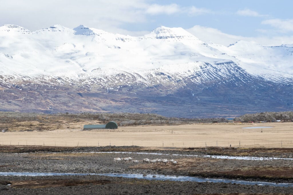
A small Reindeer herd crossing the Fossá river.
Where to stay
There is a campsite by the trailhead – the Fossárdalur campsite. If you are looking for a quiet place in a beautiful setting, then you’ll most likely enjoy this campsite. You can pay with the Parka app too.
If you’re not camping, there also is the Fossárdalur Guesthouse you can stay at.


Leave A Comment