Hiking to Hattver and Háttur in Landmannalaugar, Iceland
The hike to Hattver and Háttur is one of the least frequented in Landmannalaugar, but also a hike that leads to one of the most curious rock formations in Landmannalaugar, Háttur.
This rock formation called Háttur, which means “Hat” in Icelandic, is one of the most curious ones in Landmannalaugar.

Hattur and the Hattver greenery.
Literally, Háttur is a mountain with a “rocky” hat on its top. It probably is one of the most unique and recognizable rock formations in the area, only beaten by Grænihryggur and Uppgönguhryggur, at least in my opinion.
And, by the way, Uppgönguhryggur is also part of this hike – so you get to see two amazing rock formations for the price of one!

Uppgönguhryggur
In a nutshell: this is a location you would visit if you have already hiked the major trails in Landmannalaugar, and if you are looking for a less touristy experience, to enjoy the unique landscape of Landmannalaugar away from the crowds.
Table of Contents
How to get to Hattver and Háttur
I won’t be extensively talking about how to get to Landamannalaugar in this post, as that’s been treated extensively in my main post about Hiking and Camping in Landamannalaugar.
But long story short: this hike starts at the Landmannalaugar campsite. The best way to get to the Landmannalaugar campsite is to drive there from Road 208 north. Then, turn onto Road f224 and park before the river crossing – or in your allotted parking slot. And, while technically road 208 North is not an F-road, you will need an F-road Capable car to drive Road F224.
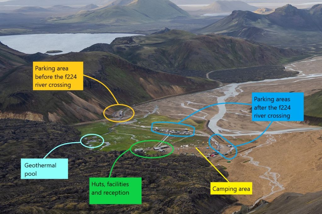
Anyway, don’t forget to book your parking spot in advance! Since 2024, visitors arriving at Landmannalaugar between 8:00 AM and 3:00 PM must reserve parking in advance. Without a parking reservation, you will be turned away.
If you are looking for car rental options, check Blue Car rental – bookings through ThePhotoHikes come with a 5% discount! More on that here if you want to know how it works.
Hattver and Háttur Hiking Trail & Map
The hike to Hattver and Háttur is a relatively long one, moderately difficult, and with a modest elevation gain. There are some moderately exposed sections on top of Uppgönguhryggur, but nothing too bad.
Here is the map of the hike to Háttur and Hattver. You can also download the GPX file from the activity linked below for free.
If you are familiar with Landmannalaugar, you probably noticed the first part of the trail is the same trail that leads to Skalli, So you can leave the Landmannalaugar campsite following the Skalli trail and then turn toward Hattver when you see the small sign on the rocky slopes of Mount Skalli.
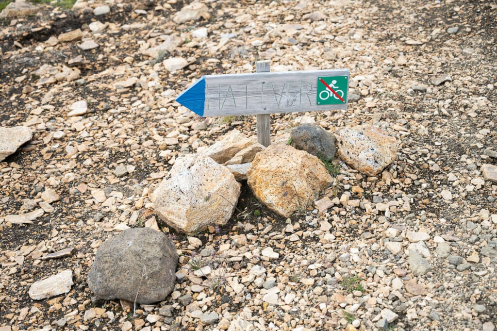
From the Skalli Trail to Jökulgil
As soon as you leave the Skalli hiking trail and follow the blue sign to Hattver, the landscape in front of you will progressively open up. First revealing the beautiful and colorful mountains toward Torfajokull, then the Jökulgil alluvial plan, and finally Uppgönguhryggur.
I have visited Uppgönguhryggur several times, and each time I see it my jaw drops. You’d have to see it for yourself, but for me, it’s like a giant, natural sculpture in an open-air museum.

Uppgönguhryggur.
A walk on this ridge, surrounded by the colorful Rhyolite mountains of Landmannalaugar, is an amazing experience. Not only because of the landscape, but also because of all the shades of yellow, blue, and white that run across Uppgönguhryggur.

Traversing this beautiful ridge will take approximately 20-25 minutes. Some sections are moderately exposed and can be slippery when wet, so proceed cautiously – hiking poles are recommended.
The ridge ends with a steep descent into the Jökulgil Canyon, where Hattur will be visible to your right.

Descending toward Jokulgil and Hattver. Hattver is on the right-hand side.

Hattur, on the left-hand side of the image.
Hattver and Háttur
Once you are at the bottom of the canyon, it’s just a short walk through the riverbed to Hattver and Hattur. No river crossing is required, but there are some small river streams you can easily jump above.
From there, keep walking to your right, in the general direction of Hattur. Right around the corner of the next ridge, you should start seeing the first greenery and perhaps some free-roaming sheep.

Sheep in Hattver.
The omnipresent Icelandic sheep also like to hike here and graze in this scenic outlet.
Anyway, here you have arrived at Hattver, where the hike ends. It is also a great spot to just walk around the Jokulgil Canyon a little more if you’d like to explore the area.
There are plenty of photo opportunities here too; you can see a good part of the mountain ranges around Jokulgil.

Hattur, viewed from Hattver.


Where to Stay
The only closeby, and most obvious option would be the Landmannalugar Campsite or its Hut (which needs to be booked in advance).
Landmannahellir is another campsite not too far from Landmqnnalaugar on F road F-225 – much quieter than Landmannalaugar.
Additional Resources
- Book your parking spot here, if you are planning to visit between 8:00 AM and 3:00 PM
- Discover more hikes in Landmannalaugar; check out the best day hikes or my full Landmannalaugar hiking and camping guide.


Leave A Comment