Best 5 Day Hikes in Landmannalaugar with Maps
As a passionate hiker and photographer, I have been to Landmannalaugar several times in the last few years and here I want to share a round-up of what I think are Best 5 Day Hikes in Landmannalaugar with Maps. This is a round-up post of my hike reports from each one of these locations, so you can use it as an overview and to dig deeper into each one of the hikes which I’ll link in each section. I’ll also link the map to the activity if you want to download the GPS.
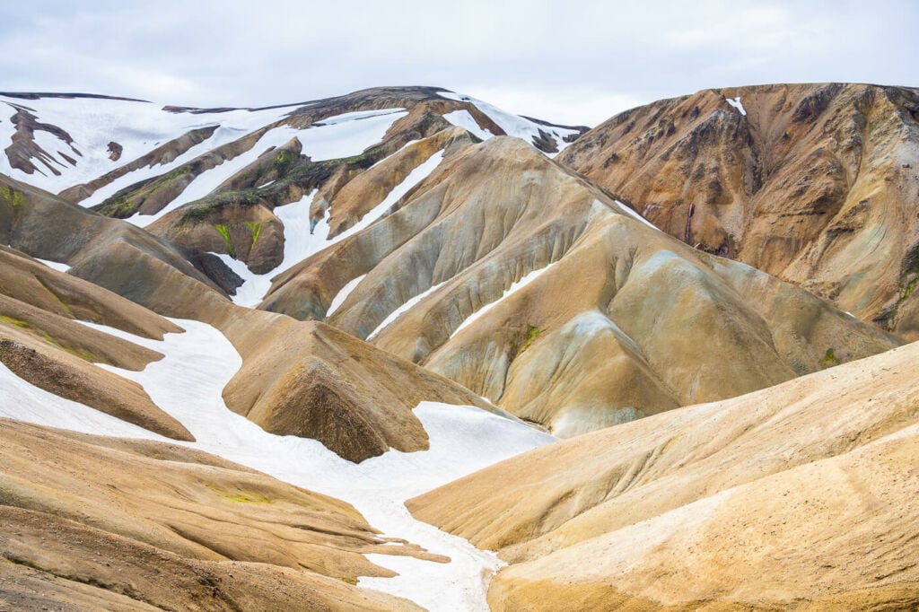
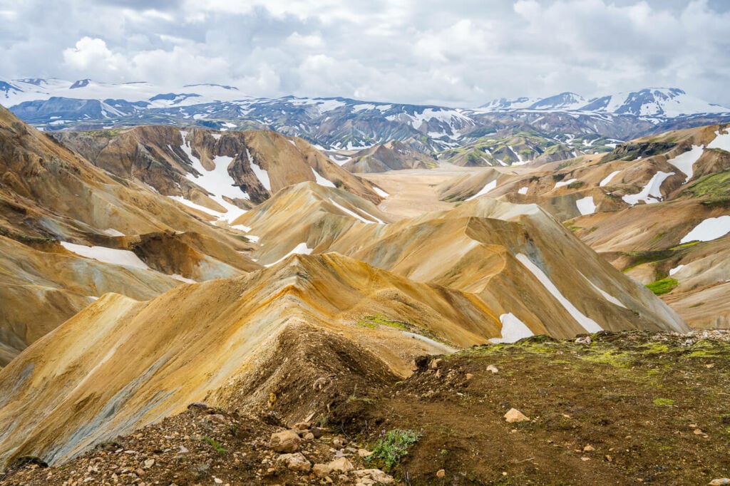
Typical, beautiful Landscape in Landmannalaugar
Before getting started, you should know it is possible to hike in Landmannalaugar only during the summer months, generally from mid to late June until around mid-September. Also if you are driving you will need to have a 4X4 allowed to drive on f-roads. check with your rental car agency before renting one. Additionally make sure you are fit enough for the hikes you plan and make sure you can safely complete them in time with some to spare. If you are planning some hikes in Iceland, you may also want to check out my tips on what to pack for a hiking holiday in Iceland.
Now, without further ado here are the Best 5 Day hikes in Landmannalaugar with Maps.
Bláhnúkur
- Hike Difficulty: moderate, includes some slippery sections.
- Hike Time: 3:30 / 4:00 Hours
- Distance: 6.85 KM
- Elevation Gain: 340m
- Landscape: 5/5
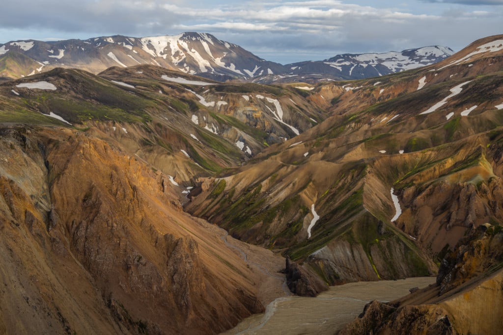
View over the colorful Rhyolite Mountains of Landmannalaugar
The Bláhnúkur hike easily is the most popular in Landmannalaugar, and for very good reasons. Bláhnúkur is a beautiful mountain in itself and the 360 degrees panoramic views from the top are just stunning. You can get lost in the moment viewing the surrounding landscape from the top, wondering what other marvels may be hidden in the landscape ahead of you.
Here is the Map of the hike and here is my Bláhnúkur Hike report and photography tips.
Brennisteinsalda
- Hike Difficulty: Moderate
- Hike Time: 02:30 / 03:00 Hours
- Distance: 8.04 KM
- Elevation Gain: 300m
- Landscape: 4/5
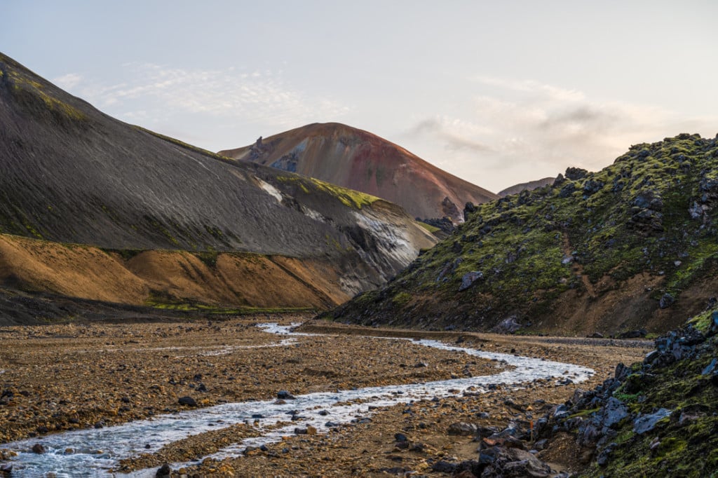
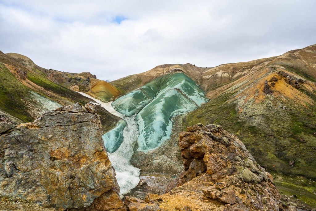
The top of Brennisteinsalda viewed from the Graenagil Canyon.
Brennisteinsalda is the trail you should hike if you want to get close to the geothermal activity. Being Brennisteinsalda a volcano, there are a few fumaroles on the trail to the top. The views from there are also fantastic, though I personally prefer the ones from Bláhnúkur.
Here is the Map of the hike and here is my Brennisteinsalda hike report and Photography tips.
Sudurnamur
- Hike Difficulty: Moderate
- Hike Time: 3:30 / 4:00 Hours
- Distance: 9.81 KM
- Elevation Gain:
- Landscape 4/5
On the trail to Sudurnamur
Sudurnamur is a bit of the “underdog” compared to Bláhnúkur and Brennisteinsalda, but not a hike you should ignore. the views it offers are very different from either Bláhnúkur or Brennisteinsalda, but no less magnificent.
Here is the Map of the hike and here is my Sudurnamur Hike report and Photography tips.
Skalli and Uppgönguhryggur
- Hike Difficulty: Hard, long and rather strenuous hike.
- Hike Time: 07:30 / 08: hours
- Distance: 22.2 KM
- Elevation Gain: 1,090 m
- Landscape: 5/5
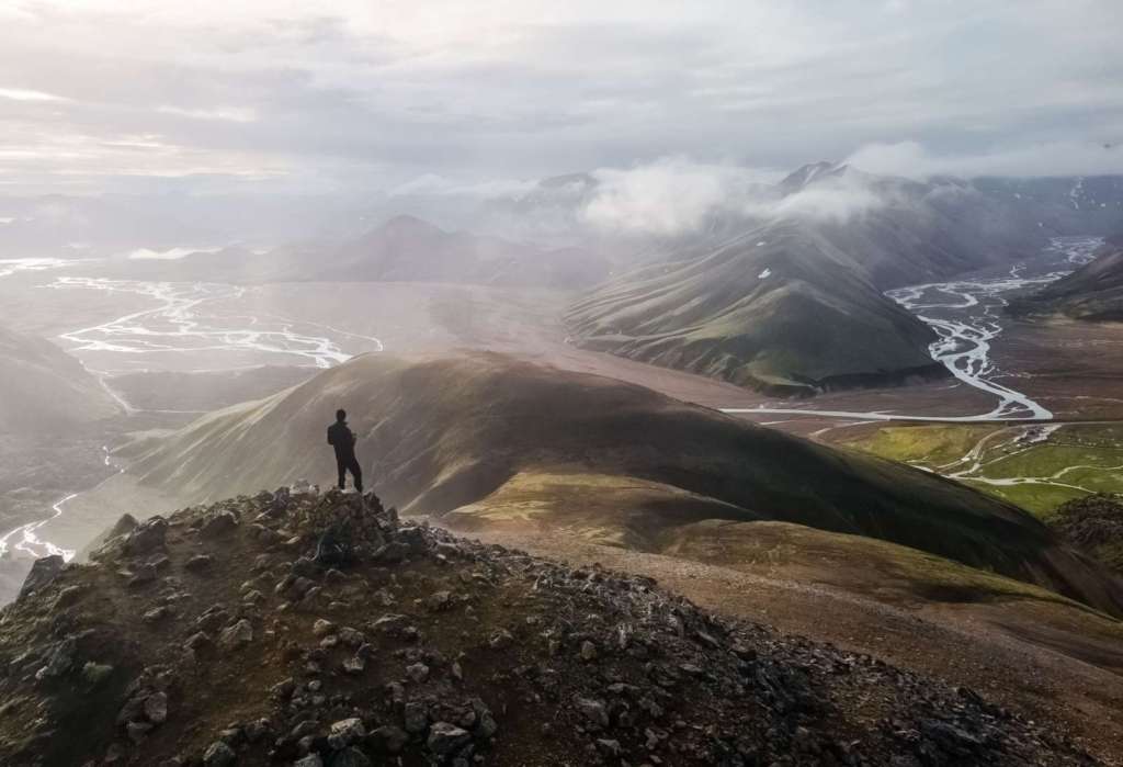
Uppgönguhryggur
Here we are in what I’d consider the Olympus of the hikes in Landmannalaugar. This is my personal Favorite along with Grænihryggur. This is a long but rewarding hike, best for experienced hikers who want to view more of the remote Landmannlaugar landscapes. If you came here on a bus tour, attempt it only if you are sure you can complete it in time; you’ll be stopping on the trail several times to take photos or just admire the magnificent landscape!
Also, if you are short on time, you may want to consider skipping the detour to Uppgönguhryggur and just hiking the Skalli trail. This would save you one hour or one hour and a half.
Here is the Map of the hike and here is my Skalli and Uppgönguhryggur hike report and photography tips.
Grænihryggur or the Green Ridge
- Hike Difficulty: Hard, includes river crossing and steep, slippery terrain
- Hike Time: 05:30 / 06:00 Hours
- Distance: 16.8 KM
- Elevation Gain: 830 m
- Landscape: 5/5
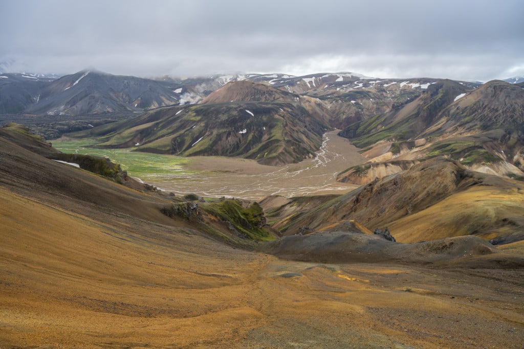
Grænihryggur – the green ridge or green backbone viewed from the trail.
This is the only hike that is not accessible from the campsite. There are both day tour packages to this location, but you can also drive to the trailhead if you have a car. This is another long and demanding, but rewarding hike for the more experienced and fit hikers. This is one of the most unique rock formations in the whole area, which says a lot. If you visit, never step on it!
Here is the Map of the hike and here is my Grænihryggur Hike report and photography tips.
Landmannalaugar Day Hikes Frequently Asked Questions
Can you do Landmannalaugar Day Hikes from Reykjavik?
Yes, although it is a long drive, day hikes are feasible. The drive is at least three hours and a half each way though, so you may still want to consider doing an overnight. You can check my Landmannalaugar Camping and Hiking guide here.
Do you need a 4X4 for Landmannalaugar?
Yes, you do need a 4×4 vehicle to drive to Landmannaugar. While technically road 208 north is not an f-road, you will still have to drive road f224, which requires a 4×4 approved for the highlands. Check with your rental car agency.
What is the easiest route to Landmannlaugar?
From Road 208 north. From the Ring Road, Take route 26 and follow it until it turns into road 208. The road is paved up until the Hrauneyjafosstöð Hydropower plant; from there it is a rough, dirt road and roughly a 45 minutes drive. Top tip: makes sure you stop at the Sigöldugljúfur Canyon on your way to Landmannlaugar
Are there river crossings on the road to Landmannalaugar?
If you are coming from road 208 north, there is one river crossing next to the Campsite. However, you can park the car before the river and walk the last 500 meters to the campsite, where most of the trails start. If you are coming from road f-208 south there are several river crossing and you should attempt it only if you have experience with that type of driving.
Are there organized Day tours to Landmannalaugar?
Yes, there are several options to do organized tours or day trips from Reykjavik to Landmannalaugar. If you do not have rental car, this is your best option. check out Trex – Travel Experiences or Reykjavik Excursions.
Rhyolite mountains in Landmannalaugar.
Conclusion – Best 5 Day hikes in Landmannalaugar with Maps
So these were my top 5 Day Hikes in Landmannalaugar. If you prefer to stay longer and discover even more hikes, check out my even more comprehensive Guide to Hiking and Camping in Landmannalaugar. Also, do not forget to bring your swimsuit for a hot thermal bath in the natural pool!
Do you want to share your favorite hikes or tips for Landmannlaugar? Let us know in the comments below!
Additional Resources
- If you prefer to join a guided tour, check out some amazing tours in Landmannalaugar.
- Check out my tips on what to pack for a hiking holiday in Iceland.
- Check out more Hikes in Iceland here.
- Discover the best hiking books and guides on Iceland.
Car or Camper Van Rentals
I can definitely recommend two companies here:
- Cars: Blue Car Rental, which is the largest Car rental company in Iceland, and for good reasons. Free Cancellation, Unlimited mileage, 24-hour breakdown assistance, SCDW, CDW, TP, and GP insurance are included in the price. Blue Car Rental is also located within walking distance of the Keflavik Airport, so you can be on your way to explore Iceland right away. I’ve always been happy with my rentals there, which is why I’m happy to recommend their services here on my blog.
- Camper Vans: CampEasy.With CampEasy, you can rent 2WD or 4×4 campers alike. With a raised Chassis, larger tires, and extra insurance with reduced liability for river crossing, their 4X4 campers are the best choice for your trip into the Highlands. Their Website also provides extensive information about roads you can take and instructions on river crossings. Perfect choice for a hiking holiday in the highlands!
These are my two favourite companies in each respective rental area, which I why I am happy to recommend both here. If you also like this blog, booking through them is a great way to support it. I’ll get a small commission fee at no additional cost, so you can essentially support the running costs of this blog for free too.


Leave A Comment