Saxer Lücke loop Hike via Fälhensee and Hoher Kasten, Appenzell, Switzerland
The loop hike to Saxer Lücke via Fählensee and Hoher Kasten is one of the most scenic in the Appenzell Region. While it is a very long day hike, the scenery is hard to beat.
Formally known as the Geological Hiking Trail (Geologischer Panoramaweg), this is a trail that offers spectacular panoramic views of the Alpstein region and the Rhine valley. A trail where you can enjoy some truly unique landmarks.
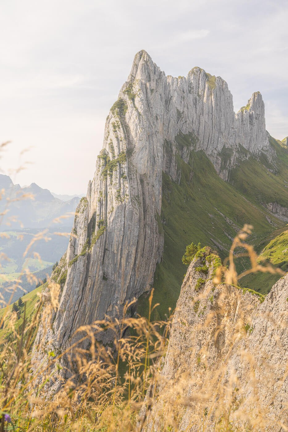
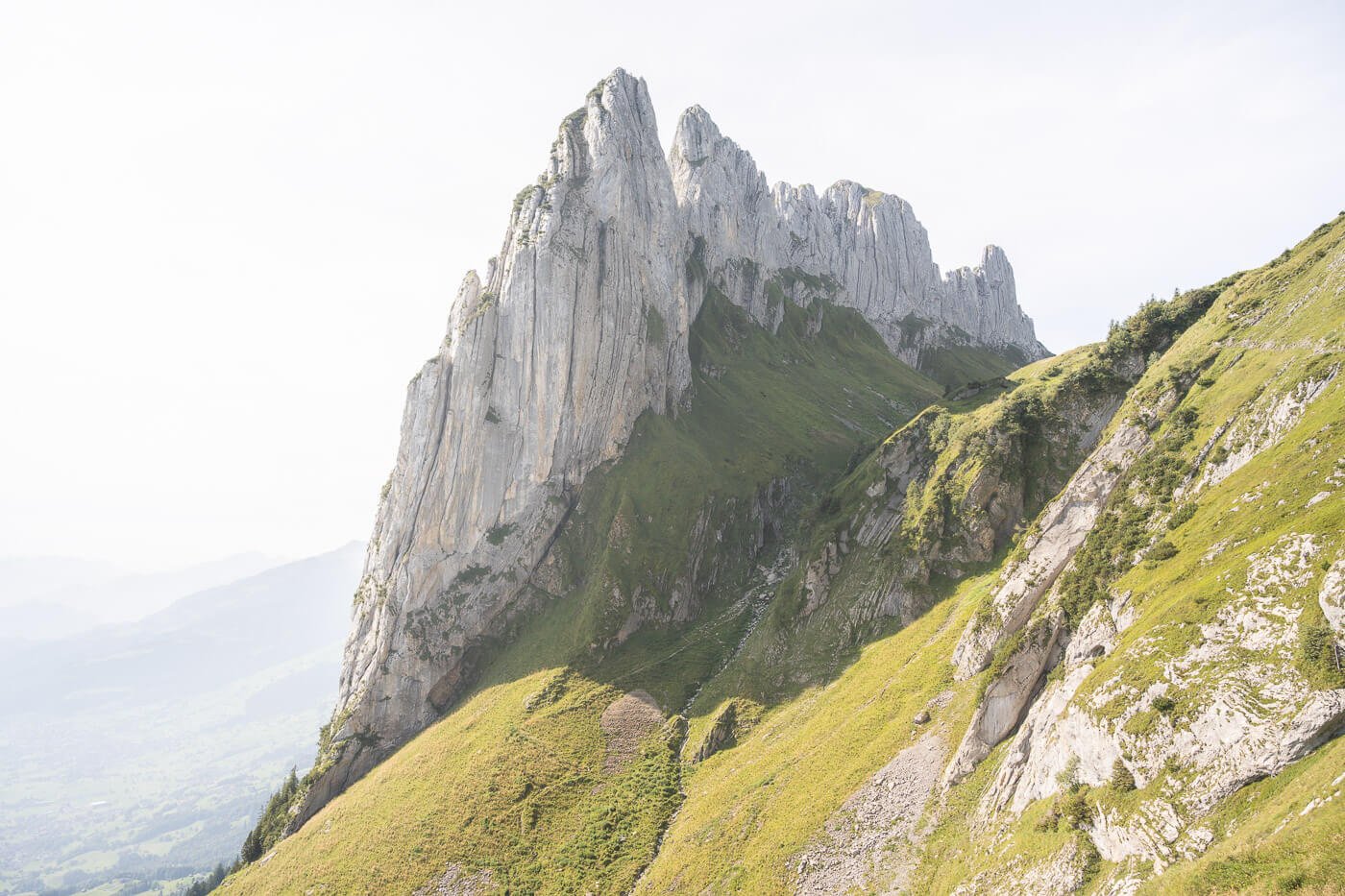
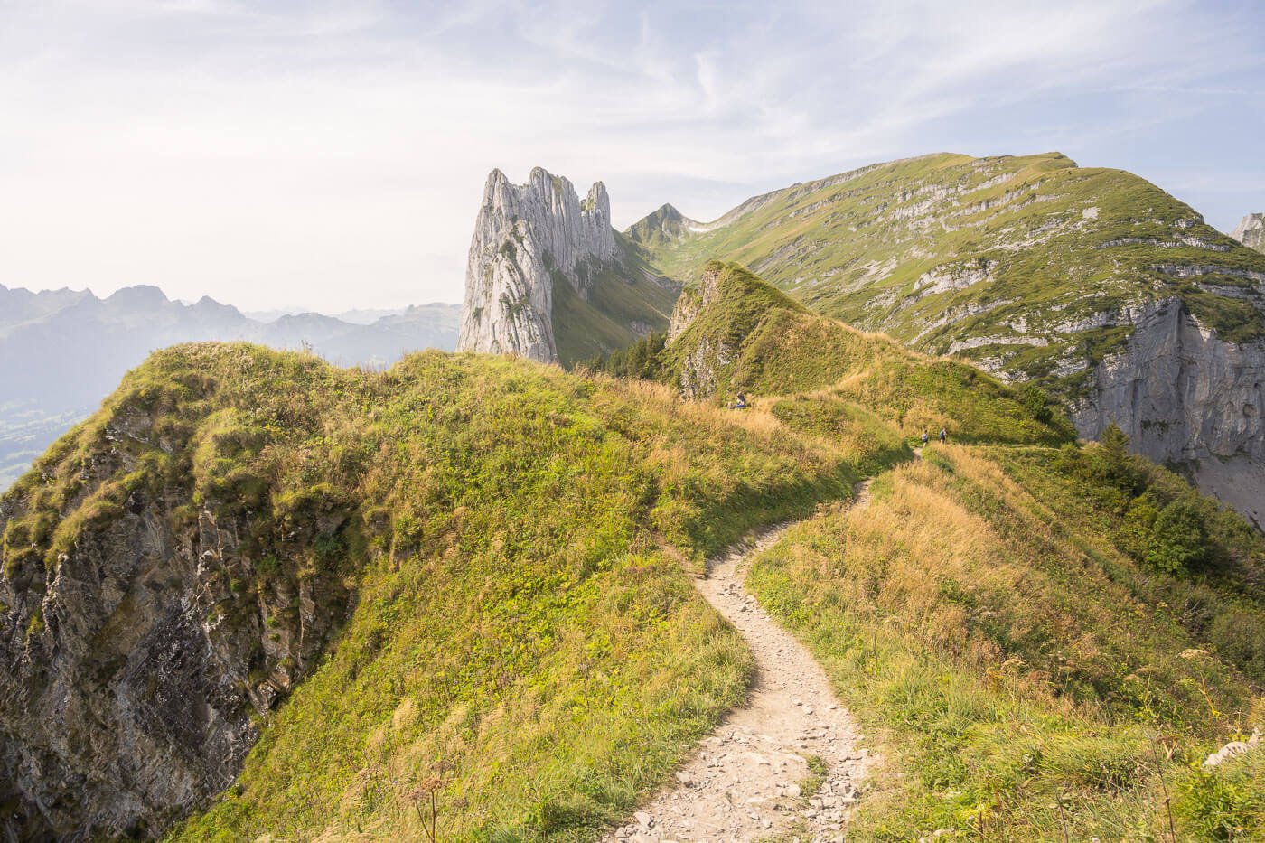
The spectacular ChrüzbergKreuzberge, from above the Saxer Lücke pass.
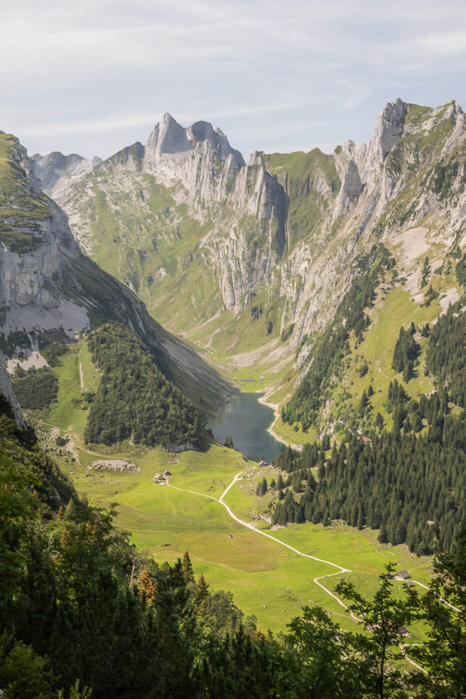
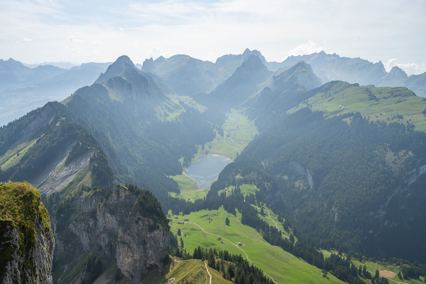
Fählensee is a beautiful, Idyllic mountain lake nestled between the steep mountains of the Alpstein Range. The lake is worth a visit in itself, as it is an extremely scenic spot.
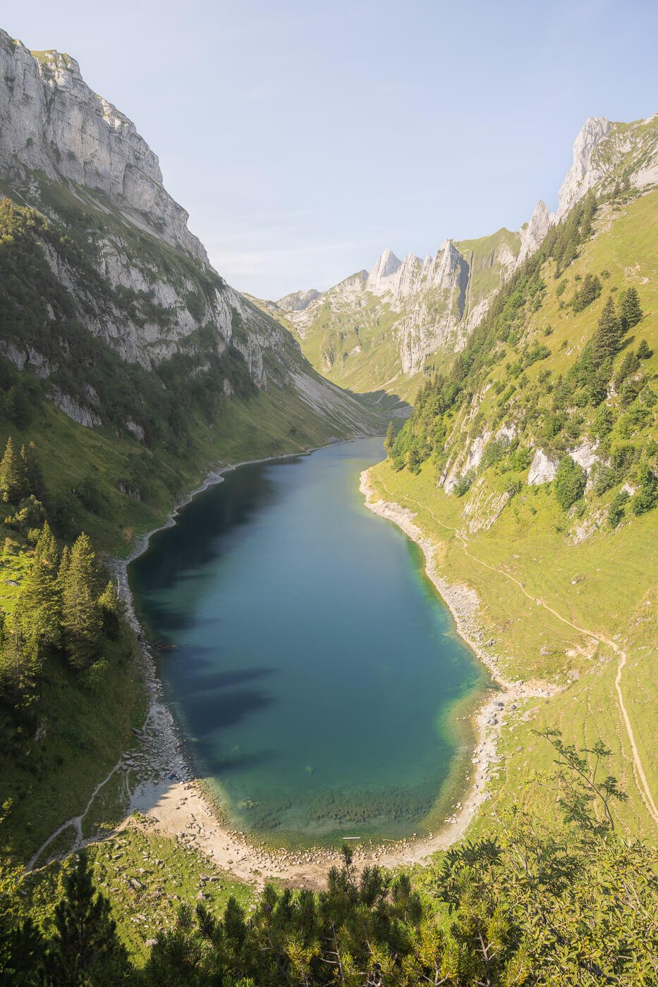
Fählensee
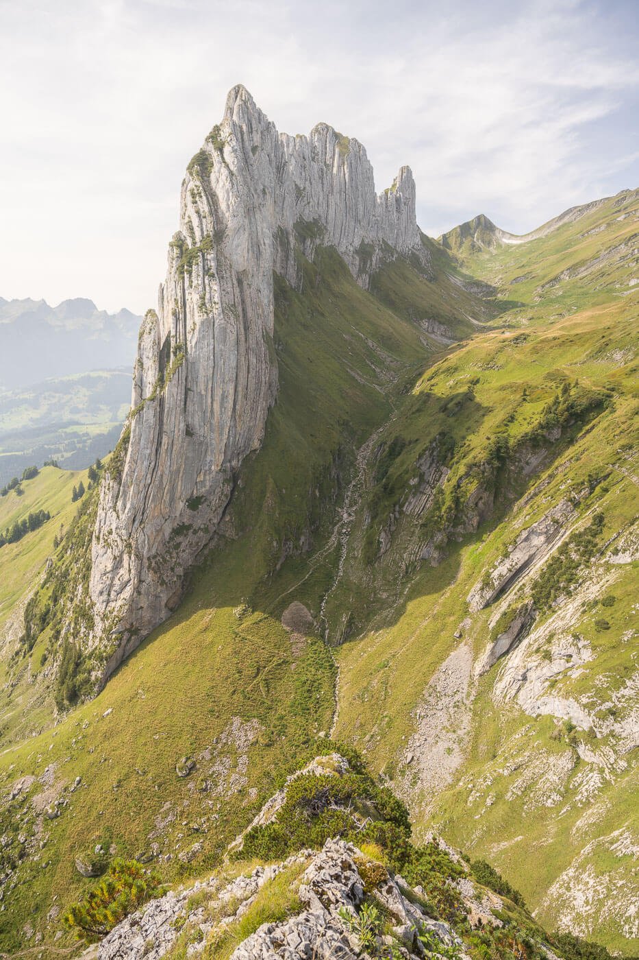
Saxerlücke is a popular mountain pass situated between two mountains: Hüser (1951 m) and Chrüzberg (2065 m), also called Kreuzberge. The views here are some of the best in the Appenzell region. The pass is mostly known for the view of the mountain Kreuzberge it offers.
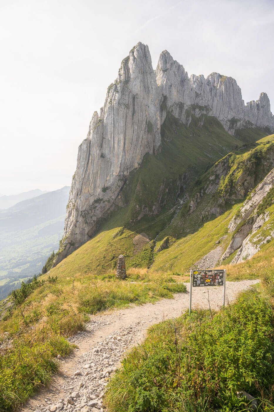
Saxer Lücke
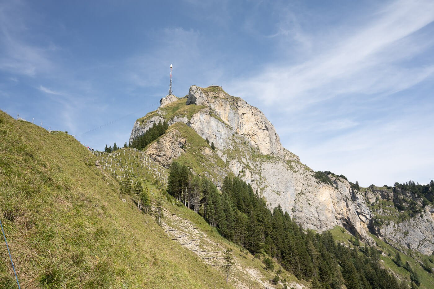
Hoher Kasten (1,794m) is a mountain from which you can view almost the entire Alpstein region and much more. The views it offers are breathtaking too.
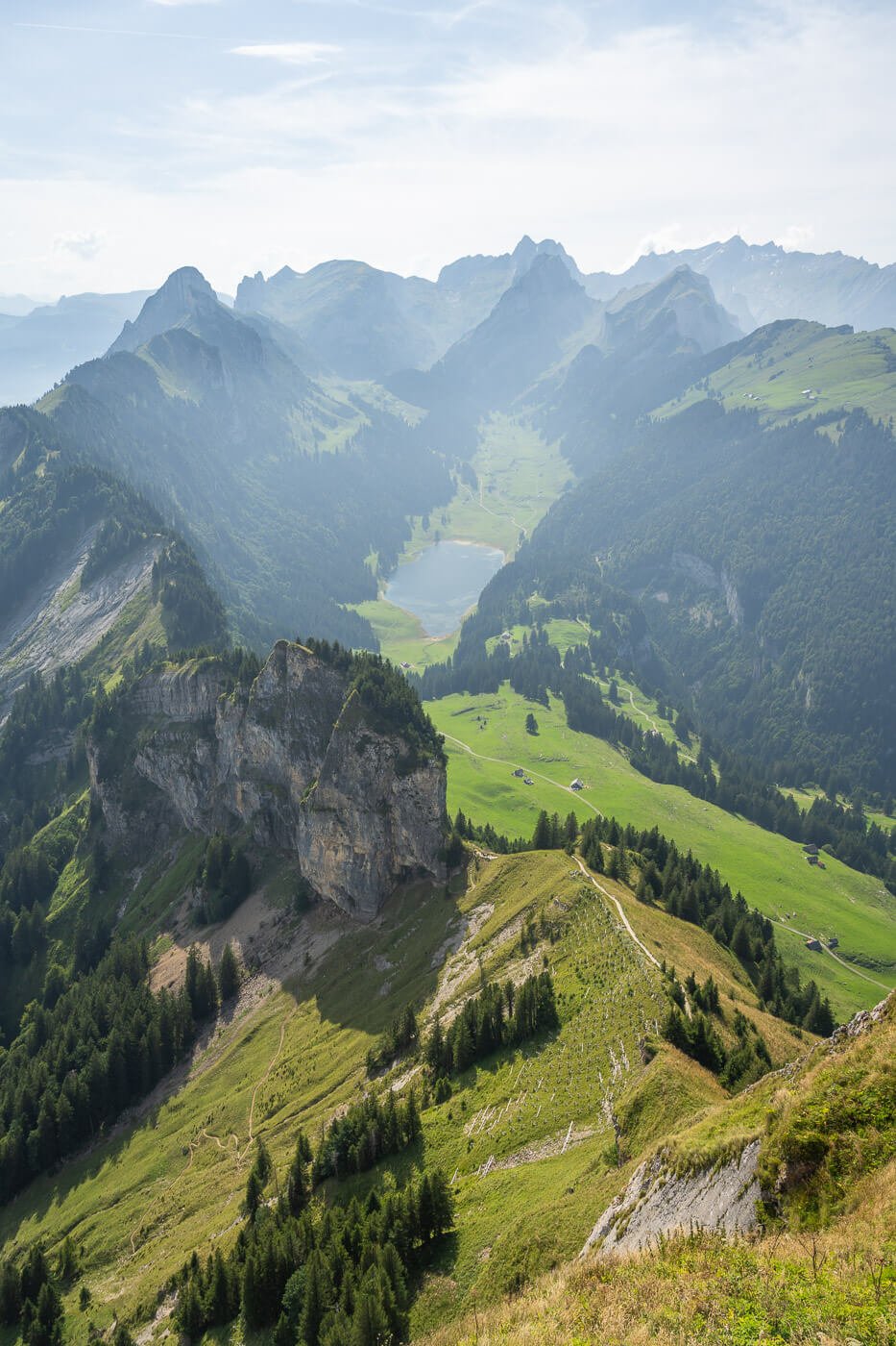
View from Hoher Kasten
You can, of course, also visit these landmarks separately, but as they are relatively close together, it makes sense to catch them all at once in one epic day hike.
Table of Contents
Overview & Map of the Saxer Lücke loop hike via Fählensee and Hoher Kasten
If you want to do the entire look hike, keep in mind it is a long and demanding trail with several up and downhill sections. At more than 22m, it would take most of the day to complete, also because you’ll be stopping quite often to soak in the fantastic views. And, you’ll likely want to take detours to explore even more – at least that’s the effect this trail and its surroundings had on me.
If you want to make this hike shorter, you could take the cable car up to Hoher Kasten, which will save you more than an hour and a good chunk of elevation gain.
Last but not least, be aware that this will likely be a crowded hike. Alpstein and the Appenzell region are generally a very popular hiking destination. So, as a tip, start the hike early in the morning. In most years, it should be possible to do it from late Spring to mid-autumn, but it entirely depends on the snow and ice situation.
| Max Altitude | 1,794 m |
|---|---|
| Distance | 22,3KM KM |
| Elevation gain | 1,520 m ↑ / 1,520 m ↓ |
| Hike time | 07:30/ 09:00 Hours |
| Hike Difficulty | Hard |
Here is the map of the hike. You can download the GPX file for free from the activity linked below
How to get to the trailhead and Parking
The trailhead is in Brulisau, but there are a few different ways you can visit the landmarks on this hike. To do the same 20+km loop trail I’ll describe below, the best way is to park in Brulisau. From there, you also have the option to catch the cable car up to Hoher Kasten and do the hike clockwise. That will save you about an hour/hour and a half.
Alternatively, as the quickest way to get to, you can take the cable car from Frumsen to the Berggasthaus Staubern and hike from there.
- Driving Directions: The two main entry points to the Appenzell region to get to Seealpsee are via the A1 highway (from the Western side) or the A13 (from the Eastern side) highways. Keep following directions to Weissbad and Wasserauen, then follow directions to Brulisau. You can easily do this as a day hike from Zurich too, as the drive takes less than an hour and a half.
- Parking: There is a large, paid parking area in Brulisau. It fills up quickly shortly before the opening time of the Cable Car, so it pays off to be there a little earlier.
- Public Transport: by train, you will need to get to the Weissbad train station first, then from there catch Bus 192 to Brulisau.
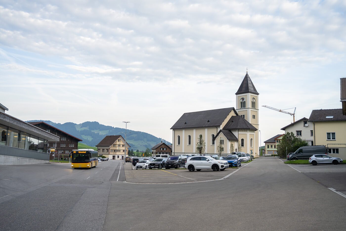
The parking area in Brulisau, with the Bus from Weissbad on the right.
The Fählensee, Saxerlücke and Hoher Kasten Hiking Trail
The hiking trail begins on a seemingly unassuming paved road, which soon transitions into a dirt road. The trail passes through a forest and by some scenic mountain landscape, through idyllic valleys and beautiful huts.
Initially, it is a rather average hike, as you don’t have many views while walking in the forest, but after a bit less than an hour, you’ll have the first views of the jagged Alpstein mountains.
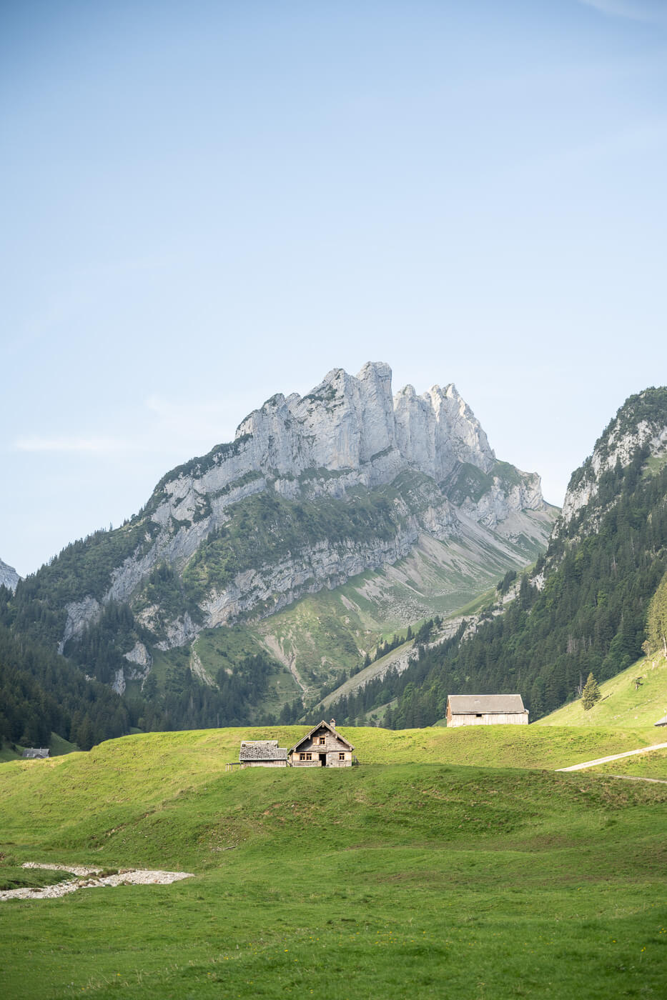
Brulisau to Fählensee
The hike from Brulisai to Fählensee is mostly on gravel roads, with moderate elevation gain. Most of it is at the beginning, when the paved road turns into a dirt mountain track. It’s not very challenging, but it does take time to cover the 7.5km that separates Fählensee from the trailhead.

Most of the trail to Fählensee is on gravel roads.
It takes a couple of hours to reach Fählensee, where it’s not unusual to find farmers or shepherds dressed in traditional clothing. The lake is much bigger than it looks in photos, and the mountains are much steeper. An absolutely gorgeous location.
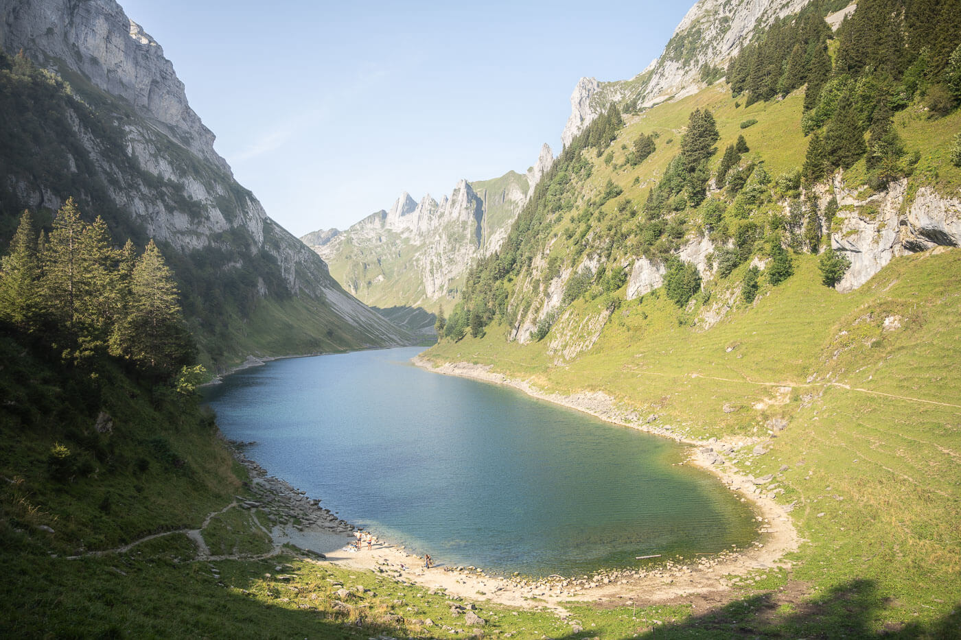
Fählensee

There you’ll also find the Bollenwees restaurant and guesthouse, where you can enjoy fantastic views of the lake as well as a coffee, some snacks like Nussgipfel, or delicious local dishes. The Bollenwees Berggasthaus is also a place where you can stay for the night, but you should book it in advance.
Anyway, after a couple of hours, I stopped there to enjoy a coffee, a Nussgipfel, and the view from their terrace, right above the lake.
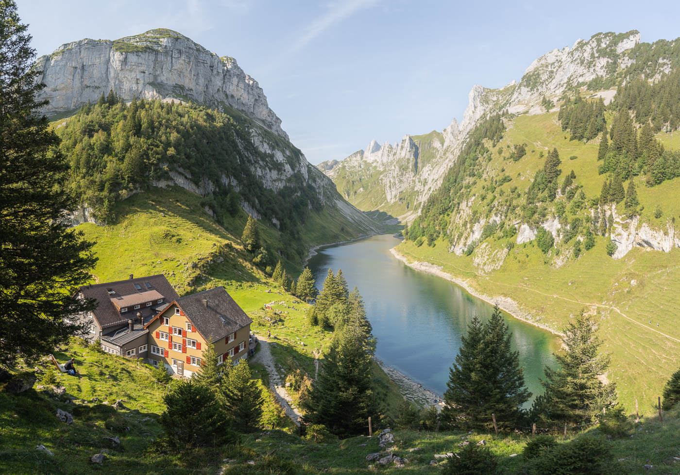
Bollenwees Berggasthaus
There are several good viewpoints of the lake around the guesthouse. You can walk right below the guesthouse to get to the lake, and to each side of the lake, to different viewpoints.
Before continuing onward toward the next landmark, I’d recommend taking the short trail that leads to a viewpoint above the Bollenwees Berggasthaus. The trail to the viewpoint above the guesthouse is short but steep, but well worth the detour. Not many seemed to get up there, but there are some of the best views of the lake.
Not a drone photo; view from the viewpoint above the guesthouse.
Fählensee to Saxerlücke Viewpoint
The part of the trail between Fählensee to Saxerlücke is the steepest and where most of the elevation gain is on this hike. It is from here, the trail also gets busier, because there’ one possible trail to hike between the two points, unlike getting to Fählensee from the opposite direction, where there are multiple options. As you hike up the steep trail, you’ll start to see Kreuzberge’s jagged peaks in the distance, towering above the pass.
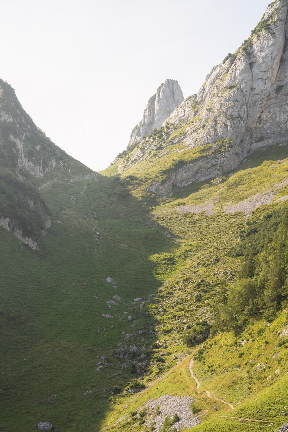
The steep trail connecting Fählensee to Saxer Lücke.
That already gives quite a good sense of scale. And even if the trail looks very steep, it won’t take long to cover that distance.
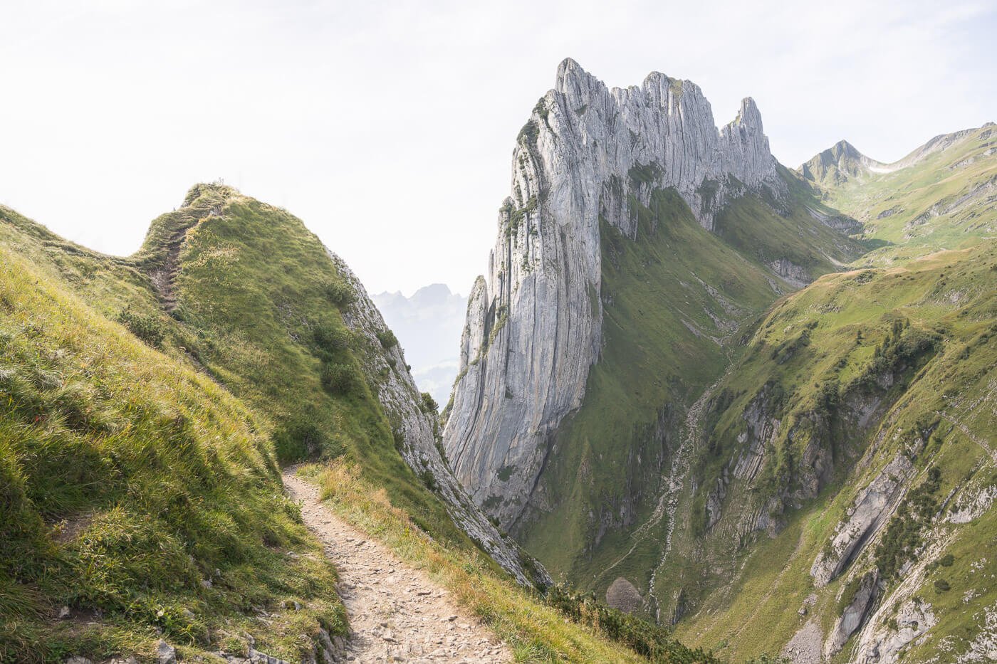
As you hike up and reach the pass, the views of the valley on the other side will open up, also revealing Kreuzberge’s full size. A beautiful, gigantic rock face, textured with several veins in the rocks that run all across it.
Saxer Lücke
It’s worth spending a little time here to enjoy the views, but not too much! From the pass, you’ll then need to hike up the ridge that leads to Hoker Kasten, and on that ridge, you’ll find numerous viewpoints and short detours you’ll likely want to stop at. Actually, I’d recommend doing so, because the views are gorgeous. Just be careful on some of those viewpoints, as they are steep and in some cases exposed.
I did stop at all of them, and that caused the hike to take much longer than I anticipated. The additional time it took to explore all the viewpoints was well worth it. In the end, it’s all about the views.
Saxerlücke to Hoher Kasten
As you leave the pass, the trail climbs up again, twisting its way up the side of the mountain, until you reach the top of the ridge. From here, it is essentially a trail ridge with a moderate elevation gain. This ridge is dotted with spectacular views of the Alpstein range, the Rhine valley, and again, the Kreuzberge mountain.
The trail continues on the ridge for a while until reaching the Berggasthaus Staubern, which is one of the possible starting points. Also, the easiest option if you just want to hike to the Saxer Lücke viewpoint.

Berggasthaus Staubern.
The guesthouse also works as a restaurant and has a terrace where you can enjoy a good meal and the views toward the Rhine valley, with the Alps in the background to the south.
From there, the trail continues on the ridge toward Hoher Kasten, which will be right in front of you for most of the trail from here onwards. At the same time, the views will open up again, this time toward the inner part of the Alpstein range, revealing all the jagged mountains and the lakes in the valley below—a sort of anticipation of what awaits atop Hoher Kasten.

Hoher Kasten.
As you approach Hoher Kasten, you will probably wonder how the hell you can climb this seemingly impossibly steep rock face. From the trail, it does look impossible to climb. In fact, the trail is on the opposite side, and you’d have to walk around the lower part of the cliffs to get to the other side, where you can either take an easy gravel path or another trail, a little more technical, thet leads to the viewing platform and observation deck on the top of the mountain.
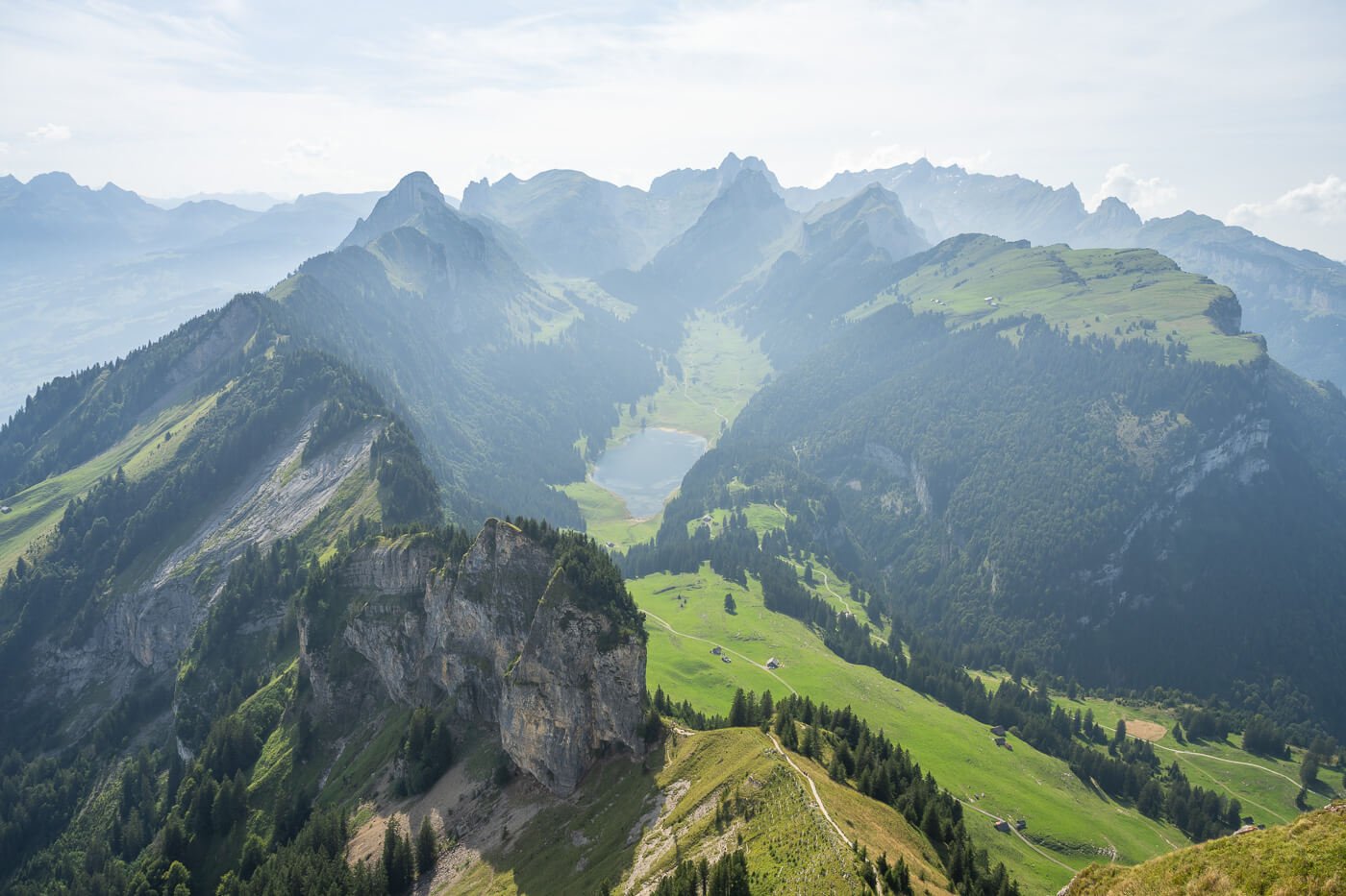
From there, the views of the Alpstein range are incredible. You can see the whole ridge up to Kreuzberge and well beyond that, with Sämtisersee, the lake in the middle, perfectly framed by the steep Alpsrtein mountains. An absolutely epic view to end such a great hike.
View from Hoher Kasten


Fählensee, Saxer Lücke, and Hoher Kasten Photos and Photography Tips
No doubt, Fählensee, Saxer Lücke, and Hoher Kasten offer plenty for landscape photography, and definitely, Saxer Lücke and Kreuzeberge are the most popular spots.
Quite unusually, at least for me, I found myself using portrait orientation way more than landscape, and I am not a big fan of portrait orientation in landscape photography. If I can, I avoid it, but somehow, all along this trail, I found it to work better than landscape in most cases. and that was through for all of the locations on this hike, Fählensee, Saxer Lücke, and Hoher Kasten.
I found the elements in this part of the Alpstein range line up better in portrait orientation. Probably because everything is so narrow and “squeezed” into the landscape, portrait orientation creates a better depth. At least all my favorite photos from this short trip were taken in portrait mode.
All the photos were taken with a 24-70mm lens, full frame. I rarely felt the need for anything wider. If you want to try and catch colorful skies, it’s probably best to attempt Sunset at Saxer Lücke – or Sunrise if you want to see Kreuzeberg catch the warm morning light. Apart from the early morning, the Kreuzberge viewpoint is not the best in terms of light, as the viewpoint faces the north side of the mountain, which is in the shadows for most of the day, especially in summer. Still, you can catch some color provided you are willing to be out early in the morning or late in the evening.
Video of the Saxer Lücke loop hike via Fälhensee and Hoher Kasten
Last but not least, if you want a better feel for the views, here is a short-ish video of this hike I made while hiking the whole loop:
Where to stay
The area around the Alpstein range in Appenzell offers no shortage of accommodation, but it’s best to book in advance as it is a very popular hiking destination, especially from late spring to early autumn.
Wasseraunen is a popular choice to stay at, as it is close to the main trailheads. Appenzell is a bigger town with more amenities, but a little further away from the trailheads. Otherwise, there are plenty of guesthouses within the Alpstein range you’ll come across while hiking; for instance, the already mentioned Bollenwees and Staubern guesthouses.
Wild camping is no longer tolerated in the Alpstein region, and tent campers are required to use designated camping areas (source here).
Additional Resources
- Discover more Hikes in the Alpstein range: Seealpsee and the Berggasthaus Äscher.
- For a comprehensive overview of Hikes in Switzerland, check out my main Switzerland page.


Leave A Comment