Mer de Glace and Grand Balcon Nord Hike in Chamonix, France
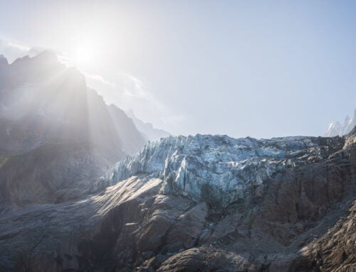
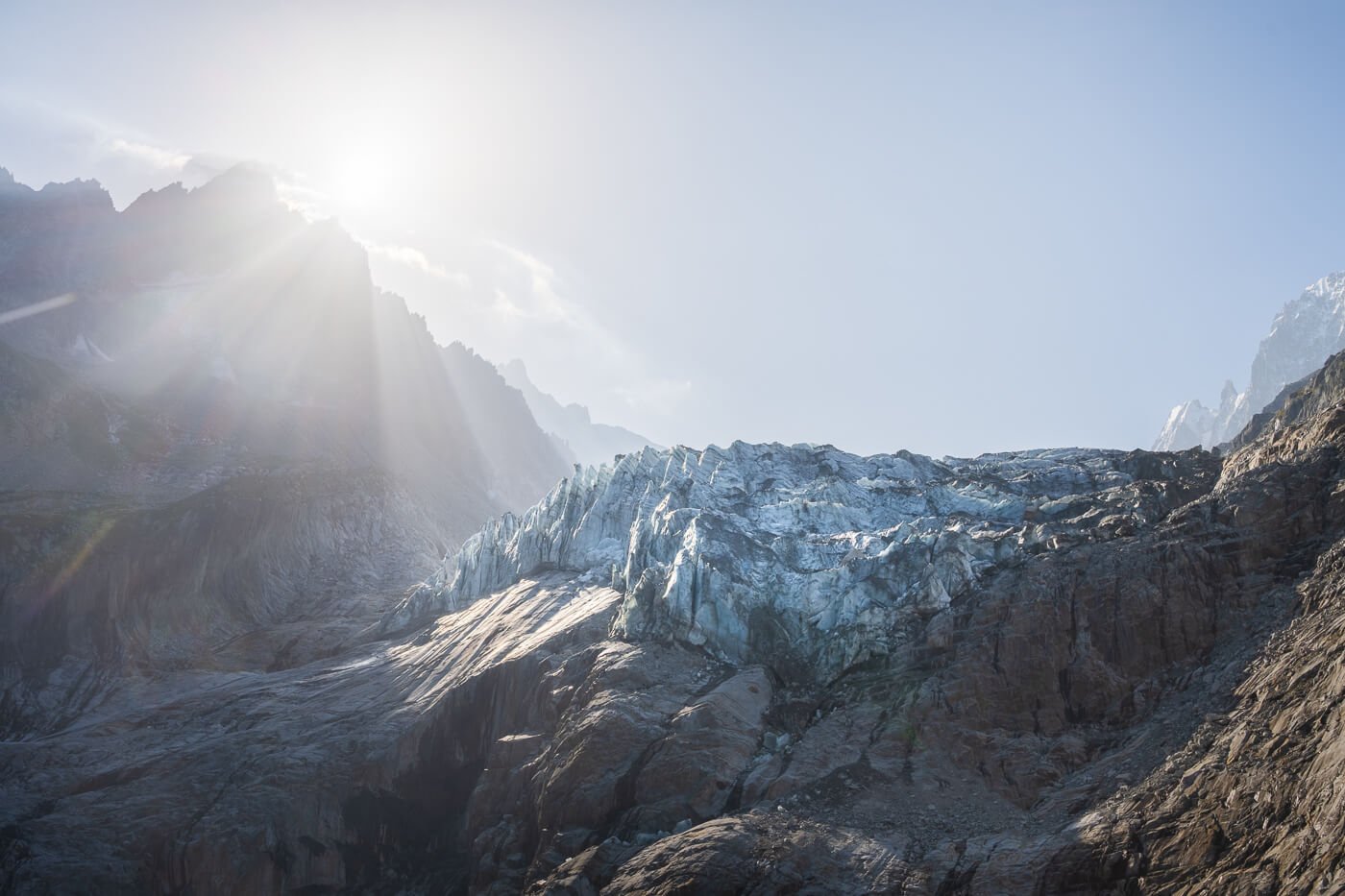
The hike between the Mer de Glace and Grand Balcon Nord is one of the most popular and scenic hikes in Chamonix, on the Mont Blanc. Even though the “Mer de Glace”, or “Sea of Ice”, is just a former shadow of its former self, it is still a beautiful sight, with the glacier and the steep, jagged mountains around it.
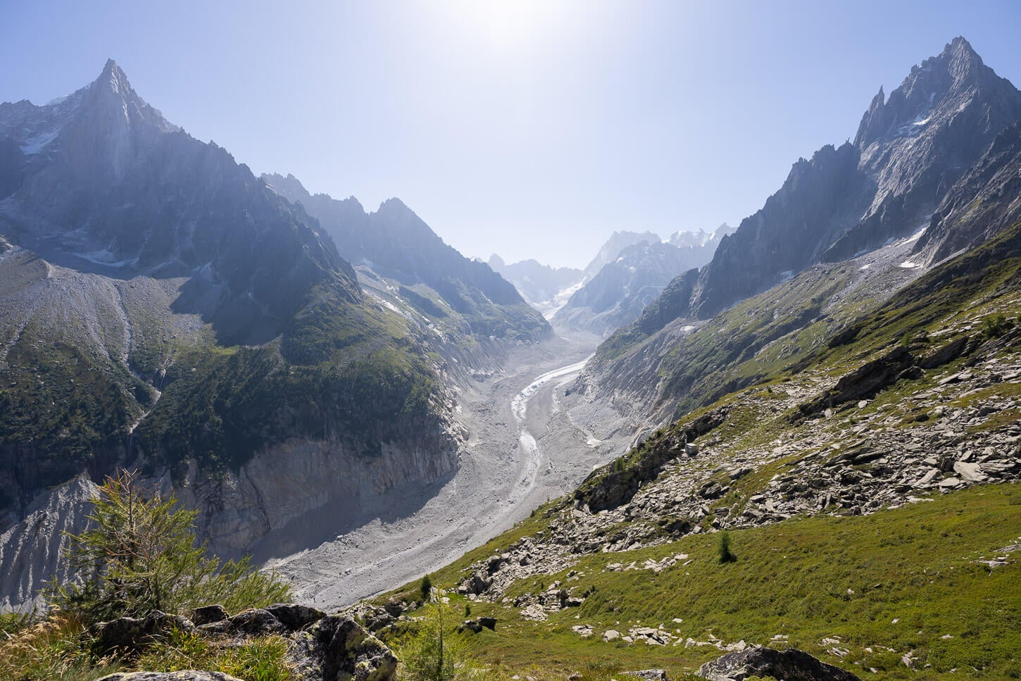
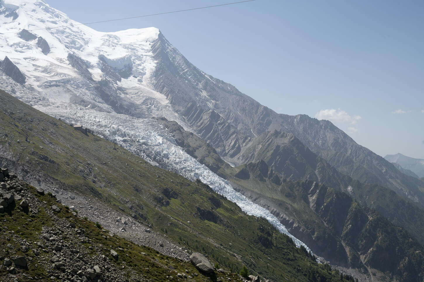
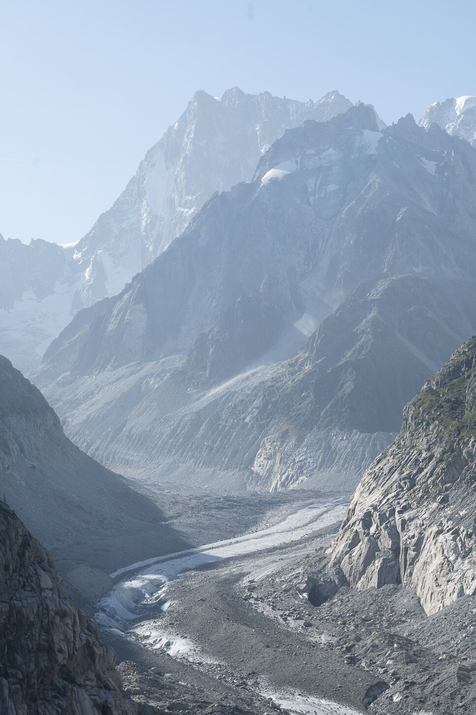
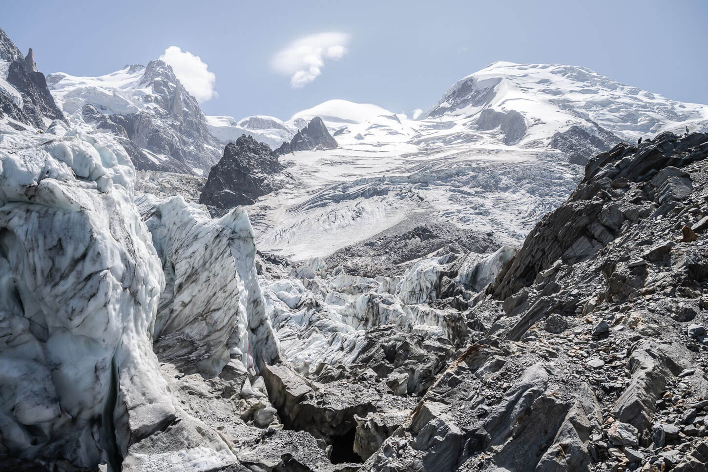
Mer d Glace – view from the Grand Balcon Nord Trail
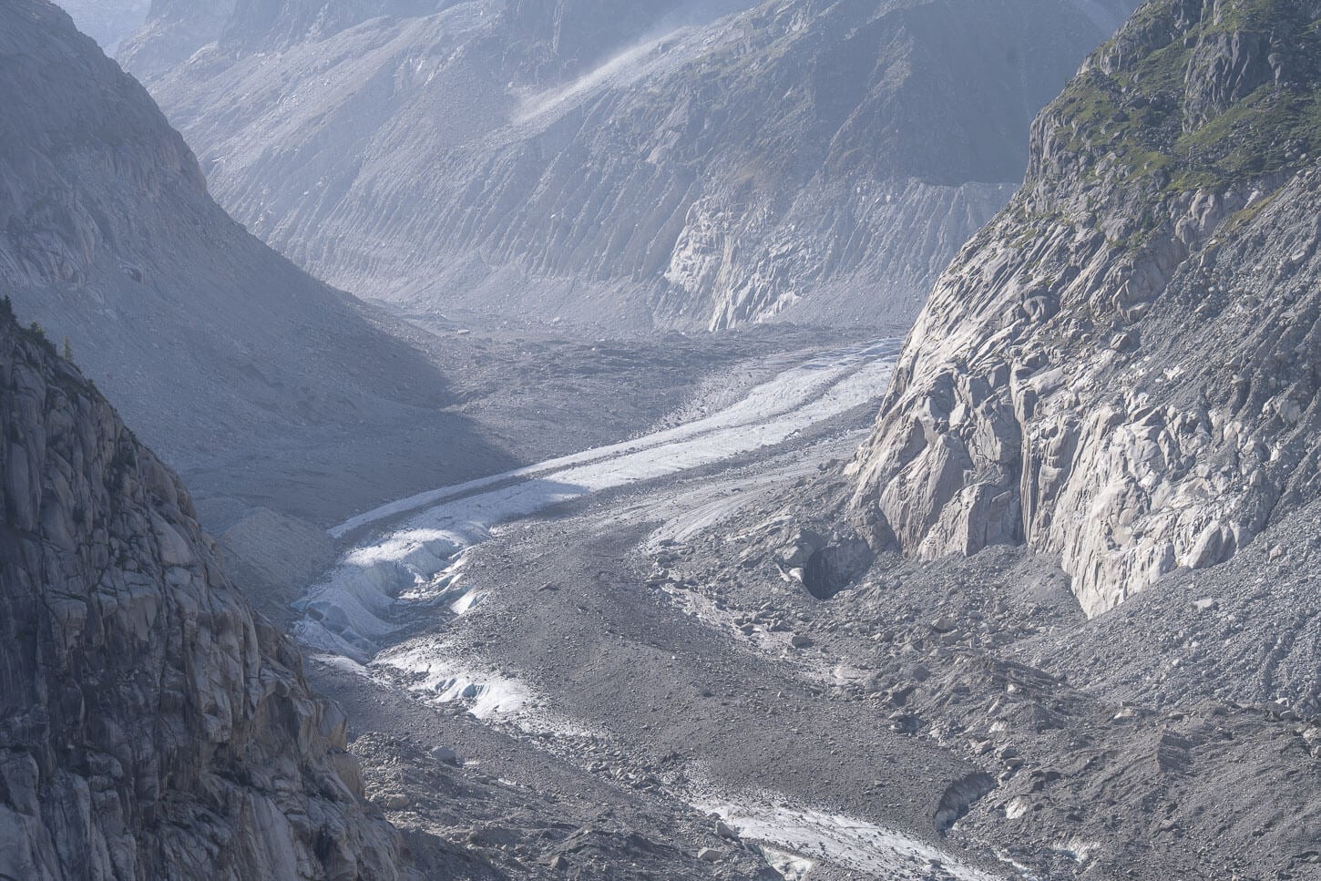
Yet, compared to what it was several years ago, it is quite a disheartening sight. The Mer del Glace has shrunk so much that much of it is now covered in rubble that keeps falling from the now free mountainside. Literally meaning “Sea of Ice”, the glacier now resembles more of a meandering river.
Still, this is one of the three most popular hikes in Chamonix, along with the hikes to La Jonction, Lac Blanc, and the Grand Balcon Sud. There are several ways you can do this hike, either directly from Chamonix or by taking the train or cable car for part of the way. More details on this below.
I personally chose to hike the whole loop from Chamonix and back without the use of the cable car. However, the most common way is to take the cable car to Plan de l’Aiguille and hike toward Montenvers/Mer de Glace. Then take the train back to Chamonix.

The Hut “Buvette Plan de l’Aiguille” with Mont Blanc in the background.
Table of Contents
Overview of the Mer de Glace and Grand Balcon Nord Hike & Map
The loop hike from Chamonix is rather tough, mostly due to the elevation gain. Other than that, though, the trail isn’t technical.
On the other hand, the point-to-point hike between Mer de Glace and Plan de l’Aiguille is an easier hike. In this case, the total distance, one way, is about 6 km (3.7 miles), with a positive elevation gain of about 740m (2,440 ft.) and a negative elevation gain of about 350m (1,150 ft.).
However, the most common direction of travel to hike the Grand Balcon Nord Trail is from Plan de l’Aiguille towards Montenvers. The reason for this is the easier elevation gradient. So if you are looking for the easier option on the legs, this is the one.
Either way, the trail is well-marked and easy to follow.
| Max Altitude | 2,310 m / 7,578 ft. |
|---|---|
| Distance | 19.4 km / 12.05 miles |
| Elevation gain | 1,460 m ↑ / 1,460 m ↓ (4790 ft.) |
| Hike Time | 06:30/ 08:00 Hours |
| Hike Difficulty | Loop from Chamonix: Hard / Grand Balcon Trail only: Moderate |
Here is the map of the hike. You can download the GXP file for free from the activity linked below.
How to get to the trailhead and Parking
The trailhead is located in the center of Chamonix, regardless of which direction you decide to hike. Ideally, you should start the hike from either the Plan de l’Aiguille valley station or Parking des Planards.
- Driving Directions: If you are coming from the North, you’d have to head either to Geneva or Martigny. From Geneva, you will need to cross the border into France. Then, take highway A40 toward Chamonix and the route N205, until Las Bossons and then Chamonix. From Martigny, you’d have to drive through mountain passes toward Forclaz/Col des Grands Montets, and past Argentiere to get to Chamonix. From Italy, you’d have to drive through the rather expensive Mont Blanc tunnel, or you can drive through the San Bernardo tunnel and then go to Martigny, and follow the road to Forclaz/Col des Grands Montets from there.
- Parking: There are a few parking areas in Chamonix, and the best ones for this hike are either “P+R Centre-Ville” or “Parking des Planards“. Both are paid, but they are right by the two cable car stations. The Centre Ville Parking is next to the Plan de l’Aiguille valley station, while Parking des Planards is close to the Montenvers station. The latter parking area is also suitable for an overnight in a van or an RV, which is what I did.
- Public Transport: If you are not staying in Chamonix but in a nearby village, the trailhead is a short walk away from Chamonix’s main train station.
The Mer de Glace and Grand Balcon Nord Hiking Trail
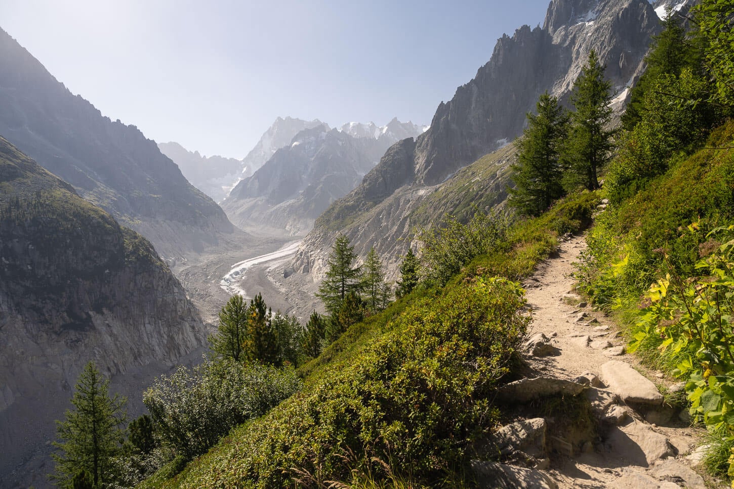
If you decide to hike from Chamonix to Le Montenvers station and the Mer de Glace viewpoint, below you’ll find a quick overview. Also, I will describe the loop clockwise, as this is the way I did it. I did it that way because I wanted to catch the early morning light at Le Mer de Glace. That’s it.
If you do not care about that, it makes sense to do it the other way around and end the hike with the spectacular view of Mer de Glace. It’s much better than the views at Plan de l’Aiguille.

Mer d glace, View from the Montenvers Station observation deck.
Hiking to Mer de Glace from Chamonix
If you plan to hike directly from Chamonix, the trail to Le Montenvers is almost entirely in the forest. In terms of view, there’s not much, but the trail in the forest is nice and quiet. If you enjoy walking in the atmospheric shade of the forest, it’s worth it. Otherwise, the first significant view is below the Le Montenvers Station.
The elevation gain of this part of the trail is also significant, at almost 1,000 meters in total, over 5.5km. It’s not trivial for a trail that is almost entirely in the forest, too. I personally prefer to just hike, but I’m just pointing out that if you want to save some energy, this stretch of the trail is a good candidate to do so.

View of the Montenvers Railway from the trail, just below the mountain station.
On the way up, you also get a good scenic view of the railway. From there, it’s a short walk to the Montenvers mountain station. There, you’ll find a rather large observation deck that offers great views of the Mer de Glace.
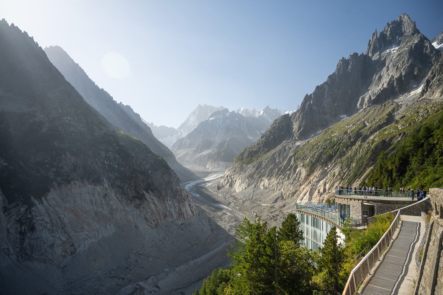
Montenvers Station and observation Deck.
View of the glacier from the Observation Deck.
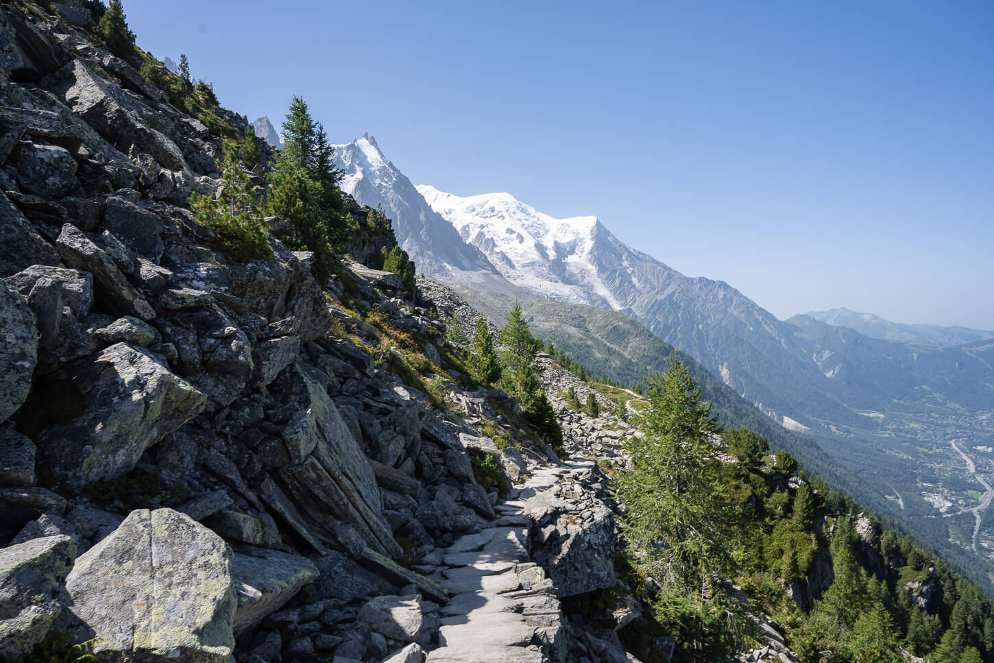
Hiking the Grand Balcon Nord trail
The Mer de Glace viewpoint and Montenvers station are also the starting point of the hike of the Grand Balcon Nord. From the station, the trail slowly gains elevation up the side of the mountain, winding its way up above the glacier.
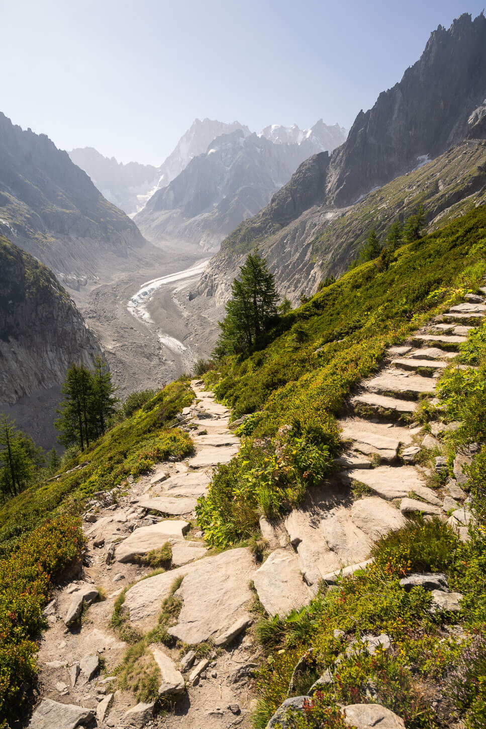
Sections of the trails are on a stone path, which makes for rather easy going, despite the elevation gain. In many ways, I preferred the views from the trail than from the observation deck at Le Montenvers. It’s higher up, and you get a better view of the mountains and glaciers deep into the valley.
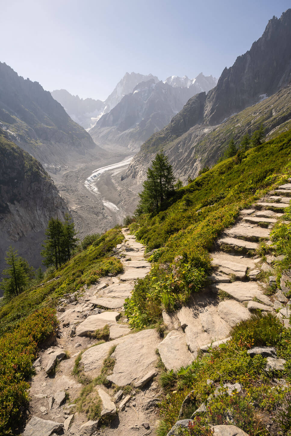
The Grand Balcon Nord trail initially climbs up the side of the mountain and above the glacier.
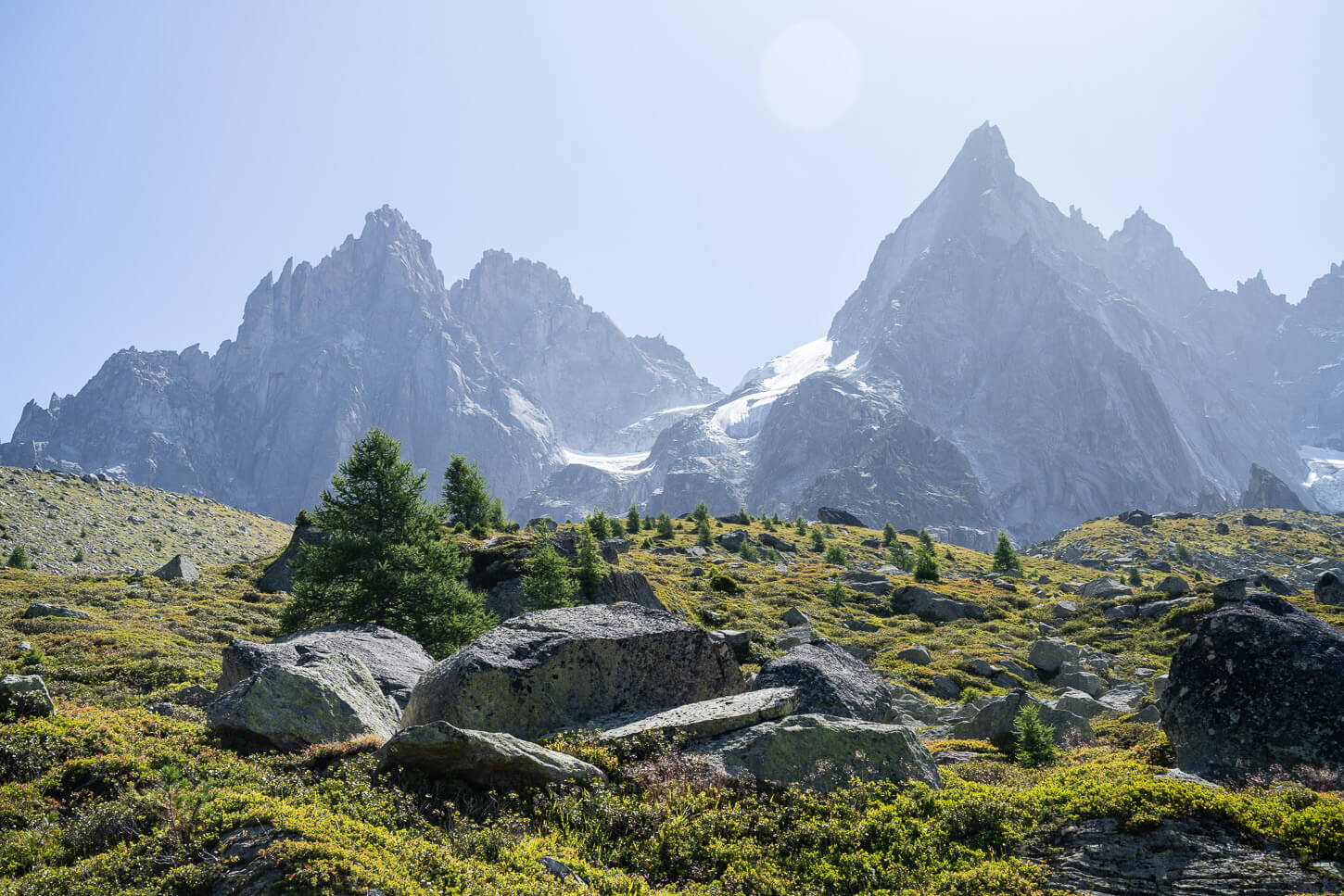
There are several great viewpoints of the glaciers on this section.
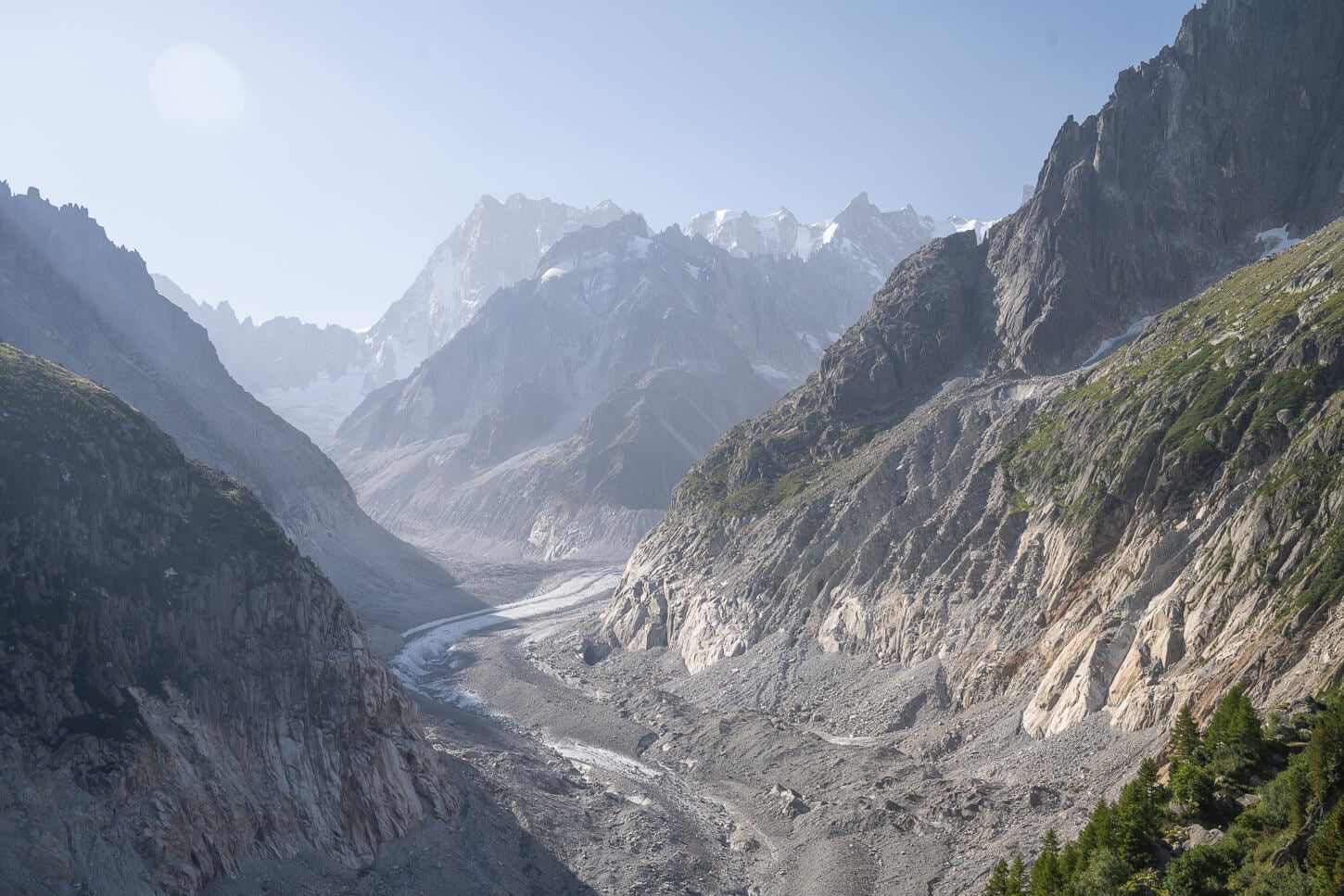
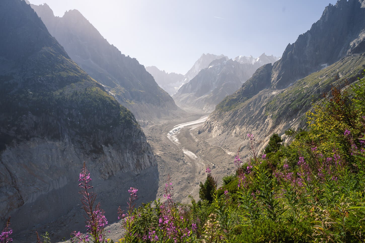
Another great highlight on this section of the trail is the Signal Forbes (2,200 m.a.s.l) viewpoint. It’s a short detour from the main trail in a rocky area/ This detour leads to a lookout of the glacier, which is probably the best viewpoint of Le Mer de Glace. At least that was the case for me.
View from the Signal Forbes lookout, a short detour from the main trail.
Some of the panoramic views are truly breathtaking.
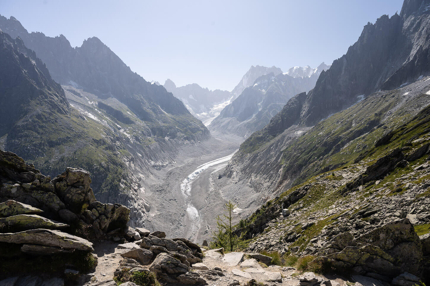
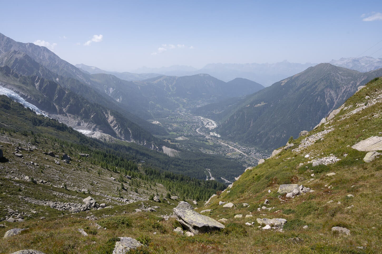
From the Signal Forbes lookout, you then need to walk back to the main trail, where the views open up to the Chamonix valley down below, and gradually to the Glaciers toward the Southern Side of the Mont Blanc Massif.
This part of the trail, between the Signal Forbes lookout and Plan du l’Aiguille, is flat in some sections, with up and down hill sections distributed across the trail.
After the Signal Forbes Lookout, the views open up to the valley below too.
Gradually, the glaciers of the Mont Blanc Massif come into view too.

As you approach the Plan de l’Aiguille du Midi, you will have a view of the Glacier further east in the background, looking like some sort of painting from the ‘800. That was at least the impression I got looking at views like this.
Approaching Plan Du Midi, with the cable car station coming into view (lower right)
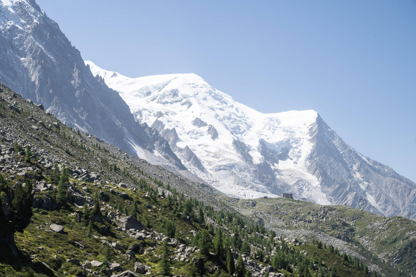
The first hut you will reach is Refuge du Plan de l’Aiguille. From there, it’s a short uphill section to the other hut, Buvette du Plan de l’Aiguille, and the cable car station.
The main lookout points toward Les Bossons Glacier, and it is right next to the Buvette du Plan de l’Aiguille hut. It’s a wide area with plenty of space to just sit down and relax in the sun or in the shade of any big boulder you may find, before heading back down.
the trail offers good views of the jagged peaks of the Mont Blanc Massif too.
The Hut “Buvette Plan de l’Aiguille” with Mont Blanc in the background.

The lookout area behind nex tto the cable car station.
The area offers good views of the Bossons Glacier
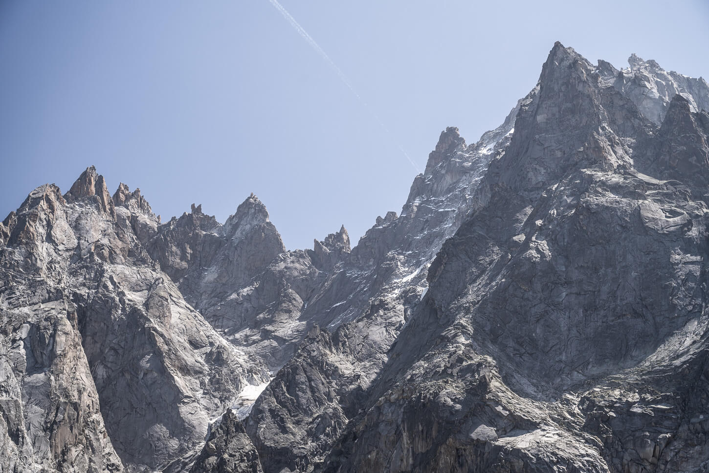
The area is also surrounded by the impressive, jagged peaks of the Mont Blanc massif.
Plan de l’Aiguille to Chamonix
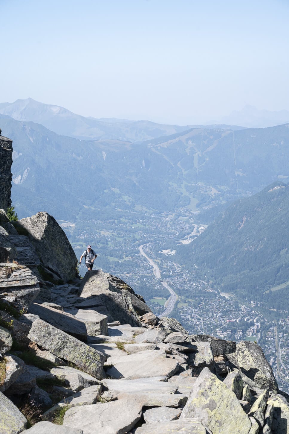
You can either take the cable car down back to Chamonix or hike down. If you decide to take the cable car, you can purchase the ticket on site at the station. I hiked back down to the Centre Ville parking area. The trail is overall steeper than the climb to Montenvers, so more energy-consuming than the hike from Chamonix to Montenvers.
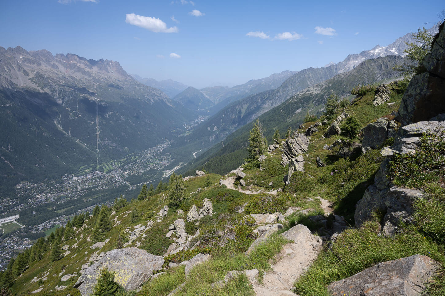
It takes about two hours to reach Chamonix. On the first part, you will have a view of the town and the mountains on the eastern side of the valley, as the trail winds its way down toward the side of the mountain.
Then the last bit of the trail enters the forest to re-emerge out of it once you are at the parking area.
Mer de Glace and Grand Balcon Nord Photos and Photography Tips
Purely speaking from a landscape photography perspective, I think the real value of the hike is almost entirely between Le Montenvers Station, the Mer de Glace Viewpoint, and the Signal Forbes Lookout. The views of the Mer de Glace on this section of the hike are hard to beat.
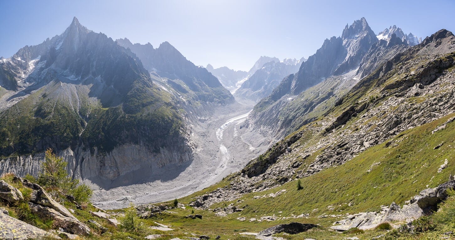
The path between Le Montenvers and Signal Forbes is a landscape photography “classic”. It’s also fun to try to match the leading line of the stony path with the leading lines of the glacier.
In terms of lenses, I brought with me a range between 14mm and 200mm, full frame. The 24-70 mm got used the most, all across the trail. The 70-200mm lens is the second most used. In such landscapes, I thoroughly enjoy capturing the smaller details of the landscape, such as the glacier or the jagged peaks. This worked equally for the Mer de Glace observation deck and the Signal Forbes lookout.
200mm photo, from the Mer de glace Lookout at the Montenvers Station.
Panoramic image made with six frames.
Other sections of the trail still have great views when they open up to the mountains around. But you are mostly hiking right below the mountain, so for long stretches, you are looking down at the busy and built-up Chamonix valley rather than some natural landscape feature.
Where to Stay
Chamonix would be the obvious choice. Easy walk to the trailhead. It’s a rather crowded town in summer and winter alike, but it’s always worth a visit.
If you are looking for a quieter option with more of a mountain village vibe, my preference goes to Argentiere. It’s a short drive or train ride away.
If you are in a Van, Parking du Planards is a basic, paid option close to the trailhead. There’s only a bathroom that serves the parking area, not showers or other facilities. It isn’t a campsite, just a parking area where you can overnight.
There is also one free parking area where you can overnight in Argentiere.
Additional Resources
- Here is a great article about the Mer de Glace. Highly recommended read. It also shows paintings and more recent images of its former glory.
- For an even more epic glacier hike, check out La Jonction or the Argentiere Glacier hike.
Leave A Comment