The Blahnúkúr Hike in Landmannalaugar – Iceland
The Blahnúkúr Hike in Landmannalaugar is one of the most renowned in the Fjallabak Nature Reserve, and for a very good reason. From the top, the views are 360 degrees spectacular, and the trail traverses terrain that could very well be from another planet.
The Blahnúkúr Hike in Landmannalaugar is a loop trail that offers fantastic vistas everywhere you look. As you hike the trail, you may feel like you are in a painting or a gigantic artistic or abstract installation. This hike may inspire some healthy reverence toward its beauty. If you hike this trail alone in the silence of a summer evening, you may even be tempted to tip-toe your way across the trail.
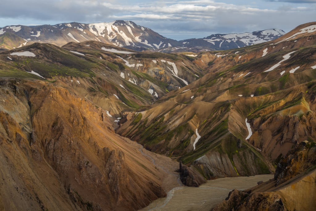
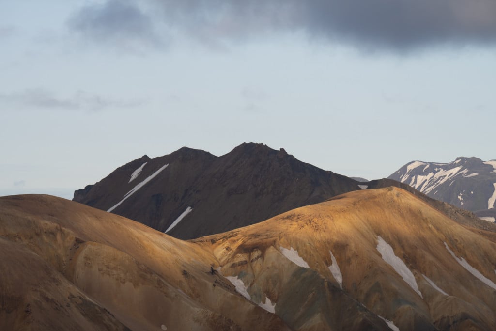
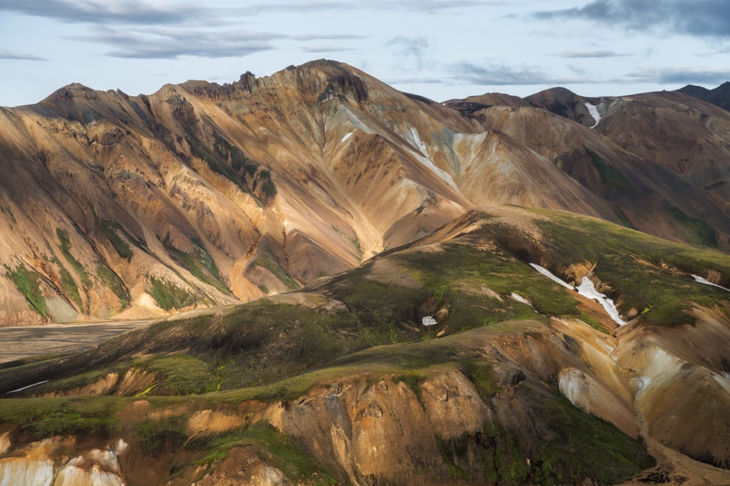
View over the colourful Rhyolite Mountains of Landmannalaugar
How to get to Blahnúkúr and Overview of the Hike
- Getting there: This Hike is only possible in Summer as the F roads leading to Landmannalaugar are only open from June/late June until mid/late September. If you are driving, a 4WD is required. It is advisable to take the F208 North to Landmannalaugar as there is no river crossing until you get to the camping ground, and it’s suitable for smaller 4WD cars, like a Dacia Duster or a Suzuki Jimny. You can leave the car in the parking lot just by the river. A small pedestrian bridge will allow you to cross the river from there. You should only attempt to get to Landmannalaugar via other F Roads (like the F208 south) with a larger 4WD as the river crossings are unsuitable for a small 4WD car.
- Please note: as of June 20th, 2024, you will need to reserve parking in advance if you plan to visit Landmannalaugar between 9 AM and 4 PM (source). You can reserve your parking spot in Landmannalaugar here. The reservation system will be in place every year between June 20th and September 15th.
- Start of The Hike: the Landmannalaugar campground
- Photography & Scenery value: compulsive shooting for landscape and abstract compositions.
- Difficulty: Medium to hard, depending on fitness.
- Tip: If you are up to it, you can include Brennisteinsalda in the hike. You may want to do this too, especially if you only have one day to visit.
To rent a car, I can recommend Blue Car Rental; if you prefer a CamperVan, I can also recommend CampEasy. Make sure your vehicle is allowed on F-roads before booking, though.
The Blahnúkúr Trail
| Distance | Elevation Gain | Hike Time |
|---|---|---|
| 6.87 KM | 340 Mt | 3.30/4 Hrs |
The first part of Blahnúkúr hike
As Blahnúkúr towers the camping ground, it will be in your constant sight and you can just start heading toward it. You will soon see some signposts pointing toward the trailhead.

On the trail, just outside the campsite. Blahnúkúr is the mountain in the background.

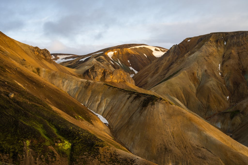
The first part of the Blahnúkúr trail, above the Graenagil canyon
The first section will be on a sort of sandy and friable ground. Here’s a short mobile video clip of this first bit. Carefulness here is required, especially if you are hiking your way down:
After that, the trail will become increasingly solid and steeper as you hike your way up.
This part is rather steep, and if you are short of breath, well, that’s an excellent excuse to stop and enjoy the views! But, seriously, take your time through this hike to soak the views in as much as possible.
As you keep going up, the trail will become less steep. The last bit of the climb is a relatively easy one.

The “flattish” part of the trail after the first steep climb

Looking back toward the trail and the campsite
Once you reach the top, the descent will start on the other side of the mountain. I did this hike as a loop through the Graenagil Canyon, But you will also have the option to either detour through the lava field or to hike up Brennisteinsalda.
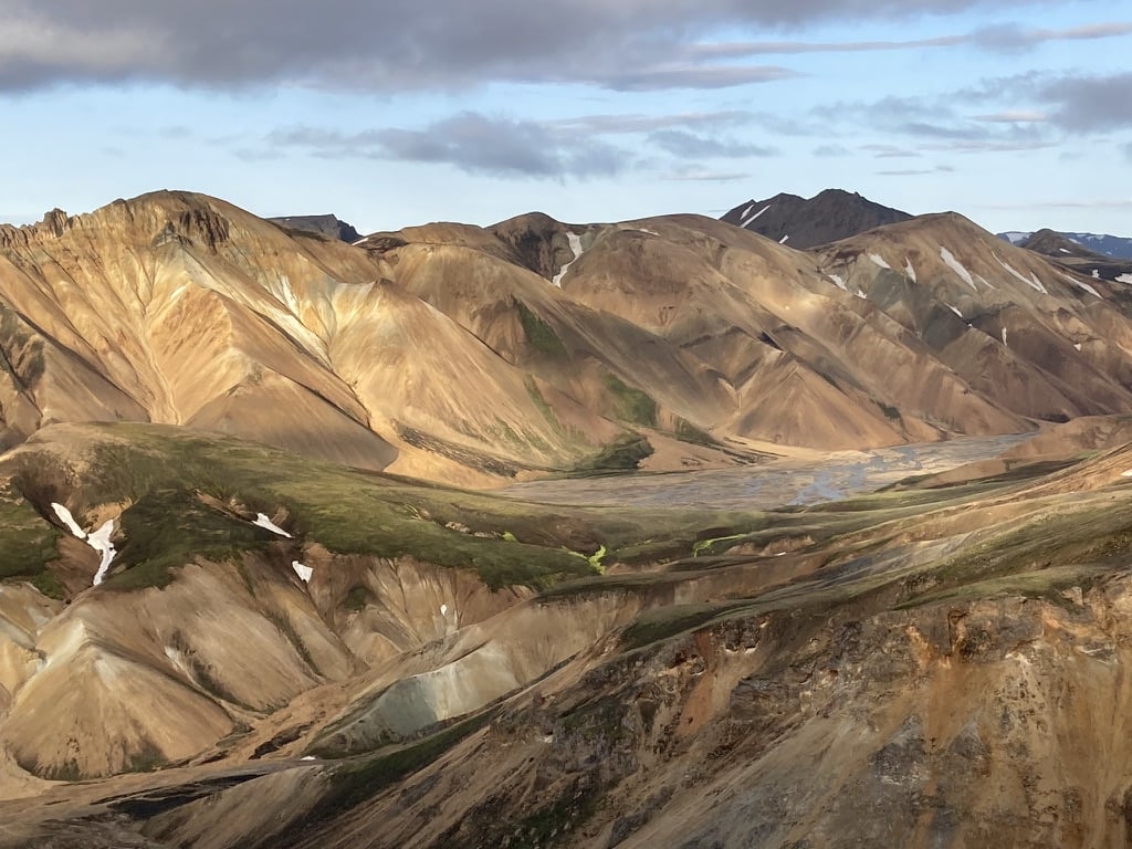
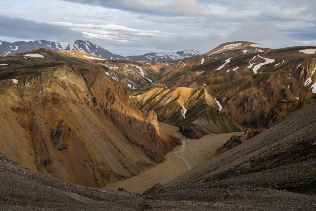
View from the top over the colourful Rhyolite Mountains of Landmannalaugar

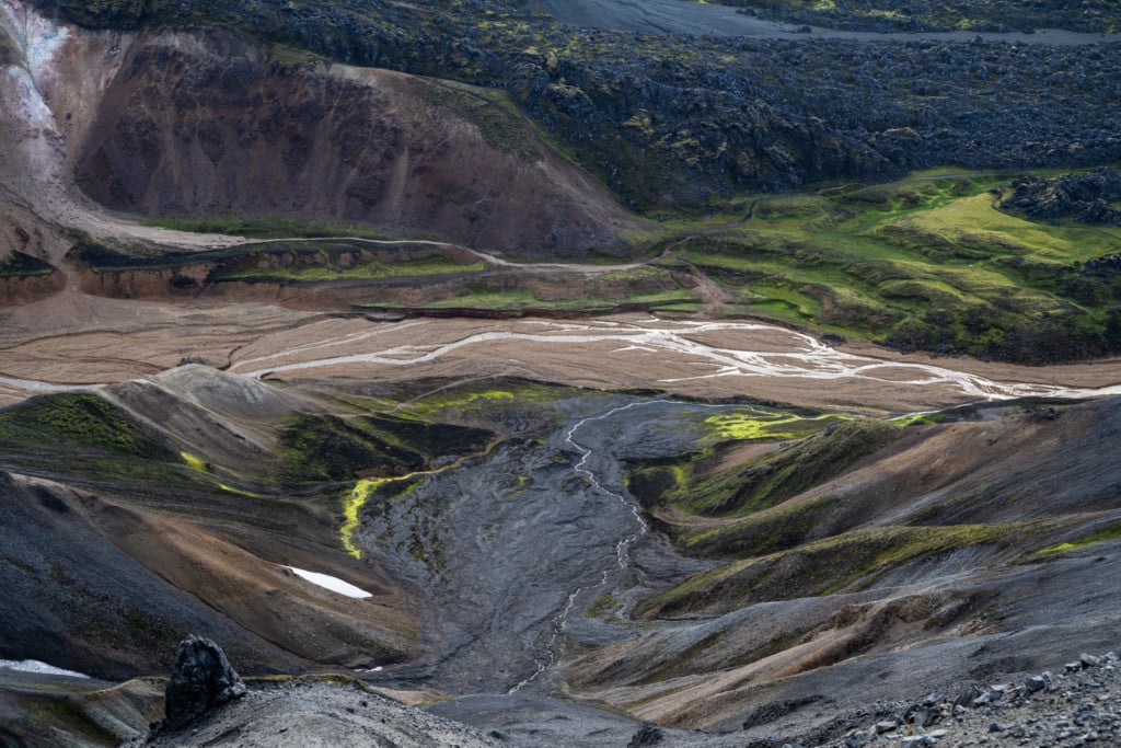
The second part of the Blahnúkúr trail. Can you see the hiker on the bottom right-hand side of the photo?
The second part of the Blahnúkúr hike
Once you start your descent, the colourful walls of the surrounding mountains will replace the open views over the vast highlands. In this second part of the hike, the terrain will be more colourful, while the shapes of the surrounding mountains will start to look like some open-air art installation.
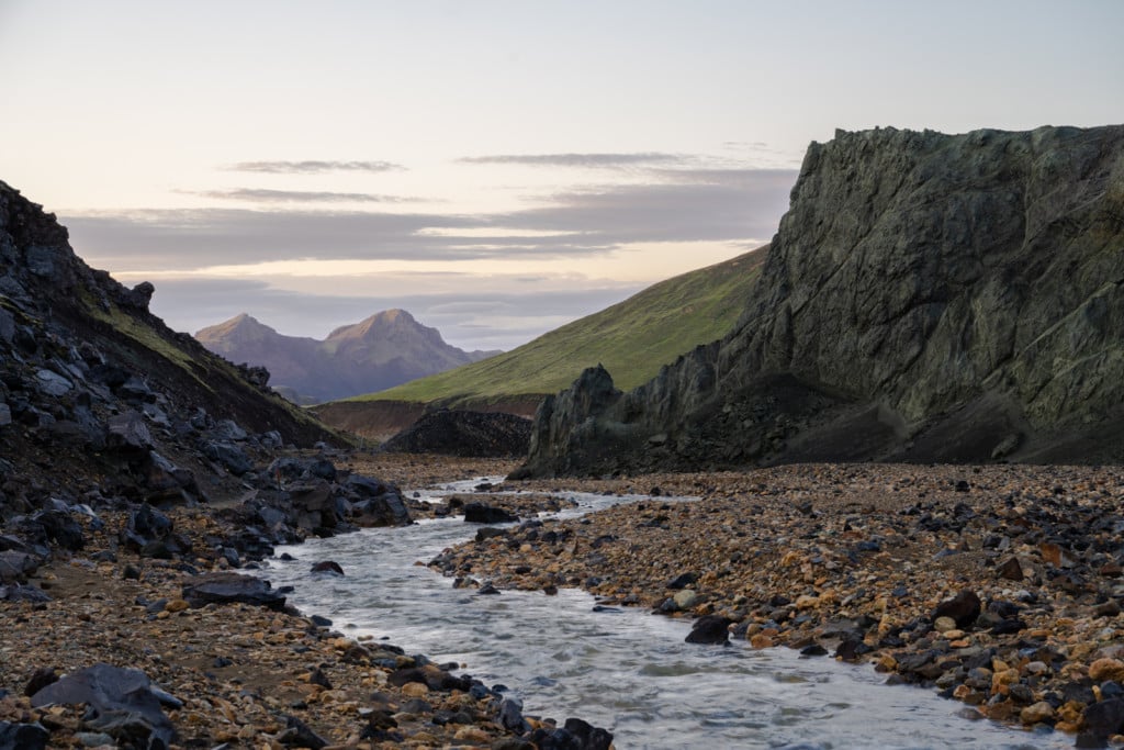
As you keep going down, you will have to cross a small creek before reaching the fork between the trail through the lava field, the Brennisteinsalda hike, and the Graenagil Canyon trail.
Looking down toward the creek crossing and the trail that splits into different directions
I looped back through the scenic Graenagil Canyon, as I had already hiked through the lava field coming back from the Sudurnamur hike.
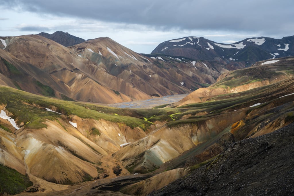
The Graenagil Canyon, looking back at the first part of the trail
You’re a short hike away from the hike’s starting point from here. Time to go back to your tent, get your swimsuit and head to the free thermal pool for a dip!
Photos and Photography tips for the Blahnúkúr Hike in Landmannalaugar
You will have a lot of fun shooting your way through this hike. Bring anything in the 14-200 range and beyond. If I had a lens up to 400-500mm, I would have brought it. With such a long lens, you will have many more compositional choices when shooting the farther away mountains. I wish I had more reach than my 70-200mm lens.

Shot from the first part of the trail

View from the trail

Brennisteinsalda
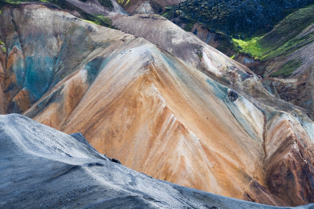
Closeup of the colourful Rhyolite mountains

Another view of the colourful Rhyolite mountains
View over the surrounding mountains
Another view over the surrounding mountains
Nonetheless, I had a lot of fun with my camera on this hike, with shorter and longer focal lengths.

Also, you may not need a tripod unless you want to take selfies or time-lapses. I had one with me but did not use it.
Flying drones here is not allowed. Landmannalaugar is part of the Fjallabak nature reserve, where flying drones is prohibited.
Map of the Blahnúkúr Hike
Here is the map of the hike from the parking area. If you need a GPS track, you can download the .GPX file from the Komoot activity.
Where to Stay
The Camping Ground is the most obvious choice if you have a tent. At the time of writing (2022), a night is 2,500 ISK per person per night. This includes a QR code for a 5 minutes warm shower. Also, there is a hut where up to 78 guests can be accommodated in dorm rooms. If you have a camper van, it’s ok to sleep in the parking lot, but you would have to pay to use the hut’s facilities.
Additional Resources
- Check out my comprehensive “Guide to hiking and camping in Landmannalaugar”
- Check out the Best 5 Day Hikes in Landmannalaugar with Maps
- Check out more Photo Hikes in Iceland here.
- Link to the website of the Icelandic Touring Association managing the hut
- Discover the best hiking books and guides on Iceland.


Leave A Comment