The Sudurnamur Hike in Landmannalaugar – Iceland
The Sudurnamur Hike in Landmannalaugar (Suðurnámur), for some reason, is not as hyped as the closeby Bláhnjúkur (Blue mountain peak) or the Brennisteinsalda hikes. Still, photographically speaking, it offers some of the best landscape views in the area.
How to get to Suðurnámur and Overview of the Hike
- Getting there: This Hike is only possible in Summer as the F roads leading to Landmannalaugar are only open from June/late June until mid/late September. If you are driving, a 4WD is required. It is advisable to take the F208 North to Landmannalaugar as there is no river crossing until you get to the camping ground, and it’s suitable for smaller 4WD cars, like a Dacia Duster or a Suzuki Jimny. You can leave the car in the parking lot just by the river. A small pedestrian bridge will allow you to cross the river from there. You should only attempt to get to Landmannalaugar via other F Roads (like the F208 south) with larger 4WD as the river crossings are unsuitable for a small 4WD car.
- Please note: as of June 20th, 2024, you will need to reserve parking in advance if you plan to visit Landmannalaugar between 9 AM and 4 PM (source). You can reserve your parking spot in Landmannalaugar here. The reservation system will be in place every year between June 20th and September 15th.
- Start of The Hike: the Landmannalaugar campground
- Photography & Scenery value: It is excellent for landscapes and abstracts; it feels like visiting an alien landscape.
- Difficulty: Moderate to hard, depending on fitness.
To rent a car, I can recommend Blue Car Rental; if you prefer a CamperVan, I can also recommend CampEasy. Make sure your vehicle is allowed on F-roads before booking, though.
Tip: for the best light, it is advisable to hike this trail in the early AM or late in the evening. The trail will be less crowded, and the rising/setting sun will ensure excellent lighting conditions. At this latitude, the “Golden Hour” becomes the “Golden hours” because the sun will stay lower on the horizon for much longer than in lower latitudes. Make sure your vehicle is allowed on F-roads before booking, though.
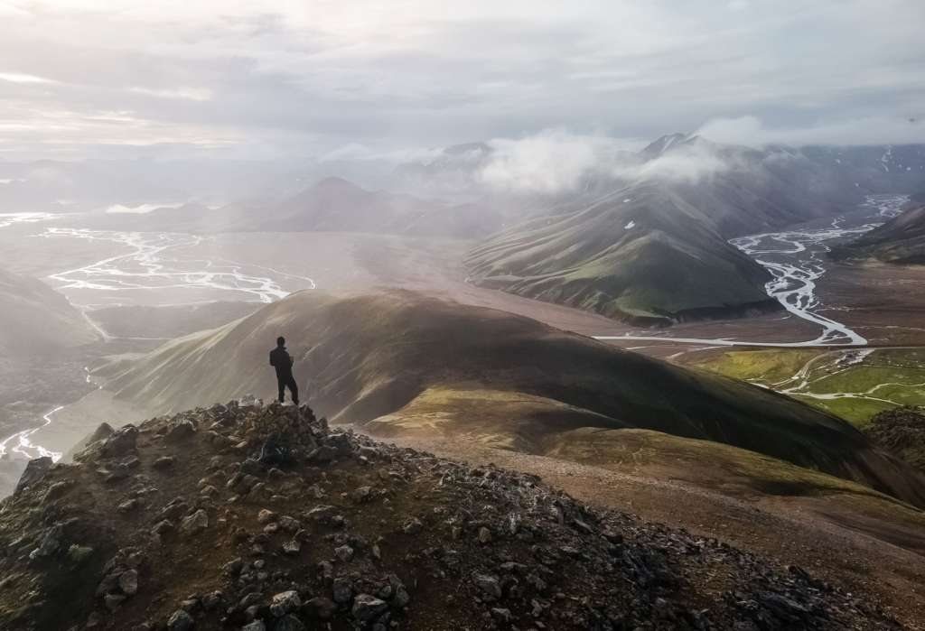
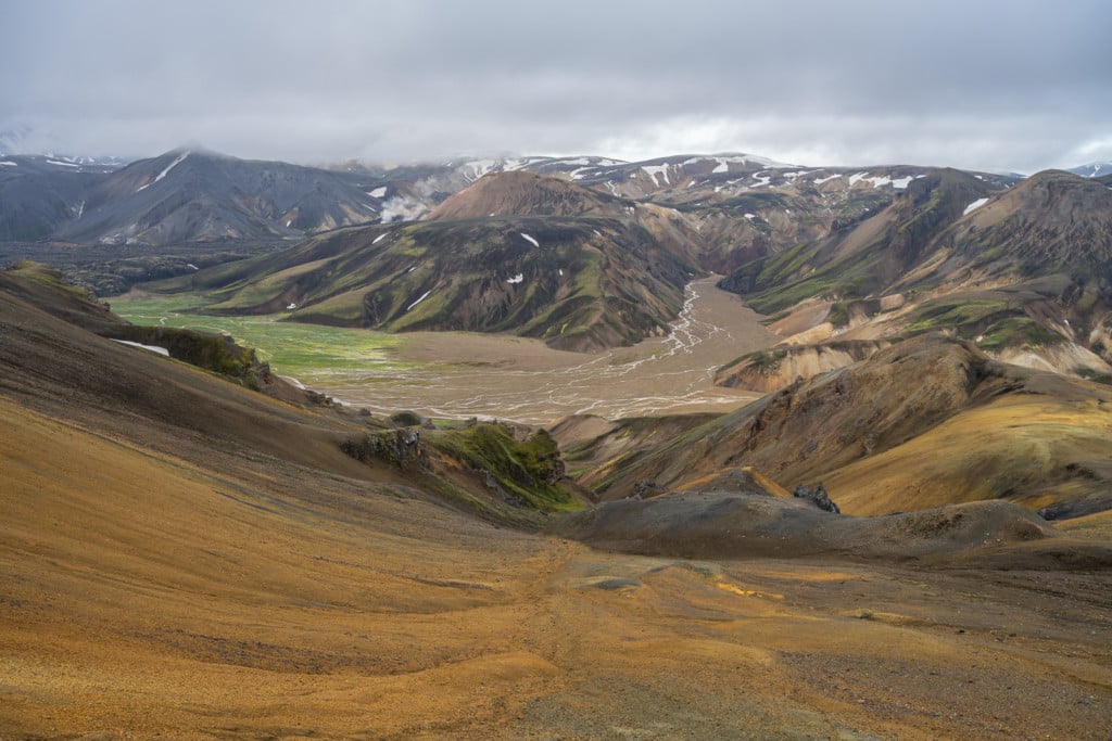
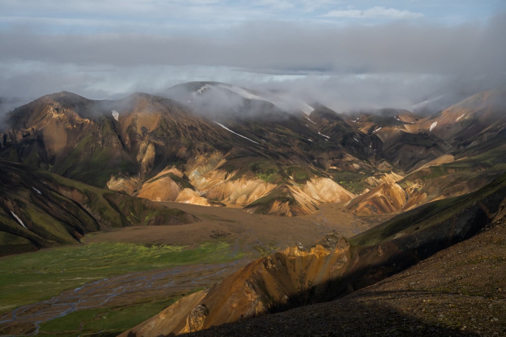
One of the several magnificent views on the Sudurnamur trail
The Suðurnámur Trail
| Distance | Ascent | Duration |
|---|---|---|
| 9.81 KM | 440 MT | 3/4 Hrs |
If you are hiking this trail in the early morning or late evening, I recommend doing it counterclockwise. This is because you will reach the best views over the plain below after a couple of kilometres, and you will save the easiest part of the Hike for later when you are already tired.
From the camping ground, you will need to walk down road F208 for about one KM till you see the signs pointing towards Sudurnamur. Here the first small ascend will start. It can be pretty steep in some areas, but it’s nothing too extreme. You will then reach a plateau before starting the second climb, which will lead you to the first peak.
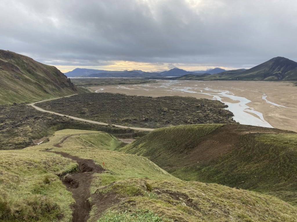
View over the F208 road leading to the camping ground
The photo above shows the beginning of the first ascent. Note red signposts mark the trail.

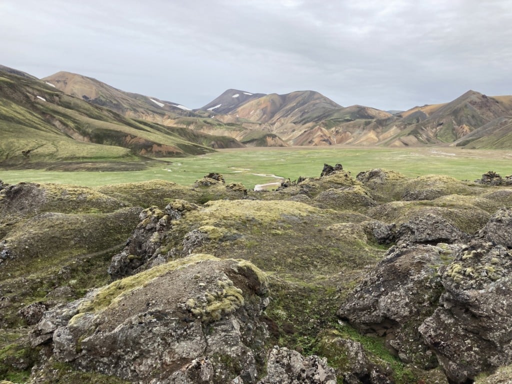
Panoramic view from the trail
View over the plain and the camping ground.
You will continue on flat ground until you reach the second ascent to the Sudurnamur peak. From The second peak, you start the descent towards the plain below. You will have to cross some small creeks before circling back to camp through the lava field.
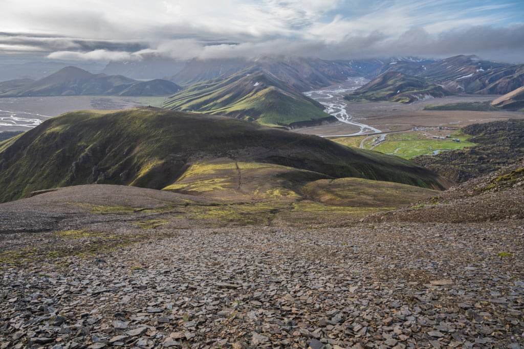
The first part of the descent, looking toward the lava field close to camp.
The trail will cross some of the creeks in the plains below, as shown in the photo above. Waterproof boots are recommended but not necessary; the water level should be low enough to allow you to jump from stone to stone.
Looking back at the trail from the lava fields close to the campsite.
From here, you need to cross the lava field to get back to camp. Once back at the campsite, you can enjoy a well-deserved relaxing dip in the free Thermal pool by the campground!
Photos and Photography Tips for the Sudurnamur Hike in Landmannalaugar
Here is a short clip showing the surrounding area:
In terms of photographic equipment – Lenses: anything above 20mm should be more than enough. I didn’t spot many opportunities to use ultra-wide lenses, so anything between 14 to 20mm may not get much use on this Hike.
I would recommend bringing anything in the range of 24 to 200mm. But, of course, if you have a longer telephoto, you may want to bring that one too!
You will see classic landscapes and abstract photo opportunities during the first ascent.

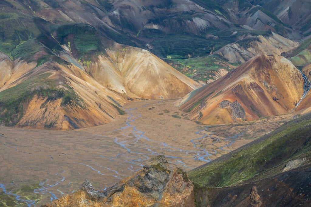
View over the river below
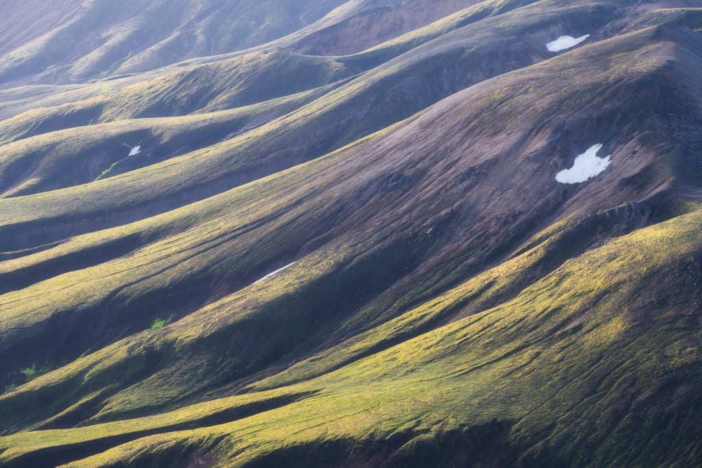
Abstract photo of the surrounding landscape

The warm morning light shining on the landscape
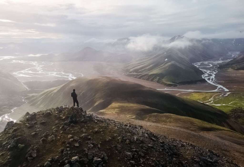
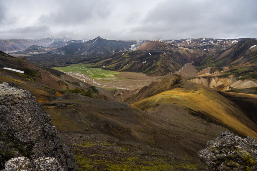
Further in the Hike, the landscape will bring you closer to the colourful Rhyolite mountains. The views from there are spectacular, and you will feel like you’re on an alien planet.
View over the surrounding mountains
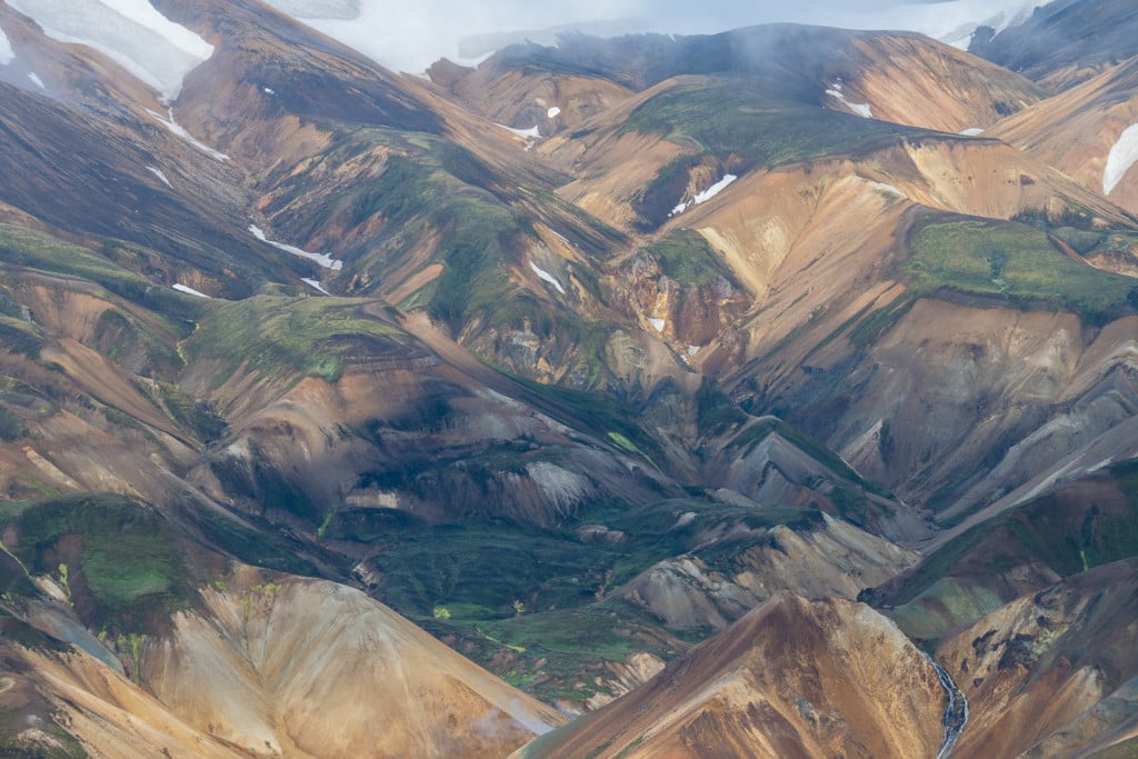
The colourful Rhyolite mountains
The sunlight usually helps bring out the colors from the Rhyolite mountains.
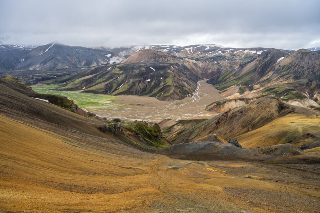
View from the Sudurnamur trail in Landmannalaugar over the Colorful Rhyolite mountains and the surrounding landscape.
This hike has no bad spots, just like Landmannalaugar does not generally have any. Coming back to the campground, though, it’s like the feeling you just ended a hike in a magic land. For this reason, I recommend staying 2-3 days if you have enough time to explore more trails in the area. The Blahnúkúr and Brennisteinsalda hikes are also spectacular.
Map of The Sudurnamur Hike in Landmannalaugar
Here is the map of the hike from the parking area. If you need a GPS track, you can download the .GPX file from the Komoot activity.
Where to Stay
The Camping Ground is the most obvious choice if you have a tent. At the time of writing (2022), a night is 2,500 ISK per person per night. This includes a QR code for a 5 minute warm shower. Also, there is a hut where up to 78 guests can be accommodated in dorm rooms. If you have a camper van, sleeping in the parking lot is okay, but you would have to pay to use the hut’s facilities.
Additional Resources
- Check out my comprehensive “Guide to hiking and camping in Landmannalaugar”
- Check out the Best 5 Day Hikes in Landmannalaugar with Maps
- Check out more Photo Hikes in Iceland here.
- Link to the website of the Icelandic Touring Association managing the hut
- Discover the best hiking books and guides on Iceland.
Got a question or your own experience to share? Let us know in the comments below!


Hi. Thank you for your post, it is really good!
We will have 2 separate self driving days in Landmannalaugar. We were there last year but the weather was not great. I was thinking about doing 2 hikes : Skalli and Sudurnamur ( try to get to Haala) . Last year we were going to do the Brennisteinslada/Blahnjukur but we got zero visibility on the first peak and called it a day. We went to ugly puddle and had a fantastic view. Could you please let me know your suggestions for our 2 days in Landmannalaugar? Thanks
Hi Veronica,
Thanks, hope you’ll enjoy better weather this time around! I haven’t done the Haalda trail yet, but I can definitely recommend Skalli. I am currently in Iceland and hiked the Skalli trail a few days ago – I’ll post a report as soon as I get a chance. The views from the Skalli trail are truly spectacular.
The views from the summit are good too, but everything seems a little too far away, in my opinion. However, from the Skalli trail, you can access Hattver/Uppgönguhrygg, which was the highlight of the Hike. So I would definitely recommend Skalli, with the detour to HattverUppgönguhrygg. The detour to Hatta ver is also marked and has red trail marks. In all, that will be a 20/22km hike with a 1000+ total elevation gain, including the detour.
So I would personally combine the Hike to Skalli with either Sudurnamur or Blahnúkúr – Blahnúkúr is still worth it too if you had zero visibility the first time.
Hope this helps!
Hi! I hope you are having a great time out there! Thanks so much for answering to me so quickly!! I really appreciate it. Quick question: in order to get to Hattver/Uppgönguhrygg how are the river crossings? Is the trail dangerous? Also, did you go to Skalli and come back same way? And for reference how would this trail (including Hattver/Uppgonguhrygg) compare to the Canyon in Thorsmork in terms of difficulty and risk? Thanks again.
Thanks! I’s definitely having a great time exploring new trails!
I did it as a loop, it’s well marked. Skalli’s summit is not on the trail though, it’s on a short detour – same place where the Hattver trail starts. Basically, if you are hiking to Skalli counterclockwise, at one point, you will have the trail to Skalli’s summit on the right and to Hattver on the left.
The real highlight on Hattver’s trail was Uppgönguhrygg. There are a couple of short sections on Uppgönguhrygg’s ridge that are a little exposed but nothing too bad. Apart from those, the trail is good and does not present particular risks. Still, it’s quite a long and demanding trail. No river crossings, but you can descend into the Jökulgil Canyon from Uppgönguhrygg and turn back there.
Compared to the other trail in Thorsmork, this is a much safer and doable trail.
Thanks again for your help! Not sure you have been to Langisjor, it is a bit out there in the Highlands, but it is beautiful. If you haven’t i would recommend it and also a stop at Skaelingar for a very peaceful atmosphere and lots of moss covered volcano rocks. Thanks for your patience!
Thanks! I have never been to Langisjor indeed, but I’m planning to go next week – Icelandic weather permitting :)!
One last question. Is there any snow left on the Skalli trail? Thanks
There definitely is more snow in Landmannalaugar this year compared to the same time last year, but no snow left on the Skalli trail.
Edit: just remembered there actually was a small, hard snowbank on a flat area in the last part of the trail, but that was it.
Thanks again for your help and patience!
Hi, I hope you are having a great day!
I was wondering if I could combine this hike, so the sudurnamur hike landmannalaugar with the blahnukur hike in landmannalaugar. From the pictures that I see here these seem to be the prettiest. So I was wondering if you knew if this would be a good combination or if another hike would be better (we are driving here as a daytrip from Reykjavik). Any advise would be of great help! Thanks :)
Hi Isabel,
I like your thinking :)! Yes, you actually can. You can also add Brennistenisalda to the tour. For instance, you could hike to Sudurnamur and before reaching the Laugahraun lava field, you will see the trail marks to Brennisteinsalda. Then you can descend on the other side of Brennisteinsalda and hike up Blahnukur. It’s probably going to be a 15/16 km loop.
If you do not feel like including Brennisteinsalda, skip the first trail marks and continue to the Laugahraun lava field. Once you’ve reached it you will see the trail marks to Brennisteinsalda again. You can follow them until you reach the trail marks to Graenagil and you can hike up Blahnukur from there. More or less the same distance as the first option, but less elevation gain.