Segla Mountain Hike – Senja, Norway
Undoubtedly, Segla is one of the most iconic mountains in Northern Norway. While Segla looks as inaccessible as a mountain could be, the hike to the top is relatively easy. However, it does require some cardio fitness; this is one steep hike. A head for heights is also required since the top of the mountain is surrounded by cliffs hundreds of meters tall on three of its four sides.
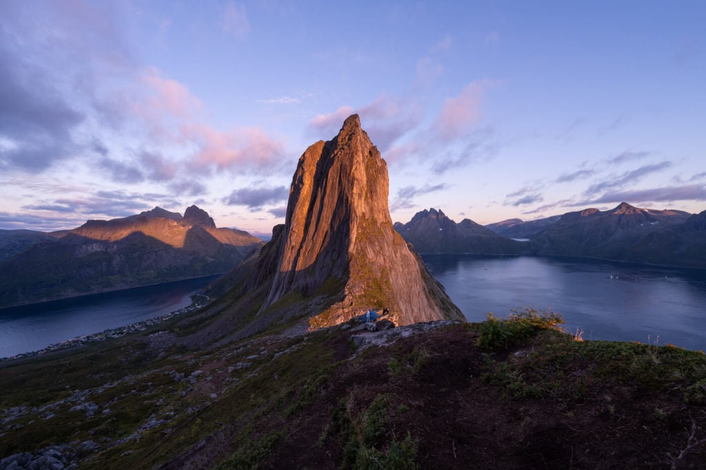
Segla at Sunset, from the trail to Hesten. From here, it looks impossible to hike.
What about the fourth side? That’s where the trail is. It is still steep and full of big boulders, it may require some minor scrambling, but it is very “hikable” nonetheless.
Needless to say, the views from the top are breathtaking and well worth the effort of getting to the top. Keep in mind, though, for the best and most iconic views of Segla, the hike to Hesten is the one you have to go to. You can check my post on that hike here to find out why.
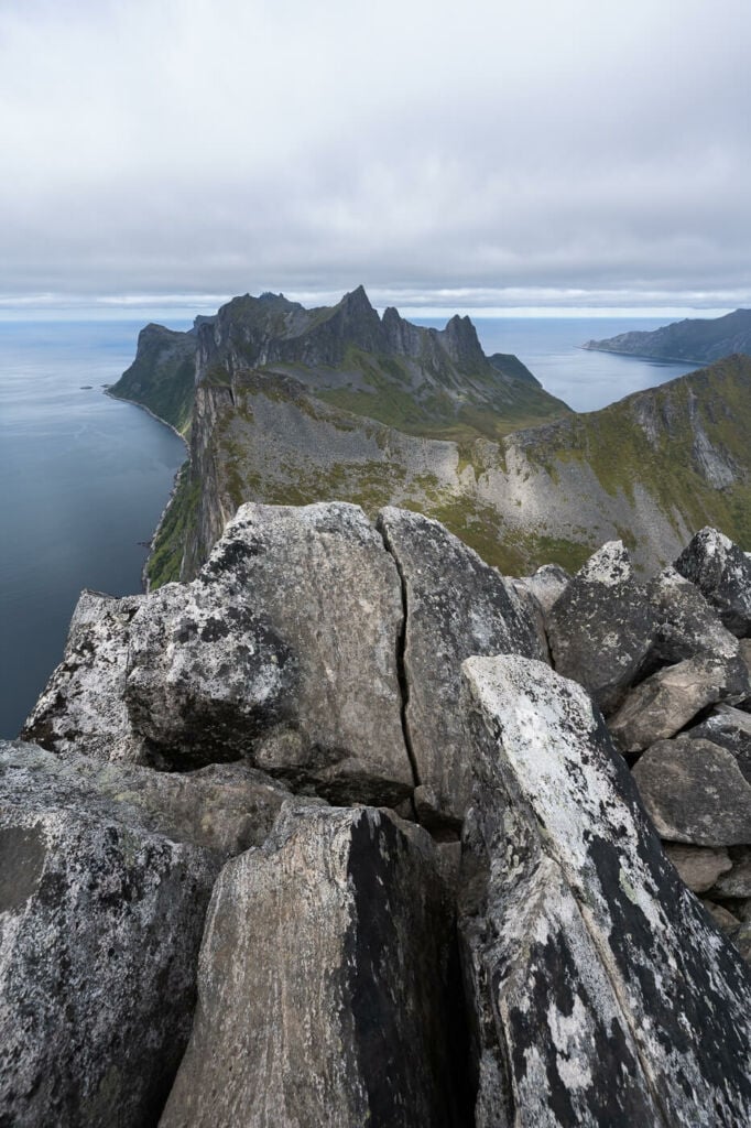
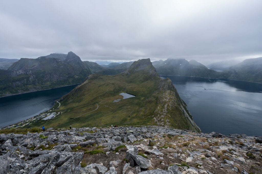
View from the top of Segla toward Hesten.
Table of Contents
Overview of the Segla Hike
| Altitude | 639 m |
|---|---|
| Distance | 4.40 KM |
| Elevation gain | 580 ↑ / 580 ↓ |
| Hike time | 2:30/3:00 Hours |
| Hike Difficulty | Moderate |
- Tip: If you would like to hike up Segla and Hesten on the same day, you don’t need to return to the starting point. You can do a Segla and Hesten loop Hike. There is a signposted connecting trail at the foot of the mountain on each side.
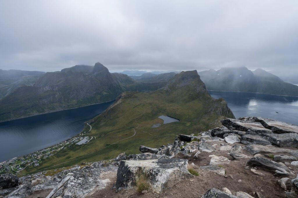
Panoramic image from one of the vantage points close to the top of the mountain.
How to get to Segla and Parking
- Driving Directions: Segla is essentially located in the small village of Fjordgård. It takes a few hours to drive there from the nearest airports, Tromsø’s, Harstad/Narvik (Evenes) Airport, or Bardufoss. The drive will take 3/4 hours from any of these, give or take. I chose Harstad/Narvik (Evenes) for my trip because I also planned to visit the Lofoten, and Harstad/Narvik is almost in the middle of the two. If you are only visiting Senja, Tromsø or Bardufoss are better choices.
- Parking: there are two dedicated parking areas you can leave the car in Fjordgård. One is down by the Harbour, on the opposite side of town from where you came from. The coordinates for the Harbour parking are 69°30’44.4″N 17°37’40.5″E. The other is a paid parking close to the trailhead by the local Montessori school. Its coordinates are 69.5047121886322, 17.62691999041218. If you park there, I would recommend installing the EasyPark app first, as it can also be used to pay for this parking area.
The “other” side of Segla
Segla Mountain Trail
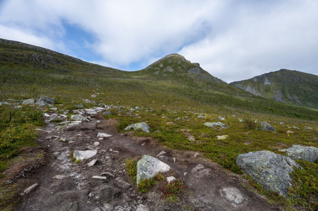
The trailhead is next to the parking lot by the Montessori school. You can’t miss the signs. Additionally, the trail is well-worn, and Segla is a mountain that can’t be missed. It will be right in front of your face all the way to the top. Still, the mountain is entirely different when seen from the opposite direction to the Hesten viewpoint. Not as imposing and with a good amount of vegetation around its base, Segla almost looks deceivingly easy to climb. The first part of the trail is easy too. Essentially, it’s a walk uphill on a gentle gradient trail.
The second part of the hike is the toughest one. While the climb is not particularly difficult, the second part of the hike is steep, with lots of loose rocks and exposed sections, if you follow the trail closer to the edge. The whole face of the mountain is a trail on that side. You can choose your path since there are so many intertwined trails. Ultimately though, they will all converge near the top.
To get to the top from the second part of the trail, it’s a scramble in places. Proper hiking boots are recommended. While this part of the trail may be a bit of a “huff and puff”, sweaty hike, you’d have good excuses to stop along the trail several times to enjoy the fantastic landscape.
The summit is very rocky, with plenty of big boulders with wide gaps in between. Still, there are a few spots you can lay on and peek beyond the edge of the cliff into the fjord below. Enjoy the views and be careful when approaching the edge; it’s a vertical drop all the way down!
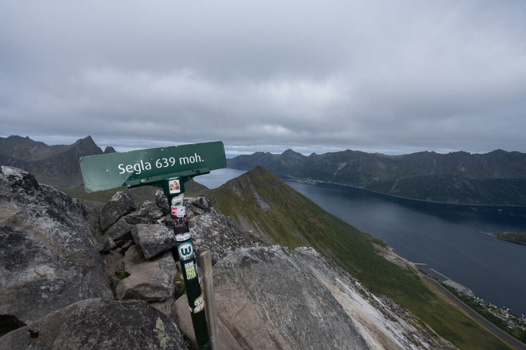
The sign marking the summit.
Photos of the Segla Mountain Hike
The whole area around Segla is extremely beautiful, and the best views are along the trail on the steep slopes of Segla. Needless to say, the scenic views from the top are some of the best ones in this area. It was even better than I expected. in a way, it’s like being atop a needle, so the views are wide open in all directions.
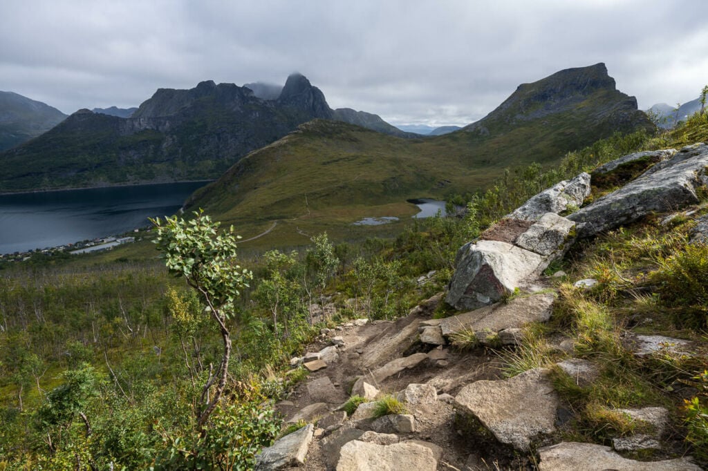
The section of the trail closer to the saddle, with the village of Fjordgård in the background.

View from the saddle before the second, steep part of the hike to Segla begins.
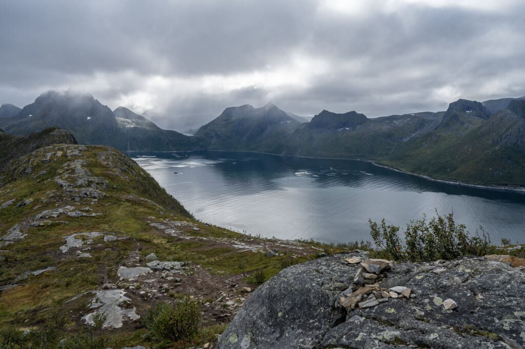
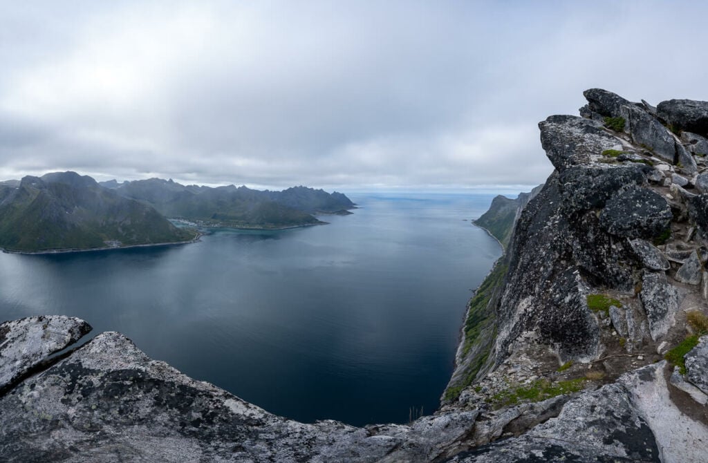
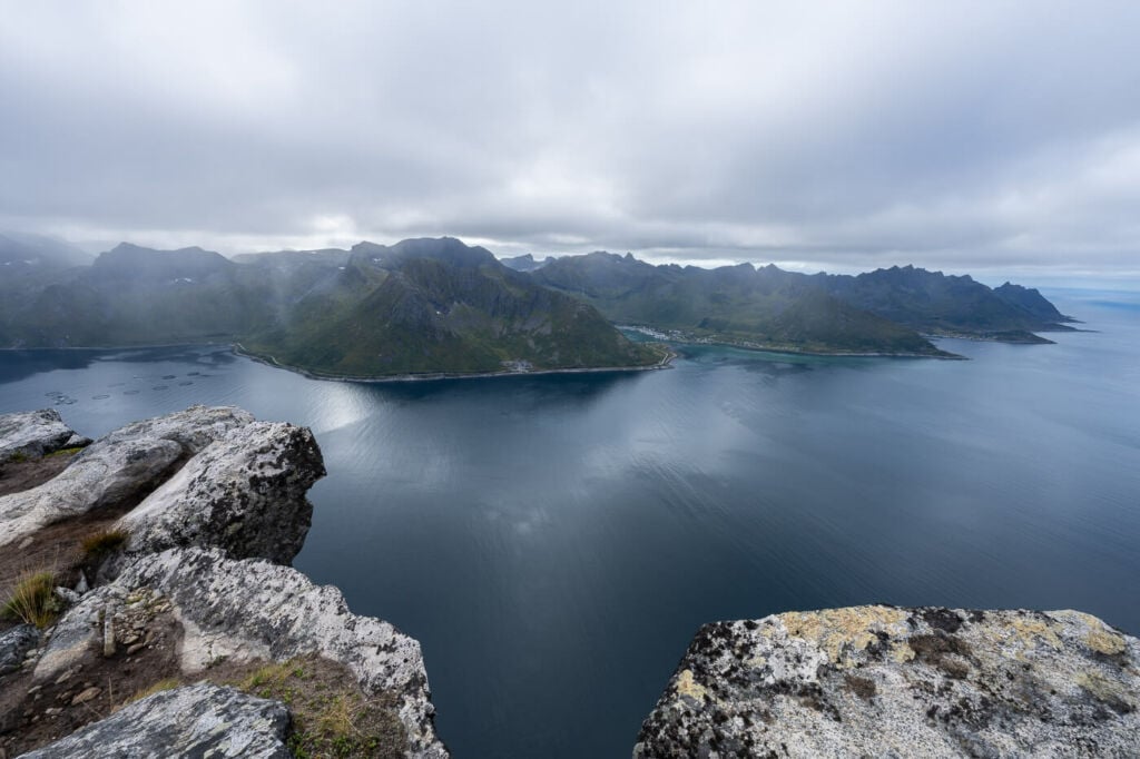
View of Mefjorden
Here the trail starts gaining elevation, and you can see a short section of the first part of the trail on the left-hand side.
Here you can get an idea of how steep, rocky and wide the trail is. Essentially, you can pick your own line up the mountain.
..and finally, the same view but from the top!
View from the top toward Mefjorden.
Another view of Mefjorden from the top of Segla.
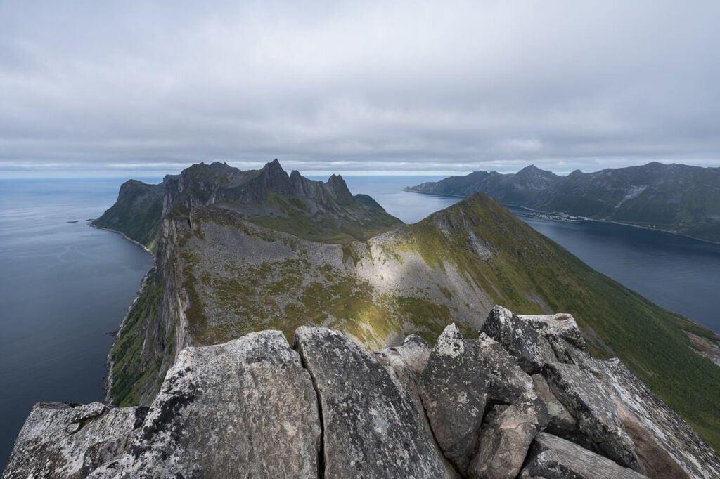
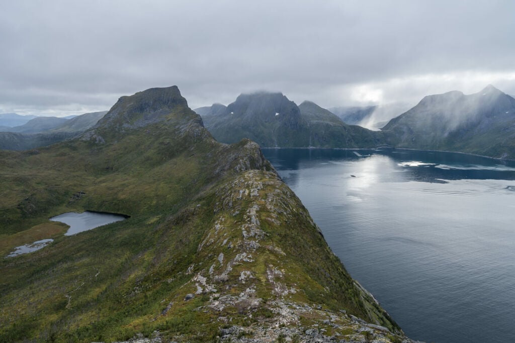
View from the top toward Hesten, Stavelitippen and Inste Kongen.

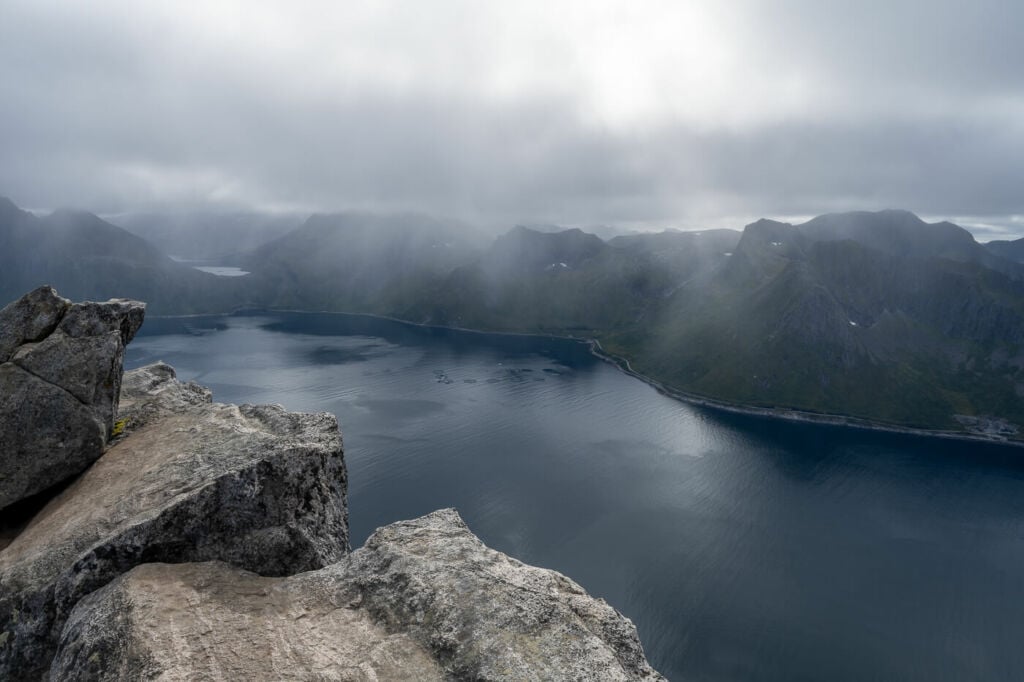
One of the many ledges over Mefjorden.
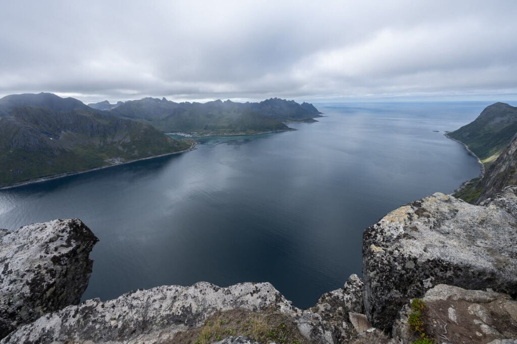
The spectacular view of Mefjorden toward the Ocean.
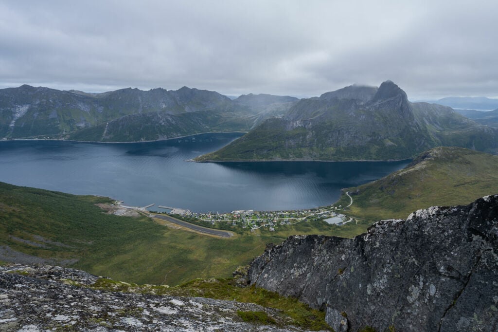
The Village of Fjordgård, from the top of Segla.
Video of the Hike to Segla
Last but not least, you can also watch a video of this hike on my YouTube channel. No commentary, just the trail, the views and some relaxing music:
Map of the Segla Mountain Hike
The trail is easy enough to follow, and it’s also well-worn. Hey, you can’t miss a mountain like Segla, either :). If you need a GPS track, however, you can download the .GPX file from the Komoot activity.
Where to stay
There are a couple of accommodations available in Fjordgård, where the trailhead is. On the other hand, there aren’t many campsites in the area, and Segla’s mountain top is unsuitable for a tent. Still, it is possible to camp somewhere in the area within the Allemannsretten regulations. Please note it is not allowed to camp around Storevatnet, as it is Fjordgård’s drinking water reservoir.
It is possible to overnight in the parking lot by the school (paid) and by the Harbour (paid too as of 2023).
Additional Resources
- Here’s my full Senja Hiking guide, with the best hikes in the region and trip-planning tips.
- If you are planning to take photos of this iconic mountain, you’d better get yourself on this other Hike to Hesten (with a detour to Stavelitippen, if you feel like it). Also, you may want to check out these other amazing Hikes on the Island of Senja: Husfjellet, Keipen and Grytetippen, or Inste Kongen and Kongeporten, or the easy Barden Hike.
- You can check the main page on Hiking in Norway for more Photo Hikes and inspiration.


Thank you for this!