The Barden Hike, Senja, Norway
OK, let’s start with a statement; the hike to the Summit of Barden on the Norwegian island of Senja does not get much credit like Hesten or Segla, but to me, the views it offers are equally breathtaking.
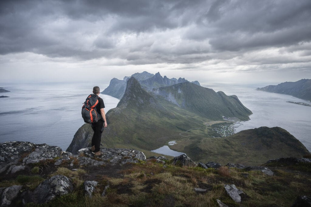
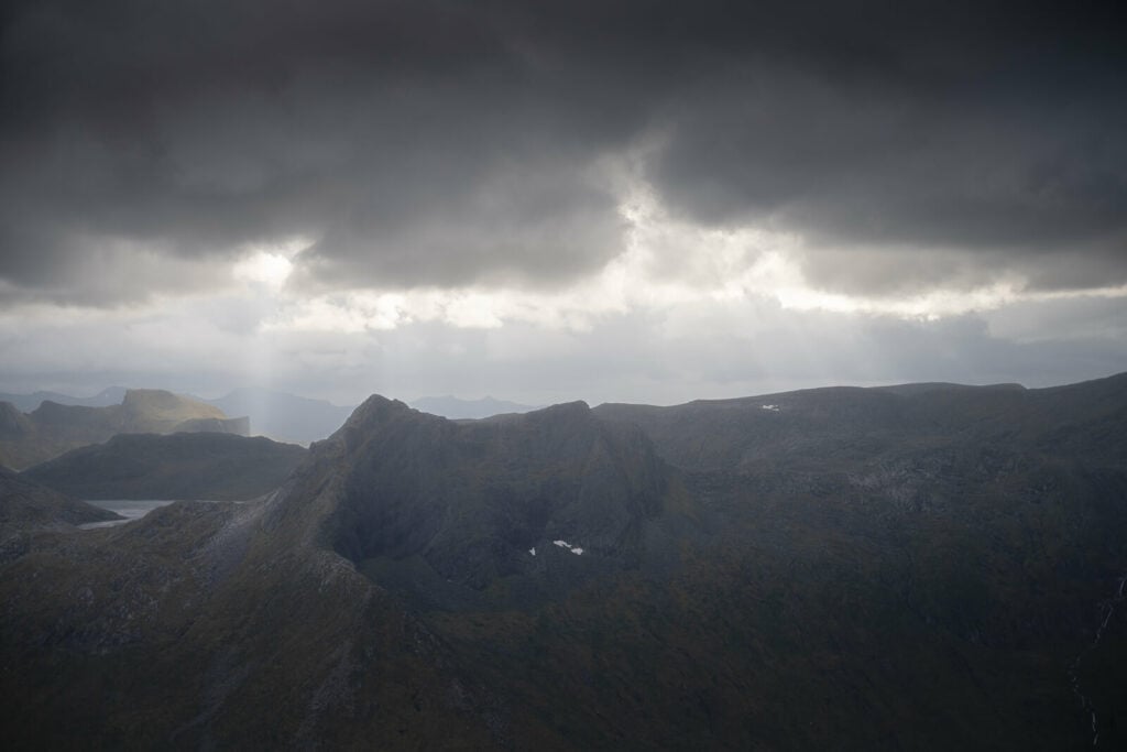
View from Barden.
This is also the easiest hike out of the four main hikes (Hesten and Stavelitippen, Segla, and the challenging Inste Kongen) that you can access directly from Fjordgård.
So why this isn’t as well regarded as Hesten or Segla? Well, I get it. If you only have one or two days to spend in the area, you’d probably want to view Segla or Hesten first.
Still, this is a short hike, and it will likely take most people less than an hour to get to the top and enjoy the spectacular views. So if you can, try to fit it in as a second hike for the day. You won’t regret it.
That is what I did too; I hiked to Husfjellet in the morning and to Barden in the afternoon. I ended the day well tired but happy I did both.
Table of Contents
Overview of the Barden Hike & Map
Here are some quick stats on the hike to Barden. Please note this is the trail from Fjordgård. There’s another one that can be accessed by the parking area before the gallery that leads to Fjordgård. that trail is a little shorter but a bit steeper overall.
| Max Altitude | 659 m |
|---|---|
| Distance | 6.13 KM |
| Elevation gain | 720 m ↑ / 720 m ↓ |
| Hike time | 02:00/ 02:30 Hours |
| Hike Difficulty | Easy/Moderate |
Here is also the map of the Barden Hike. you can download the GPS track for free from the activity linked below:
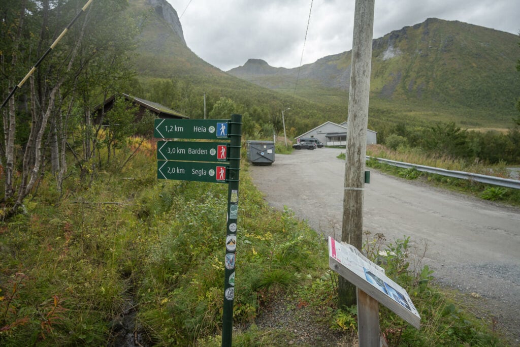
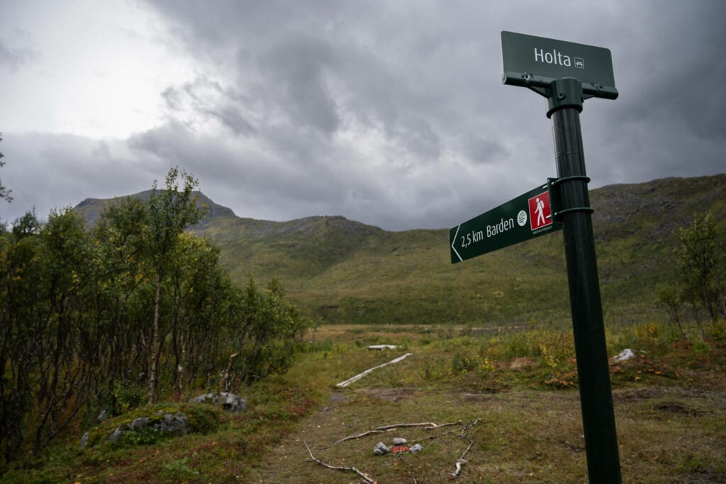
How to get to Barden and Parking
As mentioned above, there are two possible trails to get to the top of Barden. One is the same trailhead as Segla and Hesten. The other one is the same as Keipen and Grytetippen.
- Driving Directions: Whether you are coming from Tromsø, Narvik, or the Lofoten, you will have to drive toward Fjordgård. the drive takes 3/4 hours from either Narvik or Tromso. More from the Lofoten.
- Parking: paid parking is available by the Segla trailhead. If you choose the other trail before the gallery, parking space is limited, but free.
- Public Transport: the only option you have is bus number 370 or 380 from Lysnes to Mefjordvær. You could get to Lysnes from Tromso by ferry. So Technically entirely doable without renting a car from Tromso.
The trailhead with the parking area in the background.
The Barden Hiking Trail
As you leave the Parking area, you can just follow the Red/Green trail marks to Barden, until the trail
From here, the first part of the trail is flat and mostly on boardwalks. You can tell it’s a very wet and boggy area even by walking on the boards. Still, this makes it for some fast-moving on the trail.
The boards will disappear once the gradient increases. First, you’ll have to cross some birch woods, and then a boulders field.
500mt. into the hike the trail spots from Segla’s to Barden.
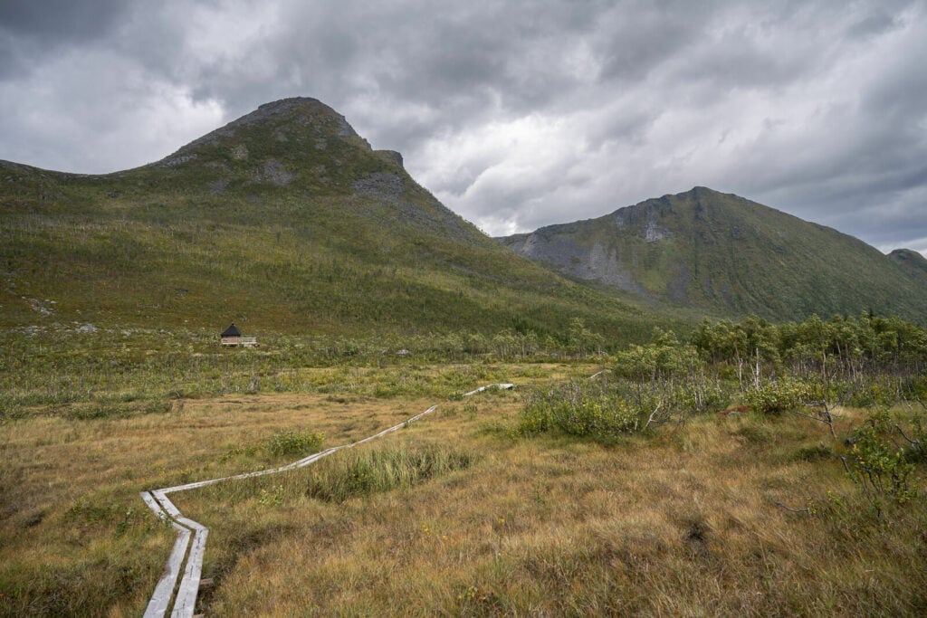
The trail then continues on a boardwalk for almost two KM.

The last bit before the summit is relatively steep and crosses a boulders field.
The hike, although relatively steep in place is never difficult, but can be slippery in places and you may need to help yourself with your hands in a couple of passages.
The summit is wide and flat. Once the climbing section has ended, you will still need to walk a few minutes toward the real summit. Be careful on the southern side, it’s a vertical drop to the sea.
Summit to Sea.
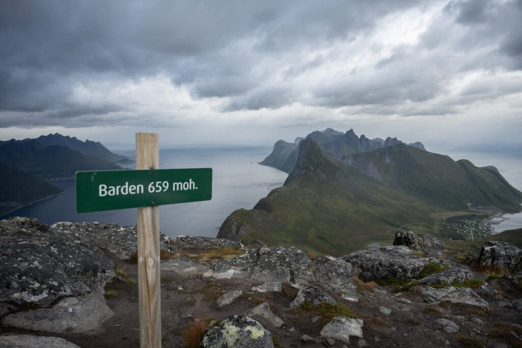
Also, there’s a logbook at the top and a sign marks the summit. Enjoy the views!
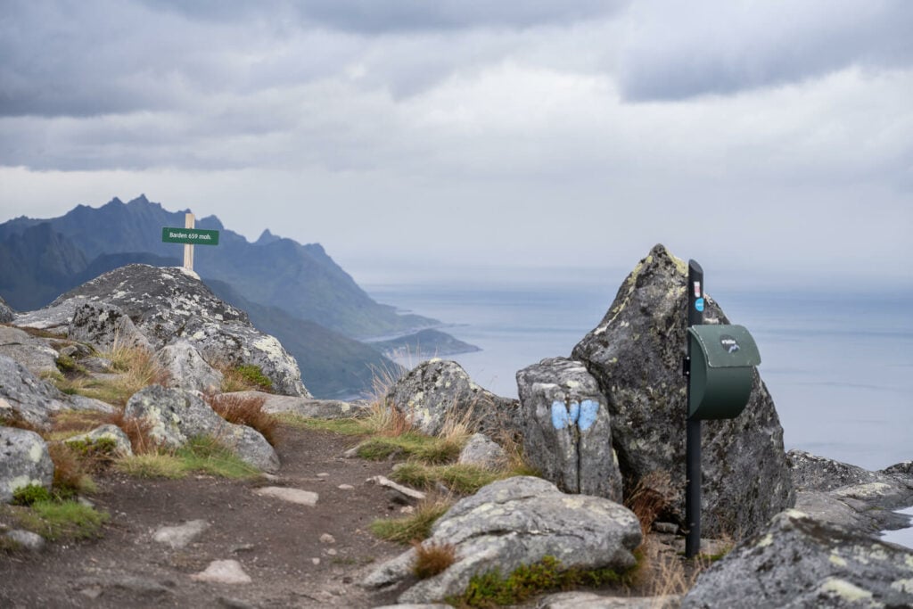
The summit and the box with the logbook.
The Barden Hike Photos and Photography Tips
Admittedly I didn’t get much good light when I visited. Actually, I was lucky to be able to get up there at all, in between storms, Northern Norway can be like that.
Anyway, the landscape is amazing regardless. I think it works well on cloudy days too, with some drama in the sky and low-hanging clouds.
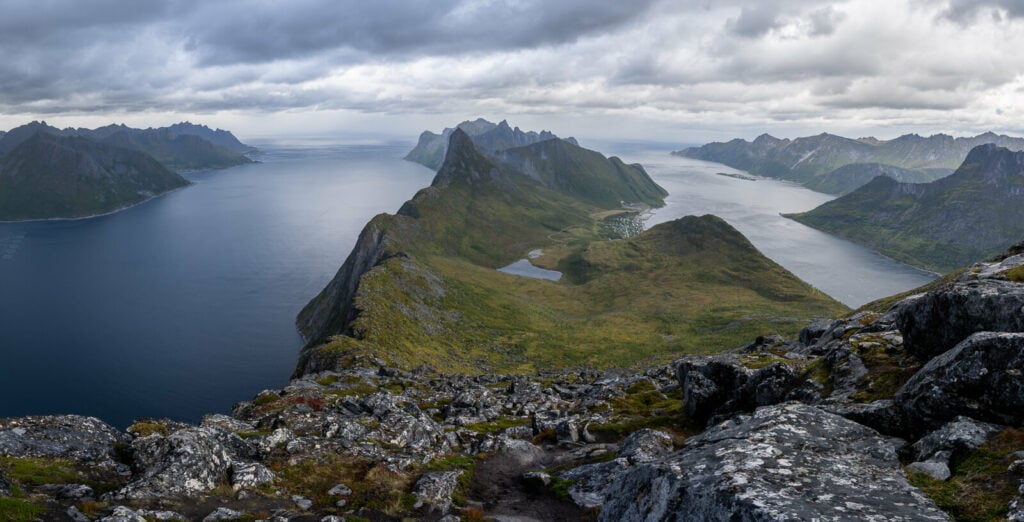
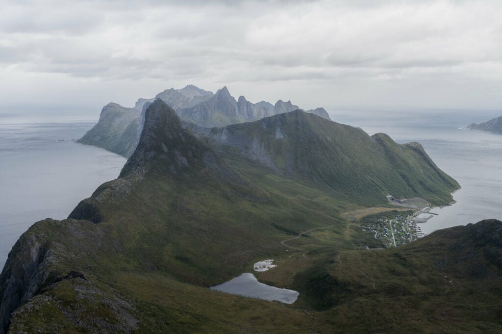
Panoramic image from the summit.
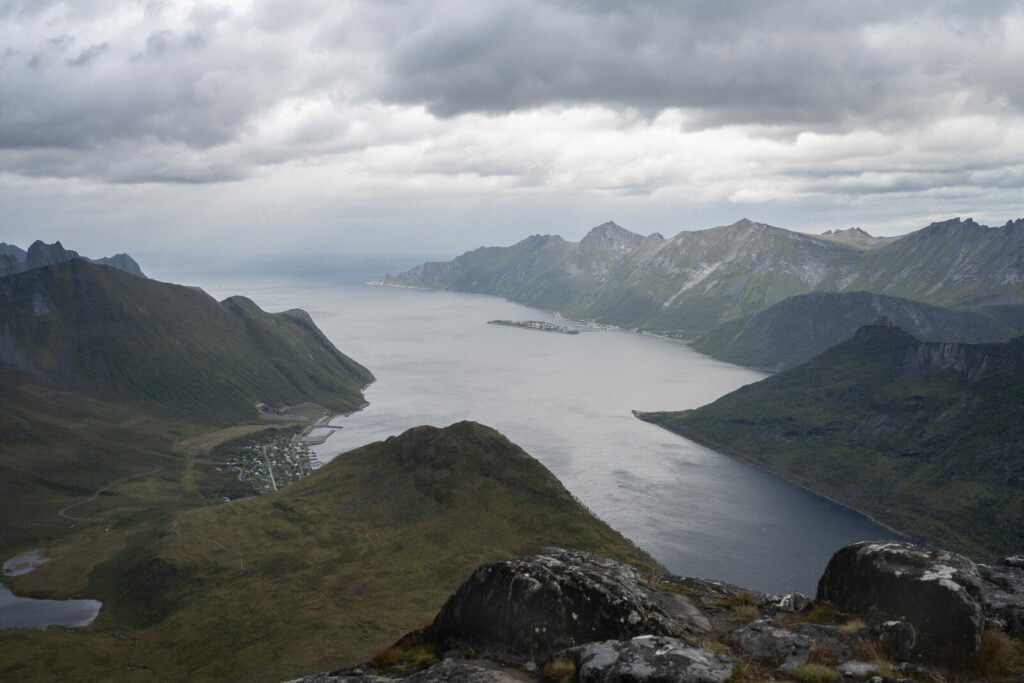
Fjordgard, on the left.
However, this would be a great golden hour/sunset hike, since the location faces north-west. I can imagine the scene with the sun setting right in front of you, or crossing the horizon during the midnight sun.
But I get it; same as for the hike. If you have to choose only one for sunset, Hesten would probably have to be the one. I have not been to the top of Barden for sunset myself (yet), but I am surely planning on it.
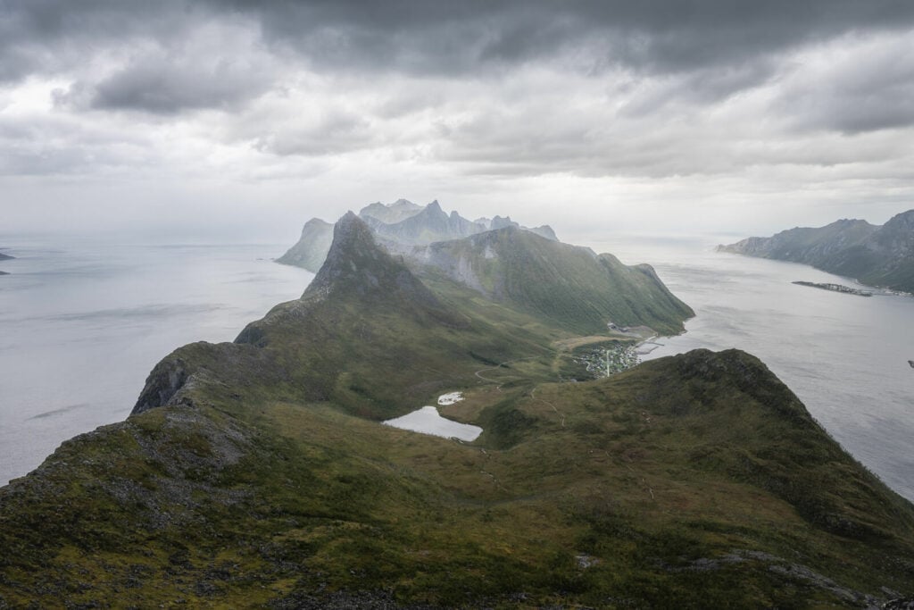
Anyway, in terms of landscape, the summit of Barden is the one that offers the best view of the whole peninsula where Fjordgård is located. You can see all the main summits from here, Segla, Hesten, Stavelitippen and the might Inste Kongen.
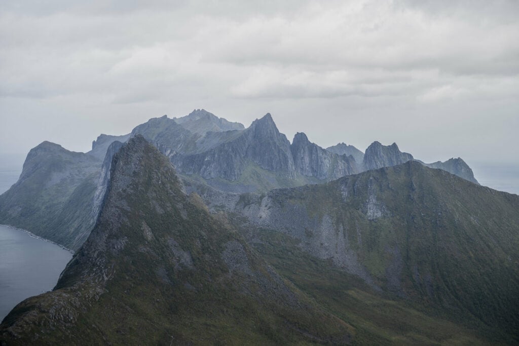
So bring a telephoto lens too if you have one, to zoom in on some of those beautiful mountains.
Segla, the first mountain on the left.
Light on the mountains, 200mm shot.
Lastly, assuming you comply with all local regulations, you could fly a drone here. I could not due to the very strong winds.
Where to stay
There are a couple of accommodations available in Fjordgård, B&B and guest houses. Please note it is not allowed to camp around Storevatnet, as it is Fjordgård’s drinking water reservoir.
If you have a van, it is possible to overnight in the parking lot by the school (paid), which has some basic facilities, and by the Harbour (paid too as of 2023).
Additional Resources
- Check out these other amazing Hikes on the Island of Senja: Segla, Husfjellet, Keipen and Grytetippen, Inste Kongen and Kongeporten, or Hesten and Stavelitippen.
- You can check the main page on Hiking in Norway for more Hikes and inspiration.


Leave A Comment