The Husfjellet Hike, Senja, Norway
The Husfjellet Hike is one of the top hikes on the Norwegian Island of Senja. And a very popular one too, for good reasons. Stunning landscape, impressive cliffs, and amazing panoramic views. All the ingredients you need for a perfect hike with stunning views.
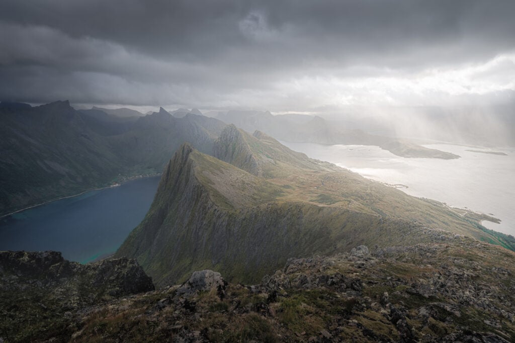
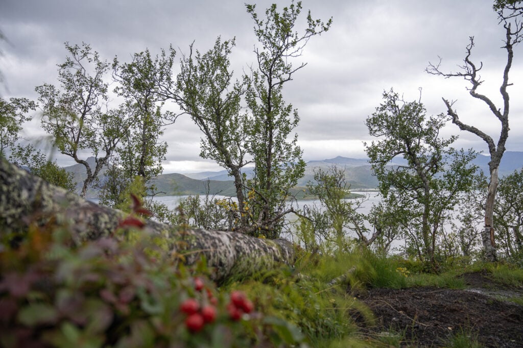
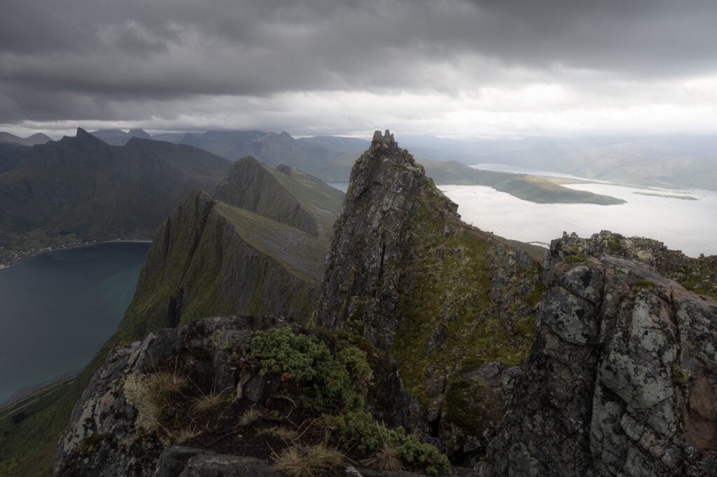
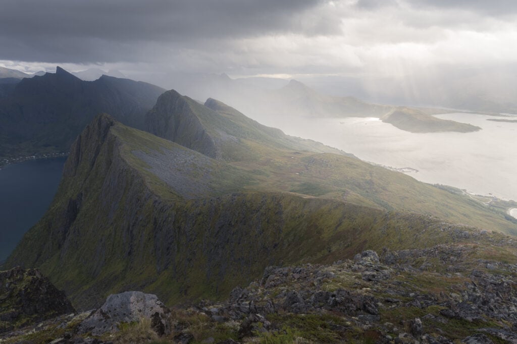
View of the ridgeline below Husfjellet.
The hike is relatively easy and it’s a great way to experience the dramatic landscape of Northern Norway. The trail from Skaland to Husfjellet will take you through diverse terrain, including rocky sections, grassy slopes, and potentially snowfields, depending on the season. Essentially, it is also a good “summary of what hiking on the island of Senja looks like.
If you have plans to Visit Senja and Hesten or Segla, you should absolutely put Husfjellet on the list. The drive from Fjordgård to Skaland only takes about forty minutes and it’s an extremely scenic drive too. It’s actually one of the National Norwegian scenic routes. Well…for that reason it will probably take longer than forty minutes but you get the point :)
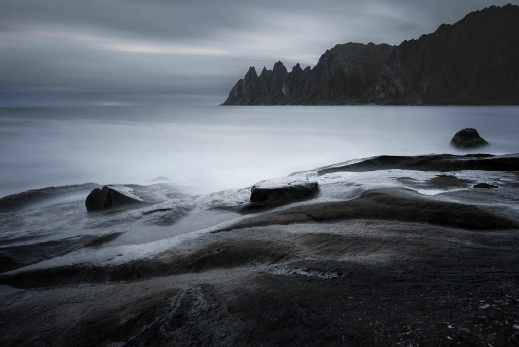
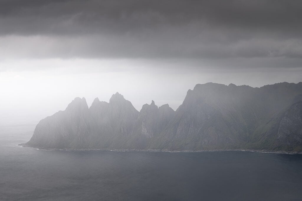
Tungeneset and the Oksen mountain in the background. One of the many attractions along Senja’s scenic route.
Table of Contents
Overview of the Husfjellet Hike
While the hike is relatively easy per se, the elevation gain is not negligible but the effort to get to the top will reward everyone with incredibly beautiful views.
| Max Altitude | 632 m |
|---|---|
| Distance | 8.70 KM |
| Elevation gain | 860 m ↑ / 860 m ↓ |
| Hike time | 03:00/ 03:30 Hours |
| Hike Difficulty | Easy/Moderate |
Enjoying the views!
How to get to Husfjellet and Parking
The island of Senja is quite remote but relatively easy to get to – so is Skaland, the town where Hisfjellet is located.
- Driving Directions: From Tromso, you would first need to drive to Finnsnes, then take road 86 to Strumsbotn. From there, continue onto Road 862 and continue onto Road Fv251. It’s about 3:30/4:00 hours. From The Evenes airport to Skaland you also need to get to Finnsnes first. Then follow the same directions. It also takes about the same time.
- Parking: paid parking is available at the trailhead. You can pay with the EasyPark app.
- Public Transport: Bus 362 stops right in front of the trailhead. From Finnsnes (Finsness quay) you can take bus 360 and then change in Straume to 362. Otherwise, you can take bus 380, change to bus 370 in Lysnesnand then bus 362 in Senjahope.
The Husfjellet Trail
Trailhead is next to a parking lot in the small Village of Skaland. you could say the trailhead is located at the center of the village :). It’s also well-marked and signposted so you will have no trouble finding it.
The first part of the trail is partly on a gravel road and partly in a birch forest. It is a well-worn trail so it’s also easy to follow. Then the trail will turn into a small birch forest and the steepness of the trail will gradually increase. The views will start to open up as soon as you’re out of the birch forest, revealing the beautiful coastal scenery.
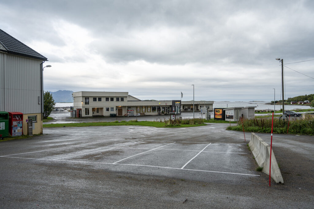
The Parking area by the trailhead in Skaland
The beginning of the trail
Birch trees on the trail to Hisfjellet
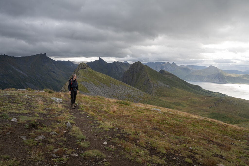
Next, you’ll reach a smaller summit (Sommardalen, 327m) on the way to the top of Husfjellet. From there you will need to continue through a quite flat and boggy section before the last but if the climb. Careful here; there is a boardwalk to help you through the bog but it can be very slippery and you may fall, hit and bruise your hip and your elbow (yes, real story ;)).
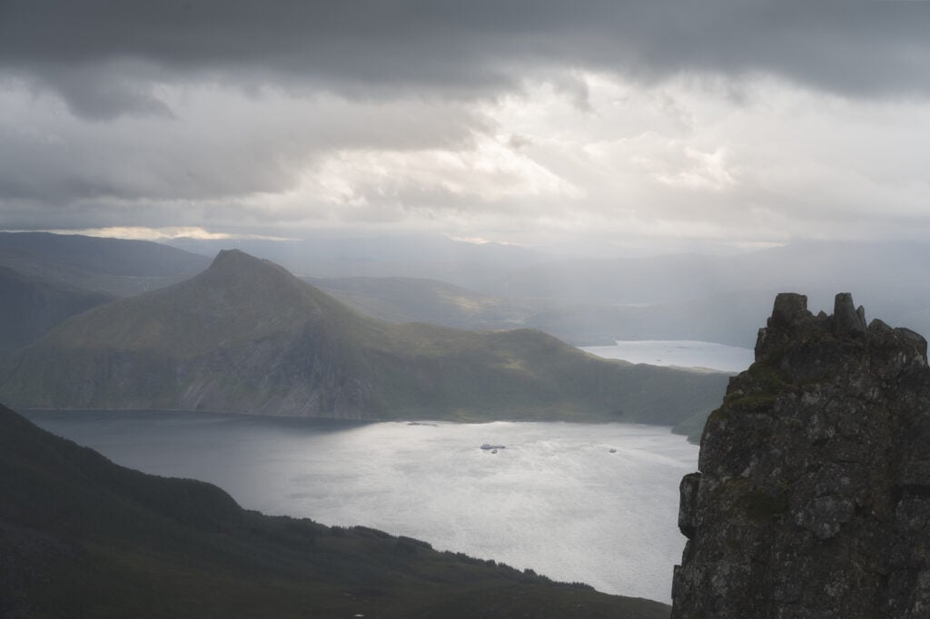
Half on the way up there’s an amazing viewpoint that offers an amazing view of Steinfjird, Ersffjord, Tugneneset and the Mountain Oksen. Here’ you’ll be just a short hike away from the summit, marked by a post.
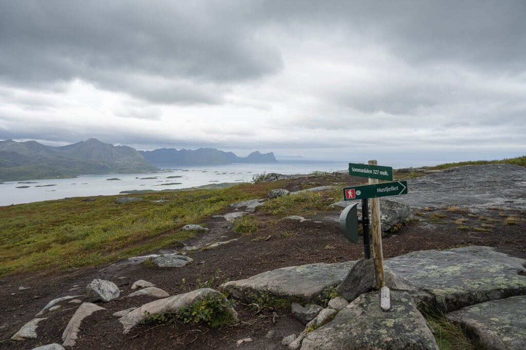
The Summardalen summit.
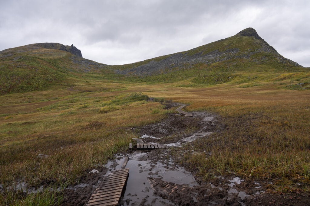
the trail continues on across the bog. Husfjellet is the mountain on the left hand side.
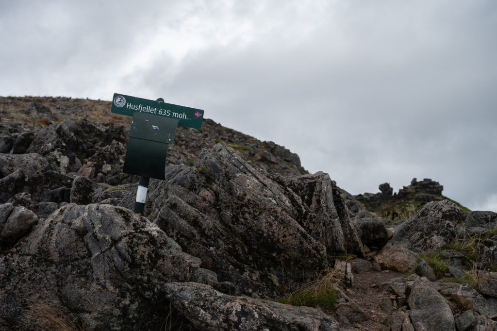
Husfjellets’ summit signpost.
Once you’ve reached the summit you can continue onward to the cliffs overlooking Steinfjord and Ersfjod. You should definitely explore those sections as they offer the best views, but you should also be aware the terrain becomes progressively exposed, so it requires a good head for heights as well as sure-footedness. No need to go all the way out on the cliffs though,
You should definitely take your time here to sit down a bit and enjoy the amazing views!
View from the cliffs around the summit.
The Husfjellet Hike Photos and Photography tips
This is a location that offers plenty of photo opportunities and it’s one I will also return to.
If you are also planning to do this hike for photography, you should definitely be there in the early morning or late afternoon, if not for Sunrise or Sunset. Husfjellet is a location good for both. I did it in the early AM and was lucky enough to enjoy some amazing light.
Dramatic light mixed with rain on the other side of the fjord.
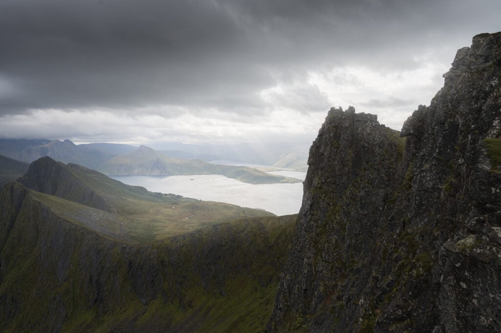
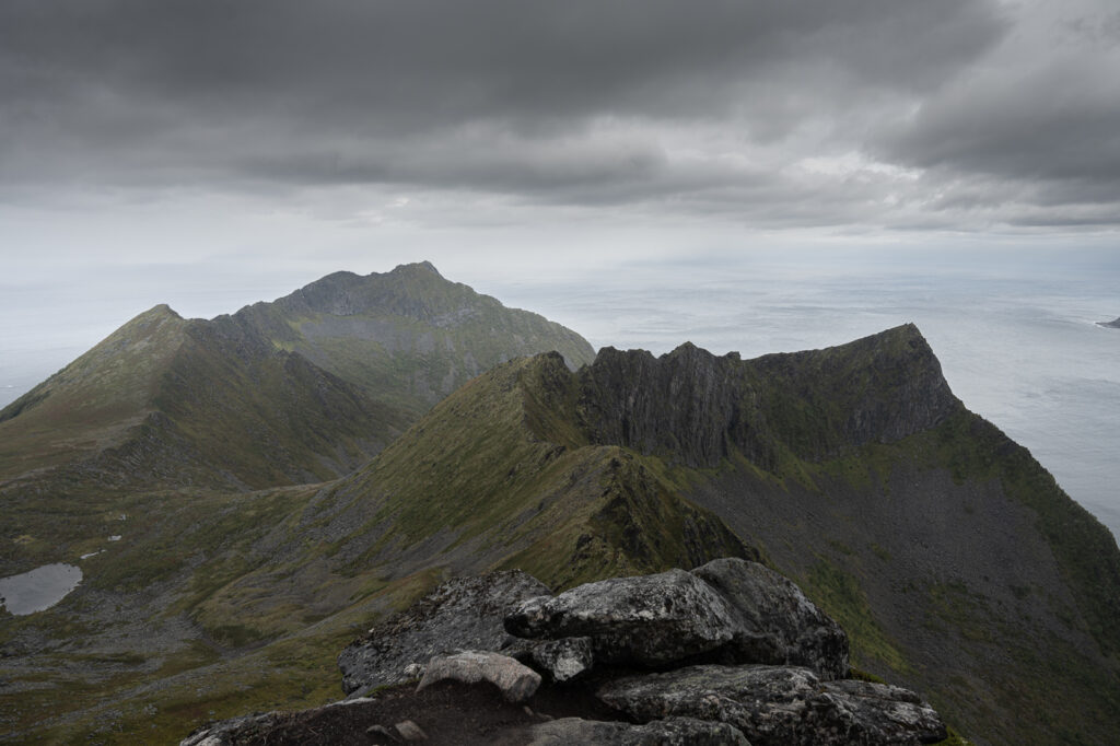
View from the cliffs beyond the summit
The mountain Oksen from a vantage point just below the summit.
More dramatic light and rain.
Detail of the mountains in the distance
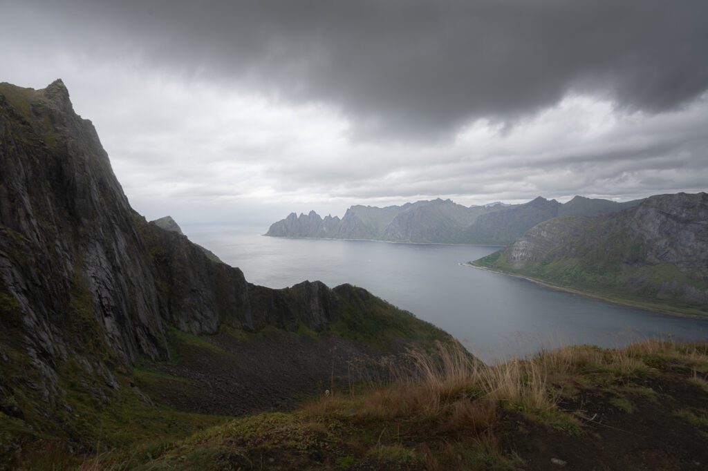
View from the summit. to the north-west.
While it was enough overcast to completely destroy any hope of a colorful sunrise, the heavy clouds also left space for some light to peek through in between them and the frequent snow showers. I definitely enjoyed watching and shooting the clods and that light as the conditions were changing very fast too. Anyway, from the top the views are magnificent in all directions so there are also plenty of compositions to choose from. The ridgeline just below Husfjellet to the east is particularly beautiful.
Also – this is where you can take the “classic” foto of someone standing on one of the nearby cliffs. If you are thinking of doing that, be aware that is also very exposed. I did plan to take a similar shot too, but the strong winds and slippery rocks made it unsafe to even attempt.
You also get fantastic views of the so-called “Devil’s Jaw” (the mountain Oksen), which is a beautiful subject from anywhere you look at it. This is particularly good in my opinion, compared to the more classic view from the Tugneneset rest area.
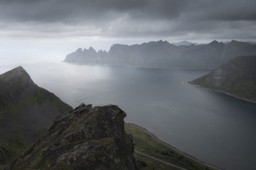
The beautifully bizarre Oksen mountain
Detail of Oksen, 70mm
Video of the Hike
Last but not least, you can also watch the video I made on this hike – it also includes a final timelapse.
Map of the Husfjellet Hike
Here is the map of this hike. You can download the GPS file from the link Komoot activity, should you want to.
Where to stay
If you want to camp, it’s possible to do so on the mountain, provided you respect all the local regulations, which you can read on the board by the trailhead.
Alternatively, there is a campsite in Skaland, as well as a couple of guesthouses. If you want, you can also do this hike in half a day and then move to another location. For instance, I spend the night before the hike in Senja at one of the guesthouses and then moved on to Fjordgård to hike Barden in the afternoon.
Additional Resources
- Here’s my full Senja Hiking guide, with the best hikes in the region and trip-planning tips.
- The island of Senja is an amazing place for a Hiking holiday. Here are some more amazing hikes on this beautiful Norwegian island: check out Hesten and Stavelitippen, Segla, or Keipen and Grytepippen.
- If you are in the area, check out the official page of Norway’s scenic routes on the Senja island.
- Check out the main page on Hiking in Norway for more hikes in Norway.


Hello Marco:
As long as the weather is good, we really want to go on this Husfijellet trail. We (total 10 persons, 2 cars) are planning to be there on March 17, 2024. Is it a good timing? How will the road conditions be like? We will stay the night of March 17 at Mefjord Brygge. Will there be high possibility of seeing aurora then? Hope we have enough luck.
Hi Sandy,
Yes, the spring equinox is a great time to catch the northern lights, weather permitting. It’s also the solar maximum, which means higher chances of intense aurora displays. I will be in Iceland chasing the lights too at that time, fingers crossed!
On hiking to Husfjellet: getting to Skaland, where the trailhead is, should be no problem unless there’s a raging snowstorm. You can check road conditions and traffic information here.
As for hiking to the top, I have not been there in winter, but I will most likely depend on how much snow and ice there is on the trail. If there is snow you may need snowshoes, if there is no snow there will most likely be patches of ice on the trail or there ground may be frozen, so you may still need microspikes or Yaktrax.
If you are staying on the island of Senja, best to check with your local host about the conditions of the trail. Some locations offer guided snowshoe tours as well like the Skagi Lodge, so that would be a good starting point.
Hope it helps and enjoy your trip!
Hello Macro:
Thanks for your prompt response. The information you provided does help. We will enjoy the trip. Wish you have a wonderful Iceland trip, too.
Sandy