The Keipen and Grytetippen Hike – Senja, Norway
I had high hopes for my hike to Keipen (938m) and Grytetippen (885). This was my first time up the two mountains, and I knew the views were supposed to be amazing. Sure enough, despite the clouds around the top of the two mountains, the hike delivered.
Along with Hesten’s and Segla’s, these are the best views you can get on the Island of Senja. The hike is relatively short at a little over 9KM, but the terrain isn’t easy. Steep, muddy sections and scree fields with big boulders here and there are sure to keep you busy on your way up.
Still, this hike is well worth the effort, plus you get two summits and two different panoramic views on the same hike!
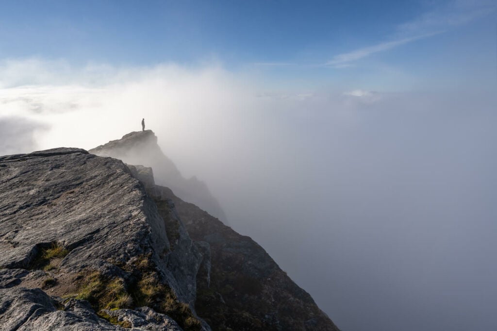
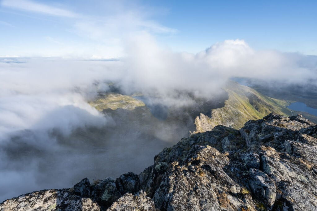
Above the clouds, on top of a peak next to Keipen.
Table of Contents
Overview of the Keipen and Grytetippen Hike
Note there are two possible trails. The main, marked trail starts on the side of road E826. This is also the one I am describing here. It’s also possible to hike up Keipen and Grytetippen from the Barden trailhead, the one before the gallery, to Fjordgård. I have not hiked that trail yet, but I will do that later this year and update the post accordingly.
| Max Altitude | Keipen (938m) and Grytetippen (885) |
|---|---|
| Distance | 9.41 KM |
| Elevation gain | 830 ↑ / 830 ↓ |
| Hike time | 5:30 / 6:30 Hours |
| Hike Difficulty | Moderate to Hard |
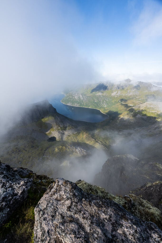
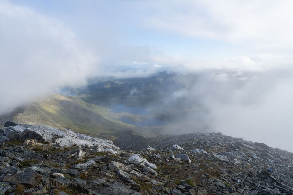
View from the top of Grytetippen
How to Get to Keipen and Grytetippen
Located along road 862, the trailhead is easy to get to but somewhat hard to sport when driving by. Watch out for the marked trail posts.
- Driving Directions: The trailhead is along road 862; click here for Google Maps coordinates. It’s just a few KM away from the village of Fjordgård. Watch out for the trail post marking the trailhead (see photo below).
- Parking: there are some small pullout areas along the side of the road you can leave the car. If those small areas are already taken, you would have to take the other trailhead. More parking places are usually available there.
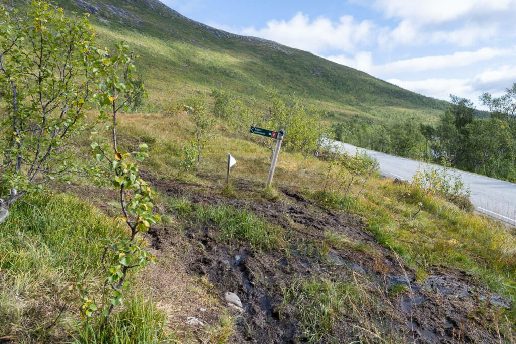
The trailhead next to road 862. Watch out for that trail post.
The Keipen and Grytetippen Hiking Trail
The first part of the hike is a muddy, steep climb up the side of the mountain. Slipping and falling into a mud puddle is a real possibility. While I like a hike over challenging terrain, the first part is not particularly fun. You’d spend most of the time trying not to fall in the mud.
However, there is a small creek on the side of the trail and some small waterfalls, which are pretty nice. And, should you fall in the mud, you could quickly wash in the river before continuing :).
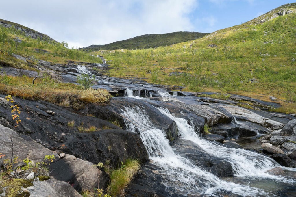
The small creek and waterfall next to the trail.

View from the trail, looking back toward the trailhead.
After about 40/45 minutes into the hike, the terrain will change from muddy to rocky. Next, you’ll have to cross a flattish area before reaching the last part of the climb across a scree field. Here you can choose which mountain to hike up first, as the trail splits.
If you want to go to Grytetippen first, keep to your left. For Keipen to your right. This second part of the hike is slow going. The scree field is steep, and it requires caution as several boulders are unstable. The trail isn’t very easy to spot either, but you can follow the small cairns other hikers left.
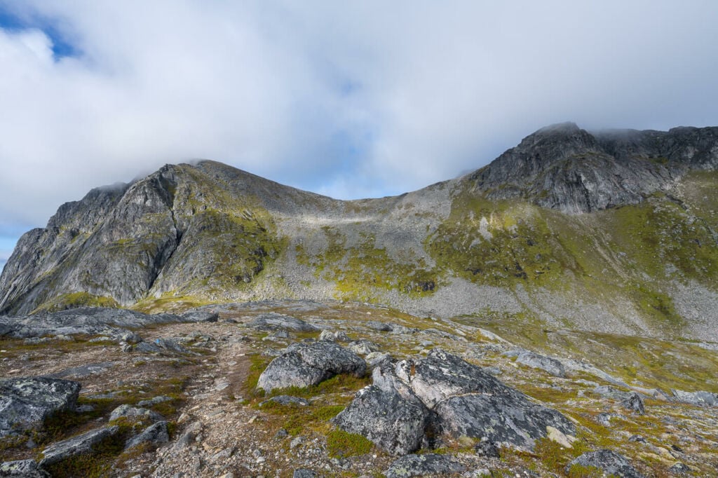
Grytetyppen on the left and Keipen on the right. The scree fields in the middle.

The ridge trail connection between Keipen and Grytetippen
Whichever mountain you decide to hike up to first, a ridge trail connects the two summits; it takes about 30/40 minutes to reach one from the other. Once up there, have a snack and a drink and enjoy the views!
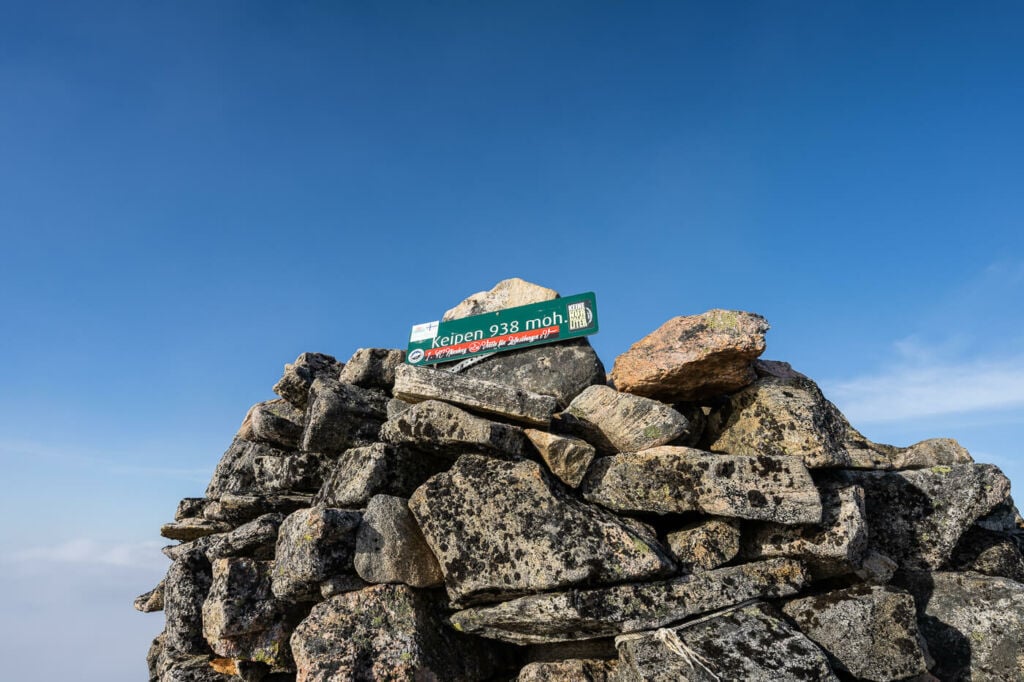
Keipen’s summit, the highest point on this hike.
Keipen and Grytetippen Photos and Photography Tips
This is a great sunset/sunrise hike. Especially Grytetippen during the midnight sun season, as the sun crosses the horizon just in front of the mountain. Unfortunately, I could not fit a sunset hike into my schedule also due to the weather, but I will try again next year. I’ll likely camp up the mountain, hoping to catch some northern lights too.
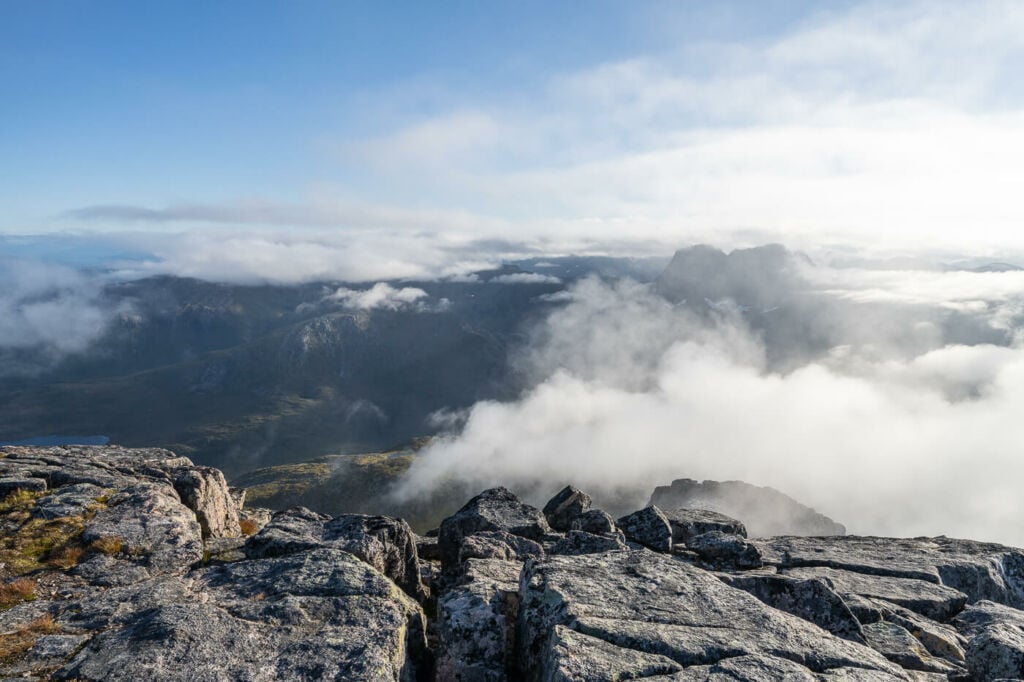
Although the views are incredible all along the hike, the most scenic and photogenic ones are on the top of the mountains and along the ridges connecting the two peaks. Overall, though, I personally preferred the views from Grytetippen.
You should definitely bring a wide angle or go for panoramas. Several rocks work well as your foreground, giving depth to the image, so anything from 14 mm up to 35 should work best for panoramic shots.
I didn’t find much use for a telephoto lens, but I am sure it can find its use at times. With the sun low on the horizon though, I’m sure there are plenty of opportunities.
I ended the hike with two selfies; mine and one of my Brocken spectre (photos below) :)!
View from the ridge leading up to Grytetippen’s summit.
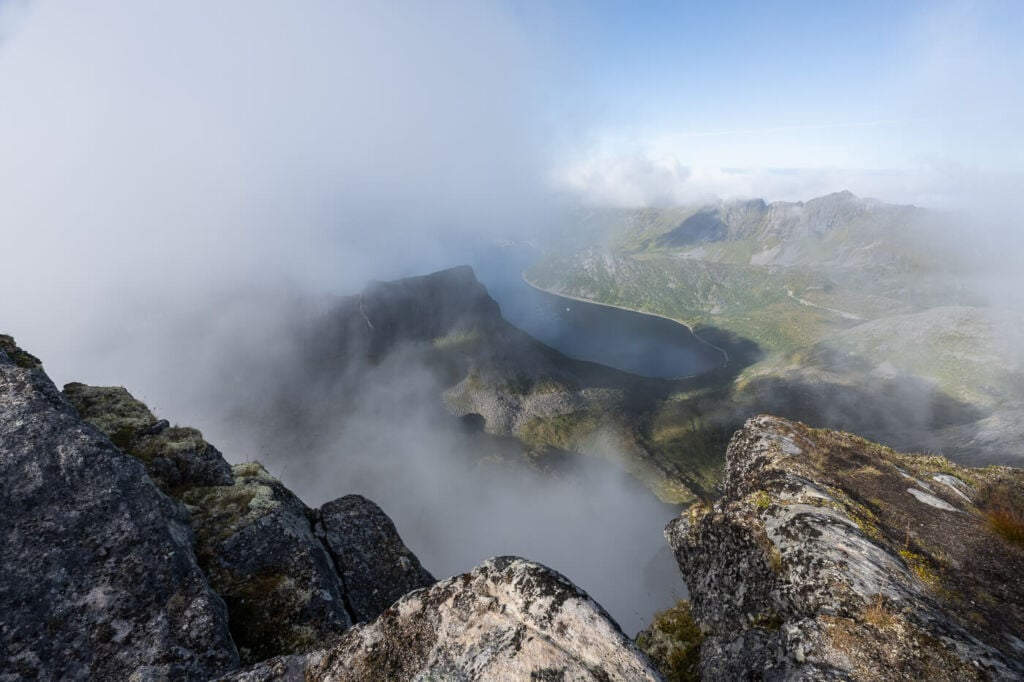
View from Grytetippen’s summit.

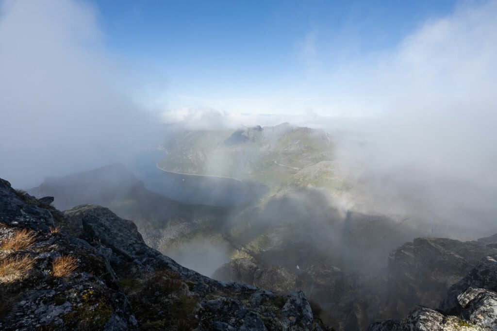
Yet another view from the summit :)
View from the ridge leading up ti Keipen’s summit.
Another view from the same ridge.

The panorama from just below Keipen’s summit, in the direction of the trailhead.
View from Keipen’s summit.
Selfie from the top of Keipen. Here I was actually looking at…

…my own Brocken spectre inside a fogbow!
Video of the Keipen and Grytetippen Hike
Below is a short video of the hike: nothing fancy, just the trails, some music and the views.
Map of the Keipen and Grytetippen Hike
Here is the map of the hike. If you want the GPX file, you can download it from the Komoot activity below:
Where to stay
There are a couple of accommodations available in Fjordgård, which is the closes village. The closest campground is Fjordbotn. However, keep in mind it is also possible to wild camp somewhere in the area, within the Allemannsretten regulations.
Additional resources
- Here’s my full Senja Hiking guide, with the best hikes in the region and trip-planning tips.
- If you are in the area, you can also check out the hike to Hesten (with a detour to Stavelitippen, if you feel like it) and the hike to Segla. Also, make sure to check out the hike to Husfjellet or Barden.
- You can check the main page on Hiking in Norway for more Photo Hikes and inspiration.
- Check out my Norway Hiking book recommendations to discover even more trails.


Leave A Comment