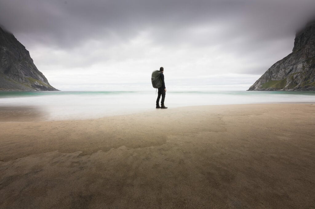
Kvalvika Beach Hike – a beautiful hidden beach
The hike to Kvalvika Beach is both one of the most popular and one of the best day hikes you could do on the Lofoten Islands. For good reasons. A beautiful, secluded beach where you can only see the sea, the sky, and the mountains. Here, apart from other hikers, it’s also hard to spot traces of civilization, which makes a visit to this beach all the more appealing.
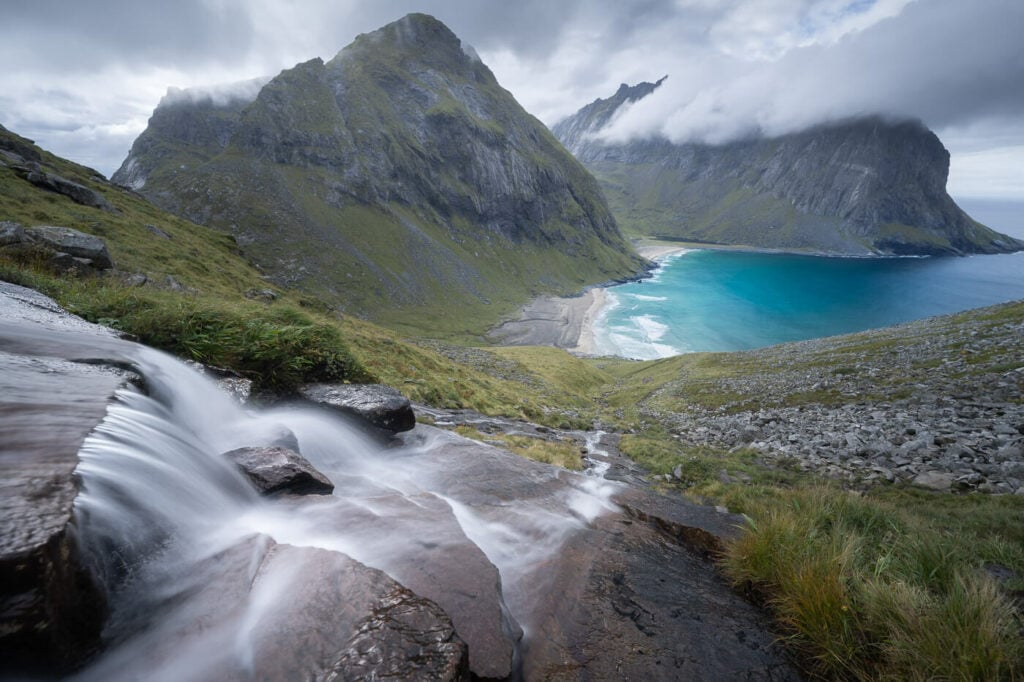
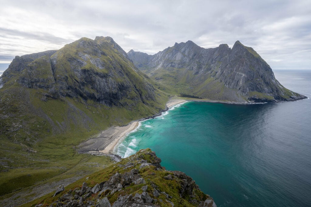
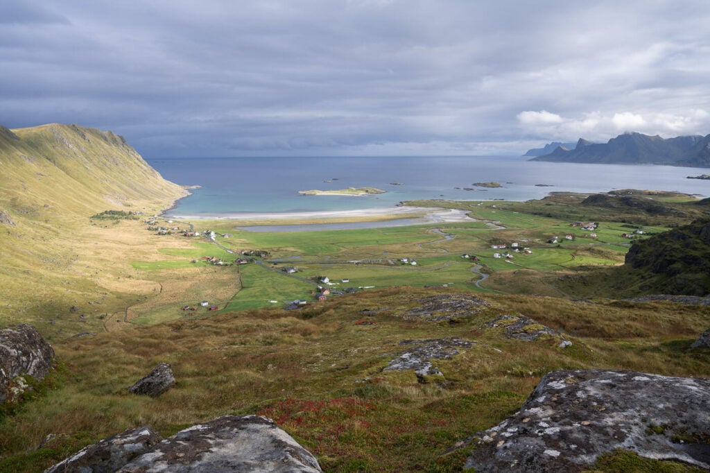
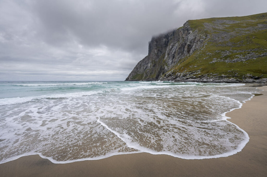
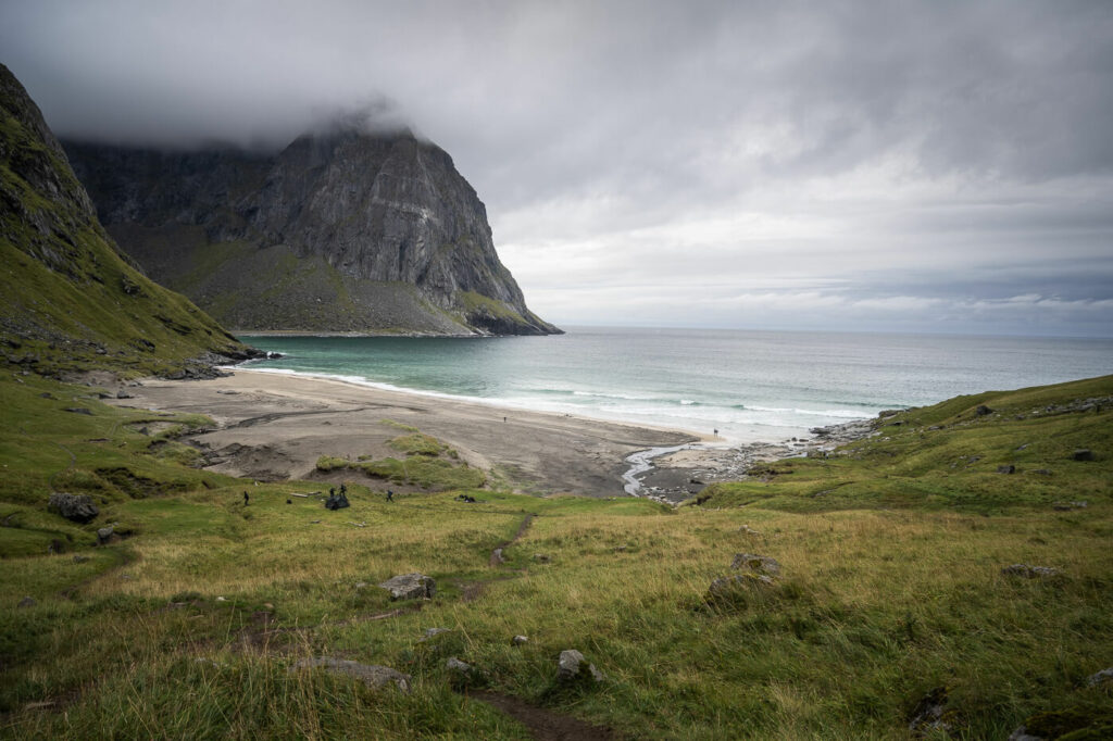
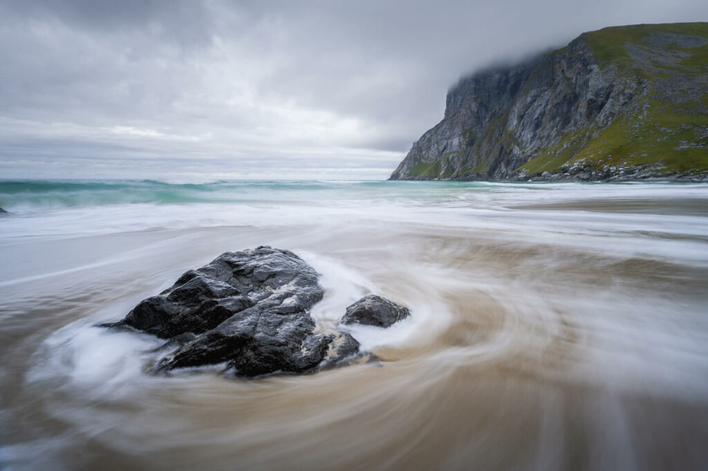
Kvalvika beach, from the Hiking trail connecting to Ryten.
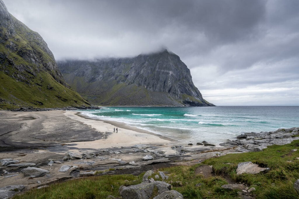
The whole scenery is just unique. Golden sands stretch out into the sea and dramatic rock formations punctuate the coastline. It’s a perfect spot for relaxation, picnics, and photography, with opportunities for swimming for the brave (given the chilly Norwegian waters) – provided the sea and the weather cooperate.
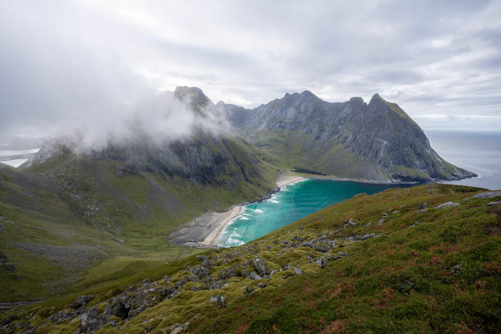
I’d highly recommended to combine this hike with a visit to Ryten. The views from this nearby mountain are just epic and well worth the effort of the additional elevation gain.
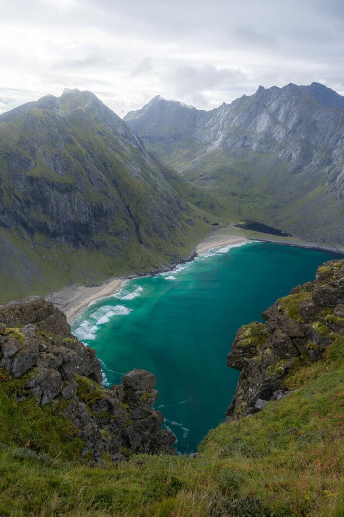
View of Kvalvika beach from the top of Ryten.
All in all, this is a fun, full-day hike, whether you decide just to hike Kvalvika beach or to include Ryten too. The views of this secluded little bay nestled in the fjords of northern Norway are second to none.
Table of Contents
Overview of the Kvalvika Beach Hike & Map
There are several different trails you can take to get to Kvalvika Beach, some shorter, and some longer. All of them are quite easy. More likely though, you will have to hike from one of the paid parking locations in Fredvang. The reason for this is limited parking spaces at other locations, but I’ll point you to all of them anyway.
Regardless of which route you will take, I think the longer loop hike is worth it just for the additional scenery and viewpoints. An even better route would be to include Ryten in the loop.
One tip: make sure you bring enough water with you on this hike; a recent paper reported finding a relatively high concentration of E. Coli in the freshwater sources around the beach and on the mountains. Essentially the water is not safe to drink. Yikes.
Anyway, the table below refers to the loop hike that starts in Fredvang. It’s the one I always did and the one most folks will take too. Still, I’ll also add a map of each other option.
Anyway, if you want a tip on when to go: September. Even if more and more people are visiting the Lofoten Islands in September every year, the summer crowds have already long gone.
| Max Altitude | 270 m |
|---|---|
| Distance | 9.59 KM |
| Elevation gain | 520 m ↑ / 520 m ↓ |
| Hike time | 03:30/ 04:00 Hours |
| Hike Difficulty | Moderate |
This is the map of the Kvalvika Beach Hike from Fredvang, the most common one:
Here is also the link to the shorter hike to Kvalvika Beach from the small, free parking area. Here is the link to the hike from the free southern parking area, longer and more challenging than the previous one.
Lastly, here is the link to the loop hike that includes Ryten.
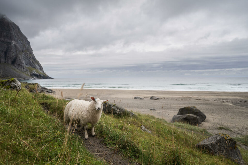
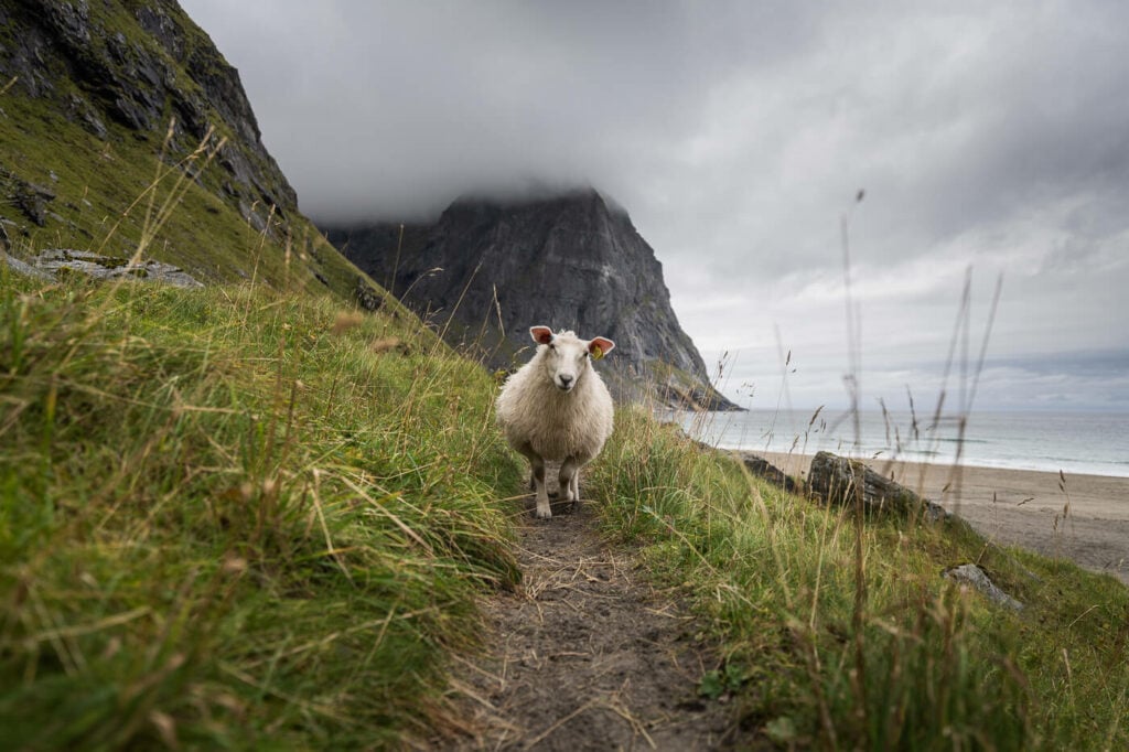
Hiking sheep on the trail :)!
How to get to Kvalvika Beach and Parking
This is one of the most popular and visited places in the Lofoten Islands. Finding a parking spot close to the trailhead in Summer (July and August) may be a bit of a challenge.
- Driving Directions: From the E10 (Kong Olaf road), whether you are driving from the north or south, you will have to turn toward Fredvang, at the bridge connecting the Moskenesøya and Flakstadøya islands. Keep following the road until you spot the parking signs.
- Parking: The closest, free, parking spot is here, but it is small you are unlikely to find a place here but it’s worth trying if you want to take the shortest route and only want to visit the beach. Otherwise, you’d need to resort to the other paid parking places in Fredvang. I usually park there anyway; I always prefer the look hike for the additional scenery. Anyway, there are three main parking spots in Fredvang, None of them free. The first parking area is by the Fredvang School. You can pay with the EasyPark app. The other two are on private ground next to a farm. One is here (this is where I usually park and the one I’d recommend) and the other one is here. Make sure you have cash with you to pay for parking.
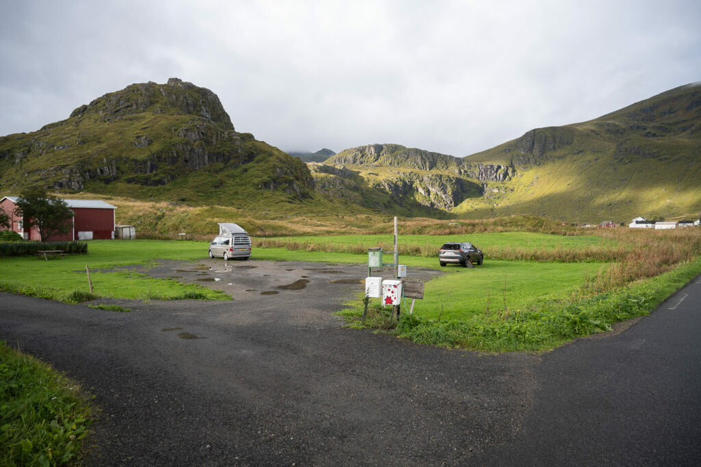
One of the two paid parking areas on private ground.
- Public Transport: The closest bus stop is Fredvang Nord, where buses 300 and 771 stop. However, this isn’t the best option as buses will stop here once a day, from Monday to Friday. Here you can check the timetable. The walk to the trailhead is about ten minutes, more or less the same as the parking lot by the school.
The Kvalvika Beach Hiking Trail
The first part of the trail from the Fredvang parking is flat and likely to be muddy. The trail borders some fields along the mountains. there are some boardwalks on the muddiest sections, but be careful because some of them can be quite slippery.
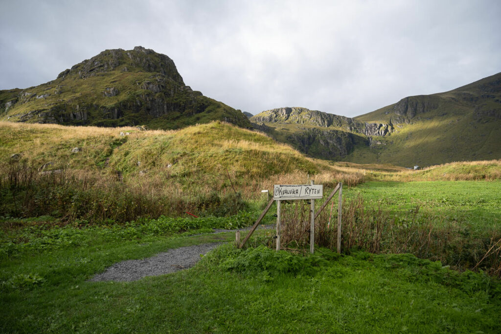
Anyway, you won’t have trouble finding the trailhead, there are plenty of signs all around the area.
After about a KM a moderately steep ascent begins. With it, the views will gradually open up.
Next, you’ll reach a small lake and then you will have the steepest, but short, part of the trail ahead of you. There also are some chains you can use for balance and to pull yourself up the trail without having to scramble on the rocky and muddy terrain. The chain must have been installed relatively recently, as they were not there a few years ago.
Also, this is a good location for a stop to take in the views of the mountains and the fjords around you. I’d say a hike up there is worth the views in itself.
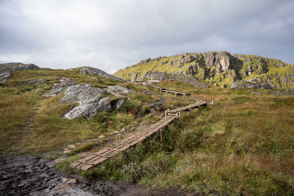
Next, the trail continues up the mountain and the trail is largely covered in boardwalks. These are much more stable and better finished than the ones at the beginning. So that means much quicker progression and drier feet.
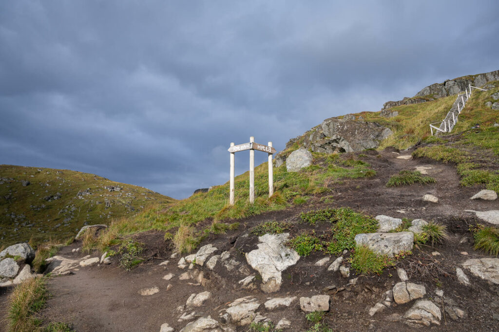
You’ll also pass by a sign pointing to a hut – keep left for the beach – unless you want to take a detour to the hut. Again, keep following the boardwalk. Yes, there are many – this is a good thing both to preserve the vegetation and to avoid walking through some very boggy areas.
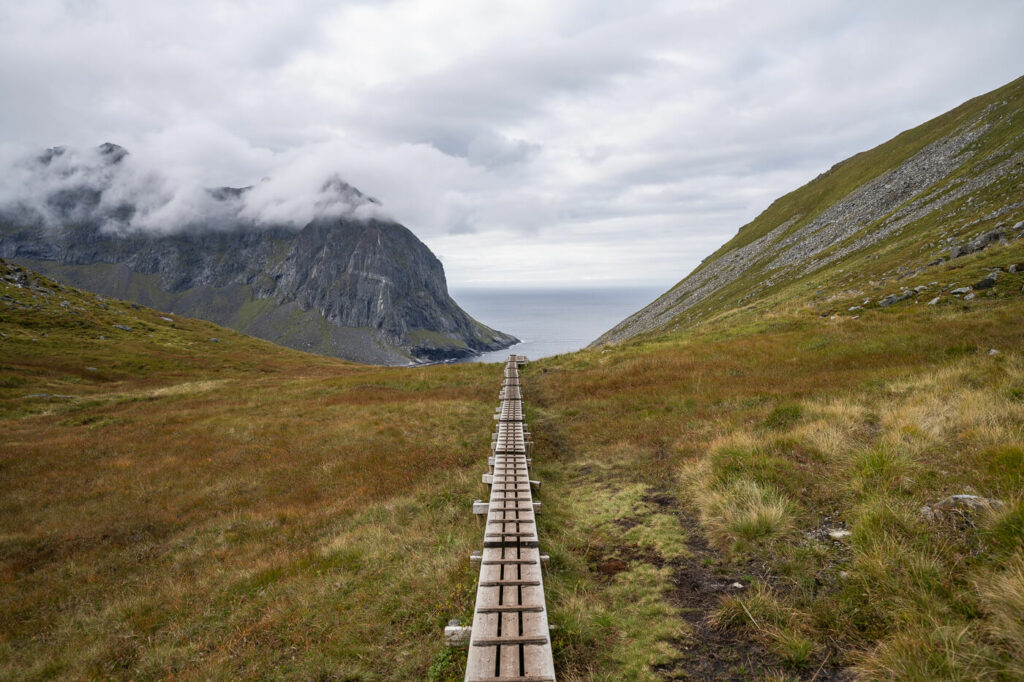
Your next waypoint will be the saddle where the trail to Ryten and Kvalvika beach split. Again, keep to the left to descend to Kvalvika Beach. You’ll see the beach from here already, so no chance for errors. Also because – you guessed it – there are some boardwalks again, at least to cover the first part of the descent.
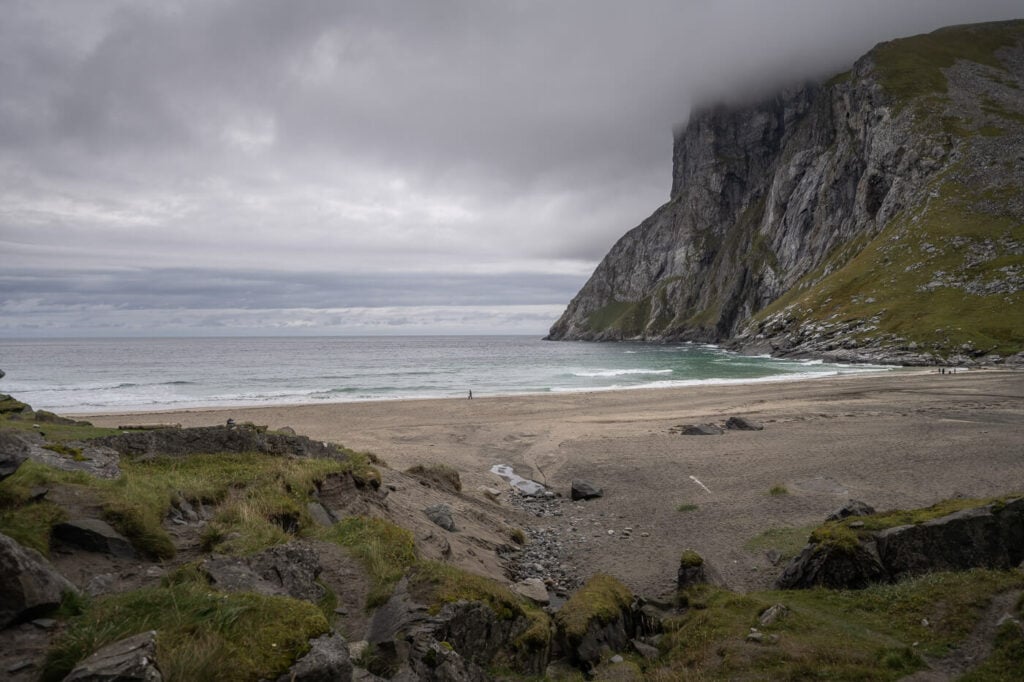
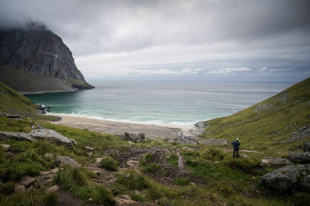
Anyway, here’s a tip on a viewpoint: if you want to get some better views of the beach from above without having to hike up to Ryten, you can walk about 10 minutes uphill to a fantastic lower viewpoint
There you’ll find some cliffs that offer views, in my opinion, as good as the ones from Ryten’s summit.
Lower Kvalvika beach viewpoint.
Now back to the trail to Kvalvika. The walkboards only cover part of the descent to the beach, the rest it’s all dirt and mud. You can stop by a small scenic waterfall next to the trail, about halfway down.
From the waterfall, it will take another 15 minutes or so to reach the beach. There you’ll have a fantastic view of the imposing wall of rocks that enclose the beach.
Kvalvika beach, from the Hiking trail connecting to Ryten.
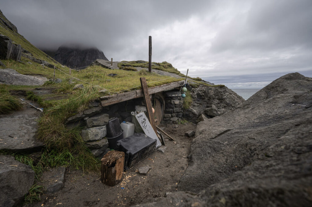
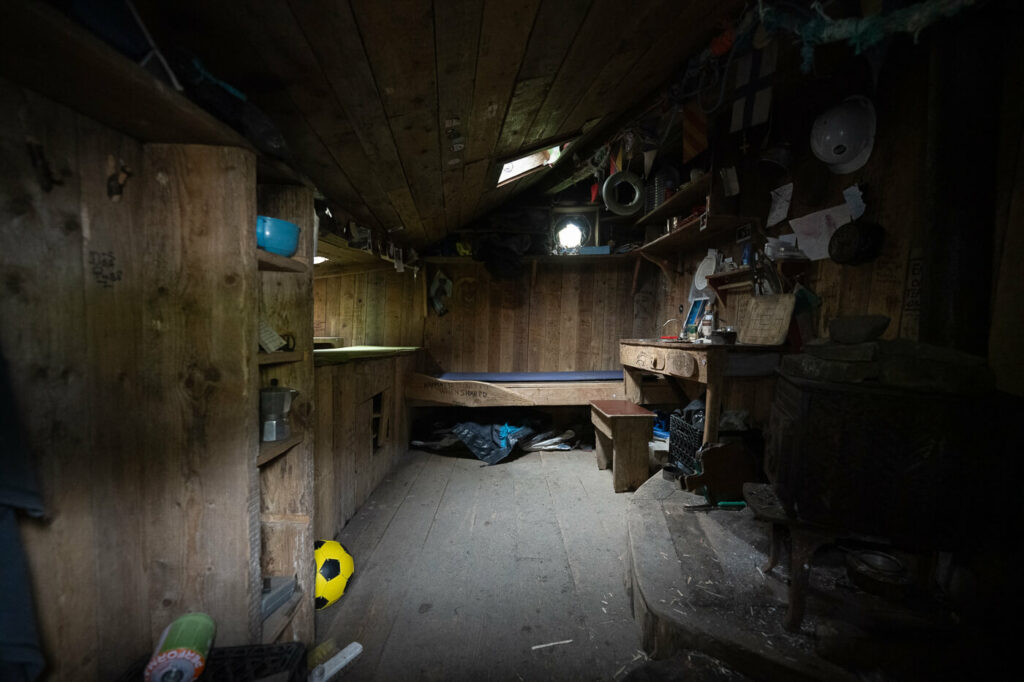
Another novelty you will find on Kvalvik Beach is the hut that was built as part of the documentary “North of the Sun“. I’d recommend watching it if you haven’t already. But anyway, the hut is still there and it is viewable.
To close the loop, you can either hike back the same way or take the other trail that leads to the free parking area. From the parking area, you’d then have to walk along the road for a few hundred meters and hike up to the saddle
Kvalvika Beach Photos and Photography Tips
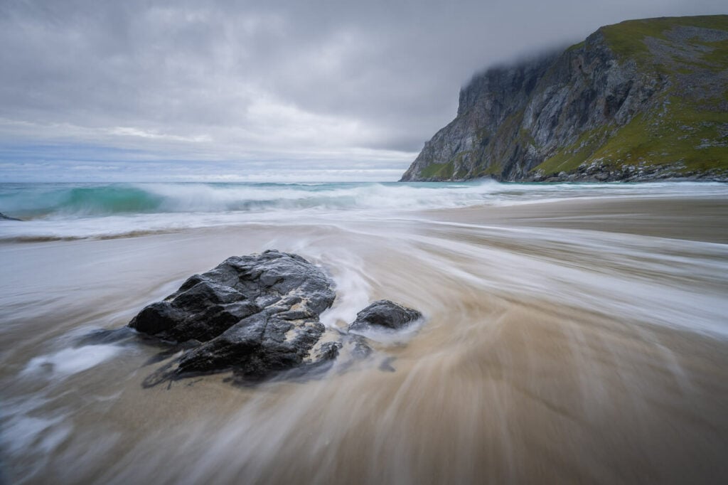
First and foremost, seascapes. there are several good spots along the beach to take some seascapes, so do bring your tripod and ND filters. The best foregrounds I’ve found are in between the two small beaches. There are some rocks that can be included in the foreground to create some depth.
Second, the light. To be honest, it’s not great here. The beach typically does not catch that much light and is mostly in the shadows because it is essentially nestled between mountains on three sides.
Of course, that does not matter on cloudy days. However, if you want to catch sunrise/sunset, it’s best to go in September. The sun will set right in from the beach, which also means opportunities for a good golden hour earlier in the day.
Anyway, if you are doing this hike for landscape photography, you’d definitely need to get up to Ryten too!
Video of the Hike
For a better feel for the trail, here is also a short video of my last hike to Kvalvika beach and Ryten:
Where to stay
Kvalvika Beach is a great place to camp, especially if you are visiting during the midnight sun season. If you plan to visit Ryten, that is also a good place to camp, with plenty of space.
- The Lofoten Beach camp in Skagsanden is the closest one.
- Ramberg also offers accommodations and additional facilities like coffee shops, supermarkets, and dining options. Fredvang also has a few options.
Additional Resources
- Planning a trip? Here are my tips for planning a trip to the Lofoten Islands
- Check out the Ryten Hiking trail, if you just want to hike to Ryten instead.
- Check out the main page on Hiking in Norway for more hikes in Norway.


Hi! I heavily utilized your recommendations throughout my trip to Norway the past two weeks so I wanted to say a big thank you for taking the time to write up everything!
A few notes on this hike in particularly it would have been great if you could mark with GPS coordinates where the “10 minutes uphill to a fantastic lower viewpoint” is actually located. I ended up wandering around to see if I could figure out where it was.
Also for those not in the know I didn’t realize that the sign Hytta was was what you were referring to when you talked about the hut.
Additionally “Your next waypoint will be the saddle where the trail to Ryten and Kvalvika beach split. Again, keep to the left to descend to Kvalvika Beach. You’ll see the beach from here already, so no chance for errors. ” The saddle point where the hike split you definitely could not see the beach I would say there was quite a bit more walking and some more boardwalks before the beach was actually visible.
Additionally, the area where the boardwalks end and the stone sherpa steps begins is wildly muddy and the trail was closed to the beach. I believe they’re still working on the stone steps and it’ll be done in the next year or so?
Anyways thanks again!
Thanks Joanna, I appreciate the time you took to share your feedback! I just looked it up and yes, they are still building the stairs and the trail is partly closed. I could not find any clear info on when they expect to complete it, but I think that’s good; the trail was very muddy in that area.