The Ryten Hike, Lofoten Islands
The Hike to Ryten is one of those hikes to a location with something primordial. The hike isn’t challenging, but there’s something about the view above Kvalvika Beach that makes this location unique. Perhaps it’s the hidden beach or the impressively steep mountains around it. Whatever it is, here’s where you can enjoy some of the finest views in the Lofoten.
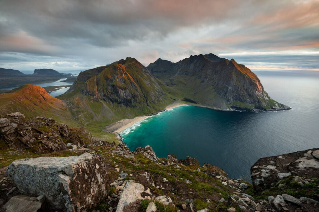
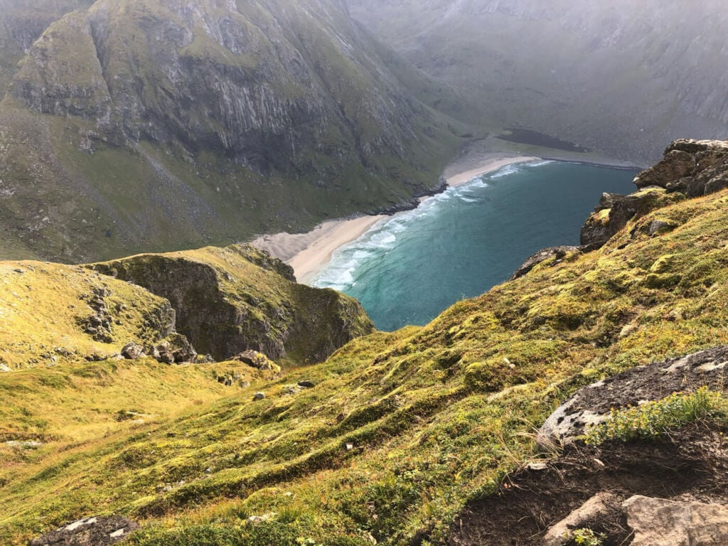
The view from one of the many ledged overlooking Kvalvika beach.
This is also a very popular location for the same reason. So popular you can see the trail up the side of the mountain from the opposite side of the fjord! Anyway, don’t be scared by the crowds. This is a fun day hike and one of the very best in the Lofoten. The views are spectacular throughout, the trail isn’t particularly difficult and well worth your time.
Anyway, I’d highly recommend to also include a detour to Kvalvika beach. The hike will take an additional couple of hours, but it’s time well spent.
Table of Contents
Overview of the Ryten Hike & Map
The hike isn’t particularly difficult or demanding, but there are a couple of relatively steep, although short, sections. The hiking trail to Ryten is likely to be very muddy in places, so bring waterproof shoes/boots or just accept you may get wet feet.
| Max Altitude | 460 m |
|---|---|
| Distance | 8.16 KM |
| Elevation gain | 460 ↑ / 460 ↓ |
| Hike time | 3:00/ 3:30 Hours |
| Hike Difficulty | Moderate |
Here is the map of this hike. you can download the GPX file for free from the activity linked below:
How to Get to Ryten
The Ryten trailhead is located in the village of Fredvang, which can be reached either by car or public transport.
- Driving Directions: From the E10, whether you are coming from north or south, you will have to turn toward Fredvang, at the bridge connecting the Moskenesøya and Flakstadøya islands. Keep following the road until you spot the parking signs.
- Parking: There are two paid parking lots. One on private ground, close to the trailhead, here. The other one is by the school, a little further away – 10 minutes walk – from the trailhead. This is a popular place that can get very crowded, especially in high season, so it pays off to be here early o late in the day.
- Public Transport: The closest bus stop is Fredvang Nord, where buses 300 and 771 stop. However, this isn’t the best option as buses will stop here once a day, from Monday to Friday. Here you can check the timetable. The walk to the trailhead is about ten minutes, more or less the same as the parking lot by the school.
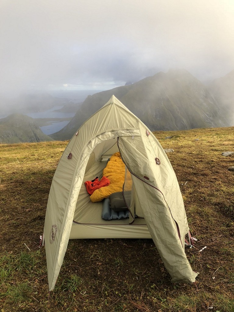
My trusty ultralight Big Agnes Fly Creek UL HV on Ryten.
The Ryten Hiking Trail
The trail is relatively easy, and there are exposed sections – although there are a couple of short, steepish sections
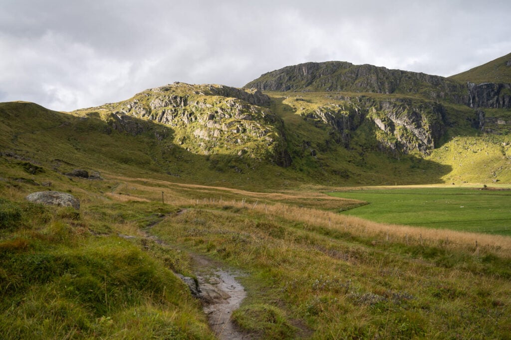
Anyway, The first part is rather flattish and can be boggy, but there will be walkboards for part of the way. Still, I’d recommend being careful here, as the boards will likely be wet and slippery.
The ascent to the summit can be divided into two parts. After the first 15/20 minutes on a flat trail, you will come across the first part of the climb. at its top, you will reach a small lake and you’ll have a pretty good view of the fjord ahead of you, toward Roren and Ytresand.

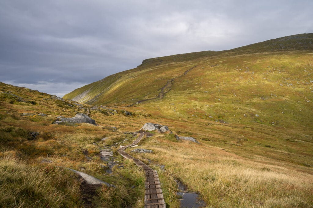
From there, the trail continues up the mountain; here you’ll have the second, steep part. you’ll find some chains bolted to the rock you can use to pull yourself up. While having chains on the may sound scary or challenging, they are there mostly for balance – still, be careful.
Once past this part, you’ll have another section on boardwalks, which makes for some easy walking. Next, the trail will fork; to the left for Kvalvika beach and the right for the summit of Ryten.
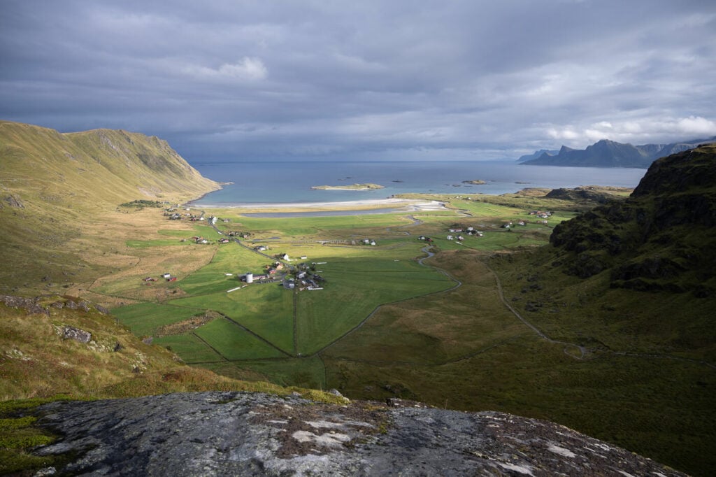
Again, you will have great views over the bay until you reach the rocky ledges just below the summit. there, you’ll have a full view of the beaches below. The Kvalvika Beach panoramic viewpoint is not the actual summit; if you want to bag a peak and visit the real summit, you will have to walk for another 10 minutes in the opposite direction to Kvalvika Beach, until you find the cairn that marks the summit.
If you have time, you can combine this hike with a visit to Kvalvika Beach on your way down the mountain.


Sunrise on a late-September morning
The Ryten Hike Photos and Photography tips
There are many great views on the way up, especially as Kvalvika beach becomes visible. Undoubtedly, the best views are from the many rocky ledges below the summit.
I used anything between 14 and 200 mm. You’d need an ultra-wide lens to capture the whole landscape of the beach and the mountains surrounding it. You can also find interesting compositions in the range of 100-200 mm as the views are open and wide, and there’s plenty of space.
In terms of light, it’s generally best to be here late in the afternoon. How much depends on the season at this latitude, but generally speaking, from the early morning until late afternoon, the beach and the west side of the mountain will largely be in the shadows. Check any of the sun position/calculator apps available before heading there.
Lastly, flying drones here is not allowed, as Ryten is part of the Lofotodden National Park.

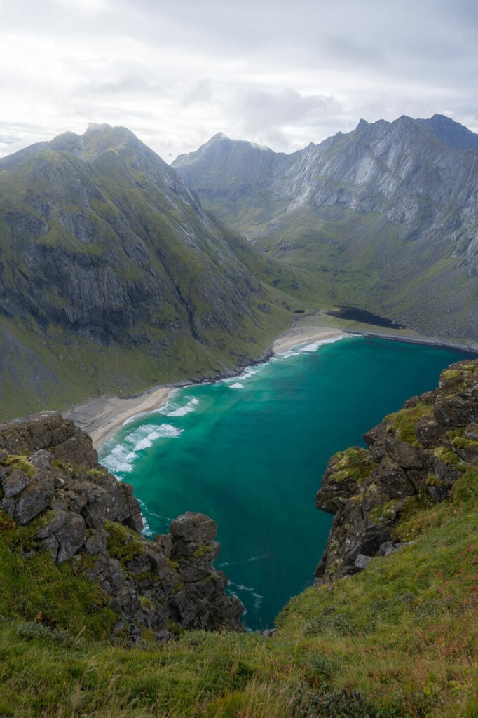
Kvalvika beach
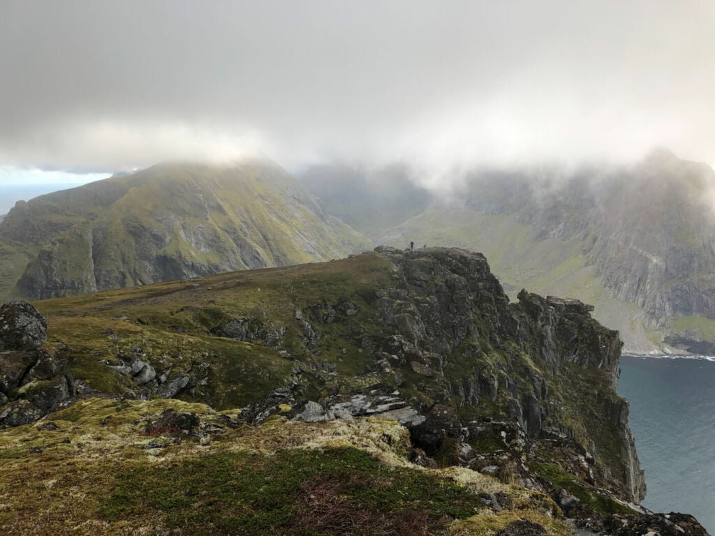
View from the actual summit of Ryten
The trail and some of the first views of Kvalvika beach.

Sun and rain on the mountain around Kvalvika beach.

Part of the coastline and the mountains of Flakstadøya

The Bridge in Frdvange – 200mm shot from Ryten.
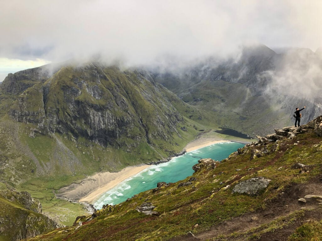
Selfie anyone?
Sunset over Kvalvika beach.
Video of the ach Ryten and Kvalvika BeHike
For a better feel for the trail, here is also a short video of my last hike to Kvalvika Beach and Ryten:
Where to stay
If you are into it, camping up the mountain is a great option. Plenty of space to pitch a tent as the top of the mountain is broad and flat-ish. Otherwise, there are several different options you can choose from if you are planning to spend the night in the area:
- The Lofoten Beach camp in Skagsanden and the Ramberg camping Ramberg are the closest ones.
- Ramberg also offers accommodations and additional facilities like coffee shops, supermarkets, and dining options. Fredvang also has a few options.
Ryten is also kind of conveniently located in between Leknes and Reine. So within about 30 minutes of driving you have even more choice for accomodation.
Additional Resources
- Planning a trip? Here are my tips to plan a trip to the Lofoten Islands.
- Check out the Hike to Kvalvika beach too.
- Check out the main page on Hiking in Norway for more hikes in Norway.


Looks like a beautiful spot. Hopefully travelling there from Canada in fall of 24
It is! Fall is my favorite time of the year to visit the Lofoten, hope you’ll manage to get there!