The Útigönguhöfði Hike, Þórsmörk Panoramic Views, Iceland
While the Hike to Útigönguhöfði in Þórsmörk is one of the lesser known and frequented in Þórsmörk, it is also the one that offers some of the most panoramic views of the whole Þórsmörk and Goðaland area.
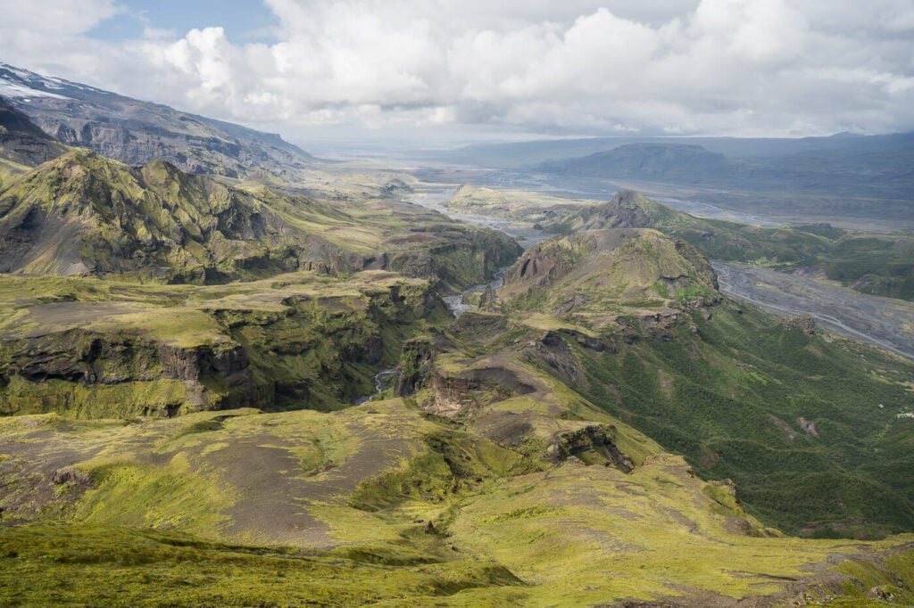
View from Útigönguhöfði
With a seemingly unpronounceable name for outsiders, Útigönguhöfði appears as a rather steep and imposing mountain with a sharp pear. It is the mountain that towers above the Basar campsite on the right side of the Krossá River.
The hike itself is very enjoyable and quite challenging in the last part, going over steep and soft-crumbly terrain, where you can help yourself with some chains to get to the top. There, spectacular views of the glacier, canyons, and mountains around Þórsmörk await.

Mountains, Glaciers, and Canyons south of Útigönguhöfði. View from the Summit.
Table of Contents
Overview of the Útigönguhöfði Hike & Map
There are a number of ways you can get to the top of Útigönguhöfði. The easiest way is taking the out-and-back trail from the Basar campsite. You can also include a detour into the lower part of the Hvannárgil canyon if you want to.

The other option would be taking the first part of the Fimmvörðuháls trail and then taking the first “red trail” detour. This would make it a much more longer and demanding hike – but I just wanted to mention it since that makes it possible to hike up to Útigönguhöfði from both its east and west sides.
In this post, I will describe the out-and-back hike, which is the one I did. The approach is from the west side of the mountain.
Hiking to Útigönguhöfði is only possible in summer.
| Max Altitude | 805 m |
|---|---|
| Distance | 5.5 KM |
| Elevation gain | 580m ↑ / 580m ↓ |
| Hike time | 01:45/ 02:15 Hours |
| Hike Difficulty | Initially Easy, Hard in the last part |
Here is the GPX track of the Útigönguhöfði Hike. You can download the GPX file for free from the activity linked below, should you want to.
How to get to the Útigönguhöfði trailhead and Parking
- Driving Directions: Don’t. Don’t drive to Þórsmörk unless you have a properly modified off-road vehicle and experience fording difficult rivers. It is too risky in terms of totaling the car in the river. The best way to do this hike is to catch a bus to Basar, the closest to the trailhead.
- Parking: again, leave the car at one of the pick-up points of the various companies offering transportation to the area.
- Public Transport: no public transport to Þórsmörk, but you can buy trips with Trex or Reykjavik Excursions. For this hike, stop at Basar, which is what I did.
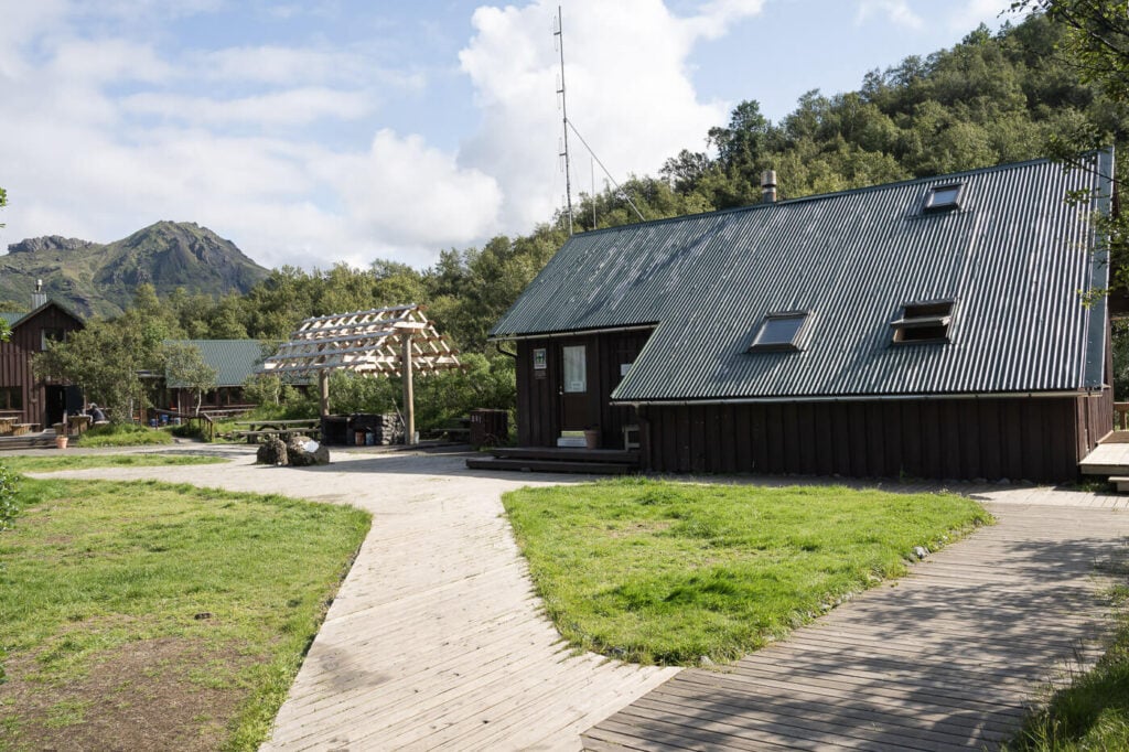
The Basar Campsite.
The Útigönguhöfði Hiking Trail
The trail out of The Basar campsite is nicely maintained and goes through a relatively thick birch trees forest. The views open up here and there until you are completely out of the bushes.

From this point onwards, the hike is relatively easy. The trail is marked with red trailmaks sticks, and you will have Útigönguhöfði right in front of you the whole time.
As you hike your way up the mountains the views will gradually open up revealing Canyons, Glacier and Rivers all around.

Looking back toward Basar – which you can see near the river on the right side.

One of the many Canyons in Thorsmork

One of the many glacier tongues in Thorsmork.
As you get closer to the mountain, the path will then become increasingly steep, and in the last stretch, you will find chains you can use to help with the balance.
Although the trail looks very steep, it isn’t as difficult as it may seem at first glance. Sure, you’ll need to be careful because it is steep and easy to slip, but it is not exposed. You just need to proceed with the due caution.


The last part of the trail, just below Útigönguhöfði’s summit.
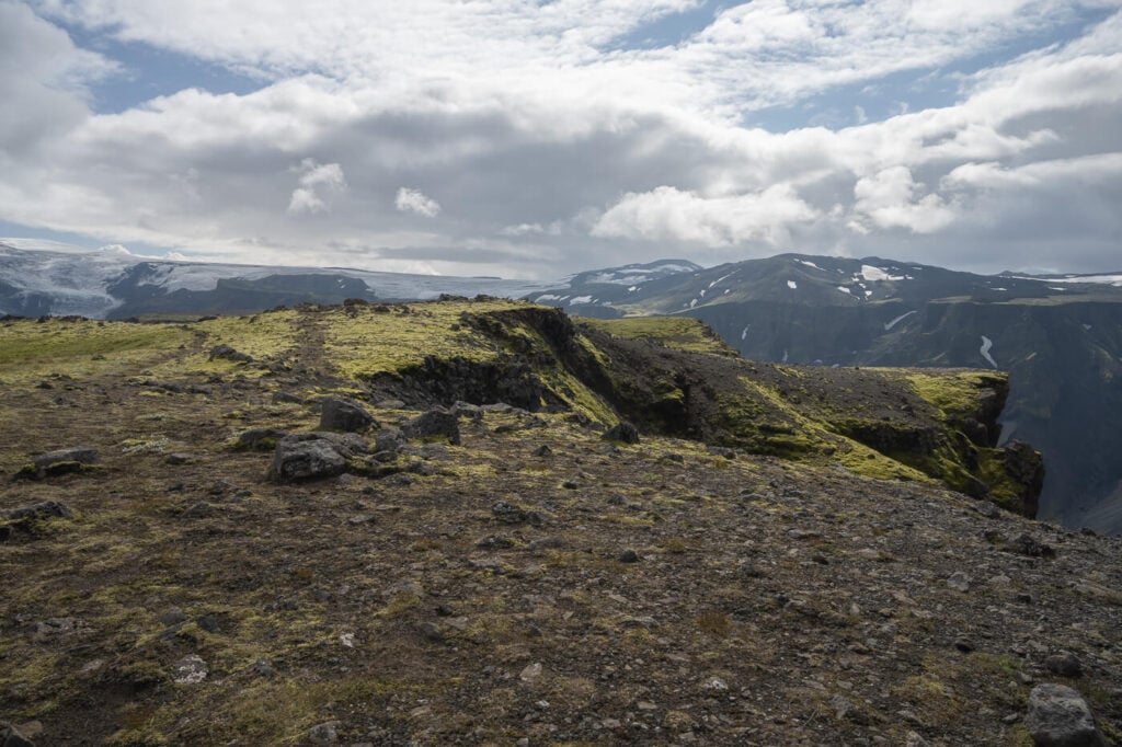
The Útigönguhöfði summit is a bit of a surprise, once you get there, you find a very wide, flat area – something completely different from what you’d expect from down below, looking at the steep sides of the mountain.
Anyway from up there you can wander around the top to get to several different viewpoints around the summit. All worth exploring.
The views are as you’d expect – 360 degrees fantastic.


Útigönguhöfði Photos and Photography Tips
The main benefit Útigönguhöfði offers is the wide-open view from its unobstructed, 360 degrees views from its summit. Such wide views open up to many different compositions – as well as making it a good location for both sunrise and sunset.
In any case, I’d recommend lenses ranging from 18 to 200 mm or more. you can see very far on a clear day, so longer lenses will be more fun to shoot with.


However, if you have one day and want to get the best shots in terms of landscape, you should probably hike Valahnúkur instead. It’s a smaller mountain, but it offers the best views in the Area.
Still, if you have the time for another short, half a day hike in Þórsmörk, definitely consider Útigönguhöfði too.
Where to stay
You essentially only have three choices in Þórsmörk:
- Volcano Huts: there is a hut with a restaurant, Yurts, and private rooms for 2-3 persons with shared bathrooms, apart from the camping. Also, there is a small hot pool available for use. And warm showers for guests. Here’s their website.
- Basar: Huts and camping available, plus other amenities that can be checked on their page.
- Langidalur: Hut and camping are available here too. Here’s their page.
Additional Resources
- Discover more hikes in Thórsmörk: Upper Hvannárgil Canyon Hike, the Stangarháls Hike, or Valahnúkur.
- Check out more Hikes and Photo Spots in Iceland (with maps) here.


Leave A Comment