Hike to Kitinden – a less frequented trail with Epic views, Lofoten, Norway
The Hike to Kitinden is a bit of a personal challenge. I have attempted to hike it several times, four to be precise. The first three times I had to retreat not even halfway up the mountain, due to bad weather. The fourth time, I almost made it to the top, but then some nasty weather pushed me back again.
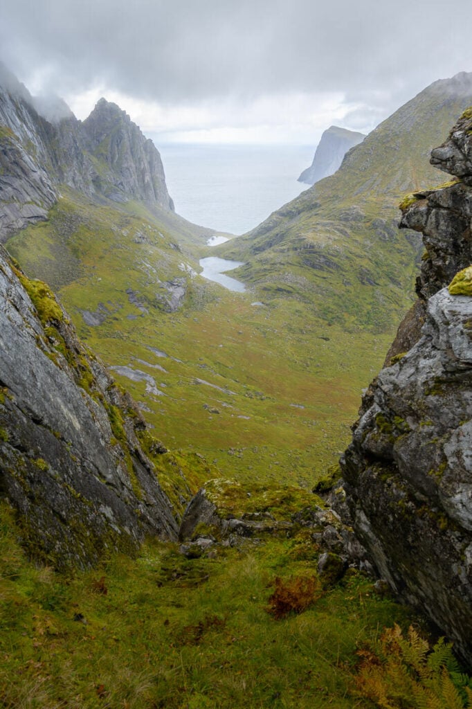
View from the trail toward Vestervika
But what’s so special about Kitinden?
First, this is not a hike you’ll meet many people on. More likely, you’ll meet no one. sure, it does not have the same views as the nearby Ryten, but you can still enjoy some fantastic landscapes away from the crowds.
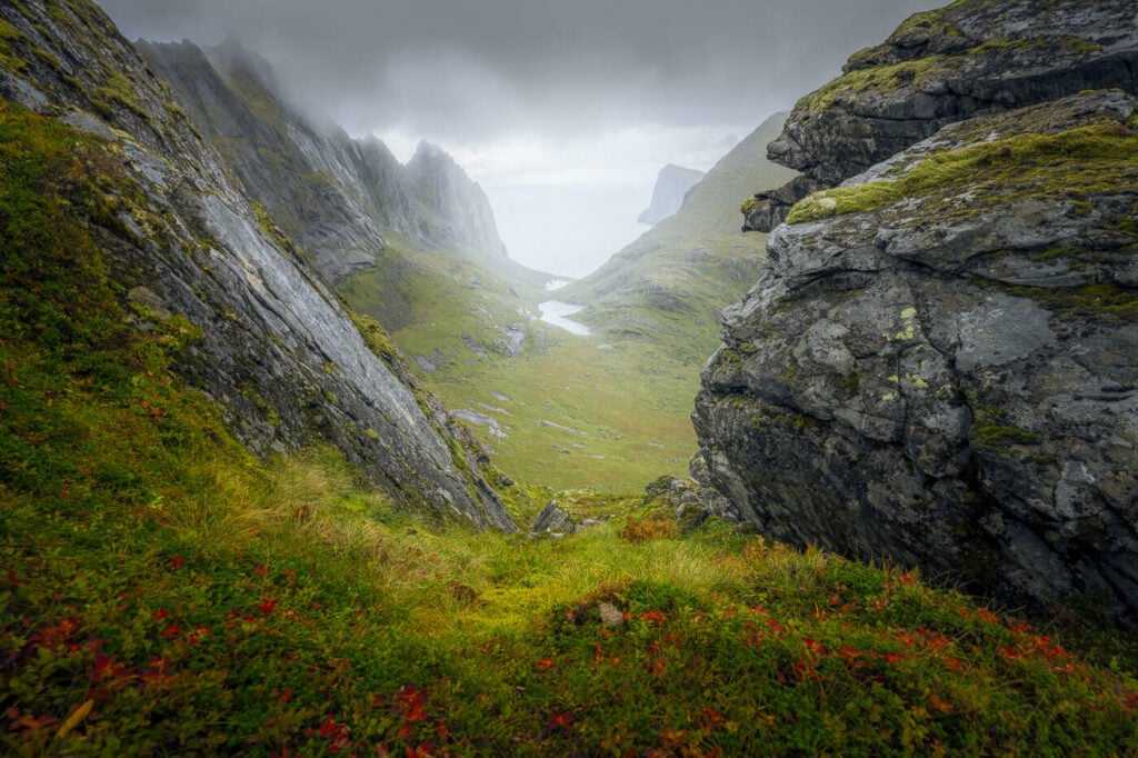
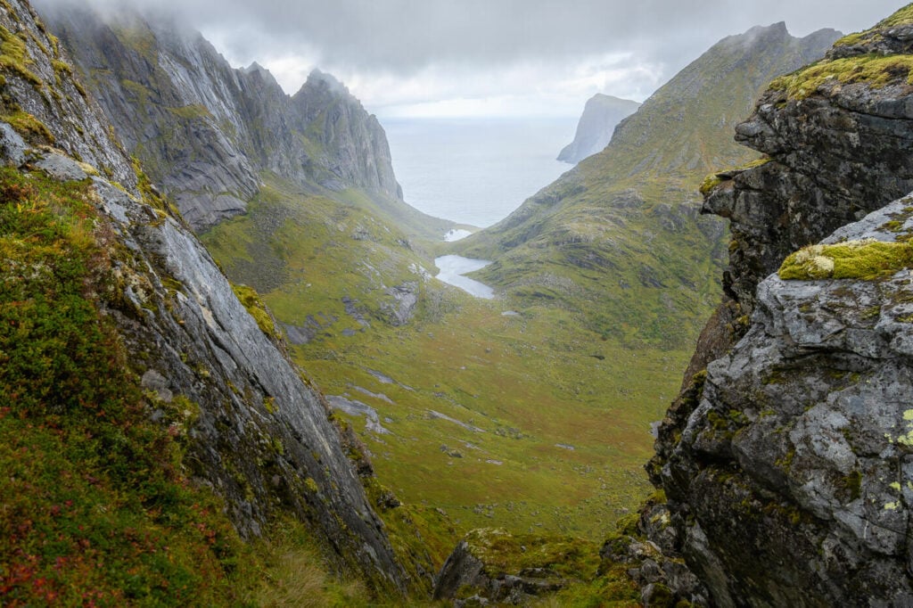
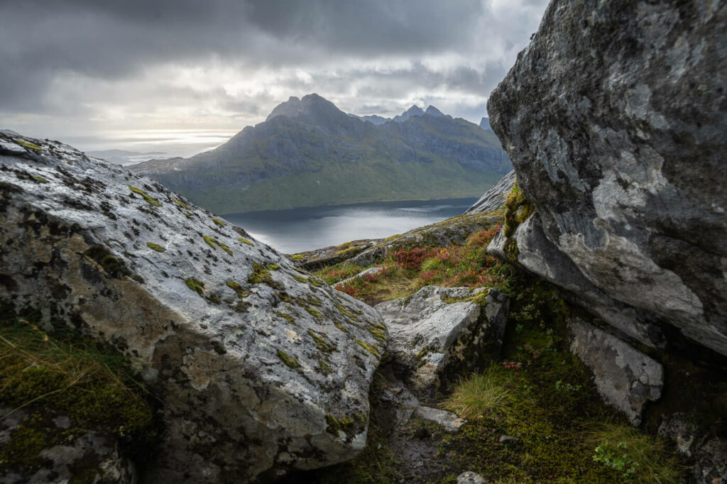
Second, the epic view from a specific point along the trail toward Vestervika Beach, just below the summit. This is a location I’m planning to go back to for the midnight sun when the conditions arise.
Vestervika beach viewpoint, the highlight of the hike.
Third, this is a mountain you don’t see many photos of, and that’s a perfectly good reason for me to go and explore.
All in all, the hike is moderately challenging, with some sections that require scrambling. Quite a steep grading throughout, but not too long of a hike. Still, well worth the views!
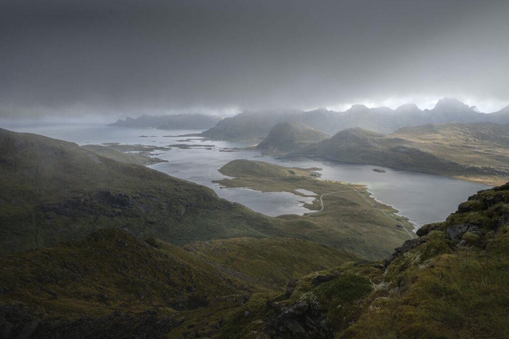
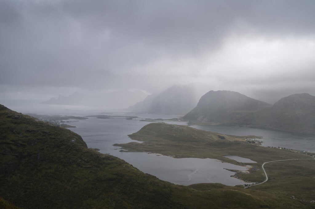
Panoramic view of the Flakstadoya island to the north of the trail
Table of Contents
Overview of the Hike to Kitinden & Map
Note: the hike in the map below is shorter than the actual trail because I did not make it to the top due to bad weather.
This isn’t an overly difficult or long hike, but carefulness is required especially in the last bit of the climb, where you will find many big and slippery, if wet, boulders.
It should be possible to hike from the end of May or the beginning of June, assuming the summit is snow-free.
| Max Altitude | 742 m |
|---|---|
| Distance | 11.5 KM |
| Elevation gain | 650 m ↑ / 650 m ↓ |
| Hike time | 03:00/ 03:30 Hours |
| Hike Difficulty | Moderate, |
And here’s the map of the hike
How to get to Kitinden and Parking
Unlike the more famous hike in the Lofoten, the trailhead isn’t exactly the easiest to find. Nothing marks the trailhead, and it isn’t easily visible from the road.
- Driving Directions: First you will have to drive to Fredvang. From there, keep driving past the parking areas to Kvalvika Beach and Vestervika Beach. You’ll find the trailhead a few hundred meters after the parking of the Vestervika trail.
- Parking: free parking in any of the small pullout areas on the side of the gravel road. This is where I parked, right by the trailhead.
- Public Transport: none, but you could technically walk from there if you can get to Fredvang by bus.
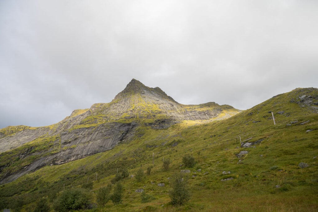
Kitinden’s top, looking deceivingly close to the road.
The Kitinden Hiking Trail
The trail starts in an unusual way, with a ladder above nothing. There obviously was a fence one, but it appears to be long gone. So only the steps are left, looking a bit like some conceptual sculpture or art piece over an invisible fence.
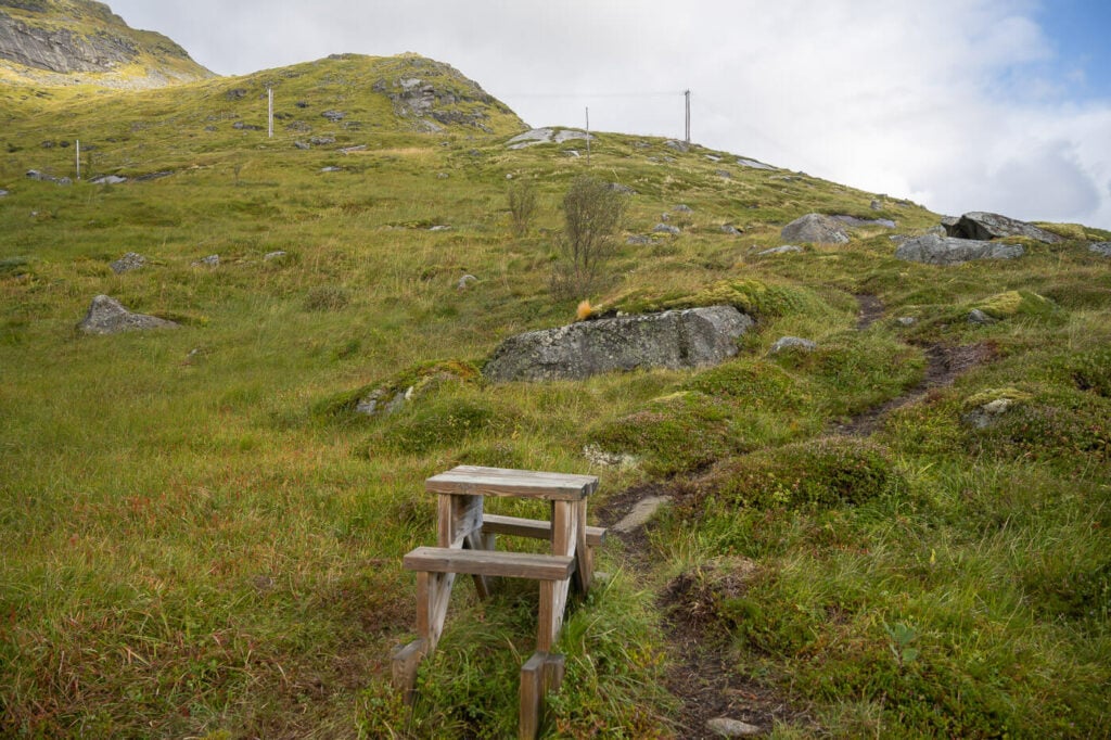
The trailhead – or is it a conceptual sculpture?
From here you’ll find two or three trails going in different directions. From what I could tell they all converge back into one further up the mountain. So you can take any of them as long as they seem to be heading further up the mountain rather than following its side. Beware of sheep tracks too!
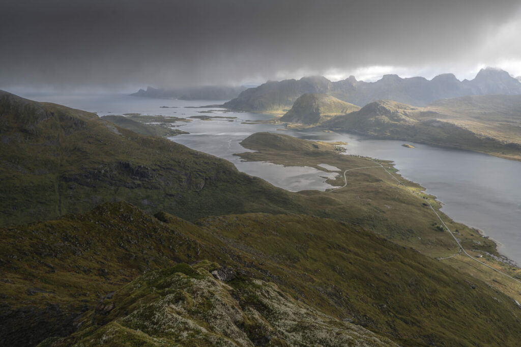
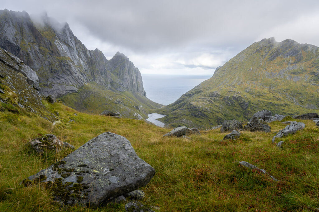
As you climb up, the view will also gradually open up to the south toward Moskenesøya and to the north toward Flakstadøya, revealing some fantastic mountain landscapes.
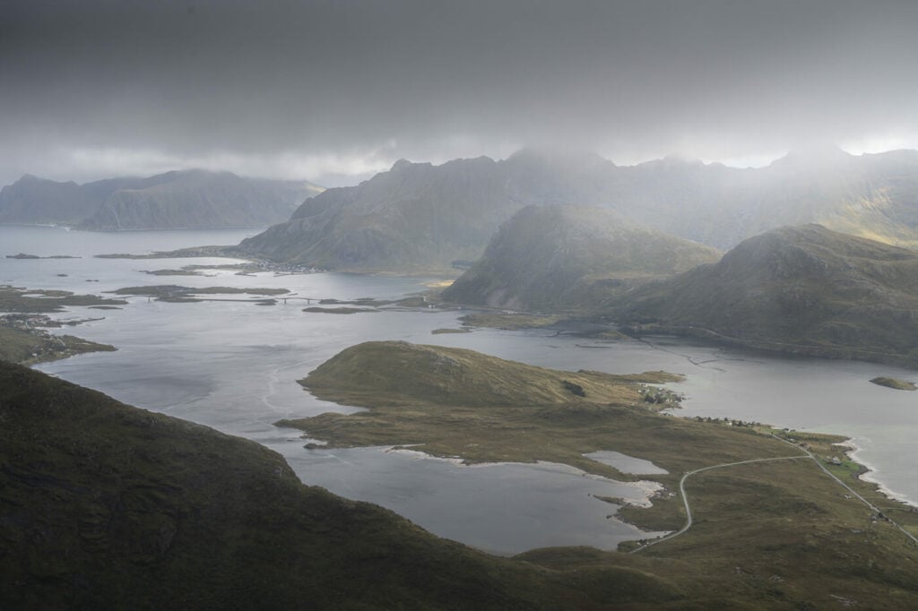
View toward Flakstadøya
View toward Moskenesøya
Anyway, the trail is barely visible in most places and that’s also what I liked about this hike. It’s all relatively steep, except for a short stretch just below the summit, which is relatively flat. This is the bit that offers the best views, toward Vestervika Beach. This is also the main view I hiked this mountain for.
Panoramic view toward Vestervika beach.
After this point, there’s more steep hiking and some scrambling ahead. Big boulders that require carefulness and there are some holds hidden by the vegetation in between boulders.
The last part appeared to be the steepest and rockiest. Again, I had to turn back here, just a short hike away from the summit. It was just not safe in wet conditions and with a wall of rain fast approaching.
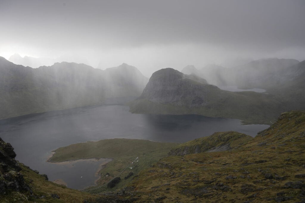
A wall of rain approaching from the south.
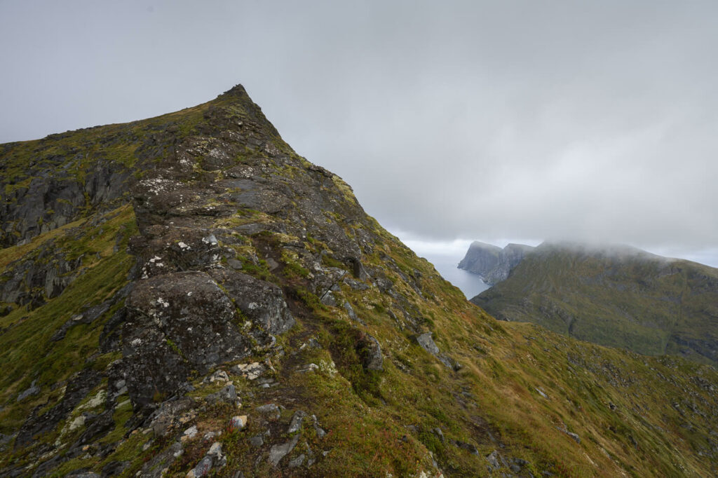
View toward the summit, where I had to retreat due to bad weather.
Absolutely to be avoided under the rain, which is the reason why I had to turn back not far from the summit. It’s just too steep and slippery to be safe.
As usual, one more excuse to go back and attempt it again!
The Kitinden Hike Photos and Photography Tips
The hike to Kitinden offers very scenic views right from the beginning.
You can’t really get a view of Kvalvika beach from this mountain, while you can see do you can see bits of the Vestervika of the beach.
However, as I already mentioned, one specific spot on the mountain is worth the hike by itself. It’s where the views open up toward Vestervika. This is a spot off the beaten path that has a lot of potential in terms of landscape photography.

View from the trail toward Vestervika
I plan to be there to catch the midnight sun sometime in the future. Provided the weather is good, the sun will pass low on the horizon right in between the mountains, potentially providing some epic warm light to lit the scene. I’m sure you can see what I mean by looking at the photo.
At least, that’s how I’d imagine it provided the weather is good. Still I always chad bad weather here, but that’s how it often goes at these latitudes.
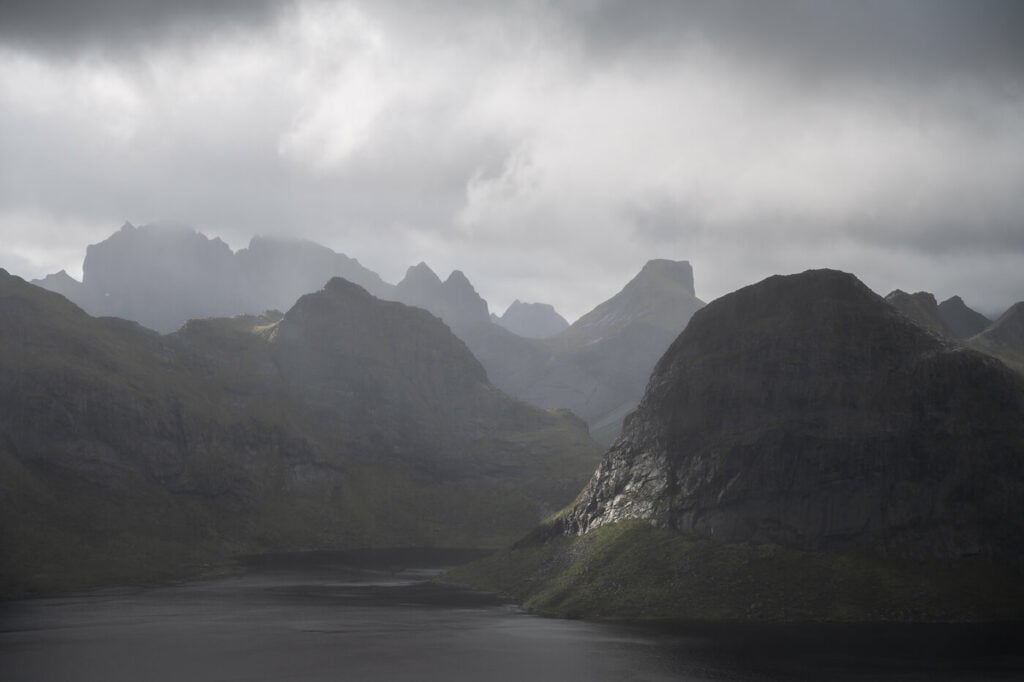
Anyway, this hike is much more too. The views from the trail are wide open to the north, south, and east. Under the right lighting conditions, there’s plenty to have fun with using a medium telephoto lens.
Sidelight and Dark clouds toward Flakstadøya
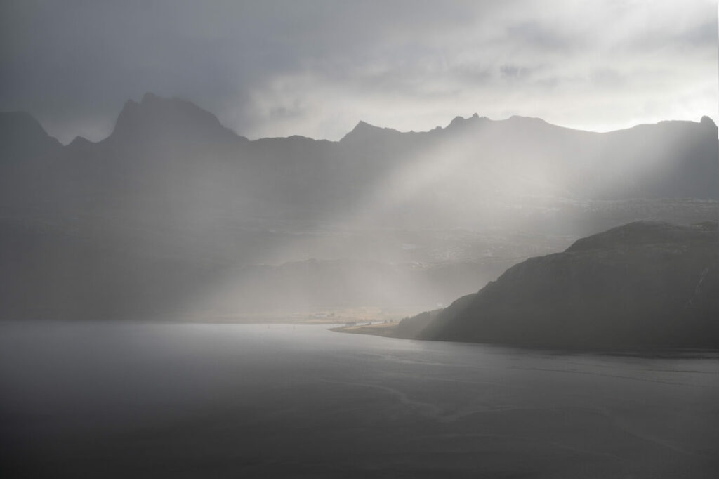
Beam of light through rain and clouds. 70mm.
Rain in the distance.
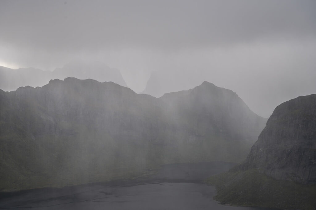
Heavy rain
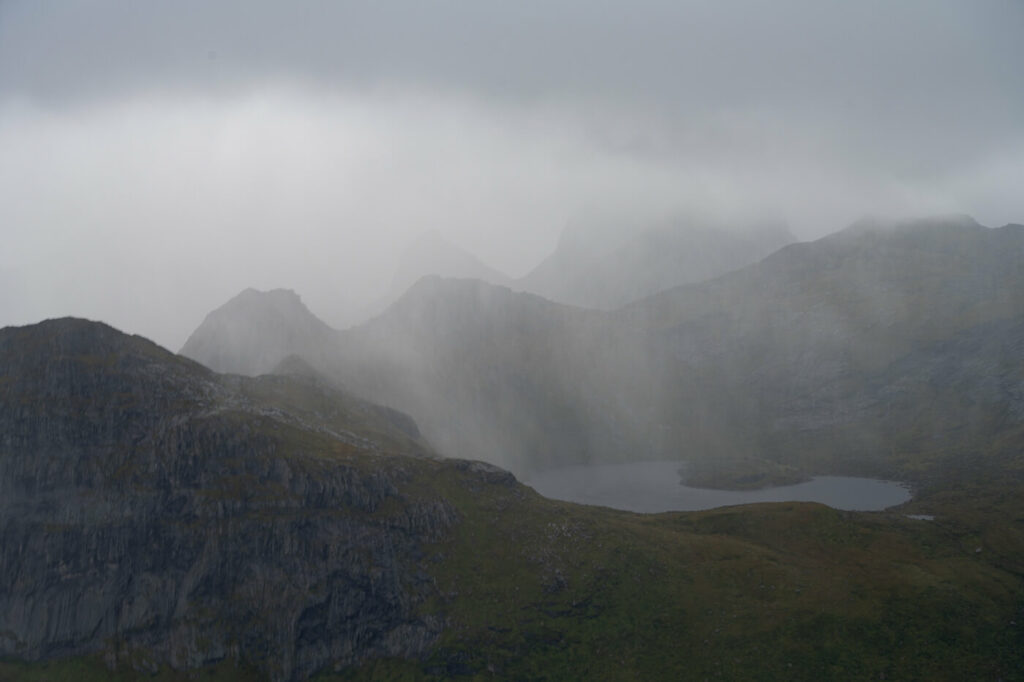
More heavy rain in Lofoten style
In terms of lenses, I recommend a medium telephoto, up to 10mm, and an ultra-wide angle. There is enough material to find an interesting foreground to use the wide angle, while the views are also open enough for a medium telephoto lens. I personally had the my 14-24 and 24-70 and felt it was enough.
Plenty of rocks that can be used as foreground make UWAs fun to use on this trail.
Drones: the mountain is part of the Lofotodden /national park, so flying drones is no longer allowed here – technically it was possible before 2018 before the Park was created, so you can still see a few drone videos online.
Where to stay
If you are camping in a van, the small pullout areas around d the gravel road are quite a popular location, so much so you may have trouble finding one free for parking in the morning.
In a tent, there are a few small camping spots around the Vestervika viewpoint, so that’s where I would spend the night If I were to camp there.
Otherwise, Fredvang and Ramberg offer some accommodations and are just a short driver away.
Additional Resources
- Planning a trip? Here are my tips for planning a trip to the Lofoten Islands
- Check out the Ryten Hiking trail, if you want to experience another location even further away from the cross, check out Markan.
- Check out the main page on Hiking in Norway for more hikes in Norway.


Leave A Comment