The Markan Hike on Moskenesøya – Lofoten Islands, Norway
The Hike to Markan on the Lofoten Island of Moskenesøya goes through some of the most remote and pristine terrains in the Lofoten Islands. The panoramic views over the surrounding landscape are just fantastic, and the feeling of remoteness this hike offers is unique to this area of the Lofoten.
The Markan Hike on the island of Moskenesøya is rather long and strenuous, but its rewards are worth the effort. Still, despite the challenges, this hike is quite fun. At least it is if you enjoy navigating and finding your way through rugged terrain. I did enjoy this hike and its challenging terrain – keep reading if you want to know more.
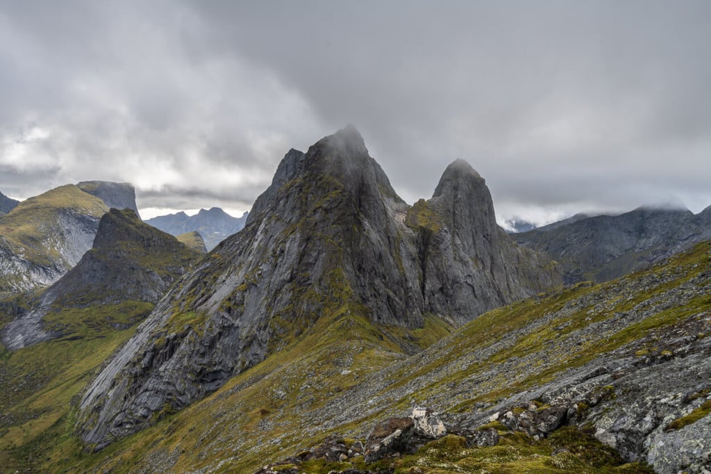
Kråkhammartind
How to get to Markan and overview of the Hike
- Getting there: there are two trails to Markan. One begins at the village of Kirkefjord, which can only be reached by boat. The other one starts at Selfjorden, and it’s the one I am describing here. When planning the hike, I had chosen the latter option – hiking from Selfjorden. While it’s a longer hike, the trailhead is reachable by car. This provides the flexibility of starting the hike when you prefer rather than depending on the boat schedule. These are the GPS coordinates of the small parking area where you can leave the car: (68.03662456601126, 13.082302331303147). To get there, you can drive to Fredvang. From there, head toward Krystad. Keep following the road until you reach a crossword where the paved road turns into a gravel one. Keep following it until you reach the end of it – this is where you can park the car.
- Start of The Hike: directly from the parking area. From there, you can keep going in the same direction you came from.
- Photography & Scenery value: some of the best views of the steep and dramatic mountains of the Moskenesøya island
- Difficulty: Hard
- Tip: bring a pair of used-up trainers to cross the swampy area and keep your feet dry. I used military-style waterproof hiking boots on this hike, as I do in most of the Lofoten. The reason why I use this type of boots here is because of this type of terrain. While military-style boots are a little heavier than proper hiking boots with them, you can plough through swampy areas without worrying about getting your feet wet. Unless you step in a water-filled hole in the ground up to your knee, in which case they won’t help much. Real story ;).
The Markan Trail
| Distance | Ascent | Hike Time |
|---|---|---|
| 12.2 Km | 620 Mt. | 6/7 Hrs. |
This is one slow going hike. The very first part is okay, but it will soon turn into a very boggy and swampy area. This is the wettest part of the hike. However, provided the weather is good, you’ll get great views over the surrounding mountains even from here.

You will first reach a small hut as soon as you cross this flat and swampy area. Here you will enter a birch forest. Even if you don’t have much of a view over the surrounding area, the trail is relatively easy to follow. At times, you will have to cross small water streams or jump up and down boulders to keep going.
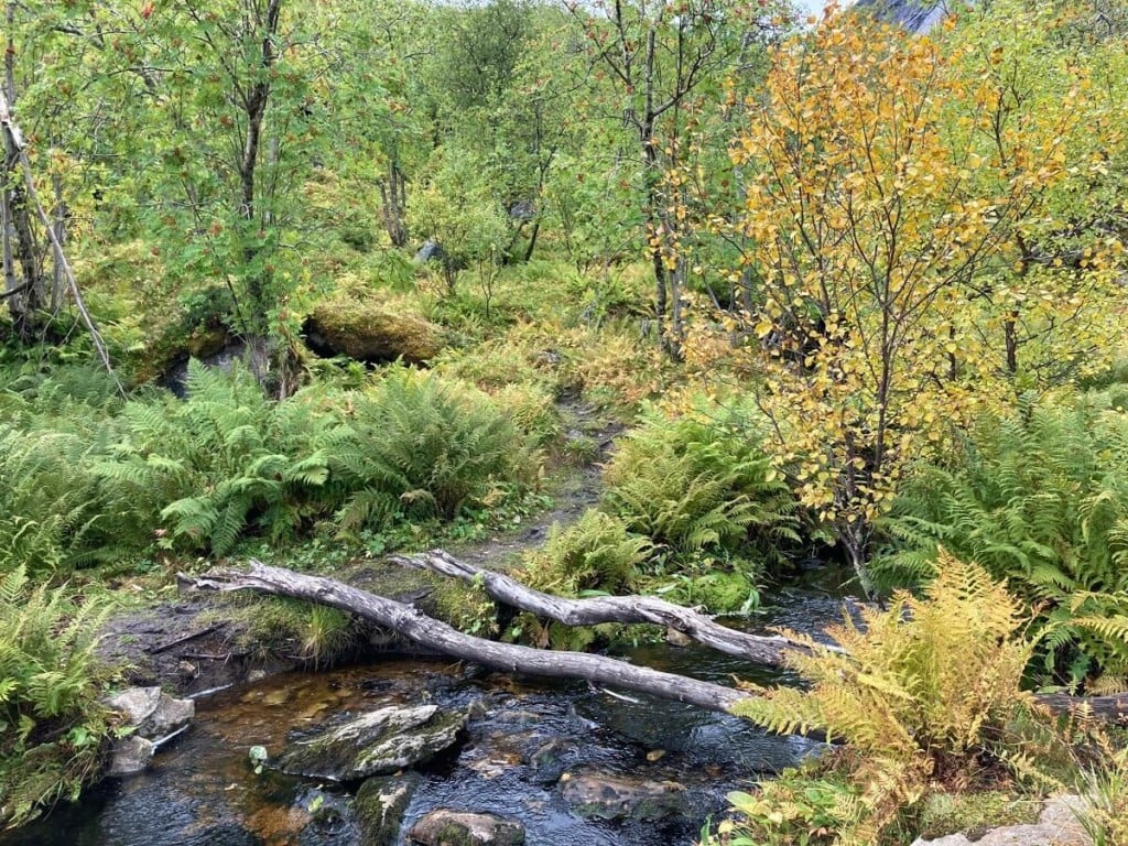
Part of the trail through the birch tree forest
The trail will start gaining elevation until it reaches another flat area as you keep going. This is where the small lake (Fageråvatnet) is and where the trail becomes quite rocky. It’s also quite hard to follow the trail here. I also missed a turn here and had to backtrack a bit – you can see it on my map below.
As you pass the lake, the steepest part of the hike will begin. This section is steep, wet, muddy and slippery, so caution is required. As I mentioned earlier, this is one slow hike, and it is so because of such sections. On the other hand, the views will keep getting better and better as you climb up. This is where the effort starts bringing its rewards in terms of scenery.
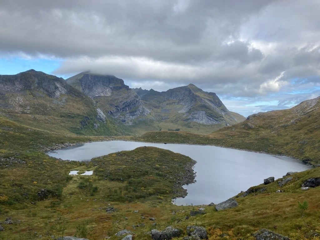
View over Fageråvatnet from the second steep ascent before reaching the Fageråskaret pass
After this section, you will reach the trail connecting to the Fageråskaret pass. Be careful not to follow it – unless you want to go to the pass. Instead, you should look for some faint trail traces over the rocks to your right and start climbing in that direction. Keep going up, and you will soon reach the summit. From there, the scenic views will make the effort of the Markan Hike on Moskenesøya well worth it.
Photos and Photography tips for the Markan Hike
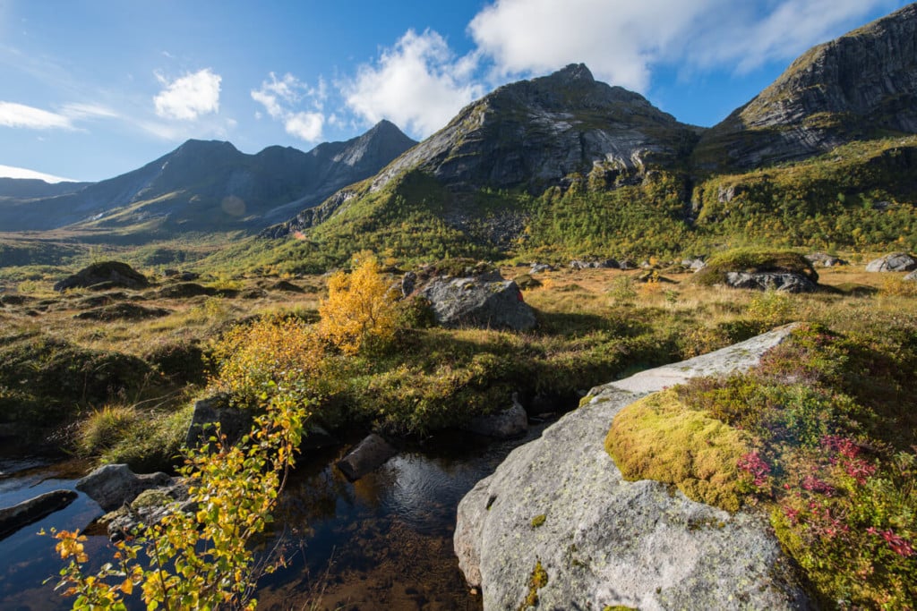
The first part of the hike before entering the birch forest will already offer spectacular views of the impressive peaks surrounding the area. Not much scenery through the birch forest, though. Things start getting interesting as soon as you start gaining elevation on the second climb before reaching the Fageråskaret pass.
From there, you will already have great views over Fageråvatnet and the surrounding mountains. However, some of the most photogenic views are at the top of the second climb, just before the last stretch that leads to the summit.
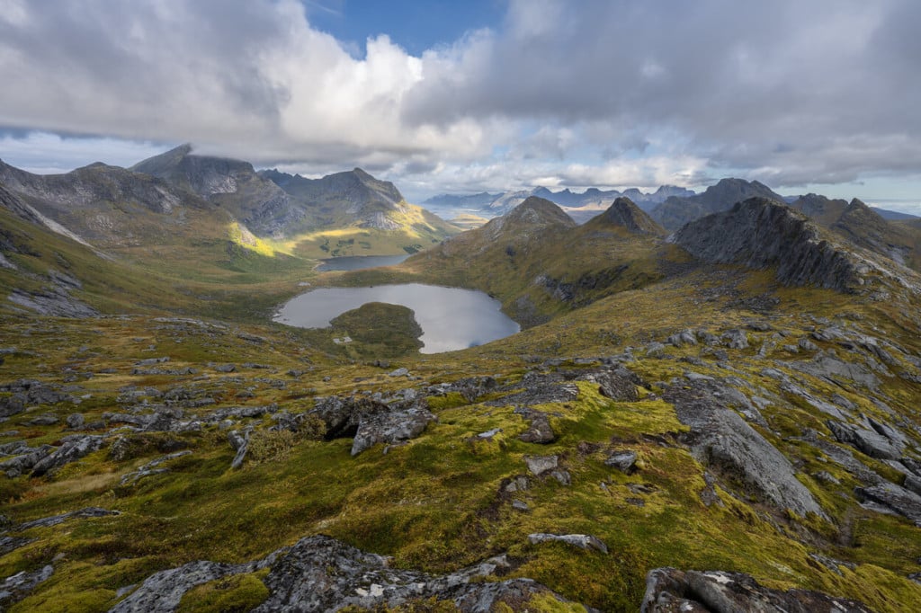
Another view over Fageråvatnet
From the pass or just above it, you will have the best views of Kråkhammartind
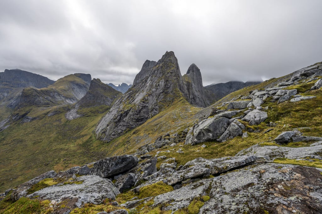
Kråkhammartind
The views from the summit are also great.
Solbjørnvatnet
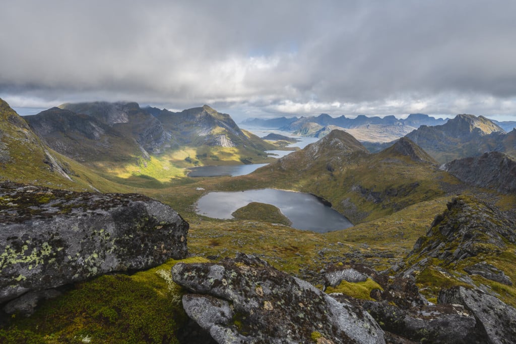
Fageråvatnet
Additionally, I think this location is great for panoramas, especially from just above the pass, where you can get great views of all the mountains and their valleys.
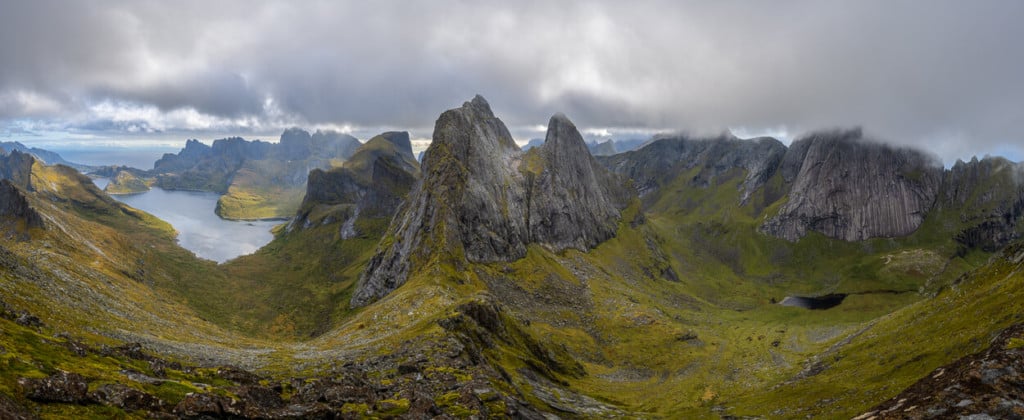
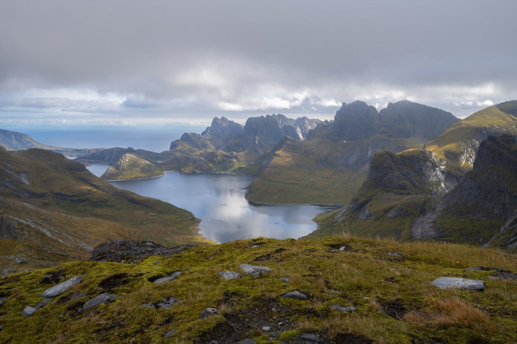
Solbjørnvatnet, the lake on the left; Kråkhammartind, the peak in the middle and Horseidvatnet, the small lake on the right
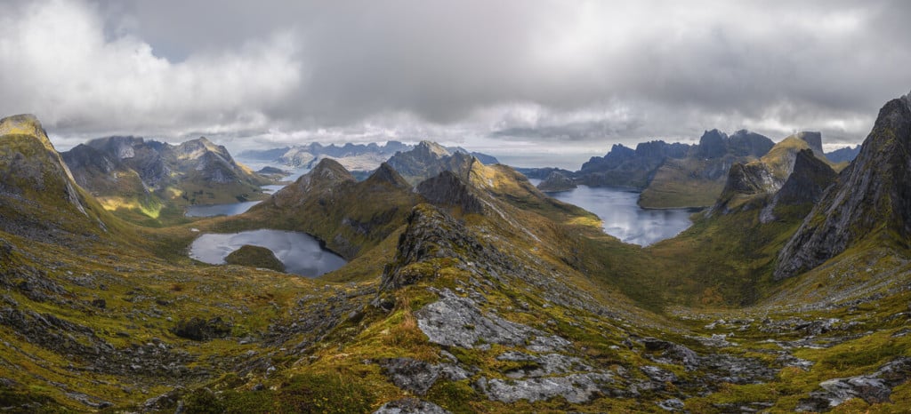
Fageråvatnet, on the right and Solbjørnvatnet, the lake, on the left.
I only had my 14 to 24 mm and 24 to 70 mm on this hike. I think anything within this range or up to 120 should be more than enough on this hike. If you want to bring something longer to compose on the farther away mountains or shoot some wildlife, you can have fun with those as well. Keep in mind that this hike is quite long and can be strenuous due to the type of terrain, which is why I decided to leave the 70-200 lens in the car for this hike.
Don’t bring a drone here. This hike is in the Lofotodden National Park, where drones are prohibited. Besides, it may be attacked by a sea eagle :)!
Map of the Hike to Markan
Here is the map of the hike. If you need a GPS track, you can download the .GPX file from the Komoot activity. However, please note the slight detour by Fageråvatnet – that’s where I lost the trail and had to backtrack. So please don’t follow my track there ;).
Where to Stay
If you want to camp in the area, the best location is probably the small lake (Fageråvatnet) you come across halfway through the hike. There are some flat areas suitable for camping around its shores, and it is a little more sheltered than the top of the mountains around it. If you are planning more hikes in Selfjorden, this could be a good spot for a base camp.
Another good spot to camp is the Fageråskaret pass, much closer to the summit. Or, you could descend on the other side to Horsed beach, but in that case, it would probably be better to start the hike from Kirkefjord. You can check the timetable of the boat from Reine to Kirkefjord here.
Additional Resources
- If you re planning a trip to the Lofoten, check my planning guide for some tips
- Check out the main page on Hiking in Norway for more Photo Hikes and inspiration.
If you have been on this hike and would like to share your experience, let me know in the comments below.


Leave A Comment