The Volandstinden Hike, Lofoten, Norway
Volandstinden, also called the “Shark Fin” due to its shape, may at first seem almost impossible to hike;
Volandstinden, or the “Shark Fin”.
Such a prominent and steep mountain promises fantastic views, and it does not disappoint. Furthermore the hike is fur, especially the last part that is a bit of a ridge trail on to of the several smaller peak around Volandstind.
The last one, which is not the true summit, is the steepest and even from relatively close it seeming is impossible to hike without climbing. Though, as we’ll see later, that is not the case and while it is steep, it is neither too exposed, nor difficult to hike up to. and it’s worth it.
The hike to Volandstind is worth it if you are looking for a moderately difficult, half a day hike in this area.
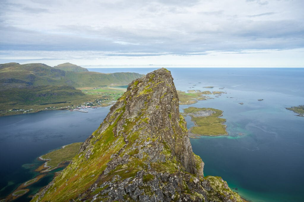
The seemingly, impossibly steep peak next to Volandstinded
Table of Contents
Overview of the Volandstinden Hike & Map
Here is a summary and some details of this hike. it’s an out-and-back hike up the side of the mountain and along its crest for the last part.
However do note that there are two trailheads, one on each side of the mountains. The main one is on the side of Selfjorden, while the other one is on the side of Skjelfjorden. The hiking distance is comparable. However, here I refer to the trail on the Selfjorden side, along road E10.
| Max Altitude | 457 m |
|---|---|
| Distance | 5.28 KM |
| Elevation gain | 440 m ↑ / 440m ↓ |
| Hike time | 02:00/ 03:00 Hours |
| Hike Difficulty | Moderate |
How to get to Volandstinden and Parking
The main trailhead is easy to reach, as it is located directly on the highway E10.
- Driving Directions: If you are coming from Leknes/Ramberg, drive past the deviation for Ramberg. after a few hundred meters, you should see the “Fredvang Bridge”. drive past that on the E10. After a few hundred meters, you should see a wide rest area across a small pond you your left. Shortly after that, you should see a gravel road again on your left. Drive slowly as you would need to enter that gravel road.
- Parking: free, but limited, parking is available at the trailhead along the E10 road. there also are a few parking options further down along the road. So if that’s full, you can try to find a spot further down the road. Or by the other trailhead – which is paid – in Skjelfjorden.
- Public Transport: The bust stop Fredvang kryss is within walking distance of the trailhead. Lines 300 and 732 stop here. You can check the timetable on the Reis Nordland website.
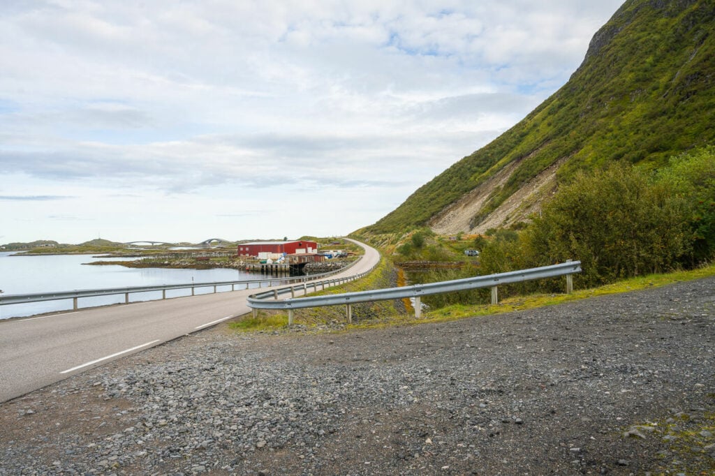
The gravel road leading to the parking area by the trailhead along route E10 is easy to miss.
The Volandstinden Hiking Trail
From the parking area, you can follow the dirt road uphill back toward the access road and continue on it. Soon you’ll see a narrow trail leading into the bushes and up the side of the mountain. That’s the one to take.
At first, the trail follows a small creek upstream, crossing it here and there. This first part is likely to be muddy and boggy..and slippery. If it recently rained the trail can be a bit of a mess here, but that’s not unlike most of the hiking trails on the Lofoten Islands.
The steep and rocky ascent up the side of Volandstinden
Next, you’ll reach a saddle which is where the trails from Selfjorden and Skjelfjordsn connect. This area is primarily flat, but the trail will soon turn into a rocky mess up the steep side of the mountain.
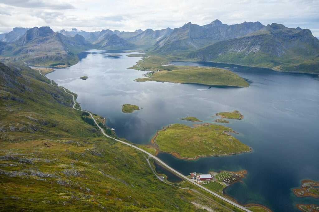
the trail isn’t too difficult here, but there are a lot of big boulders with gaps between them. Here the views will start to open up on all sides, offering spectacular views of both Skjelfjorden and Selfjorden.
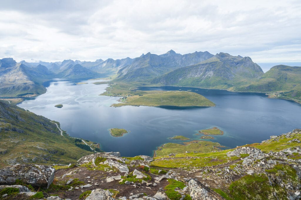
Selfjorden, Wirth a view of the Moskenesøya Island.
View on the opposite side, toward Ramberg.
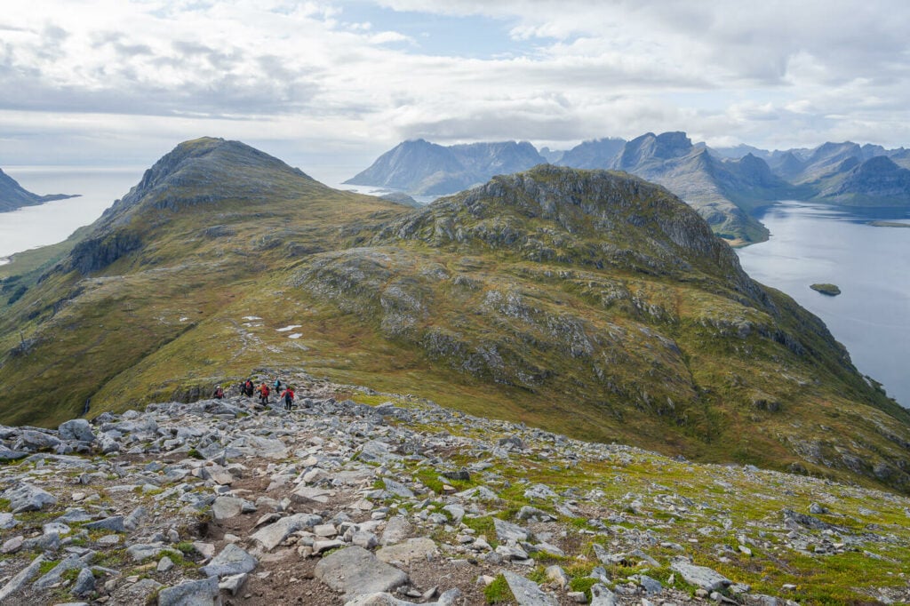
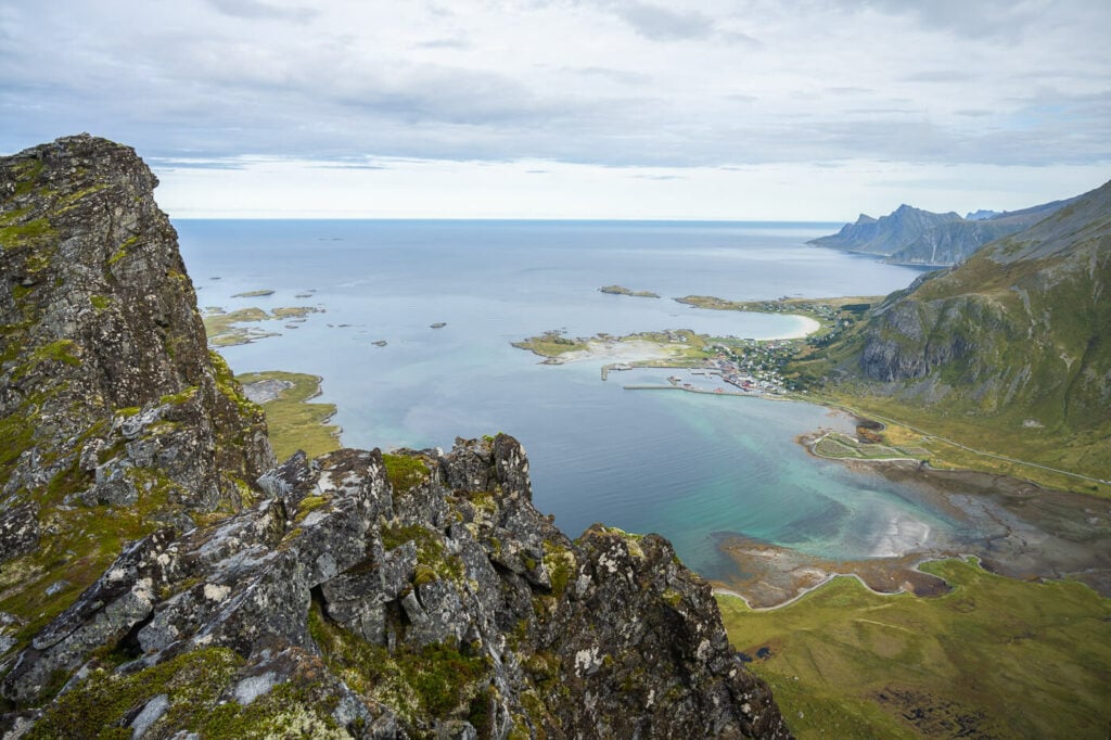
The trail then continues to climb but it’s never very steep, up to the top of the ridge. Still, some of the viewpoints along g the way are completely exposed, so approach them carefully.
The last part of the trail is more like a ridge walk on top of the crest of the mountains with, again, great views of both sides of the fjord. You can continue to the last peak on the ridge, which looks impossible to climb from afar.

The final steep peak. the trail is on the left, barely visible.

The steep but relatively easy trail to the top of the last peak.
However, getting top there is quite easy, as there is a steep but very doable trail leading up to the top. Still, a good head for heights is required.
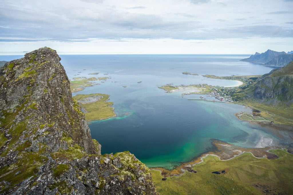
You’ll find a cairn up top and stunning 360 panoramic views. Enjoy!
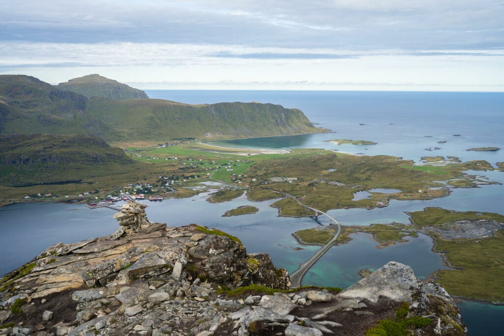
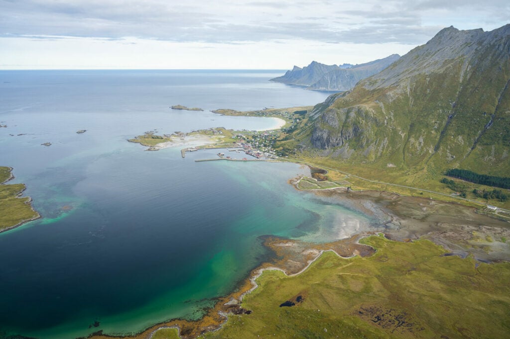
View toward Fredvang and Røren.
Ramberg and a little further away, Rambergstranda.
The Volandstinden Hike Photos and Photography Tips
Volandstinden is a very beautiful mountain per se, so it’s worth exploring the area around it to take some photos of the mountain from afar.
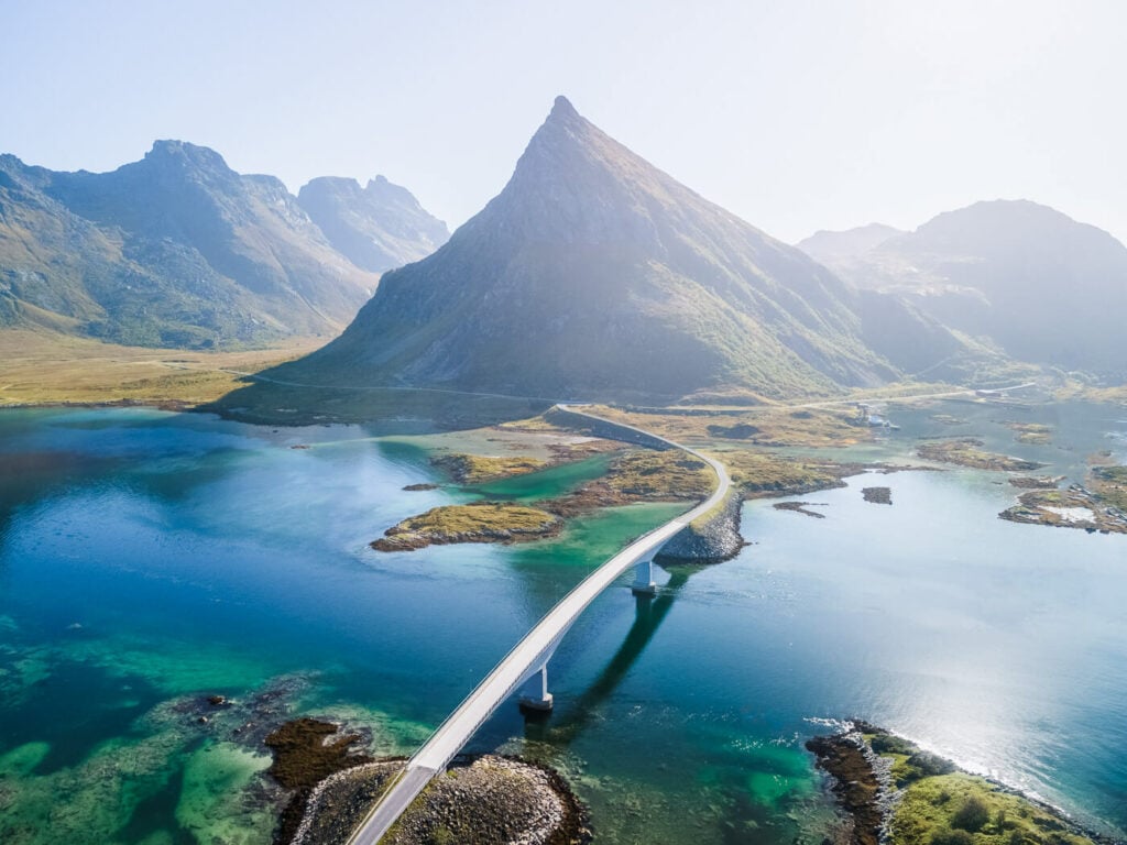
Most commonly, Volandstind is photographed with a drone from a paid parking area between the two bridges to Fredvang. If you are planning to take this show, you can park here – again paid, and you can pay with the EasyPark app. not possible to park anywhere else as this is a very narrow transit area.
Volandstinden, or the “Shark Fin”.
On the hike to the top of Volandstinden, there are a couple of nice waterfalls to stop at. I visited them a couple of times since they are quite close to the road. So you could also just stop for a quick snap even on rainy days like I did here:

Since there are not that many waterfalls in the Lofoten Islands, that makes it kind of a compelling stop. However, I think on dry Summer days there won’t be probably much left of the waterfall. An ultra-wide lens is needed since it’s rather small
The scenic views from the top of the mountain are as great as anywhere else in Norway amen make for great landscapes at any time of the day. I mostly used my 24-70mm full-frame lens and I think anything in the range of 18-120mm should be well enough.

The Bridge to Fedvang across Selfjorden.
Road E 10 and the Fantastic views of Selfjorden

This would be a great place to watch the midnight sun or even sunset in autumn. Also, some aurora – though best to bivouac up top; the section with big boulders may be a little sketchy to hike down at night.
Lastly, assuming you comply with local regulations, it is possible to fly a drone here, as Volandstinden is not within the boundaries of the Lofotodden National Park – where flying drones is prohibited.
Where to stay
Ramberg is an excellent place to stay; there are plenty of hikes around. Also, some cafes, the “biggest” supermarket in the area, and a campsite with a Restaurant among others.
However, as this is a very short hike you could easily add it to your itinerary and stay in other places such as Reine or Leknes.
In terms of camping, the best place is the saddle halfway up the mountain. It may be possible to camp at the top with a small freestanding tent – though only in fair weather.
Additional Resources
- You can easily combine a hike to Volandstrinden with some others in the area: would be one, which is what I did. Flakstadtind, Kollfjellet or Nubben or Røren are all good options.
- Planning a trip to the Lofoten? Here are my tips for planning a trip to the Lofoten Islands.
- Check out more Hikes in Norway


Leave A Comment