Hike to Hesten and Stavelitippen – Senja, Norway
Located on the Norwegian Island of Senja, the Hike to Hesten (558m) and Stavelitippen (580m) are among northern Norway’s best and most scenic hikes. It’s also quite an easy one. The Hike from Fjordgård to Hesten is only two KMs, and the elevation gain is slightly over 400m. For the views you get, this is a no-brainer of a hike; get up there :)!
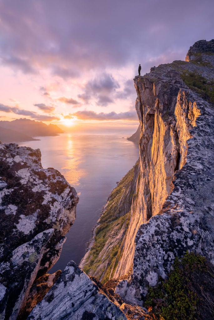
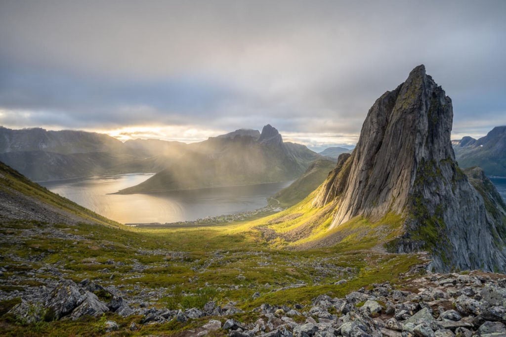
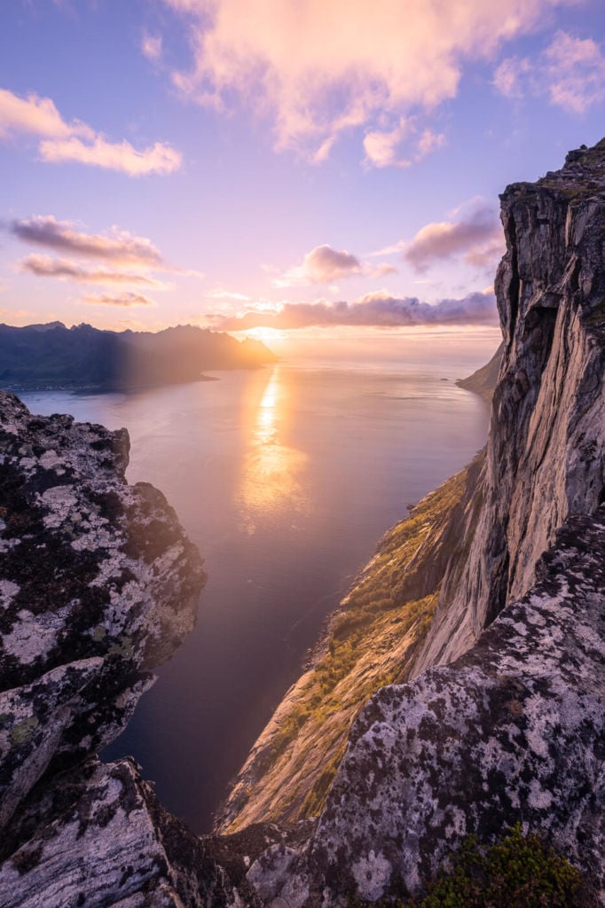
Sunset from the trail leading up to Hesten
Also: this is the hike you should go on to get the best view over the iconic mountain of Segla. I’m saying this because it is a somewhat common mistake for people to hike up Segla instead of Hesten. So much so that the local restaurant even hung a photo warning tourists wanting to see Segla. Here it is:
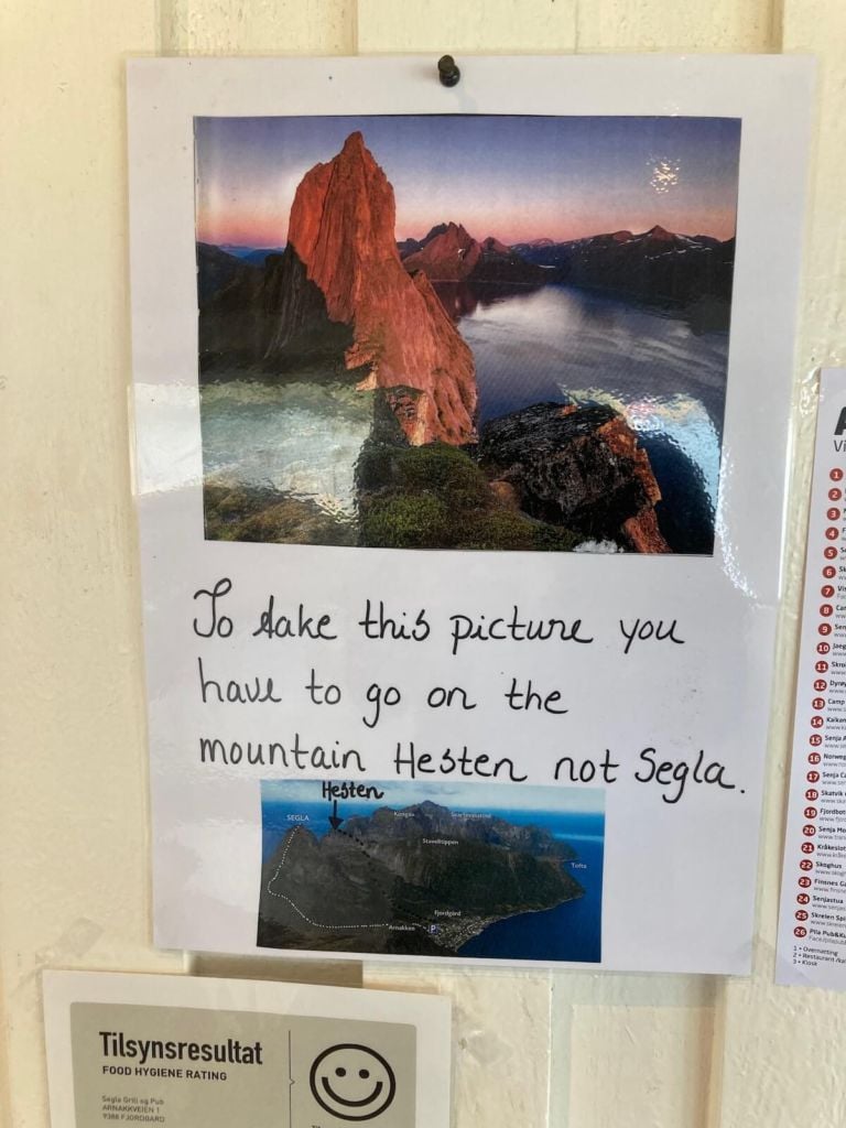
The sign in the Bar close to Segla’s trailhead
This is where you would need to go and the hike I am describing here. As I mentioned above, the hike is relatively short and not overly difficult, and the views you will get are hard to find anywhere else. Apart from the very recognisable landmark of Segla, the cliffs on that side of the mountain are truly spectacular.
I enjoyed this hike so much that I hiked up Hesten twice on the same day, for Sunrise and again for Sunset.
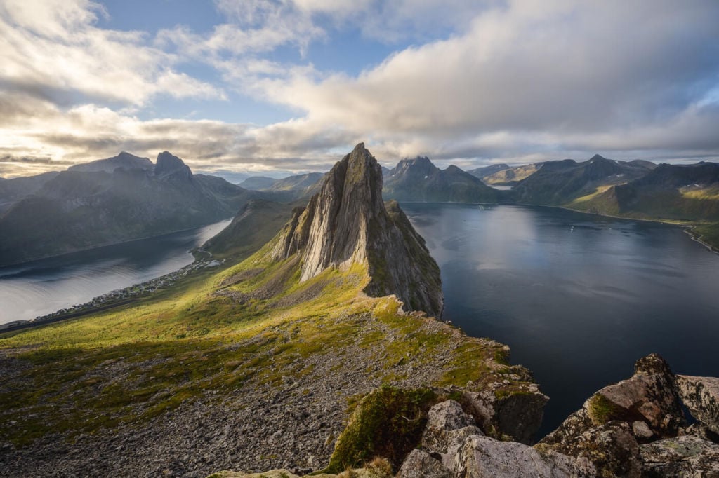
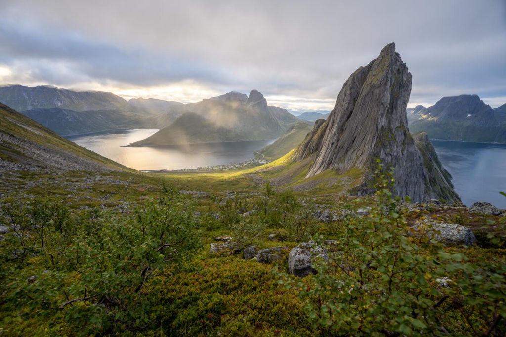
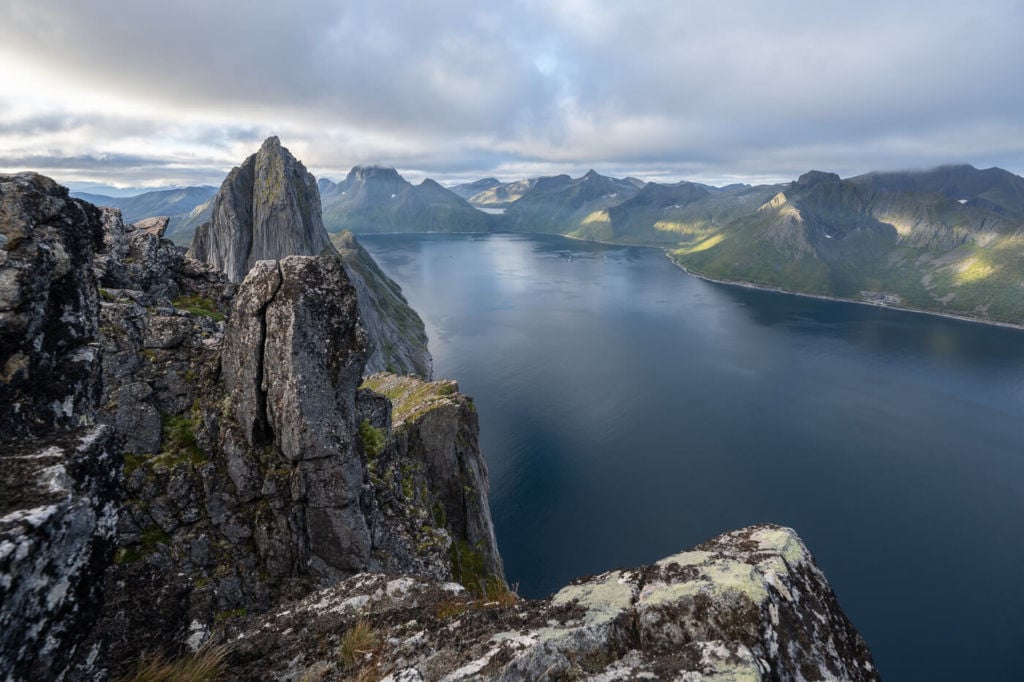
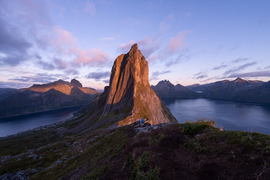
Segla lit by the early morning light.
How to get to Hesten and Stavelitippen and Overview of the Hike
A quick note on the trail. This is not a trail for those who are afraid of heights. Once you reach the Seggelskaret ridge (located between Segla and Hesten), you will be on top of an almost vertical cliff dropping into the sea below for a few hundred meters.
- How to get to Hesten and Parking: First, you would have to reach the small village of Fjordgård. There are two paid parking areas where you can park the car. One is down by the Harbour, on the opposite side of town from where you came. The coordinates for the Harbour parking are 69°30’44.4″N 17°37’40.5″E. The other is a paid parking close to the trailhead by the local Montessori school. Its coordinates are 69.5047121886322, 17.62691999041218. If you park there, I would recommend installing the EsyPark app first, as it can also be used to pay for this parking area.
- Start of The Hike: You will need to walk to the Hesten trailhead from wherever you park the car. The distance is pretty much the same from either the Harbour or the paid parking areas.
- Photography & Scenery value: spectacular mountain views and stunning, almost vertical sea cliffs. Also suitable for Sunrises and Sunsets.
- Hike Difficulty: If hiking to Hesten only, the hike is easy. Adding Stavelitippen to the itinerary makes the hike a little harder. Some sections are moderately exposed, nothing too bad, and a little scrambling is also required.
- Tip: The Seggelskaret ridge is that portion of the trail between Segla and Hesten. From here, you can get some of the best views of Segla and views from the ridge to the sea below.
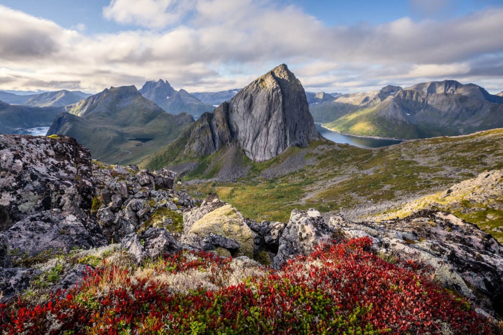
Segla viewed from the trail leading up to Stavelitippen.
The Hesten and Stavelitippen Trail
The table below shows the whole hike, from the Parking area to Hesten and then to Stavelitippen. However, if you prefer hiking to Hesten only, that would make the trip a couple of KMs shorter.
| Distance | Elevation Gain | Hike time |
|---|---|---|
| 7.72km | 730m | 4.30/5.30 Hrs |
Hike to Hesten
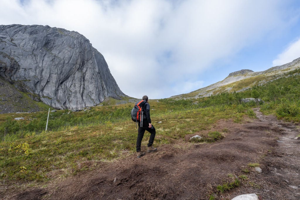
From the trailhead, you will see what almost looks like a gravel road going uphill, with a row of lamp posts close to it. This is the first part of the trail. The trail is also marked with blue dots painted on the rocks, so look for those.
As you start hiking uphill, the gravel will disappear, turning the trail into a typical mountain trail. This part is relatively easy and never steep.
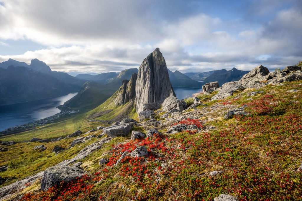
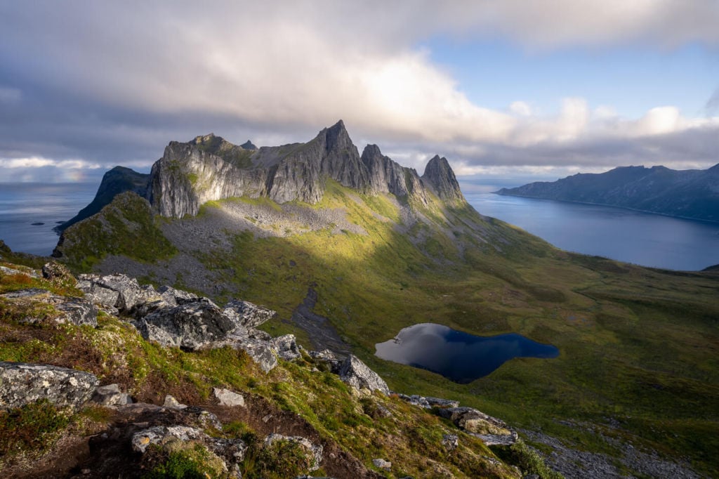
Segla, on the left, and Hesten, the ‘small’ summit on the right
From there, you will soon reach a flattish area leading you to the ridge called Seggelskaret. You can continue to your left to reach the base of Segla’s vertical wall. To the right, you will continue the climb up to Hesten.
Going up to Hesten, the trail will increasingly become steeper and rockier, nothing too difficult, though. As you approach the summit, you may need to scramble up the last few rocks until you reach the sign marking the top of Hesten. Enjoy the Views!
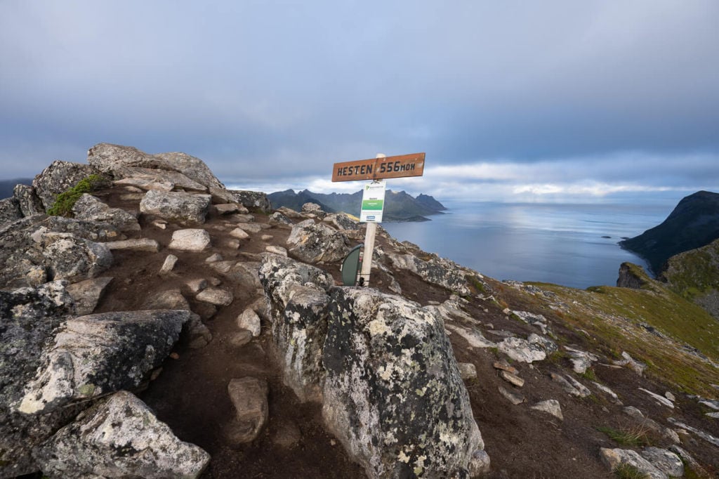
The sign marking the summit of Hesten.
Hike to Stavelitippen
From the summit of Hesten, looking towards Segla, the trail continues on the ridge to the left. This part of the trail will initially lead you downhill to a saddle that connects to another trail to your left, the one to Inste Kongen. Keep going straight toward the small summit ahead of you. Here the trail will start ascending again.
Soon the trail will become a sort of boulder field with two or three sections that require scrambling. Some areas are moderately exposed but wide enough to keep a safety margin. However, I recommend carefully picking your line here since some areas are more exposed than others.
There are a couple of false summits on the way up, but soon enough, you will reach the actual summit too. Enjoy the views from your second summit of the day!
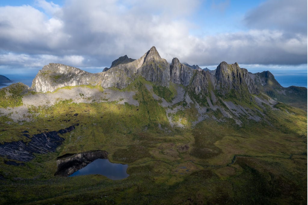
Inste Kongen, the mountain in the middle, viewed from the Summit of Stavelitippen
Photos and Photography Tips for the Hike to Hesten and Stavelitippen
There are several excellent spots that offer great views of Segla and from the cliffs. On the ridge, there are plenty of ledges that provide incredible views of the face of the cliffs dropping for a few hundred meters down into the sea below, almost vertically. It’s great fun but not for those afraid of heights; additionally, carefulness is required.
However, my favourite spot was the Seggelskaret ridge, where you have the best views of Segla and great views from the cliffs toward the sea. From the top of Hesten, you also have stunning views of the mountains on the other side, like the Inste Kongen.
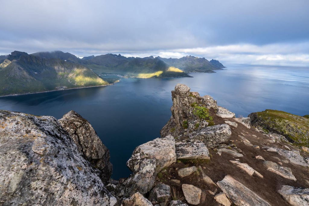
From the top of Stavelitippen, instead, you have the best views of the fjord where Fjordgård is located. The are also several excellent vantage points to shoot Segla from.
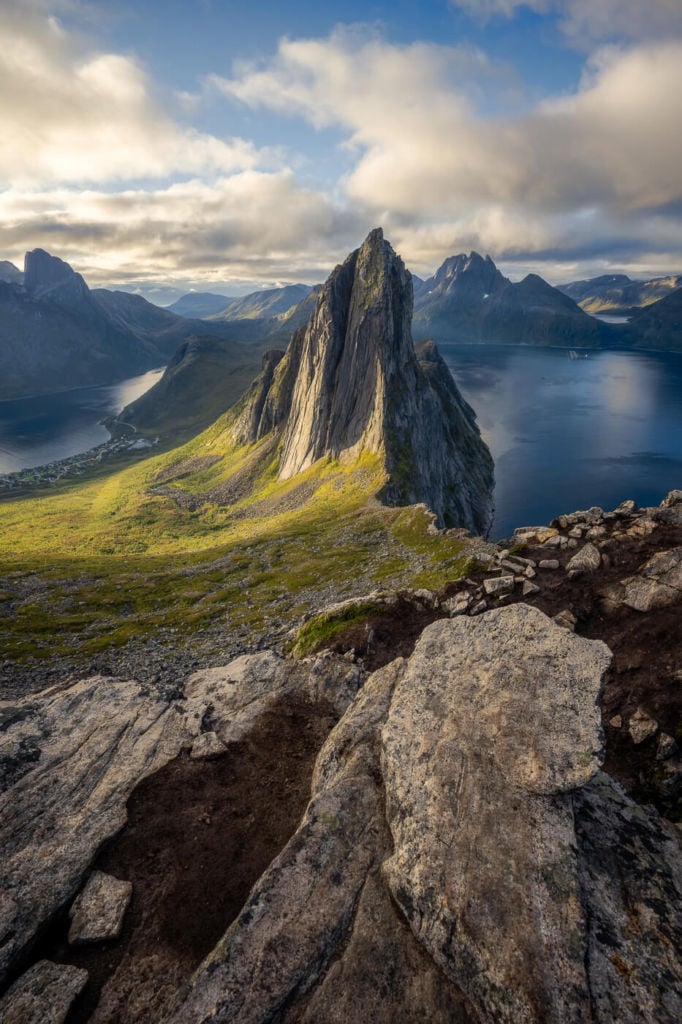
Segla shortly after Sunrise.
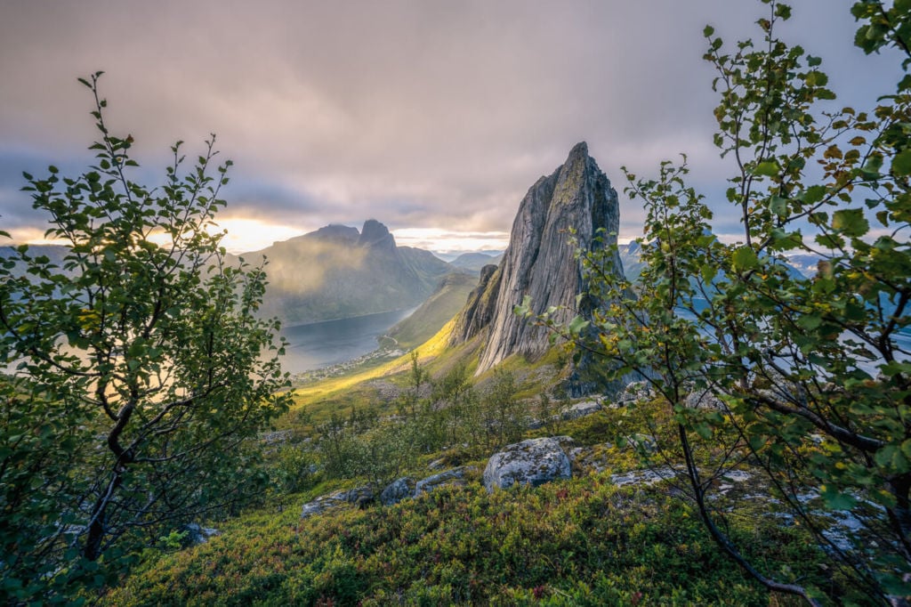
Segla viewed from the trail leading up to Stavelitippen.
Inste Kongen, the mountain in the middle, viewed from the top of Hesten.
Segla lit by the early morning light.
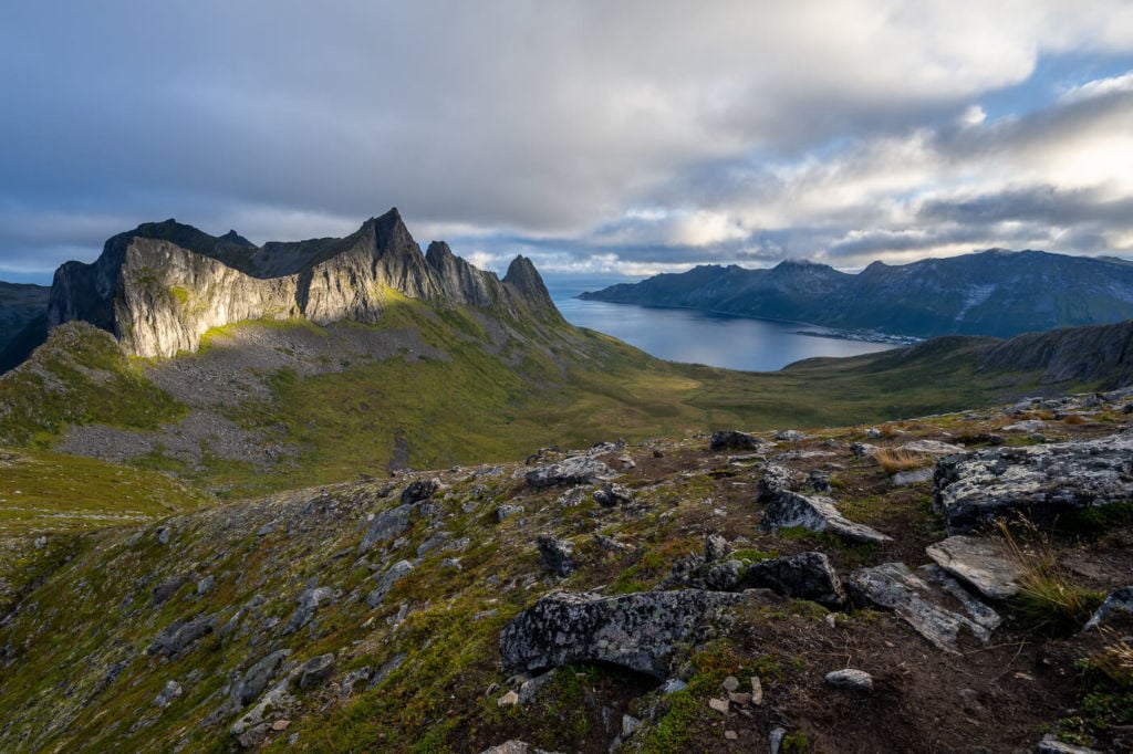
Inste Kongen shortly after Sunrise.
Segla, on the left, viewed from Hesten.
View from Hesten.
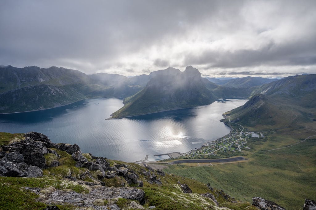
Fjordgård and Ørnfjorden, viewed from the top of Stavelitippen.
Segla at Sunset.
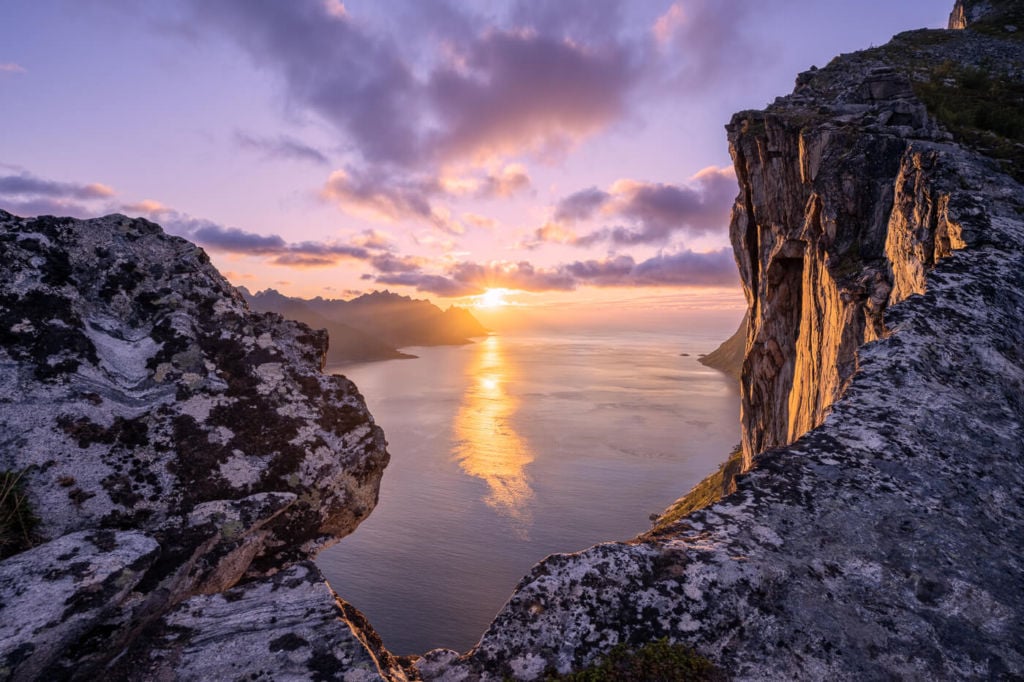
Sunset from the trail leading up to Hesten.
Sunset from the trail leading up to Hesten.
I’m really looking forward to visiting this mountain again sometime in the near future. Yes, the views are amazing!
Video of the Hesten and Stavelitippen Hike
If you want to get a better feel for the trail, here is a short video of this hike
Map of The Hesten and Stavelitippen Hike
Here is the map of the hike. If you need a GPS track, you can download the .GPX file from the Komoot activity.
Where to Stay
There are a couple of accommodations available in Fjordgård.
Wild camping is allowed within the Allemannsretten regulations, and there will likely be a few people camping up Hesten. There were also a few tents pitched directly on the trail when I was there. Guys, don’t do that; please. There is enough space up the mountain for you not to pitch a tent on the trail ;).
Additional Resources
- Here’s my full Senja Hiking guide, with the best hikes in the region and trip-planning tips.
- If you want to hike to the top of Segla, that’s also possible! Check out my post about that hike here. Also, you may want to check out these other amazing Hikes on the Island of Senja: Husfjellet, Keipen and Grytetippen, or Inste Kongen and Kongeporten.
- Check out the main page on Hiking in Norway for more hikes in Norway.


Leave A Comment