The Inste Kongen and Kongeporten Hike, Senja, Norway
If you landed on this page, chances are you’ve been looking for either a GPS track to hike Inste Kongen (738m) and Kongeporten, or more information on the trail that would get you there. I know, there’s not much good info out there, I was in the same situation two years ago.
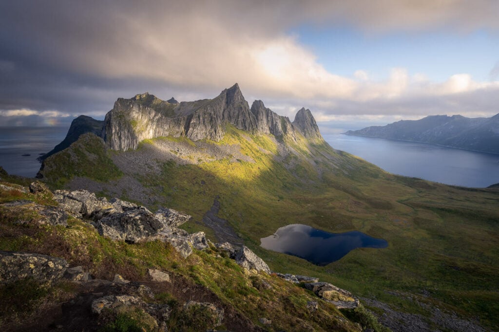
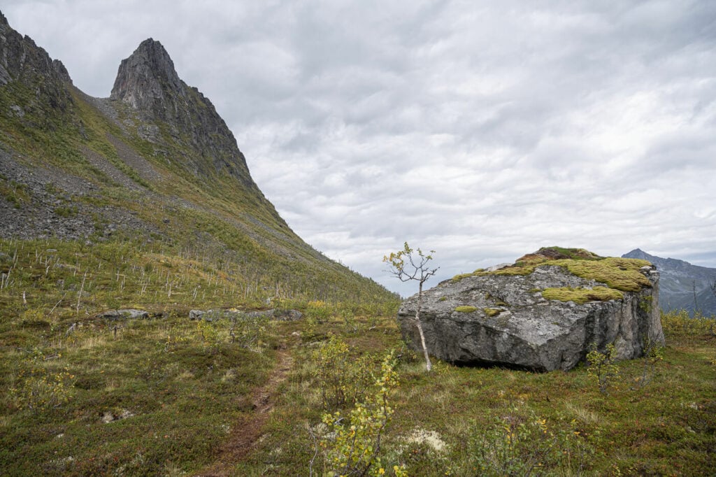
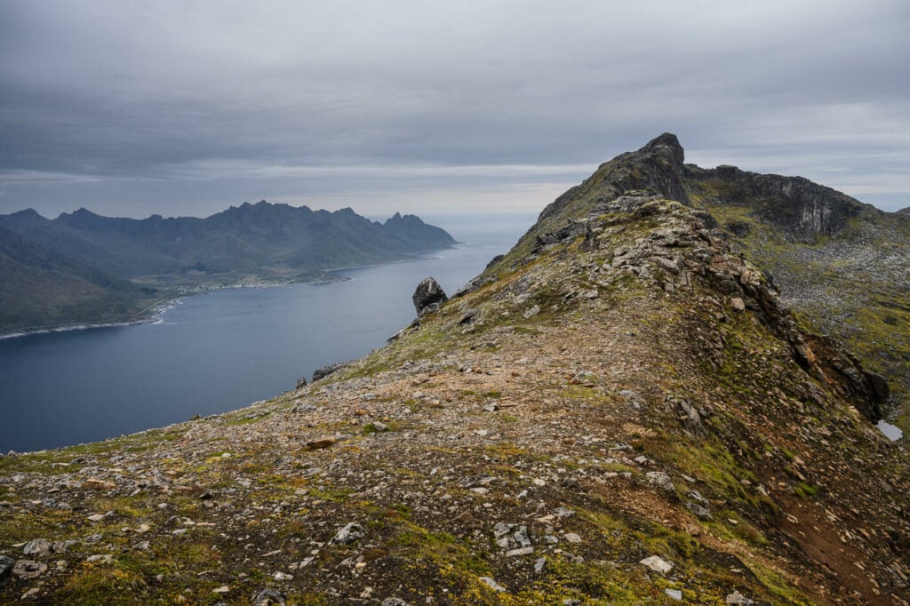
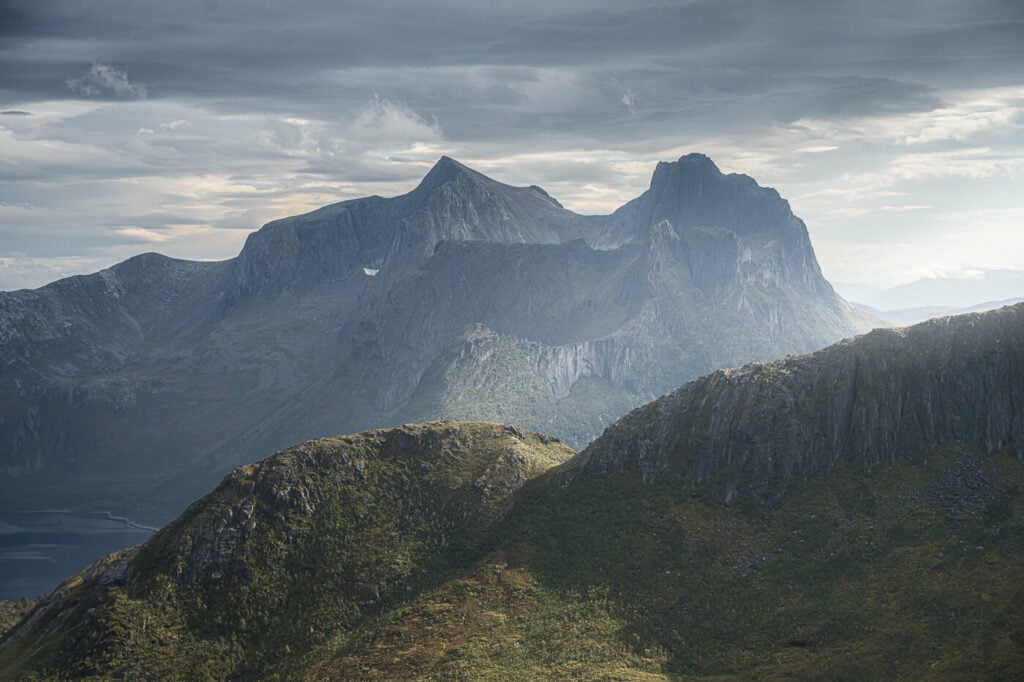
Inste Kongen is the beautiful, pointy, tall mountain in the middle. Image taken from Hesten’s summit.
I remember the first time I saw Inste Kongen (The Inner King) and Kongeporten (The King’s Bridge) from afar when I hiked to Hesten for the first time. Impressed by that mountain, I asked myself whether it was possible to hike it or not.
I could see faint traces of a trail from the ridge between Hesten and Stavelitippen, but I could not find an official trail or a proper GPS track. Still, it appeared people did go there, but I wanted to find it out myself.
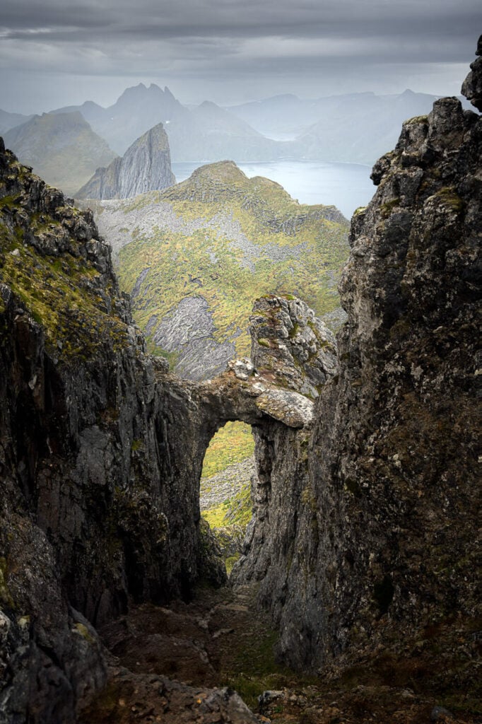
Kongeporten, or the King’s Door.
Armed with that knowledge, I planned to hike to Inste Kongen and Kongeporten on my next trip to Norway. So this is the report of this hike, which I finally managed to do in 2023. Even then I just managed to do it as a storm was rolling in.
Anyway, while the trail is relatively easy to follow, this is a long and physically demanding hike that also requires climbing steep and exposed rocks.
So beware: you should attempt this hike only if you have alpine experience, some basic climbing skills, and a head for heights. Read on for the details.
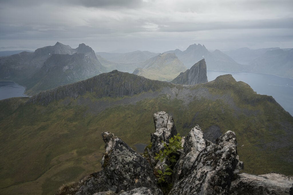
View from the narrow summit.
Table of Contents
Overview of the Inste Kongen and Kongeporten Hike
As mentioned above, this is a tough hike, mainly due to the total elevation gain and the exposed climbing sections. The total elevation gain is 1,600 meters (1 mile), despite Inste Kongen being only a 738 meters tall mountain.
This is because you would have to cross two mountain passes to get there and cross them again on your way back. On the upside, you will pass by Hesten to get there, so you can easily combine the two mountains in one hike.
Here is a quick overview of the numbers:
| Max Altitude | 738 m |
|---|---|
| Distance | 11.7 KM |
| Elevation gain | 1,610 m ↑ / 1,610 m ↓ |
| Hike time | 05:30/ 06:30 Hours |
| Hike Difficulty | Hard, with climbing and exposed sections. |
Inste Kongen, in the middle of the image.
How to get to Inste Kongen and Kongeporten and Parking
The start of the hike is exactly the same as the one to Hesten or Segla, depending on where you parked the car.
- Driving Directions: First, you would have to reach the small village of Fjordgård. Whether you are coming from Tromso or the Evenes airport, the drive will take about three to four hours.
- Parking: There are two paid parking areas you can leave the car at. One is down by the Harbour, on the far side of town. The coordinates for the Harbour parking are 69°30’44.4″N 17°37’40.5″E. The other is a paid parking close to the trailhead by the local Montessori school. Its coordinates are 69.5047121886322, 17.62691999041218. You can pay using the EasyPark app.
- Public Transport: the only options are Bus 370 or 380 from Lysnes to Mefjordvær, which stops at Fjordgård.
The Inste Kongen and Kongeporten Trail
The trail is completely unmarked but reasonably easy to follow. The only exceptions are the boulder fields of the second pass and the summit, where there are 2-3 different lines you can follow.
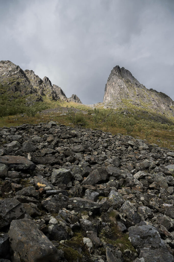
The first part requires you to hike to the saddle between Hesten and Stavelitippen. From there you will need to hike down into the valley on the other side and head up the boulders field on the other side, to reach the next mountain pass.

Very rough outline of the first part of the trail between Hesten and the second mountain pass.
Part of the trail in the marshy area
You will need to cross the wetland in between the two mountain passes. While this section is not too bad in terms of bog, I’d recommend having proper waterproof boots, or fast-drying shoes.
As you approach the pass, you should be able to see the trail again, and you can follow it for the first part of the climb. Keep an eye out for cairns here; there are a few small ones you can use too. navigate through the boulders.
While the pass looks almost impossible to hike from afar, it is actually quite straightforward to climb.
Once you are close to the top of the pass, do not cross it. Keep an eye out for a steep trail to your left. Take that one. I initially tried to cross the pass there but it did not look very safe option, so I opted for the other steep trail, which turned out to be easier (and safer).
Looking back toward Fjordgård. Look for this steep trail before reaching the top of the rocky pass.
You will then have to cross on the other side of the mountain and you should be able to see faint traces of trails to your left. To reach them you will need to descend a little further.
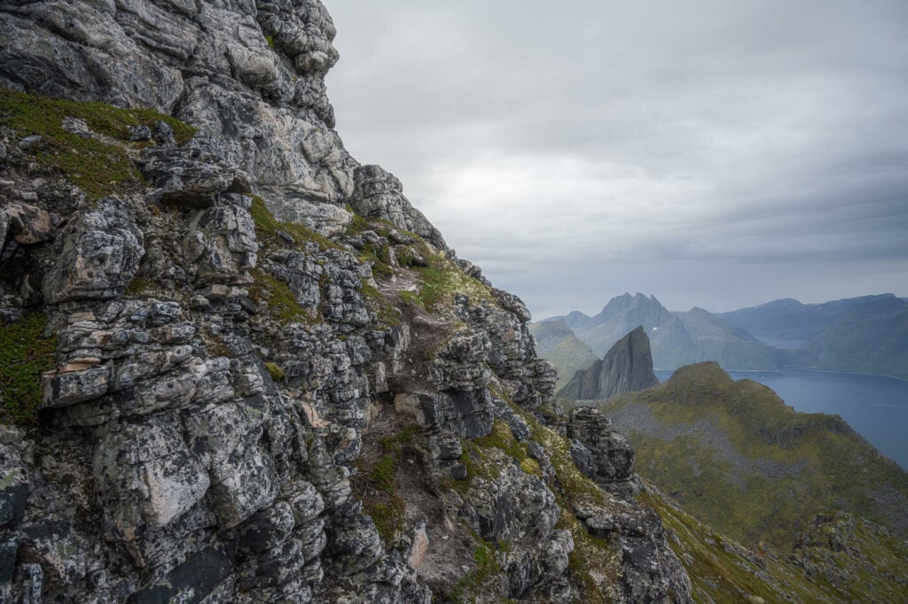
Here again, you will need to cross some rocky and slippery sections where the trail is only partially visible. Here you will need to circle around Inste Kongen to climb it from the opposite side.
The other side of the pass; if you look closely, you will be able to see faint trails here and there.
Once you get there, you will have Inste Kongen to your left. You should also be able to see another trail that goes around it. That is the one to get to the top of Kongeporten, but you will not be able to get to the summit from there.
To do that, you will pretty much need to climb your way up to Inste Kongen to your left. there are 2 or 3 lines you can follow as far as I could tell, and you will probably need to do a bit of route-finding too. Either way, try to pick the one that feels the least dangerous because all of them are steep and rather exposed. There’s no way around that.
If you want to go on the Kongeporten, look for a trail to your left here.
The “easy” part of the climb to the summit.
Halfway up the climb, you will pass by the Kongeporten viewpoint, which is just below the summit. Another short climb and you’ll be on top. Enjoy the views!
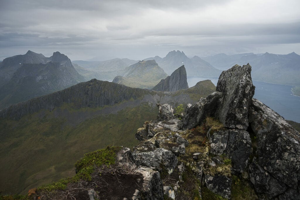
View from the summit of Inste Kongen, toward Senja.
The Inste Kongen and Kongeporten Hike Photos and Photography tips
First of all, you will be passing by Segla, a mountain that is always a pleasure to photograph. If you are planning a morning hike, you may want to start it at sunrise, to catch the morning light. Otherwise, you can plan to visit it for sunset, on the way back. I won’t spend much more time on Segla in this post. If you want to read more, you can read my post on the Hesten and Stavelitippen Hike, or on Hiking to the top of Segla too.
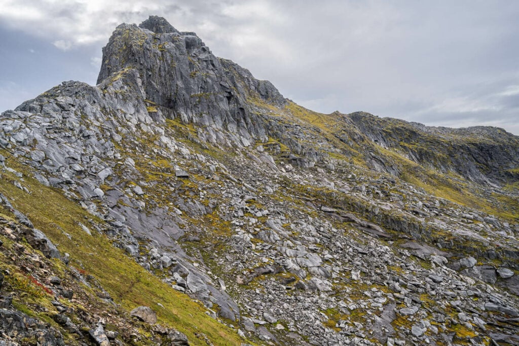
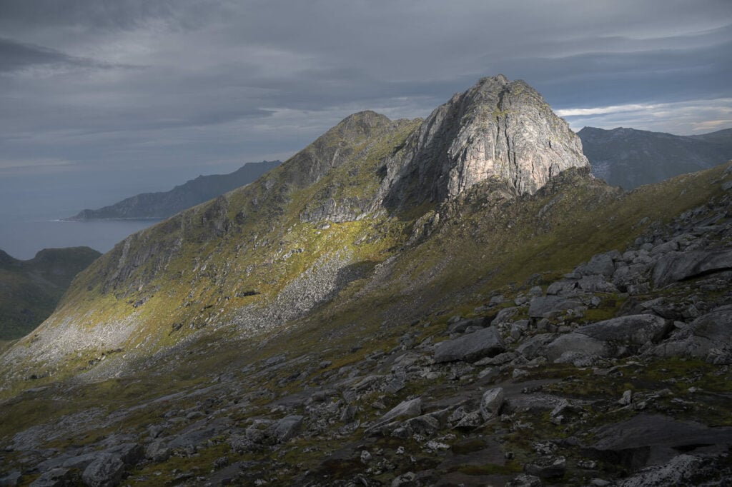
Inste Kongen, photographed from Stavelitippen.
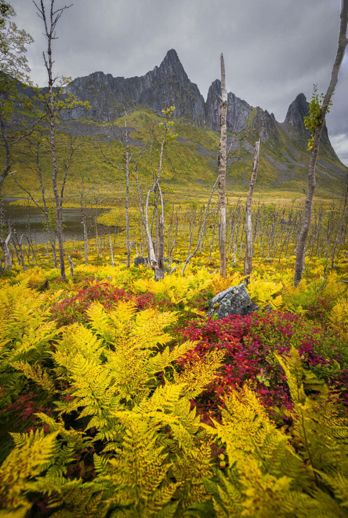
With that said, let’s move on to the Inste Kongen and Kongeporten part. The view of Insta Kongen from the first ridge already provides some good landscape photo opportunities. Same as you hike down through the birch trees, especially in late summer and early autumn when the colors start to kick in.
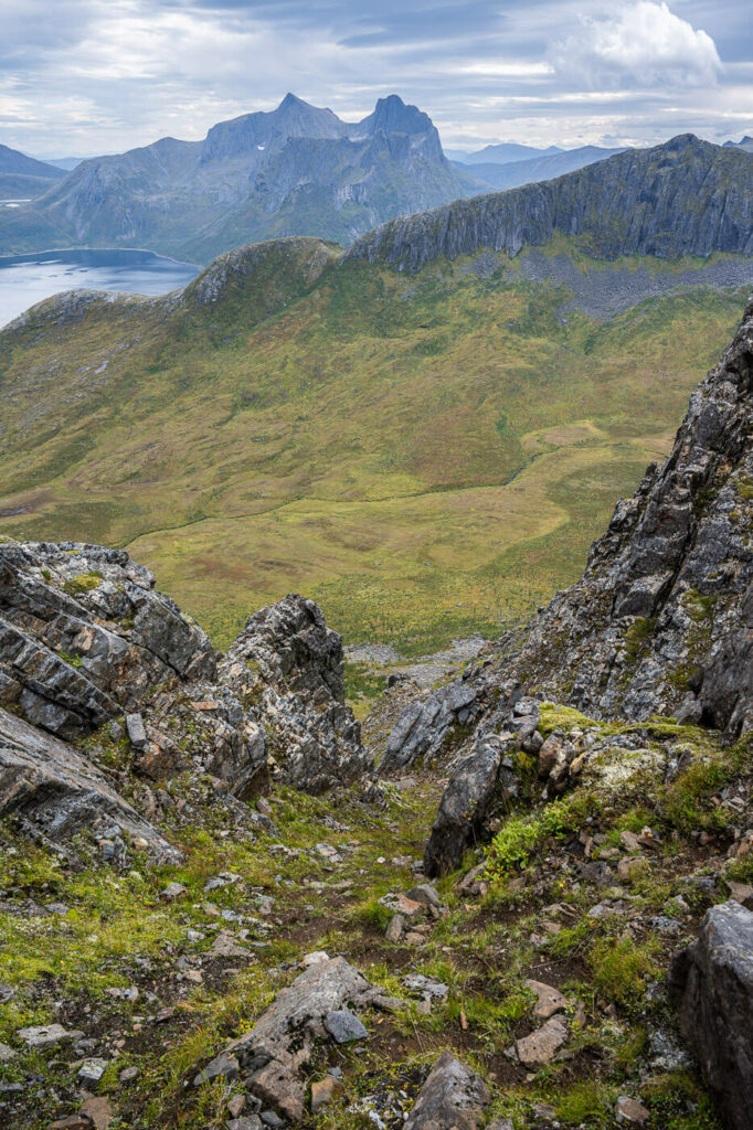
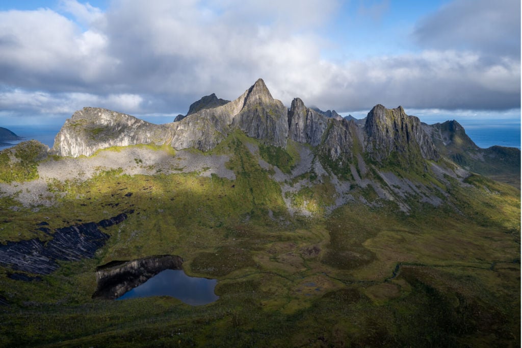
The next best views are from the last saddle before the climb up to Inste Kongen. You get fantastic views of one of the most isolated parts of this fjords, and they are amazing. The lake in the Middle is Toftevatnet.
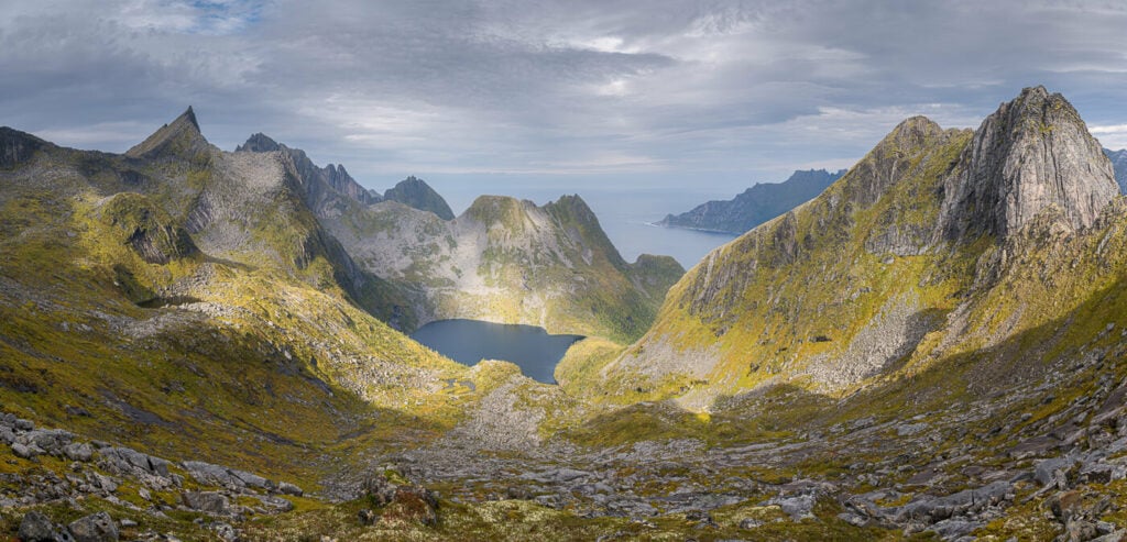
Panoramic image of the landscape behind Inste Kongen, with Toftevatnet in the middle.
Some light on Stevelitippen. In the background, you can see Hesten and Stavelitippen.
The last bits of Light I had before the storm rolled in.
Next, Kongeporten. the best view of it will be on your way up to the summit. It’s quite a subject and it’s one of those locations that looks straight out of a fantasy movie, with a name to match – the King’s door.
You can also see photos of people standing on top of it. It’s easy to get there (see the previous description of the trail),
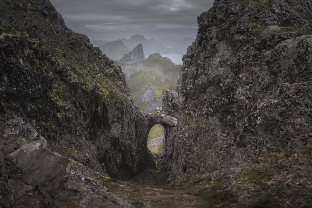
Kongeporten. While I was hoping for some light, I think dark tones suit this location well too.
Lastly, this is a location that should work well both for Sunrise and Sunset, since you have a spectacular, scenic landscape all around.
Video of the Hike
Here is also a short video of this Hike. Just a quick note; I did not film the most exposed climbing parts just below the Inste Kong summit, because I was busy not falling off the mountain :).
Map of the Inste Kongen and Kongeporten Hike
Here is the map of this hike. You can download the GPS file from the Komoot activity below. Again, keep in mind some sections require climbing exposed ridges, where a misstep could be fatal.
Where to stay
If you are planning on camping, there are a few options. The most obvious would be in the valley between Hesten and Inste Kongen. Alternatively, it’s possible to camp below the summit, on the ridge before the “climbing” section.
Otherwise, the closest accommodations will be in Fjordgård, where there are a couple of bed and breakfasts as well as a couple of guesthouses.
Additional Resources
- Here’s my full Senja Hiking guide, with the best hikes in the region and trip-planning tips.
- You may want to check out these other amazing Hikes on the Island of Senja: Husfjellet, Keipen and Grytetippen, Segla or Hesten and Stavelitippen.
- Check out the main page on Hiking in Norway for more hikes in Norway.


Leave A Comment