Hike to Blåisvatnet, a Beautiful Turquoise lake in the Lyngen Alps, Norway
If you are in the Tromsø area, the hike to Blåisvatnet is one that you shouldn’t miss. A beautiful, deep blue lake surrounded by steep and dramatic mountains, with a beautiful glacier on top of it. This is one of the most beautiful locations in the Lyngen Alps and well worth the time it takes to get there – which is relatively easy btw.
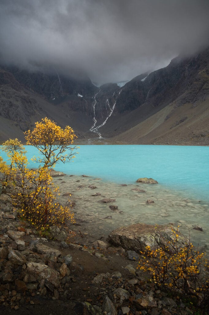
If you are wondering whether that color is real, yes, it is. It’s even better when you see it with your own eyes.
Blåisvatnet is also quite a popular location with locals, but it still is a bit of a hidden gem to international tourism compared to other locations in Northern Norway. Still, this is one of the best hikes you can do near Tromsø – and the trail is quite easy too.
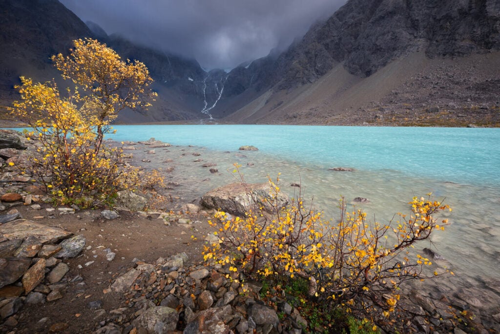
Table of Contents
Overview of the Blåisvatnet Hike & Map
The hike is quite easy, although for te most part you will be walking on a dry riverbed where there are several big stones. So while the elevation gain is modest, the difficult part will be walking on rocks and uneven terrain for most of the trail. So while the trail is not difficult per se, walking on big rocks for three KM isn’t exactly exciting. The beauty of the lake more than makes up for that though!
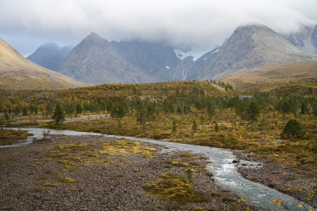
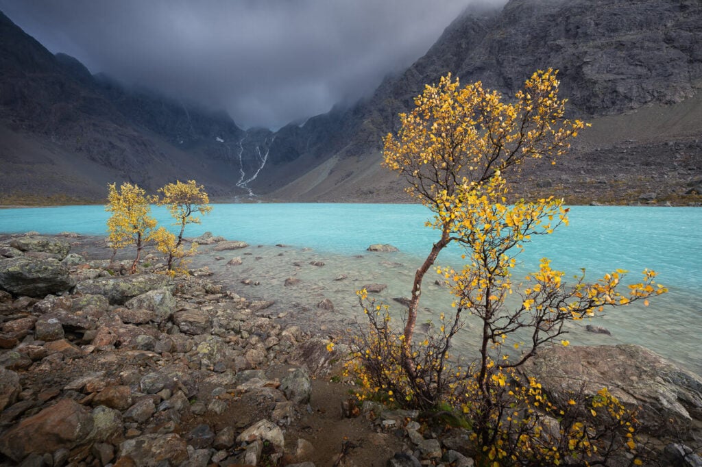
View from the trail, looking toward Blåisvatnet. the river comes from the same lake.
Technically you could do this in winter too, but the lake would be completely frozen over – typically until early June. So if you are doing this hike in the hope of catching the beautiful color of the lake, you should do it in summer to early autumn.
Again, as this is one of the best hiking trails and locations around Tromsø, you can expect it to be quite busy on a nice sunny day. Also, you consider hiking for sunrise or sunset if you wish to have a more relaxed experience. I did it around sunset at the end of summer and met a few people on the trail – and I had the lake all to myself for about 40 minutes!
| Max Altitude | 185 m |
|---|---|
| Distance | 9.53KM |
| Elevation gain | 170m ↑ / 170m ↓ |
| Hike time | 02:30/ 03:00 Hours |
| Hike Difficulty | Easy |
Here is the map of this hike. You can download the GPX file for free should you wish to from the activity linked to the map.
How to get to Blåisvatnet and Parking
Located in the Lingen Alps, it takes about 2 hours and a half hours to drive from Tromsø to the Blåisvatnet trailhead. You can also take a ferry to shorten the drive, and in that case, the drive is about two hours. I preferred the drive because I like scenic drives, and this is one of them.
Also, the drive with the ferry is about 70km, without the ferry it’s about 170 – so it is considerably longer and this is something you may want to factor in too.
- Driving Directions: You have two options to drive from Tromsø to Blåisvatnet. You could either take the ferry from Breivikeidet to Svensby or drive around the Lyngen Alps via Nordkjosbotn. You can check the Breivikeidet-Svensby timetable here. The other option is driving the E6 route towards Alta and then turning onto Road 868 after Oteren. Then take road 91 after Lyngseidet, and follow it until you reach the parking area. if you are coming from the opposite direction (from Alta, for instance, you can also take the Olderdalen-Lyngseidet ferry and continue on Road 91 from there.
- Parking: Paid parking is available at the trailhead. You could either use the EasyPark app, if you have the camera option active, or you can dist drive in and then check out at the Paying machine before you go out. If you do the latter, the machine will ask you for your booking reference number. That will simply be your license plate.
- Public Transport: Bus 465 stops by the trailhead. Check fylkestrafikk.no for the timetable. The stop’s name is Botnkrysset.

The parking area by the trailhead.
The Blåisvatnet Hiking Trail
The trailhead is directly accessible from the parking area and it starts as a nice, wide trail on gravel. Then the trail gradually changes. Next, a short section on wood chips with a bit of bog here and there, covered by boardwalks.
Then the trail will gradually become rockier and rockier until you find yourself on a very rocky river bed. that’s about 1km into the hike, so you’d have an additional 3km to complete on very rocky and uneven ground to reach the lake.
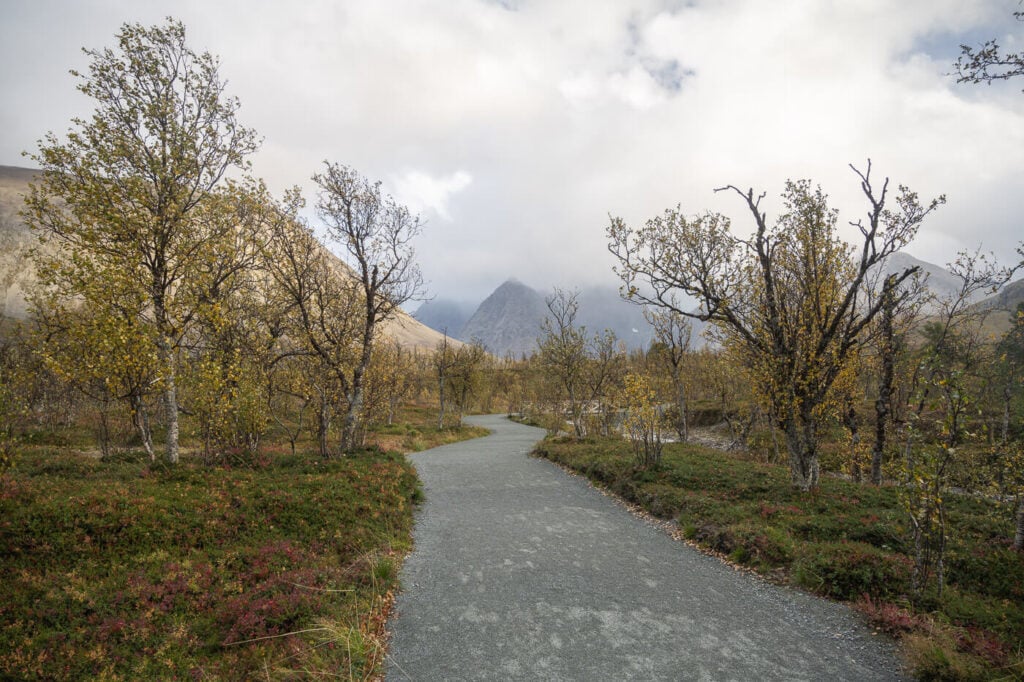
The first part of the trail, an easy path on gravel.

There are boards on some sections, to both preserve the vegetation and to help avoid the bog.
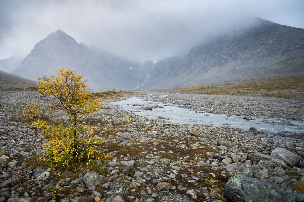
Lastly, the trail is on a dry and rocky riverbed for the last 3KM
From here, you essentially follow the river (name” that comes from the lake itself. Again, it’s easy enough but 3km on uneven and rocky ground is relatively slow going. Bring your hiking poles if you have them to help with balance.
While you have an amazing view of the mountains and the glacier in front of you as you progress on the trail, there’s no good view of Lake Blåisvatnet until you are almost upon it.
Blåisvatnet is only visible at the end of the trail, once you are almost upon it.,
Kind of a relief to see it after a long walk on the rocks. You can walk all along the shore, in between more rocks and birch trees. Be careful on the rocks, they are bogger closer to the lake, and some with huge gaps in between them.
The view of the lake will have made the long walk absolutely worth it!

The Blåisvatnet Hike Photos and Photography Tips
This is an extremely beautiful and photogenic location, although somewhat difficult to render. The lake is bigger than it looks on photos, and there are no real good vantage points on higher ground.
However, I have found the several birch trees along the short to be a really good element to add and they helped to create depth and add sense of scale.

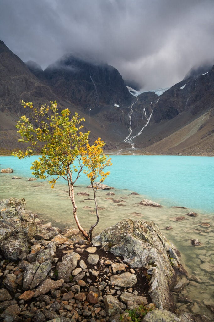
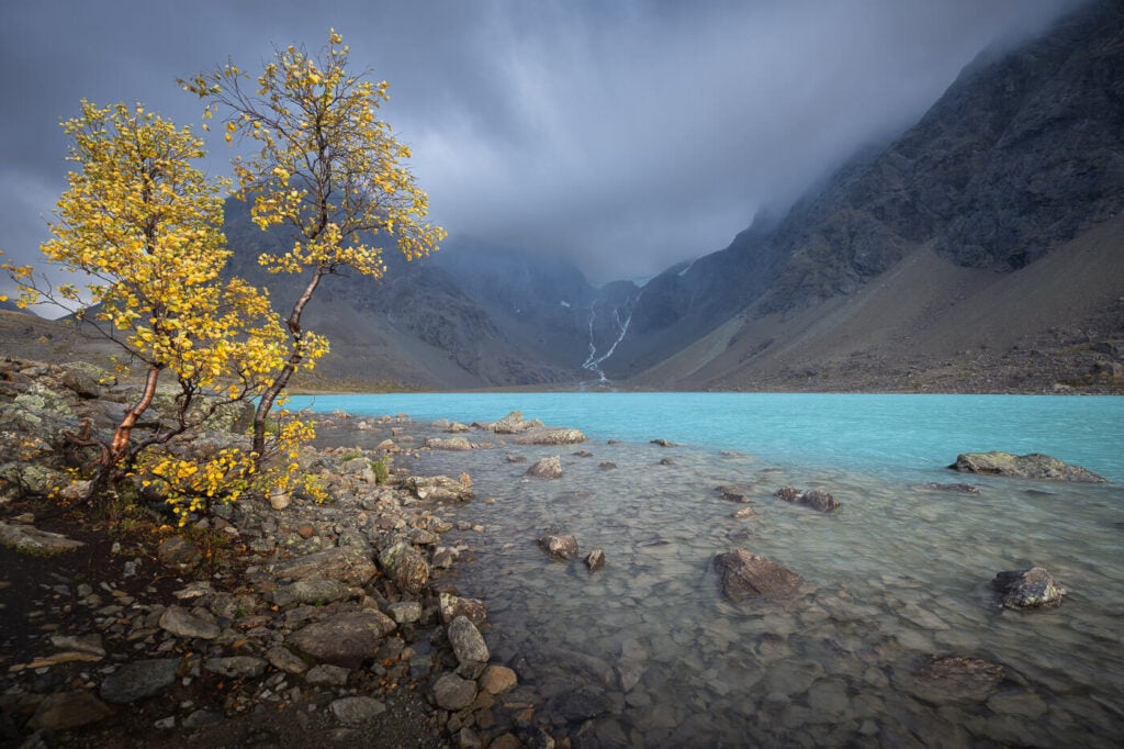
If you have to occasion to do it in September, when the foliage starts to show its best fall colors, go for it. the contrasts between the yellow, birch trees leaf and the deep blue waters of the lake are just amazing.
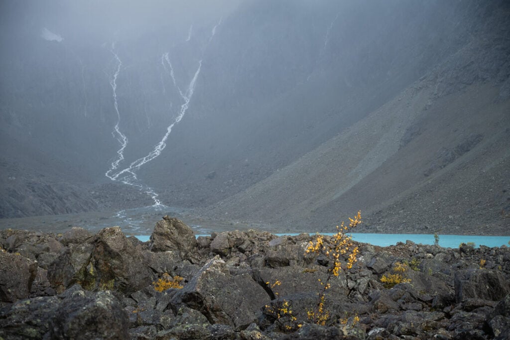
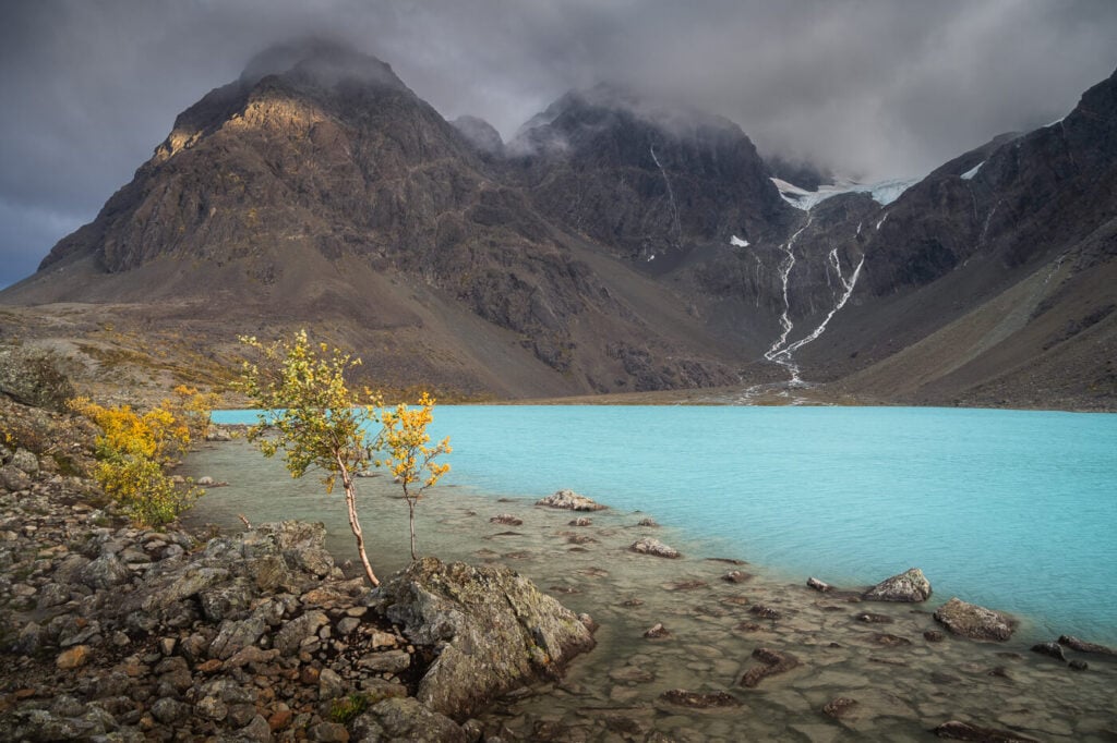
A note on the waterfalls you see in the photos. Those are not always there like you see them. It was a day of heavy rain when I visited, so the waterfall depends on rain and melt water levels.

The Lenangsbreen Glacier and its waterfalls above Blåisvatnet
Lastly, there are reindeer in the area. I saw some from a distance. I only had my 24-70mm lens on the long side with me, so this is heavily cropped. But I’d recommend bringing a long telephoto lens, just in case, and if you are into wildlife.
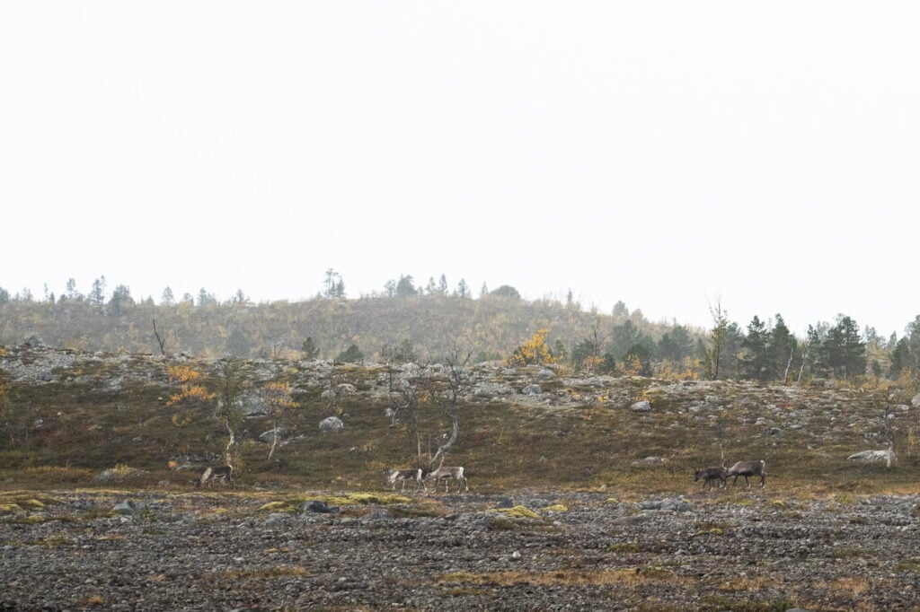
Reindeer herd walking around the Blåisvatnet hiking trail
Where to stay
If you are traveling with a van or a camper, you could spend the night in the parking area, which also offers clean toilets and a few picnic tables. The daily flow is 250NOK, so not exactly cheap – but there are more equipped rest areas along the Lyngen Alps.
I spent the night in my van at the Hatteng Rest area – quite a large one at the southern tip of the fjord with good facilities.
Otherwise, this can easily be done as a day trip from Tromso, but there are several different types of accommodations available all around the Lyngen Alps.
Additional Resources
- For another awesome hike in the Lyngen Alps – not too far from here, check out the Steindalsbreen Glacier Hike.
- Check out the main page on Hiking in Norway to discover more beautiful hikes and locations.


Leave A Comment