Litlverivassforsen Waterfall, Epic Hike in the Rago Park Wilderness
Litlverivassforsen is a 223-meter-high waterfall in Northern Norway that you can visit on a hike through the Rago National Park. The Waterfall, also called Værivassfossen, originates from the Litlverivatnet (Bassejávrre) lake.

Litlverivassfossen
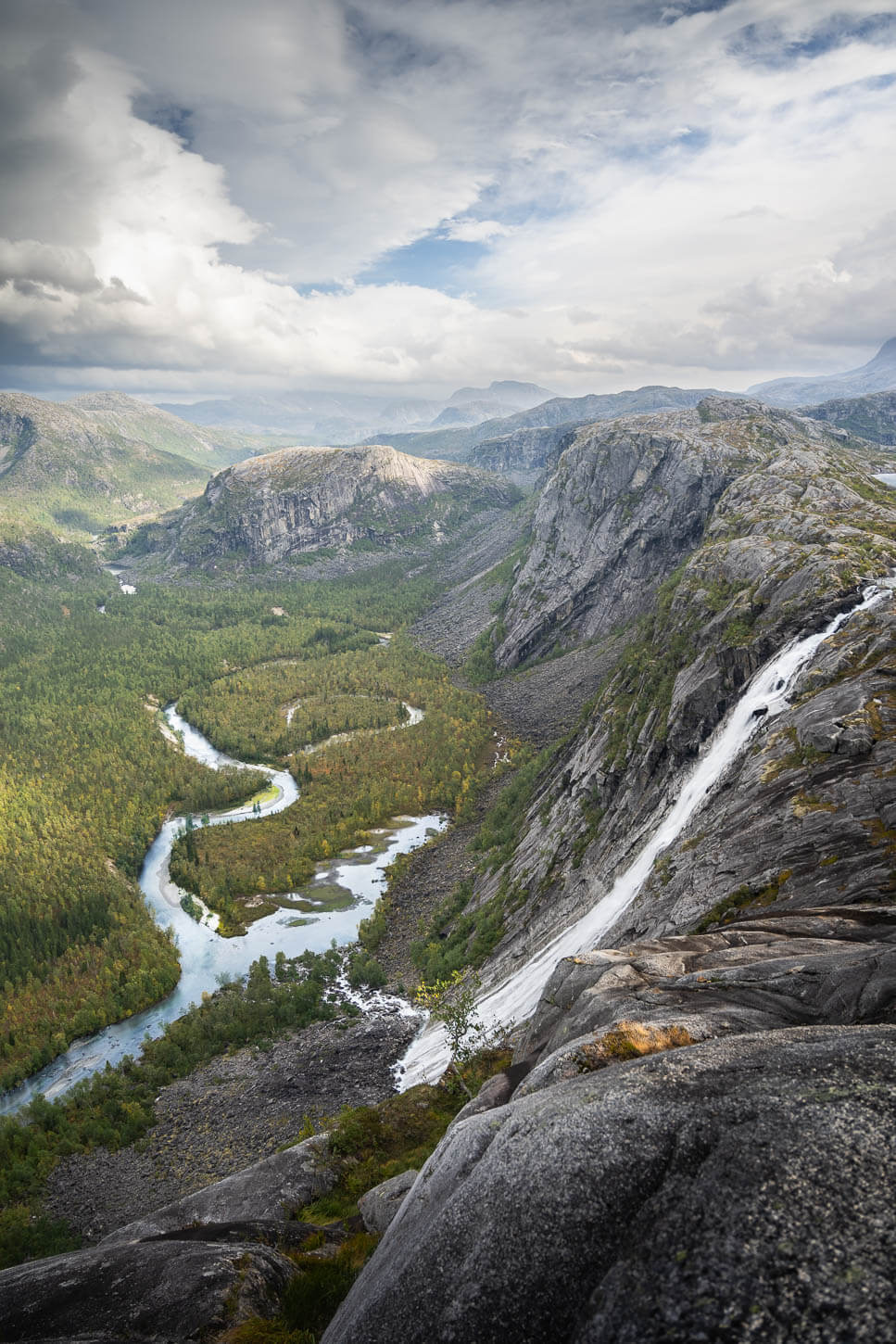
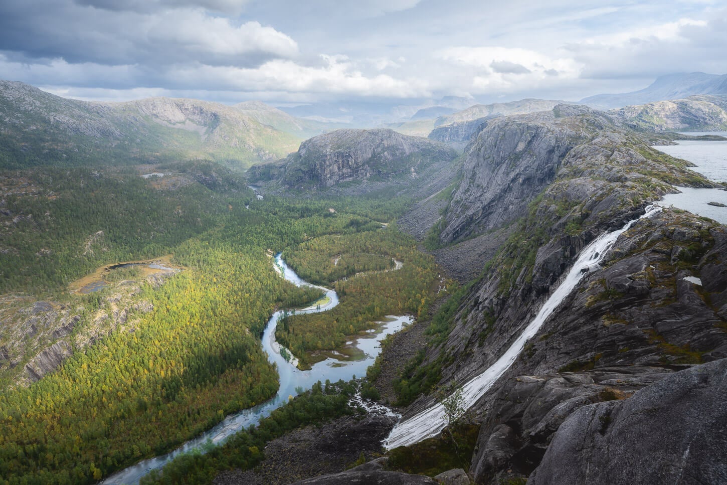
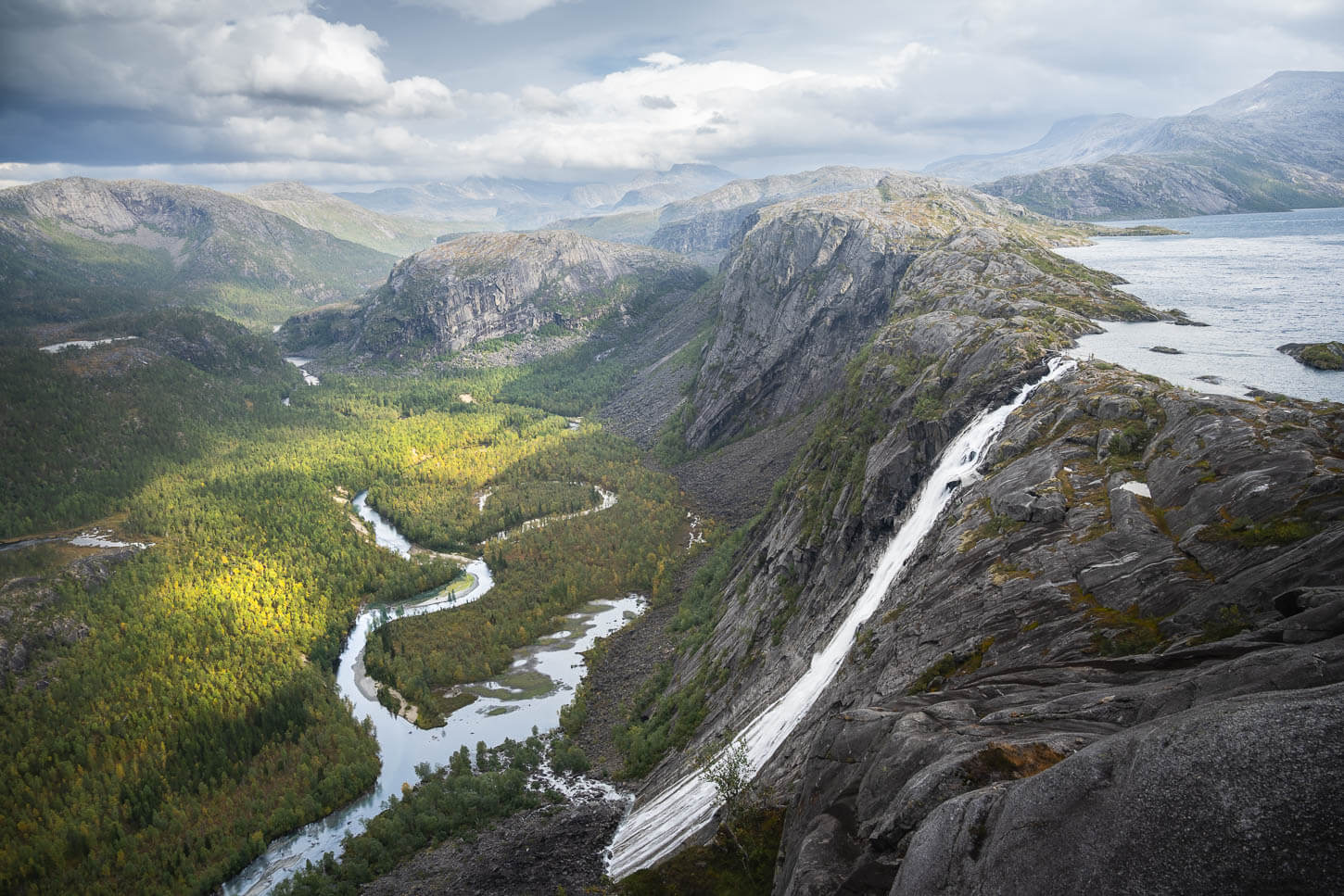
The waterfall’s name is also spelled as Litlverivassfossen or Værivassfossen, and the location is absolutely epic. From the main viewpoint above the waterfall, you have the view of the Litlverivatnet lake, from where the Litlverivassforsen waterfall drops into the valley below for more than 200m, where it joins a meandering river that flows through the wilderness of the Rago National Park.
I spent a couple of hours at the main viewpoint, looking at the waterfall and the landscape, and waiting for better light. Time flew, and it felt like one of those places you never want to leave. You have two options to hike to Litlverivassforsen. A longer 23.6 km (14.6 miles) loop hike through the Rago National Park, or a shorter, 9 km (5.8 miles) out-and-back hike to the waterfall. I did the longer hike as a day hike, but I’ll describe both, since both options rely on the same trail.
This loop hike turned out to be one of my favorites in Northern Norway, because of its length, landscape, pristine environment, and, of course, the beautiful waterfall. All the ingredients that, for me, make a hike stand out.
The Rago National Park is one of the smallest in Norway, but it offers a pristine mountain environment.
Table of Contents
Overview of the Litlverivassforsen Waterfall Hike & Map
The entire loop hike to Litlverivassforsen is long and relatively demanding. Overall, it’s difficult to complete in a single day, as the loop is almost 24 km. For this reason, may choose to do it over two days, camping along the way. In this case, the most common option is to hike counterclockwise and stop at the Storskogvasshytta hut.
Alternatively, you can do it as a much shorter, out-and-back hike from the first parking area. The shorter hike is 9 km (5.8 miles) in total and still has a total elevation gain of 550 meters (2,132 feet).
| Max Altitude | 450m |
|---|---|
| Distance | 23.6 KM (14.7 miles) |
| Elevation gain | 1,320m ↑ / 1,320 m ↓ (4,525 feet) |
| Hike time | 07:00/ 08:30 Hours |
| Hike Difficulty | Hard |
Here is the map of the hike. You can download the GXP file for free from the activity linked below.
How to get to the Litlverivassforsen Waterfall Hike trailhead and Parking
Located not too far from Bodø, and off a short deviation from the E6 highway, the trailhead is quite easy to reach. It is accessible to any regular 2WD, in case you are wondering.
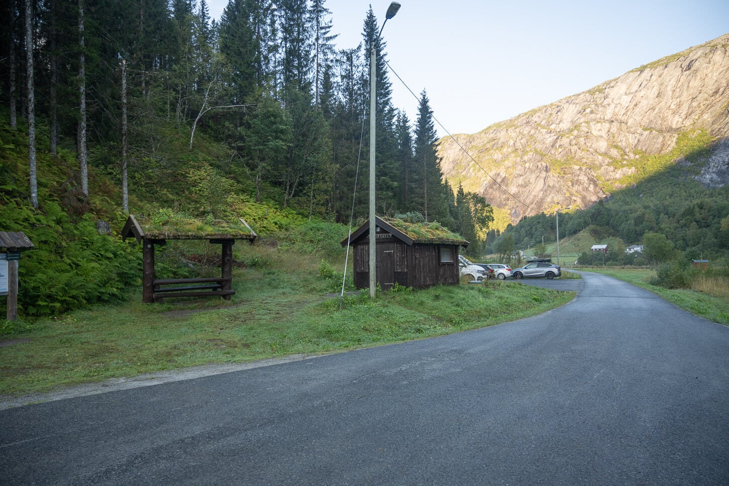
- Driving Directions: From Bodø, take road 80 North until the junction with road E6. Keep driving north until the Turnoff onto road Fv617. Keep an eye out for it, as it is a narrow road and somewhat hidden from view. Once on that road, drive past the campsite. After about ten minutes, you should reach the first parking area.
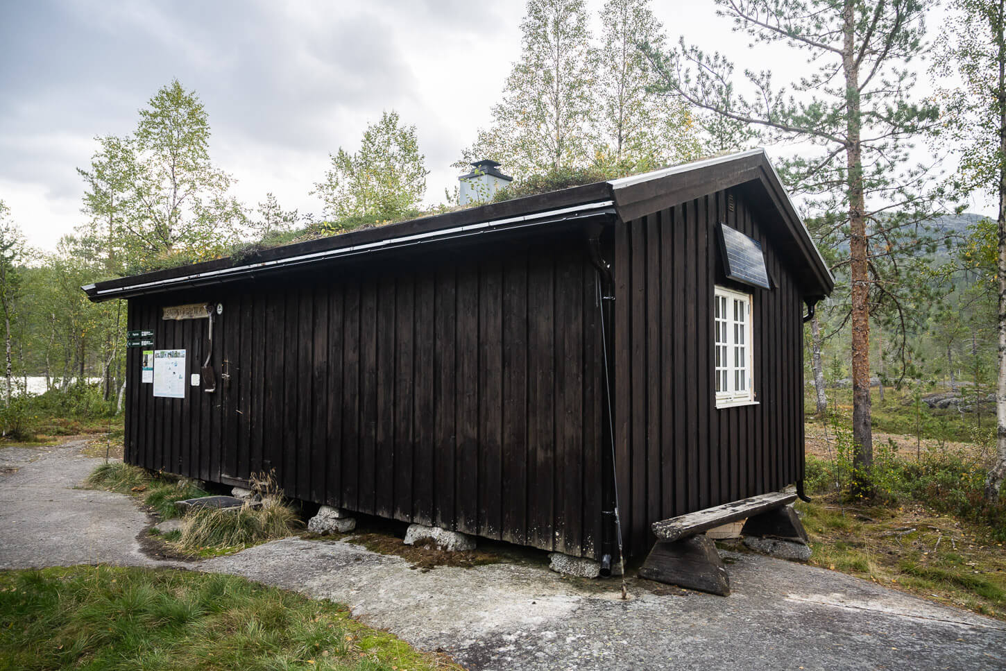
- Parking: There are two parking areas. The first parking area you’ll come across is where you should park if you plan to hike to the waterfall as an out-and-back, the shortest route. It is also the larger of the two parking areas. To get to the second parking area, keep driving to the end of the road for about another five minutes, until you reach the end of the road. The area is smaller, but it does have a free restroom. It is prohibited to park along the road outside designated parking spaces.
- Public Transport: At the time of writing, there are no services that can drop you off directly at Rago National Park or at either of the two parking areas. The closest stop is on road E6, the Trengesel bus stop. From there, it’s about 4km to the first parking area and 6 km to the second. So not a prohibitive distance.
The Trailhead at the second parking area.
The Litlverivassforsen Loop Hiking Trail
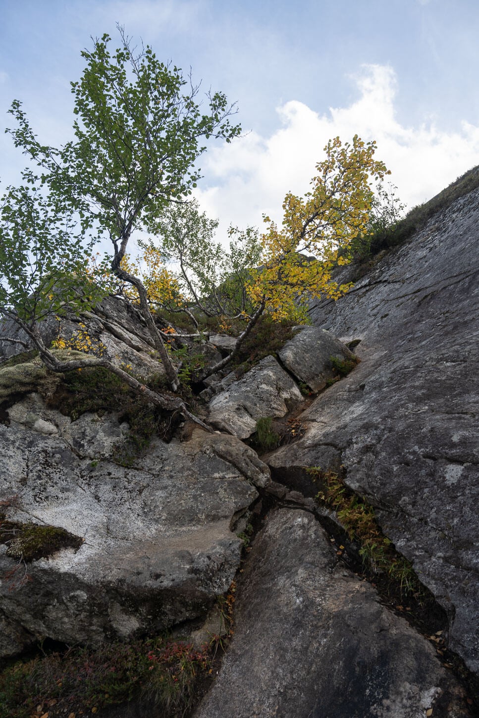
From the parking area, the trail initially meanders through the forest and along one of the rivers in Rago National Park. It’s easy walking initially, while soon enough you’ll come across the first muddy sections, if it rained recently, and other sections where you’d have to navigate through the vegetation or around big boulders. From these first sections, you can already see how pristine this environment is. The vegetation is also quite dense, so progress is slow at times.
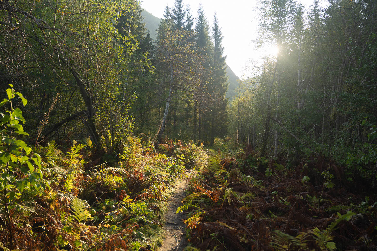
The vegetation is quite dense right at the start of the trail, which makes you feel how pristine the area is.
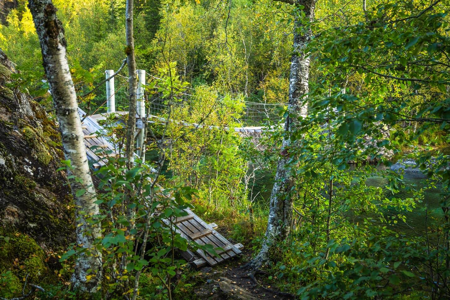
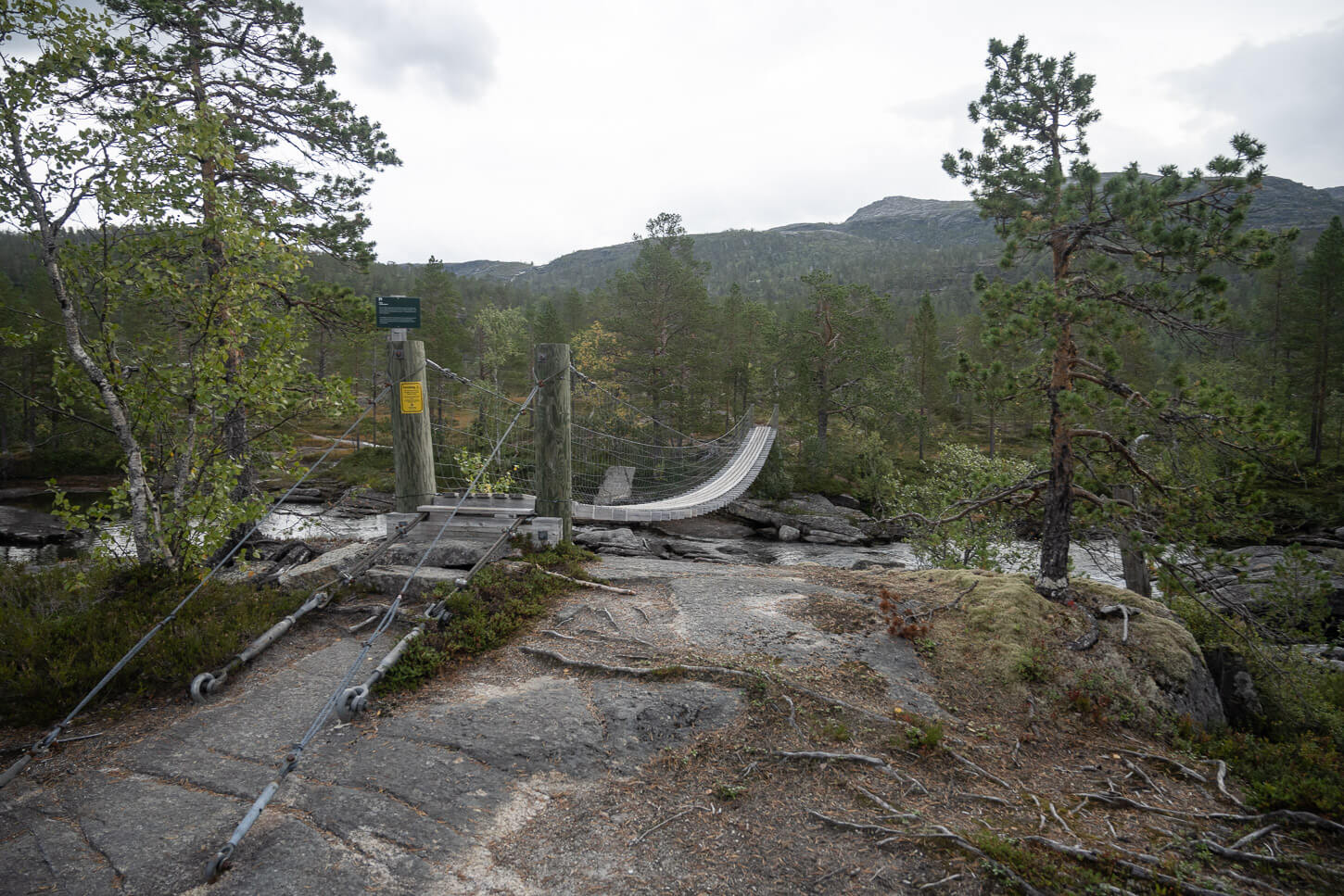
The first of the three suspension bridges on this trail.
Soon enough, you will reach another section of the river that you’ll have to cross. Here, a suspension bridge, Hengebro, had been installed, one of the three you’ll have to cross on this hike. After the bridge, the trail will climb up rather steeply to a high plateau, from where you get a good view of the landscape around.
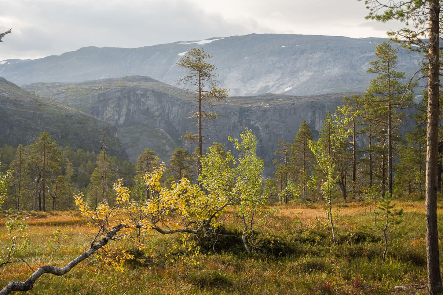
While the Rago National Park is one of the smallest parks in Norway, the views of the pristine landscape around the trail are still on a grand scale.
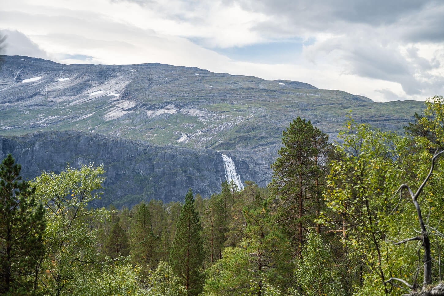
First view of Litlverivassforsen from a distance.
On this stretch of the trail, you also get the first view of the waterfall. It’s quite a distance away, and you can only see the upper part. However, the view provides a clear sense of how large the waterfall really is. From here, the trail continues through the forest all the way to the hut Storskogvasshytta.
This is also where I found two Porcini/King Bolete mushrooms. They ended up in a soup I made that evening. Foraging dinner in such a beautiful place is living the life if you ask me!
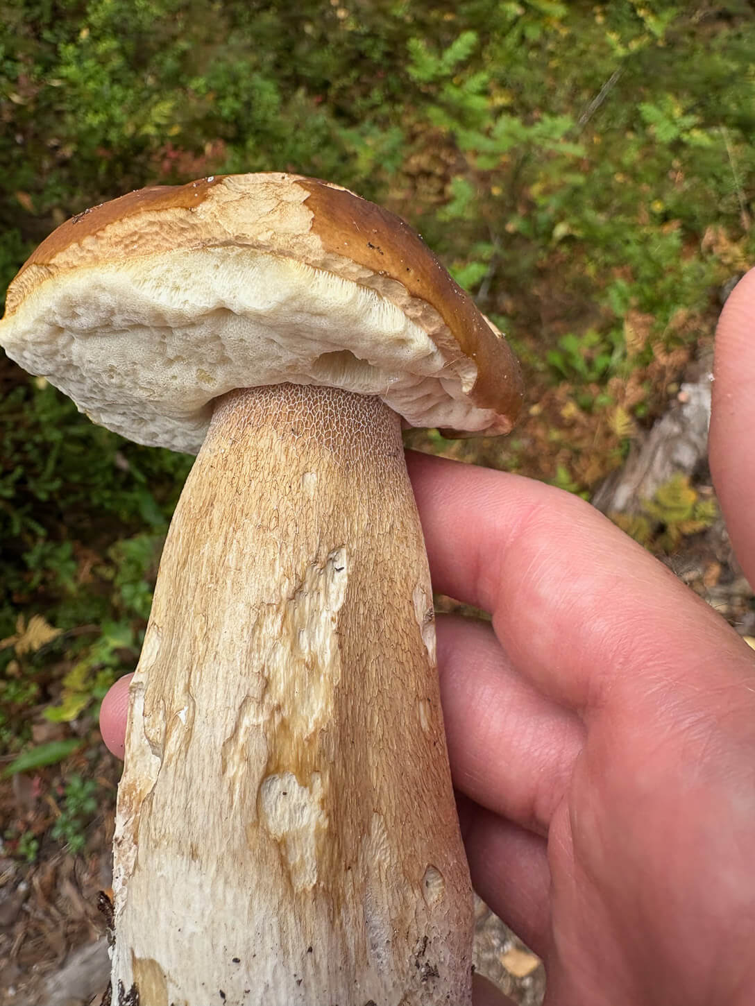
Porcino (Boletus Edulis), or King Bolete.
Storskogvasshytta, Storskogvatnet and Litlverivassforsen
Storskogvasshytta, and the nearby lake Storskogvatnet, are popular locations to spend the night at when doing this hike in two legs. It’s a nice, unmanned hut, available for use. It’s 8 km into the hike when doing the loop trail clockwise from the second parking area.
Storskogvasshytta.
The second suspension bridge on the trail.
Right after the Storskogvasshytta hut, you’ll find the second suspension bridge on the trail. This is also the wobbliest of the three, so you may want to take it slowly. And one person at a time only.
After the bridge, the trail will gain elevation again for about 2 kilometers. In this section, the trail may not be visible at all times, but watch out for the cairns that mark the way. Do pay attention to them, as it may be relatively easy to veer off-trail.
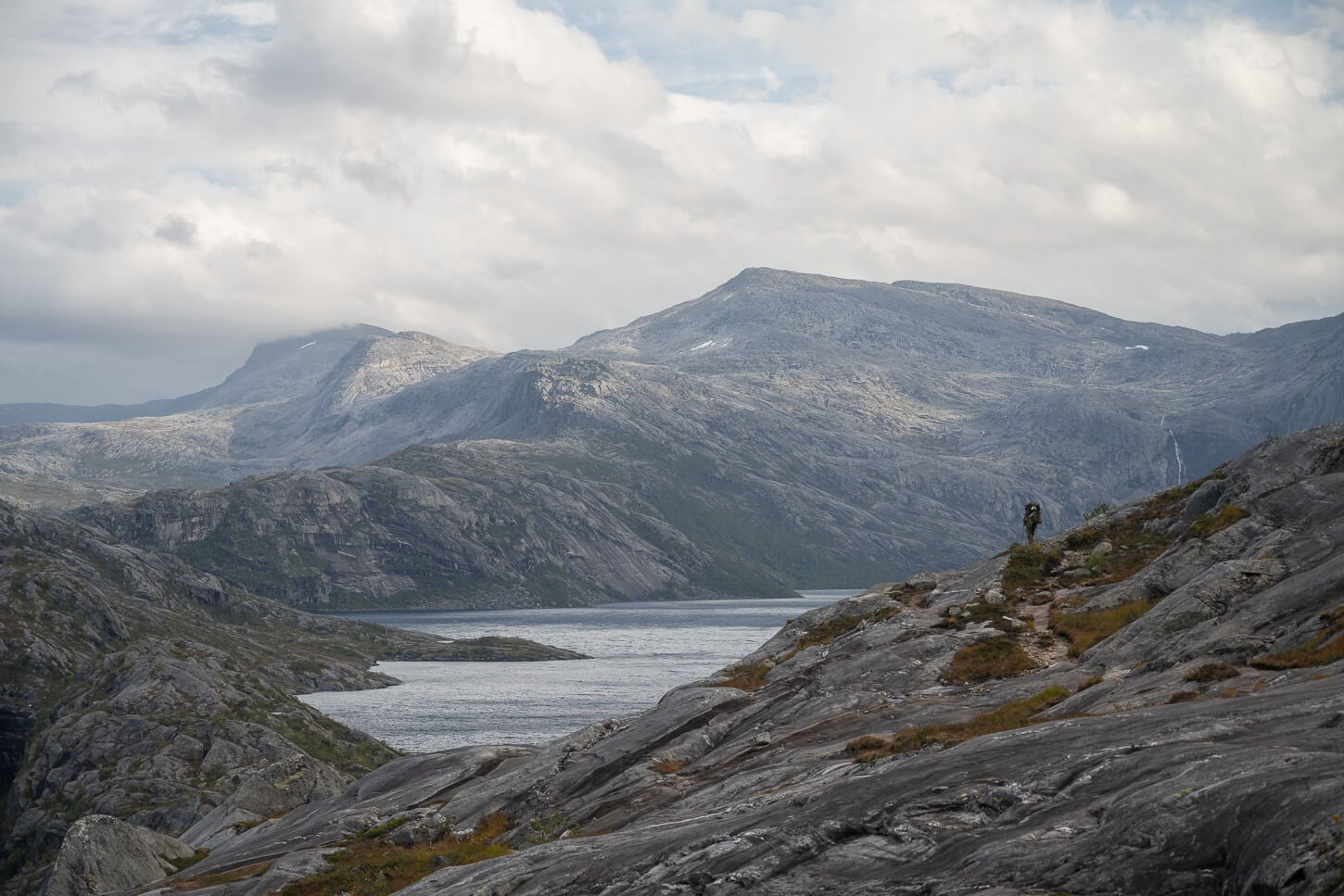
For long stretches, the views open up to panoramas of unspoilt nature.
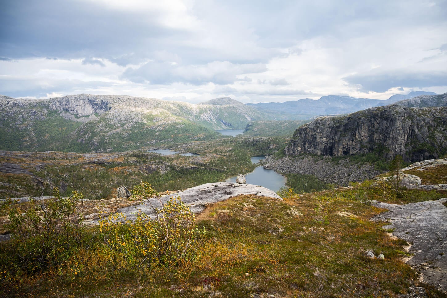
Then, after this uphill stretch, you will find yourself on a rocky high plateau. The views will open up to the valley below, its river, and the surrounding mountain—fantastic panoramic views.
From here, the trail follows a gentle downhill gradient to the Litlverivatnet lake and the suspension bridge above the Litlverivassforsen waterfall.

Litlverivatnet.
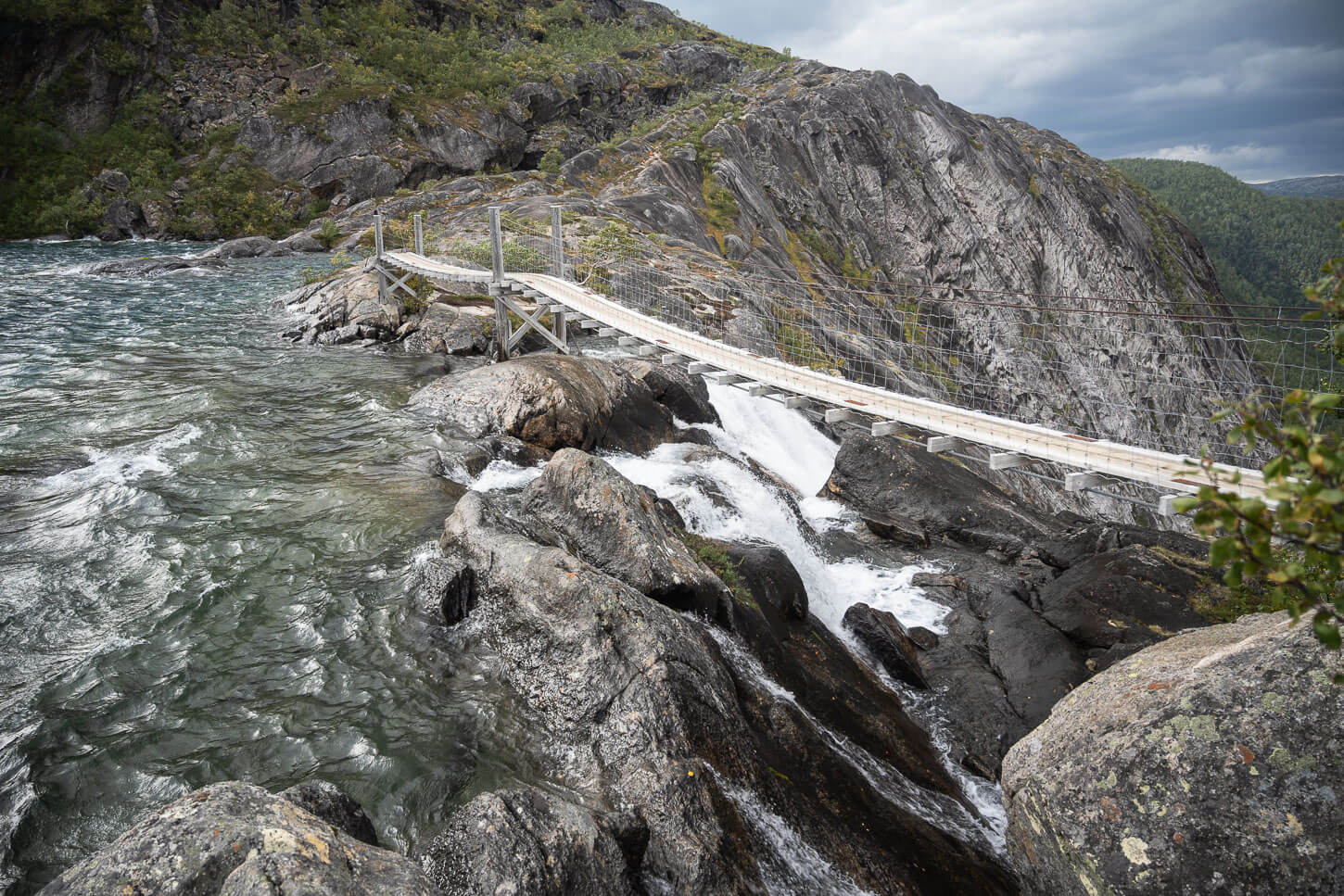
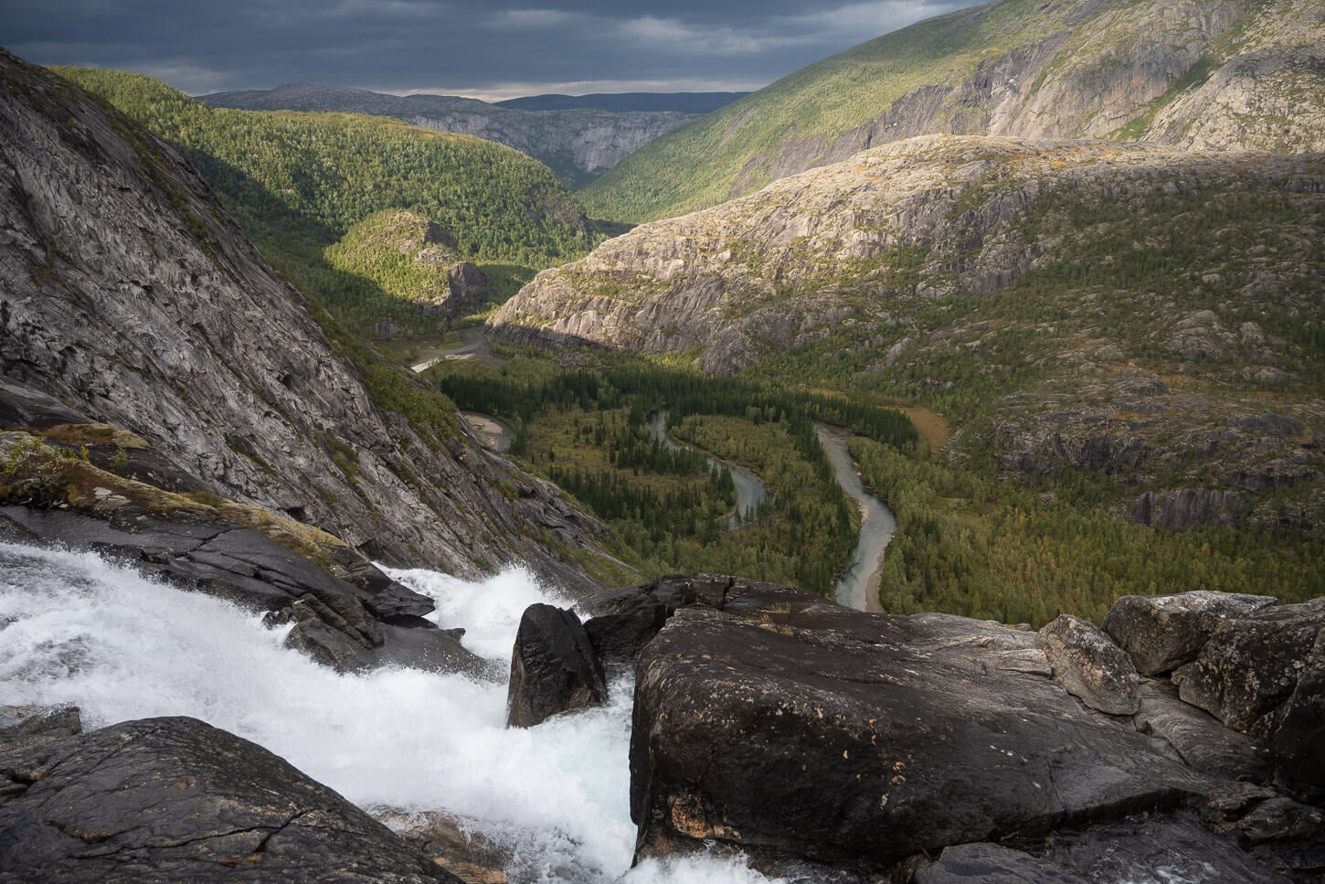
Litlverivassforsen – suspension bridge above the Waterfall.
The bridge across the lake and above the waterfall is sturdy. I crossed it in 70km/h winds, so it is safe to say it really is sturdy. Here, you get a clear sense of the lake’s true size and the waterfall’s height. From the bridge, you can see the top of the waterfall as it cascades down the mountain from the lake.
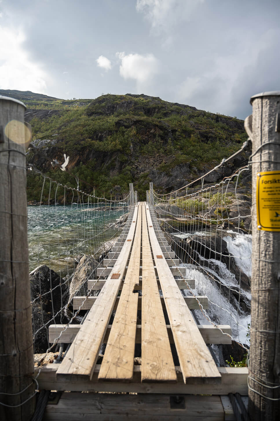
However, you’d have to cross the bridge to the other side to have a full view of the waterfall.
How to get to the Litlverivassforsen Viewpoint
The bridge crosses the waterfall at the exact point where the lake itself turns into a waterfall. This suspension bridge is very stable and not as wobbly as the second one on the trail.
And it’s somewhat hypnotic to watch the water pick up speed and begin to fall down the 200+ meter cliffs. While you do not see much of the waterfall from there, just a bit of the upper section, it’s mesmerizing to watch it fall into the “void.”
Upper part of Litlverivassforsen.
But anyway, as you cross the bridge and walk to the other side, the trail climbs up again on a surface of bare rock. It’s a relatively steep but easy climb. Finding the main viewpoint, however, is a bit of a trial-and-error mission, navigating the rocks closer to the cliffs.
There aren’t really that many spots where you have a good view of both the waterfall, the valley, and the meandering river down below. This is the best sport I could find: 67.433414, 15.832019. It’s already included in the GPX track above. A bit exposed and off the main trail, but you have the full view of the waterfall.
Litlverivassforsen.
Getting back to the Trailhead
From the viewpoint, the trail continues up the hill and down onto the other side. It’s pretty much all downhill from here, with a few marshy areas in between. This is the same section you would have to hike in the opposite direction if you want to do it as an out-and-back.
As you lose elevation, you will re-enter the treeline and reach the steep descent to the first parking area on the road. From there, you can walk on the paved road back to the other parking area.
Litlverivassforsen Out-and-Back Hike
If you want to visit Litlverivassforsen without completing the full 23km loop, you can hike part of the trail as an out-and-back from the first parking area along the road. From the parking area, you will have to hike up the relentlessly steep trail for about a km. After that, the trail will flatten out before reaching a rocky section where some scrambling may be required.
Some minor scrambling is required when hiking the shorter trail.
This rocky section will lead to the highest point on this side of the trail. From there it’s downhill all the way to Litlverivassforsen and the bridge across the waterfall. As you hike down, look for the main viewpoint to your left, toward the edge of the cliffs. As mentioned above, the coordinates are 67.433414, 15.832019.
Approaching Litlverivassforsen from the shorter trail.
From the shorter trail, the viewpoint will be a little off-trail to the left.
Litlverivassforsen Photos and Photography Tips
In terms of landscape photography, the big highlight is obviously the Waterfall. Litlverivassforsen is more of a late-afternoon, sunset location than a sunrise-early-morning location. The main reason is that Litlverivassforsen faces north-west. This means it gets good light later in the day. This is crucial because you want the light to hit the waterfall when the sun is out. If you go from morning through early afternoon, the waterfall will be in the shade. That’s not ideal lighting for the big highlight, but it would not matter much if it is cloudy.
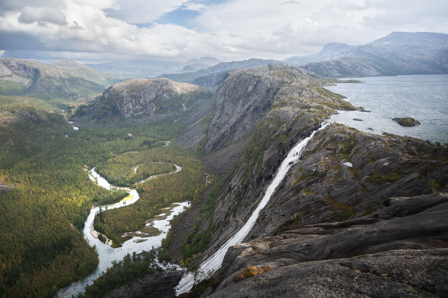
Litlverivassfossen
As you can see in my photos, the light barely hit the river down in the valley below. Provided the weather cooperates, I’d recommend planning to be there from mid-afternoon onward. At that time of day, if the sun is out, the waterfall will be illuminated, highlighting the main feature of the landscape and creating depth along the meandering river below. which, if it were also lit, could create an additional layer of depth when reflecting the light.
Unfortunately, I could not attempt to hike this for Sunset due to a rain forecast later in the day, so I had to do it in the morning. But I look forward to visiting again now that I know the best spots. And, regarding those you’d ideally want to be in the general vicinity of the following coordinates (67.433414, 15.832019) to have the best views of both Litlverivassforsen and the valley below.
I mostly photographed the waterfall with a 24-70mm lens, full frame. However, I took a couple with the 14-24 mm lens too. I think 24mm is enough, but 14mm is handy if you want to capture the whole lake too.
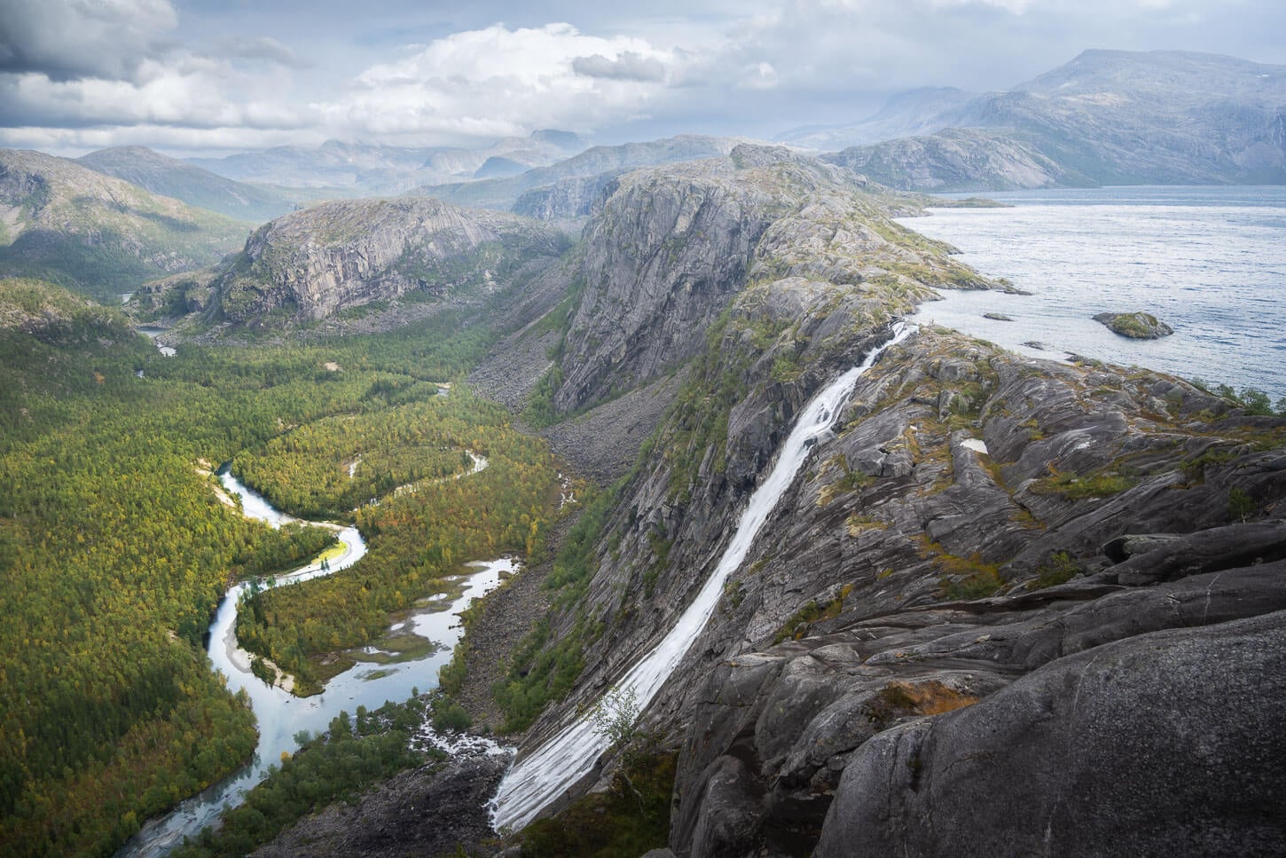
Photo taken at 24mm, full frame.
Litlverivassfossen, photo taken at 14mm, full frame.
Video of the Hike
Last but not least, here is a short video I made while hiking to the waterfall
Where to stay
Options are very limited in the immediate vicinity of Rago National Park, but the Rago Camping Øyra campsite is a great choice; I stayed there with my van as well. It’s a basic campsite, very quiet and spacious, in a beautiful, relaxing environment.
If you want to camp along the trail, there is an open cabin on the trail: Storskogvasshytta. It’s first-come, first-served, so I would not entirely rely on it in high season. And, of course, you can camp with a tent within the Allemannsretten regulations.
The closest, “largest” town is Fauske.
Additional Resources
- Check out (many) more Hikes in Norway, with Maps!
- Here is the official Website of the Rago National Park.


Leave A Comment