Cascate di Fanes, Dolomites Waterfalls Hike, Italy
While the Dolomites are famous for their incredible vistas, their jagged peaks, and the alpenglow that colors the mountains at sunrise/sunset, not everyone may know about the epic waterfall hike to the Fanes Waterfalls – or Cascate di Fanes, in Italian.
Sbarco da Fanes
The Cascate di Fanes are a series of waterfalls in a small Canyon that lies within the “Parco naturale regionale delle Dolomiti d’Ampezzo”, or “Regional Nature Park of Ampezzo’s Dolomites”. There are six waterfalls on the Cascate di Fanes hiking trail.
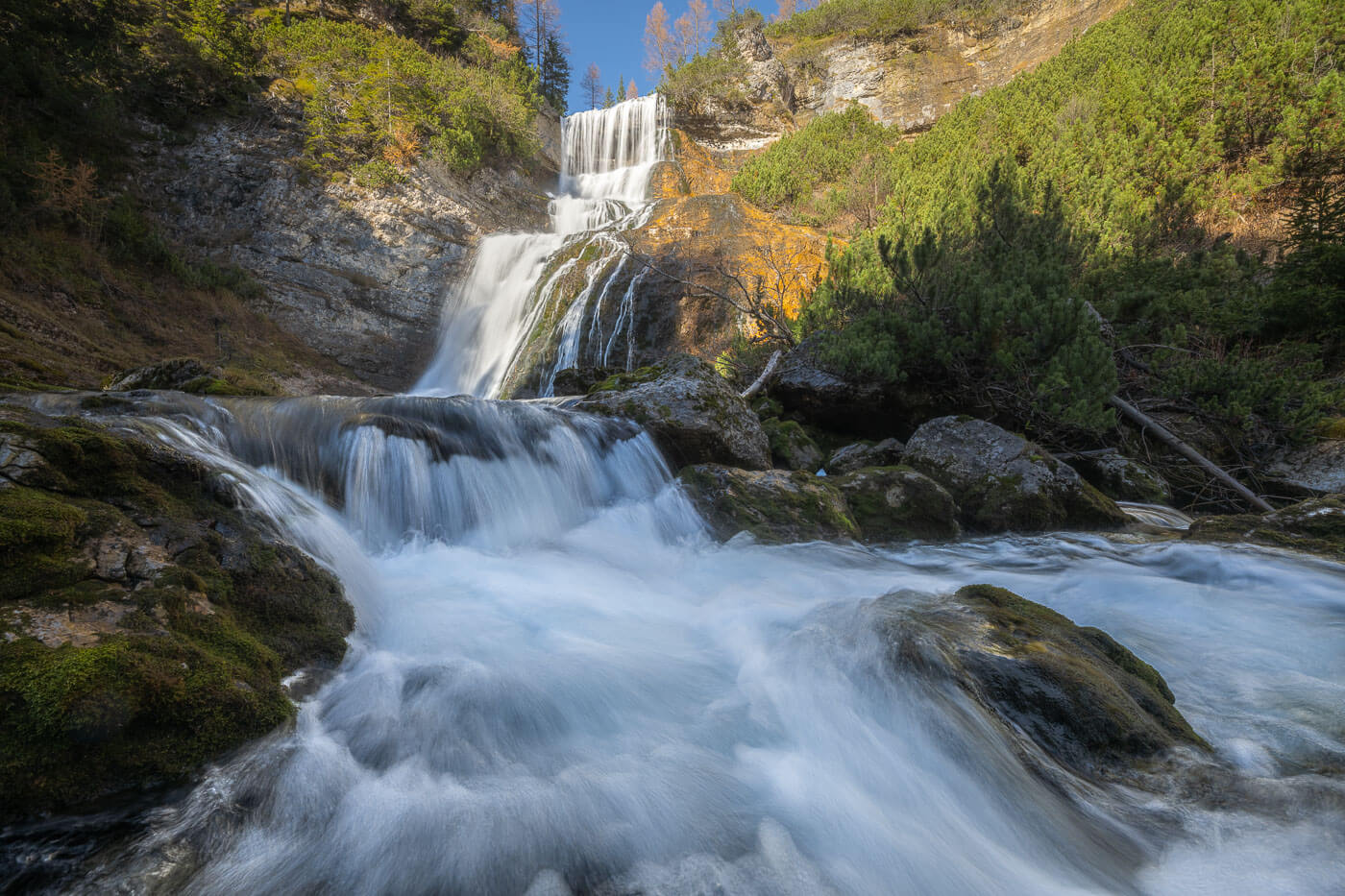
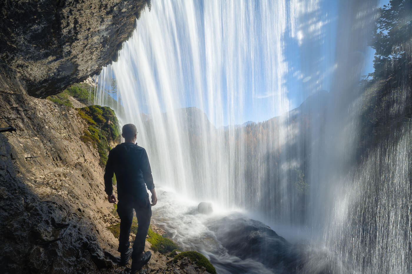
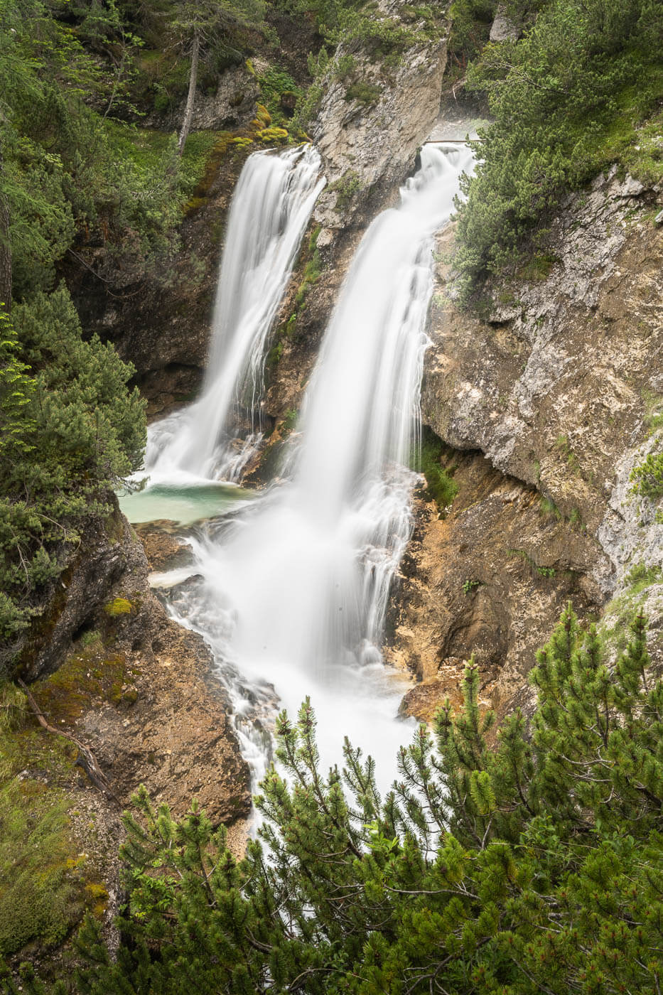
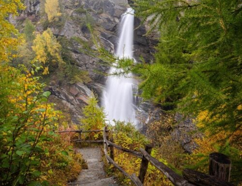
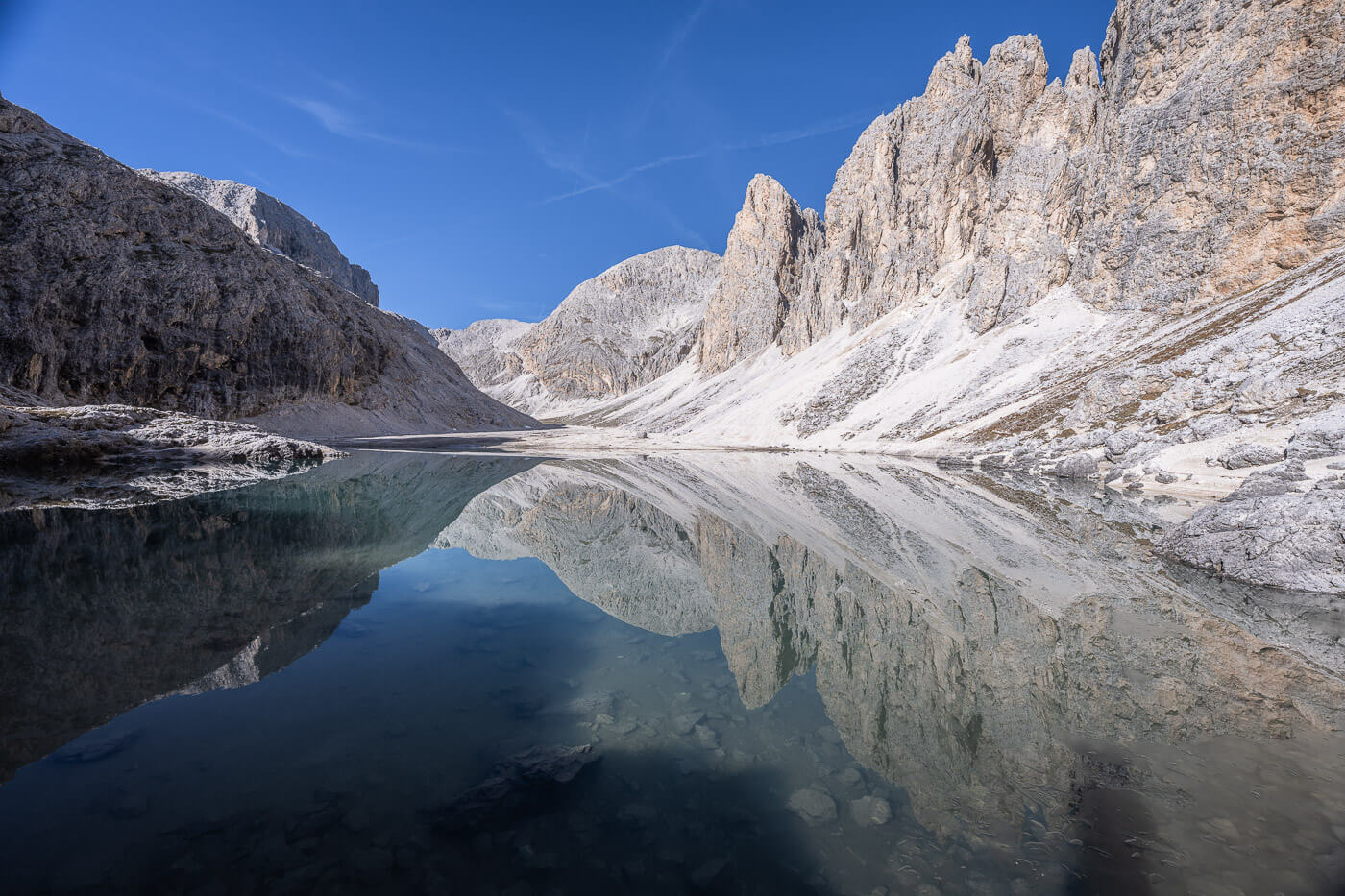
Only the first and last waterfalls have proper names. The first one, also the tallest (90m), is simply called “Cascata di Fanes”, and the last one is “Sbarco da Fanes”. A spectacular waterfall you can view from behind, without crossing, because it’s a Via Ferrata.
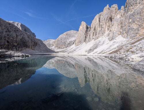
Behind one of the Fanes Waterfalls, Sbarco da Fanes.
While the waterfalls are kind of hidden, they are also conveniently located on the road that connects Cortina d’Ampezzo to Misurina, le Tre Cime, and Dobbiaco. So they are kind of in a handy location. A bit of a hidden gem, if you will – although it is still quite a popular hike, especially for anyone cementing themselves with a Via Ferrata.
Anyway, a great hike if you are looking to visit some waterfalls in the Dolomiti.
One of the Fanes Waterfalls
Table of Contents
Overview of the Cascate di Fanes Hike & Map
There are several waterfalls on this hike, and different viewpoints. The trails can be a bit confusing to navigate, especially because some turn into a via Ferrata, and, in that sense, the “map” by the entrance at the visitors center isn’t particularly useful in terms of what’s easy, what’s difficult, what’s a via ferrata, and which route it’s best to take.
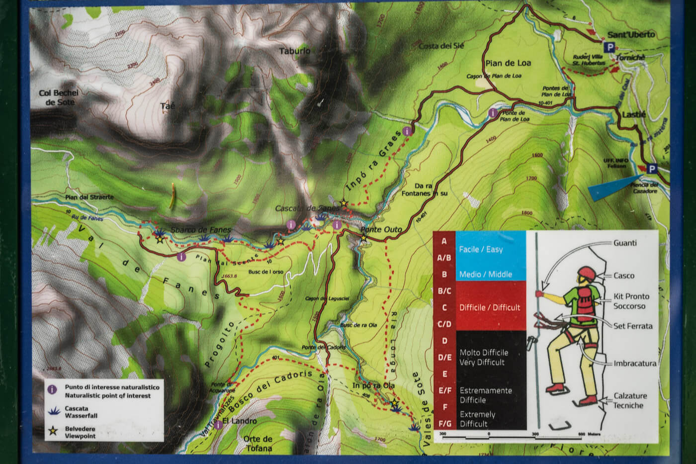
The map by the trailhead.
So I’d recommend downloading the GPX file from my own hike linked below to stay clear of the Via Ferrata trails.
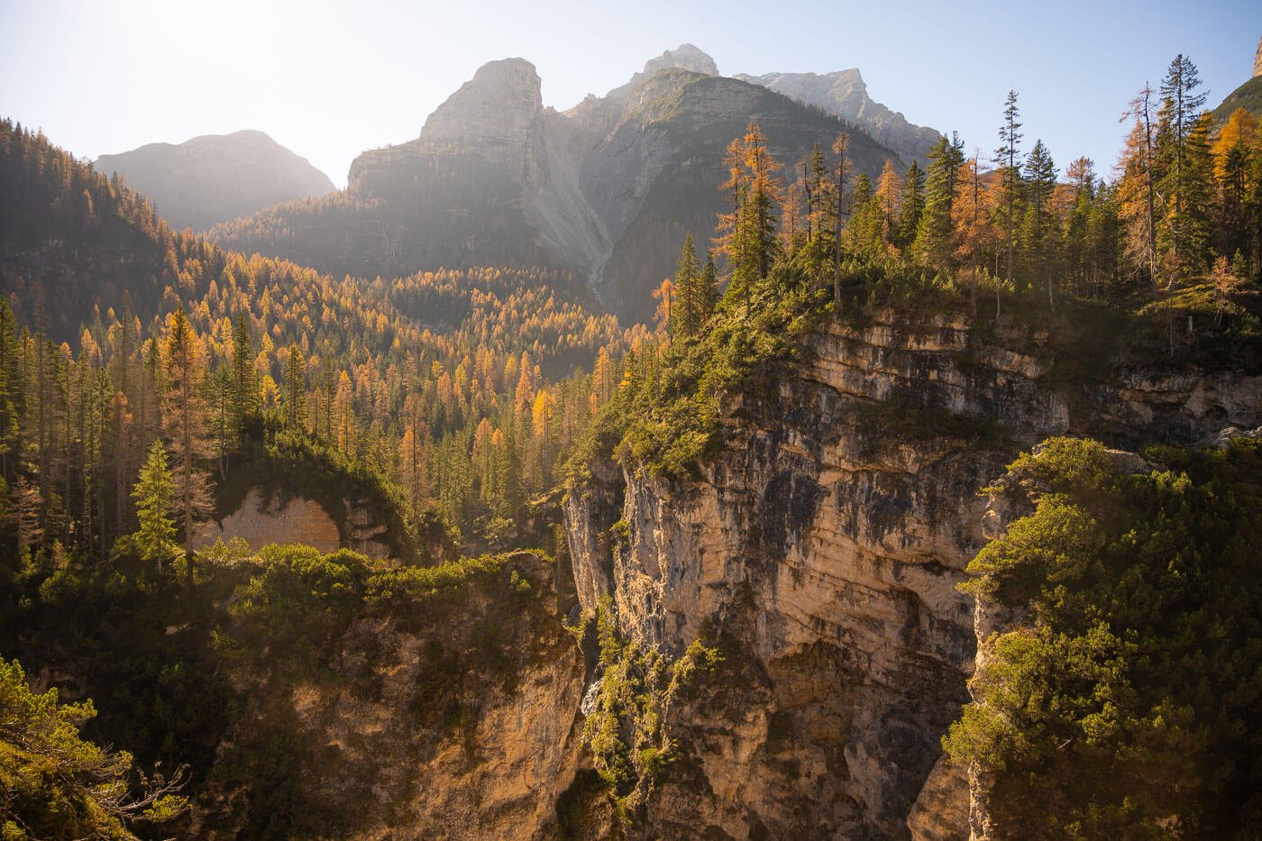
Typically, the Hike is possible from late May to Early November, but make sure to pay attention to icy spots if you are visiting in the low season. The volume of water flowing through the falls will be higher early in the season. On the other hand, later in the season, you’d have a chance to catch the golden autumnal hues.
| Max Altitude | 1,740 m |
|---|---|
| Distance | 13.3 KM |
| Elevation gain | 510 m ↑ / 510 m ↓ |
| Hike time | 03:30/ 04:00 Hours |
| Hike Difficulty | Moderate |
Here is also a map of the hike; you can download the GPX file for free from the activity linked below, should you wish to do so.
How to get to the Cascate di Fanes trailhead and Parking
There are two trailheads, both located along State Road 51 (SS51), which is the road that connects Cortina d’Ampezzo to Dobbiaco. There isn’t much difference in terms of how long the hike is, so you can choose your parking area accordingly.
- Driving Directions: From Cortina, take the road toward Dobbiaco. After about 20 minutes, you will see the sign pointing towards the “Parco Naturale Dolomiti d’Ampezzo” on your left. Turn there.
- Parking: The main parking area is accessible via a narrow, single-lane road, directly off Road SS51. The Parking is here. Parking is paid in July and August only. Alternatively, you can park at Parcheggio Sant’Uberto, also located along the SS51 road.
- Public Transport: The closest bus stop is the Podestagno bus stop, served by bus 445, which runs between Cortina and Dobbiaco. For the timetable: suedtirolmobil.info.
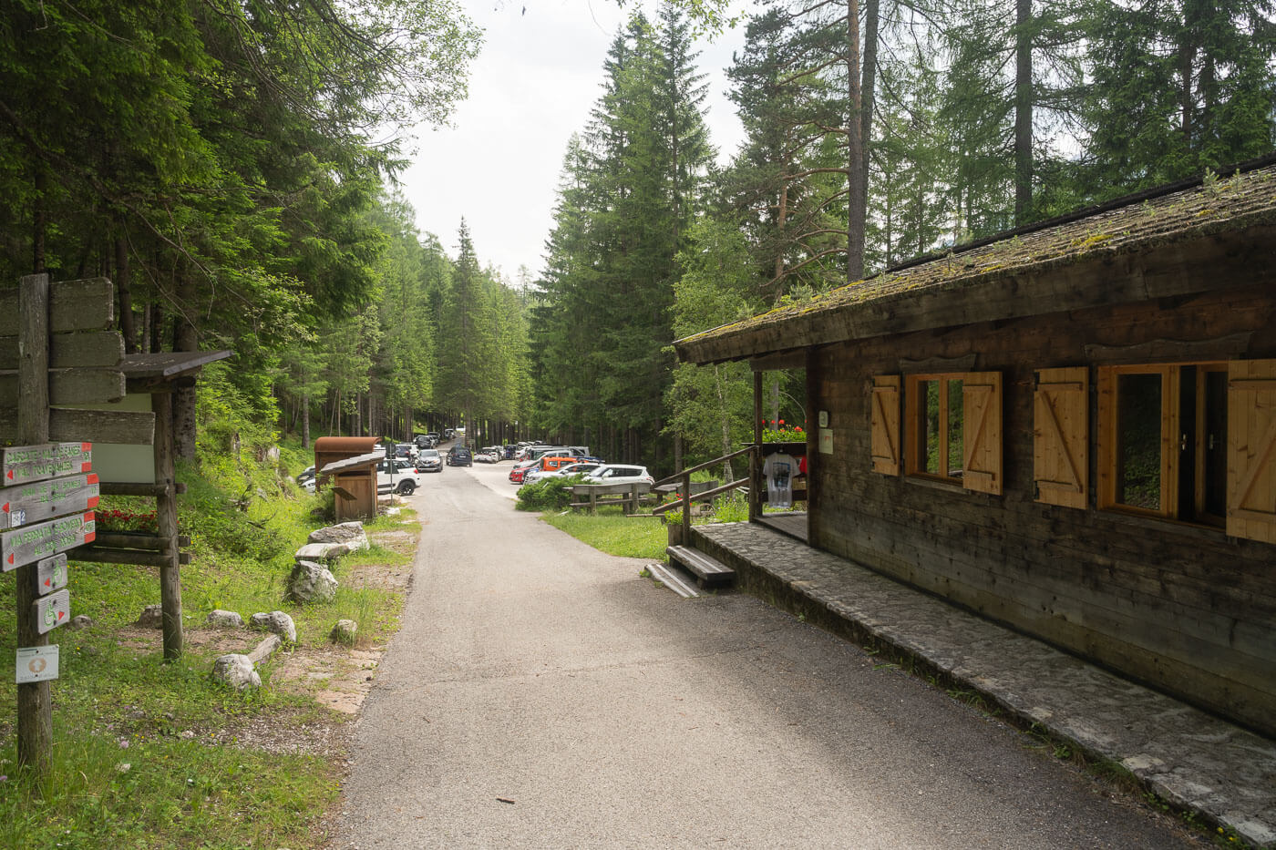
Entrance of the Park, and Trailhead of the Fanes Waterfalls hike.
The Cascate di Fanes Hiking Trail
From the parking area in Dal Pian de Loa, the trail initially follows a single-lane gravel road in the forest. If you parked your car along the road above the Visitors Center, you’ll join the road via a short trail through the forest. Initially, the road follows Rio Fanes upstream. Here and there, the views open up to the beautiful dolomitic landscape, and the rivers crossing the landscape.
One of the few creeks along the trail.
The first part of the trail is mostly on paved/gravel roads.
After about 20 minutes, you’ll reach a fork in the trail. To your left, a bridge called “Ponte de Pian de Loa”. That’s the direction to take to follow the main train, however…in order to gett the best view of the biggest waterfall you’ll see on this hike, you’ll have to take the road to your right first, and then backtrack to this point. The only exception is if you are doing the via Ferrata, in which case you can cross on the other side.
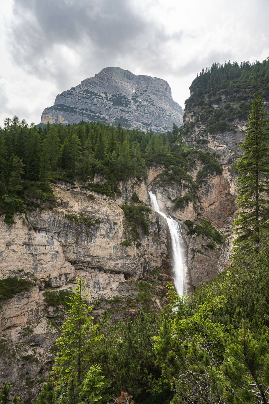
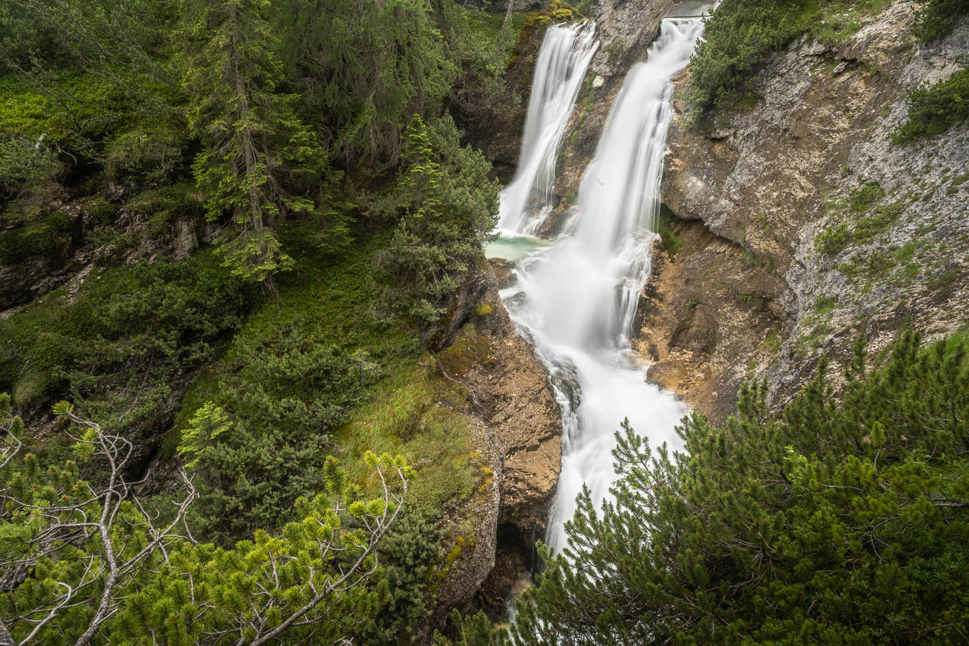
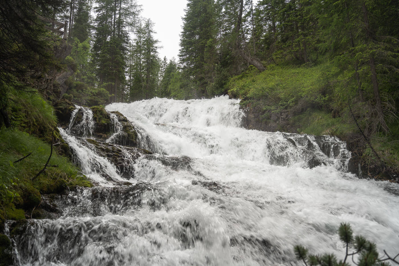
Cascata di Fanes and Ponte Alto
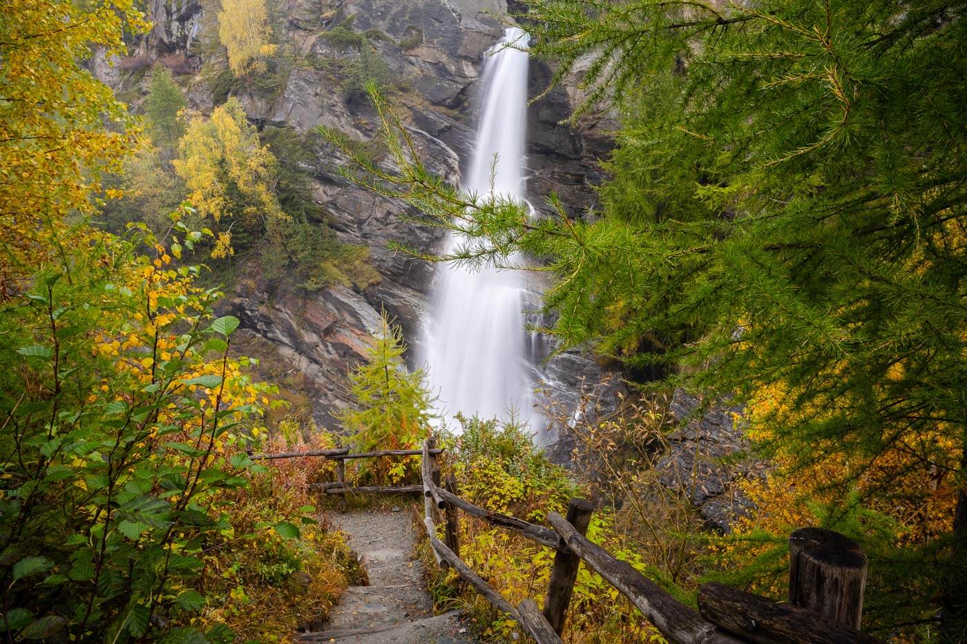
For any regular hiker like myself, the walk to the main viewpoint of Cascata di Fanes, an impressive 90 meters in two main steps, takes about fifteen minutes from this point. If you ask me, it’s worth it. The waterfall is impressive, even more so when looking at it from above.
The Upper part of the Cascata di Fanes.
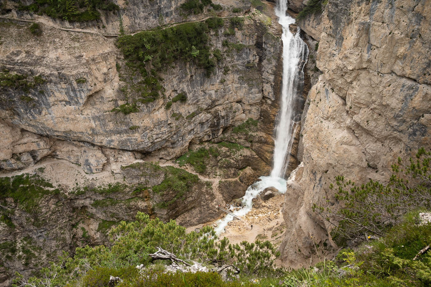
The lower part of the same waterfall.
From the main viewpoint, you can get the full view of the waterfall and a proper sense of both its size as well as its power. Watch out for those doing the Via Ferrata, as they add another layer to gauge the scale of the waterfall.
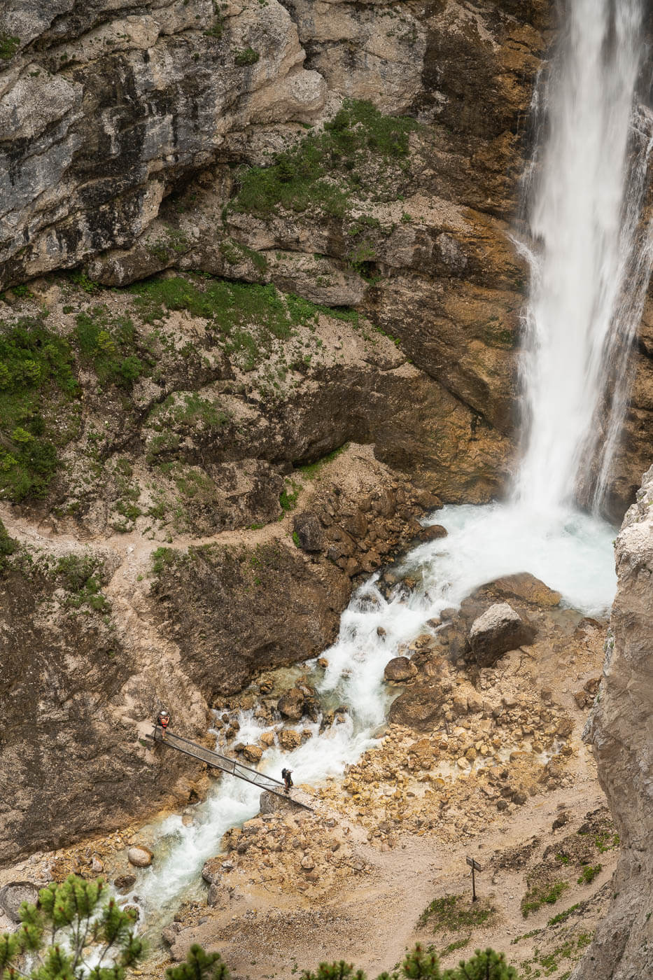
From this viewpoint, you’d need to return to the bridge we passed by earlier, “Ponte de Pian de Loa”, and cross to the other side. Once there, continue following the gravel road until you reach the next bridge, called Ponte Alto (Ponte Outo).
The Ponte Alto offers fantastic views of the Fanes Canyon. It really lives up to its name (Alto = High), as it connects two sides of a narrow ravine high up above it.
View from Ponte Alto.
From Ponte Alto, the trail continues toward the other side of Cascata di Fanes. The views of this particular waterfall from here are nowhere near what you have from the other side. You can’t get close it it without entering the Via Ferrata trail, which you don’t want to do without equipment.
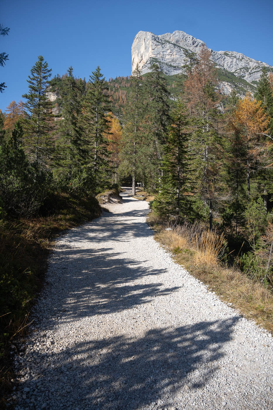
Three More Fanes Waterfalls
From the last viewpoint, the trail continues uphill on a steep gravel road for about ten minutes, until you reach a pedestrian bridge that allows you to cross the river and approach the first of the three nameless waterfalls on this trail.
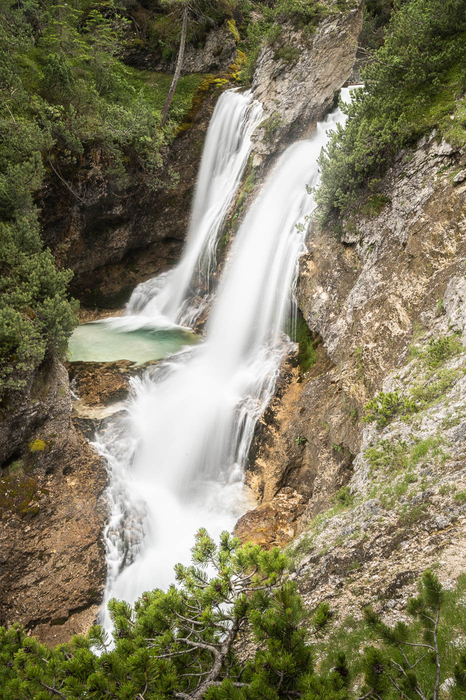
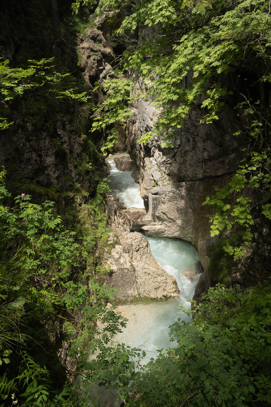
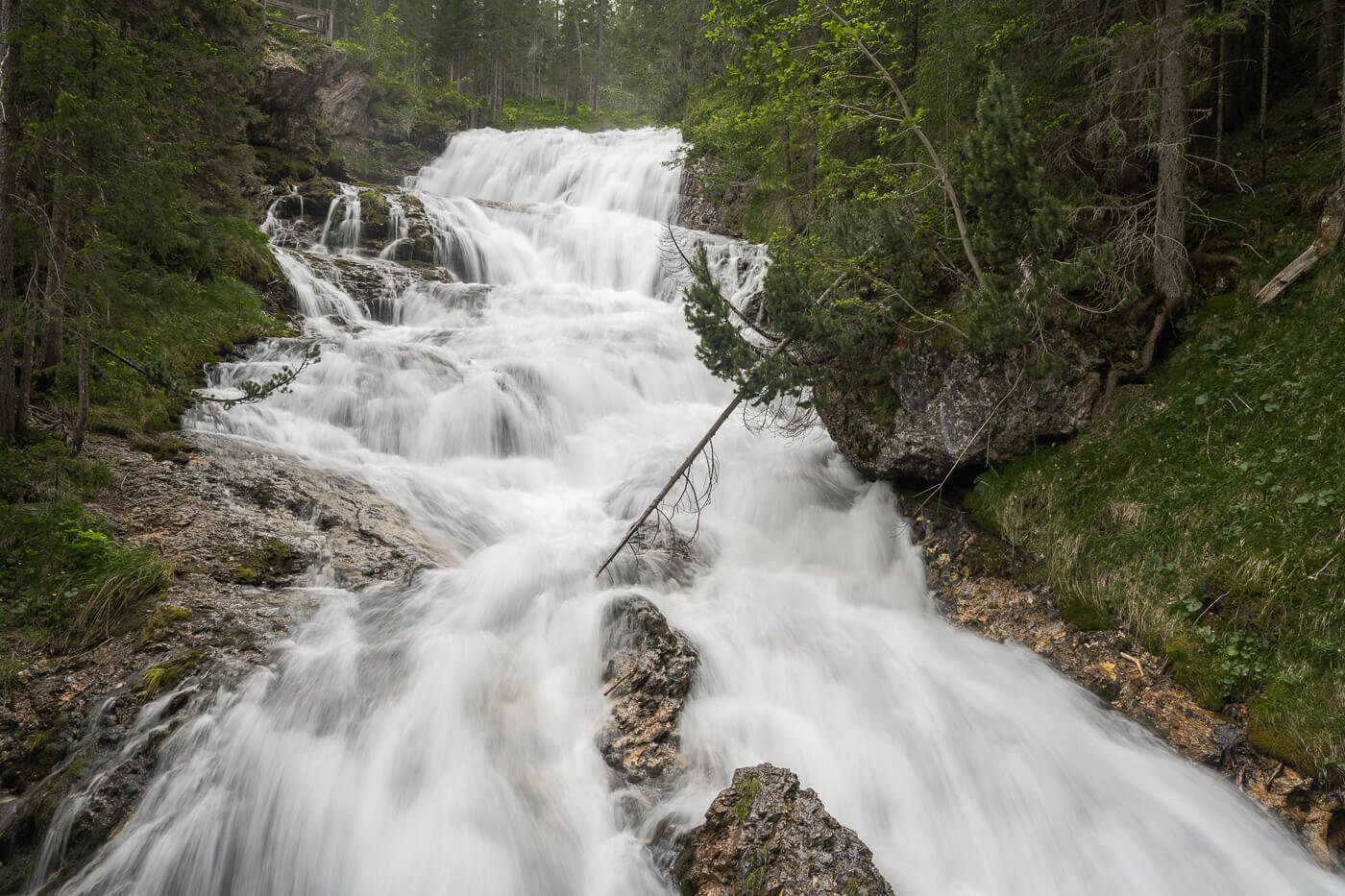
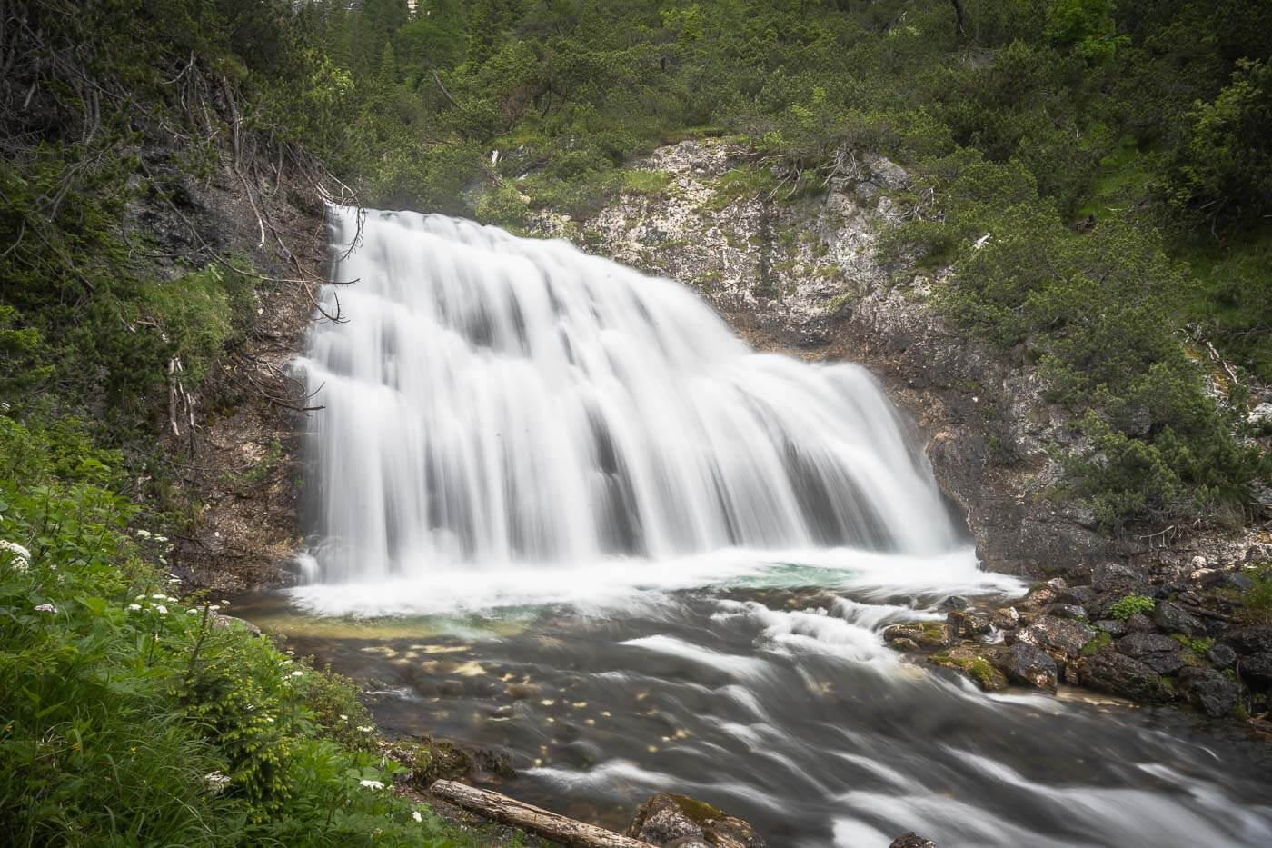
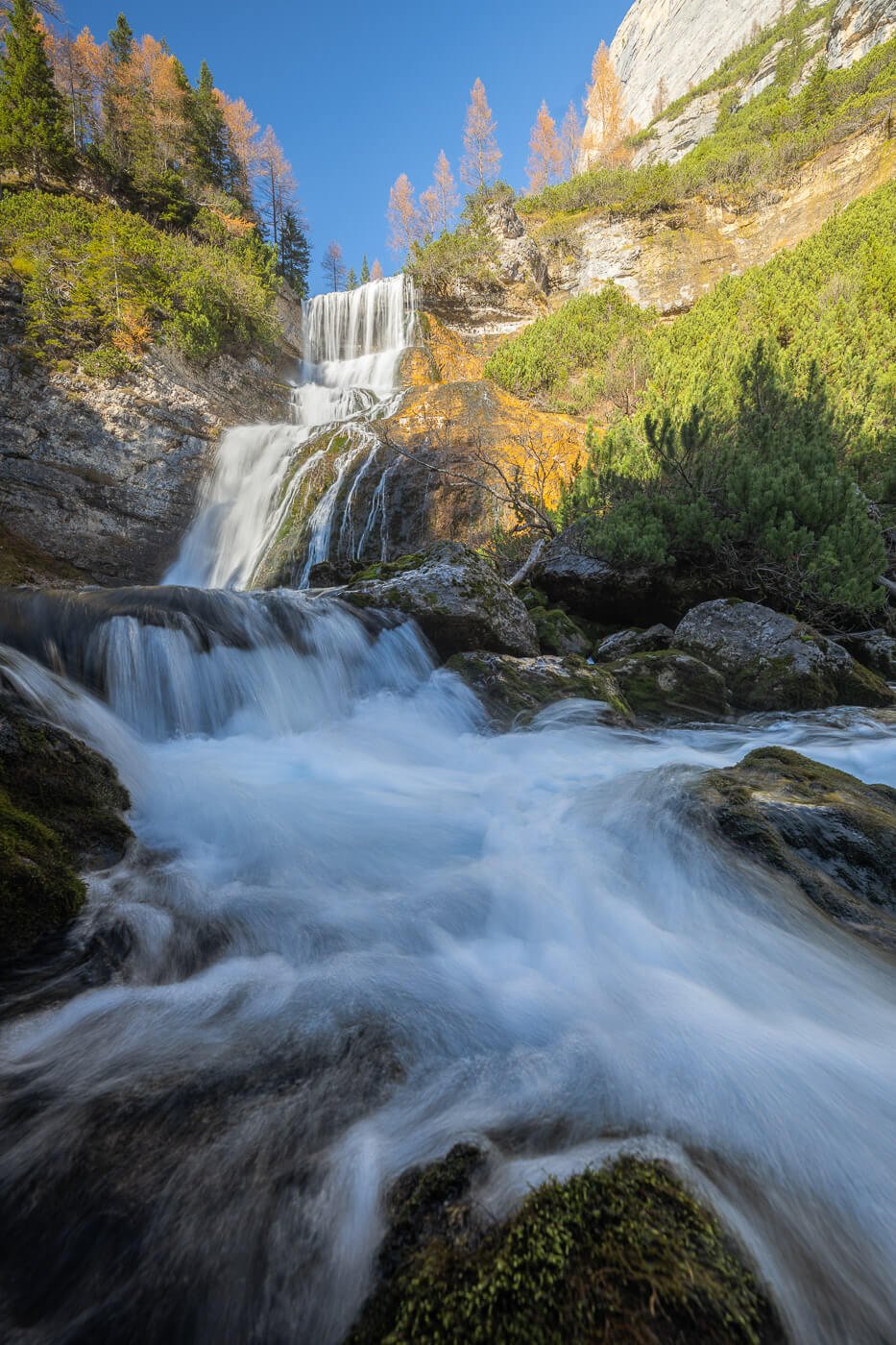
The waterfall is actually a double waterfall, nestled in a narrow gorge, with a pool of turquoise water at the bottom. Also, a very scenic waterfall, initially you can only see one of thw two branches of the waterfall. The second, hidden one becomes visible as you hike further up above the waterfall.
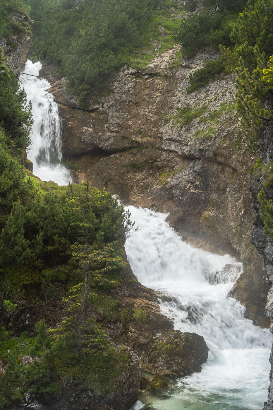
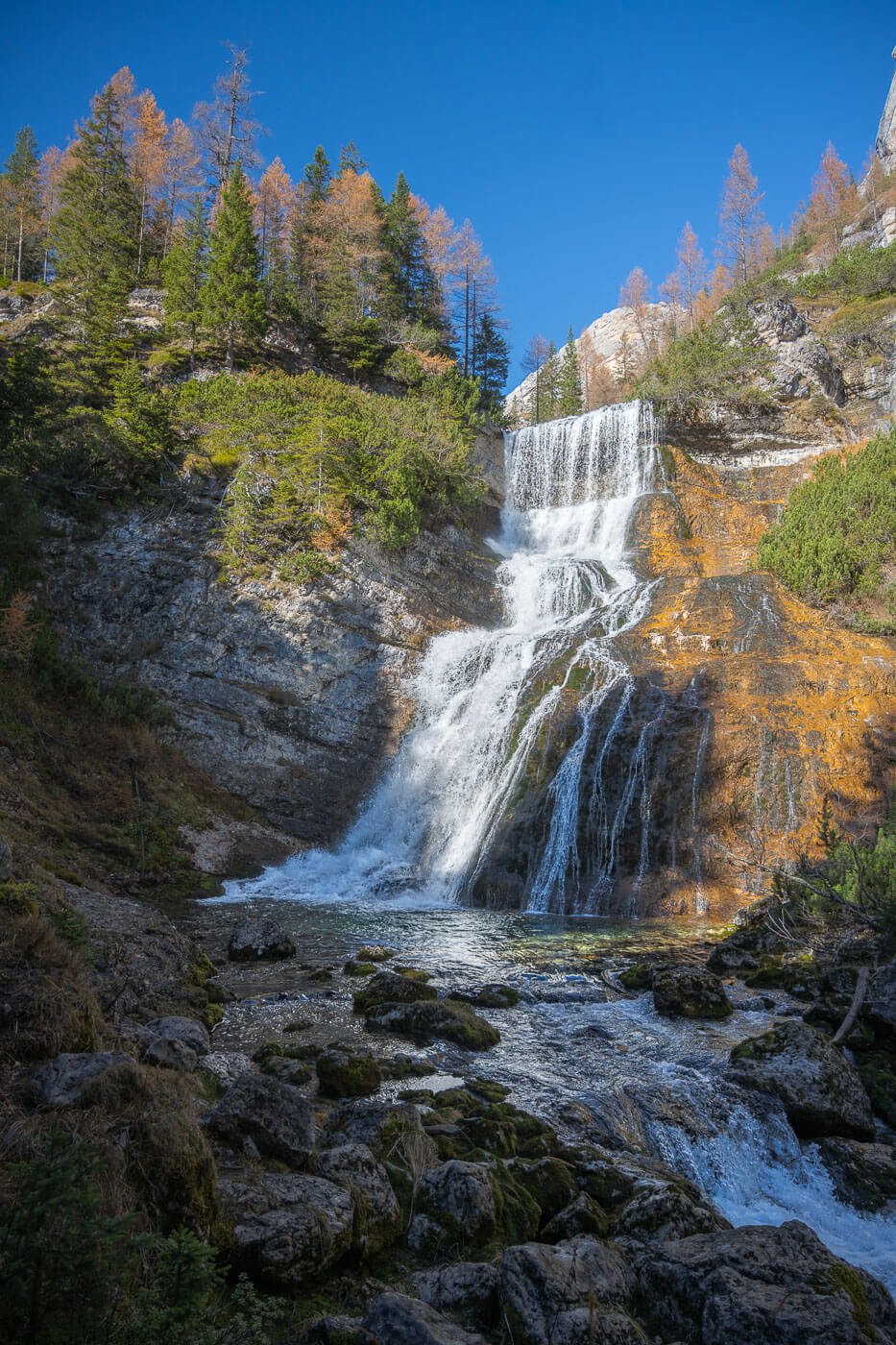
The second of the Fanes Waterfalls
A few minutes upstream, you’ll pass by another bridge, Ponte sulla Cascata del Torrente Boite, and another waterfall. This is more of a white-water waterfall along the Boite Creek. In spring, the volume of water and its force are quite impressive. It’s a relentless thundering stream of water.
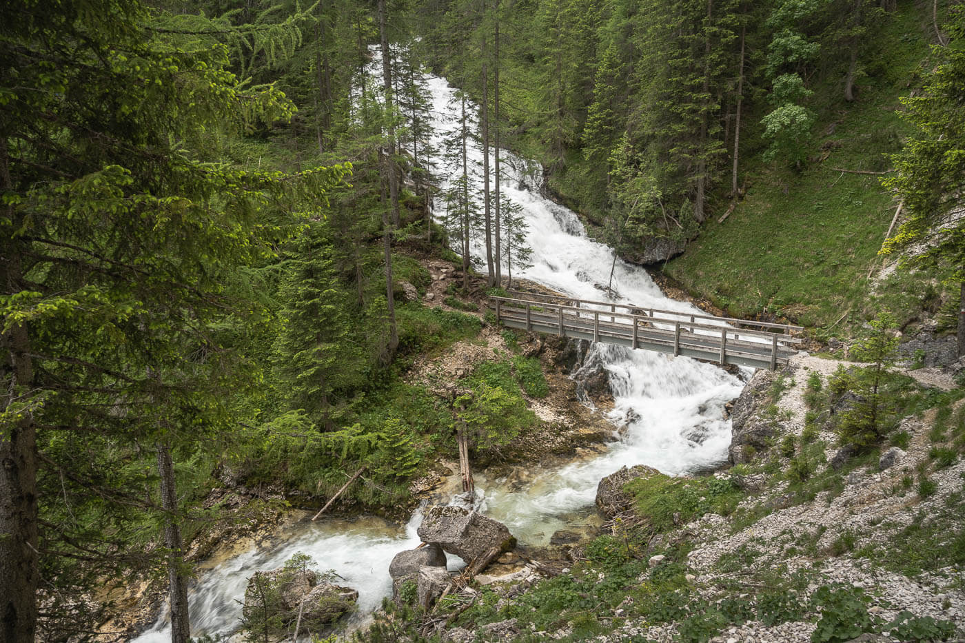
Ponte sulla Cascata del Torrente Boite – Bridge across the Boite Creek waterfall.
Then, onto the next unnamed waterfall. This is the smallest waterfall along this trail. It is about 2 meters 2-meter-tall waterfall along the same creek. Probably the least impressive.
From this waterfall then it is on to the last stretch before the grand finale with the last waterfall, Sbarco de Fanes.
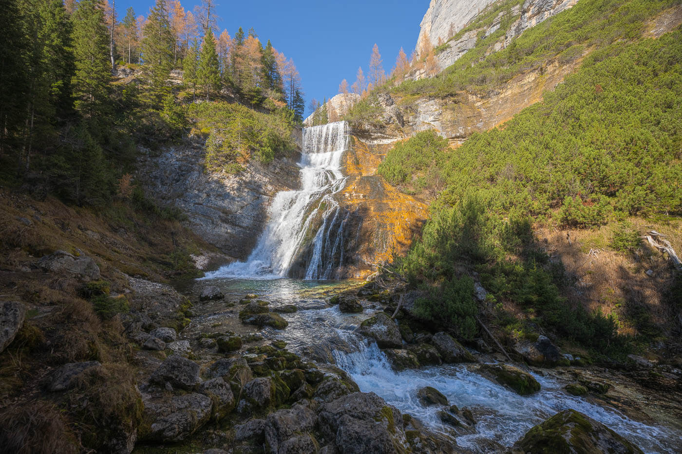
Cascata Sbarco de Fanes
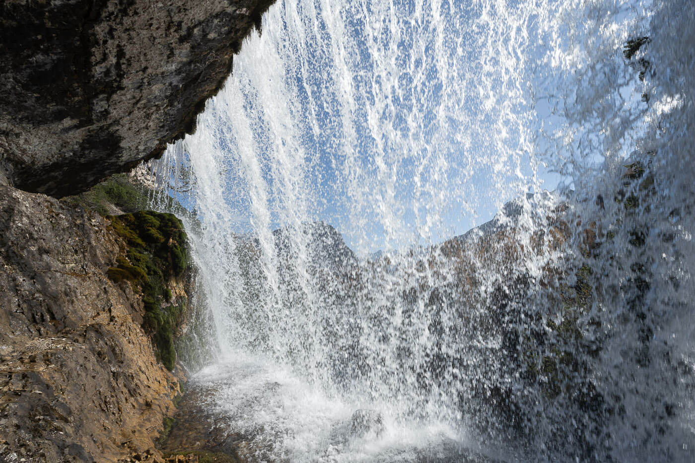
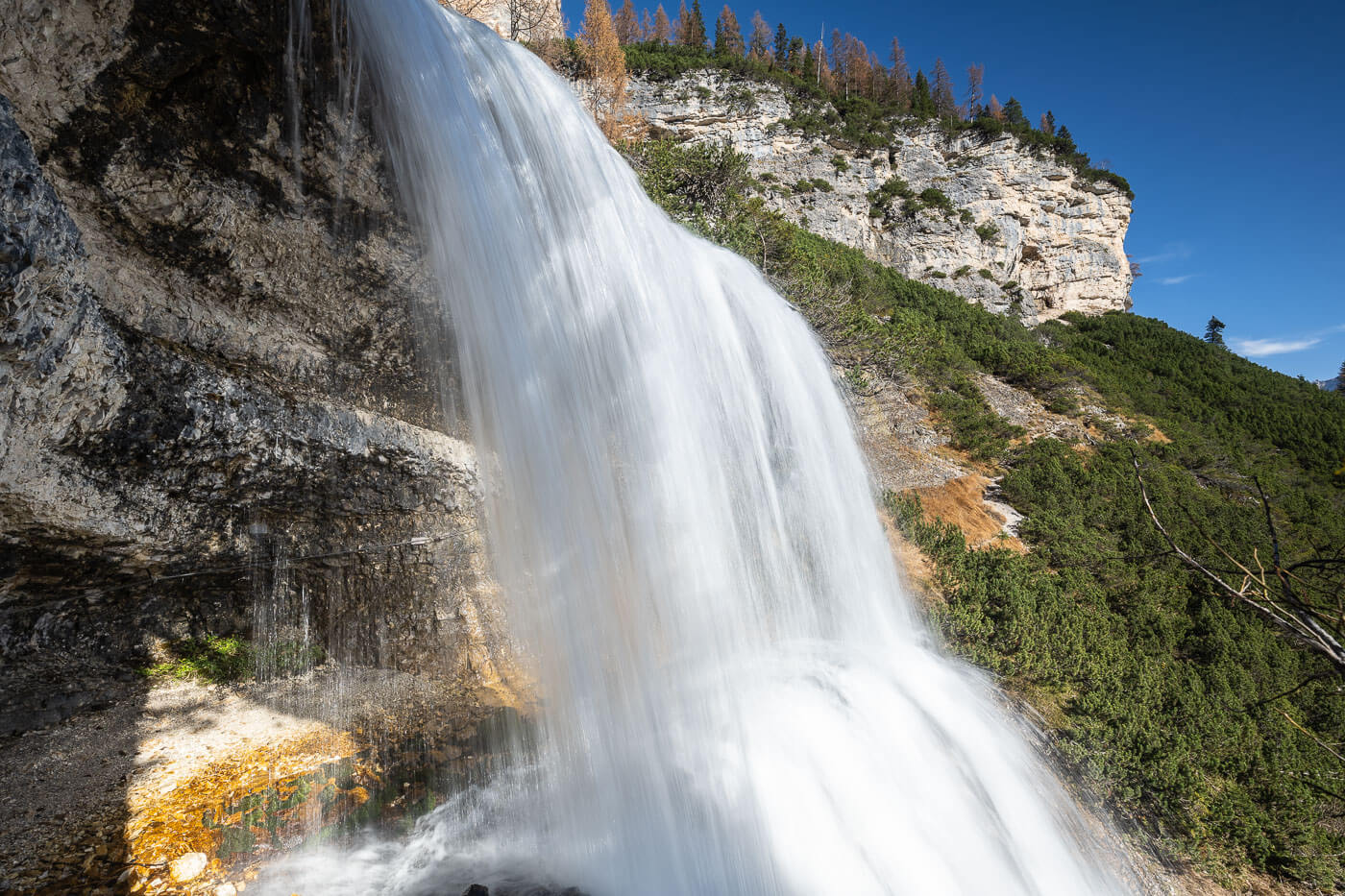
The last one, Cascata Sbarco de Fanes (Via Ferrata Cengia de Mattia), is also my favorite waterfall on this trail. Apart from being a very scenic waterfall, you can also walk behind it.
If you didn’t know you could, you’d probably be tempted to take the trail back from there. It’s just a short five-minute walk from the lower viewpoint. The trail is unmarked, but you can easily spot it on the side of the mountain.
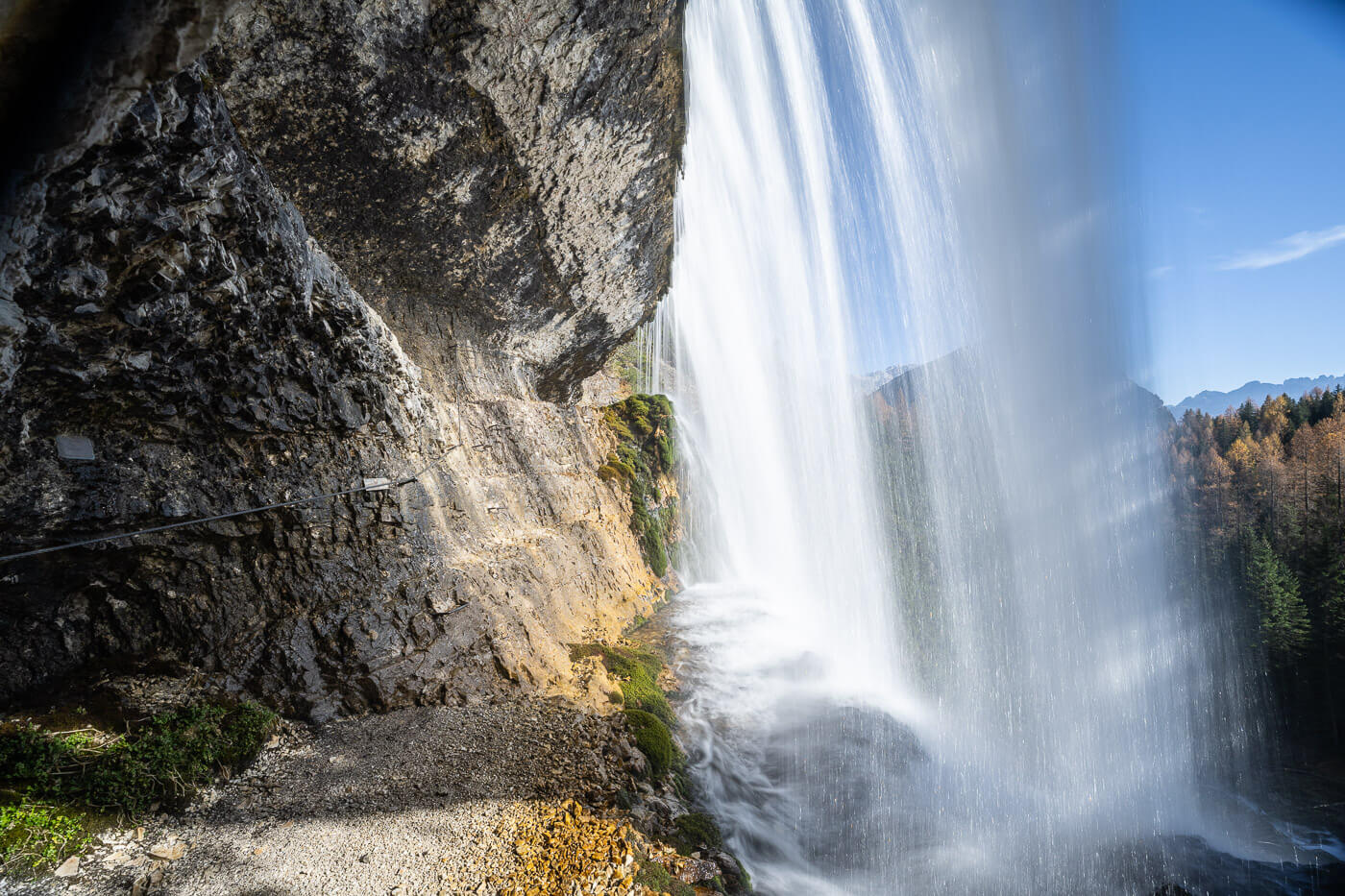
However, don’t attempt to cross the waterfall from behind. It is a via ferrata, and crossing requires specialist equipment. Some places may also be wet and slippery, so practice caution regardless.
The upper step of the waterfall, the one you can walk behind.
Anyway, back to the trail. It takes a bit to reach this waterfall on a trail partly along the river and partly through the forest. There are several viewpoints once you reach the waterfall. Down by the river, but also above the bank by the trail, you’ll have the best view of the whole waterfall and its steps.
Then, of course, the upper step of the waterfall, the one you can walk behind. You can view it by the side too, quite close. Quite an impressive sight. Same from behind. It’s always a magical experience to walk behind a waterfall, watching the water falling from above your head and flowing relentlessly towards the valley, on onwards into its infinite cycle. Plus, you can see the beautiful landscape of the Dolomites from behind the veil of the waterfall.
As you reluctantly leave this beautiful place to get back to the trailhead, you have the option to go back the same way or to take another trail in the forest, which is a little shorter. I took the latter. It’s still a nice walk in the forest, even without a waterfall. And I preferred to end the hike with the “grand finale” of the Sbarco de Fanes waterfall.
Cascate di Fanes Photos and Photography Tips
In terms of landscape photography, I think the second (the double waterfall) and the last waterfalls (Sbarco de Fanes) are the most fun to shoot. Sure, it’s always fun to shoot any waterfall, but I think these three are the most photogenic and the ones I spent the most time at. So, definitely make sure you have a tripod and your ND and polarizer filters.
I visited in different seasons, and one of the main challenges I found was managing the harsh light and contrast at any time of the day. If the sun is out, some parts of the falls are going to be in deep shadows, while other parts of the landscape, or the waterfall itself, are going to be harsh highlights. So that will require a bit of light management, either through a graduated filter or blending exposure. That won’t be a problem on a cloudy day, though.
Of all the photos in this post, almost all of them were taken with a 24-70mm lens (full frame), while most of the photos around the last waterfall, Sbarco de Fanes, were taken with a 14mm lens. The waterfall is huge, so the wider the lens, the better.
Where to stay
Cortina would be the obvious choice, as it is just about a 20-minute drive to get there. However, there are more accommodations around Lago di Misurina, as well as on the other side of the pass toward Dobbiaco. There are also a few smaller hotels and guesthouses/campsites closer to the Dolomiti d’Ampezzo Nature Park; however, no accommodations within the park itself.
Additional Resources
- View my main page on Hiking in Italy.
- Nearby, Le Tre Cime di Lavaredo and Lago d’Antorno.
- Official website of the Ampezzo Dolomites Nature Park.
Leave A Comment