Hike the Njakajaure Trail in the Abisko National Park, Sweden
The hike on the Njakajaure Trail in the Abisko National Park is one of the few trails that can be done as a day hike in the area.
Actually, it can be done in less than a couple of hours, during which you can get a feel for the remote wilderness of the park and its beauty. And, in autumn, the whole area is a feast of vibrant fall colors.
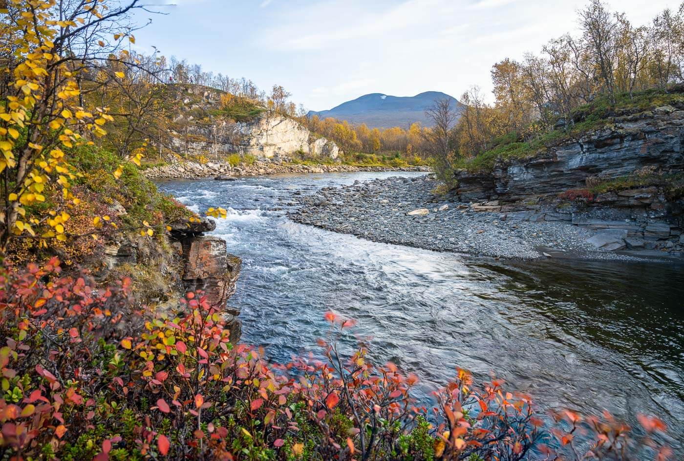
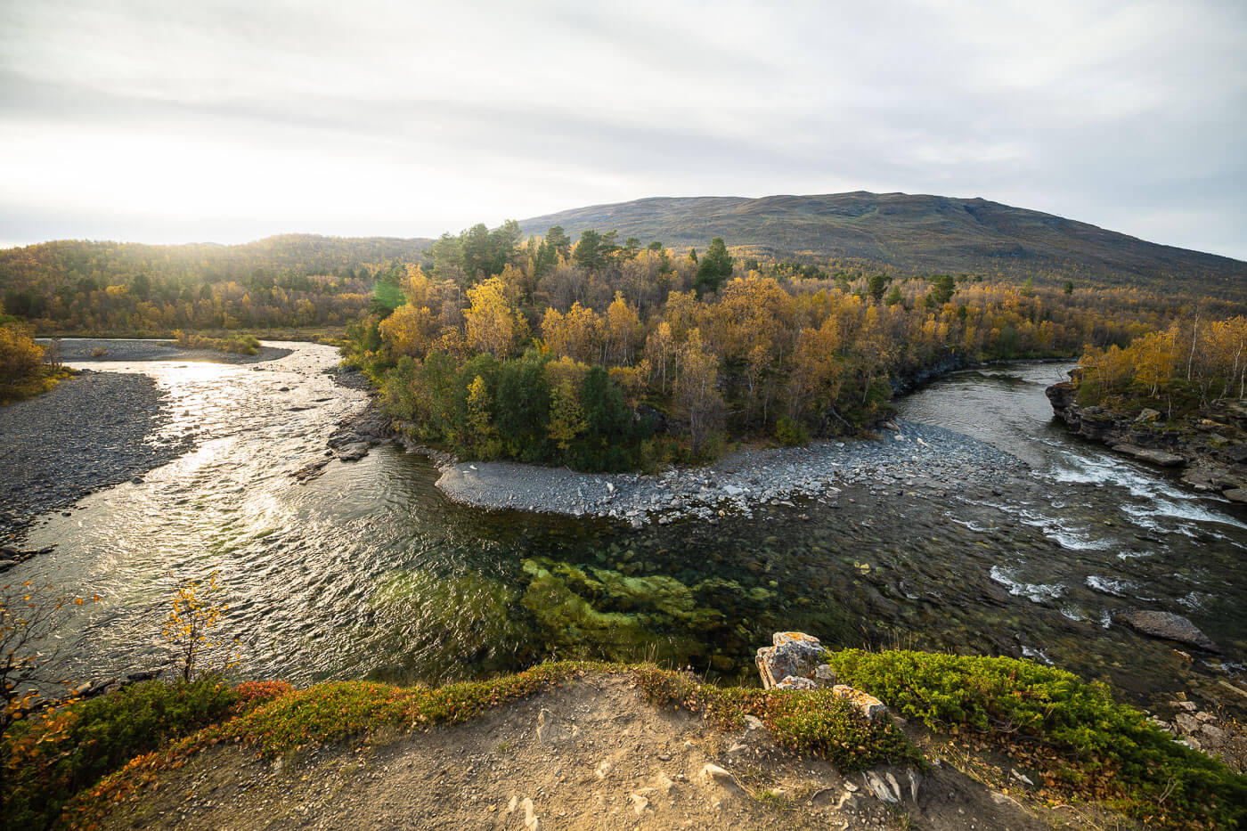
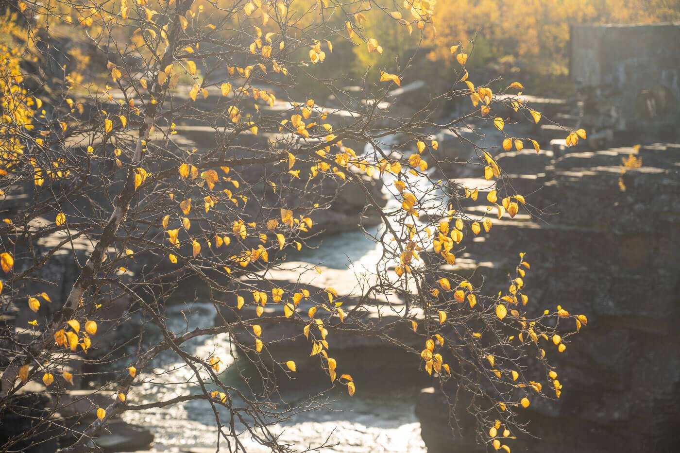
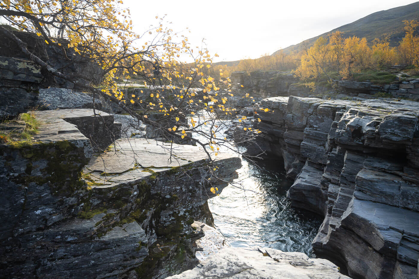
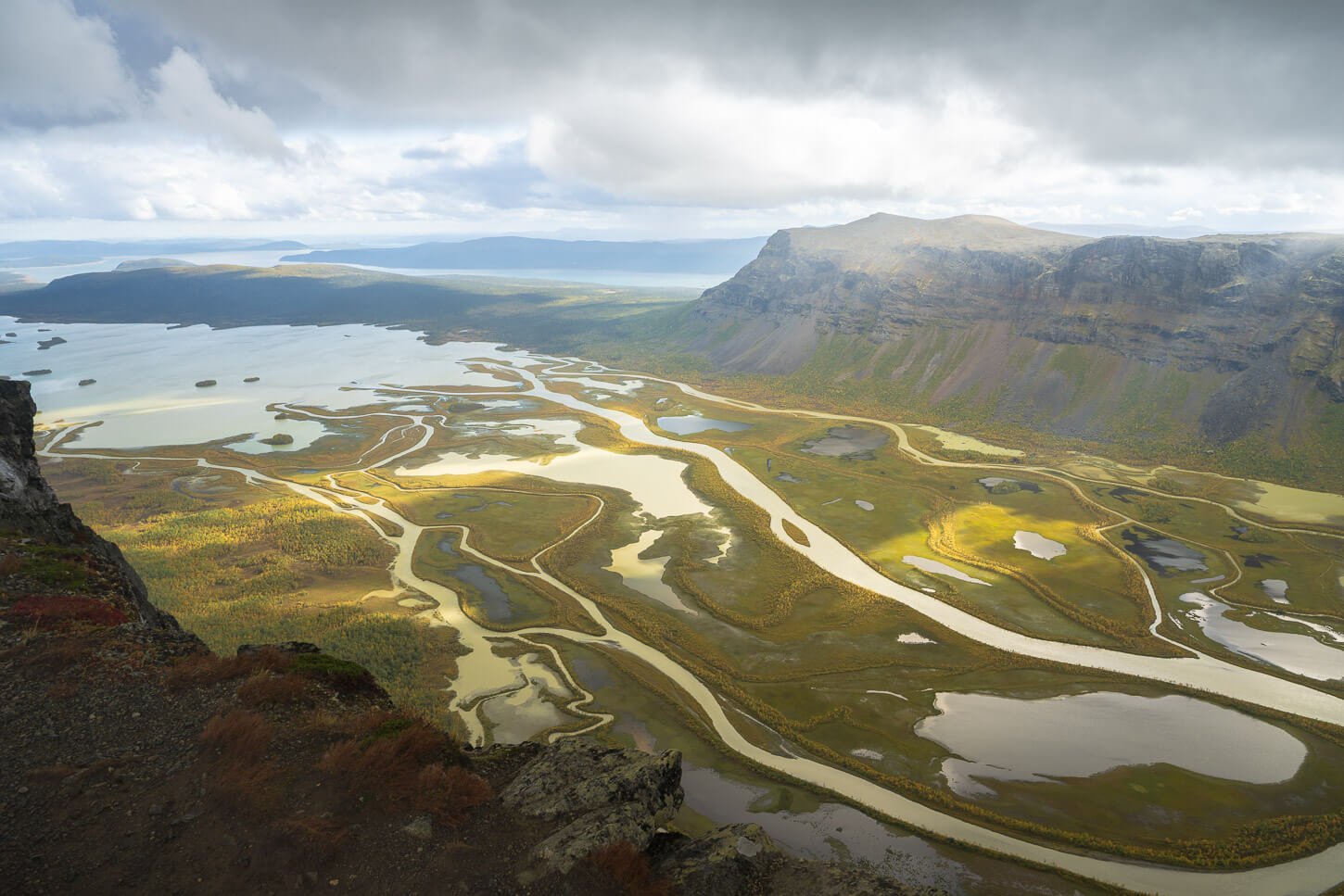
The Abiskojok River.
While the Absko National Park is an area mostly famous for the vastness of its landscapes and for the Kungsleden, a long-distance trail that starts (or ends) here. Trails for day hikes like Njakajaure would still allow you to have a feeling for the vast wilderness of the Swedish Lapland without having to commit to long-distance hikes.
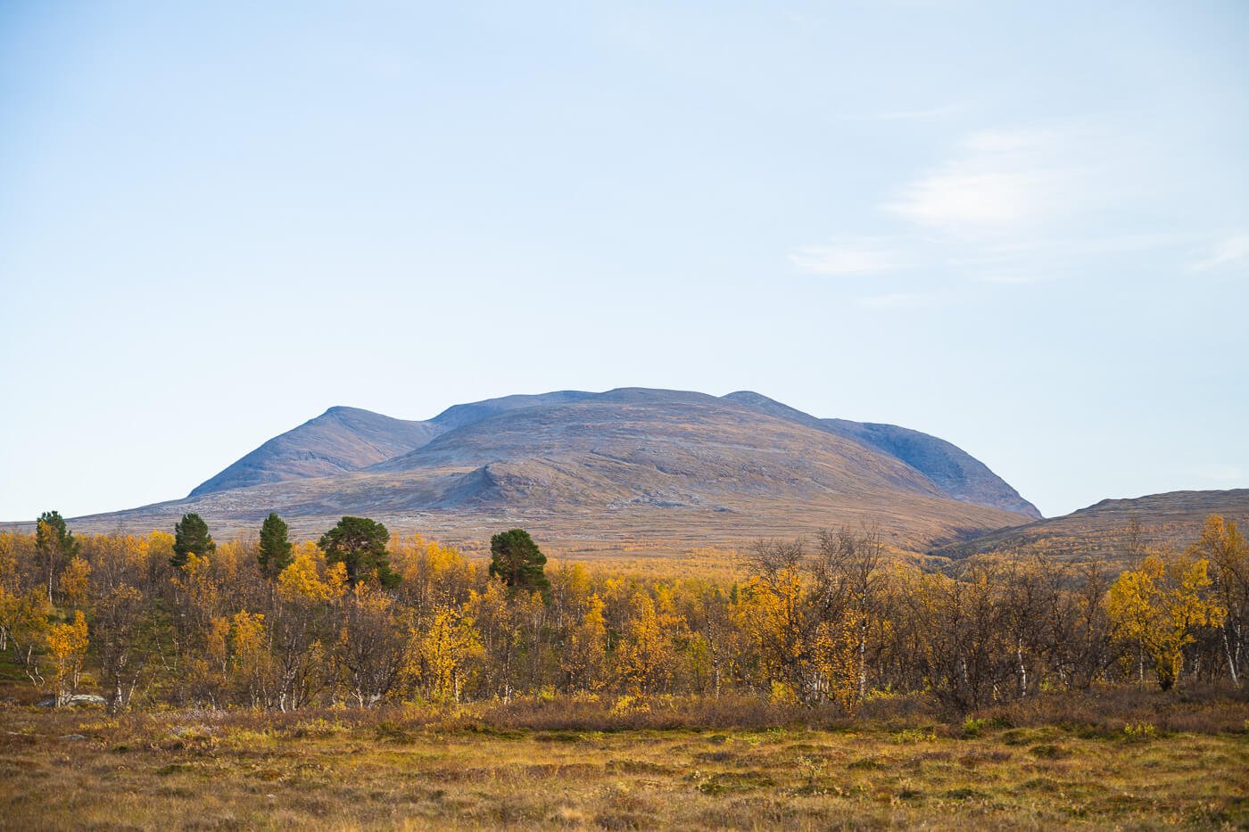
This is an area of raw natural beauty, where the rivers, canyons, forests, lakes, and the slopes of the mountains in the distance combine in a landscape where the beauty is both in its seemingly endless horizons as well as in the smaller details.
For me, it was the first hike in this area, and while it is an easy, short hike, it contained all the ingredients to experience what Swedish Lapland has to offer. An experience that left me wanting to come back for more, which I sure did and will do again.
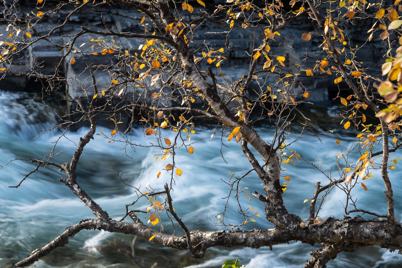
Table of Contents
Overview of the Njakajaure Hike & Map
The Njakajaure trail goes through a variety of landscapes. It starts directly at the Abisko Visitors Center. First, the southern part of the Abiskoeatnu Canyon, then a birch forest, which still offers good views of the river, and a viewpoint called “mediation point”, where the trail turns back towards the visitors center, passing by a lake and some marshy areas.
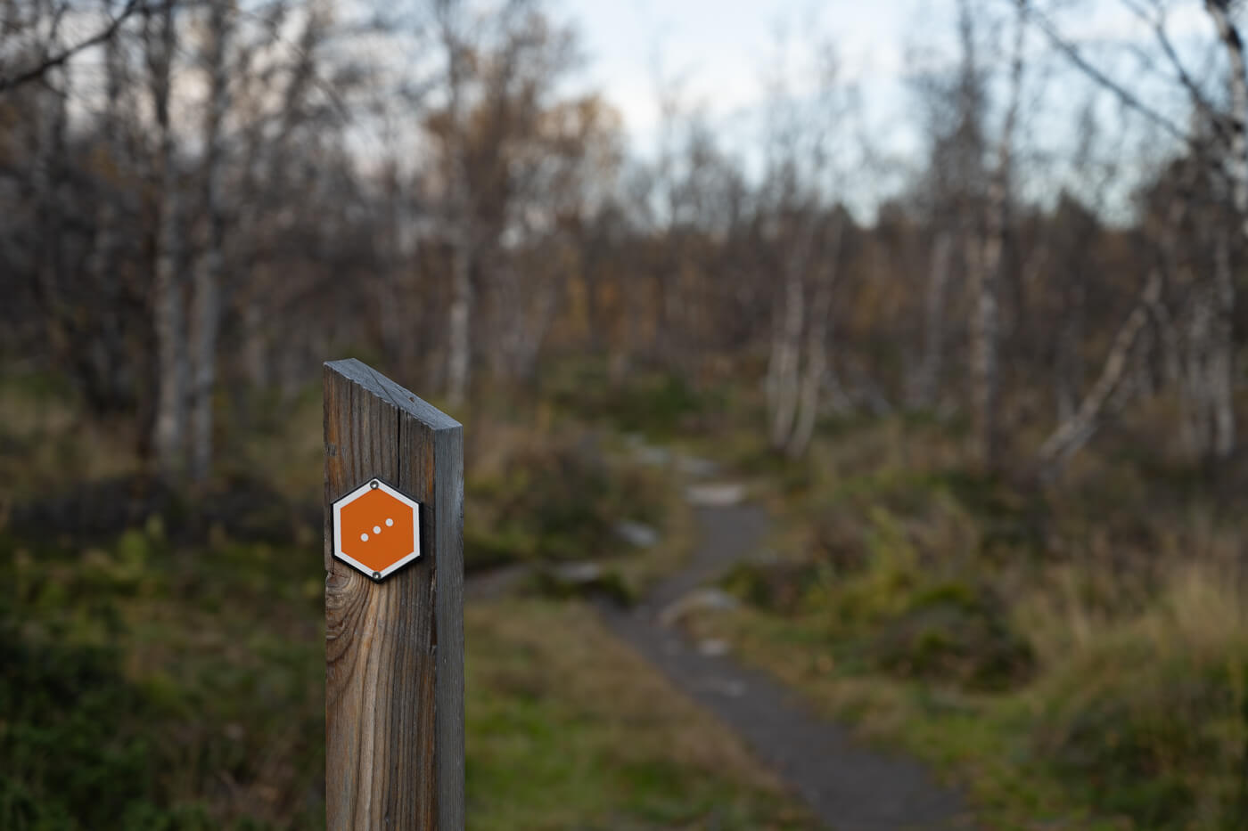
The hike has a very modest elevation gain. It is mostly flat, relatively short at about 5KM, and it’s an easy hike that presents no challenges. The trail is marked with Orange trail marks, with three dots.
The Njakajaure trail is highly recommended for Autumn Hikes. Autumn often happens around mid-September at this latitude. That’s what I did, and the colors were truly stunning.
| Max Altitude | 425 m |
|---|---|
| Distance | 5 KM |
| Elevation gain | 50m ↑ / 50 m ↓ |
| Hike time | 01:15/ 01:30 Hours |
| Hike Difficulty | Easy |
Here is the map of the hike. You can download the GXP file for free from the activity linked below.
How to get to the Njakajaure trailhead and Parking
There’s only one road to get to the trailhead, and that’s the E10. If you are touring Northern Norway, it is surprisingly easy to add this to your itinerary. Driving from Narvik to Abisko, for instance, will take less than an hour.
- Driving Directions: If you are coming from Norway via the E10 road, you can reach the Abisko visitors center 40-50 minutes after passing the Norwegian-Swedish border. If you are coming from the opposite direction, it takes about an hour to reach Abisko from Kiruna by car, and almost three from Gällivare.
- Parking: Parking is available at the Abisko visitors center. Pay attention to the signs, as some areas are reserved for long-term parking, such as those who hike the Kungsleden, for instance.
- Public Transport: The train station near the Abisko visitors center. The timetable can be found here.
The Njakajaure Hiking Trail
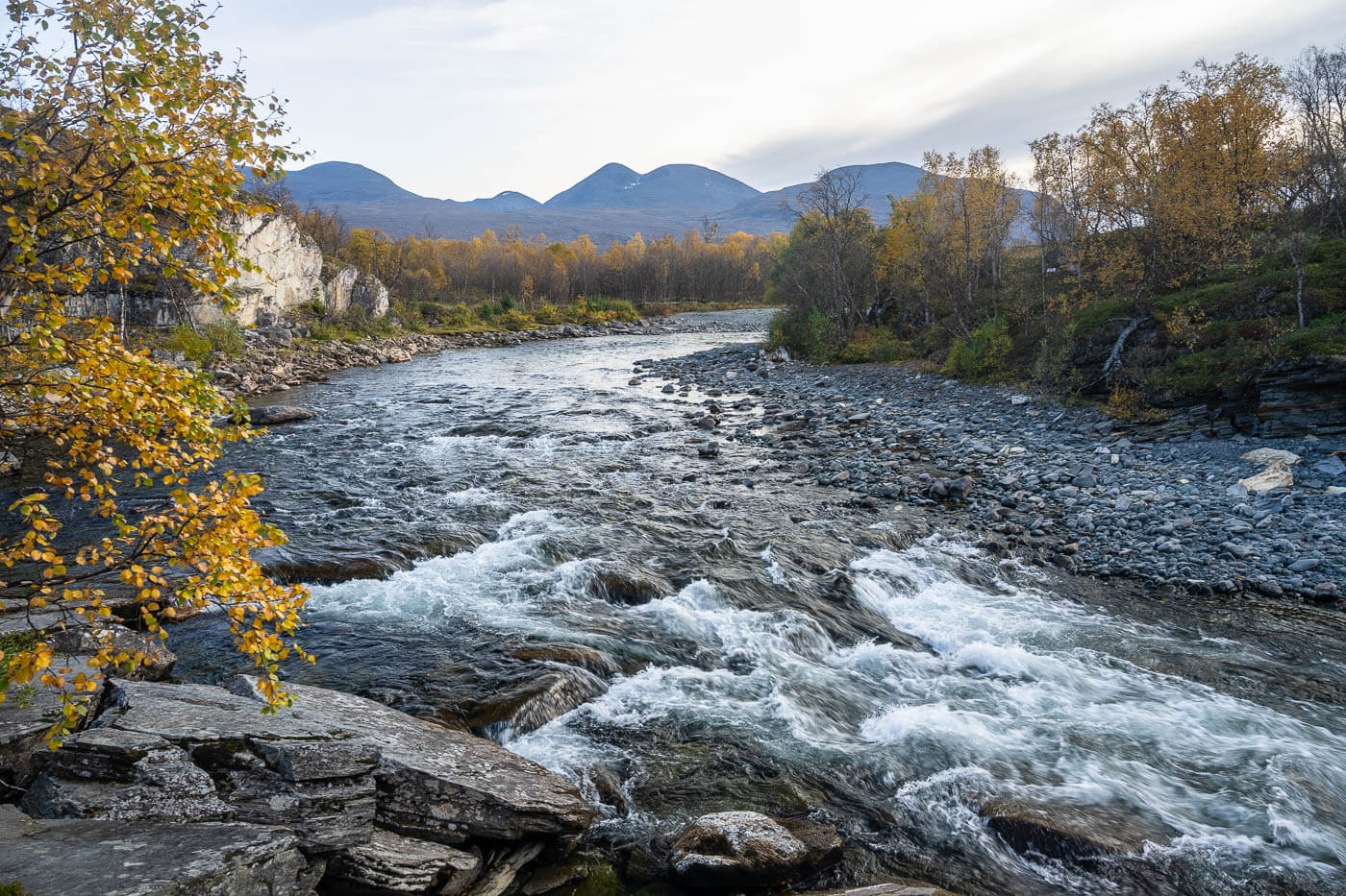
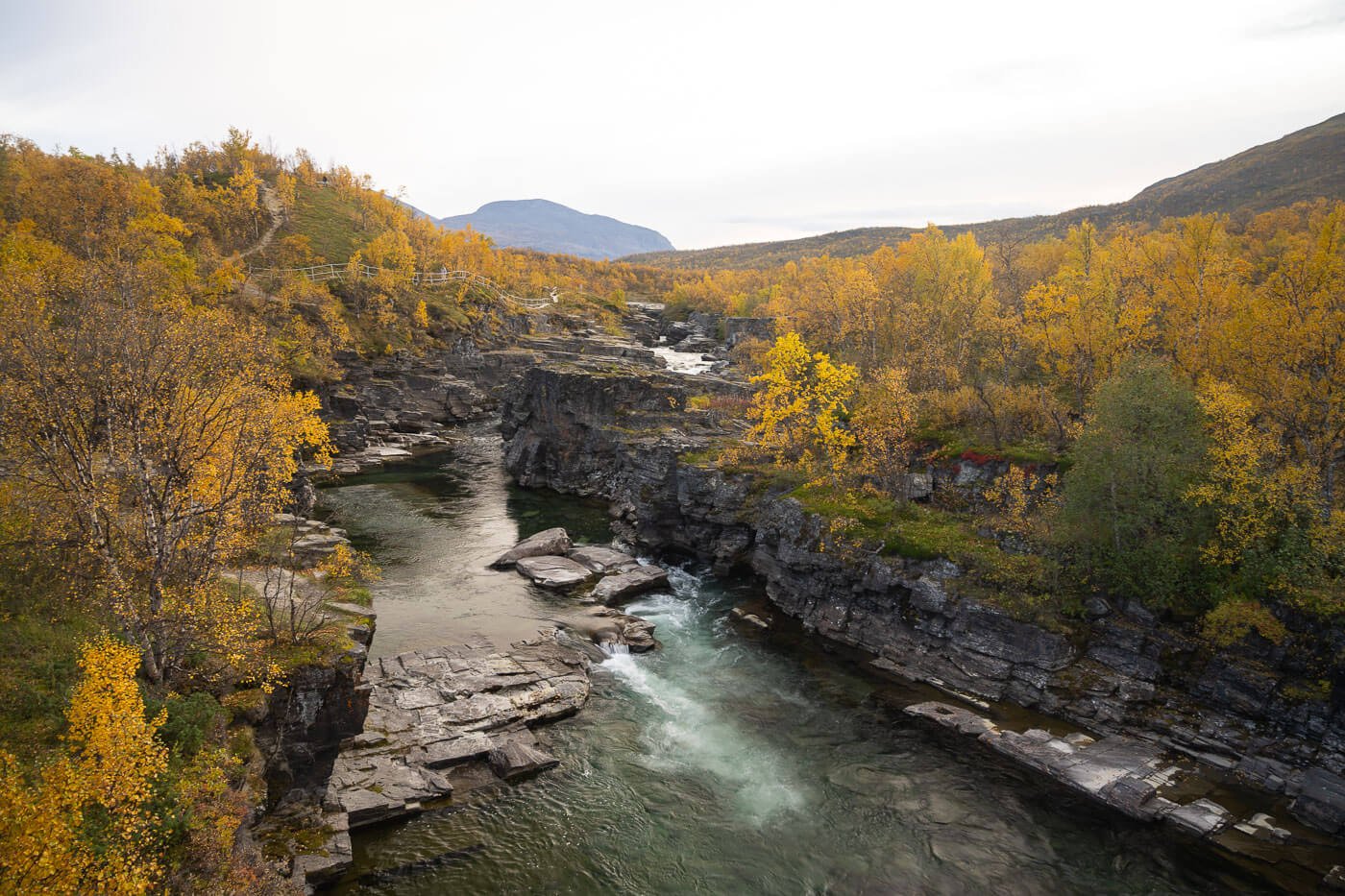
From the Abisko visitors center, the trail initially follows the Abiskojokk (or Abiskojåkka) river upstream. It’s the same trailhead as if doing the Kungsleden from North to South, and there are a lot of information boards as well as decorations about the trail and the whole area in general. It is an easy-to-walk path in general, with many access points to the river.

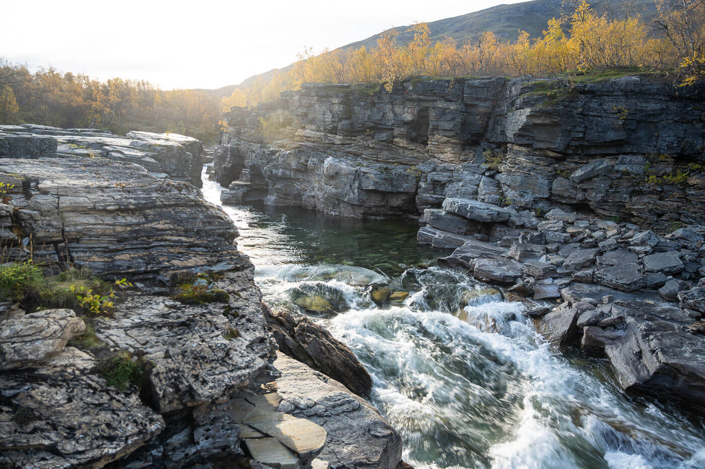
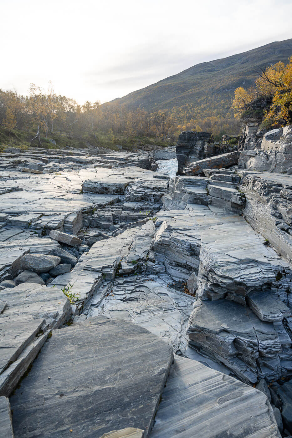
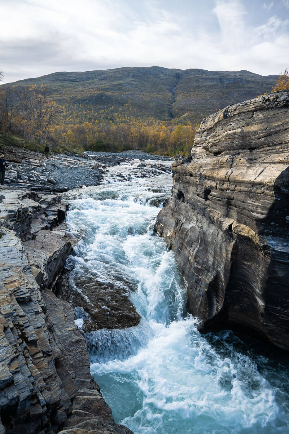
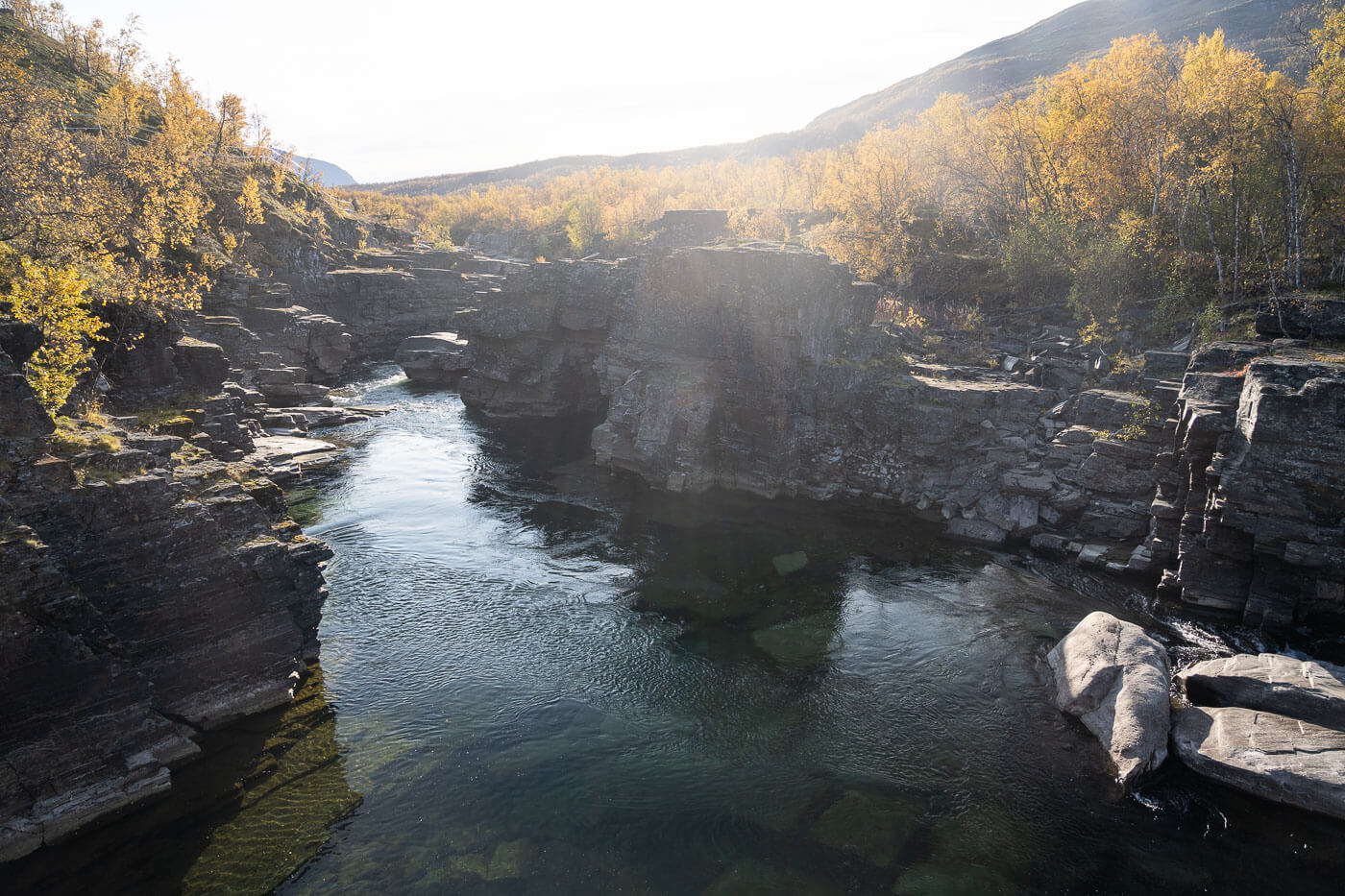
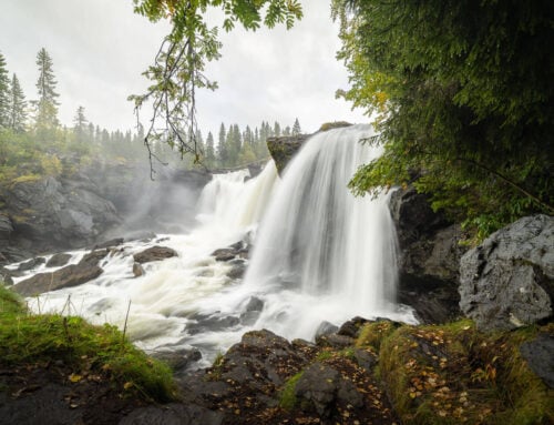
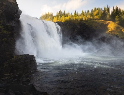
The trail also passes by the upper part of the Abiskoeatnu Canyon (the southern part is a trail on its own), so having access to the river allows you to access many viewpoints along the canyon, too. The Canyon is quite small but beautiful nonetheless, especially all the rock formations that constitute the walls of the canyon. It’s like multiple layers of rocks of different shapes and sizes.
The rocks almost appear as if men carved them. In some cases, they are so perfectly flat and layered that they almost look artificial. However, that’s the doing of the glacial river, Abiskojokk.

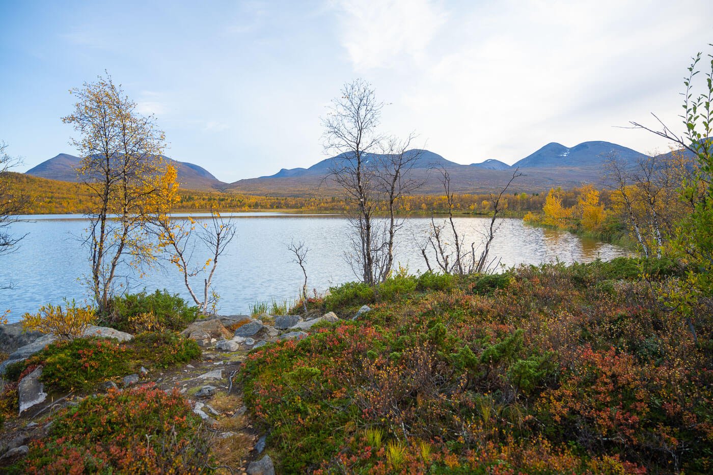
Upstream, as you leave the canyon, the river widens, and the trail keeps following it until the Abiskojokk Meditation Point. The Meditation Point is also a good viewpoint that offers excellent views of both the Abiskojokk river and the surrounding, vast landscape.
If you are wondering what the meditation point is about, it’s part of a series of meditation points with quotes, seven in total, from Dag Hammarskjöld, a former Swedish diplomat. In this case, the quote means “The longest journey is the journey inward”. The other six are along the trail between Abisko and Nikkaluokta.
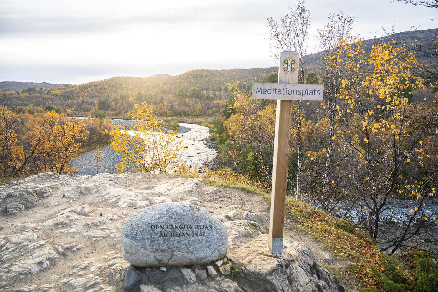
The Meditation point on the Njakajaure Trail.
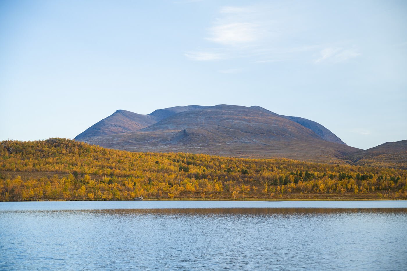
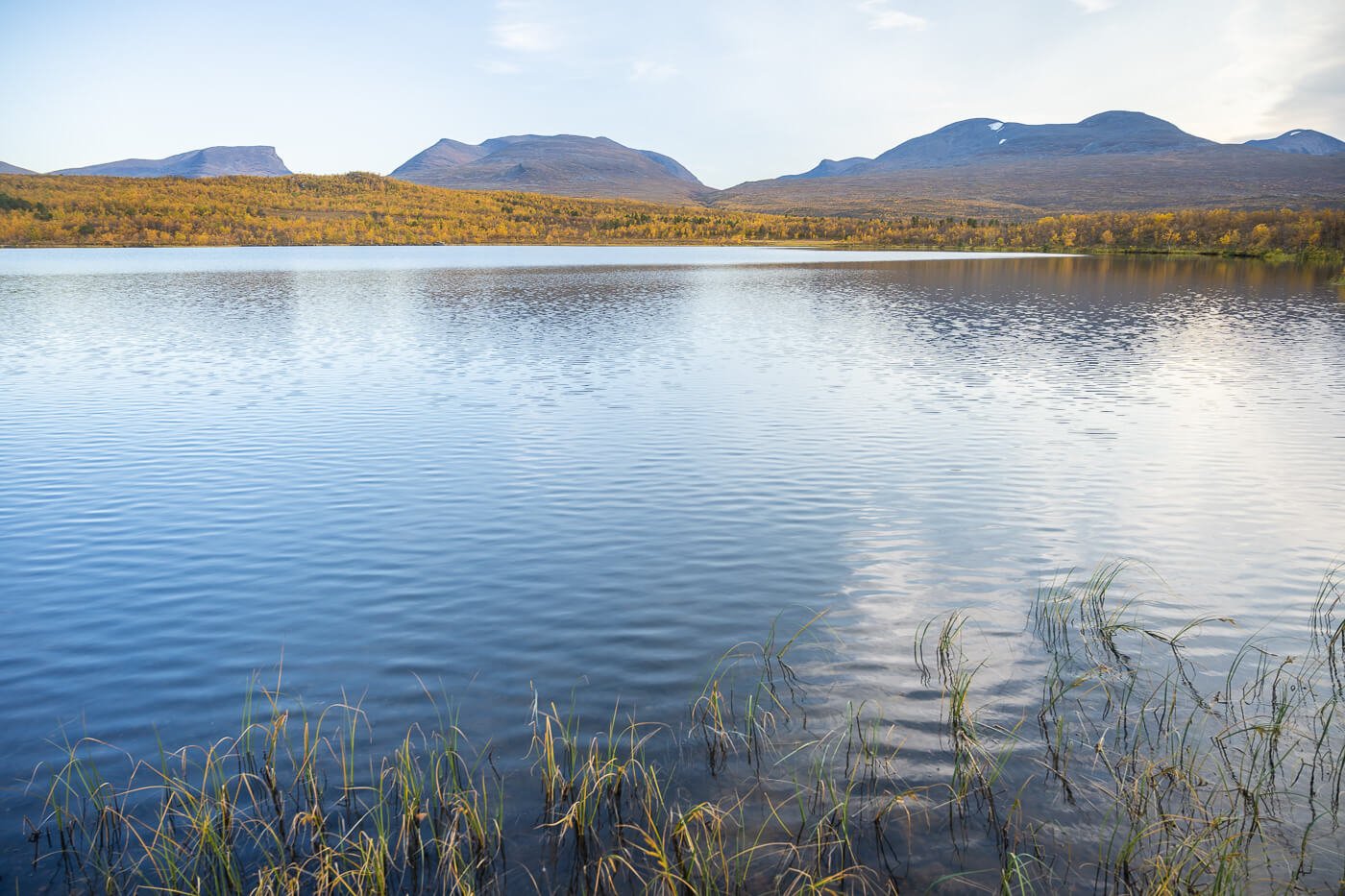
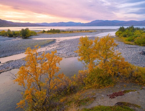
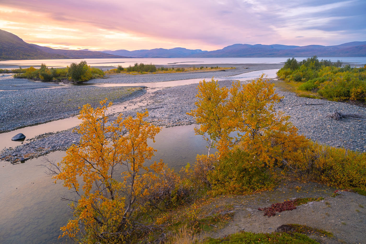
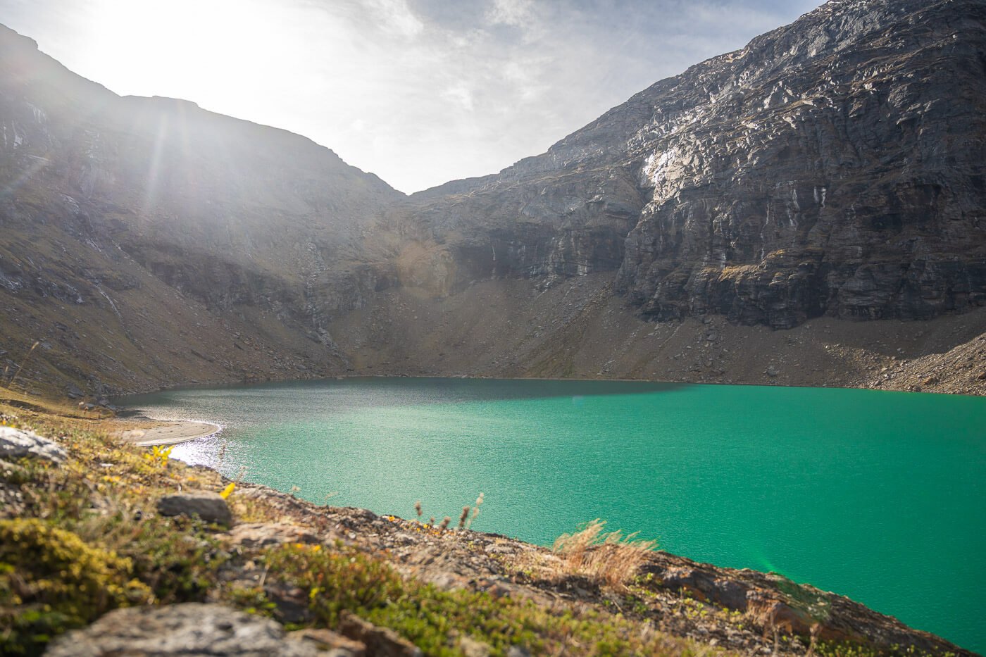
The trail then continues in the relatively thick birch forest until it reaches another viewpoint, on the shores of Lake Njakajaure (Vuolep Njakajaure). This is a beautiful, tranquil spot that offers stunning views of the vastness of Abisko National Park and the distant mountains. No artificial structures are visible from here, apart from the trail that leads to the shores of the lake.
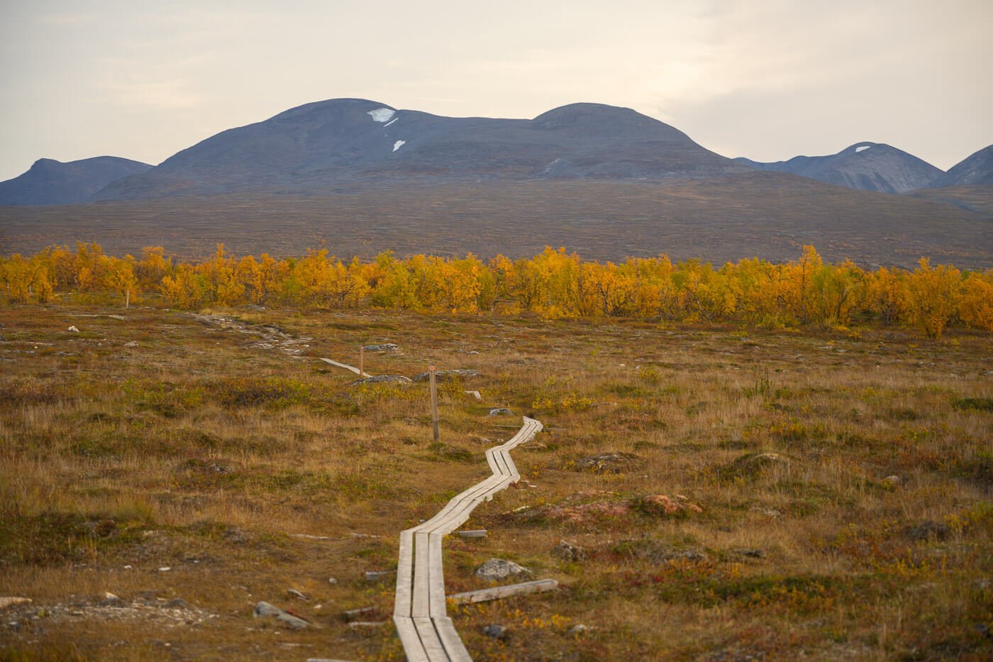
The lake is also the turning point, and from here it continues through the birch forest again, and then on some planks above the marshes, before reaching the Visitors Center again.
Lake Njakajaure.
Njakajaure Hike Photos and Photography Tips
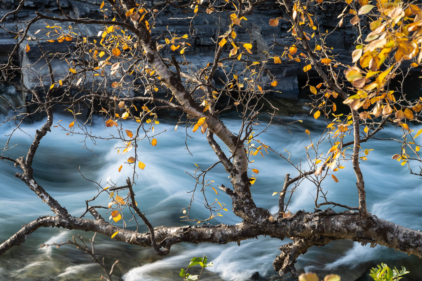
While the vastness of the landscape is what strikes at first, I soon found out the beauty of it in all the little corners of this wilderness. A tree above the rocks,
For landscape photography, this trail is best done in Autumn, as well as the area around the Abisko National Park. It’s famous for its autumn colors, and they are indeed beautiful at that time of the year. Fall colors in Abisko usually start in early-mid September and last for about a couple of weeks.


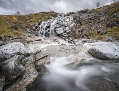
The river and the upper part of the Canyon, with its rock formations, are another major point of interest. There are plenty of interesting and unique rock formations along the upper part of the Canyon that make for interesting photos.
Still, despite its beauty, I feel it’s quite a difficult area to render properly in photos. Its vastness, especially, is hard to portray. It could be the lack of foregrounds sometimes, but I feel that aspect is the hardest to capture.
Regardless, that does not diminish the beauty of this remote location, as well as the enjoyment of taking photos in the area.
Where to stay
There aren’t too many options in the area; this is a very remote location. There are, of course, Abisko and the Abisko tourist center. You can find a campsite there too, but only for tents. If you are in a Van or RV, you need to look for one of the dedicated areas along the E10 – or a campsite along the road, like Björkliden.
Additional Resources
- You can easily combine this hike with a walk into the Abiskoeatnu Canyon and Abiskojåkka River Delta. They are both relatively short and easy hikes you could combine into one.
- Discover more hiking destinations.
- Here is a full list of the Hiking trails that are possible to hike from the Abisko Natural Park Visitors Center.

Leave A Comment