Hike to Skierfe, Sarek National Park, Sweden
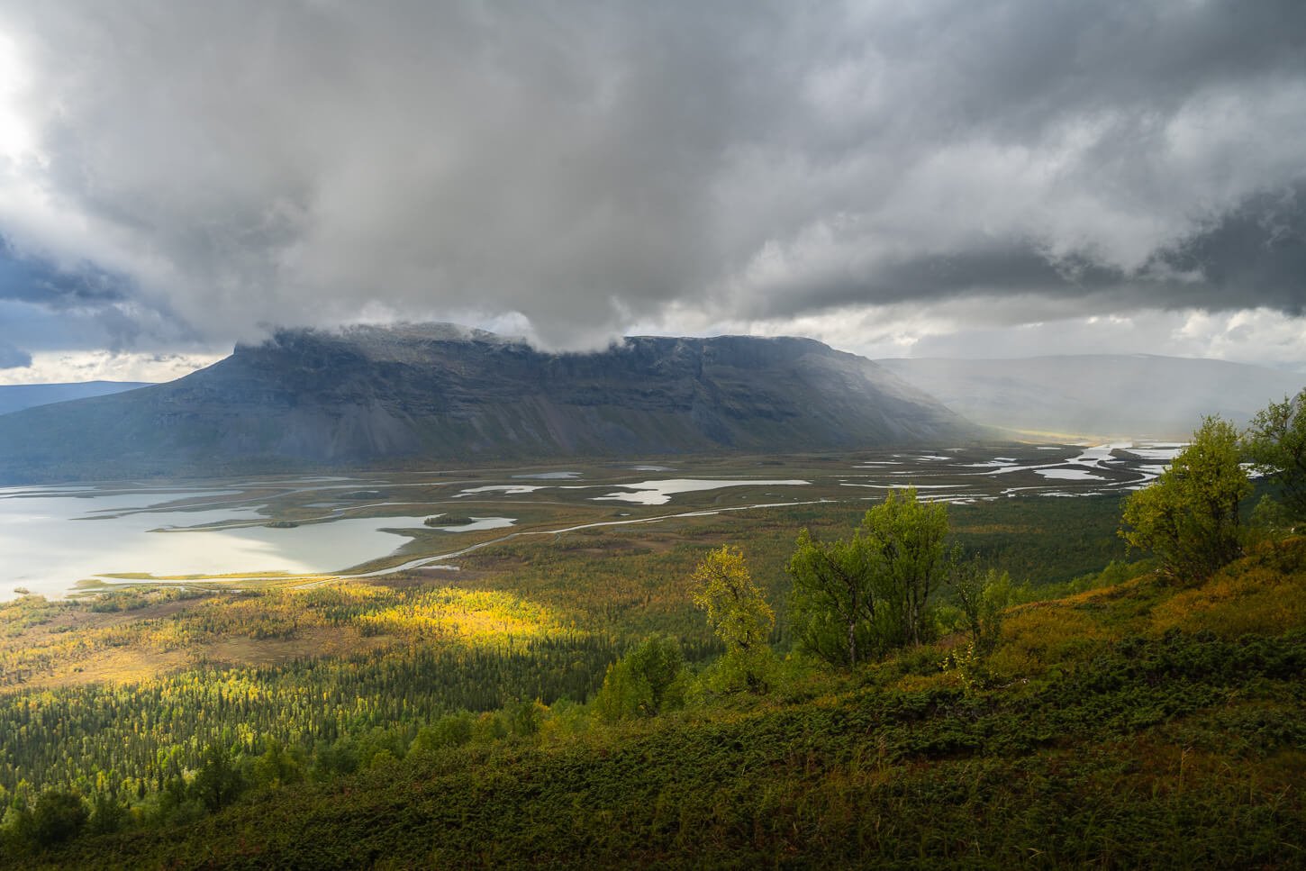
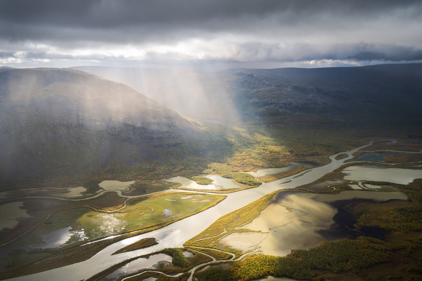
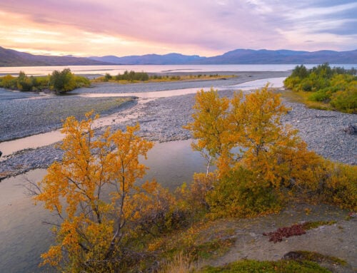
It’s probably safe to say that a hike to Skierfe is on the bucket list of many hikers and landscape photographers alike. Skierfe’s 1,179 meters-high summit provides epic views of the Rapadalen valley and the Rapa Driver delta. This spectacular view of the meandering Rapa river delta in the pristine wilderness of Swedish Lapland and Sarek national park is hard to compare to anything else in continental Europe.
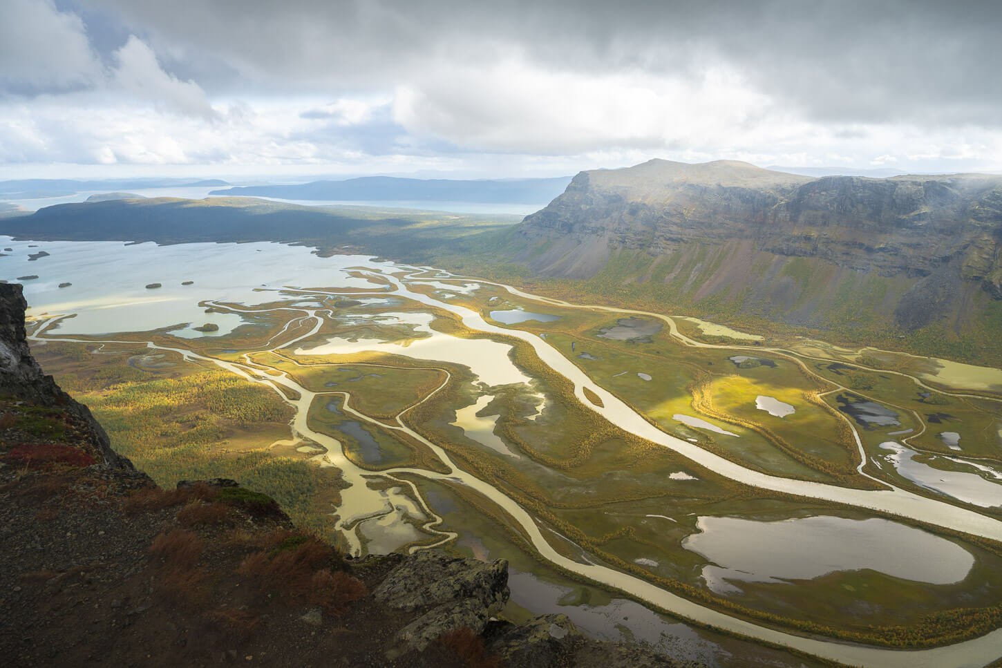
View from Skierfe’s summit.
However, great rewards only come from great effort, or so the saying goes.
Hiking to Skierfe is a bit of a logistical challenge. It is a very remote location, requiring a 48km long, out-and-back hike, from the nearest point accessible by car. Which is already quite remote in itself. So how do you tackle this hike?
The best way is with an overnight at the Aktse hut or along the trail somewhere. This means hiking to Skierfe requires at least two days and one night out. Additionally, you need time to get to the trailhead and back away from it. Which, in most cases, means one additional day of travel.

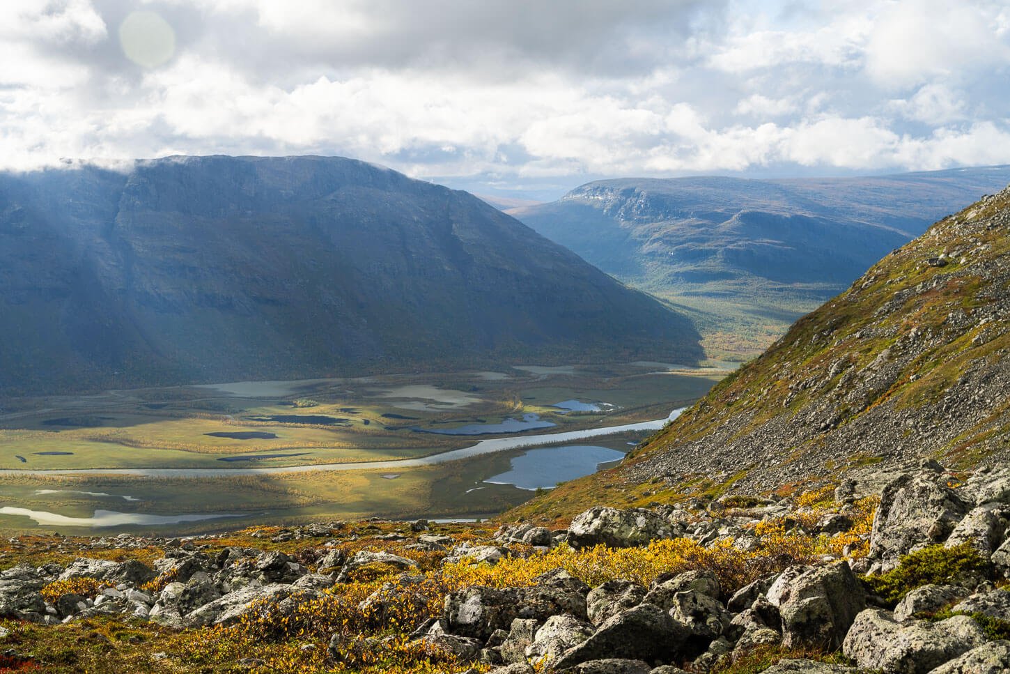
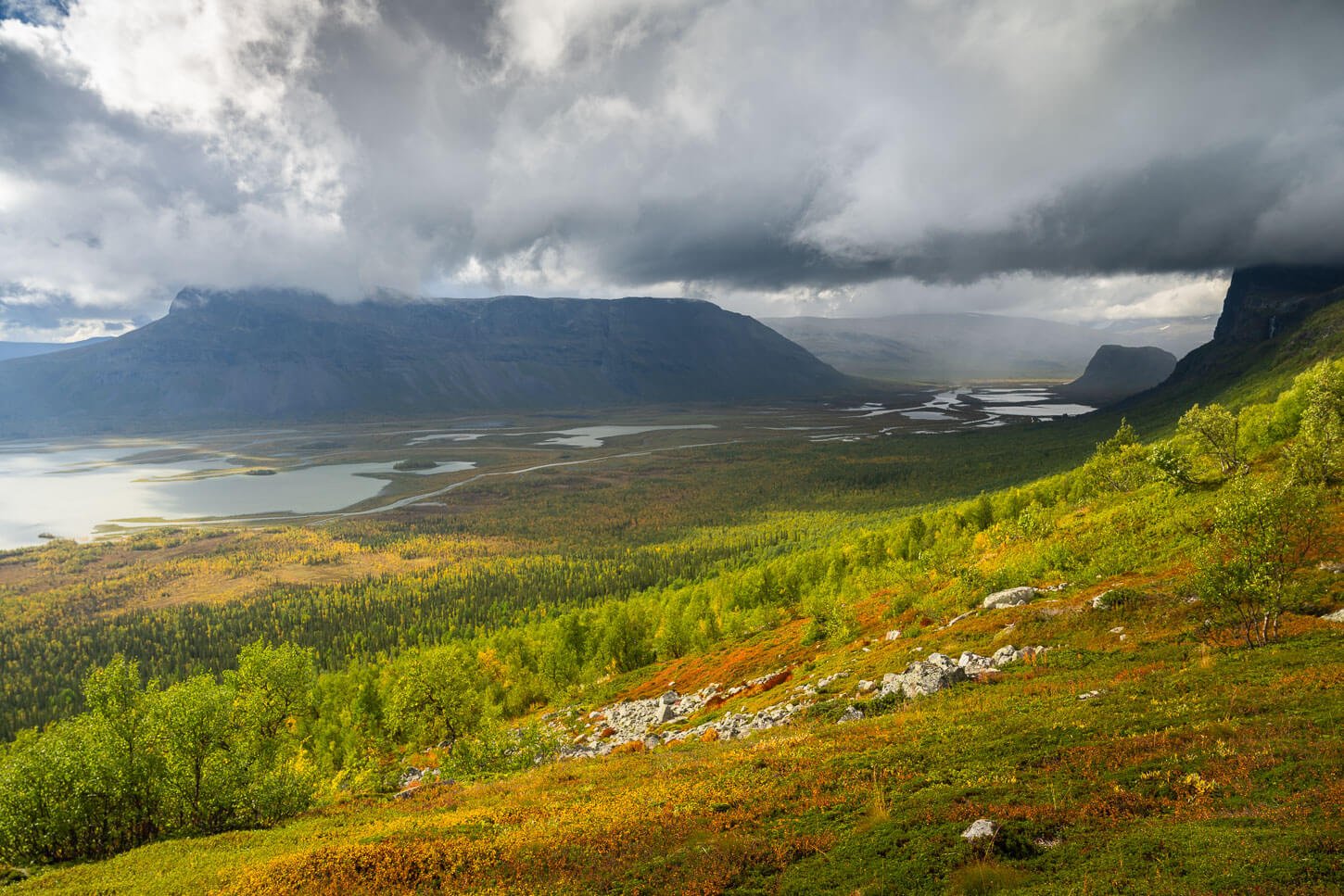
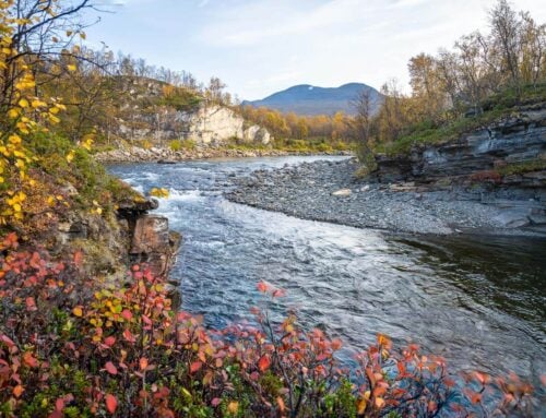
Rapadalen, from the trail to Skierfe – the mountain in the shadow on the top right.
And, do the views live up to the hype? Moreover, is it worth spending days to get to the trailhead and to Skierfe’s summit? For me, it absolutely was. Not only the hike, but the whole experience of getting there and to the top, as well as planning a journey I had been dreaming of for well over a decade, was well worth the effort. Also, considering all the beautiful views and the wildlife of the Sarek National Park.
If you are ready to plan your hike to Skierfe too, I think it is absolutely worth every hour it takes to get there and back.
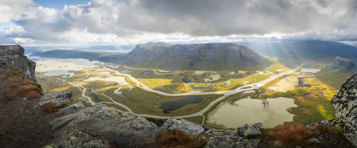
Panoramic image of the Rapadalen Valley from Skierfe’s Summit.
Table of Contents
Overview of the Hike to Skierfe & Map
The hike to Skierfe is a multi-day hike of about 48 Kilometers (almost 30 miles) from the nearest point reachable by car, which is Sitoälvsbron in the Norrbotten county of Sweden. Needless to say, you’d really, really want to do this hike if you are planning to get there. Not only is the hike long, but it takes time to get to the trailhead. More on that below.
On the hike: it really isn’t a difficult hike, and about half of it is on a dirt road, which makes for relatively fast going. The other half is a proper mountain/hiking trail. I did it in two days/one night, deciding to split the distance with most of the walking on the first day (32KM) and the remaining on the second day (16KM). That means hiking to Skierfe and back to the Aktse hut on day one, and walking back to the trailhead on day two.
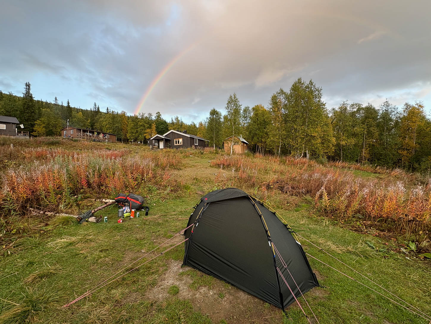
Camping at the Aktse Hut.
You can make the hike to Skierfe shorter by hiking 12km to Cykelstigen, taking the boat to Aktse from there, and doing the same on the way back, but you’d need to match this with the boat’s availability.
Would it be technically possible to hike to Skierfe in one day? Maybe, if you are used to those kinds of distances and you know you can travel light. But realistically, you don’t want to set out for such a long hike into a remote area without the proper equipment, food, or some kind of shelter.
| Max Altitude | 1,179 m |
|---|---|
| Distance | 48.3 KM |
| Elevation gain | 1,130 m ↑ / 1,130 m ↓ |
| Hike time | 14:00/ 16:00 Hours (excluding breaks/overnight stops) |
| Hike Difficulty | Hard |
Here is the map of the hike. You can download the GXP file for free from the activity linked below. It’s
How to get to the Skierfe trailhead and Trip planning Tips
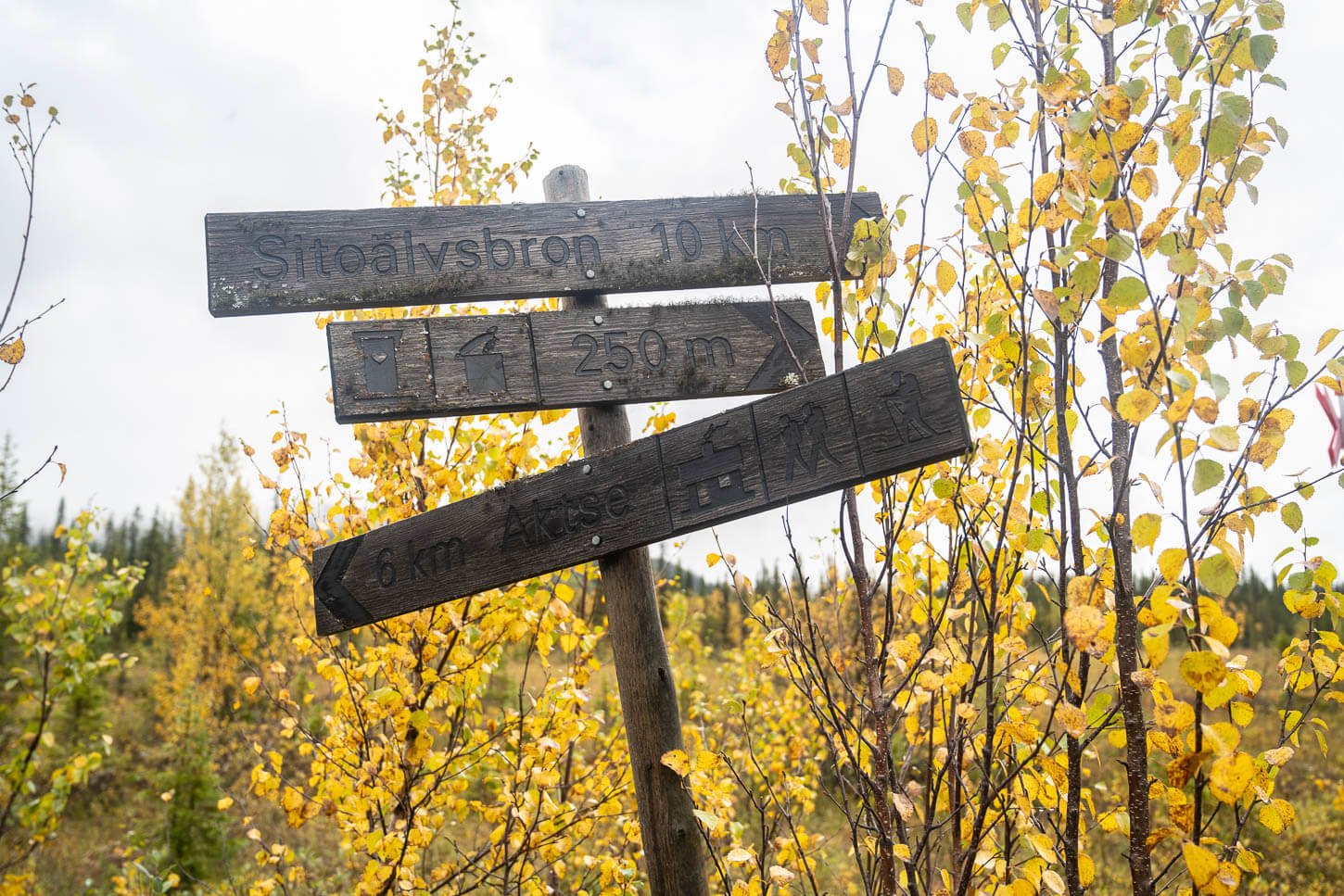
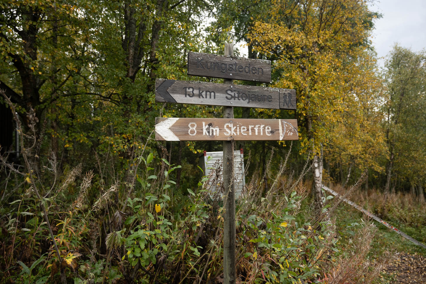
The Skierfe trailhead is technically located next to the Aktse mountain station, which borders the Sarek National Park. From there, it is a 16 km out-and-back hike. And, unless you are doing the Kungsleden, the best and easiest way to get to the Aktse mountain station is from Sitoälvsbron, which is a location that can be reached by car. Then it’s a 12km (one-way) hike to the Aktse hut.
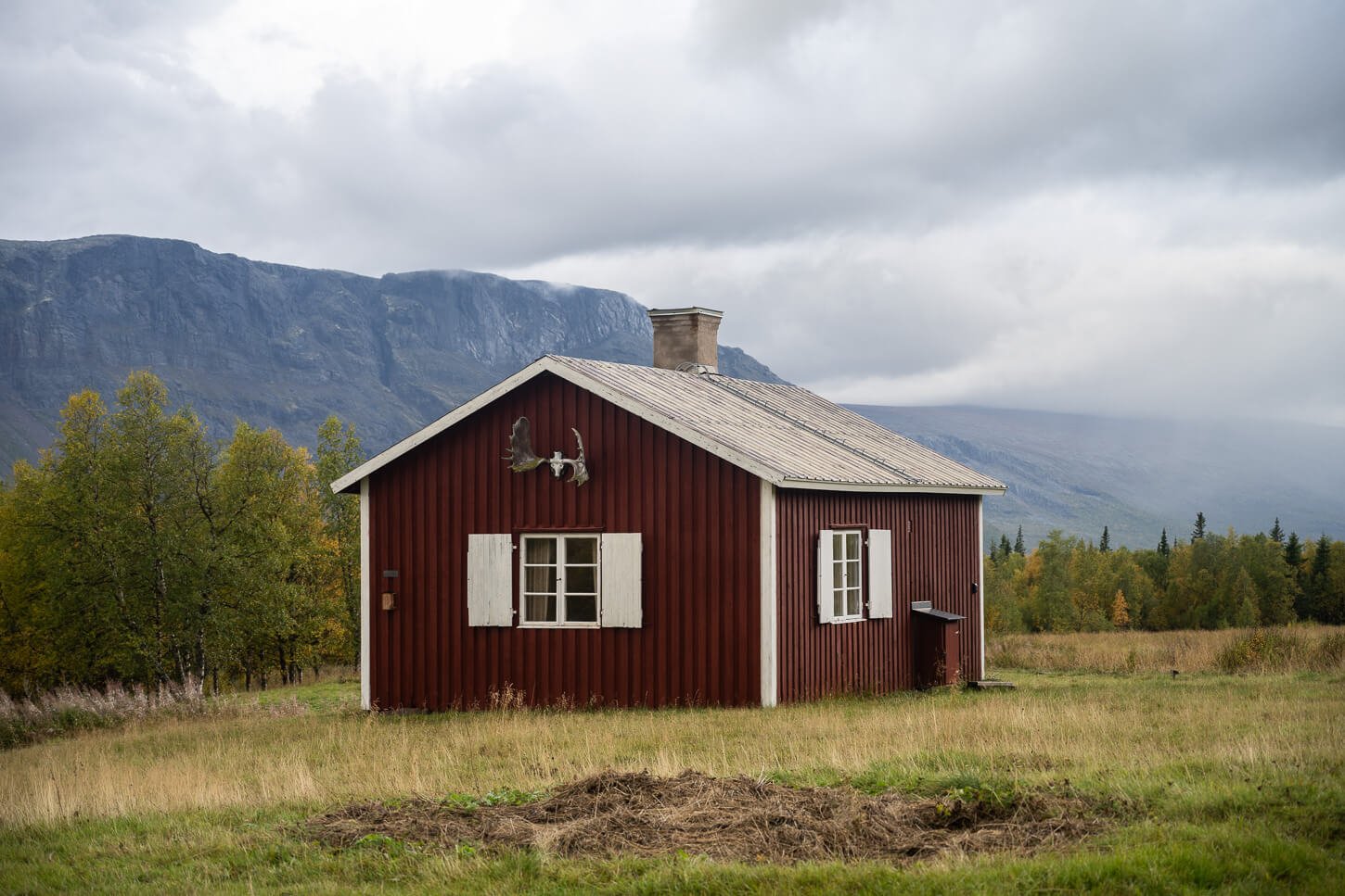
One of the huts at Aktse, the only “civilised” location – and a resupply point – on the trail.
How to plan to visit Skierfe and Rapadalen
Now the main question is, how do you get to Sitoälvsbron, which is already a remote location in itself? That highly depends on where you are coming from and what your plans are. For example, if you are planning to visit Skierfe as part of a tour across northern Sweden and Northern Norway, you can consider flying to Tromsø, Bodø, or the Harstad/Narvik Airport.
In each case, it is a long non-stop drive; 9+ hours from Tromsø, 7+ hours from Bodø, and 6+ hours from the Harstad/Narvik Airport. However, you have plenty of stops you can make in between. I’ll name a few, like the Lyngen Alps and the Abisko area coming from the north (Tromsø), or the Rago and Padjelanta National parks via the South (Bodø or the Harstad/Narvik airport).
If you are instead planning to visit Skierfe as part of a Swedish Lapland tour, you may consider a connecting flight to Kiruna or Gallivare (the closest airport). From each one of these locations, the drive to Sitoälvsbron is not as long. It takes a little over two hours to reach Sitoälvsbron from Gällivare, and about four from Kiruna. In any case, your gateway town is going to be Jokkmokk, located along road E45, where you can stock up on supplies at the local superkarmets (Coop and ICA) or Outdoor Shops (Jokkmokk Outdoor, TeamSportia Jokkmokk). And refuel if needed.
Driving Directions to Sitoälvsbron
- Driving Directions: from Jokkmokk, take road E45 north and turn onto road BD805 to Kvikkjokk/Sarek National Park. After about an hour, turn right onto the service road of a local hydroelectric power plant at these coordinates. Then, continue to follow the road, which will soon turn into gravel, until its end, for another half an hour or so.
- Parking: Parking at Sitoälvsbron is free. The area you can park at is relatively large, and there are places for several cars.
- Public Transport: none whatsoever to even get close to the trailhead in Sitoälvsbron. To my knowledge, not even private tours are offered.
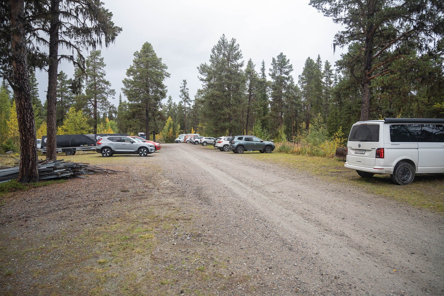
Sitoälvsbron parking Area. This is not only the closest point to hike to Skierfe, but also one of the access points to the Sarek National Park.
The Hiking Trail to Skierfe
From Sitoälvsbron, the hike can be broken down into three main sections. From Sitoälvsbron to Cykelstigen, which is the first boat docking area. Then from Cykelstigen to the Aktse hut, and from the Hut to Skierfe.
The Trailhead at Sitoälvsbron.
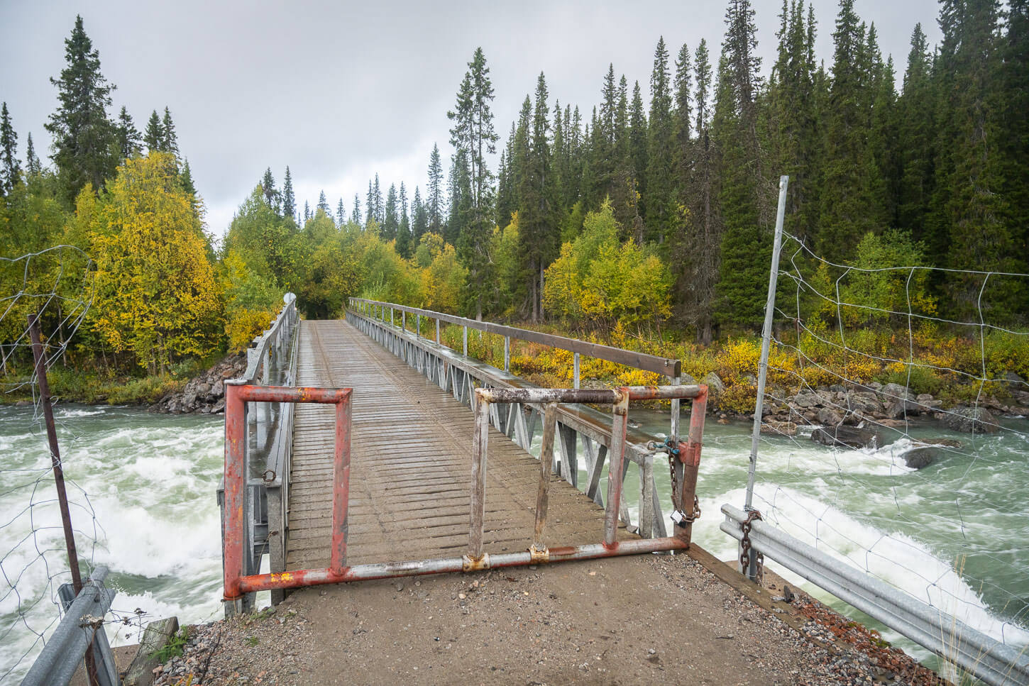
From Sitoälvsbron to the Cykelstigen
From Sitoälvsbron, you will first have to cross a bridge to access the service road that leads to the docking area, where you can take the boat to either cross the lake or get to Aktse by boat.
This area is essentially a long walk on a dirt road in the forest. You’ll pass by camping areas, maybe hunters, a couple of huts, and, of course, lots of trees. This part of the trail is about 10 km long, but it is fast going. For reference, I managed to keep a 5km/h pace with a 15KG backpack. It’s just a very long, flat dirt road.
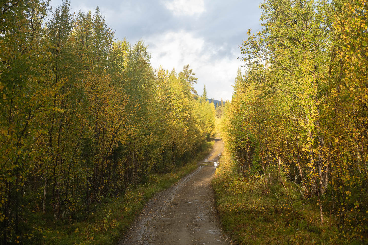
The road to Cykelstigen.
In this section, you don’t have much af a view of the landscape, but the forest around the road is beautiful. Also, better to keep your eyes open for wildlife. On my way to the hut, I came across a relatively fresh Moose footprint. It was probably just a few hours old, as it was well defined and nothing had stepped on it yet. Plus some more Reindeer footprints, which are more common.
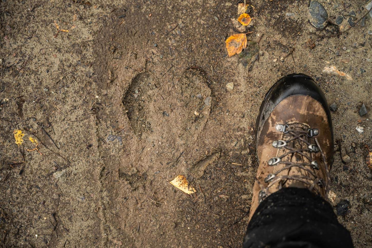
Moose footprint on the trail to the Aktse Hut.
And about Reindeer, I was lucky enough to spot a mother with its cub in the same stretch of the trail on my way back. I was only able to snap a photo with my mobile as I had packed my camera away, but definitely keep your eyes open on this section of the trail. And if you do it in the Swedish Lapland Autumn, the colors of the vegetation will be beautiful too.
The dirt road ends at the docking area where the boats leave to eithe the other side of the lake, or to the other dock by the Aktse Hut. Once at Cykelstigen, you can follow a trail to the hut.
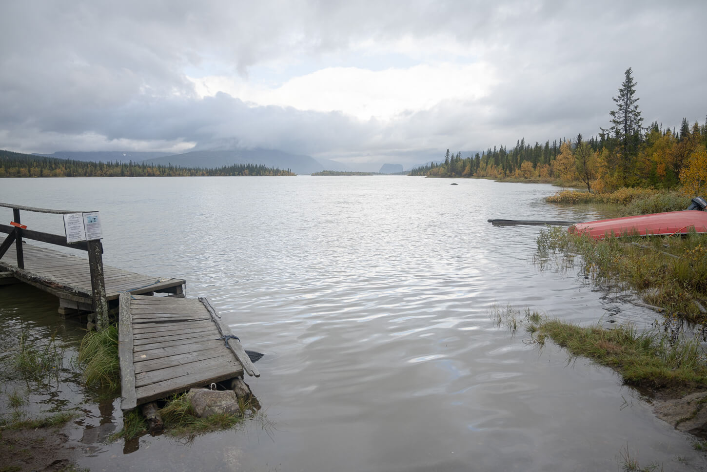
Cykelstigen dock on lake Lájtávrre.
From Cykelstigen to The Aktse Hut
From the docking area, the trail heads into the marshes, but on a boardwalk. It is another 6.2 km to reach the hut from here. The trail is almost entirely in the forest, so the pace will be slower, especially if it is wet. For reference, it took me one hour and fifty minutes to cover that distance, so a considerably slower pace.
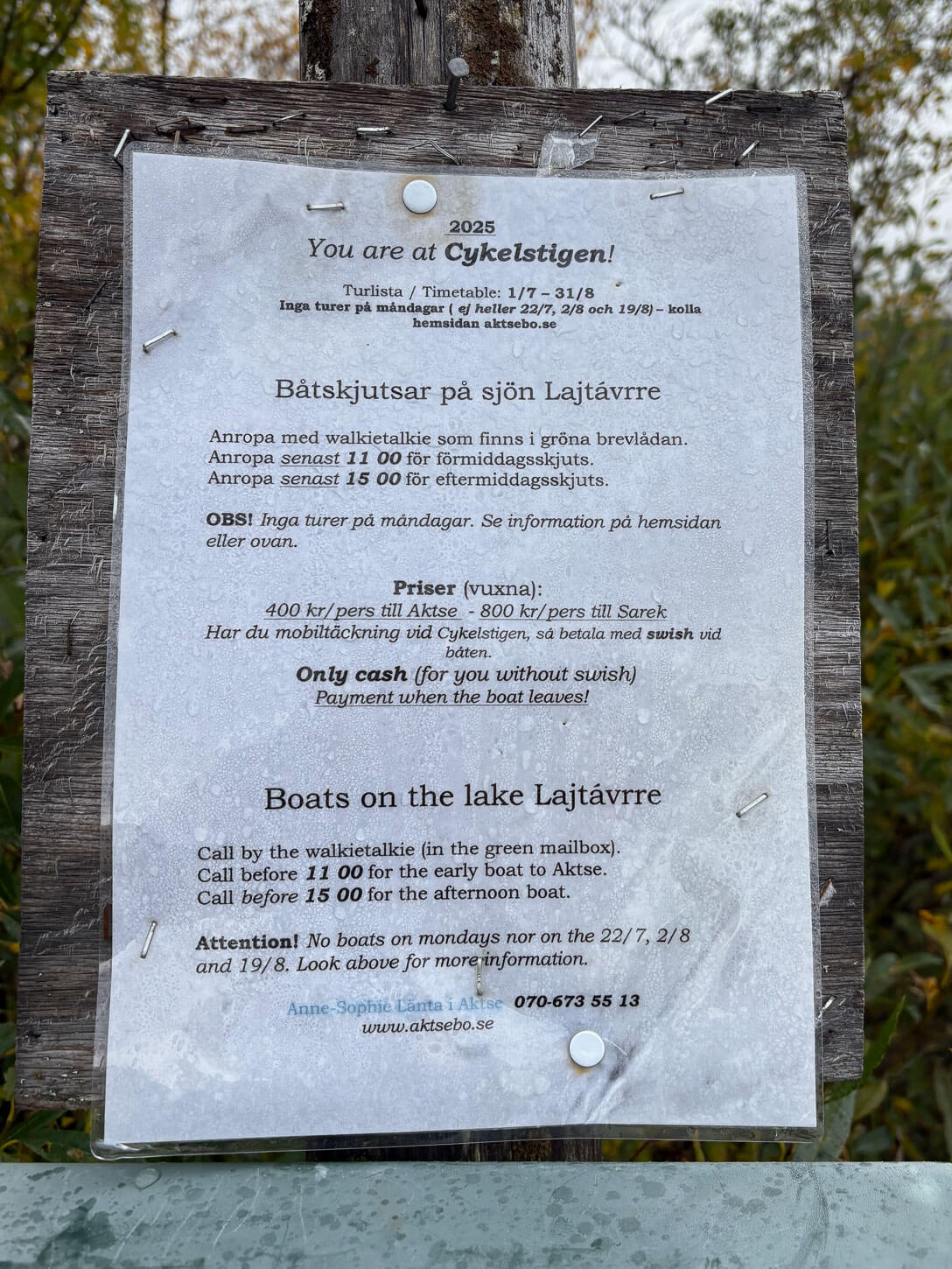
If you’d rather take the boat, here are the details of the service. Do note the cutoff times.
If you take the trail, it’s not a difficult hike. It’s just slower going. The trail is almost entirely in the forests, with lots of exposed roots, mud, and potentially slippery boards across creeks.
After a while, you will then reach the other crossroad for the boat docking area close to the hut, and from there it’s just a short walk to the hut.
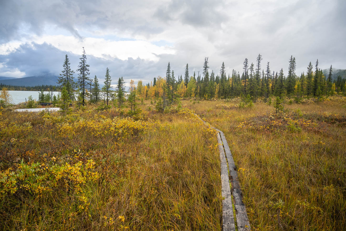
From Cykelstigen, the trail continues to the Aktse Hut loosely following the shores of Lake Lajtavrre.

Huts at Aktse. Skierfe is the pointy mountain in the background.
From the Aktse Hut to Skierfe
If you are planning to sleep in a tent at the hut, I’d recommend setting up camp here before heading up. That’s also what I did. shed most of the weight after the first 12 kilometers before heading up and back down the mountain.
From the hut, the trail starts to climb up the mountain, and this is where pretty much all the elevation gain is.
The Skierfe Trailhead at the Aktse Hut. From here, it’s another 8 km to the top.

The section of the trail to Skierfe behind the Aktse Hut.
The first part of the forest behind the hut is already moderately steep. However, as you exit the forested area, the elevation gain eases out until the last push before the summit.
As you exit the forest, you will also have the first, already good views of the landscape below Skierfe and the Rapa river delta. You already have some spectacular views here. Although they are obviously not as good as those from Skierfe, they provide a feel that is like once you reach the top.
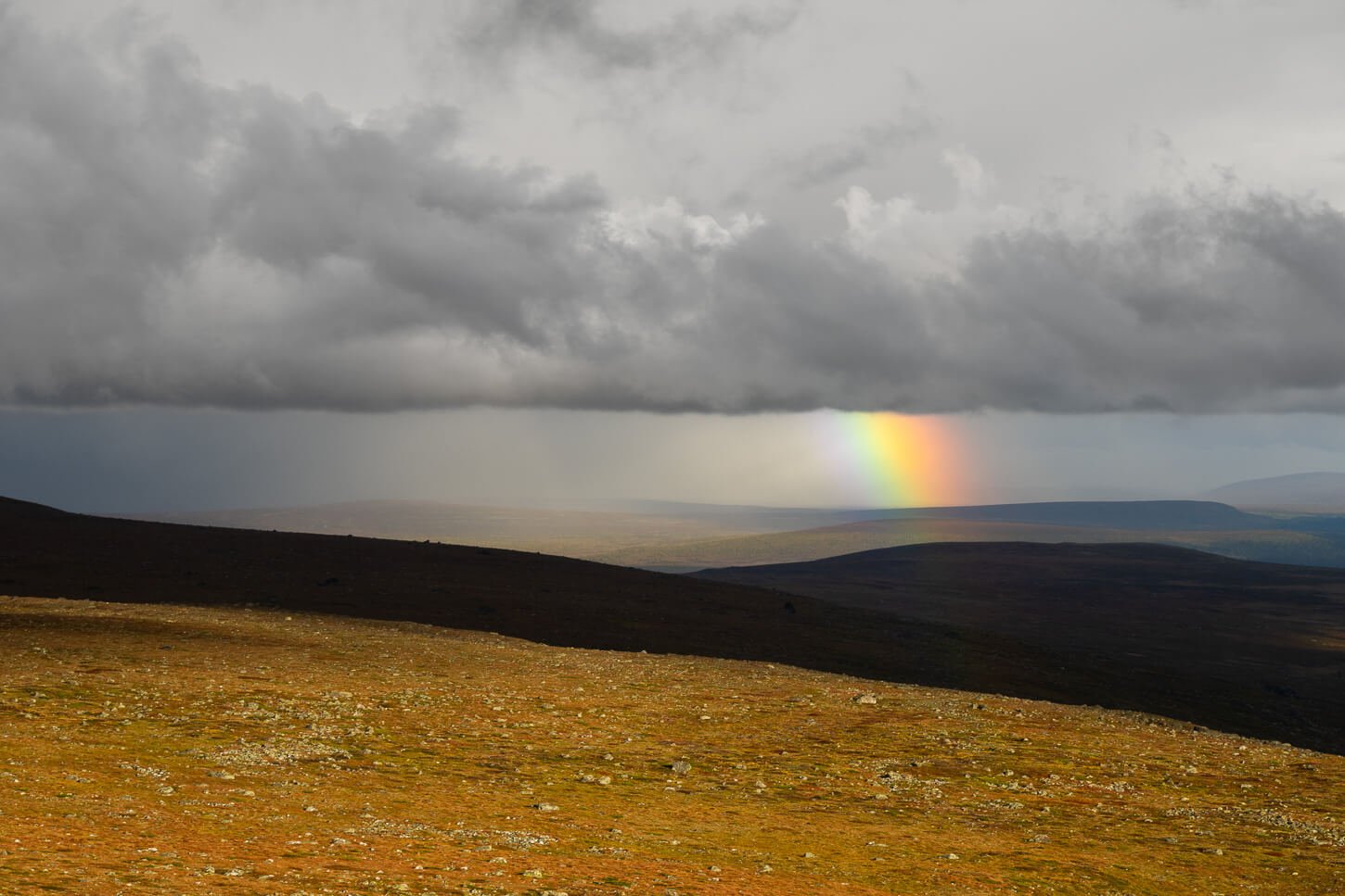
Dramatic light (and rain) above Rapadalen.
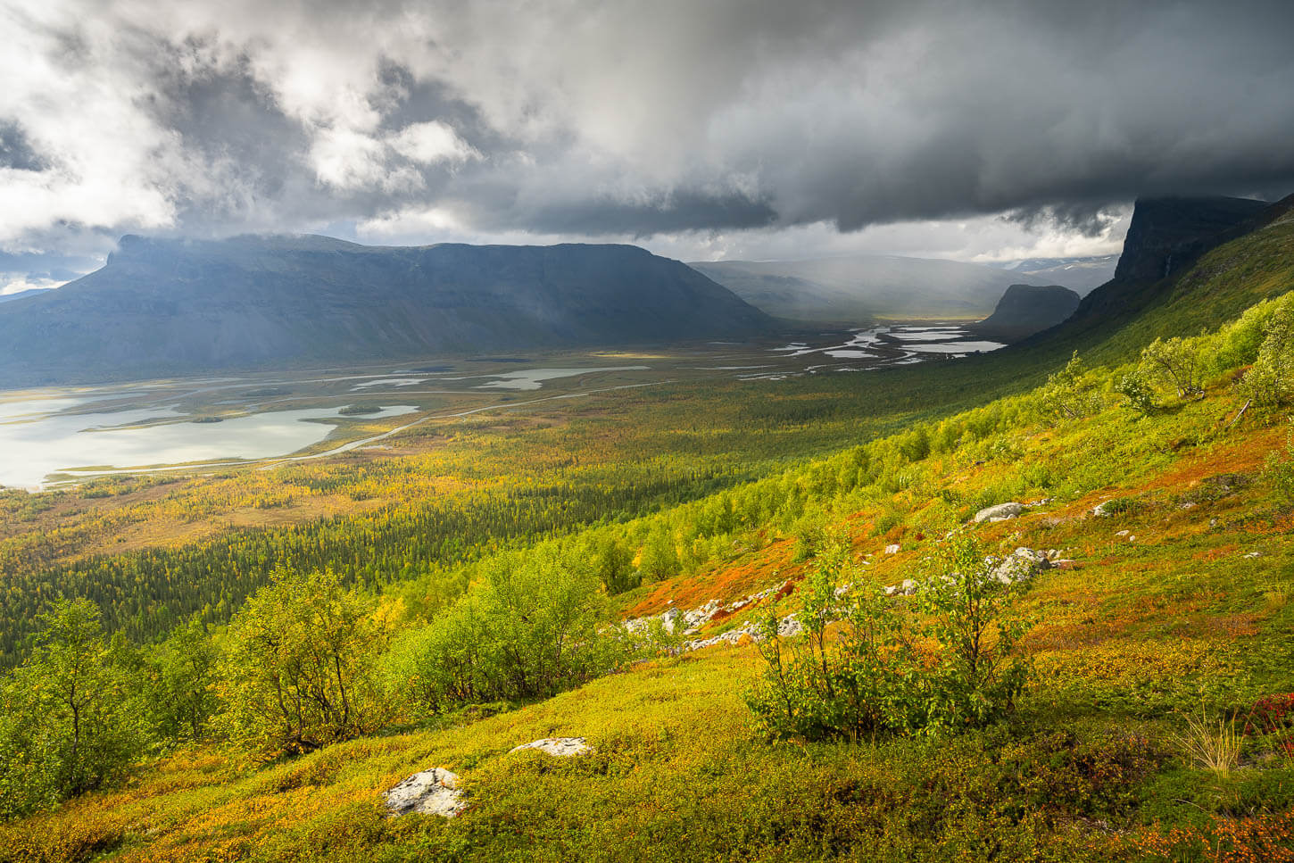
The views from the trail are spectacular even before reaching the summit.
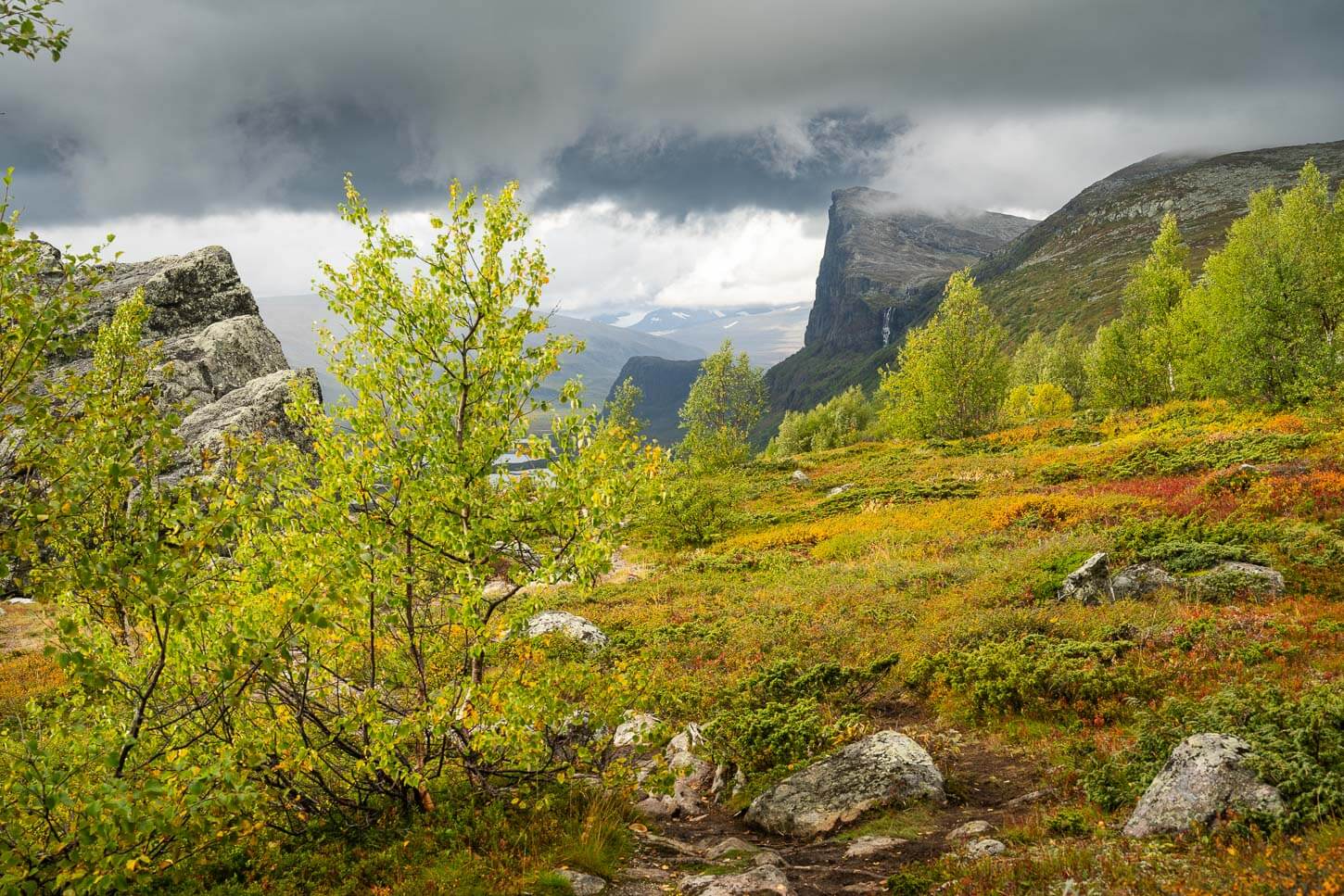
On the trail to Skierfe – the tallest mountain in this photo.
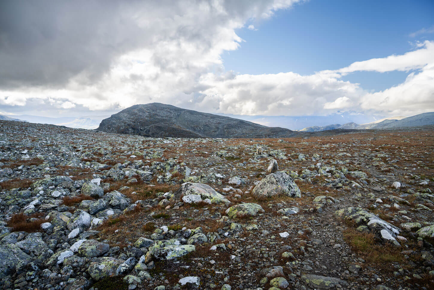
Also, in this section, the elevation gain is much gentler. Some areas in this section of the trail can be quite boggy. The, again, the trail gains elevation again, before the next flattish section, which is rather rocky.
And it will be rocky all the way to Skierefe’s summit, with the last push being again relatively steep, with some big boulders you’ll need to navigate around. The trail, although unmarked, is very visible all the way to the summit.
For the last push, the trail leaves the Rapa valley and winds its way on the other side of the mountain.
The trail gets progressively rockier.
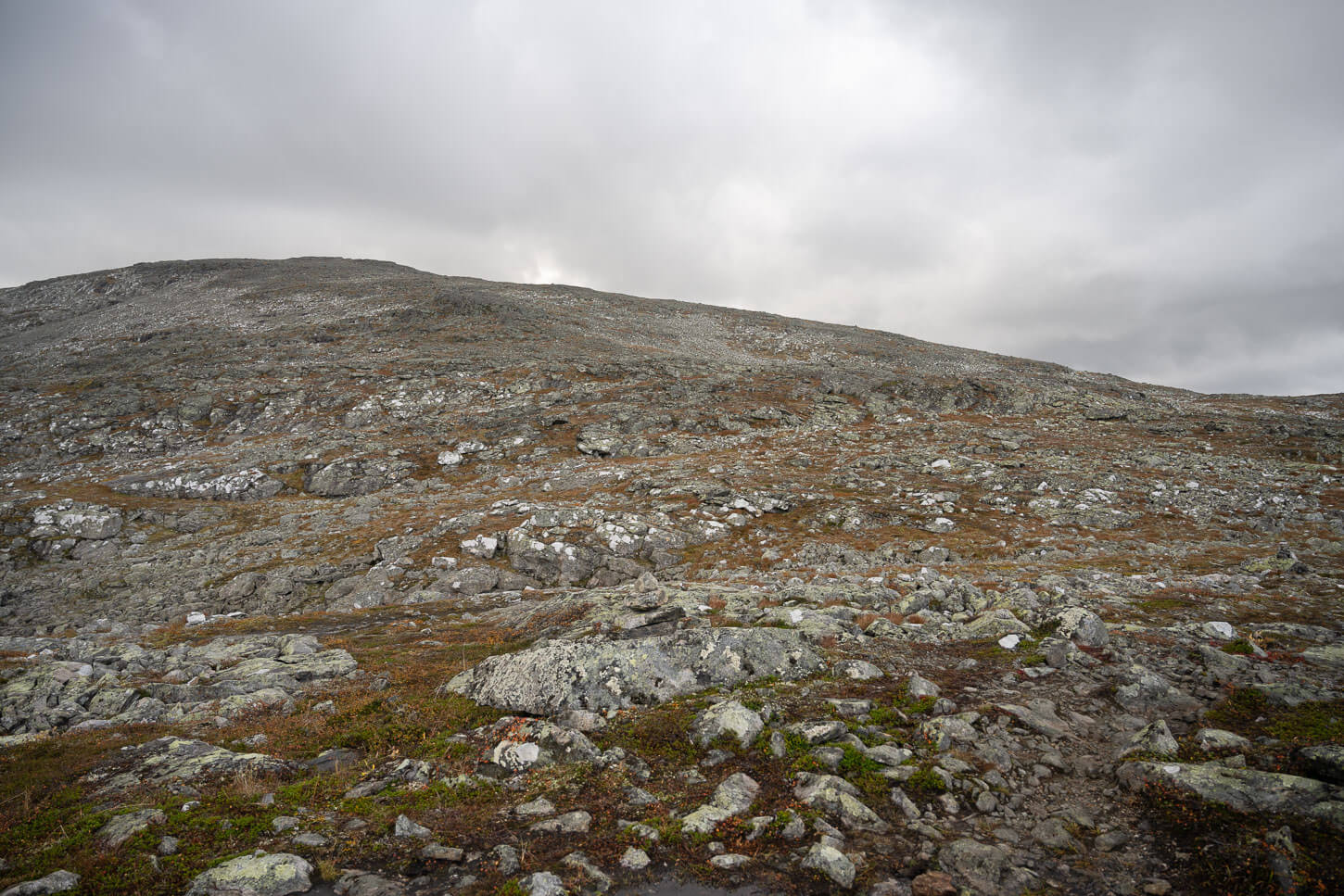
The final stretch that leads to Skierfe’s Summit.
Skierfe’s Summit
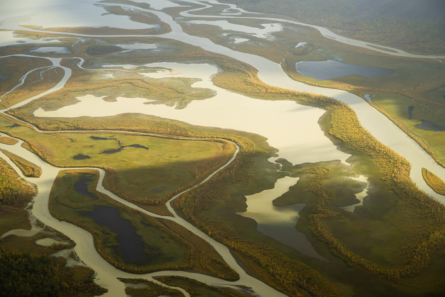
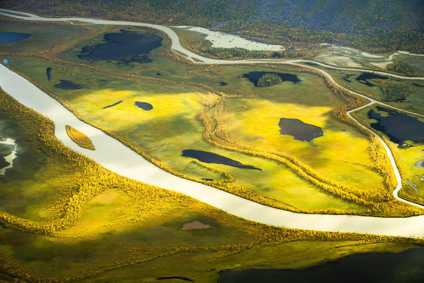
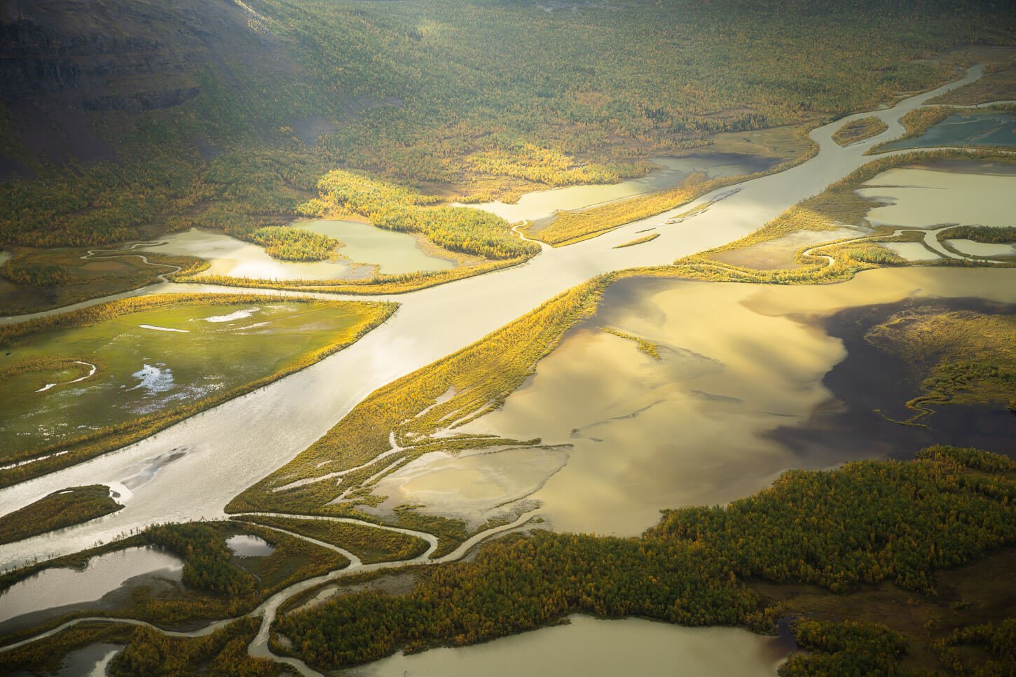
You really don’t see the river delta until you have reached the ridge at the summit. As you reach the endpoint of the hike, Skierfe’s summit, the amazing view of the Rapa valley and its river delta will reveal itself in all of its glory. Congratulations! You made it to the top of one of the best views in continental Europe!
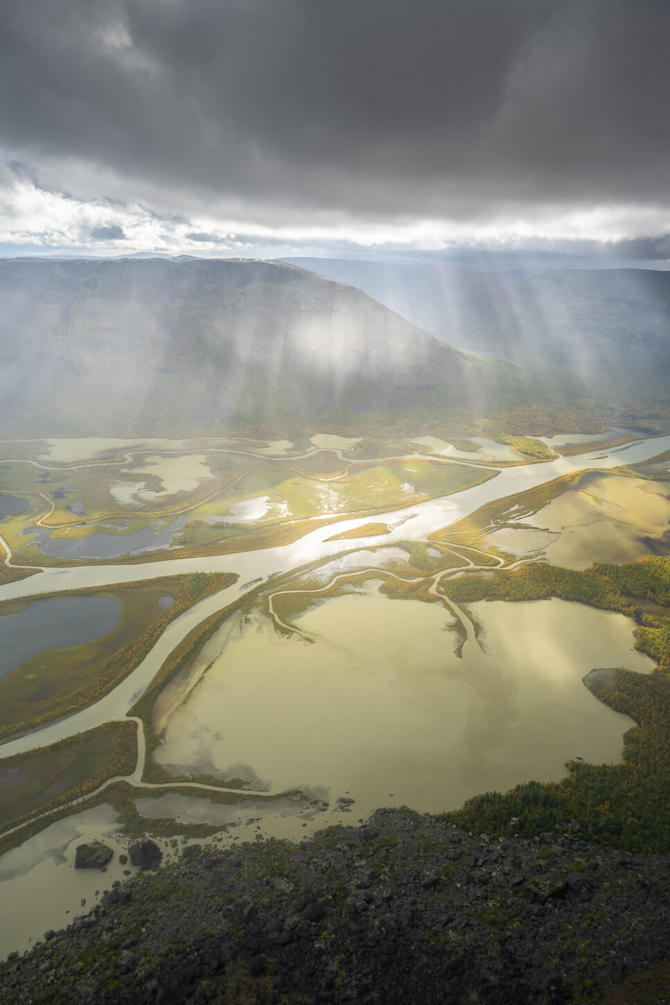
Dramatic Light above the Rapa River Delta.
View from Skierfe.
More dramatic light through a break in the clouds.
It’s worth taking your time here to enjoy the landscape. Skierfe’s summit is much wider than you’d imagine from seeing it from below. And it’s not only the view of Rapadalen, but also the view of the more remote areas in the Sarek National Park.
I spent more than two hours up there, in cold winds and passing rain showers. It’s one of those places where you could just sit and watch the landscape for hours, without realizing the passing of time.
Panorama – 8 images.
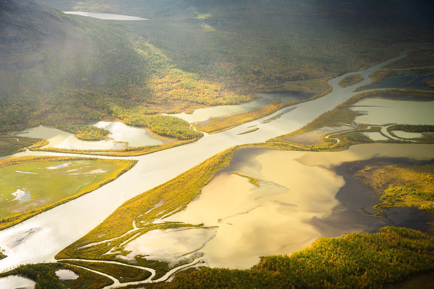
Details of the Rapa River Delta.
Skierfe Photos and Photography Tips
What I had personally envisioned when I planned my hike to Skierfe was to (hopefully) have passing clouds, with passing rain showers, in order to catch the changing light and how light plays across the landscape as the clouds and the rain moved across the landscape. And I could not have picked a better day.
The weather is extremely changeable here, so much so that the day before, the forecast was giving only a couple of hours of break in the clouds in the afternoon. So initially, I had planned to get to the top of Skierfe around that time.
View from the Trail to Skierfe.

The weather turned for the better, however, meaning constantly passing clouds and rain showers the whole day. Except in the evening when the sky cleared, and the rain stopped.
I only had with me a 24-70mm lens, which was a good enough range in most cases, but fell short in some. It was good enough for 80% of the time, and I wished I had a longer lens with me, although unfortunately, I could not really fit my 70-200 in the pack.
The benefit of having a longer telephoto lens on the hike to Skierfe would be twofold:
- The opportunity such a lens offers to create different compositions of the meandering river delta, the trees, and the marshes in between. At 70mm, that was a bit limited, but with more reach, there would be plenty of additional composition and details to focus on.
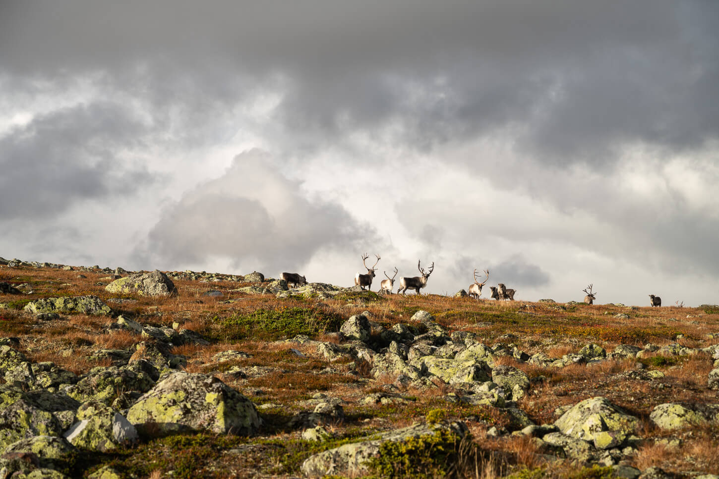
- Wildlife: There’s wildlife in the area. Reinders, Moose, Arctic Foxes are the most commons though there are harder to spot, more elusive animals like brown bears, Lynx, and Wolverines, among others.
I was able to see a large Reindeer heard, though to be fair, they are all semi-domesticated by the Sami, even if they roam free. Also, a Reindeer cub with its mother on the trail. I kept the distance as they didn’t spot me and did not want to startle the mother. Though I was only able to take a snap with my mobile. Also, just a moose footprint, but no moose, unfortunately. Or, fortunately, as September is moose rut season.
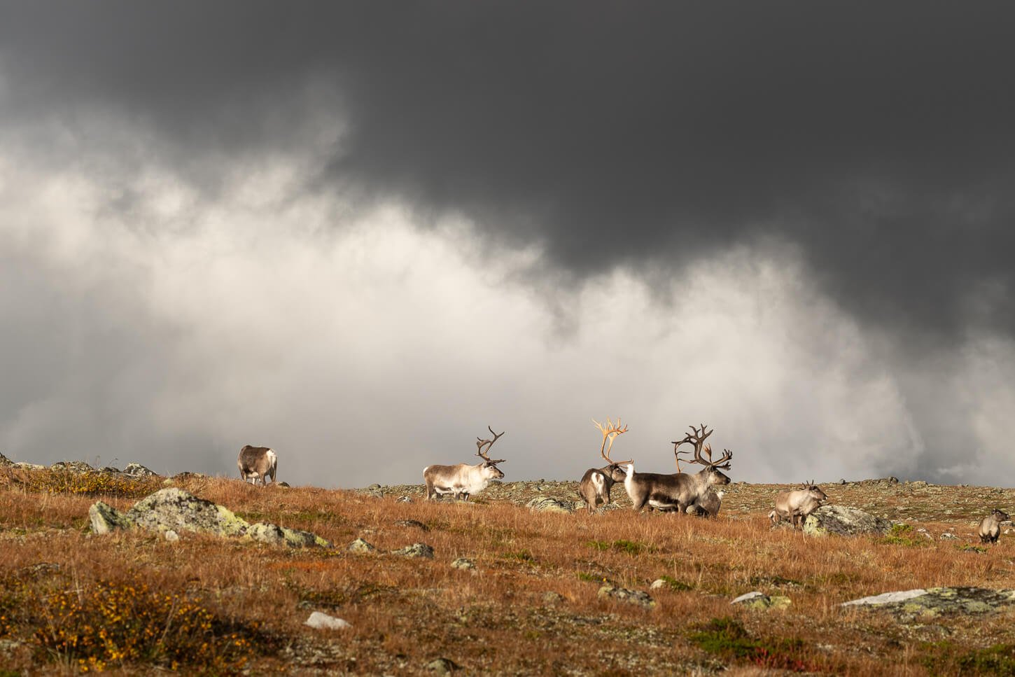
Reindeers.
Video of the Hike
Last but not least, here is a video I made while hiking to Skierfe.
Where to stay
If you are looking for a base nearby, Jokkmokk is the closest town. Still, it takes almost two hours to drive to Sitoälvsbron from Jokkmokk, so if you want to start the hike in the morning, you’d need to leave fairly early from whatever accommodation you can find in the area. If you have a van or a rooftop tent or similar, you can spend the night before at Sitoälvsbron, which is what I did in my van.
I then camped at the hut the following day, after hiking back from Skierfe. You’d need to pay only if you want to use the facilities, but if you opt not to pay, you may be asked to camp a little farther away from the hut, in order to leave the tent spots closer to the hut to those who paid for the facilities.
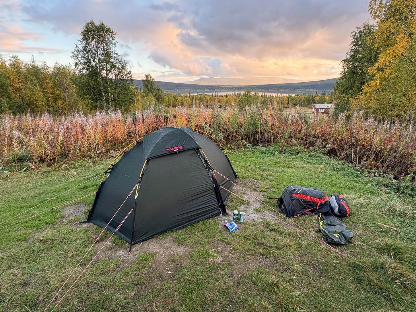
Camping at the Aktse Hut.
There are a few other spots suitable for camping above the hut, too, around the forested area. There are some areas suitable for camping before the summit, all quite rocky. On the summit too, though it’s rockier, and a bit sloping.
Additional Resources
- Here is the official page of the Aktse Mountain Cabin.
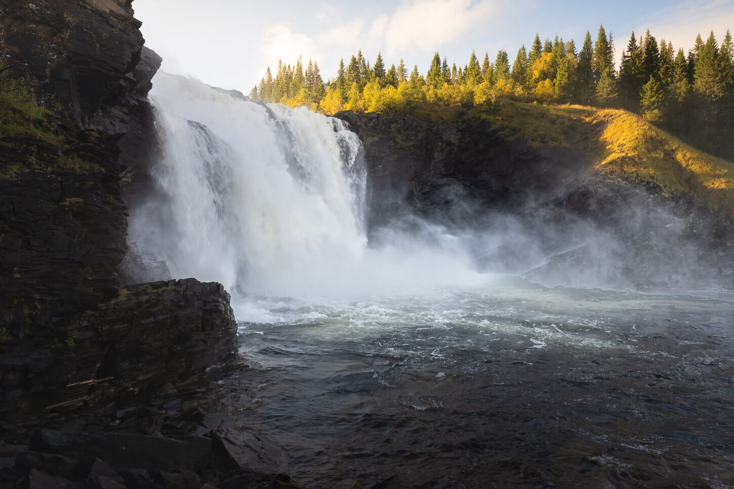
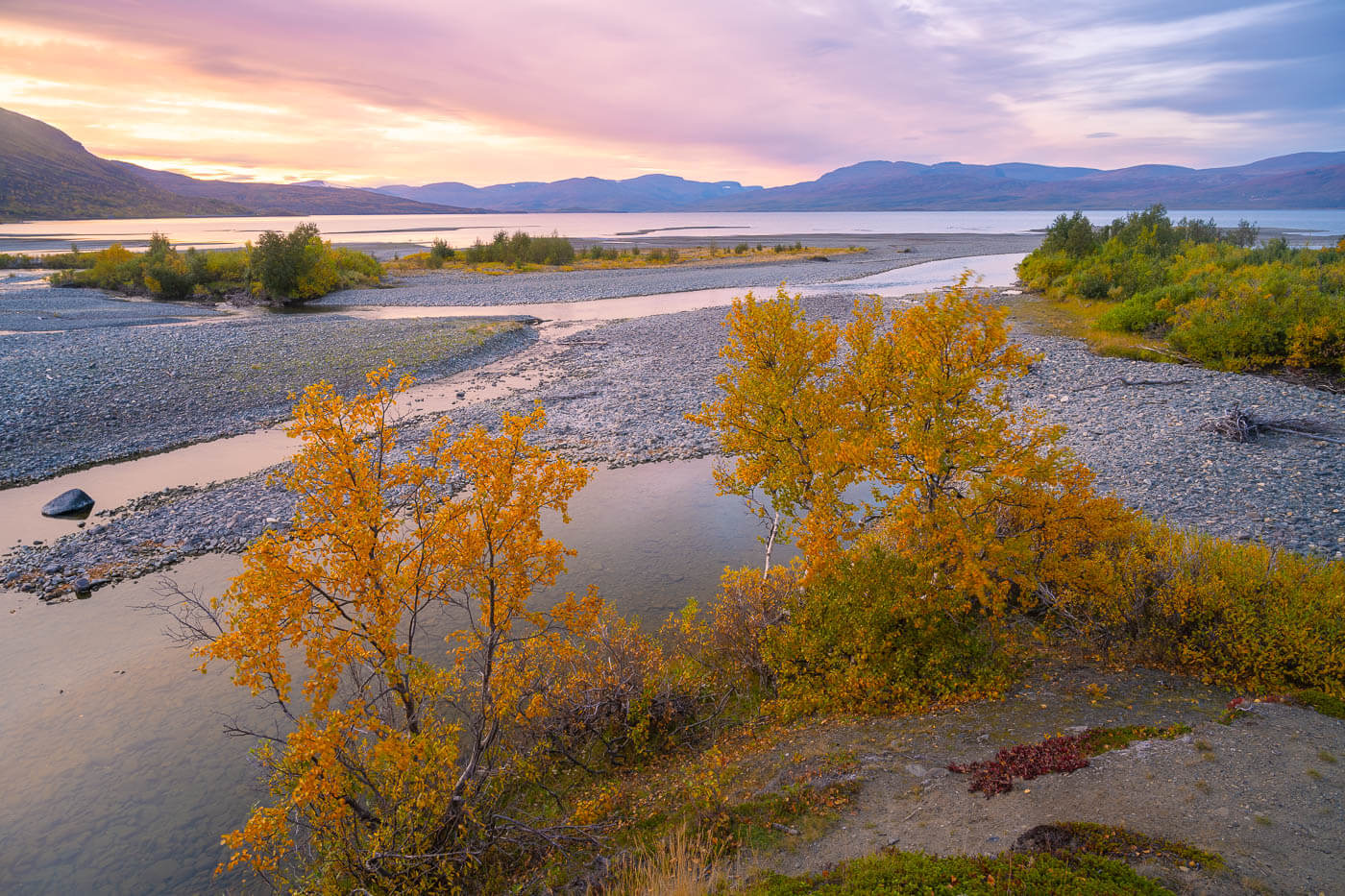
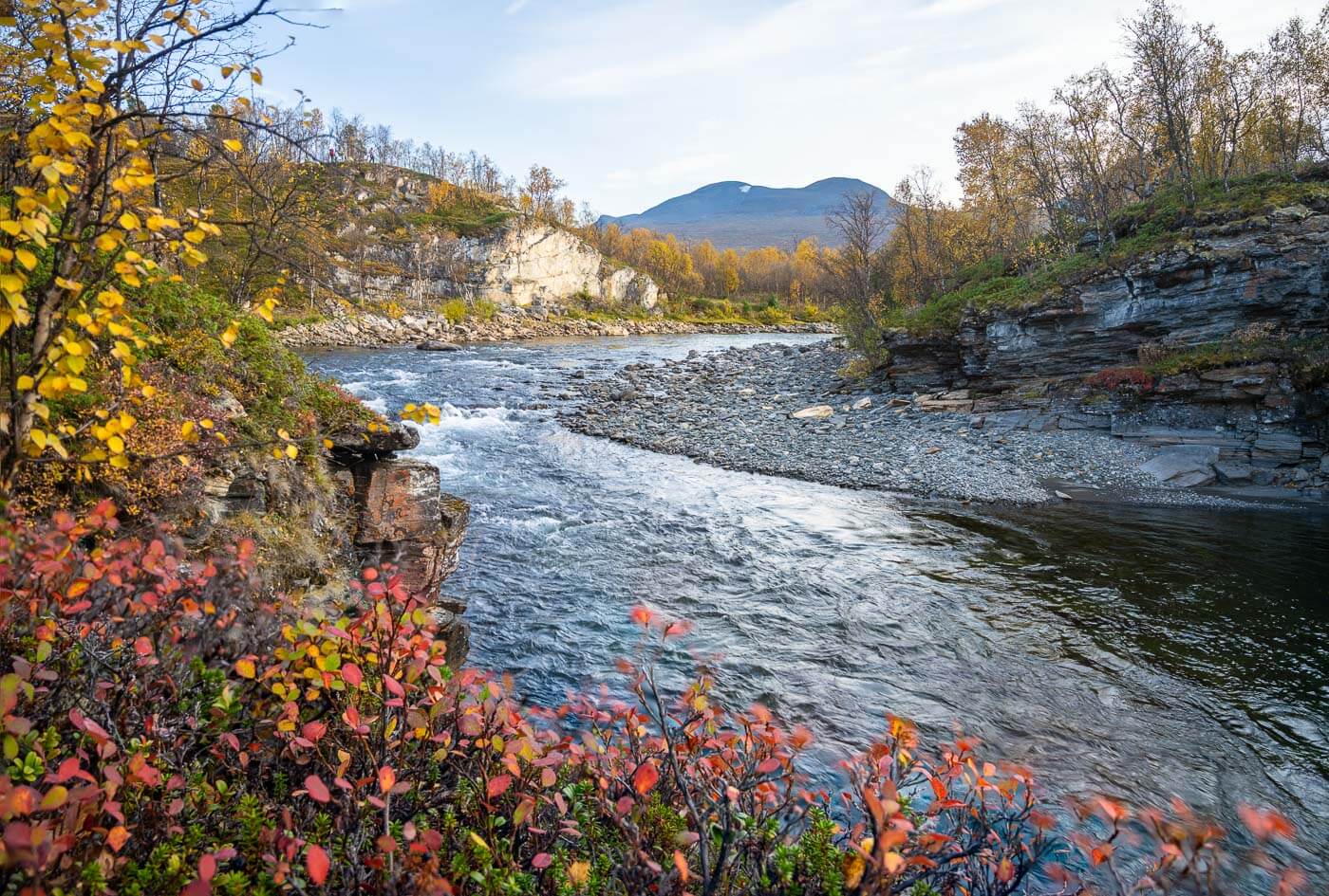
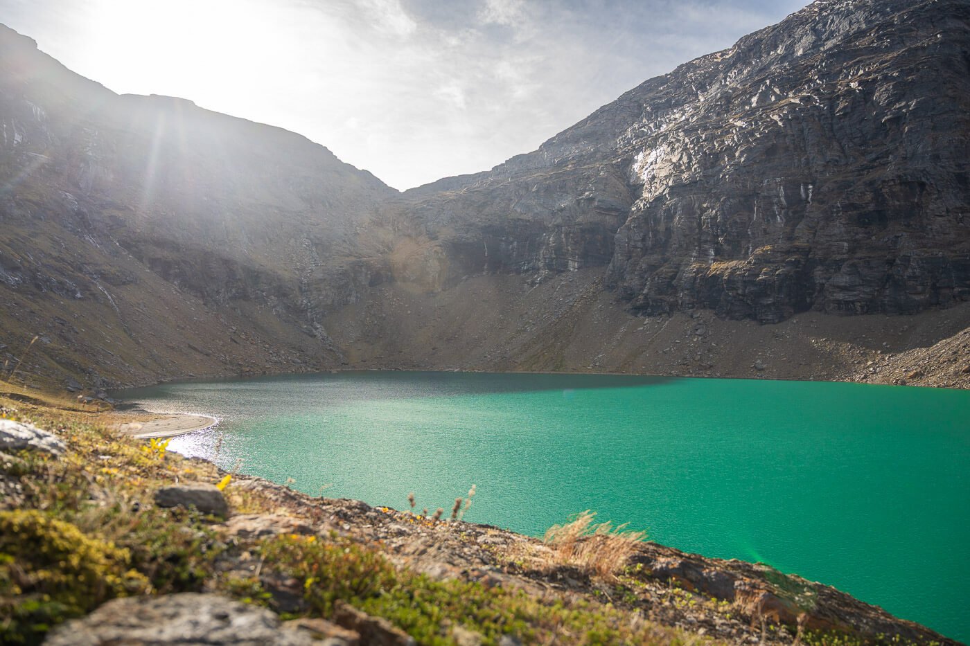
- For More Hikes in Swedish Lapland, check out Trollsjön & Svensk Fjällsphinx, or the Njakajaure Trail in Abisko.

Leave A Comment