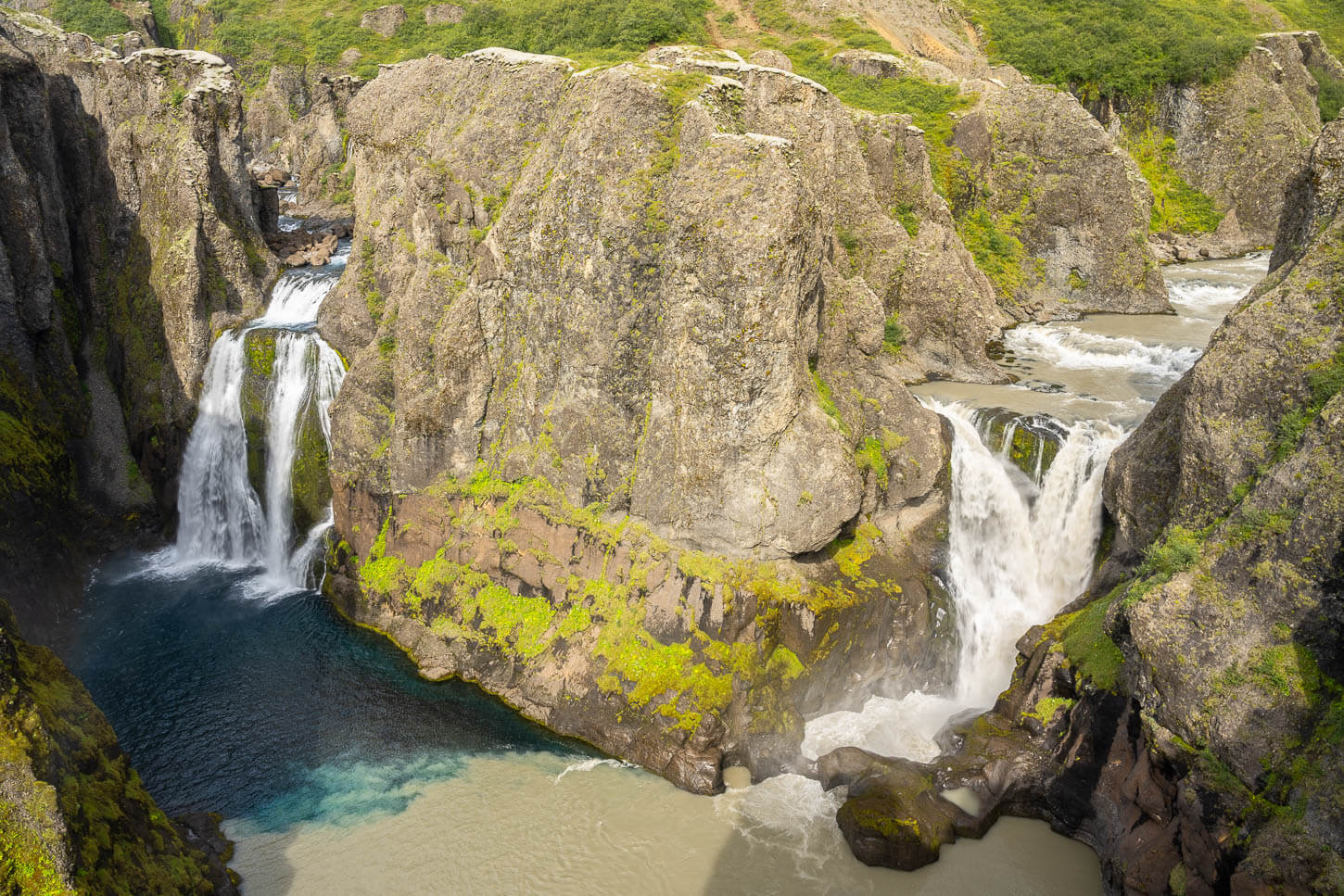
Hvítárfoss and Núpsárfoss, Twin Waterfalls in the South of Iceland
Hvítárfoss and Núpsárfoss are two beautiful, (very) hard-to-get-to waterfalls in a remote area in the South of Iceland. They are possibly the hardest waterfalls to get to in Iceland, definitely the hardest ones I ever visited.

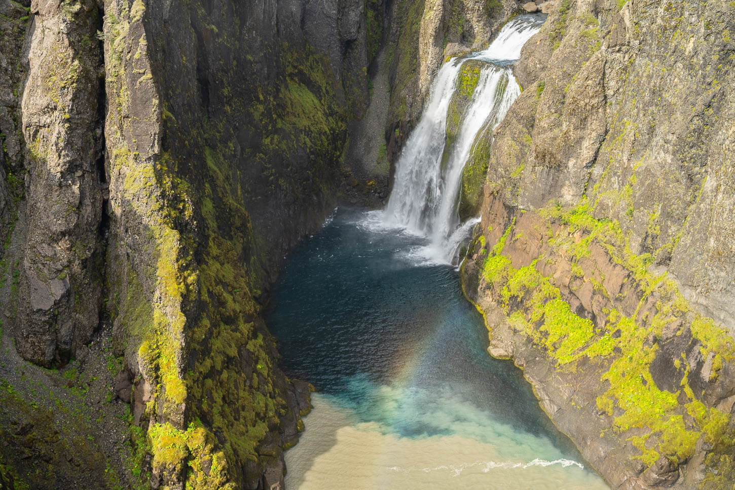
Hvitárfoss and Núpsárfoss.
Their main peculiarity is that they are two “twin” waterfalls. They originate from different rivers, but fall into the same pool of water. And since one originates from a glacier and the other from a freshwater spring, they have different colors. Núpsárfoss is creamy-whitish, as it originates from a glacier. Hvítárfoss, on the other hand, are a clear, deep blue. The effect of the water mixing in the same pool is rather unique.
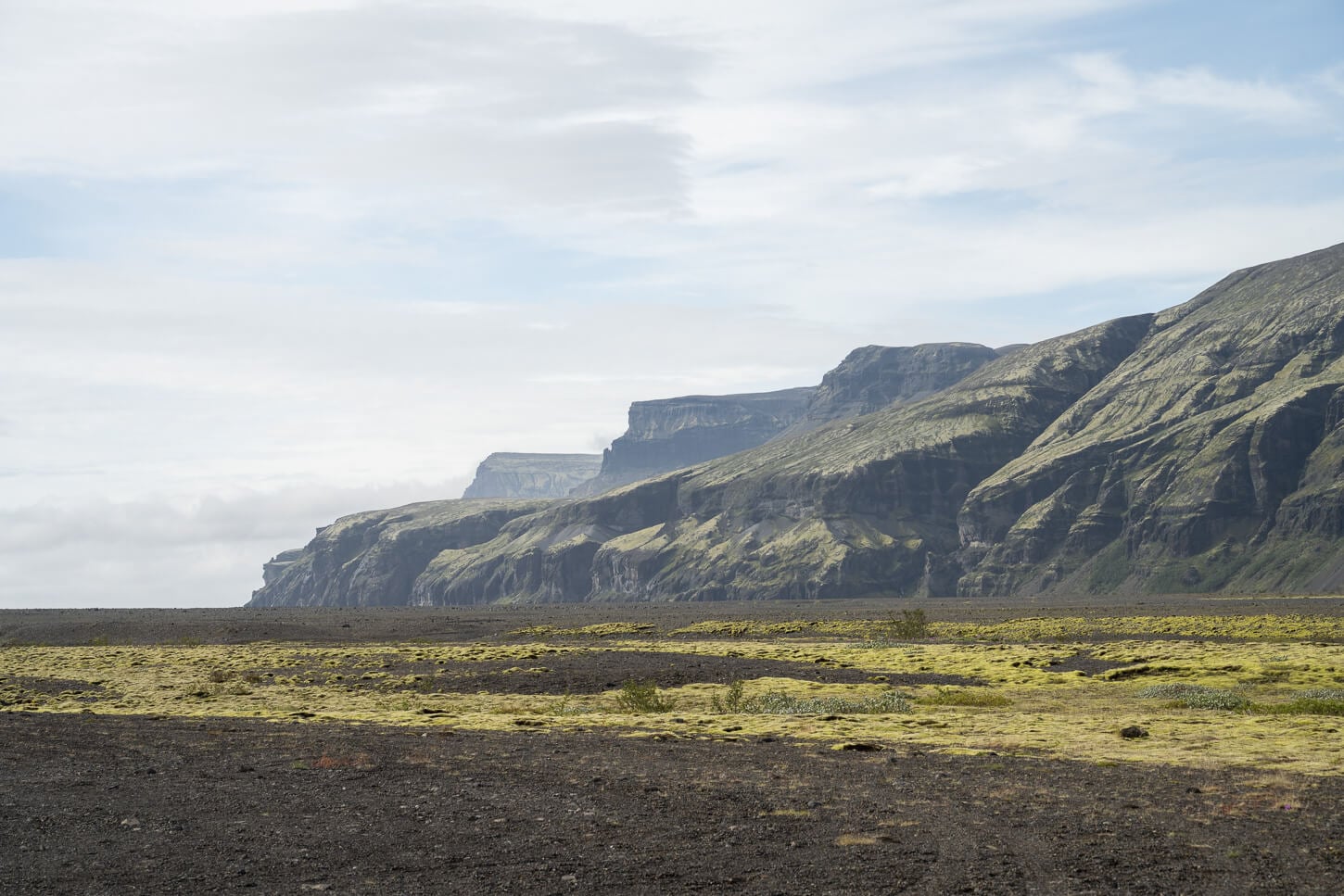
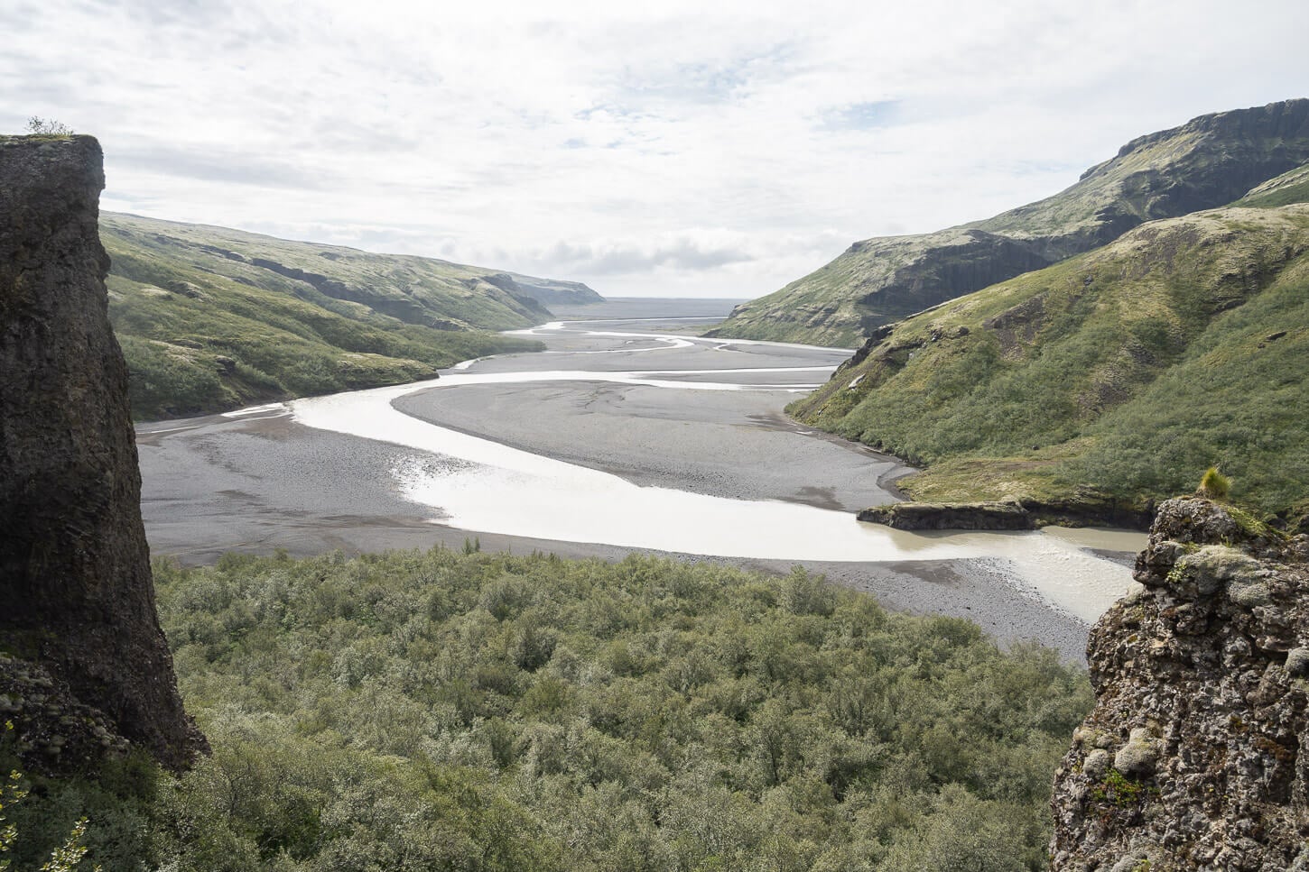
They are located in an area called Núpsstaðarskógar – a birch forest, to the north-west of Lómagnúpur and Skeiðarársandur. It is a very difficult location to get to.
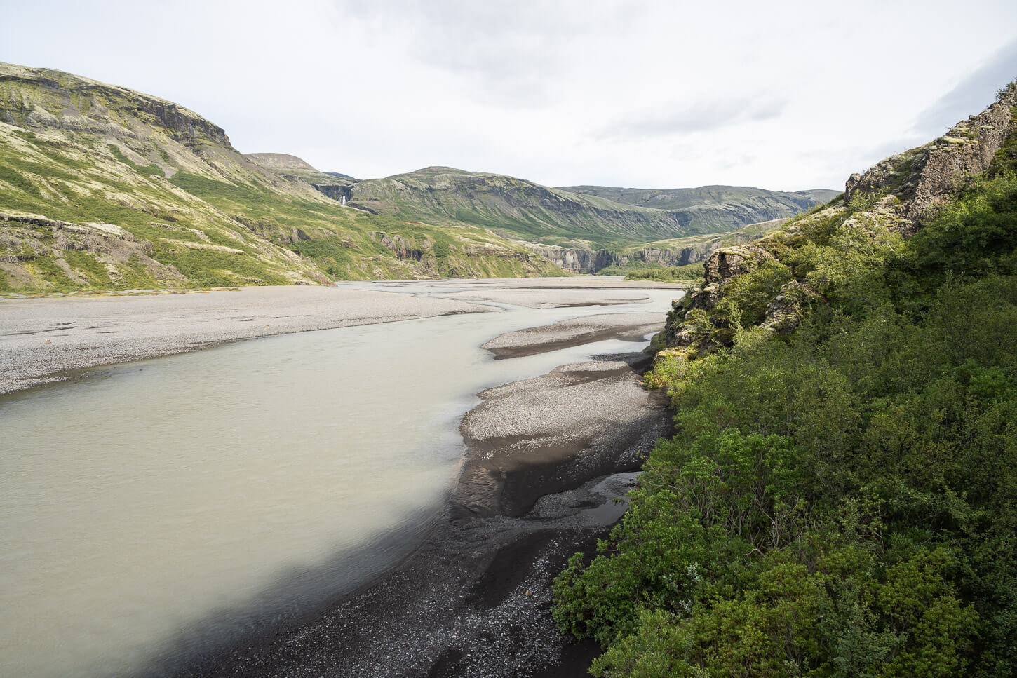
Núpsstaðarskógar and the Núpsvötn river.
Table of Contents
What to be aware of before planning a visit to Hvítárfoss and Núpsárfoss
You will need a modified 4X4 car with high clearance and river-crossing capabilities. It is a long drive on a difficult, barely visible track that can change every year. That means, you may not even be able to get there with the right vehicle, depending on conditions. This is the vehicle I used.
Then, after a one-hour hike, you would need to climb up a potentially wet, vertical wall. If you are thinking about visiting, make sure you are well prepared for this type of effort.
Also, keep in mind that climbing up is easier than climbing back down. A mistake or a fall here will come with serious consequences.
It is possible to get there in summer only, typically if the weather conditions allow it.
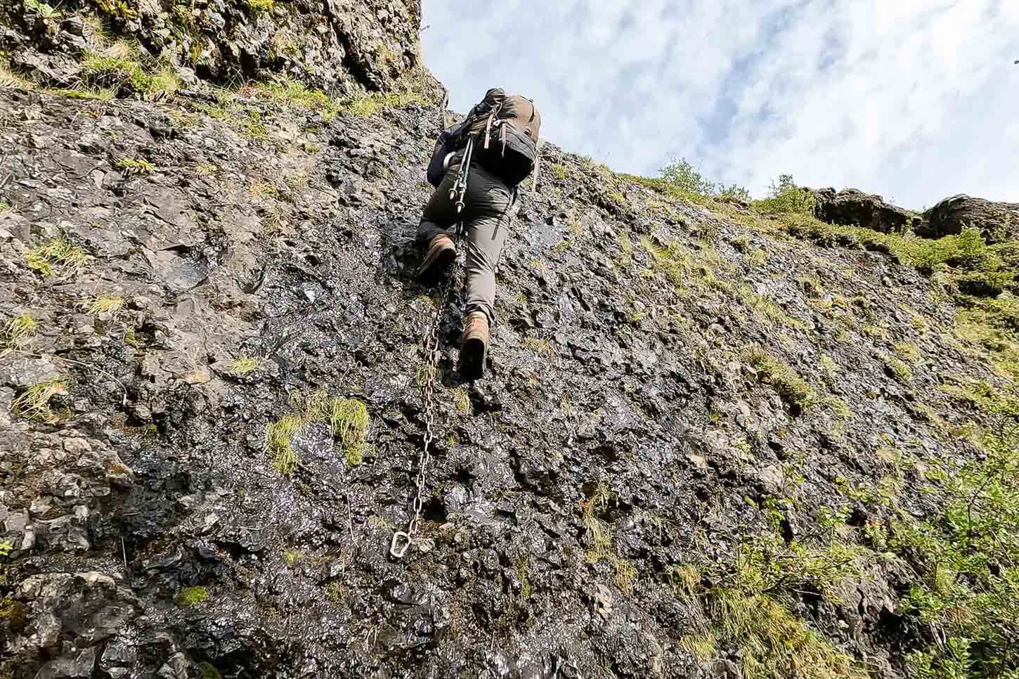
A 5-6 meter high wall has to be climbed to get to the waterfall’s viewpoint.
Sounds like a hurdle? It is, and you should be prepared for it if you are thinking about visiting. This is a remote location where, without the right vehicle, the chances of getting stuck or having to turn around are quite high. That’s why you see very few photos or trip reports from this location. It’s remote and difficult to get to.
Planning this hike and getting there did require extensive preparation, and it is probably the hardest waterfalls to reach in Iceland. It’s not a spot you can visit on a whim or as a detour from the Ring Road.
The trailhead is far from the main roads and inhabited areas.
Overview of the Hvítárfoss and Núpsárfoss Hike
For the most part, the hike is on flat ground, but it isn’t the easiest to navigate. There are sections where the trail is barely visible and in a thick birch groove. However, the main challenge involves climbing a 5-6 meter vertical wall. While there is a chain that you can use to help yourself up, there is no room for error. The same goes for when you reach the top of the climb. There is only a narrow ledge you can hang on to above the 5-6 meter tall cliff.
However, getting to the Hvítárfoss and Núpsárfoss trailhead is a challenge in itself. It requires a large 4X4 vehicle to complete the 8-9 kilometers you need to cover to get there. To give you an idea, it took me about 50 minutes to get there with a Land Cruiser with a lift kit, 35-inch tires, and a snorkel.
You should not attempt the drive unless you are driving a similar vehicle and have the proper 4×4 driving experience.
| Max Altitude | 180 m |
|---|---|
| Distance | 5.58 km, from the end of the road in Núpsstaðarskógar |
| Elevation gain | 200 m ↑ / 200 m ↓ |
| Hike time | 02:30/ 03:00 Hours |
| Hike Difficulty | Hard/Exposed/Climbing |
Unlike most of my posts, I won’t share the GPX file here. This is a very remote, difficult-to-get-to location that requires preparation, the right vehicle, climbing skills, and a “leave no trace” attitude.
It is a remote location far from help, should anything happen – either to your car or to yourself on this dangerous trail. Furthermore, it requires the proper 4X4 vehicle and driving skills, as I have mentioned above.
I have reserved my personal logistics, safety tips, and GPX track for my eBook guide, “Iceland – The Best Waterfall Hikes and Walks“, specifically for those who understand the risks involved and are committed to ‘Leave No Trace’ principles.
This ensures that the information stays in the hands of those who are truly prepared for the risks and committed to preserving these wild spaces.
I will, however, provide a quick overview and description of the trail, so you can have a good understanding of what it takes to get there. For that purpose, you can also watch the video I made while on this hike.
The Hvítárfoss and Núpsárfoss Hiking Trail
If it wasn’t for the long, tiring drive through the washout plain and for the last climb, the hike to Hvítárfoss and Núpsárfoss would not be overly difficult. Apart from the drive and the climb, the hike still has some challenges, though. The trail is poorly visible to invisible at times. This is to be expected, it’s a remote and seldomly visited location.
Then, some sections are in low, thick birch-tree vegetation, which makes for slow going. There are a couple of marshy areas to cross, too. Additionally, some sections of the riverbank have collapsed or are at risk of collapse.
That is to say, the hike and the environment demand constant focus and a keen awareness of your surroundings and potential risks. Always keep in mind that this is a remote, difficult-to-access area for SAR teams, too. So, should you need it, help could take a while.
Other than that, the trail is essentially flat, and it follows the river upstream. That is, until the last part, the final climb.
Hvítárfoss and Núpsárfoss Climb
To get to the viewpoint, you have to walk through one more thick Birch Grove, at the end of which you’ll find a vertical wall, about 5-6 meters high, with a chain hanging from its top. This is the section you need to climb up to. Moisture on the wall further complicates the search for stable footholds. This is not the place to attempt such a climb if you have never tried one before.
And, again, keep in mind that going up is easier than going back down. I know I sound repetitive, but getting here really comes with several risks you should consider carefully before heading out.
Then, once at the top of the wall, you are on a narrow, completely exposed ledge that overlooks the river and riverbed.
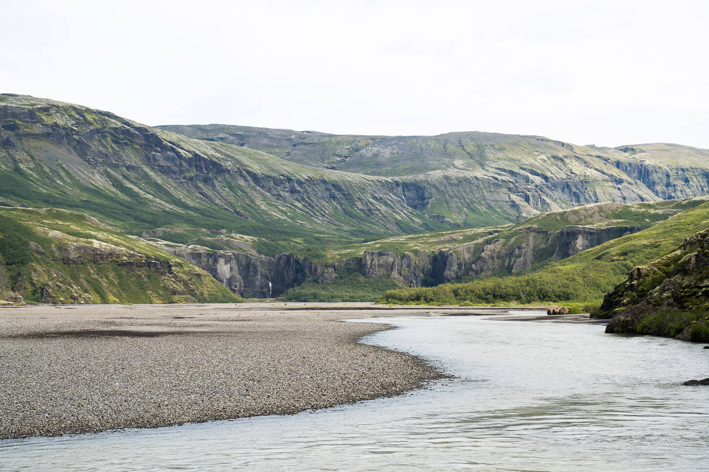
Nupsa River.
Above that, the last part of the trail leads to the viewpoint on a rocky outcrop in front of Hvítárfoss and Núpsárfoss. Hvítárfoss will be the waterfall to your left, and Núpsárfoss to your right. The viewpoints are limited, as the outcrop’s position facing the waterfalls narrows your available viewpoint.
There’s pretty much one spot that allows you to see both waterfalls clearly at the same time.
Hvítárfoss and Núpsárfoss.
Photos and Photography Tips
In terms of landscape photography, there isn’t much wiggle room here. The limited viewpoints also limit compositions. I used lenses between 14mm and 70mm, on a full-frame sensor. A lens at 14mm will allow you to capture the whole landscape, while a 24mm lens will just fit the two waterfalls. So you’d either need to go wide or make panoramas.
Hvitárfoss and Núpsárfoss at 14mm, full-frame
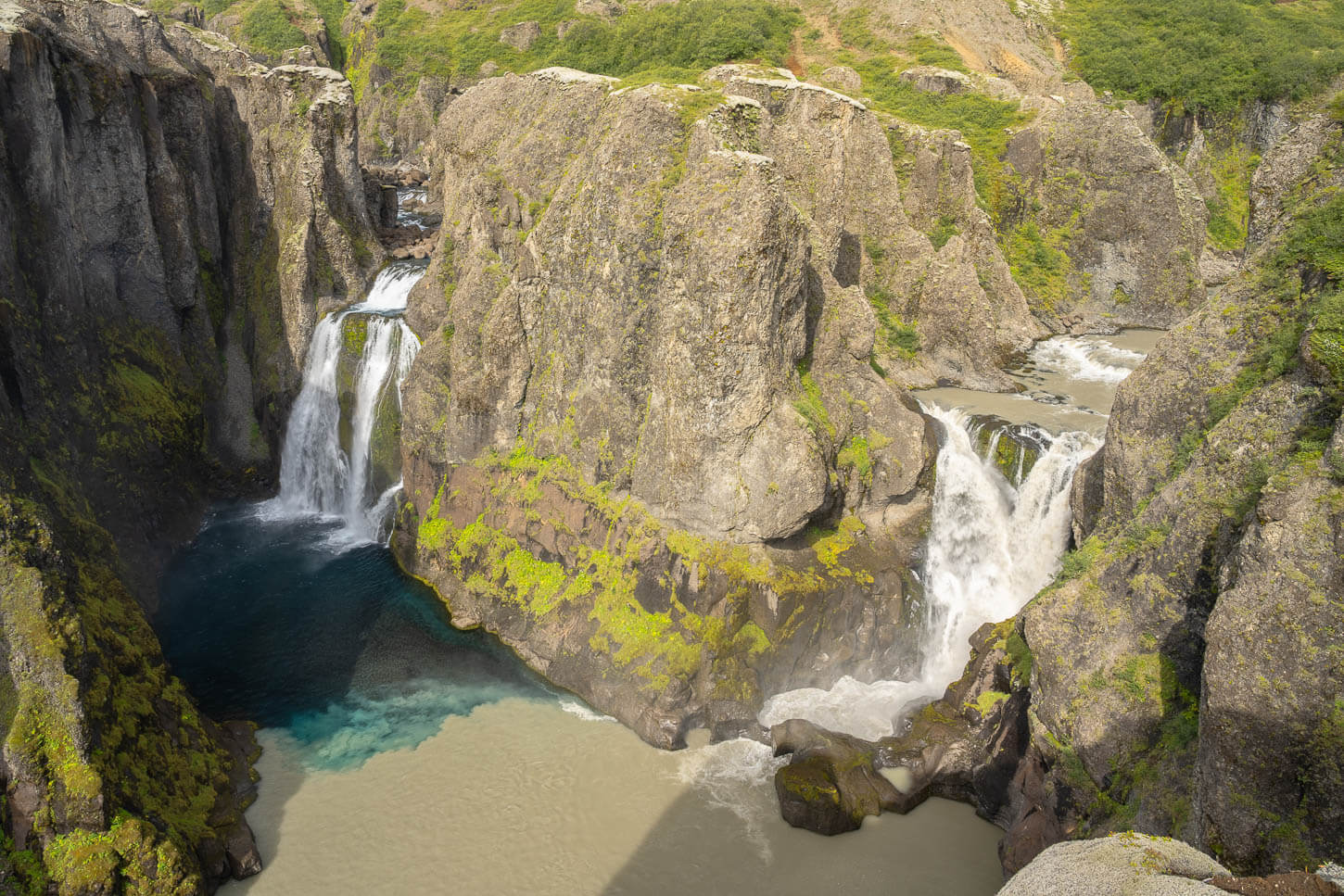
Hvitárfoss and Núpsárfoss at 24mm, full-frame.
On the other hand, a longer lens will allow you to focus on the details and each waterfall separately. Lastly, these two waterfalls do not get much direct sunlight throughout the day. Understandably so, as they are deep into a narrow gorge. If the sun is out, they do get light around noon in summer. That is the same time when I took these photos.
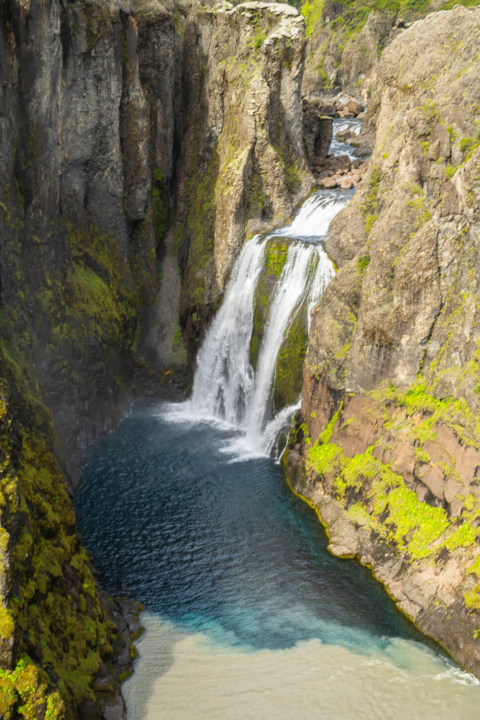
Hvítárfoss.
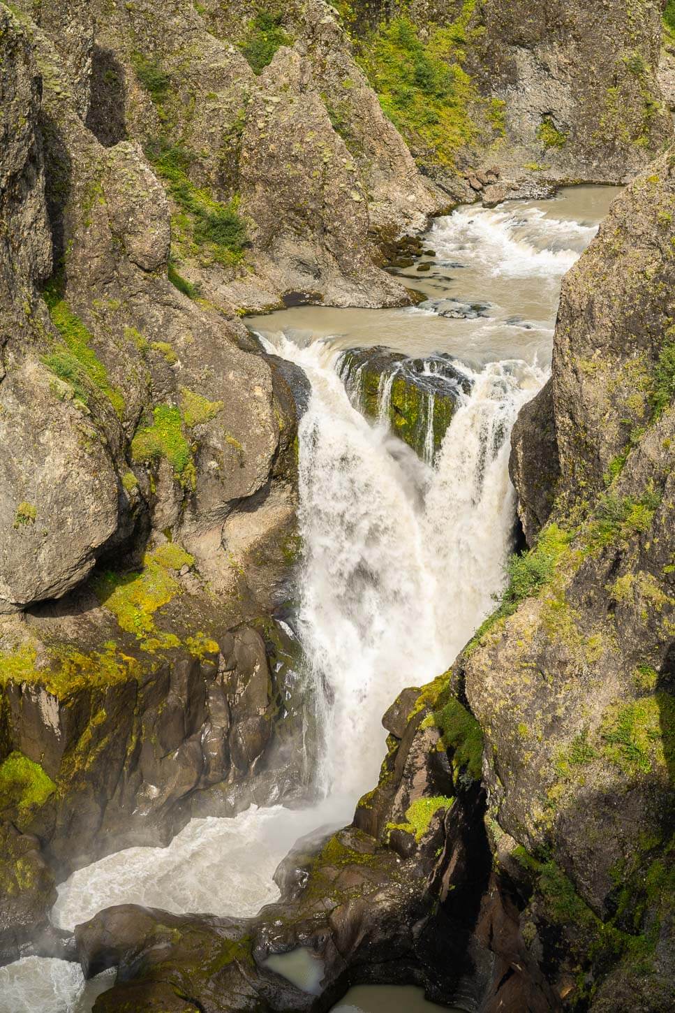
Núpsárfoss.
Video of the Hike
You can also watch the video of this hike on my YouTube Channel, along with the other waterfalls in the “Iceland Unmapped” series.
Additional Resources
- Discover more beautiful and unique Waterfalls in my eBook guide, “Iceland – The Best Waterfall Hikes and Walks“.
- Discover more Hikes in Iceland here.
- Book with Blue Car Rental through The Photo Hikes and enjoy a 5% discount.


Leave A Comment