Mongufoss, a Hidden, Beautiful Waterfall in the Westfjords of Iceland
Mongufoss is a beautiful, 60-meter-high waterfall located in a remote corner of the Westfjords of Iceland. The hike to Mongufoss is relatively long at about 11km (or 7 miles), but getting to the trailhead requires time. It is located in a remote, rather pristine area.
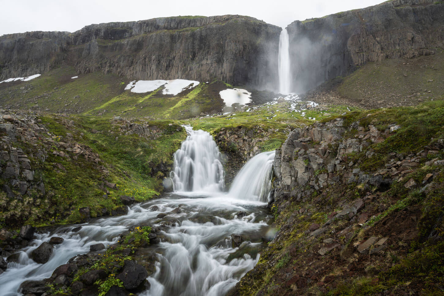
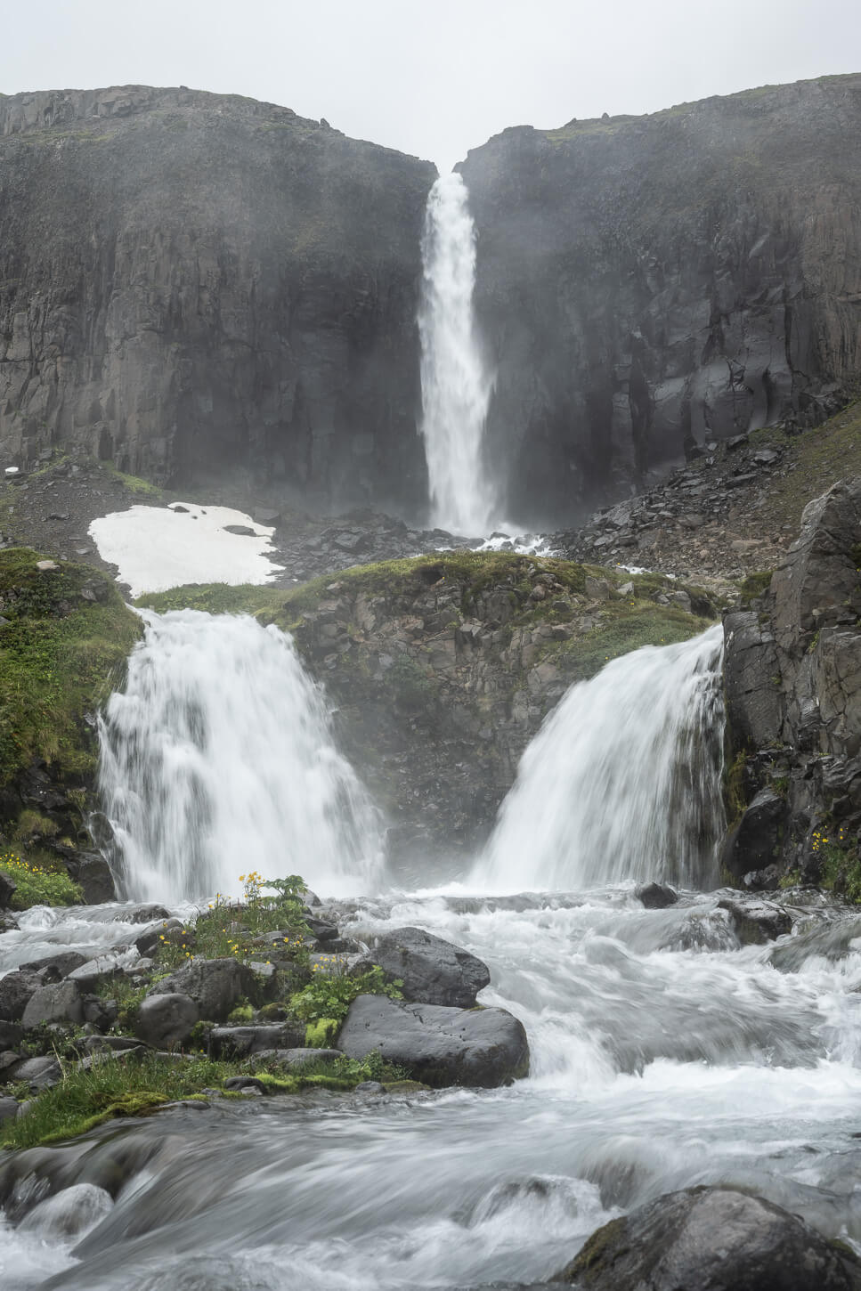
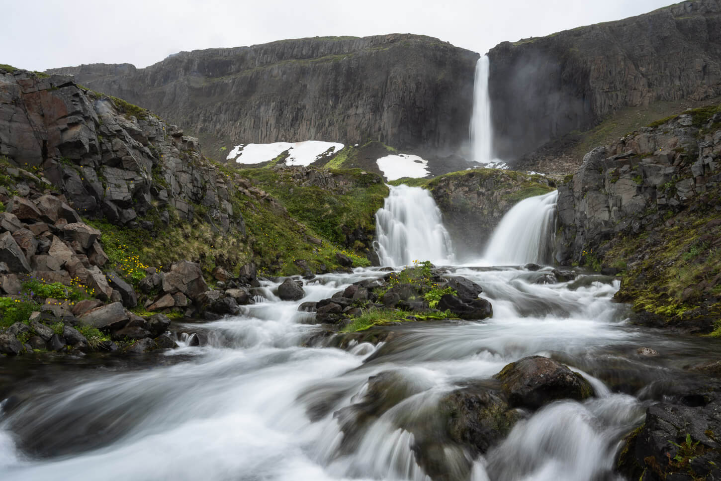
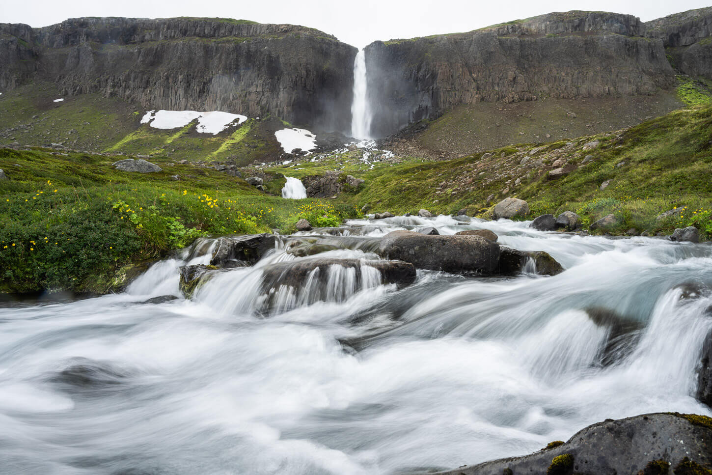
Mongufoss.
I remember the first time I noticed Mongufoss, and the impression it made on me. I was in the Westfjords of Iceland, and I was driving out of Ísafjörður. All of a sudden, after one of the many turns around a fjord, I spotted a huge waterfall far in the distance, on the opposite side of the fjord. My jaw dropped; seeing that waterfall dropping off the cliffs on the south side of the opposite fjord I was in, made me instantly ask myself, “How do I get there?”
I quickly checked the map at the next pull-out area to realize how far it really was, even if it was there on the next fjord. No chance I could get there on that trip. I drove off, quite happy to have discovered this waterfall, and determined to return one of the following years. And that’s what I did.
Bordering the Hornstrandir nature reserve, this waterfall is located in a beautiful, pristine environment on a limb of land between the sea and the tall cliffs to the north. It’s a waterfall that few people visit every year, and getting there is a bit of an adventure in itself. And not one without its challenges.
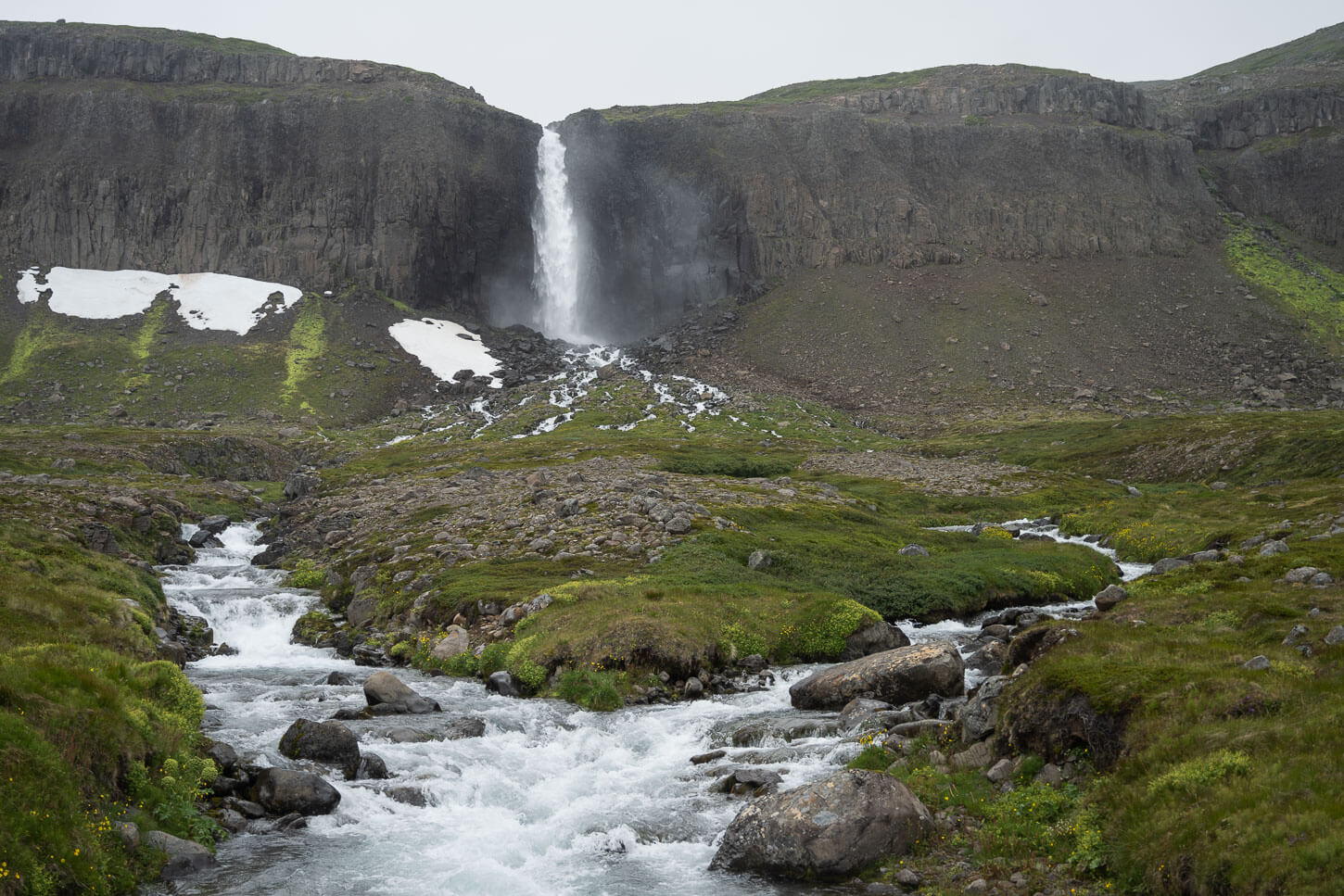
Table of Contents
Overview of the Hike to Mongufoss
There isn’t an established trail that leads to Mongufoss. While there are some visible sections, for the most part, there aren’t any. So, in addition to visiting this beautiful waterfall, you also have a bit of the backcountry feeling.
I will say the hike is not particularly difficult. However, the trailhead is as remote as it gets without having to get into the wilderness. There is no visible trail for the most part; there are some deep canals in the first half of the hike that can be hazardous to navigate.
However, getting to the trailhead requires time and long drives on bumpy gravel roads. The drive along Road 635, however, is very scenic.
| Max Altitude | 53 m |
|---|---|
| Distance | 11.2 km (6.9 miles) |
| Elevation gain | 230 m ↑ / 230 m ↓ |
| Hike time | 03:00/ 04:00 Hours |
| Hike Difficulty | Moderate |
Unlike most of my posts, I won’t share the GPX file here. This is a very remote, pristine location. It’s not a spot you can add as an easy detour to any itinerary around the Ring Road or the Westfjord. Getting there requires preparation. It is a remote location
I have reserved my personal logistics, safety tips, and GPX track for my eBook guide, “Iceland – The Best Waterfall Hikes and Walks“, specifically for those who understand the risks involved and are committed to ‘Leave No Trace’ principles.
This ensures that the information stays in the hands of those who are truly prepared for the risks and committed to preserving these wild spaces. If you’re ready to put in the work to get there safely, the guide is ready for you.
I will provide, however, a quick overview and description of the hike to Mongufoss.
The Mongufoss Hiking Trail
There isn’t an official trail or any trail markers, so first-time visitors will need to do a bit of navigation. The trail is pretty much non-existent, and the vegetation can grow quite tall; that can hide the numerous smaller streams that stem from the cliff, so you never know exactly what you might step on or into.
There are quite a few other smaller waterfalls along the cliffs, and quite a few beautiful ones right from the beginning,
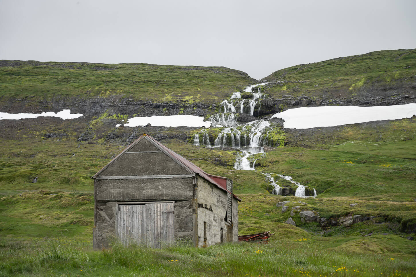
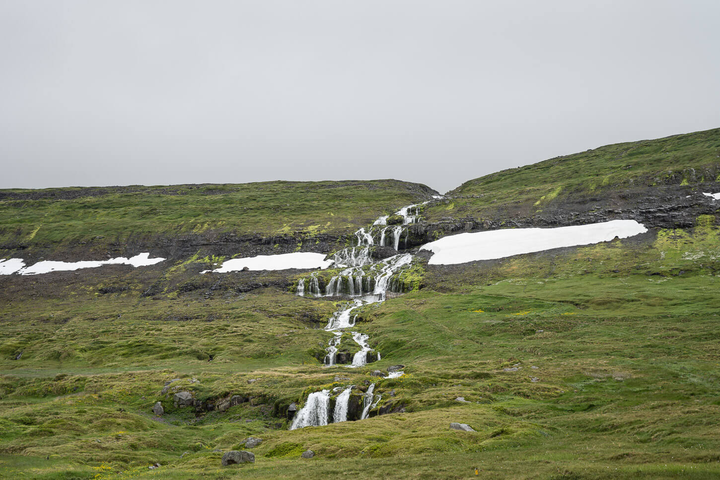
Unnamed Waterfall by the Trailhead.
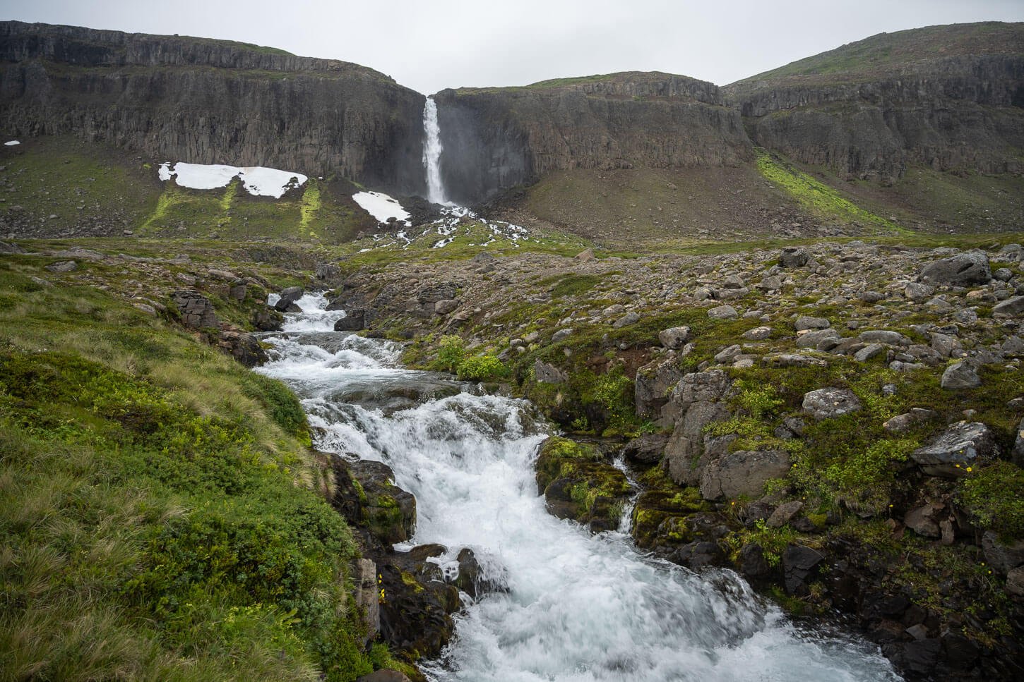
It’s a beautiful hike even without the waterfalls, though. The trail develops entirely along the coastline between the shore and the cliffs. That already provides fantastic views of the rather pristine environment of the area.
Right from the trailhead, you can see the the mumerous cliffs ahead, as if they were giants guarding the coastline.
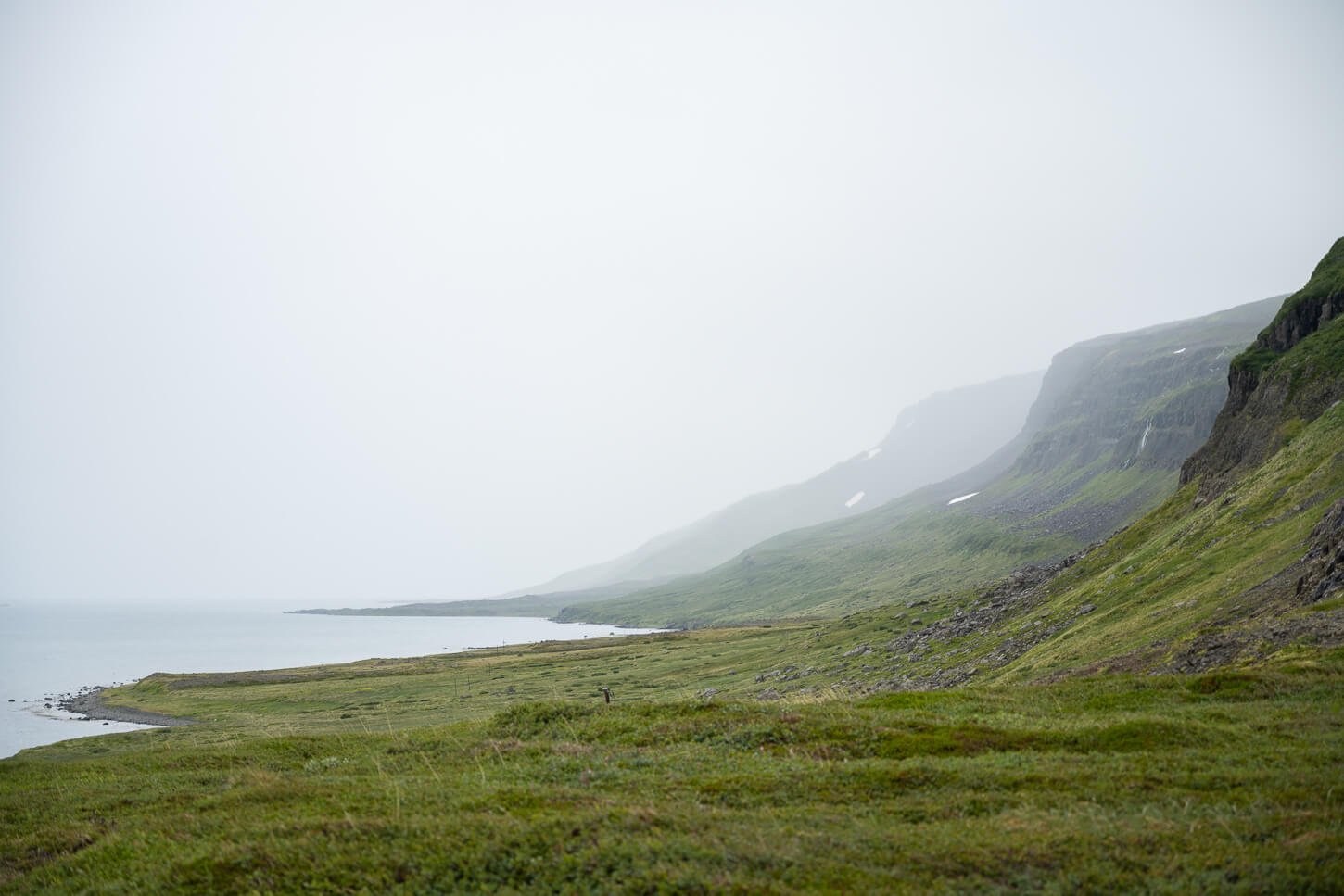
The Beautiful coastline of the Westfjords is wirth a visit in itself.
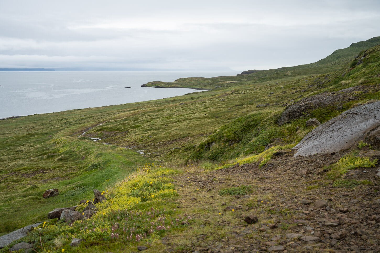
The trail is only visible in Places.
It’s only here and there that you will find occasional traces of human presence. A disrepair fence, an old electricity post, and irrigation canals that no longer serve that purpose. On the latter, they are a bit of a hazard, because they are quite wide and relatively deep, and parts of them can also be hidden by the vegetation.
You don’t see the waterfall until you are almost upon it. It will appear in front of you as you turn around the last cliff. There is also a pedestrian bridge that allows you to cross the river easily. You can follow the river upstream to get closer to the waterfall, too, although navigation closer to the waterfall is tricky due to big boulders and several other water streams.
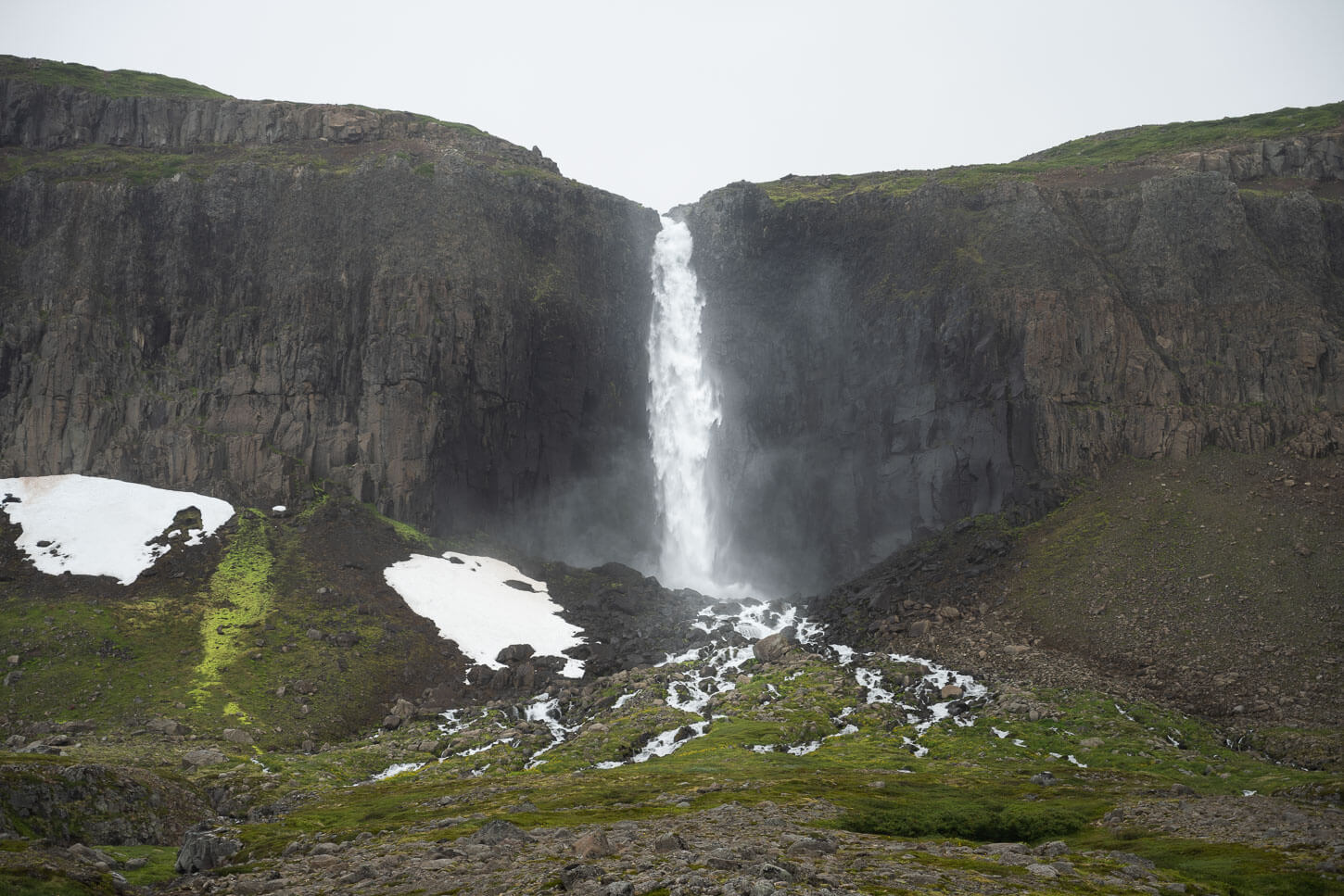
You can feel the power of this waterfall from afar; there’s no need to get very close to it. The roaring sound of Mongufoss will likely be one of the few noises breaking the silence in this remote corner of the Westfjords, which is also what makes this a unique hike and experience.
Mongufoss Photos and Photography Tips
In terms of landscape photography, this is also a very pristine location. At the time of writing, there are only a handful of photos around, and there were even fewer when I first visited in 2024. Like all waterfalls, it is very fun to photograph. There are plenty of foregrounds to choose from, too.
Also, the fast-flowing river provides more opportunities for long exposure, too. Not too long, or the water can easily lose all of its texture. None of these has a shitter speed faster than 0.5 seconds.
I took most of these photos with either my Nikkor Z 24-70 f4 or my Z 14-24 f2.8. There’s a place for both lenses, and the wider 14-24 is particularly useful to capture foreground elements.
Video of the Hike to Mongufoss
You can also watch the video of the Hike on my YouTube channel
Additional Resources
- Discover more Hikes in Iceland here.
- Book with Blue Car Rental through The Photo Hikes and enjoy a 5% discount.


Leave A Comment