Nýifoss – a Remote Waterfall in the Highlands, Iceland
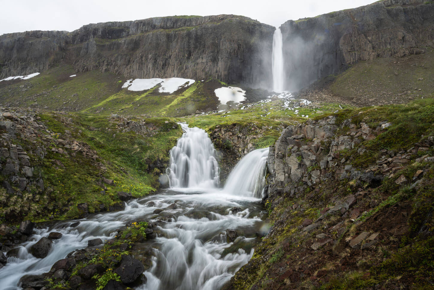
Nýifoss is a rather unique Waterfall in the Icelandic Landscape. Literally meaning the “New Waterfall,” it formed around 1939, when a catastrophic event changed the landscape around Lake Hagavatn, giving birth to the “New Waterfall”. It’s a three-step waterfall whose peculiarity is that it appears to drain the lake it originates from: Lake Hagavatn
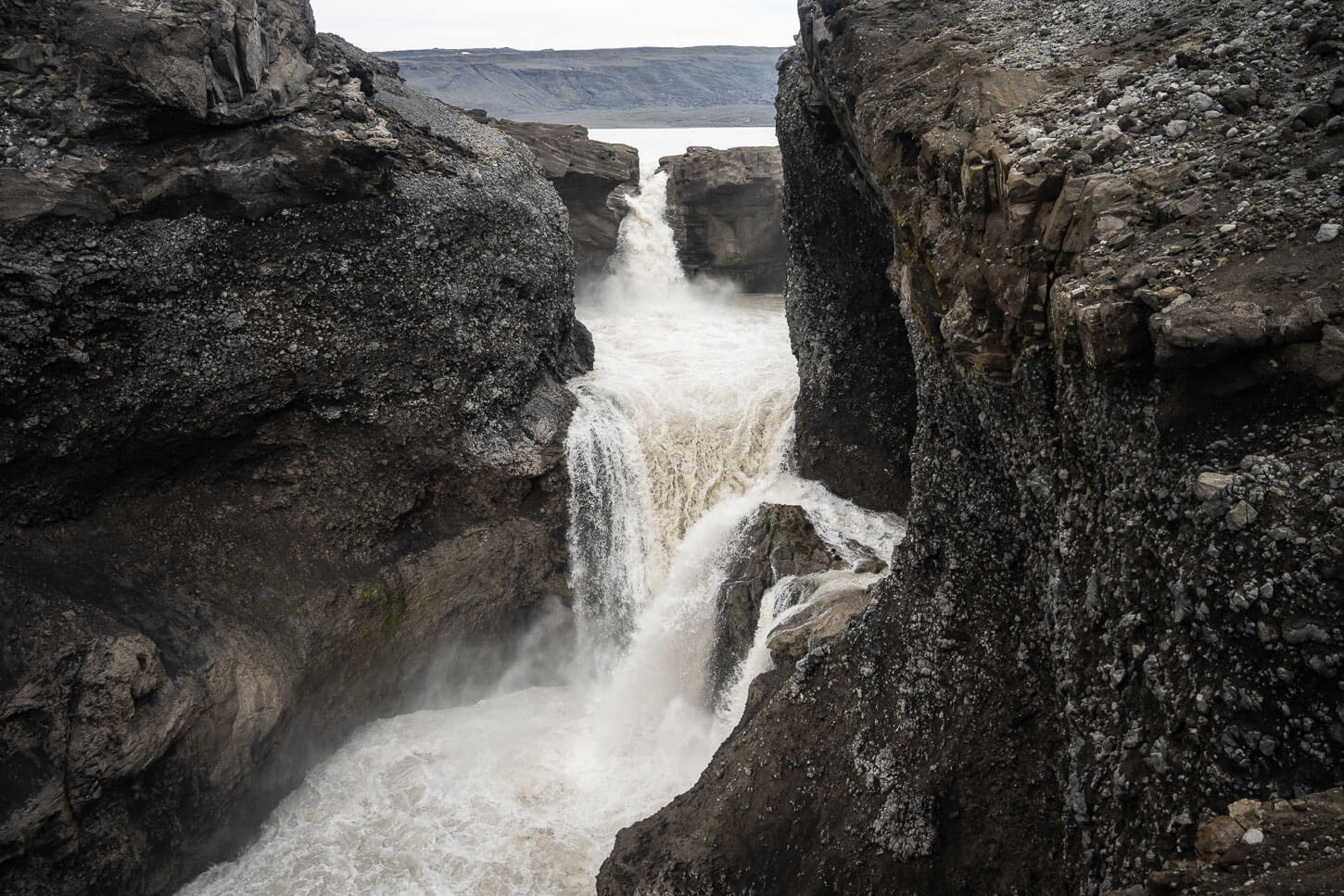
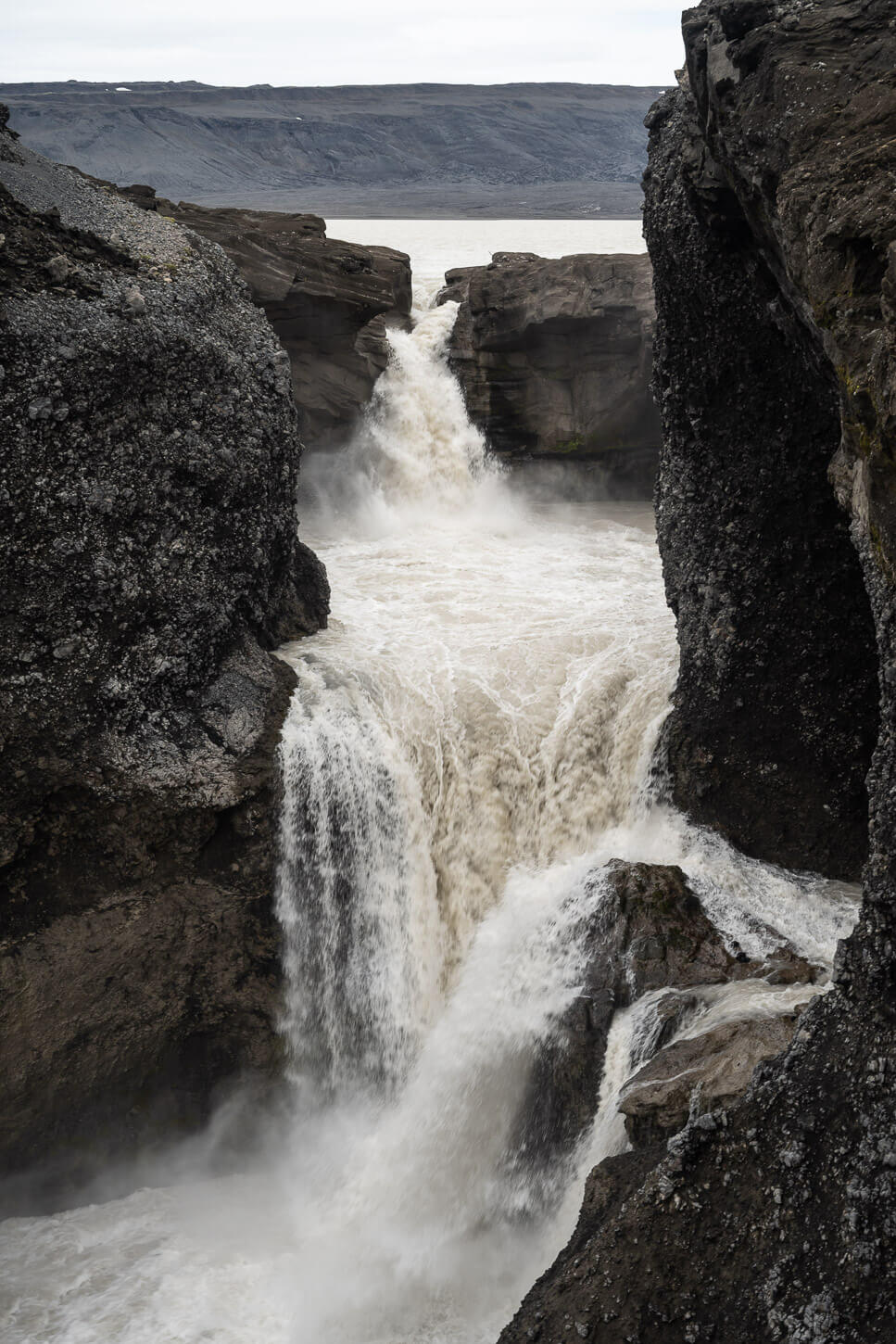
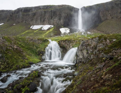
Nýifoss, upper and mid-steps.
Also, unlike many other waterfalls in Iceland in Idyllic settings, the landscape around Nýifoss is rather different. It’s a rugged, remote location with little vegetation, which enhances the feeling of being far from civilization. It kind of provides that feeling of almost being on another planet, as only the rugged and desolate landscape of some highland areas can create. Still, Nýifoss is beautiful in its own way.
The hike is rather short and easy, but it takes a relatively long drive to get there. It’s a rough 40-50 minutes drive on an F-Road, F335, that has two river crossings.

Table of Contents
Overview of the Nýifoss Hike & Map
The trailhead can be accessed via road F335. It’s an F-road that could require a large 4WD vehicle to tackle, especially if water levels (there are two rivers to cross) are high. More on that below.
For this reason, the toughest part is actually getting to the trailhead, while the hike is an easy, relatively short out -and-back walk to the Waterfall. On the other hand, the lookouts above the waterfalls are completely exposed to the narrow channel where the waterfall falls into, so all the viewpoints should be approached with particular care.
| Max Altitude | 450 m |
|---|---|
| Distance | 2 km |
| Elevation gain | 90 m ↑ / 90 m ↓ |
| Hike time | 30 / 45 minutes |
| Hike Difficulty | Easy |
Here is the map of the hike. You can download the GXP file for free from the activity linked below.
How to get to the Nýifoss trailhead and Parking
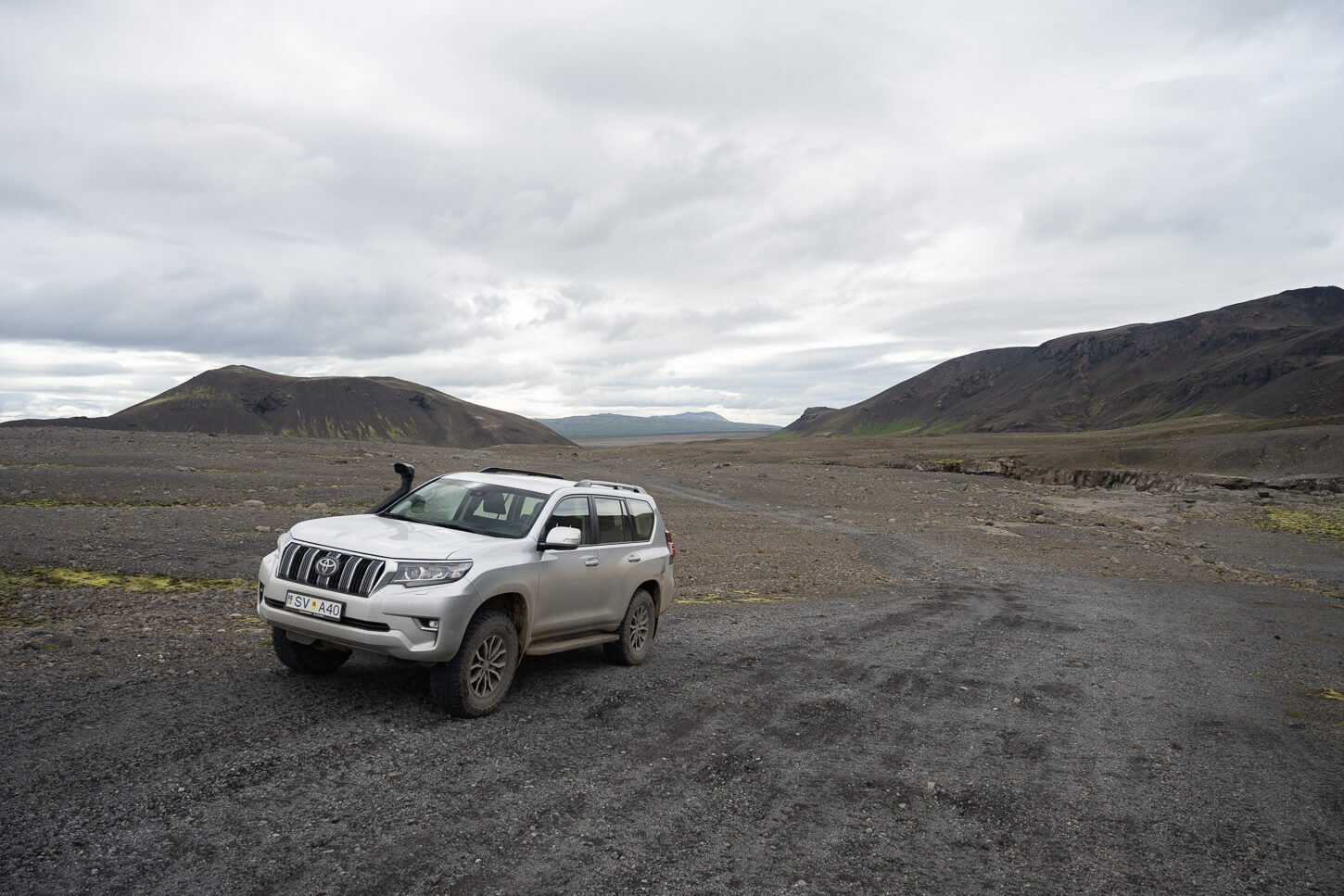
While the hike isn’t difficult, getting to the trailhead will be the main challenge. The best way to get there is via Road F335, which is a side road of Road 35, Kjalvegur. And, while Kjalvegur is no longer an F-road, F335 will be a challenge in smaller 4WD vehicles like a Dacia Duster. Ground clearance could be an issue, as there are a lot of big rocks and uneven sections along the road.
It takes about one hour to get to the trailhead from Gullfoss, and about 40-45 minutes to drive road F335. However, that highly depends on the type of car you are driving and on road conditions. Keep in mind there are two river crossings along road F335, so depending on river levels, it may not be possible at all. The second river crossing is particularly rough, and if water levels are high, there could be big rocks hidden behind the surface.
- Driving Directions: From Gullfoss, keep driving north on road 35 until it turns into gravel and follow it until the Junction with F-road 335, which will be on your left, at these coordinates. Keep following it until it ends. Proceed with caution, even if at the beginning it looks like an easy gravel road. It will turn into a more challenging road with two river crossings as you go.
- Parking: There are a few small areas where it’s possible to leave the car on the side of the road. Same location where the GPX files of the trail start. So you could use that to get directions to the parking area.
- Public Transport: none available, and to my knowledge, there currently are no tours that include this location.
The Nýifoss Hiking Trail
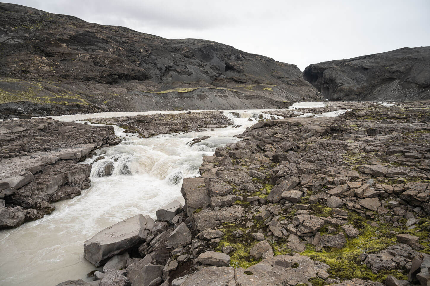
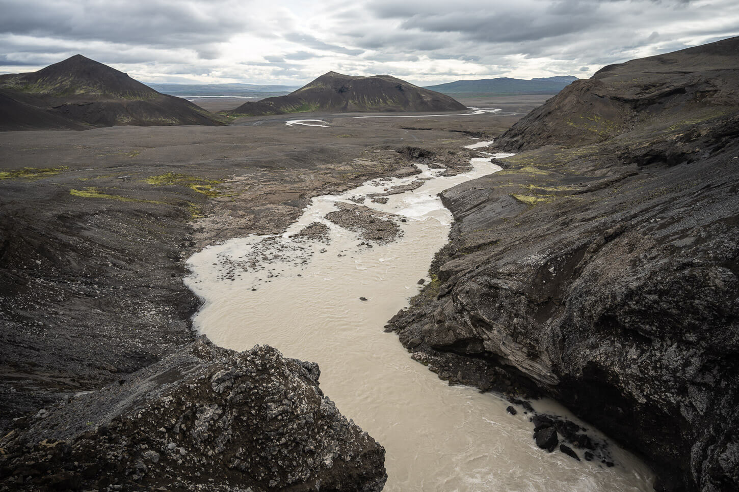
The trail isn’t really any difficult. It is a walk that follows the river upstream to the shores of the lake. From the parking area, the waterfall is not visible yet, but the river is.
I’d recommend walking to the river first and following it upstream until you have to walk up the side of the hill next to it. It’s much better to follow the river upstream than walk up road F335, as you have a view of smaller waterfalls along the same river. And, Nýifoss’ lower steps will gradually appear as you walk up the river.

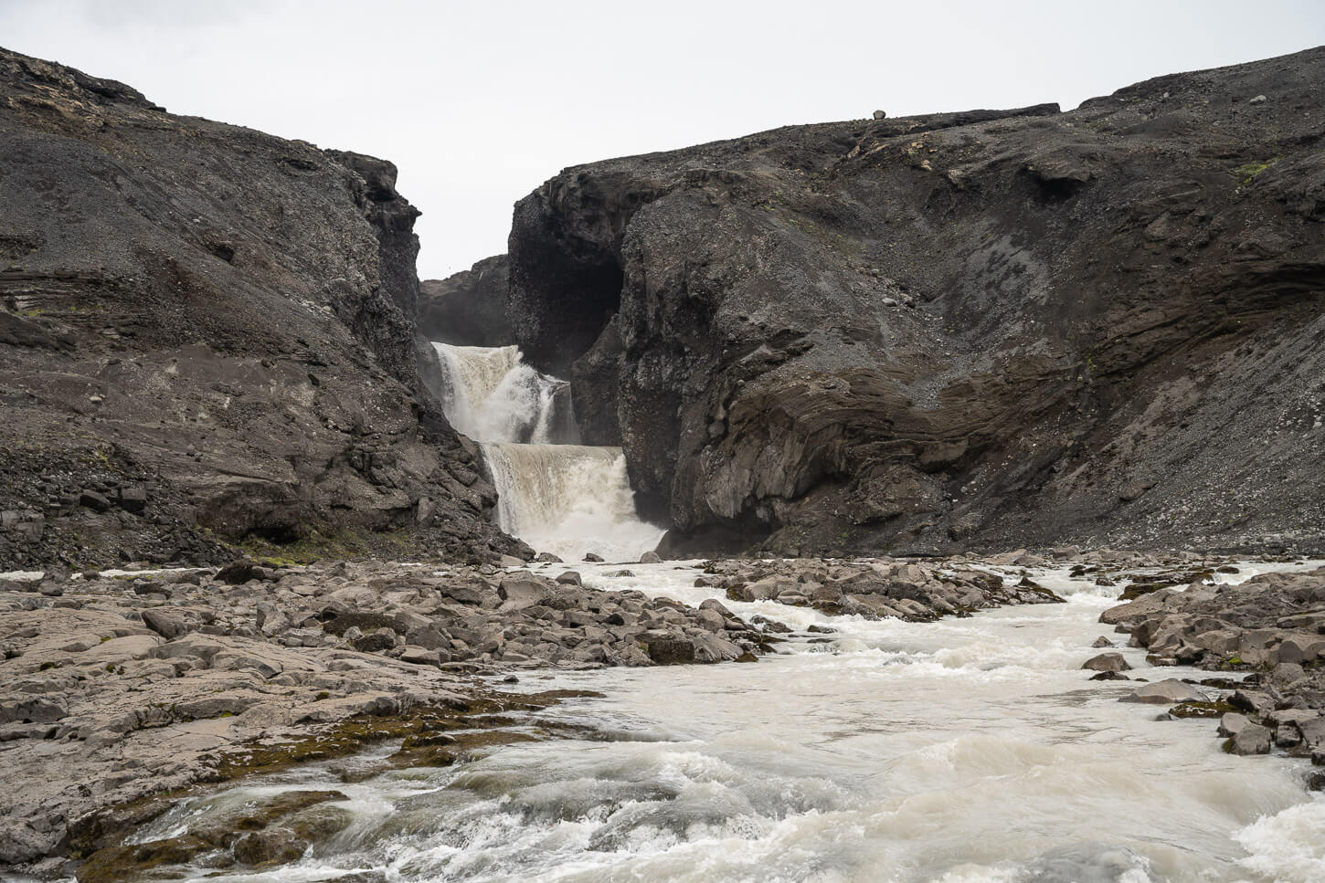

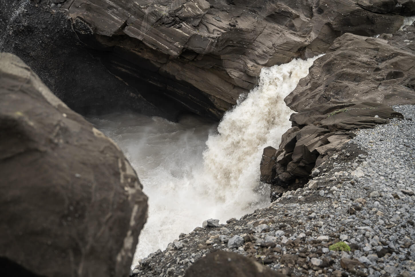
From the riverbank, you get a good view of the two lower steps, but not the upper one yet. Here, the trail also deviates back toward the road and starts to climb up the side of the hill that leads to Lake Hagavatn.
As you gain elevation, the view opens to both the barren landscape to the south and the upper step of the waterfall, with the lake as the backdrop. This is one of the two best viewpoints, in my opinion.
Nýifoss’ upper and mid-step.
View from the first viewpoint back toward road F335.
From here, you can walk toward the shore of the lake, where the Langjökull glacier appears in the background, and where you can finally get a good view of the upper step of the waterfall. Th is the other best viewpoint, because you can see the upper waterfall with most of the lake in the background – as if the waterfall is just a “draining” hole – a rather unique effect.
You can also walk right next to the upper waterfall, along the shores of the lake. Here, you really have a good sense of how the water moves into the waterfall. You can actually see the calm waters of the lake progressively accelerating toward the falls and transforming into them.
From the upper step, you can only see the waterfall and its tumultuous waters from above. That gives you a good sense of how powerful the waterfall is. It also creates a stark contrast between the calm waters of Lake Hagavatn and the waterfall.

Nýifoss Photos and Photography Tips
From a landscape photography perspective, I think the two viewpoints I described above are the better ones. In both cases, I used a 24-70mm lens, full frame, which proved to be more than enough to cover this location. I did not feel the need to go wider or longer, even though I had both my 14-24 and 70-200mm Nikkor lenses with me.
I also did not feel the need to resort to long exposures. The waters of the lake are silt-rich, and the water is rather powerful. Combine these, and you’d get a white blob. Instead, I tried tokeepittexture, which I think suits this type of waterfall better.
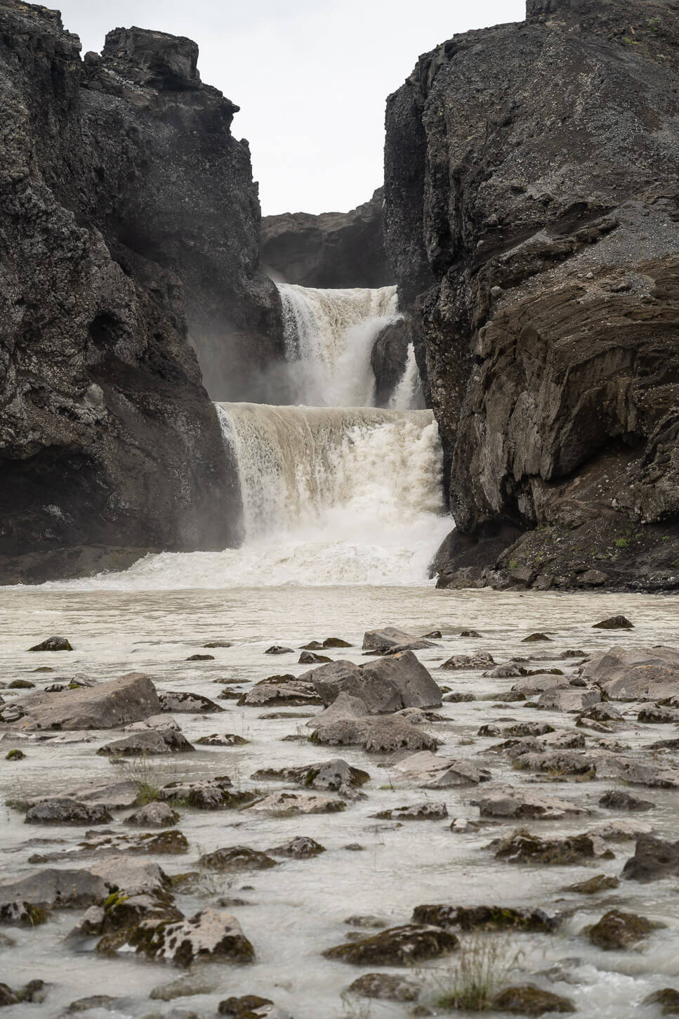
Nýifoss.
Additional Resources
- Discover more beautiful and unique Waterfalls in my eBook guide, “Iceland – The Best Waterfall Hikes and Walks“.
- Discover more Hikes in Iceland here.
- Book with Blue Car Rental through The Photo Hikes and enjoy a 5% discount.


Very different! It looks like the water will eat completely through the barrier quite soon.
Hi Anika! Yes, in that sense, it’s a unique waterfall. It looked like the lake was going to be drained any minute, too.