Pulpit Rock Hike, See Preikestolen, Norway
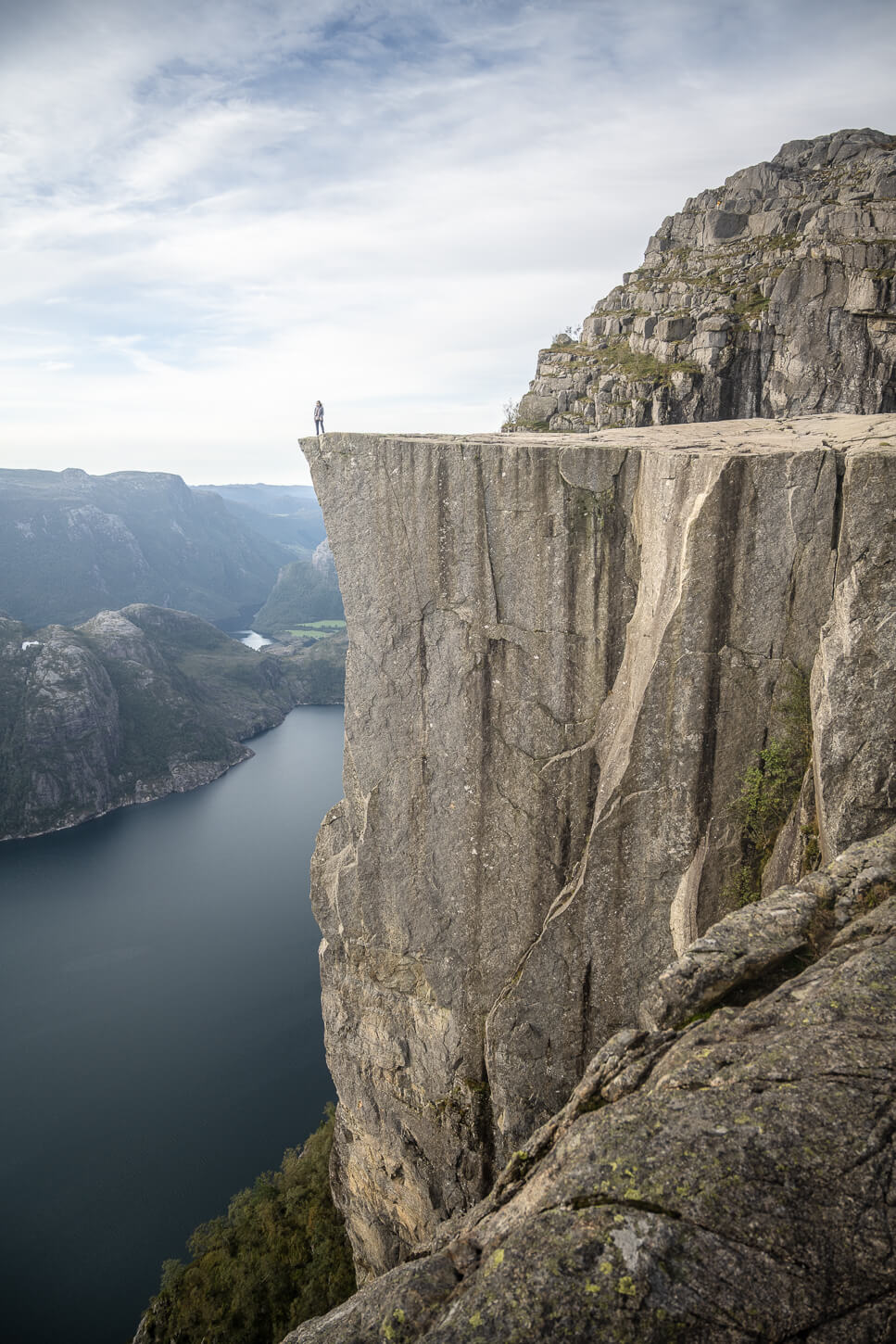
The Pulpit Rock Hike is one of the most popular hikes in Norway; it’s easy to see why. Apart from being a unique rock formation, it also offers stunning views of the Lysefjord and the landscape around it. The views from the 604 meters high (about 1,980 feet) Preikestolen Cliffs are absolutely amazing.
No wonder this is such a popular spot and one of the most visited in Norway, along with Trolltunga and Kjeragbolten.

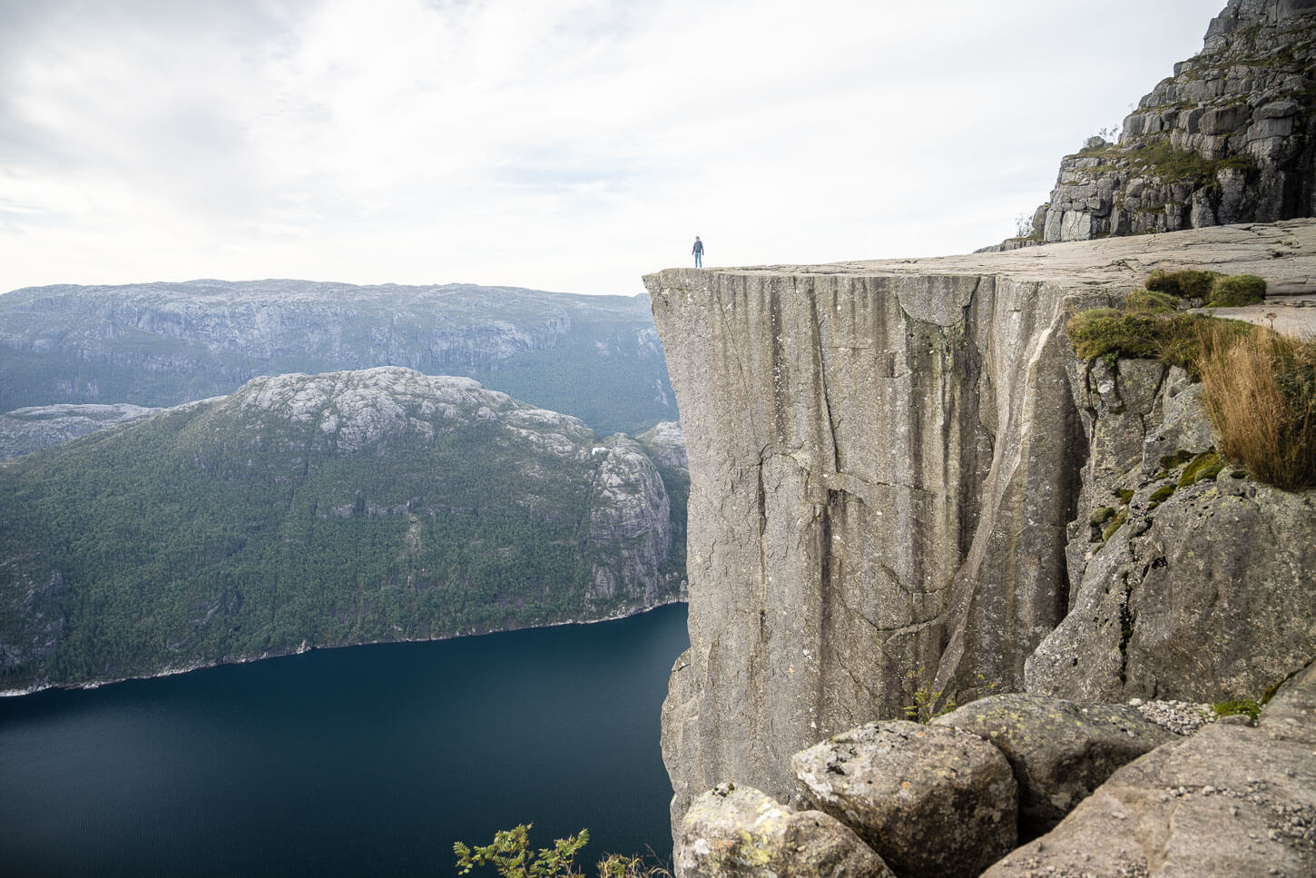
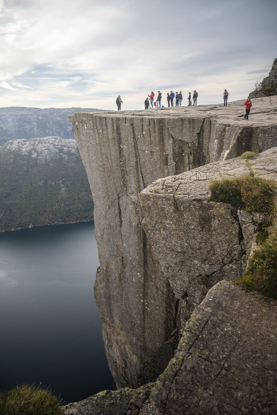
Preikestolen, or the Pulpit rock, from the upper viewpoint.
The hike to the Pulpit Rock is also relatively easy, being less than 10km (or 6.2 miles) long and with an elevation gain of just over 600m, which can be completed in about 3 or 4 hours. That probably adds to why it is so popular. However, despite the crowds, I think it is one of those unique places that are worth seeing once in your life.
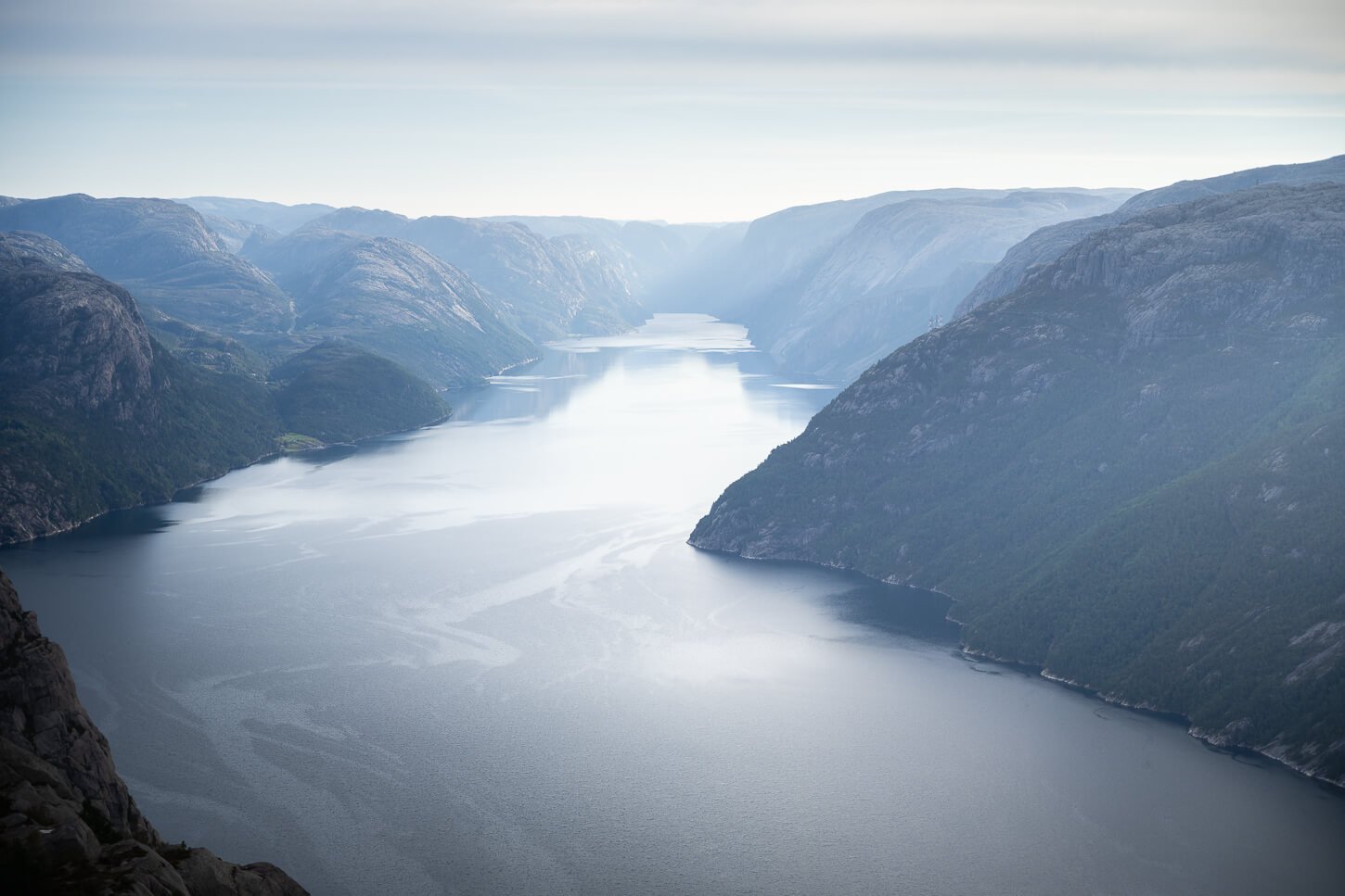
And, the view of Lysefjord is breathtaking. In total, it’s a 42km long fjord, with cliffs higher than 1,000m at their highest points, and a depth of over 400 meters in places. It’s kind of hard to grasp its real size, even in real life.
Hiker on top of Preikestolen, watching the landscape.
Table of Contents
Overview of the Pulpit Rock Hike & Map
The Hike to the Pulpit Rock is of Moderate difficulty, out-and-back, with a total distance of 9.18 km and an elevation gain of 540 meters. The hiking trail to Preikestolen does not present any particular challenge and is well-maintained, but it is moderately steep in some sections, and could be muddy in places if it rained recently. The area around Preikestolen is completely exposed, so practice caution when approaching the Cliffs.
Lastly, this is a popular sunrise hike. Due to its orientation, you can watch the sun rise from Preikestolen while it gradually paints its warm light on the landscape around it. If it fits in your schedule, you could take a powerful headlamp and head out before the sun rises.
| Max Altitude | 610 m |
|---|---|
| Distance | 9.18 KM |
| Elevation gain | 540 m ↑ / 540 m ↓ |
| Hike Time | 03:00/ 04:00 Hours |
| Hike Difficulty | Moderate |
Here is the map of the hike. You can download the GXP file for free from the activity linked below.
Getting to the Pulpit Rock Trailhead and Parking
You can get to the Pulpit Rock by car, with busses, or on guided tours. There is a large parking area right by the trailhead, and driving there, unlike some other trails in the fjords of Norway, does not require driving through some one lane, narrow mountain road with bottomless cliffs on one side. It’s a regular two-lane road.
At the main parking area, you will find an information center, a lodge, a bar/restaurant, and a small shop, as well as public toilets.
- Driving Directions: From Stavanger, it is a relatively short drive to the trailhead. Depending on where you are, oyu could either take the A13 tunnel (paid), or the Lauvik-Oanes ferry, and road 523. Both roads converge on Preikestolenvegen, which is the dead-end road that leads to the Parking area/Visitors Center.
- Parking: There are a few paid parking spots both by the trailhead and further down the road. The closest parking area is the one by the Visitors Center, Parking P1. I’d recommend arriving very early in the morning if you want to park there, as it fills up quickly. The other nearby Parking area is Parking P2, The distance between the two is about 1.2 KM, so it is entirely walkable, and there’s a also path directly from P2 to the trail.
- Public Transport: It is possible to reach the trailhead with an express bus from Stavanger, details here.
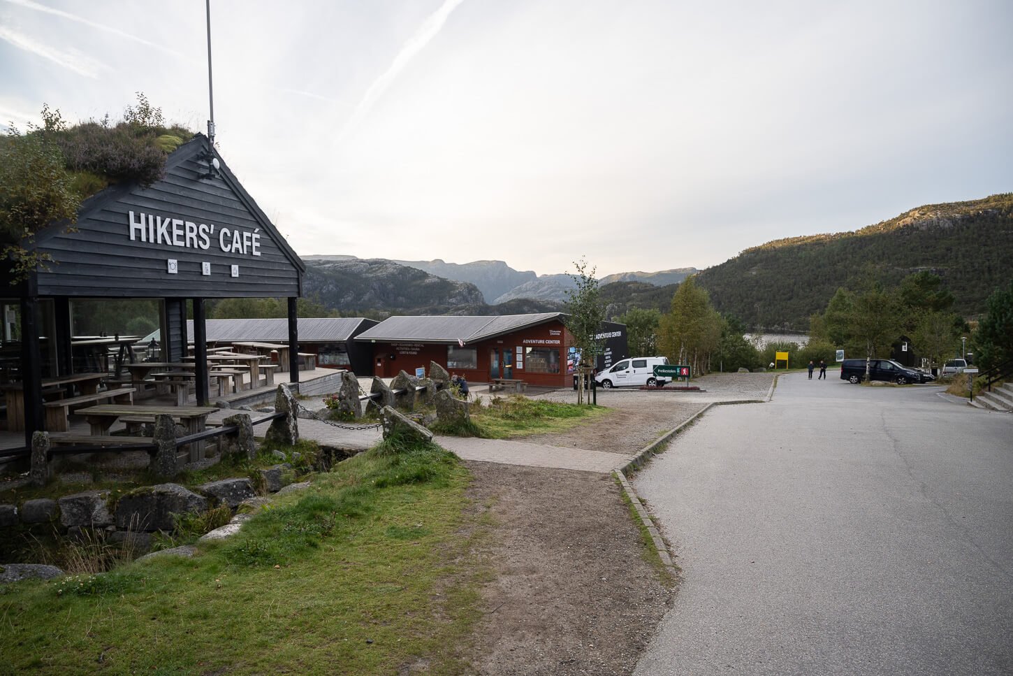
View of the Preikestolen visitors center.
The Preikestolen Hiking Trail
Right from the start, the trail is quite steep. Steepness apart, it is an easy-to-walk-on gravel path at the beginning. However, if you are not used to steep trails, you may feel it in your legs. At the top of this first “climb”, the trail turns into a proper mountain trail, but there are sections with stone steps and some boardwalks here and there. The trail also alternates between uphill sections and other flat ones.
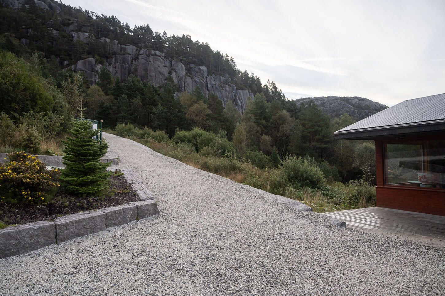
The Actual Preikestolen trailhead from the Visitors Center.
Large sections of the trail are paved with stones.
After the first steep section, you will enter a wooded area on a gentler gradient. The trail will then pass through a marsh, where boardwalks have been installed, before the next steepish uphill section begins. Again, the trail alternates sections on stone steps and sections on natural terrain.
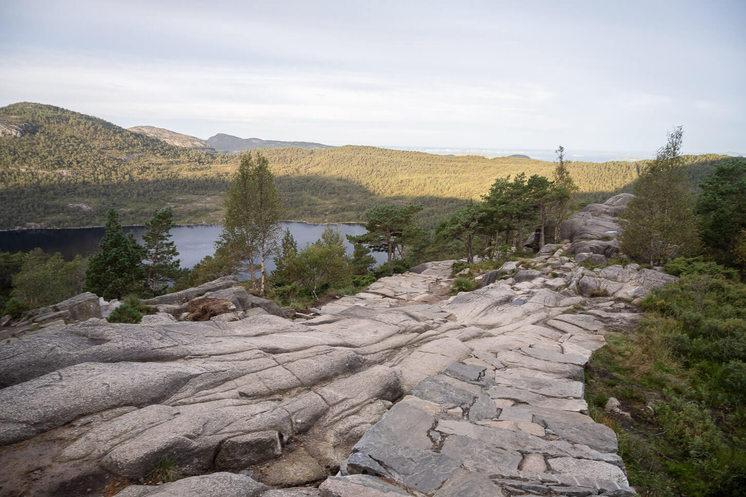
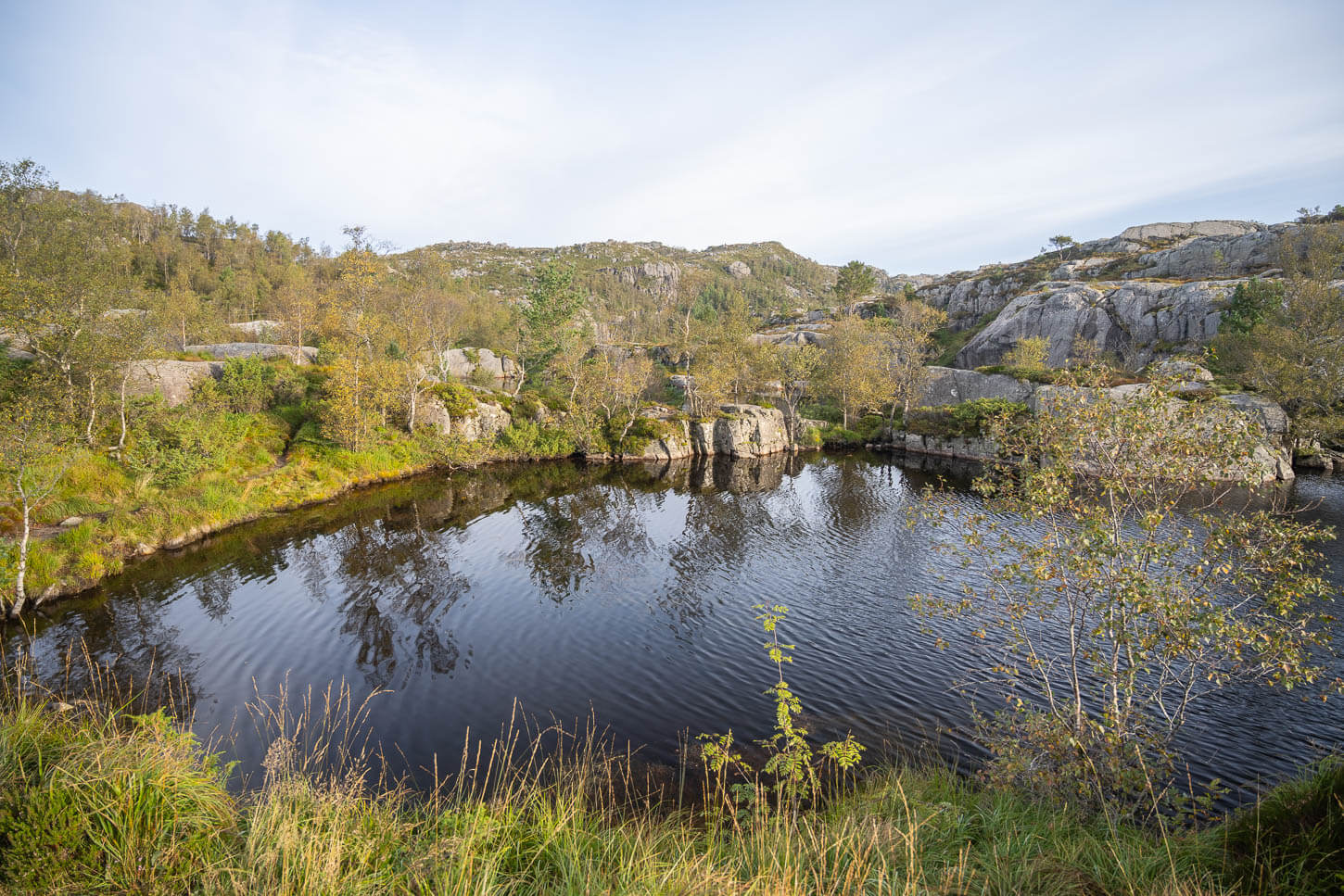
In the middle section, the trail is for long stretches until you reach a small lake and a rocky area where the emergency shelter is. Here, the trail flattens out, and the views also start to open up to the vast landscape around Lysefjord.
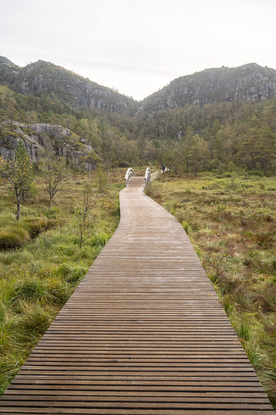
Other sections, on the more “marshy” areas, are on boardwalks.
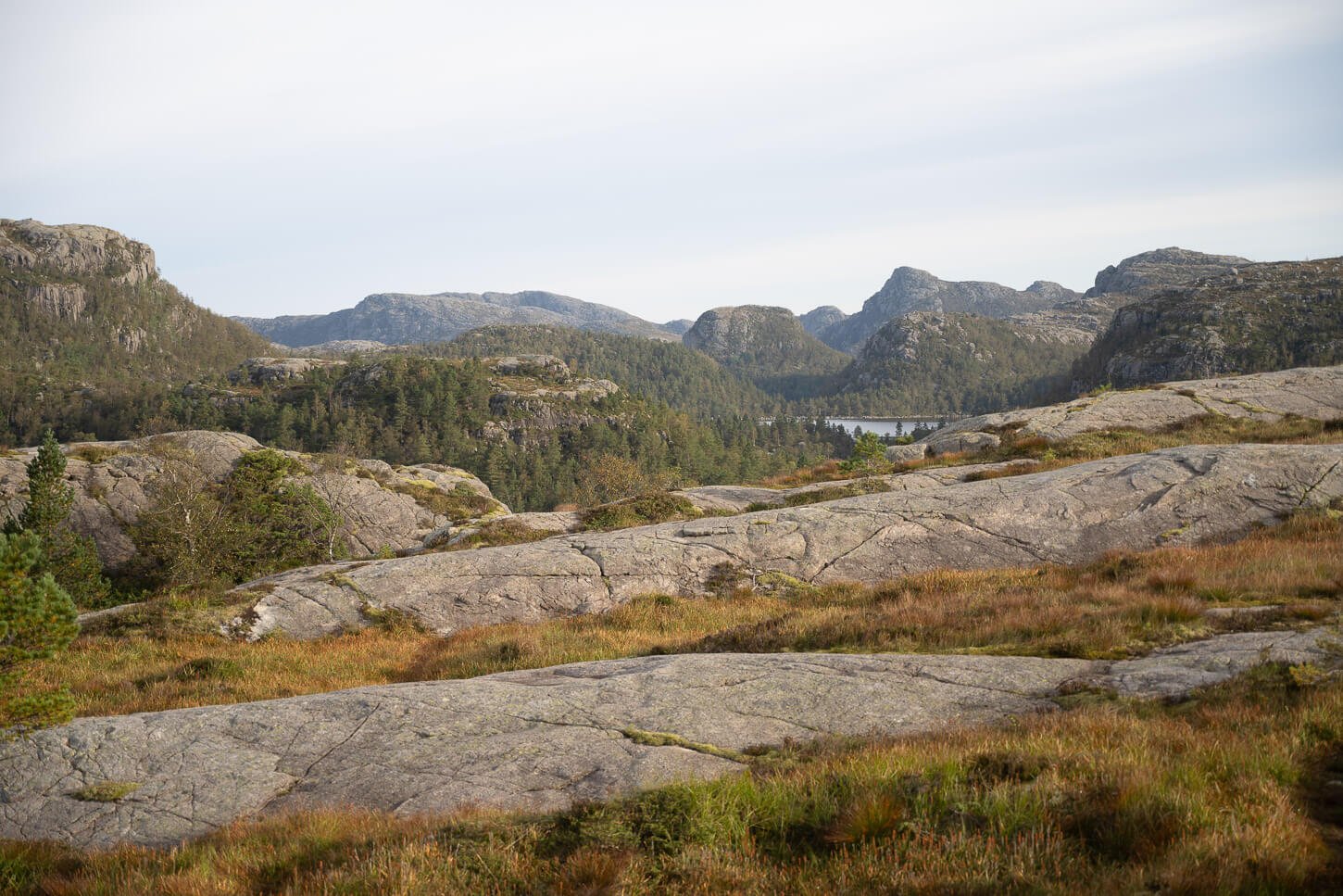
In the second part of the trail, the views open up onto the high plateau and the surrounding mountains.
Gradually, the views will also open up toward the spectacular and gigantic Lysefjord, which will appear in the distance, toward its western end.
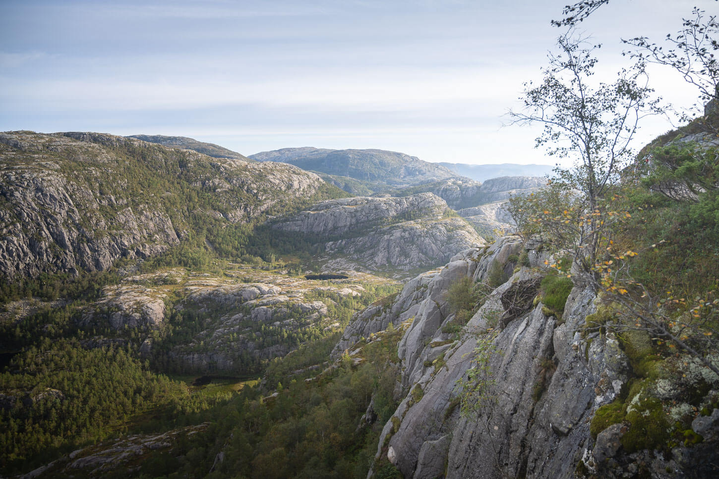
The Pulpit Rock isn’t visible until the very last few hundred meters of the trail. It’ll come into view as a rocky outcrop with a lot of people standing on it. The contrast between what looks like a small rocky outcrop and the size of the landscape around it is staggering. Even more so when people are standing on Preikestolen, as it helps to put everything into perspective.
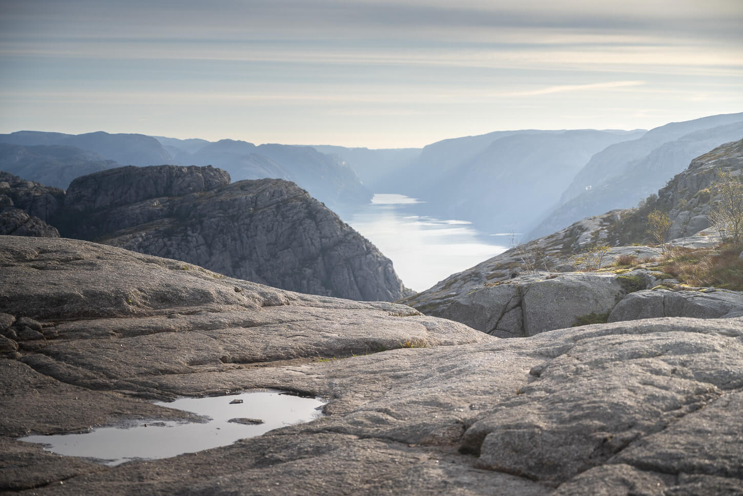
First view of Lysefjord from the trail.
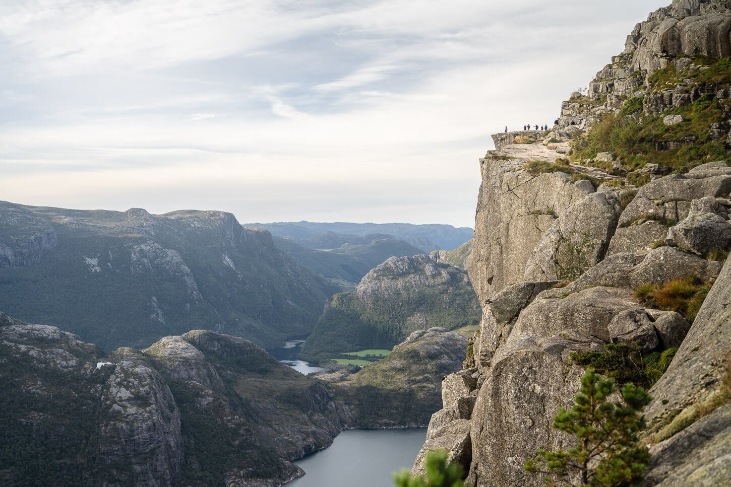
Approaching Preikestolen from the Trail.
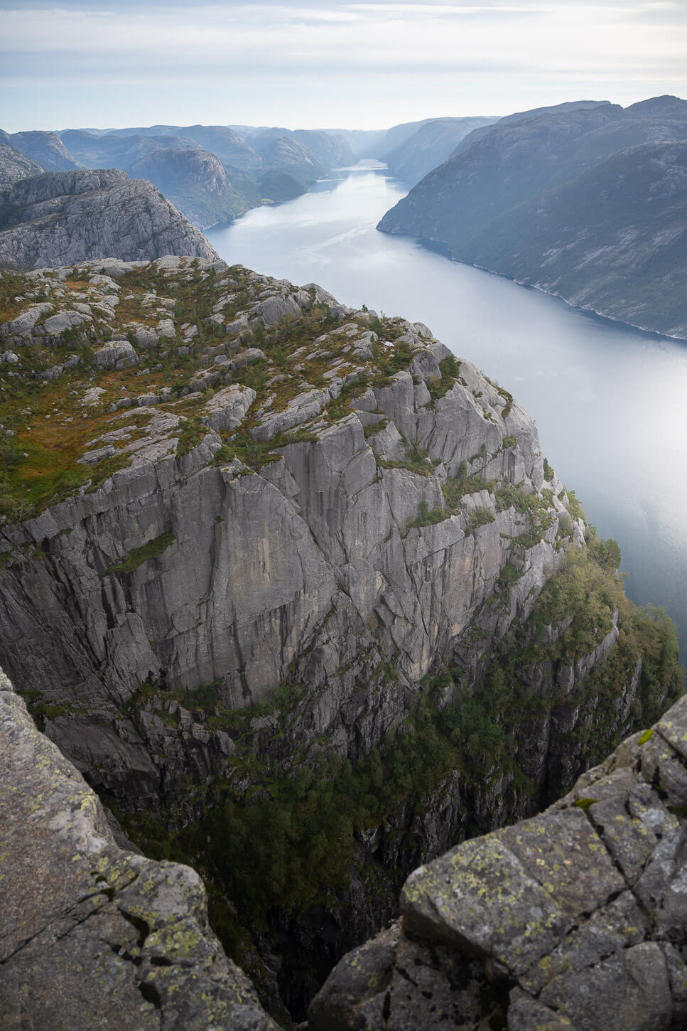
The Cliff is 604m high, and the view of the landscape around it puts its size into perspective.
Preikestolen Upper and Lower Viewpoints
From when Preikestolen comes into view, you can easily reach the lower viewpoint, which is Preikestolen itself. You will probably find people queuing up to have photos of themselves taken while standing on the Pulpit Rock’s corner toward the fjord. That’s also a small rocky, overhanging outcrop some people may not be comfortable standing on, as it is completely exposed, and while it is fairly wide, there isn’t much room for error if you get too close to the edge.
The last part of the trail is wide but does have exposed sections.
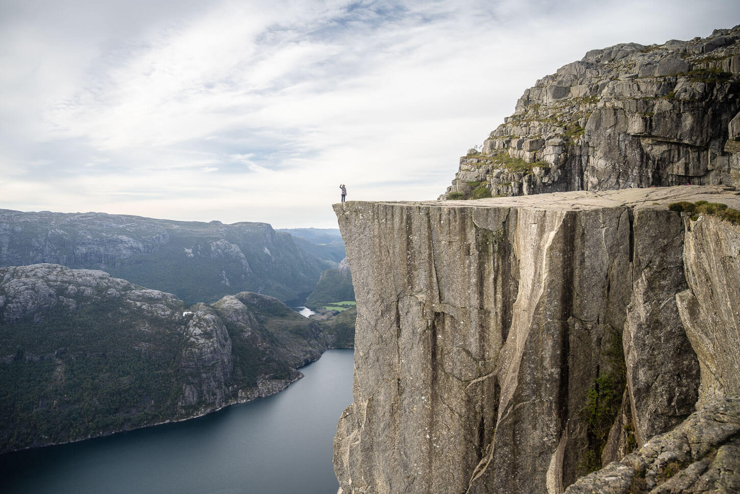
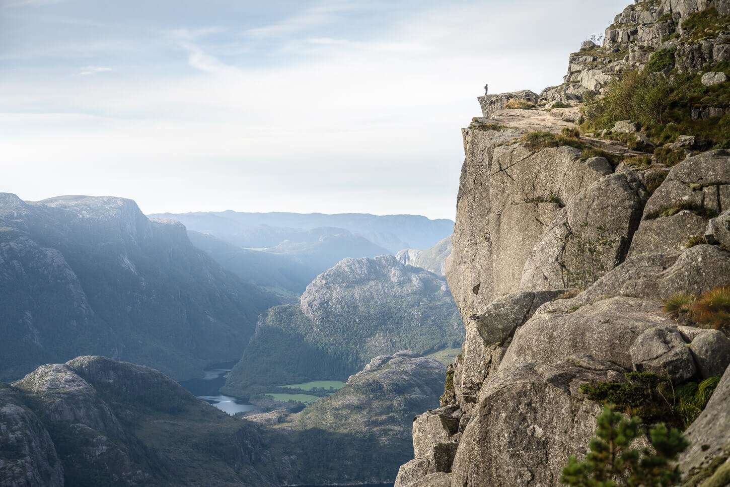
A Hiker on top of Preikestolen.
From there, it’s just a short walk to the top of the Pulpit Rock, where you can enjoy the spectacular views of Lysefjord. Again, there will likely be queues to stand on the corner toward the fjords, as people queue up to have their photos taken. It’s also the sport with the best view of the fjord, so even more people will amass there.
To get to the upper viewpoint, you’ll have to backtrack a little until you see the sign that marks the detour to it. from there, a short 10-minute uphill hike behind Preikestolen and up above it. You can enjoy the full view of the Pulpit Rock from there, against the landscape of Lysefjord. Again, the vastness of the landscape in front of you is quite incredible.
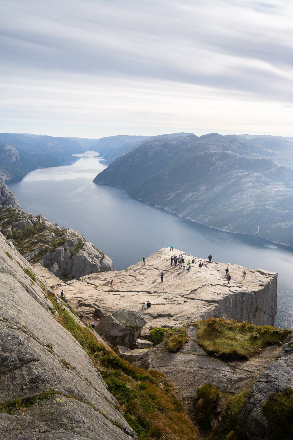
Preikestolen upper viewpoint.
From there, you can return down the same way, or take more or less harder and longer detours if you want to make your hike longer.
Pulpit Rock Photos and Photography Tips
Purely in terms of Landscape photography, there are two main viewpoints. The first one is just a few meters below the Pulpit ROck, where you can photograph the verticall wall with the background of the Lysefjord landscape. The other is the upper viewpoint where you can best capture the top of Preikestolen with the backdrop of the fjord.
While I usually I’m not a big fan of having people in Landscape photos, Preikestolen it is a great location to include the human element into the frame; it really is the best way to show the real size of the place. Tiny human vs nature type of shots.
All the photos in this post were taken with a 24-70mmm lens, and while I had a wider lens with me, I found that range to be enough

Preikestolen is a great location to capture the sunrise. As the Pulpit Rock faces the east, you can capture the warm light of the morning sun shining through the gigantic Lysefjord and hitting the Pulpit Rock directly. Purely for this reason, this is a location I will come back to – shooting sunrise at Preikestolen. Despite of how crowded it may be, I can only imagine it would be pretty epic to witness a blazing sunrise from here.
Places to stay near Pulpit Rock
If you want to stay close to the trailhead to start the hike early or to have a place to return to right after the hike, there is a Lodge within the parking area. Can’t get any closer than that! Alternatively, there are plenty of accommodations in the nearby town of Jørpeland, or again, in Stavanger.
There is also a very nice campsite in the vicinity of the trailhead, Preikestolen Camping, which is where I stayed. Apart from staying there in a Camper, in a Van, or in a tent, you can also rent some nice cottages/huts. I stayed there in my van—nice campsite, with clean facilities.
Camping at Preikestolen
While you cannot camp on Preikestolen itself, there are a few areas around it and just behind it where you may spend the night in a tent. The upper viewpoint is a good place to stay, but it’s a rather rocky place with few flat spots.
Additional Resources
- Check out more Hikes in Norway, with Maps!
- Here is the official Preikestolen website.


Leave A Comment