Hike to Diavolezza and Munt Pers on the Bernina Pass, Graubünden, Switzerland
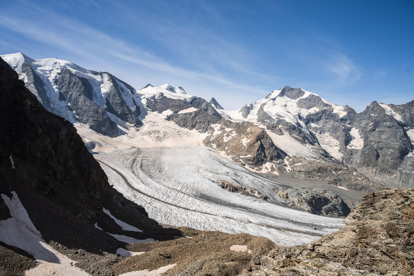
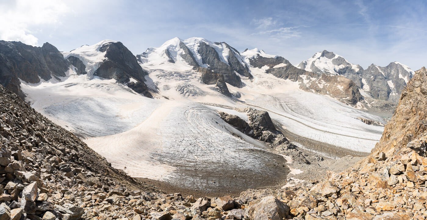
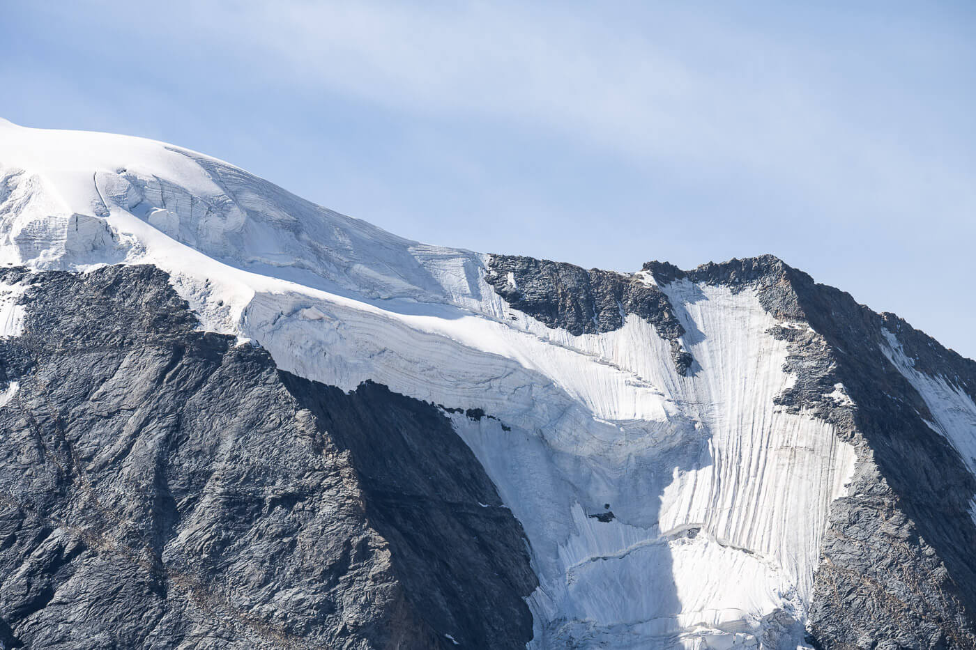
The Hike to Diavolezza and Munt Pers on the Bernina Pass is one of the most scenic hikes with glacier views in Switzerland. The views of Piz Bernina (4,048 m.a.s.l) and the various glaciers on the North Side of the Bernina group are just epic.
Apart from the sense of awe such views stir, it’s hard to describe the feelings that such places can make you feel. You see and feel the beauty of the mountains along with their ruggedness. You feel belittled by the giant 4,000m peaks around you, and yet you almost feel like part of the landscape. A landscape that seems almost eternal, but you can feel how fragile it is at the same time.
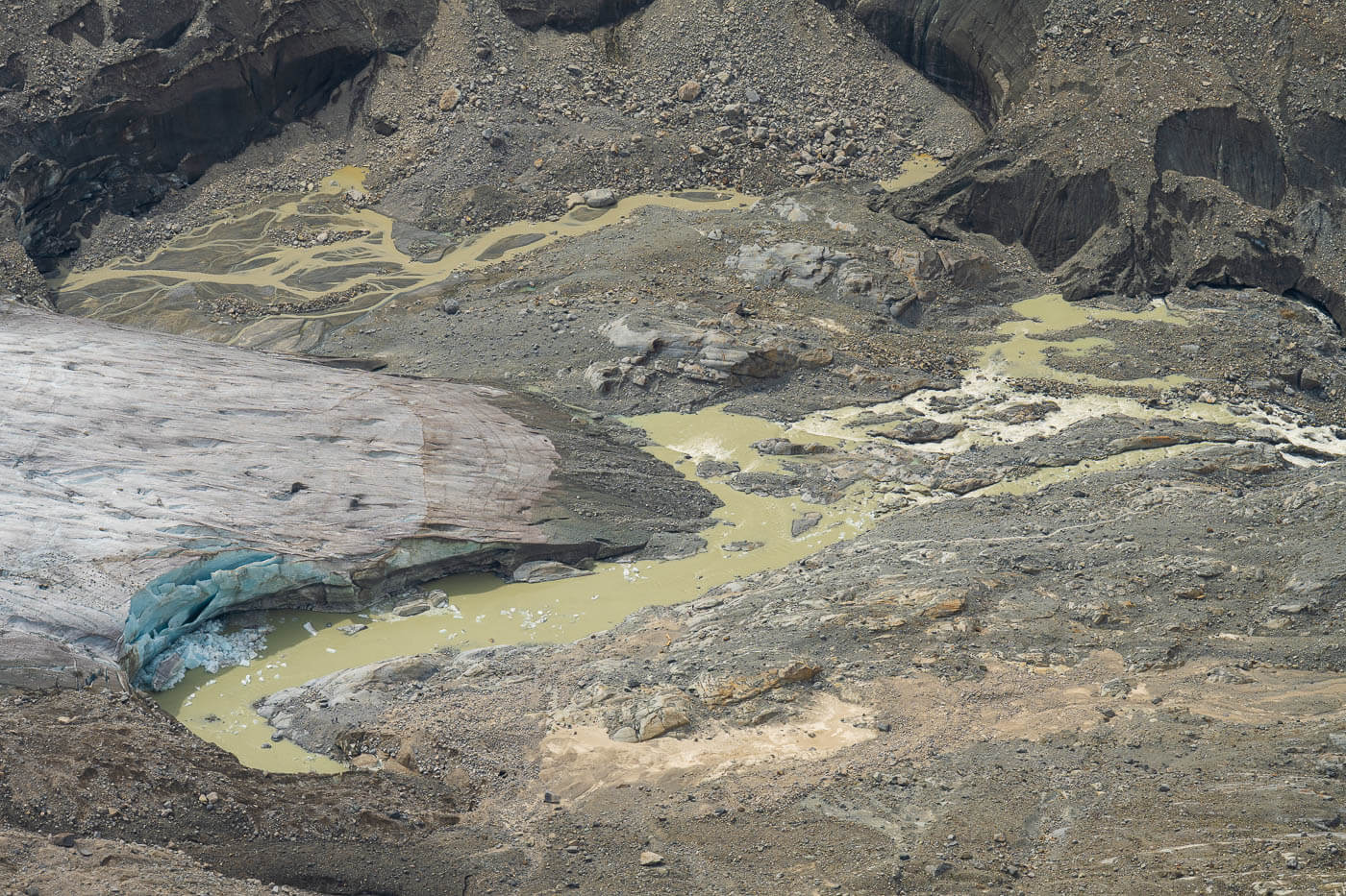
The beauty of the landscape strikes first. Then all the “little” details, the glaciers and their crevasses, the small lakes and rivers, the rocks – and the list can go on. You can’t help but wonder about the forces and events that shaped such places. I hope I am making some sense here, but it’s hard to describe the natural beauty of locations like this.
You can hike to Diavolezza directly from the Bernina pass, and from there to the various viewpoints around it. You can also take the cable car up to Diavolezza and continue from there.
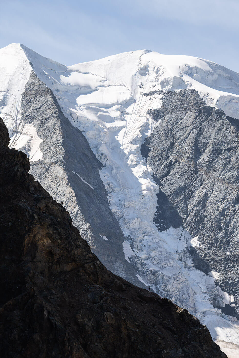
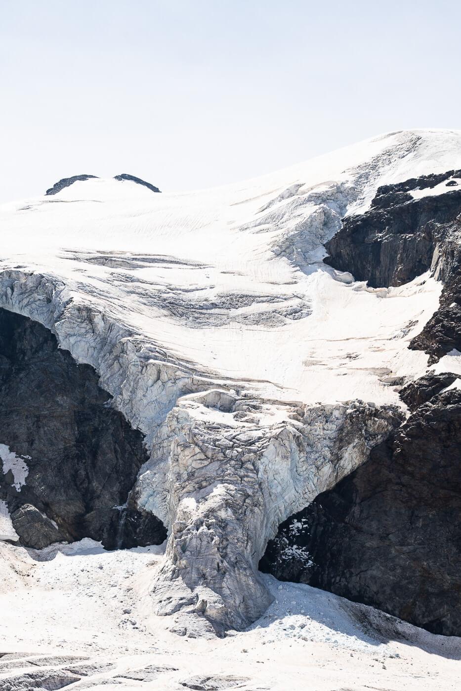
Table of Contents
Overview of the Diavolezza and Munt Pers Hike & Map
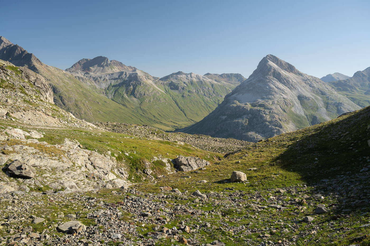
This is a hike where there are multiple viewpoints, all worth exploring. Some are easy to get to, some are difficult, and some are very challenging.
Below you’ll find the whole trail between the Bernina pass and the peaks around Diavolezza. If you prefer, you can shorten the hike (and the elevation again) by taking the cable car up to Diavolezza. That would save about 13km in total, and about a 1,000 elevation gain compared to the whole hike.
| Max Altitude | 3,207 m |
|---|---|
| Distance | 19.1 KM |
| Elevation gain | 1,590 m ↑ / 1,590m ↓ |
| Hike time | 07.30/ 08:30 Hours |
| Hike Difficulty | Hard |
Here is the map of the Hike to Diavolezza and Munt Pers. You can download the GPX file for free from the activity linked below.
How to get to the Diavolezza and Munt Pers trailhead and Parking
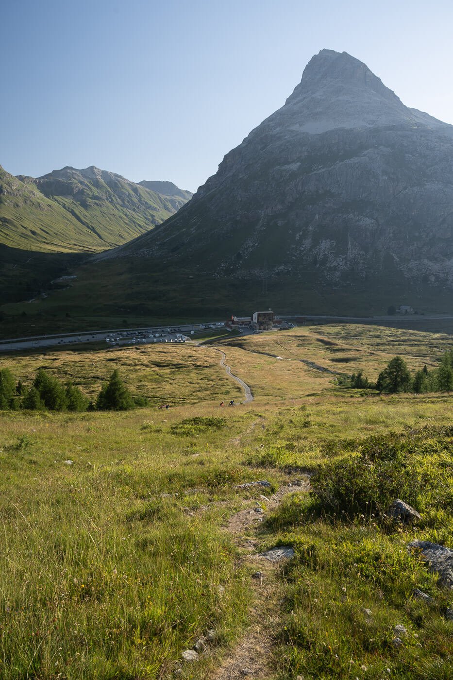
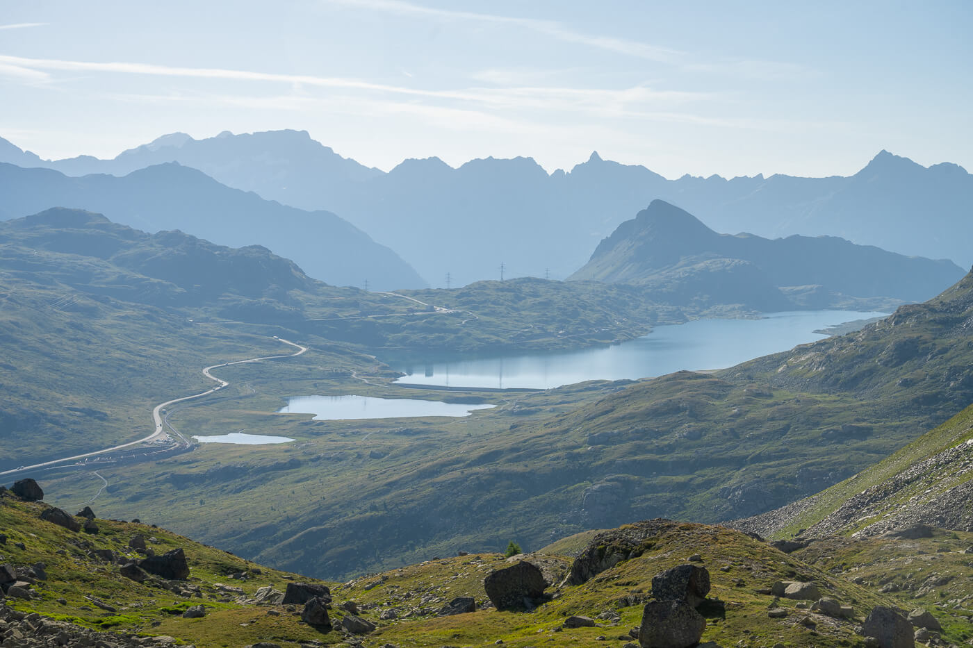
Located next to the Bernina Pass, you can reach the Diavolezza cable car station either by car or by train. Both options are easy, but keep in mind there can be heavy traffic on the Bernina Pass in summer, so if you are staying nearby, the scenic train ride may be a more desirable option.
- Driving Directions: From Switzerland, or generally speaking, from North of the Alps, you would need to drive to St. Moritz/Samedan first. From there, take road 29 to the Bernina Pass. If you are coming from Italy, you would need to get to Tirano first and then drive to the other side of the Bernina pass on road 29. It takes about an hour to drive from Tirano to the Diavolezza cable car station. Keep in mind you’ll need to cross customs, so that may add a bit of time.
- Parking: There are large parking areas by the train stop, next to the cable car valley station.
- Public Transport: There is a train station right by the Diavolezza cable car station. You can get there by taking the Bernina Express, and this is a good option for anyone planning a day trip to Diavolezza from places like Saint Moritz or Poschiavo. The train stop is “Bernina Diavolezza“. You can plan your trip on sbb.ch. Do note that you can take the train from Italy (Tirano) too.
View from the trail above the Diavolezza cable car station.
Hiking to Diavolezza (2,978 m.a.s.l.)
From the Bernina Pass and the Diavolezza Valley Station, you can take a trail that is partly on a gravel road and partly crosses it as the road zig-zags up the mountain. The panorama you’ll see hiking up this side of the mountain is what you see around the Bernina pass – only better as you hike your way up.
You’ll also get some quick, sneak peeks at the epic glacier views that await on top.
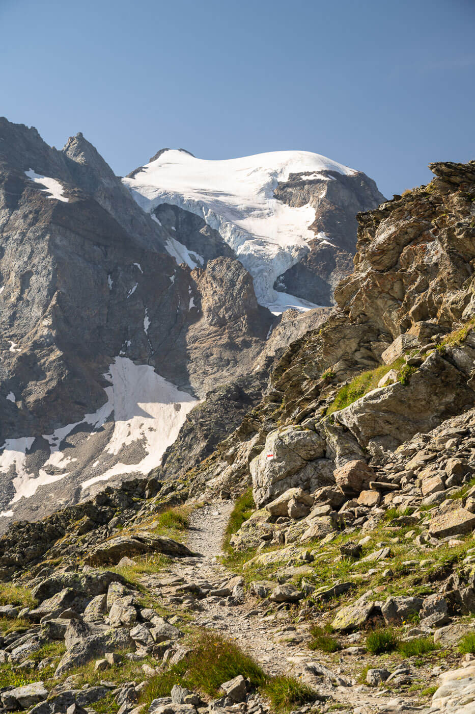
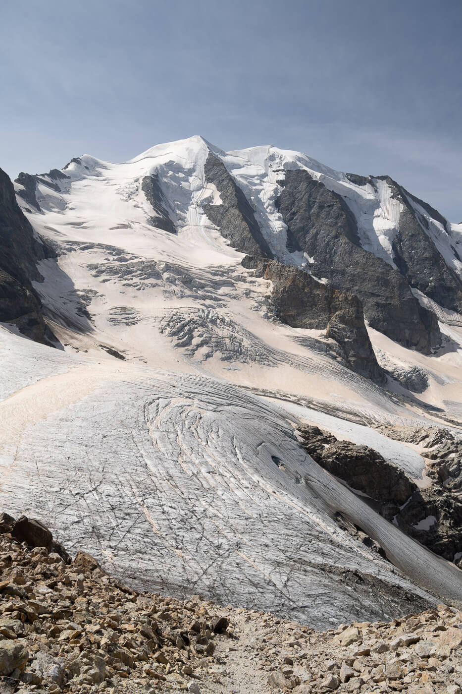
The trail that leads to Diavolezza offers a good previews of the glacier views that awaits at Diavolezza.
Bernina Pass, view from the trail that leads to Diavolezza.
However, it is quite a long walk to reach Diavolezza. While it looks relatively close from the road on the pass, the trail winds it way up the mountain and it definitely takes longer than you’d imagine, alco considering the total elevation gain involved, which is about 1,000m in six KM.
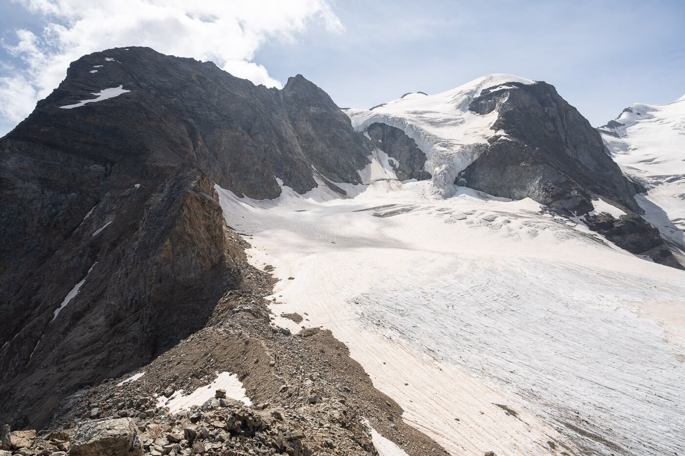
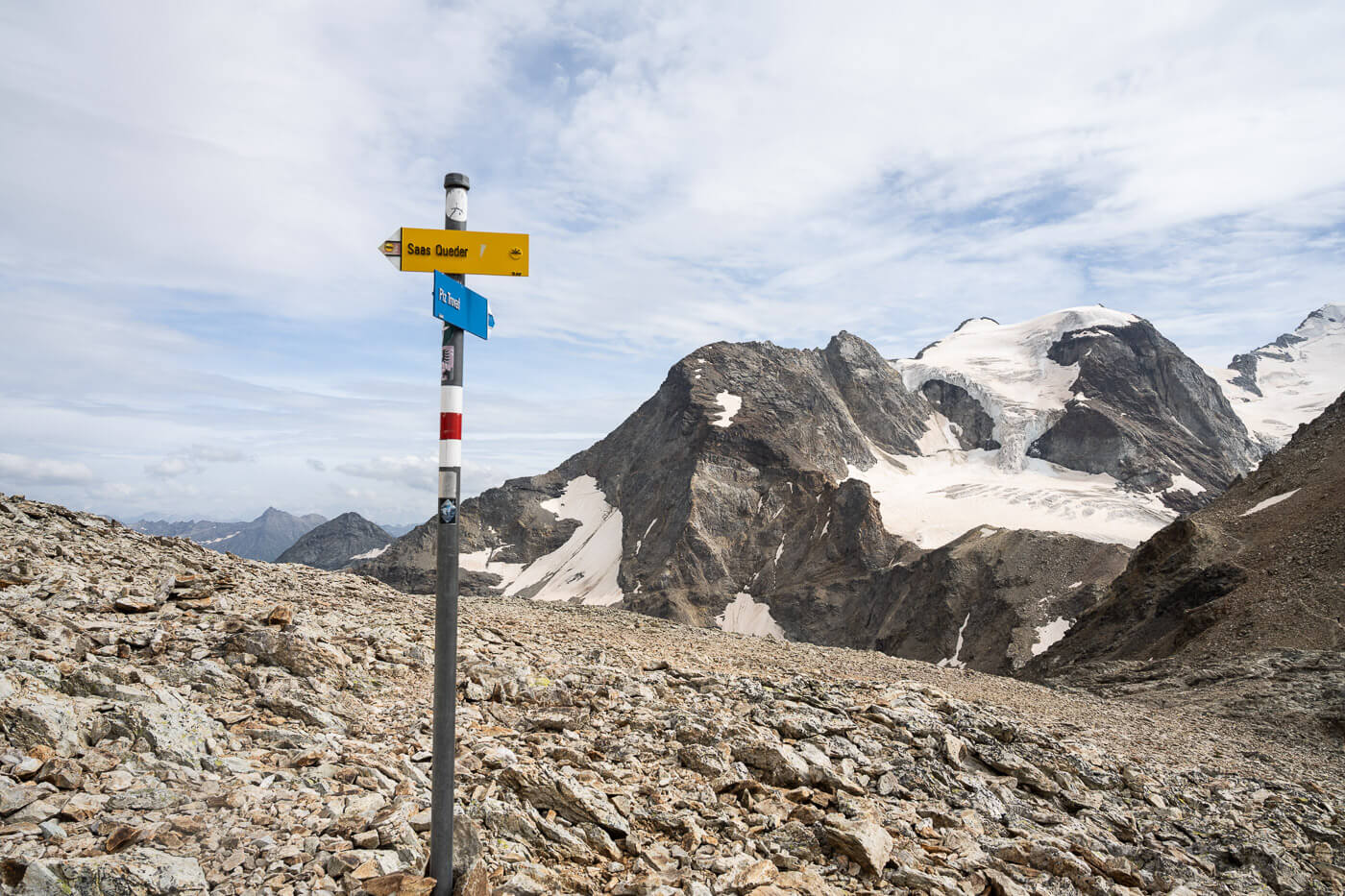
Once you’ve reached Diavolezza, you have several hiking options. Looking at the glacier, Munt Pers will be to your right, while Sass Queder will be to your left. Plus, you’ll likely spot some other trails heading in different directions. Just be careful to not end up on the Via Ferrata.
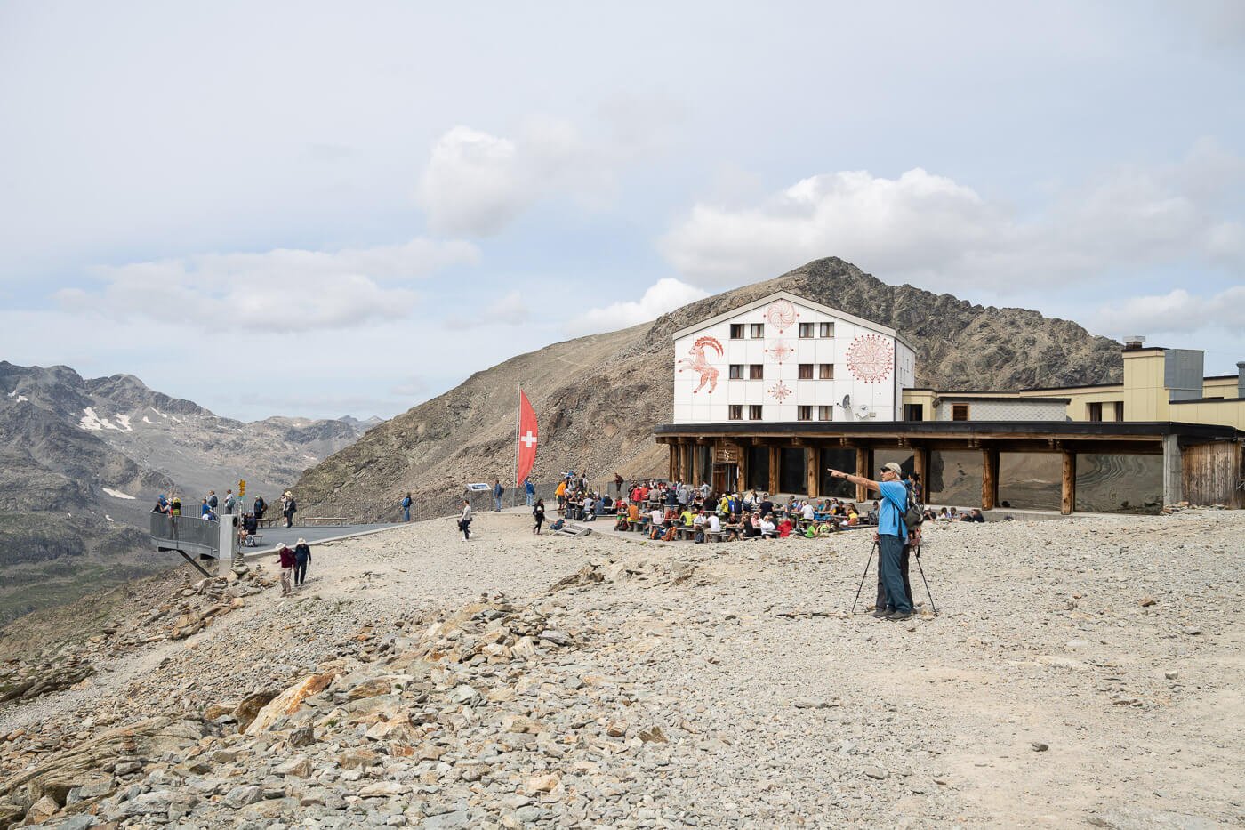
The Diavolezza Berggasthaus, with Munt Pers in the background.
Climber on the Piz Trovat Via Ferrata
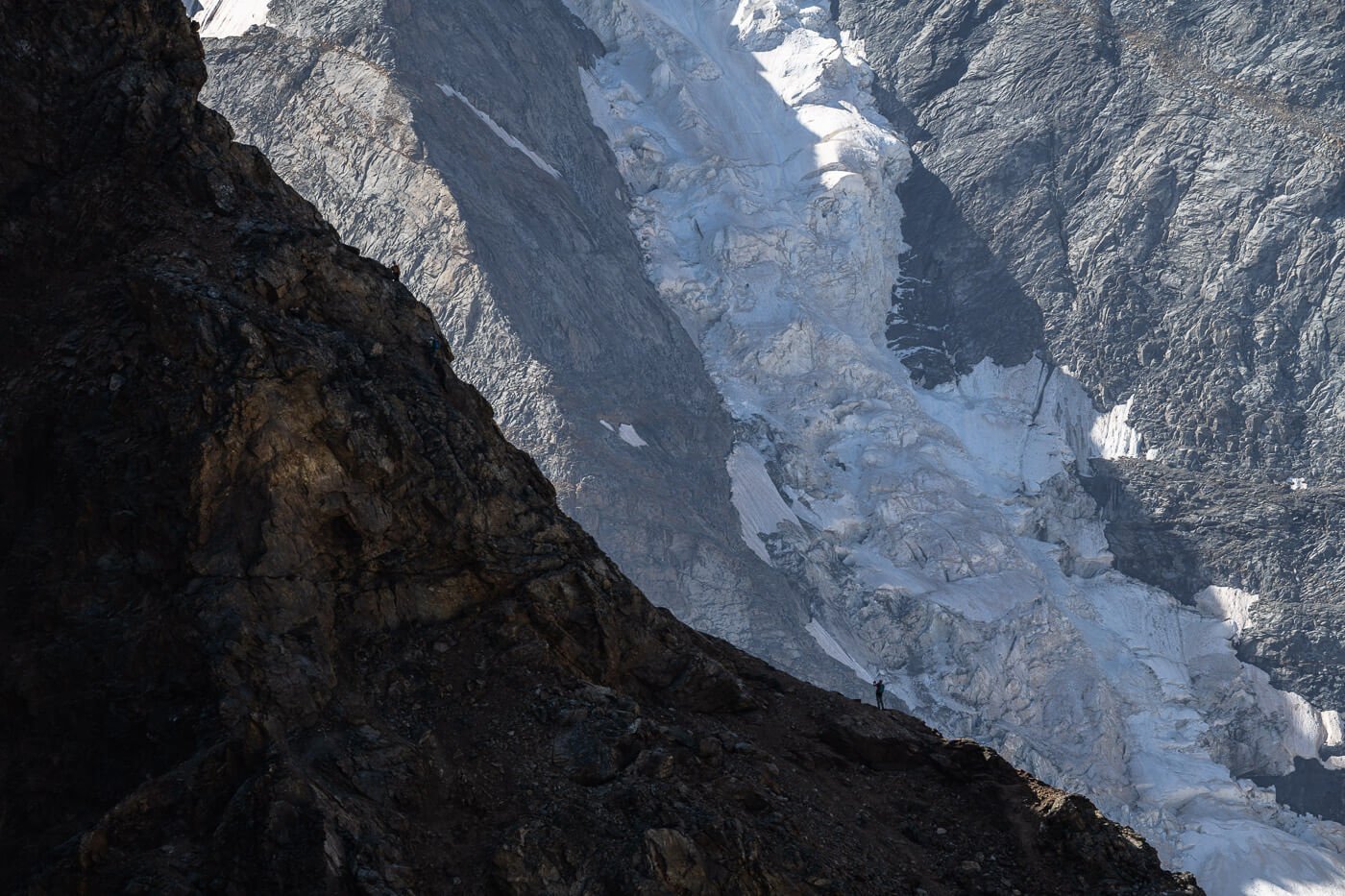
I decided to follow a trail I had not planned on visiting, which is part of the trail that leads to Piz Arlas climb. It’s a white-blue-white trail, which means an alpine trail with considerable risks between rockfall, exposed sections, or glacier crossings.
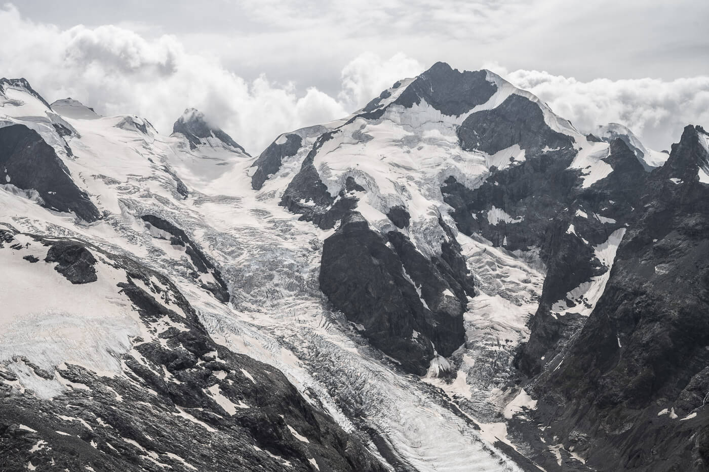
I’ll describe it below as I didn’t find much info on this compared to Munt Pers or Sass Queder. I stopped at a viewpoint that does offer great views of the glacier, but keep in mind it involves hiking on an exposed section with the risk of rockfall.
Exposed trail behind Piz Trovat that leads to a viewpoint on the trail to Piz Arlas.
Viewpoint below Piz Arlas
The first viewpoint I went to after reaching Diavolezza was one I had not planned on visiting. It’s a viewpoint on the other side of Piz Trovat, a mountain you can only climb following a Via Ferrata. However, there’s a (spoiler: very sketchy) hiking trail around it that leads to another viewpoint above the glacier.
It isn’t an easy trail and it isn’t free from dangers, be it rockfall, be it falling down the mountain yourself. It’s a narrow trail on soft and crumbly ground, on a steep slope. So, unless you have experience with this type of terrain and know the risks, I would not recommend going there. However, I’ll still describe this because I did see many people attempting it, to turn back at the sight of the sketchiest point, in the hope that anyone reading this will know what to expect.
The Exposed trail is on a steep gradient and just large enough to walk on.
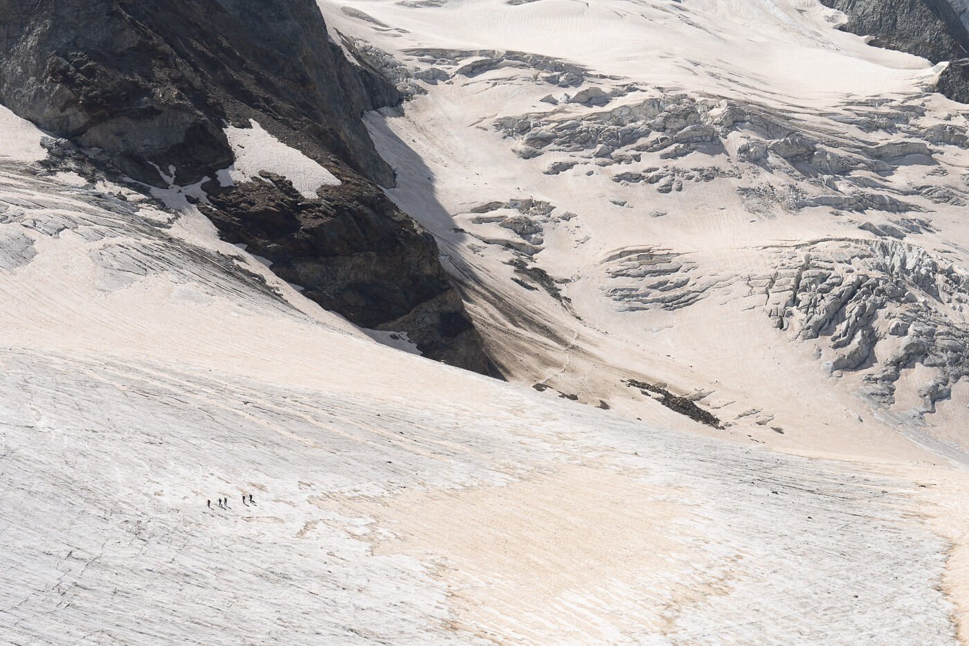
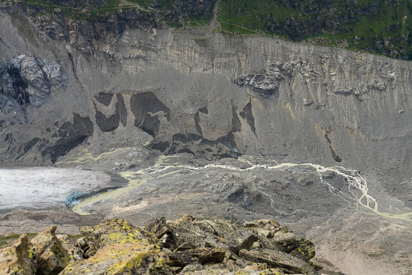
As far as I understand, this is either used to approach the glacier or to return to Diavolezza from the glacier, as well as to climb Piz Arlas. From Diavolezza to the viewpoint I stopped at, it takes about 35-40 minutes, one way. So it is not a trivial detour by any measure.
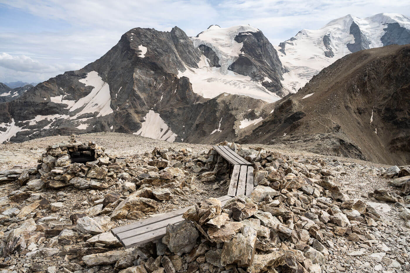
As you cross to the other side of Piz Trovat, you’ll find a relatively large, flattish area where some stone walls have been built (presumably by climbers to attempt climbs in the early AM). This is the area that offers some additional great viewpoints.
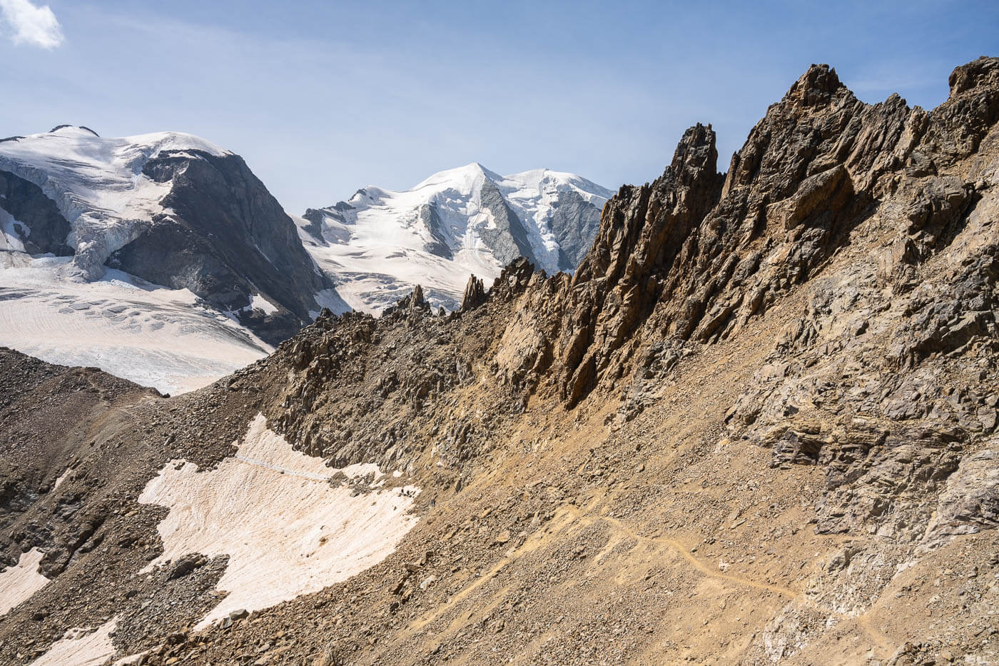
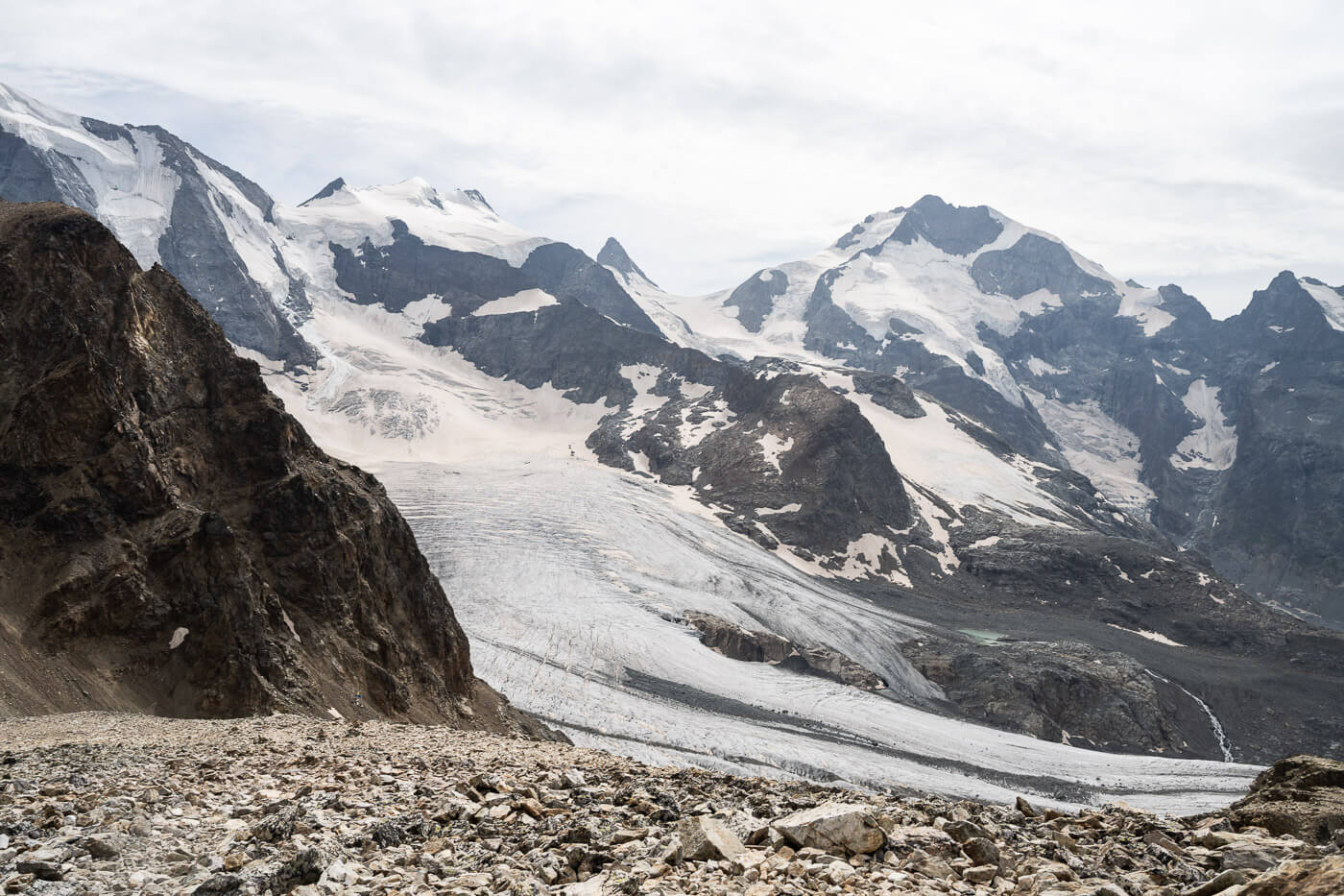
From Diavolezza to Munt Pers (3,207 m.a.s.l.)
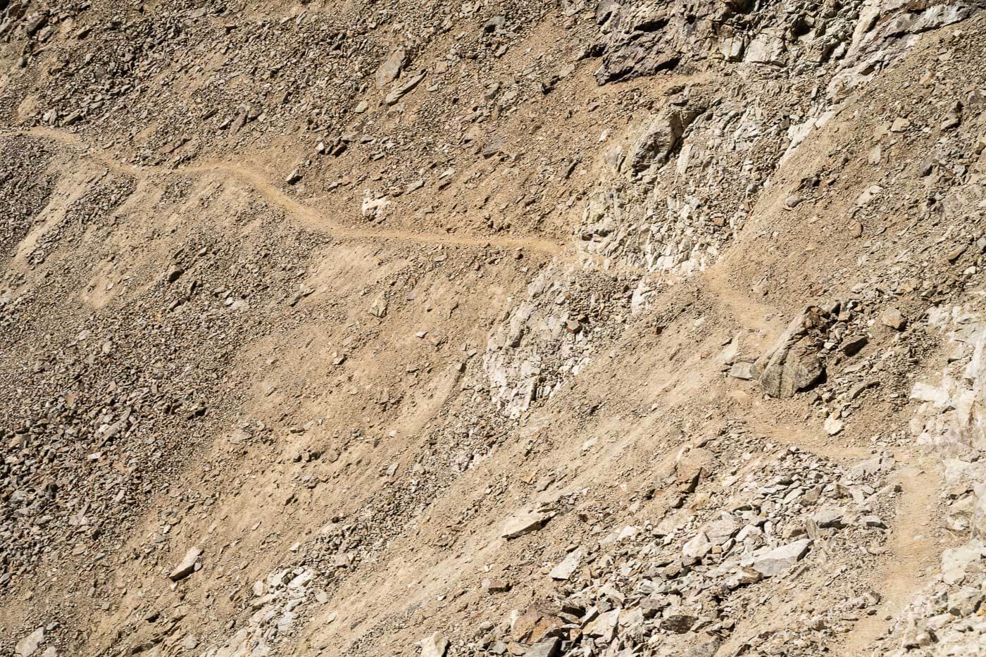
From the Diavolezza Berghaus, Munt Pers will look deceivingly close. It will take about forty-five minutes to an hour to reach the summit, so it is not very far either, but the trail is quite tocky, so it is kind of slow going in places. And, you’ll likely stop a few times to soak in the views of the beautiful glaciers of the Bernina group.
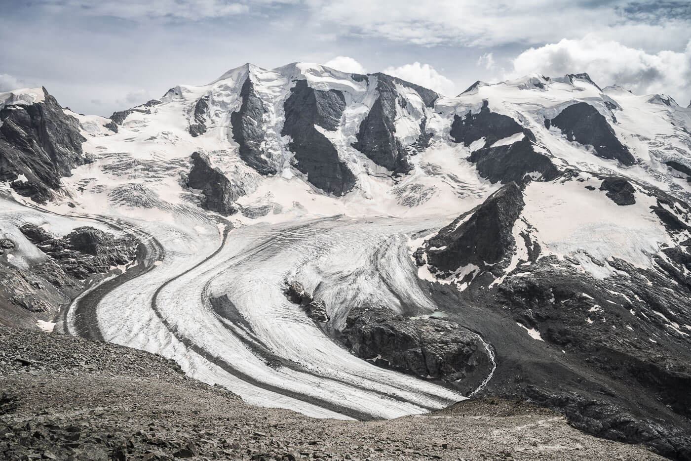
On the landscape, it gets better and better the further up you go, until you reach the summit, where the views open up to spectacular 360-degree views. Munt Pers’ summit can be quite crowded on nice sunny days. For good reason, the views are epic.
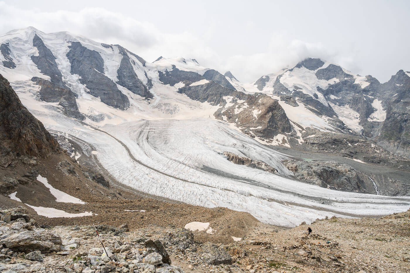
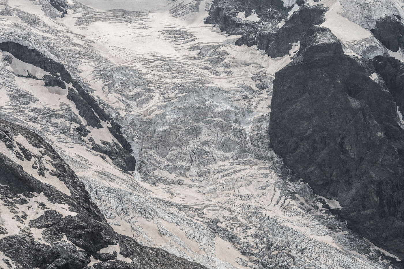
You can see the entire Bernina massif, its glaciers, and the entire Morteratsch glacier from above. I stayed up there for a good hour, just sitting and watching the landscape. Plenty of people were around doing the same too. Others stayed for longer, as they were there when I arrived and were still there when I left.
These really are some of the best views of the mountains and glaciers of the Bernina group, including the Morteratsch Glacier, and it’s definitely worth hanging out there for a while.
After my healthy dose of rest and stunning landscapes, I headed back down Munt Pers toward Diavolezza to hike up the other side to Sass Queder.
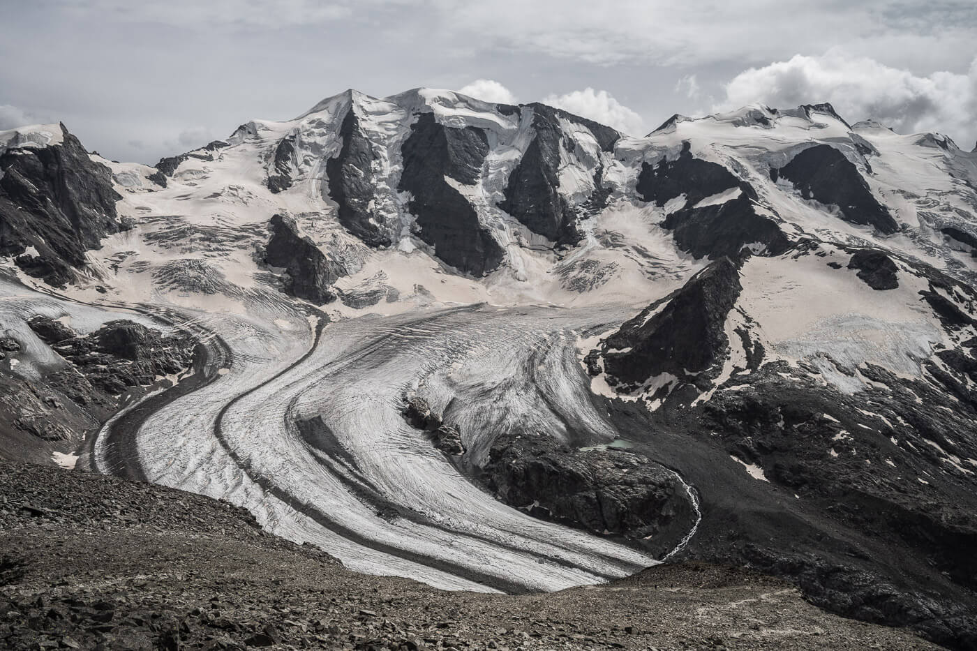

The Morteratsch Glacier, on the right.
Morteratsch glacier front, view from Munt Pers.
From Diavolezza to Sass Queder (3,066 m.a.s.l.)
Saas Quader may not offer the very best views of the various glaciers and landscape around it, but it has one special feature that can only be found here. At 3,065 m.a.s.l., you will find the highest BBQ area in Europe. One hell of a place to have a BBQ at, especially after a long hike.
Anyway, the trail from Diavolezza to Sass Quader isn’t very difficult, but it is covered on screen for the most part, so a bit slow going. Still, it’s a much shorter hike compared to Munt Pers, so it does not add much to the whole hike.
It’s a popular spot to visit. I would imagine even better if you had something to grill and a couple of beers with you!
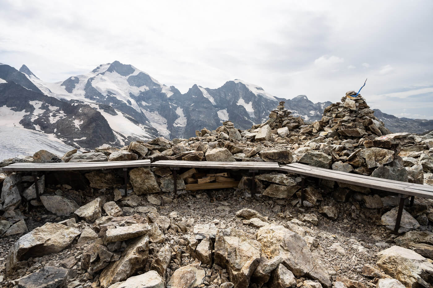
The BBQ area also has some basic benches.
The highest barbecue area in Europe, Sass Queder.
Diavolezza and Munt Pers Photos and Photography Tips
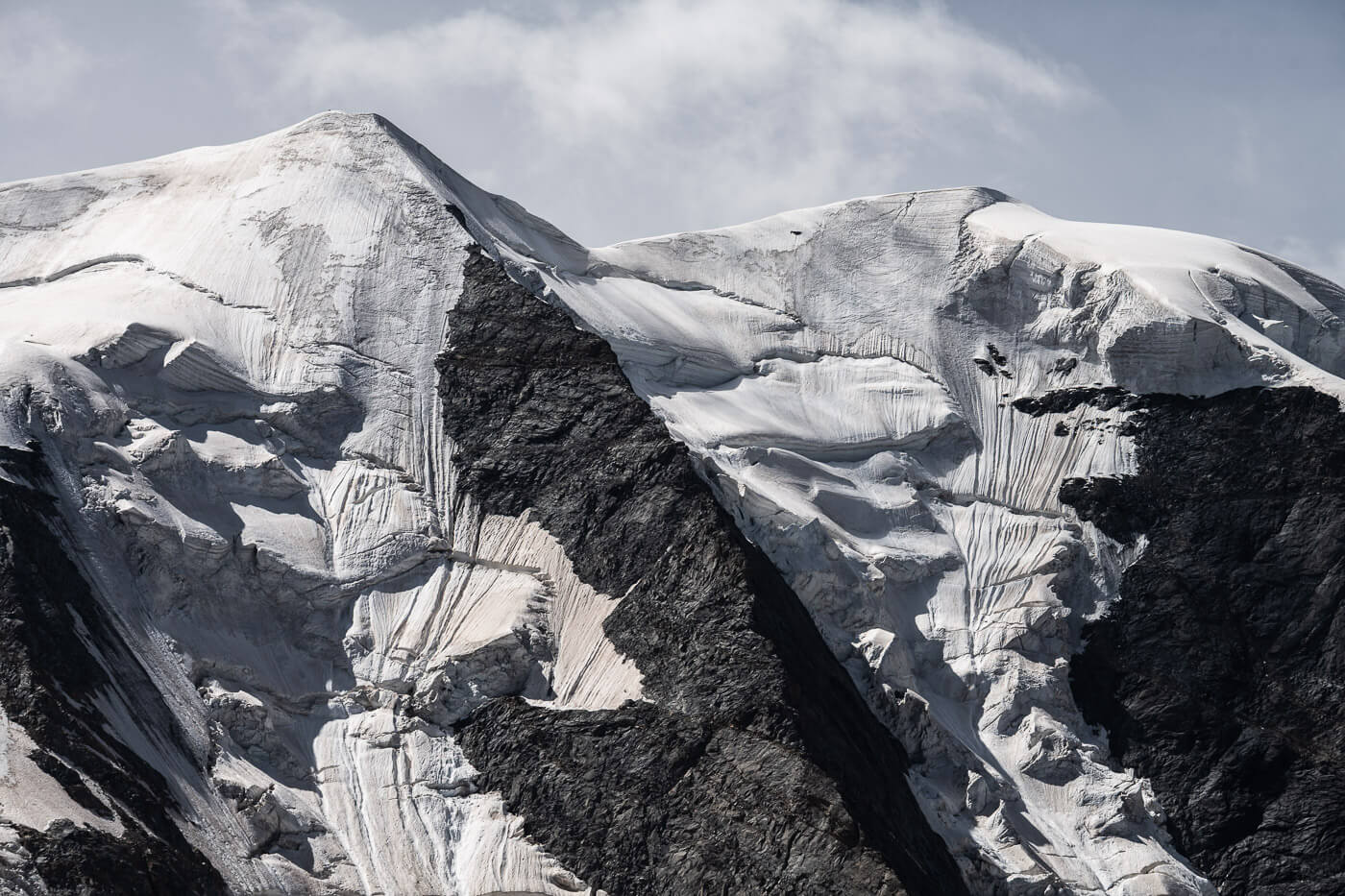
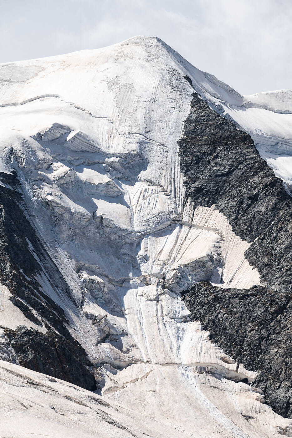
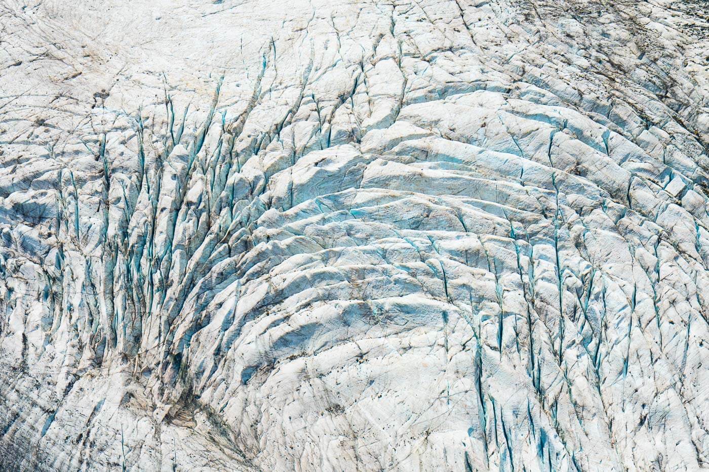
Diavolezza, and the whole area around it, is a place of beauty on different levels, both on a bigger and a smaller scale. The grand landscape is what hits first, but as you look at it, there are plenty of smaller details that pop up here and there.
The same applies to landscape photography here. There’s the wide and then there’s the details. Tons of details. I probably spent more time taking photos with my 70-200 lens and looking for interesting compositions in the virtually endless shapes created by rocks and ice.
On the wide side, you’ll want to capture as much as possible in one frame too. This grand landscape is hard to render without trying to capture its vastness. For that purpose, I went into panorama mode. To give you an idea, the two Panoramas below were created using five vertical frames at 24mm, full frame

Then there are the smaller details, which, as I mentioned earlier, were the most fun to photograph. Bottom line: Do bring a telephoto lens. There are plenty of beautiful details hidden in those mountains and glaciers. This is also a location where it’s fun to include the “human” component, to try and show the scale of the place.
Video of the Hike
Here’s a video of this hike to Diavolezza and Munt Pers. Plenty more glacier views I captured with my telephoto lens. I enjoyed watching them too in detail as I filmed them – hope you’ll enjoy these views too:
Where to stay
There are some guesthouses around the Bernina where you could stay. Also, the Diavolezza Beggasthaus, right there in the mountains, offers plenty of accommodations—book in advance for the busiest summer months.
St. Moritz/Samedan are the closest towns, and both offer plenty of choice for an overnight stay, as well as being good bases for more hikes in the area.
Camping: The Morteratsch campsite is just a short drive away and offers well-equipped facilities. If you prefer to spend the night on the pass, you can only do so in the dedicated spaces next to the Diavolezza cable car station. Here you can choose between two different parking spaces. A more expensive gravel parking, mostly flat(-ish), with electric hookups and a paved parking area slightly sloping. It isn’t very cheap considering there are only basic toilets and showers, but it is a prime location.
Additional Resources
- The shorter, easier hike to the Morteratsch glacier is worth a stop if you are coming from the direction of St. Moritz.
- If you are on the Bernina pass and are considering a trip to Italy, then also consider a hike to Ghiacciaio Fellaria. It’s another epic hike with spectacular glacier views on the Italian side of the Bernina group. That’s also what I did after this hike.
- For a comprehensive overview of Hikes in Switzerland, check out my main Switzerland page.


Leave A Comment