Hike to the Gígjökull Glacier, Iceland
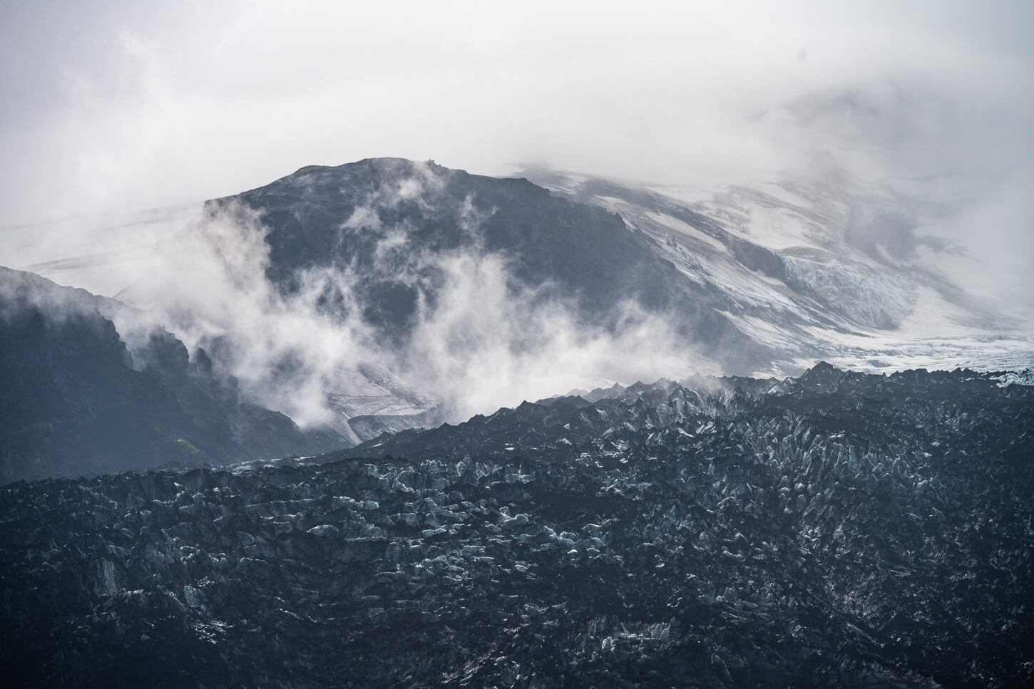
Gígjökull is an outlet of the Eyjafjallajökull glacier in southern Iceland, and it’s possible to visit it with a short hike. While it may not be the most beautiful glacier in the area, it is a rather unique and recognizable one, as it forms an almost vertical Icefall that is extremely impressive to see.
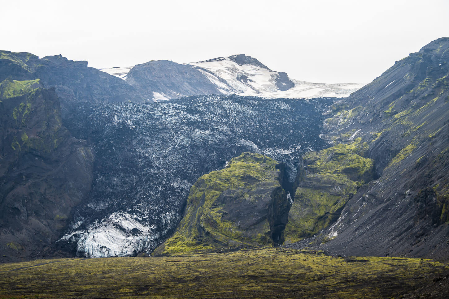
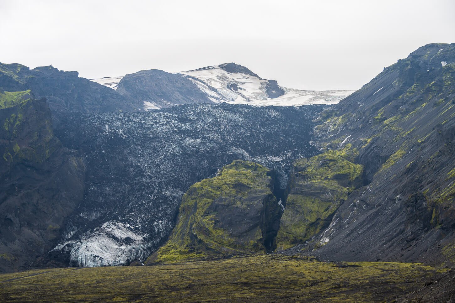
Gígjökull Glacier
Gígjökull is also surrounded by large moraines, which are up to 70 meters high, and the glacier is still partly covered in ashes from the 2021 Eyjafjallajökull eruption. During that event, the lava also partly flowed under the glacier, creating a tunnel. It’s a very dynamic environment nowadays, too, with several water streams coming out of the glacier.
While getting there is a bit tricky to visit, due to it being located on road F-249, the hike is quite easy, and well worth the relatively short time, if you either like glaciers, volcanoes, or unique and unusual landscapes.
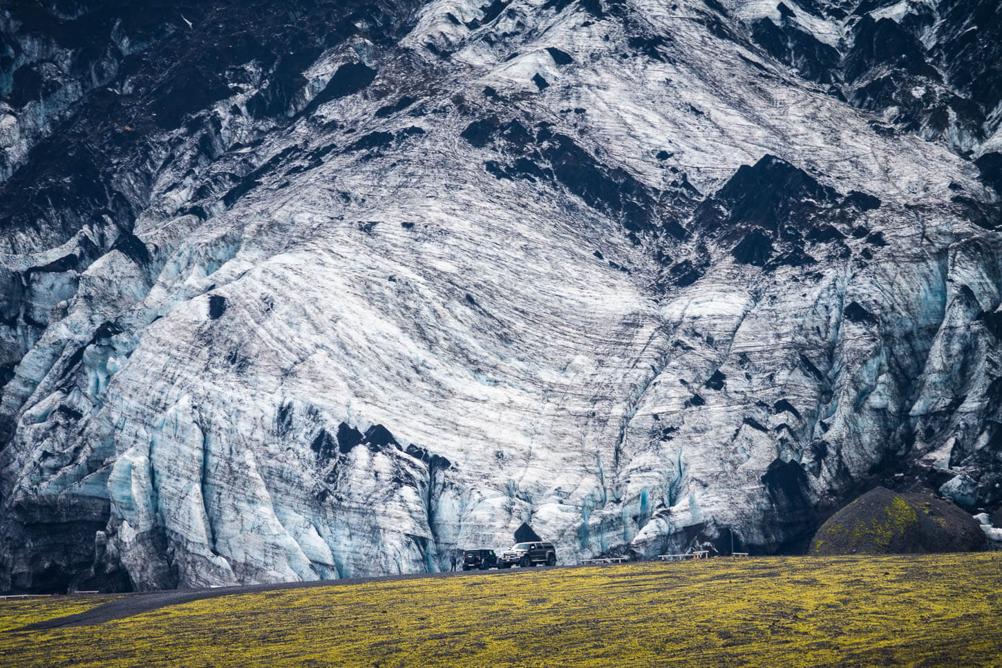
Table of Contents
Overview of the Hike to the Gígjökull Glacier & Map
There actually are two different access roads to the Gígjökull glacier:
- One that leads to the trailhead of a longer out-and-back hike, accessible with most cars suitable for f-roads, provided
- Another one, which is only accessible with a larger 4WD car and leads almost all the way to the glacier, which cuts off the trail mentioned above.
See the next section for the details on how to get to each. Here, I’ll talk about the longer trail, which is a rather easy walk on the moraine south of the glacier.
| Max Altitude | 230m |
|---|---|
| Distance | 3.88 KM |
| Elevation gain | 130m ↑ / 130m ↓ |
| Hike time | 00:45/ 01:150 Hours |
| Hike Difficulty | Easy |
Here is the map of the hike. You can download the GXP file for free from the activity linked below.
How to get to the Gígjökull Glacier trailhead and Parking
Located on road F-249, it’s only possible to reach the trailhead with a vehicle approved for F-road and allowed on road F-249, as some companies do not allow their cars to be driven on that road. So, check that if you want to head there, also be aware that there are 3/4 river crossings, and the last one may be trickier to navigate. Always keep in mind that usually no insurance covers damage caused while crossing a river.
- Driving Directions: From the ring road, turn onto the road to Seljalandsfoss, then continue following the road, instead of turning into the parking area. After about 45 minutes from Seljalandsfoss, you should see the glacier and a dirt track to your right, leading to the base of the moraine next to the glacier.
- Parking: The parking area and the trailhead are here. The other parking area, below the glacier, is here.
- Public Transport: none, but there are some private superjeep day-tours to Thórsmörk that stop here.
The trailhead.
The Gígjökull Glacier Hiking Trail
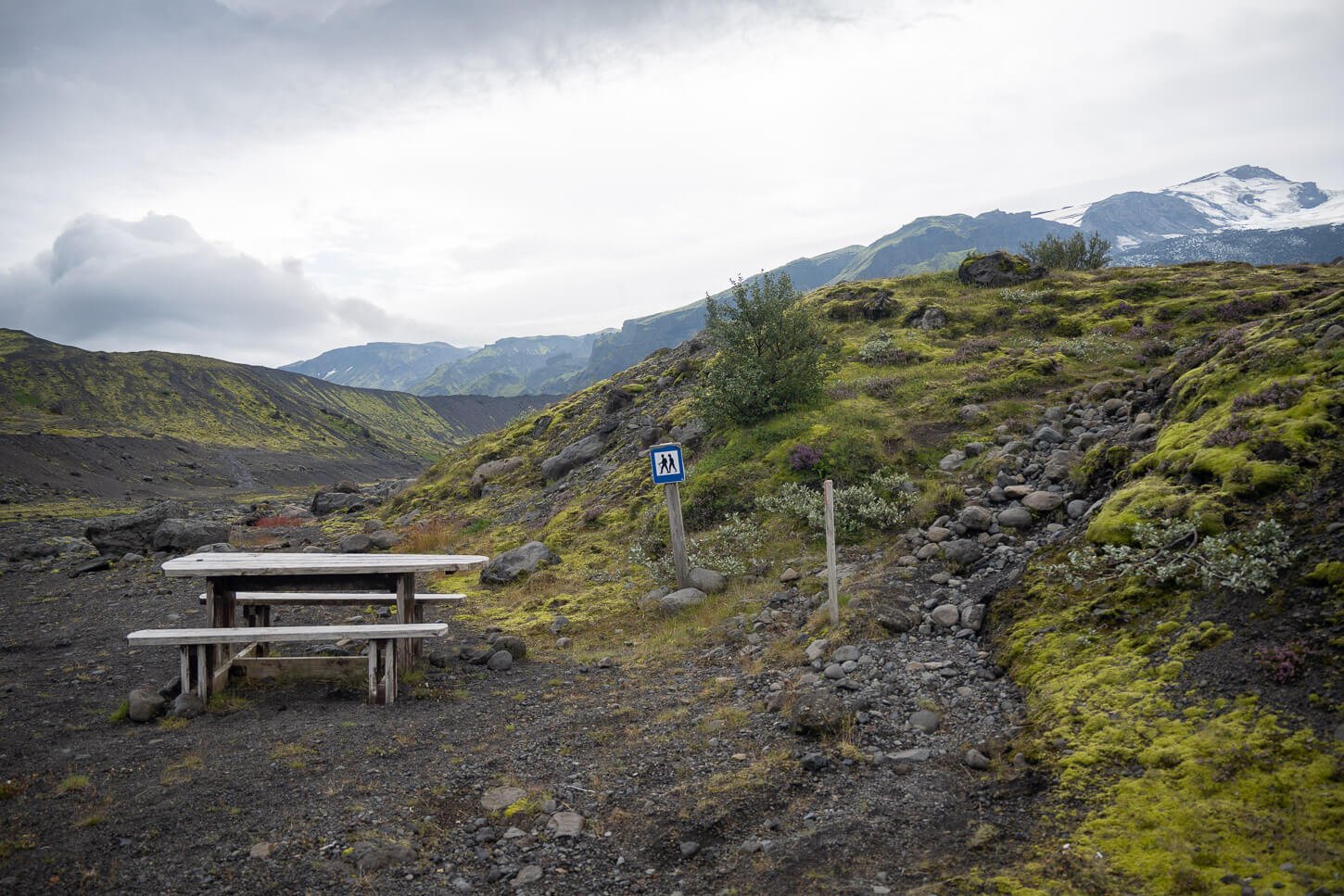
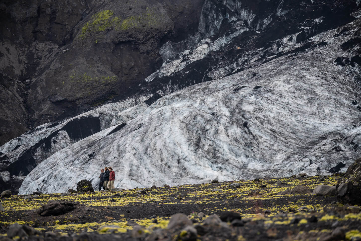
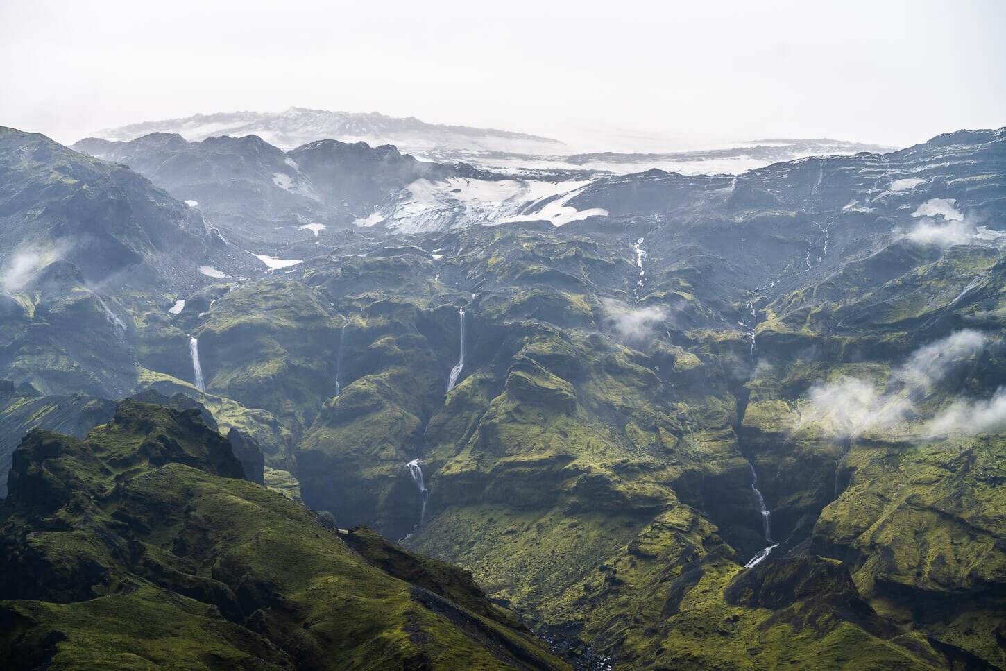
From the parking/picnic area, a well-marked trail leads first around and on the side of the moraine. From there, it continues to follow the moraine, with the glacier right in front of you. Looking at the glacier, it’s as if you’d expect it to fall and crumble to pieces anytime. The view is great even from afar, and it gets better as you get closer.
Another interesting feature visible from this trail, is a gigantic boulder split in two. you can see it in the two images below, on the right hand side. It constantly boggled my mind thinking what kinf of forces or events could have caused this. But again, we’re both in a glacial and volcanic landscape so it’s a very dynamic environment.
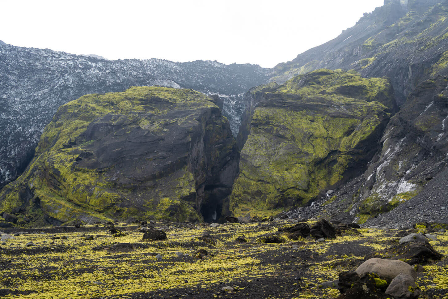
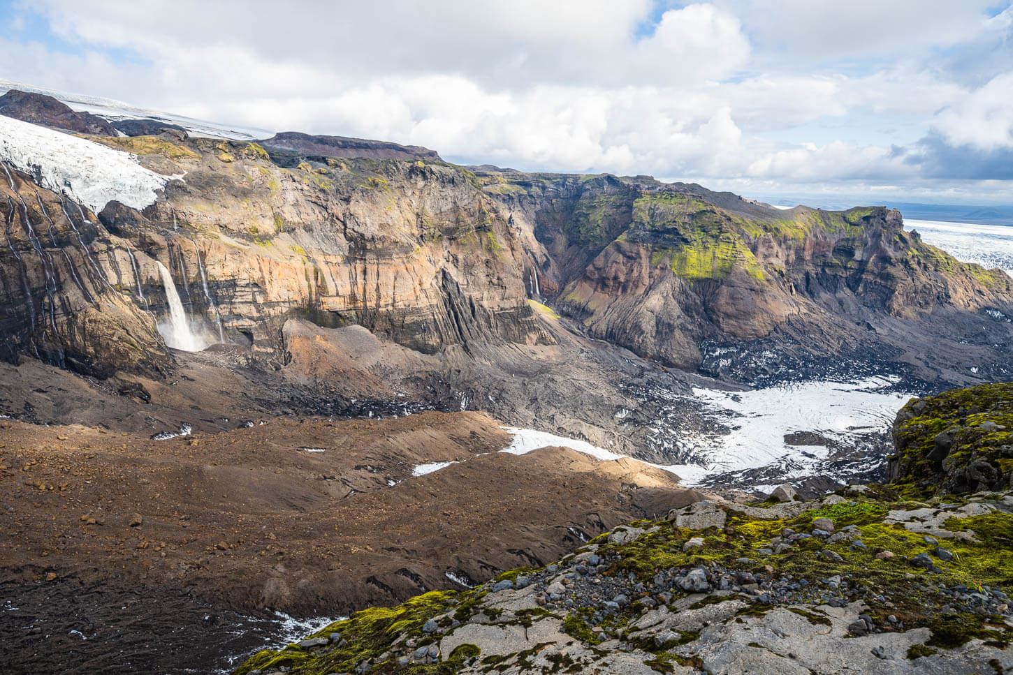
View from the trail toward the glacier, with a gigantic boulder split in two just below the glacier.
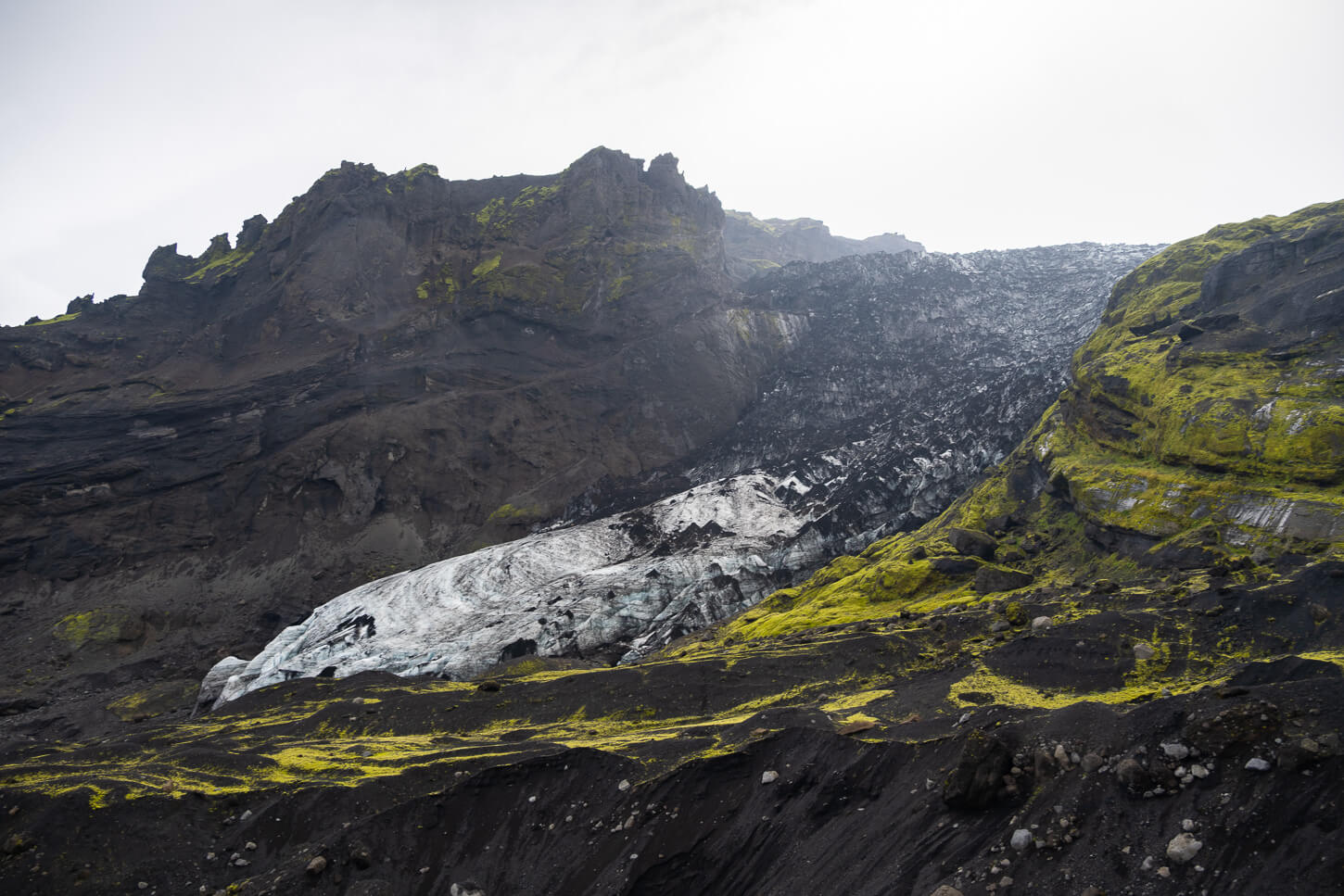
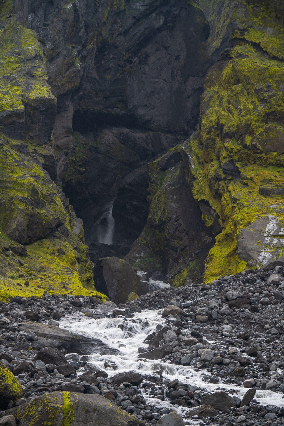
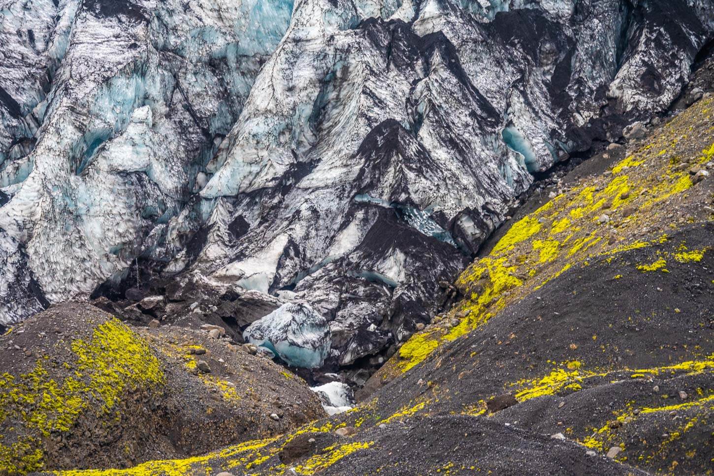
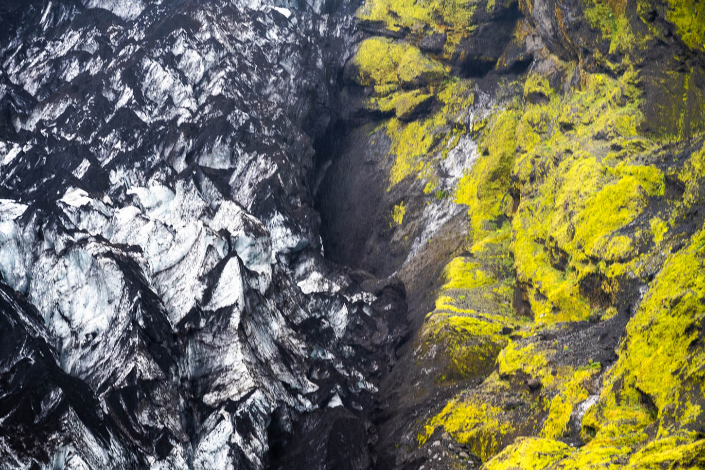
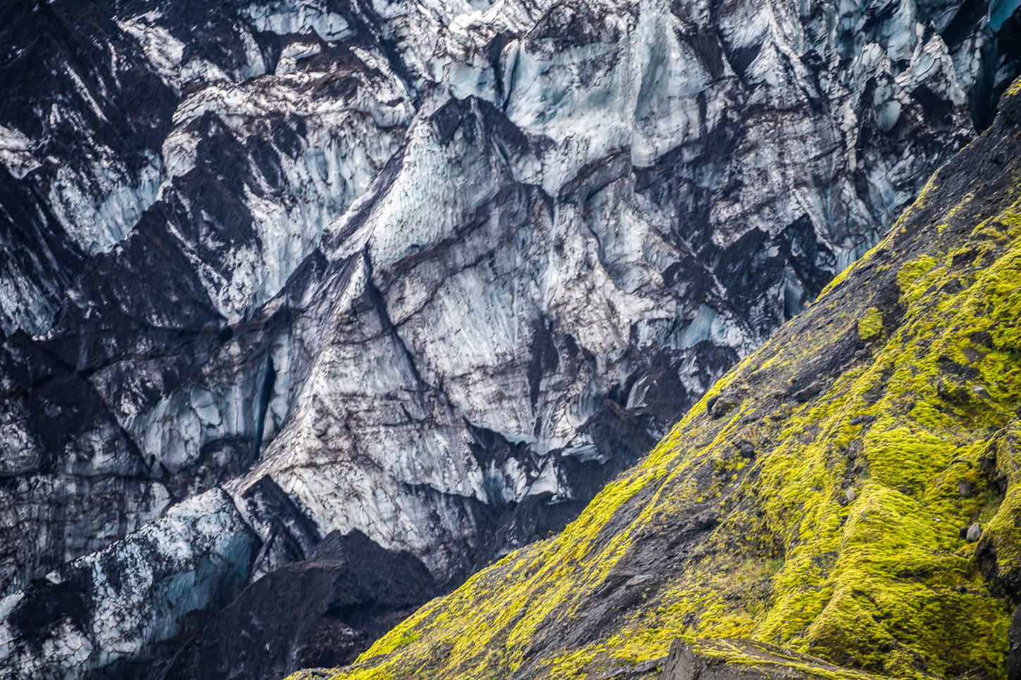
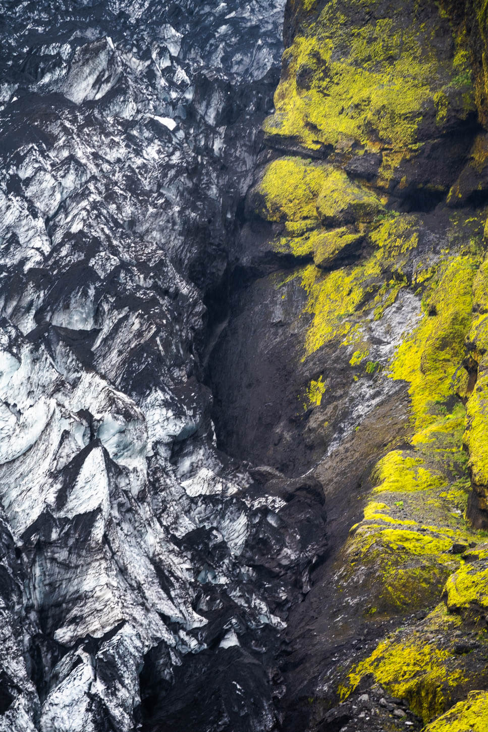
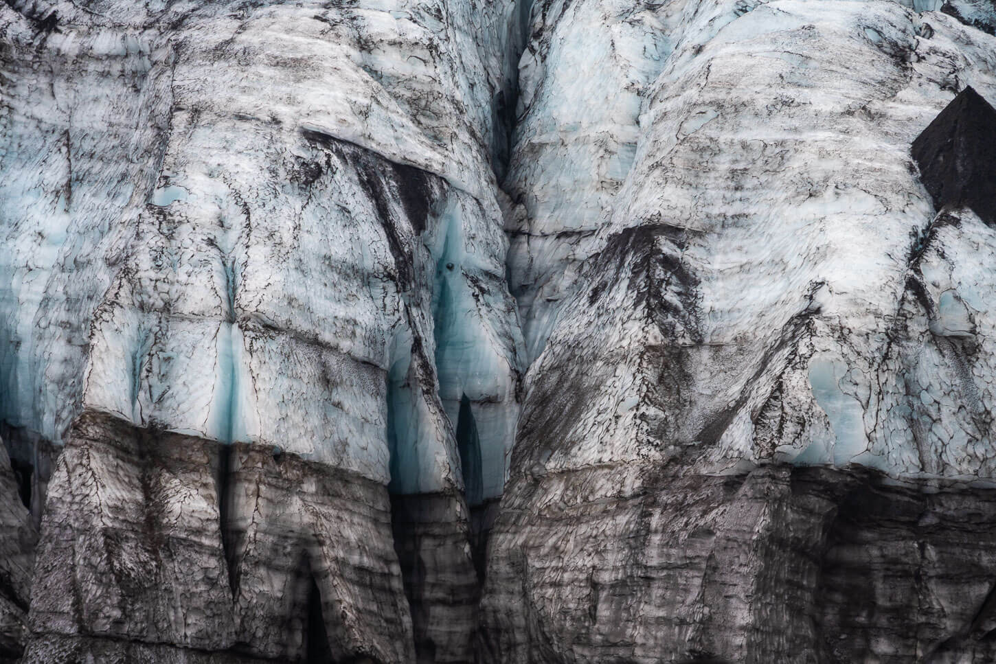
As you approach the glacier front, more and more details jump to the eye. The fine volcanic dust covering the glacier, all the little cracks and textures of the glacier surface, waterfalls hidden behind rocks, streams of water coming out from under the glacier, or all the various rocks covered in green moss around it.
The trail is easy to follow all the way to the sand banks in front of the glacier. There, you can almost feel as if the landscape is alive. It is almost intimidating seeing such a huge wall of ice, so close, right in front of you. Even more so with the raging meltwater coming right out from under the glacier, as if pouring out of nowhere
And, if from afar you’d have the impression that the glacier could crumble at any time, once you’re that close, you could feel how dynamic this environment really is
Gígjökull Glacier Photos and Photography Tips
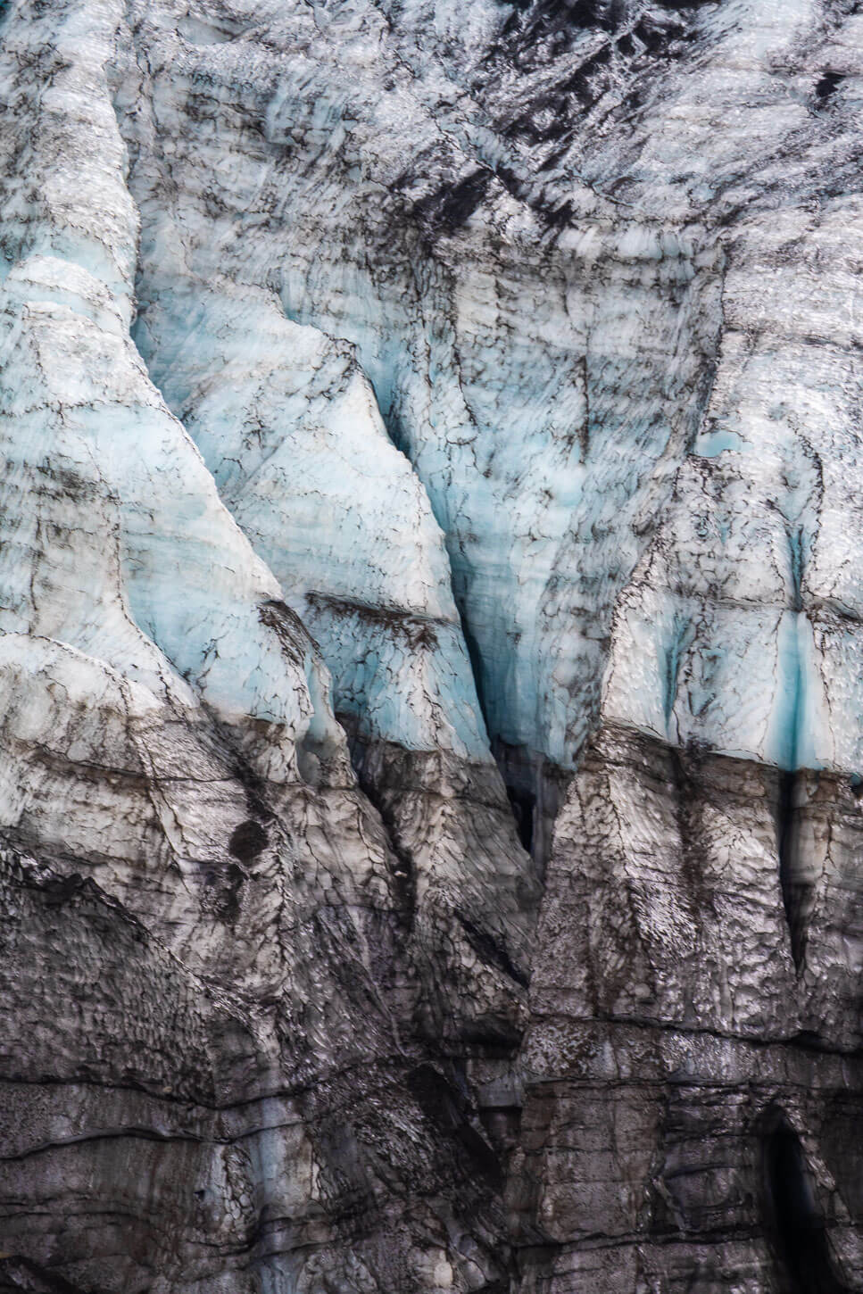
To be quite honest, the Gígjökull Glacier isn’t the prettiest in the area for landscape photography. While it sure makes an impression when you see it, it being covered in dark ashes kind of blends it in with the surrounding landscape. Due to this, it kind of loses all of its details and colors you can see when you are on the trail and close to it.
On the other hand, a longer telephoto lens opens up a completely different world. With longer focal lengths, you can isolate and better capture the intricate textures of the glacier itself: deep crevasses, blue-white ice formations, and abstract patterns created by sediment and meltwater. This range is also ideal for capturing the rich details of the surrounding landscape—the waterfalls that cascade down the adjacent cliffs, and subtle atmospheric changes like mist, clouds, and shifting light.
On this occasion, I had a Nikkor Z 28-400mm with me, and in the end, I spent most of the time shooting in the 180 to 400mm range. Isolating all the small details was quite fun, ans well as just looking at them through the viewfinder.
In that sense, there’s plenty to photograph and discover through the lens. All the smaller details in the landscape become features themselves, and there are many. So definitely, bring you longest lens, and you’ll have fun capturing all the finer details of the glacier and around it.
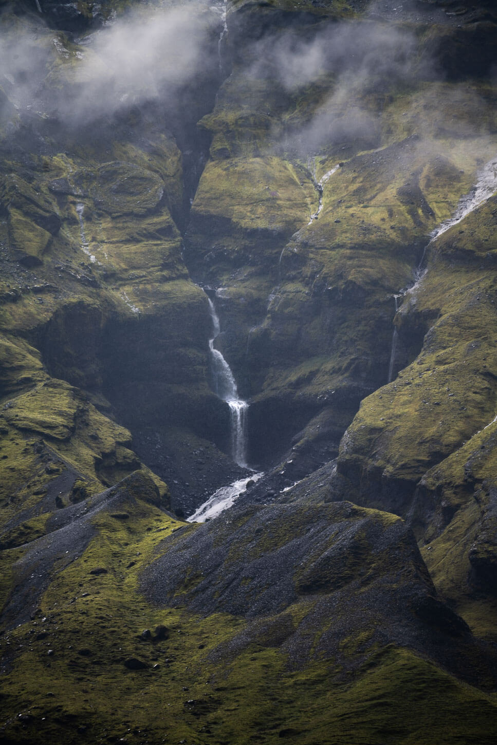
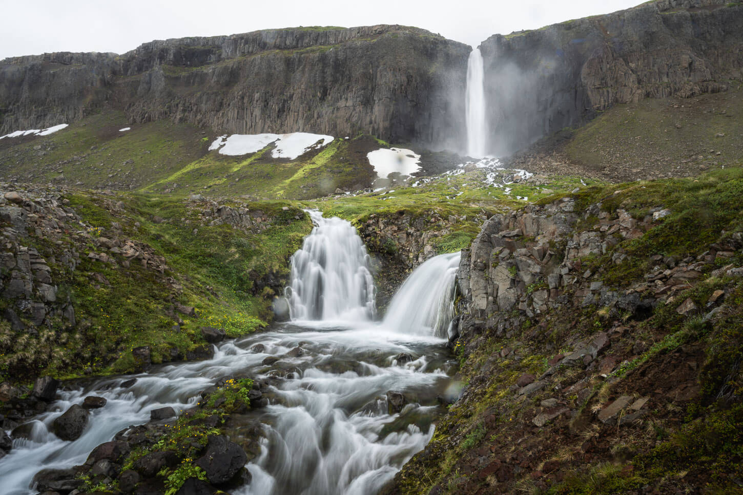
One of the many waterfalls in the surroundings of the glacier.
Where to stay
Be careful when looking for accommodations in the area, as sometimes Volcano Huts comes up as a suggestion. However, you can only get there by crossing the Krossá river, which is an extremely dangerous river to cross, and that should be avoided in a rental car.
There are a few guesthouses near the southern part of road 249; however, most of the accommodations in the area are around the town of Hvolsvöllur. Though not fancy, it’s quite a good town to stay for a night or two as a base to explore trails in the area.
Additional Resources
- Discover more Hikes in Iceland here.
- Here is an interesting read and some facts about Gígjökull.


Leave A Comment