Stellisee Viewpoint and the Five Lakes Hike, Zermatt, Switzerland
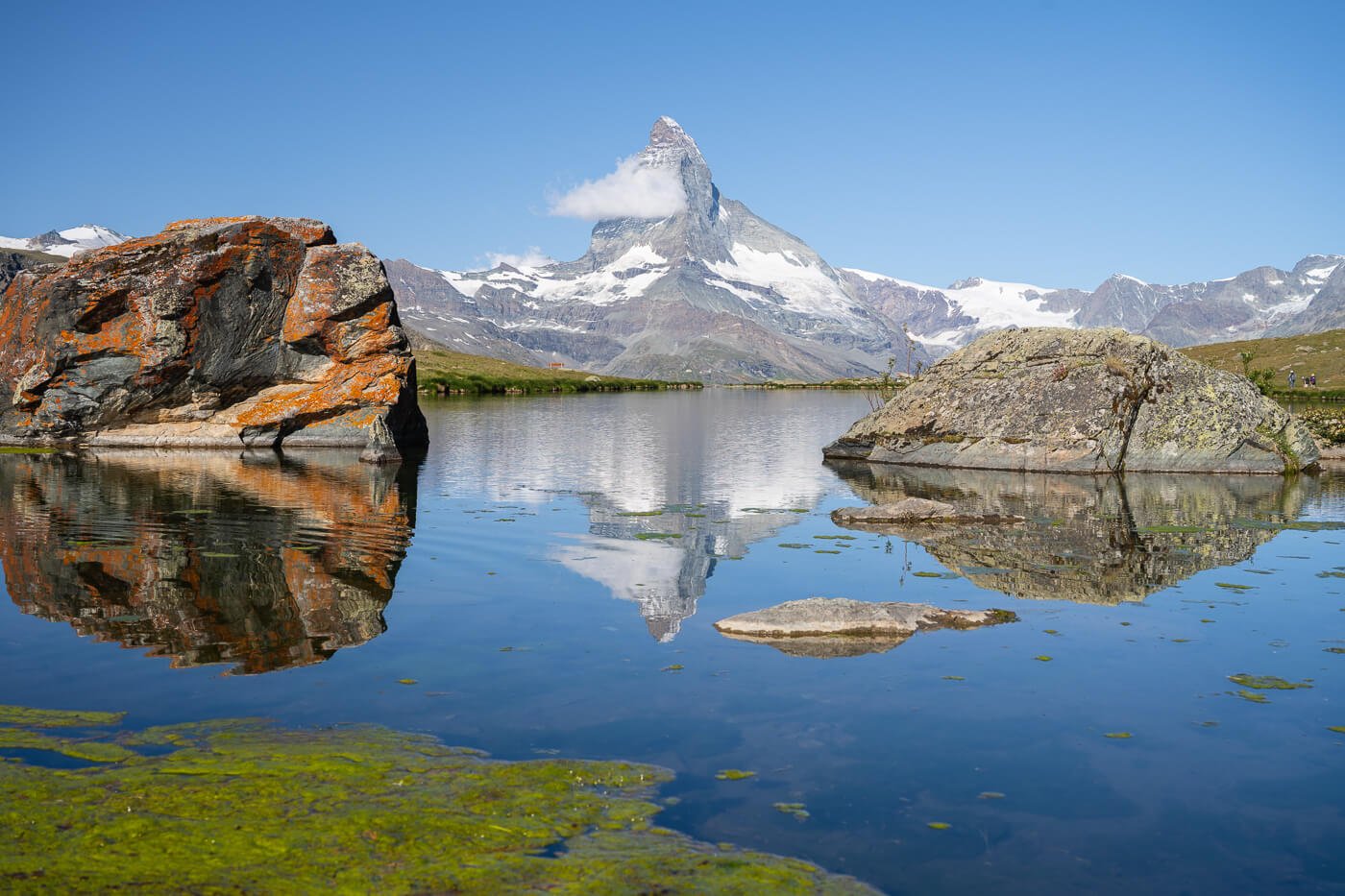
The hike to Stellisee and the five lakes is one of the most popular in Zermatt, even just for the iconic view of the Matterhorn reflecting in the little Lake called Stellisee. It is probably one of the most popular views in Switzerland, and it’s easy to see why.
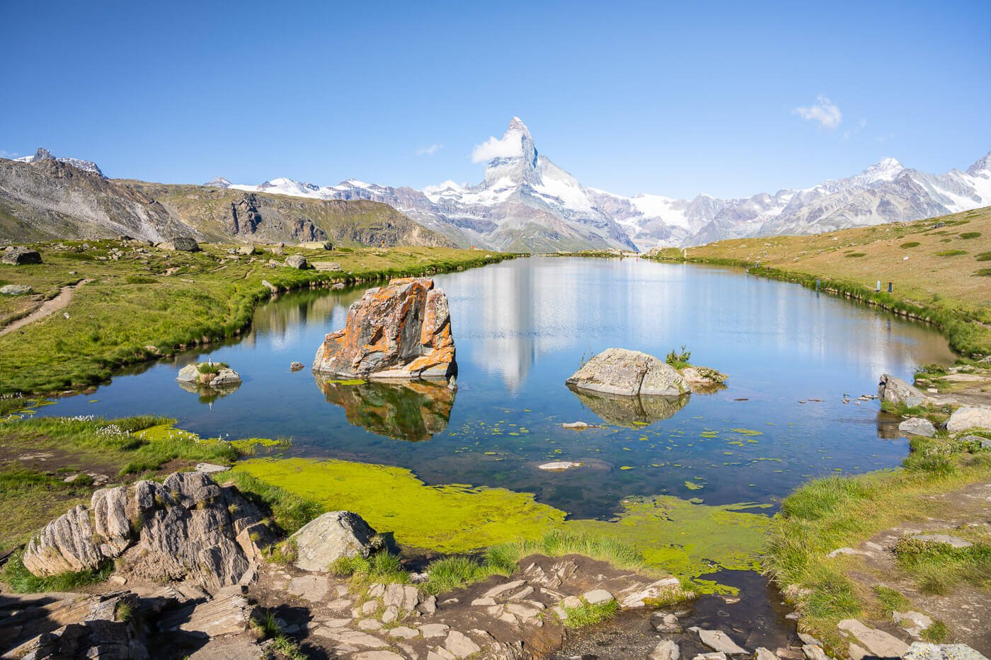
Stellisee with the Matterhorn in the background.
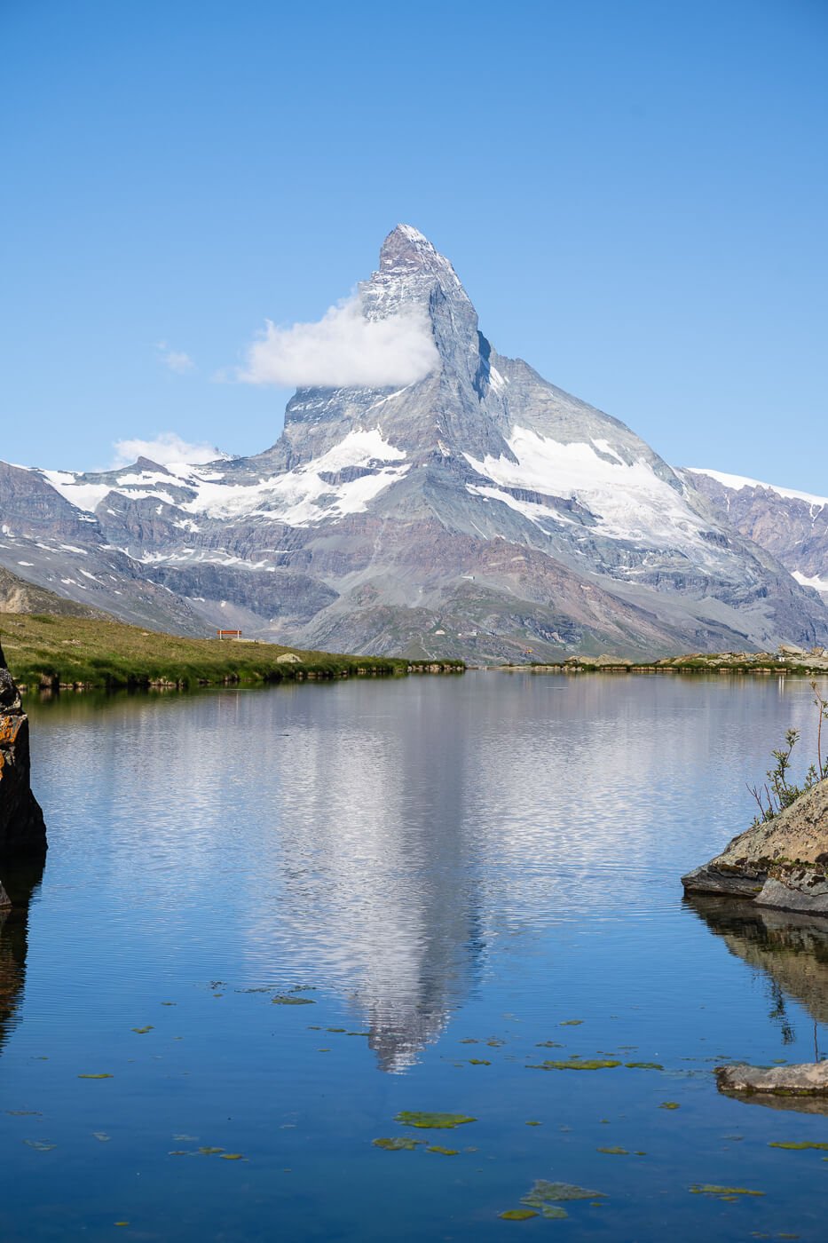
This view is not only beautiful in photos, but it is a mighty view in person, too. Seeing the unmistakable shape of such a beautiful mountain like the Matterhorn emerging from the horizon and reflecting into the lake is a unique sight.
Lake Stellisee is at an altitude of 2’537 m and you can only hike there. The hike from the Blauherd gondola station is quite easy, and that helps with the popularity of the place. If you are in Zermatt or are planning to visit during your stay, Stellisee is one of the must-see locations.
It is also part of another very popular hiking trail, the so-called five lakes hike, or 5 Seen Wanderung in German. Along this trail, you’ll find four more alpine lakes. Three actually, since one of them is a reservoir, but with stunning turquoise waters.
Table of Contents
Overview of the Stellisee and the Five Lakes Hike & Map
There are three main options to get to Stellisee and do the five lakes hike. The most common is taking the Zermatt-Sunnega funicular and then the Blauherd cable car. The other option is to hike directly from the Sunnega Mountain station to Blathered and then Stellisee, while the third option would be to hike directly from Zermatt. The latter would only be worth it if you want to avoid the Funicular and Cable car, but it does not add much in terms of landscape, and it does add a considerable amount of elevation gain on a relatively short hike.
The most common ticket is the Five Lakes Walk / Flower Trail Combi-ticket. This ticket includes the funicular and cable car up to Blauherd, and the return trip from Sunnega. This is the same one I bought.
| Max Altitude | 2,537 m |
|---|---|
| Distance | 9,45 KM |
| Elevation gain | 210m ↑ / 520m ↓ |
| Hike time | 02:30/ 03:00 Hours |
| Hike Difficulty | Moderate |
Here is the map of the hike; you can download the GXP file for free from the activity linked below, should you wish to do so.
How to get to the Stellisee and Five Lakes Trailhead and Parking
Driving to Zermatt is not possible, as it is a car-free village. To get there, you will need to park your car in Täsch and take the train to Zermatt. The train ride takes less than 20 minutes.
- Driving Directions: If you are coming from the North or the West (Bern or Zurich, for instance), you may need to rely on trains to transport your car for part of the way. This would happen if you are driving through Kandersteg or Realp. The train is not free, but if you plan ahead of time, it will save you fuel and driving time. In summer, you can also choose to drive through the mountain passes instead, i.e., the Furkapass or the Grimselpass. If you are coming from Lausanne or Geneva, you can drive via regular roads. Regardless of the road you take, you will then have to park your car in Täsch and take the train to Zermatt.
- Parking: any of the (paid) parking stations in Tasch. Ideally, you may want to park at the Matterhorn Terminal Tasch station, which can also be booked in advance. It’s the closest to the train station.
- Public Transport: You can get to Zermatt by train from pretty much anywhere in Switzerland via scenic train rides. If you enjoy scenic train rides, this is a great option. You can check the timetable on the SBB website.
The Stellisee and Five Lakes Hiking Trail
From the Blauherd cable car station, look for the 5-seenweg trail signs, not to end up on the wrong trail as I did a couple of times. You have to look for the “heart” viewpoint, a wooden heart that frames the Matterhorn. A dirt road leads to it. Take that road, and shortly after, you’ll see a trail to your right, that’s the official trail.
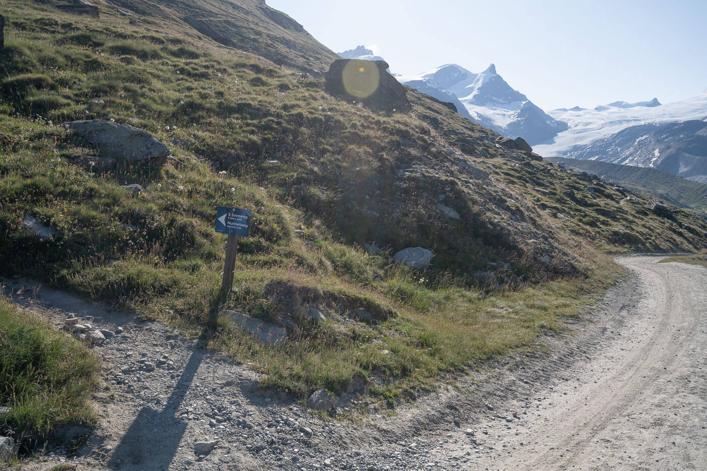
You can walk on the dirt road to the lake, too, if you prefer. There’s not much of a difference. Regardless of which road/trail you take, it would take about twenty minutes to reach the lake. The landscape is extremely scenic right from the start, though. 4,000m mountains, deep valleys, and glaciers almost everywhere you look. And keep an eye out for marmots, there are plenty of them in the area.

The landscape in the area offers plenty of breathtaking views even without the Matterhorn.
Stellisee Viewpoint – one of the best views of the Matterhorn
You’ll first reach Stellisee on the opposite side to the main viewpoint. The lake is small, so it takes just a couple of minutes to walk to the viewpoint on the opposite side. The main viewpoint is just on the shores of the lake, right next to some big boulders. You can easily recognize it by the trampled grass, too.

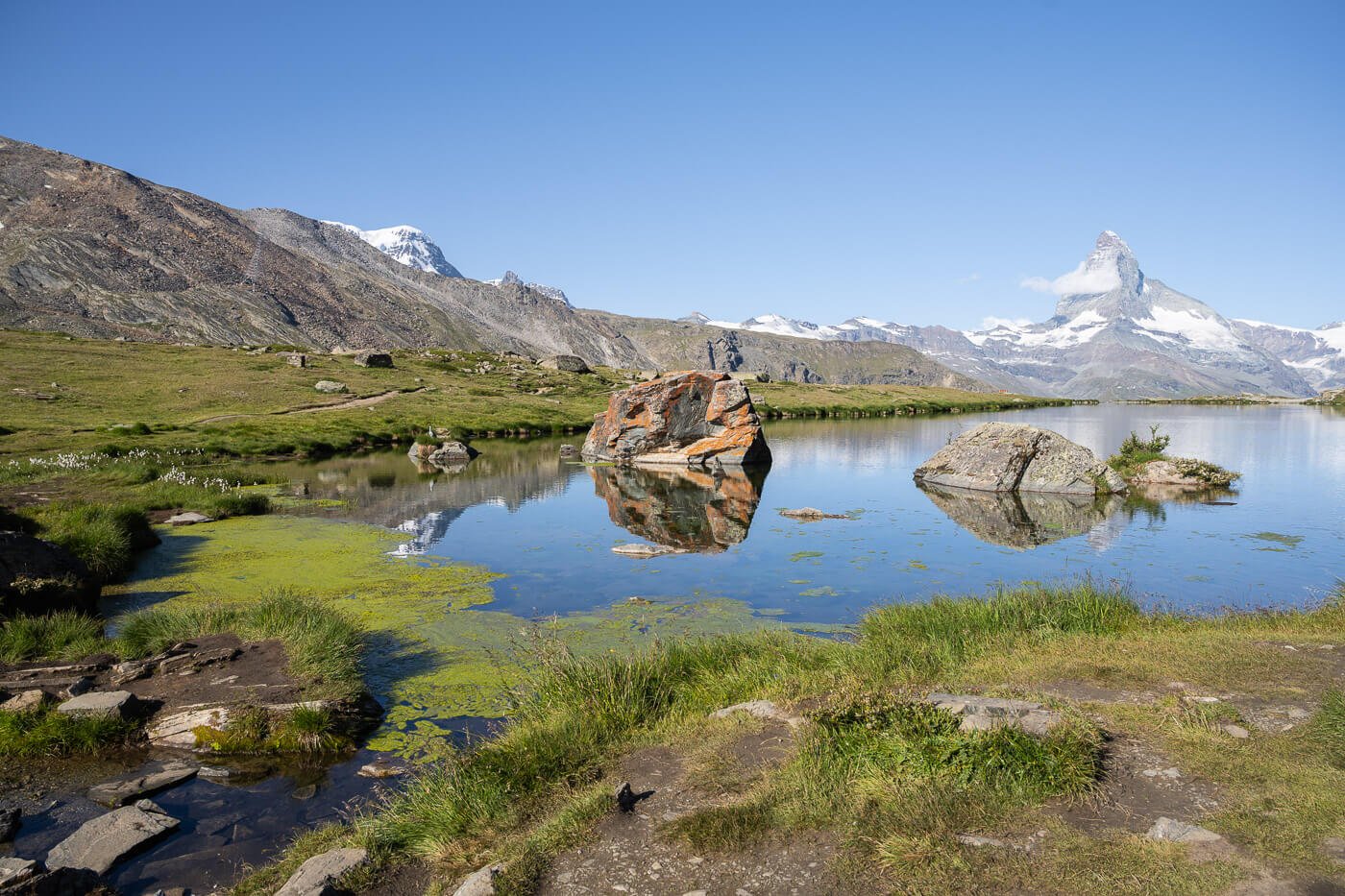
Stellisee viewpoint.
On clear days, the view of the Matterhorn rising above the lake and reflected in its waters is one of the best around Zermatt, along with Gornergrat and Riffelsee. It is a very popular attraction for a good reason; the view is just picture-perfect. And, to be honest, the five lakes hike is worth it just for the view from Stellisee..
On the crowds: it pays to take the first funicular ride up to Sunnega and Blauherd, if you want to enjoy the lake and the views without the crowds or just a few others around.

In the early morning, you have more chances of enjoying the lake without the crowd. Phot taken at 9AM in mid-July, you can see only a few other hikers on the right.
Still, there are plenty of spots around the lake to sit and enjoy the views from the main viewpoint. So even when it’s crowded, you could easily find a place in the area. Also, if you see a heron, that’s been installed in recent years. Yes, installed. It’s a fake heron – still, it makes for some nice pictures.
It’s quite well made, and it fooled me from afar. It wasn’t there on my last visit, and when I saw it, I initially approached it slowly, took a couple of pictures, and then had my “duh!!” moment :).

“Decorative” Heron installed on a rock.

The other lakes, Grindjisee, Grünsee, Moosjisee, and Leisee
There are four other lakes on this trail apart from Stellisee. Some are nicer than others, especially the second one, Grindjisee. But, to be honest, don’t expect anything on the level of Stellisee. Stellisee is one of the most scenic locations, not only around Zermatt, but in the whole of Switzerland, so the other lakes may not feel as scenic in comparison. And, to be fair, what makes Stellisee special is the view of the Matterhorn and the way it reflects it, rather than the lake itself.
With that, back to the trail. From Stellisee, the trail continues mostly downhill, mainly on a gravel road. There are some great views of the valley around Zermatt opening up, so it’s definitely a scenic walk. Most of the trail is either downhill or flat, with only the last stretch, leading back up to Leisee and Sunnega, involving some elevation gain.
Grindjisee
The next lake will be Grindjisee. As I mentioned, I think it’s the nicest lake. A lake with green waters, surrounded by larches. You can walk all around the lake, and it offers several different viewpoints. A bit hidden from the grand views around, but on the other hand, it’s a beautiful, natural lake.

Grindjisee

Grünsee
Grünsee is the “middle” lake, a lake with a slight green tint, hence the name Grünsee – Green lake.

Grünsee

Moosjisee
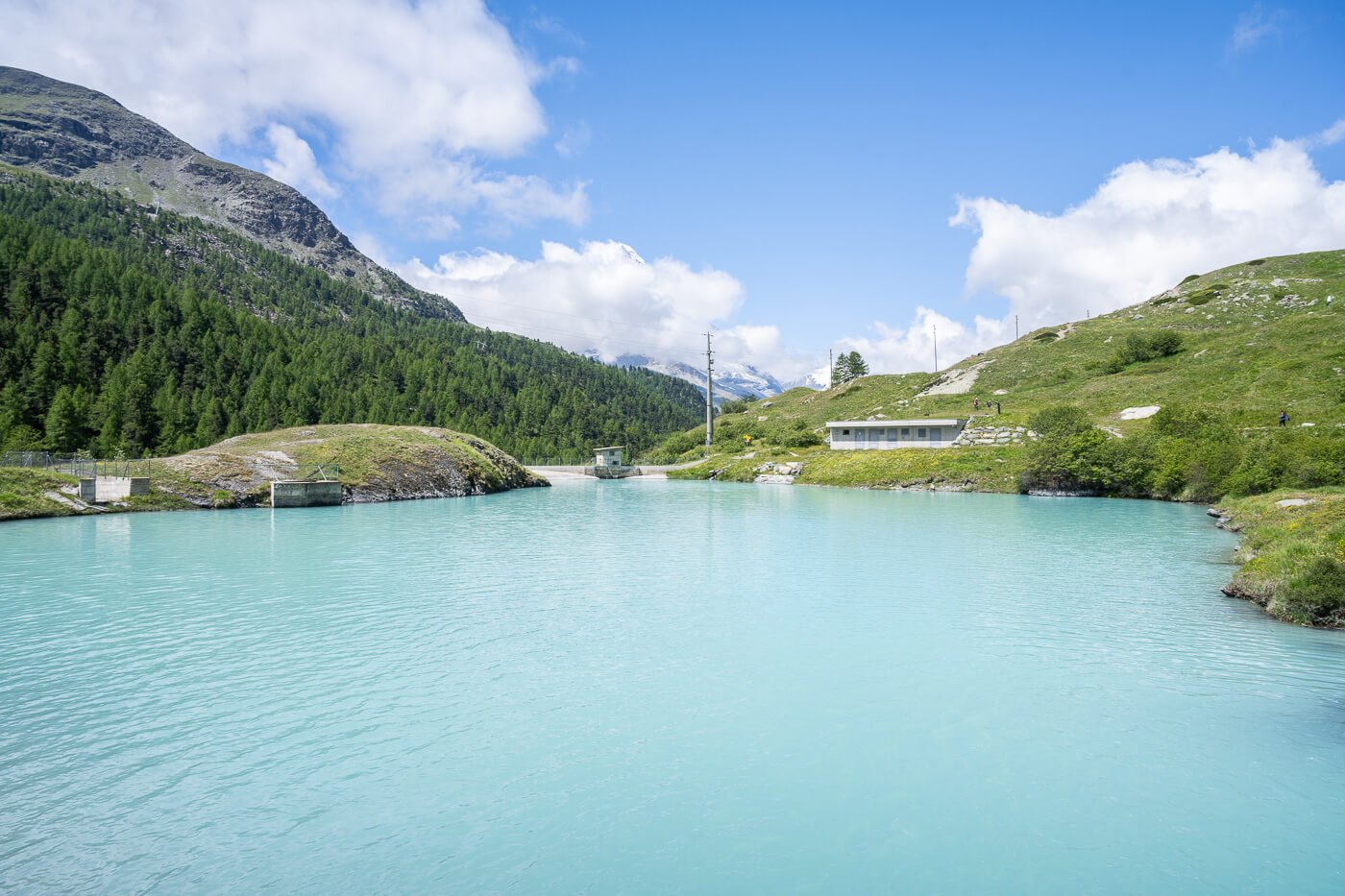
Moosjisee is a reservoir and has by far the most beautiful color of all the lakes on this trail, due to the glacial sediment in it. The turquoise color is truly beautiful and really shines. It is also quite nice to see from afar; it will surely catch your eye early in the hike, as you descend from Stellisee.
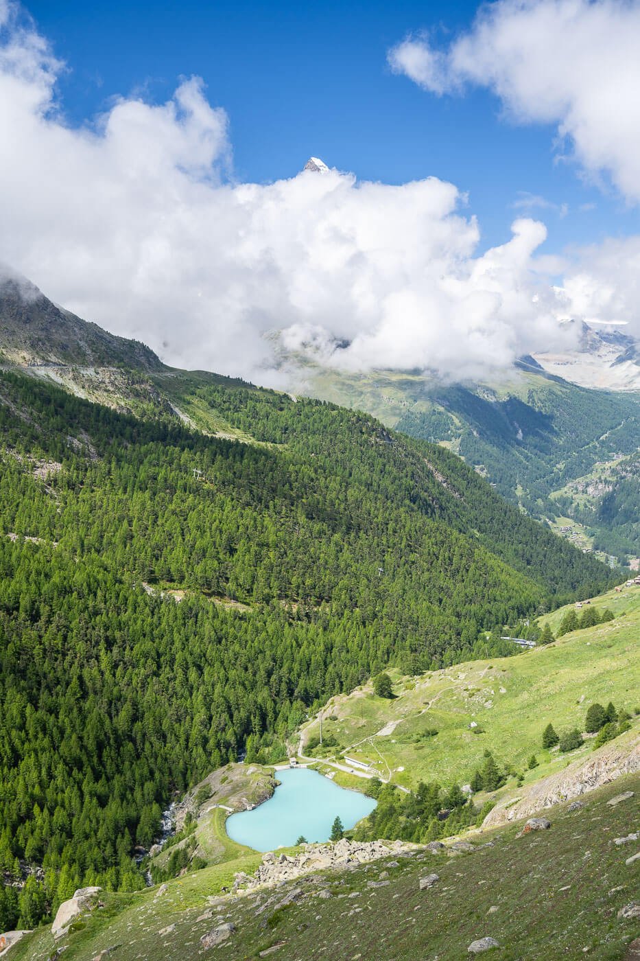
Moosjisee, view from the trail. The Matterhorn is in the background, partially hidden by the clouds.

Leisee
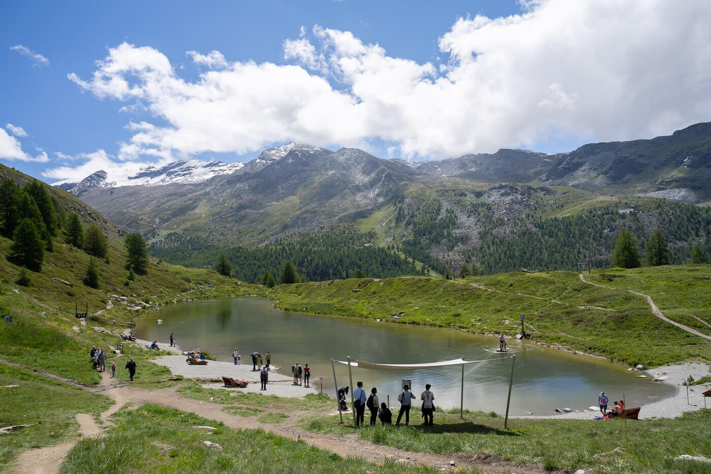
Leisee, the last lake on this hike, is more of a recreational spot. Next to the Sunnega funicular station, you can enjoy the lake here, have a picnic or just relax and enjoy the views. While it tends to be rather crowded, along with Stellisee, it is probably the lake that offers the best views of the Matterhorn.
It’s also a good place to rest and soak in the views for a little longer before taking the funicular back to Zermatt.

Leisee
Stellisee and the Five Lakes Hike Photos and Photography Tips
Now onto the photography part; if you want to enjoy the lake and capture it without the crowds, it’s best to take the first ride up to Blauherd in the morning. At that time of day, you may still find a few people around, but it will be manageable. A couple of hours later, and up until mid-afternoon, it will be quite crowded.
From the main viewpoint, you will be looking at the Eastern face of the Matterhorn, so it catches the light of the morning, which is great if you want to take a photo of the Matterhorn reflecting in the waters of the lake. That, assuming it is a windless day.


Getting up there in the morning, especially in summer, is also better if the weather is clear. That is because clouds are more likely to build up around the Matterhorn as the day progresses, so you’ll have the best chance to capture a visible mountain.
If you are a photographer and want to get the iconic shot of the Matterhorn reflecting into the small lake called Stellisee without doing the whole hike, you can take a Blauherd return ticket. It’s more expensive, but it’s the most time-efficient way to get the shot if that’s what you are after.
If you are after a sunrise/sunset photo, you can consider staying at the Fluhalp hut. It’s a ten-minute walk for Stellisee, and the best option.
The other lakes on the trail are nice, of course, but purely in terms of landscape photography, they are nowhere near as close to Stellisee.
Lastly, all the hptos in this post were taken with a 24-70 mm lens, full frame. Personally, any wider than 24, the Matterhorn would look too small, but there’s probably room to also use a longer lens.
Where to stay
Zermatt would be the obvious choice to stay at, especially for a few days if you have more hikes planned in the area, like Gornergrat and Riffelsee. Täsch is another great option, cheaper than Zermatt, and just a short train ride away – and you need to transit by Täsch, whether you arrive by car or by public transport.
Camping options: you cannot camp at Stellisee or anywhere on the trail, despite several people having posted photos of a tent under the Milky Way. You can, however, camp at the Zermatt campsite – tents only – as well as in Täsch, where you have two campsites for both tents and campers.
Additional Resources
- Do not miss the Gornergrat and Riffelsee hike while in Zermatt.
- For a comprehensive overview of Hikes in Switzerland, check out my main Switzerland page.

Leave A Comment