The Gornergrat and Riffelsee Hike in Zermatt, Valais, Switzerland
The Hike to the Gornergrat and Riffelsee may be the best all-day hike you can do in Zermatt. While Riffelsee may sound like the top attraction on this hike, I guarantee the view from the trail above the Gornergletscher and the Grenzgletscher is breathtaking. Definitely one not to be missed.
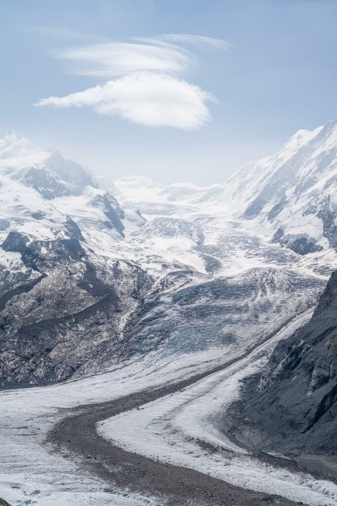
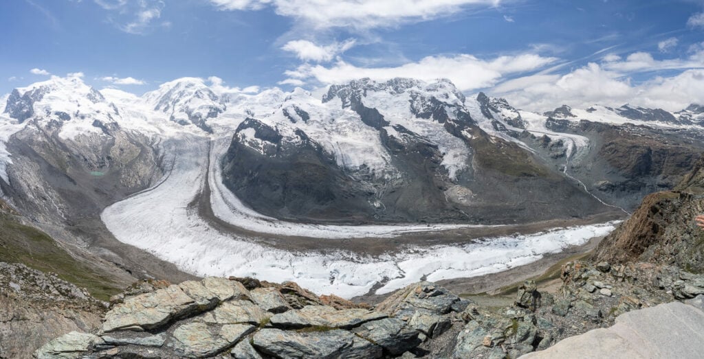
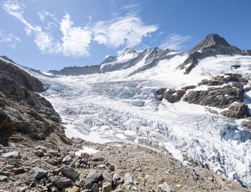
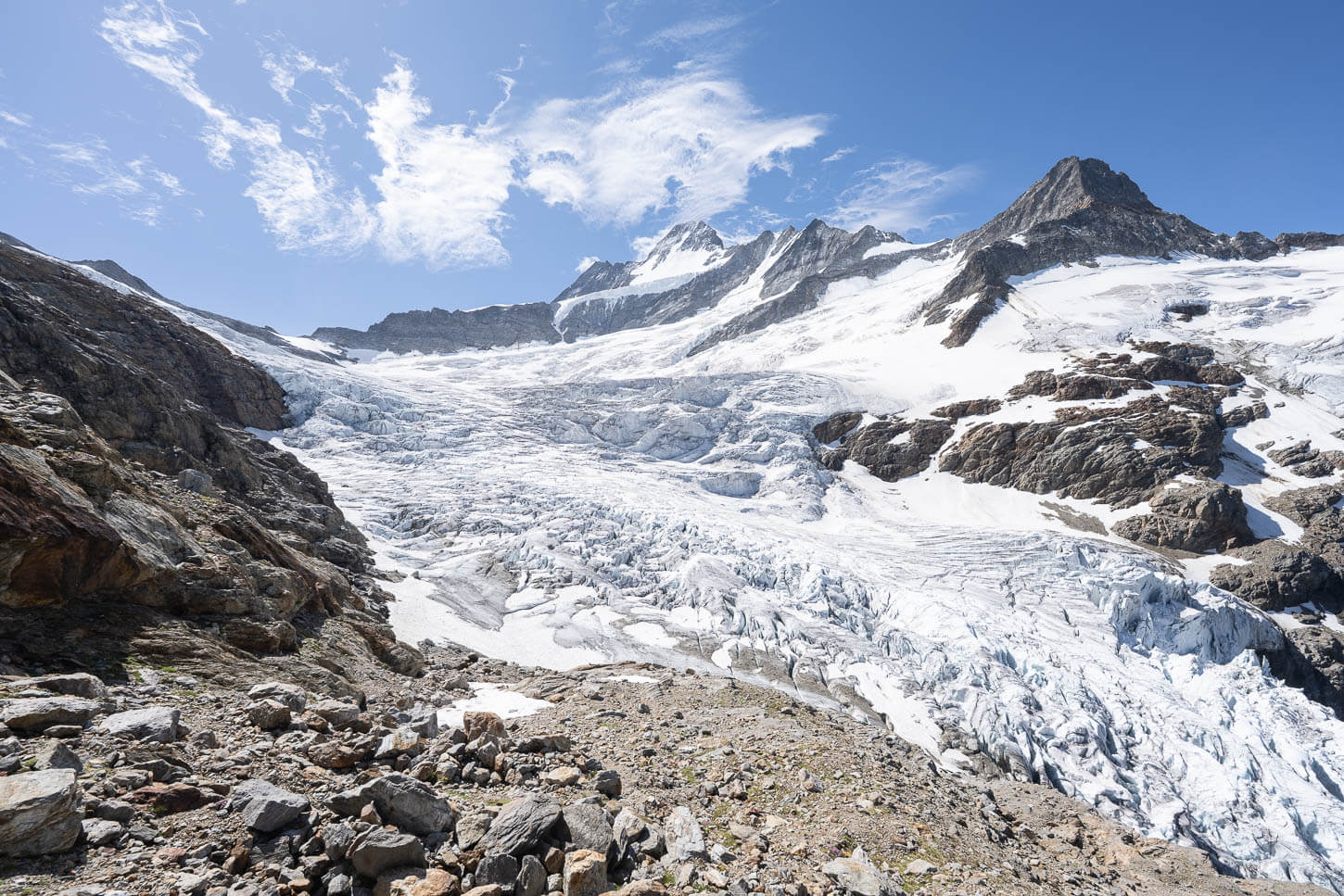
Gornergletscher and the Grenzgletscher, with lenticular cloud topping.
The view of the whole mountain range around it is just insanely beautiful. That, of course, also includes the Matterhorn, the Breithorn, and the Monte Rosa, to name the most prominent peaks. So yes, visit Riffelsee but also not not miss all the stunning glacier and mountain views around it.
The hike from Zermatt all the way up to the Gornergrat is long but not particularly difficult. The total elevation gain is quite important (1,600m or 1 mile), but any fit hiker should be able to do it. Alternatively, you could either take the train to one of the middle stations and hike from there. You could also take the train all the way to the Gornergrat station and hike to the glacier observation deck and Riffelsee from there. Read on for the details.
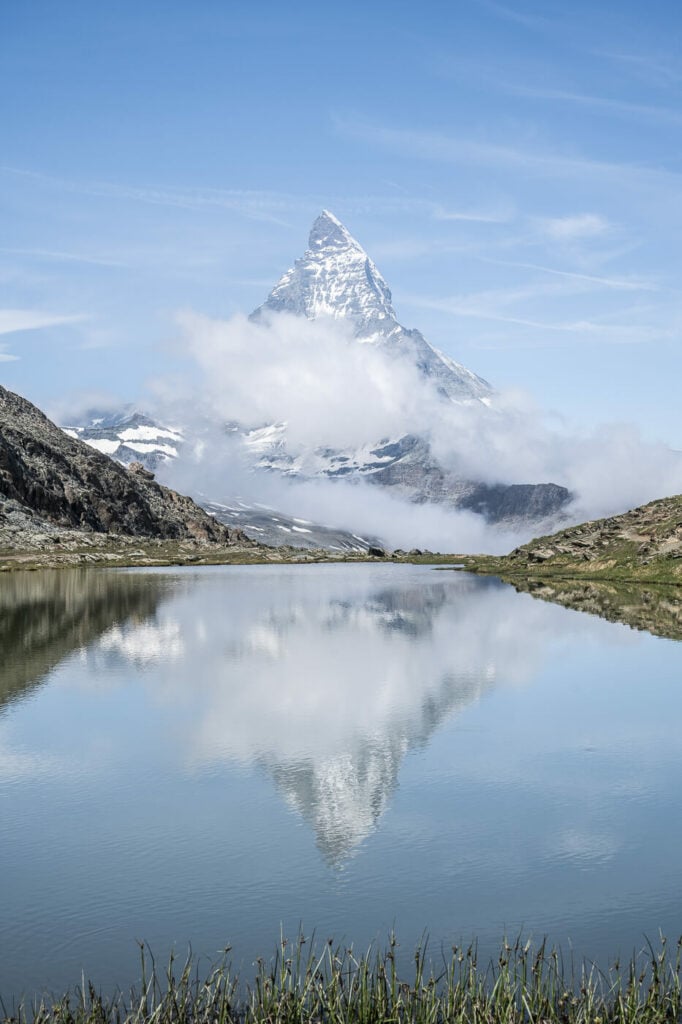
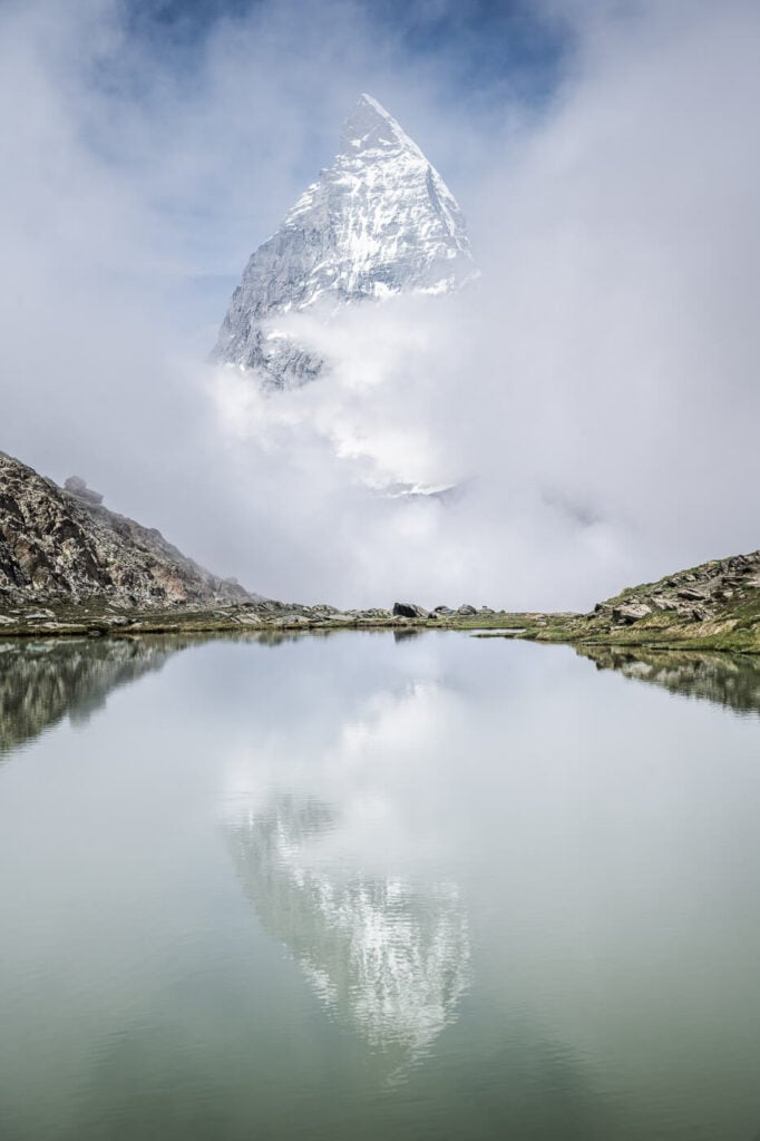
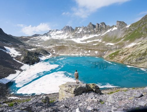
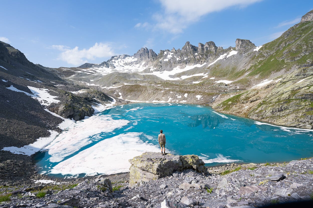
The Matterhorn mirroring into the Riffelsee
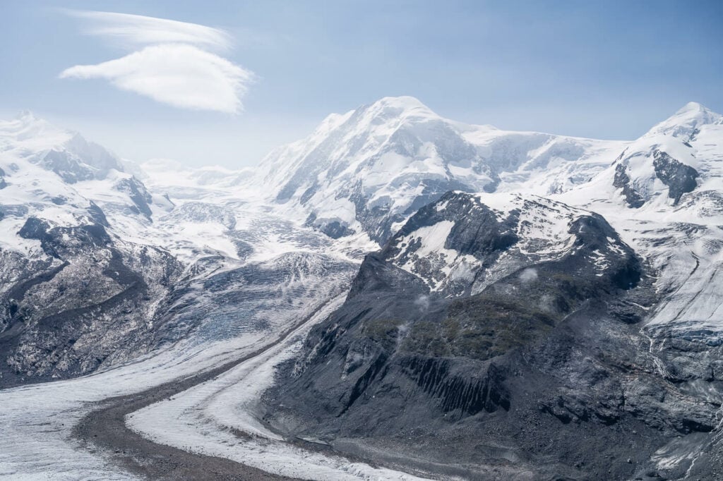
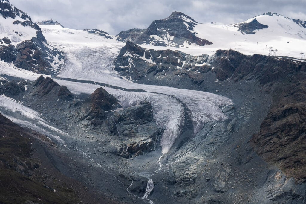
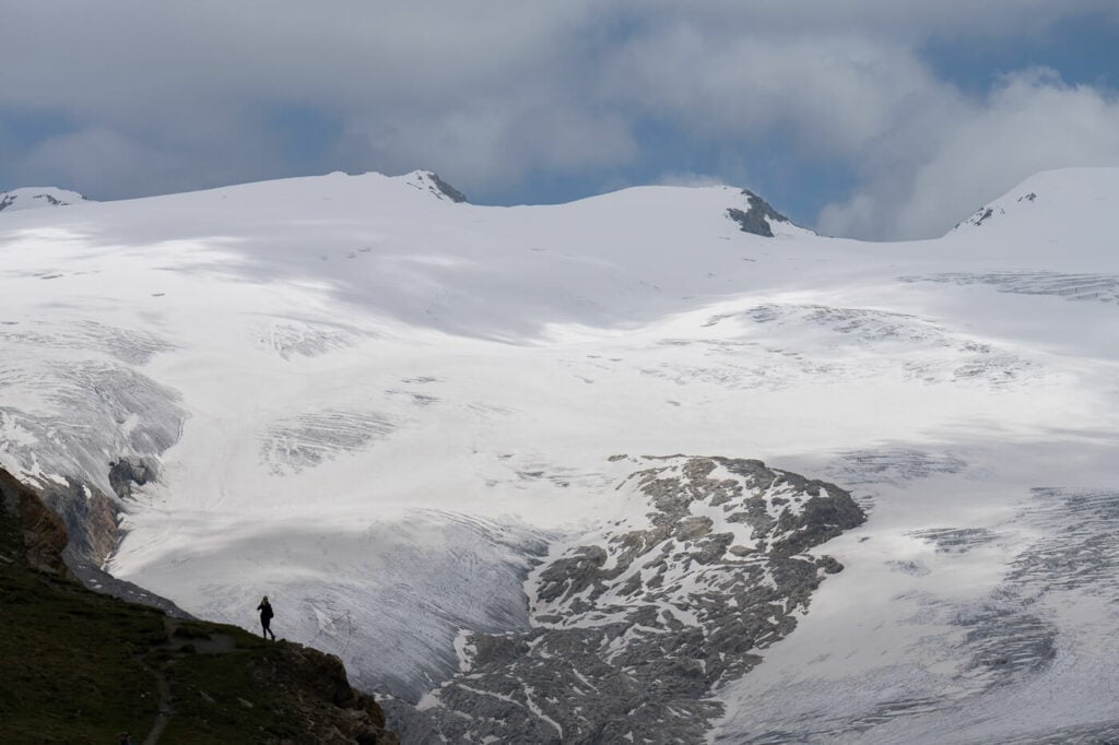
The Grenzgletscher
Table of Contents
Overview of the Gornergrat and Riffelsee Hike in Zermatt
| Max Altitude | 3,100 m |
|---|---|
| Distance | 25,0 KM |
| Elevation gain | 1,640m ↑ / 1,640m ↓ |
| Hike time | 07:00 / 08:00 Hours |
| Hike Difficulty | Hard |
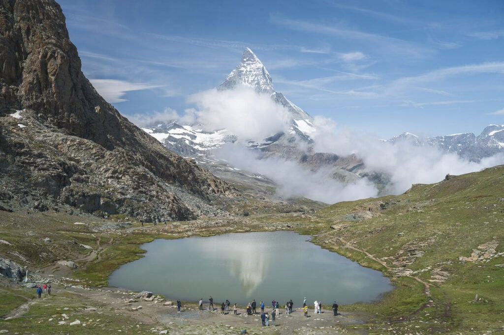
I can be crowded around the Riffelsee.
How to get to Zermatt, Gornergrat, Riffelsee, and Parking
Zermatt is a “car-free” village, which means you can’t drive to it. Instead, you will need to park your car in Täsch and take the train to Zermatt there.
- Driving Directions: Driving requires a bit of planning. If you are coming from the North or the West (Bern or Zurich for instance), you may need to rely on trains to transport your car for part of the way. This would happen if you are driving through Kandersteg or Realp. The train is not free, but if planned ahead, it will save you driving time. However, in summer you can also choose to drive through the mountain passes instead i.e. the Furkapass or the Grimselpass. If you are coming from the west (i.e.) Lausanne or Geneva, you can drive normally. Regardless of the road you take, you will then have to park your car in Tasch and take the train to Zermatt. Unless you are staying in Tasch, which is also possible.
- Parking: any of the (paid) parking stations in Tasch. Ideally, you want to park at the Matterhorn Terminal Tasch station, which can also be booked in advance.
- Public Transport: You can get to Zermatt by train from pretty much anywhere in Switzerland. If you enjoy scene train rides, this is a great option. Make sure to check the SBB (Swiss Railways) site.
Hikes looking at the landscape.
The Gornergrat and Riffelsee Hike Trail
There are actually multiple trails you can take to hike from Zermatt to Riffelsee and to the Breithorn’s summit. I choose different trails on the way up and on the way down. when possible I always do this in order to view and visit different parts or points of interest on the mountain, so if you can I’d recommend doing the same.
Zermatt to Riffelsee Hike
First, you’ll most likely need to walk through Zermatt to get to one of the trailheads to the south of the village. I had a GPS track with me but I decided to follow the marked Gornergrat trail from Zermatt.
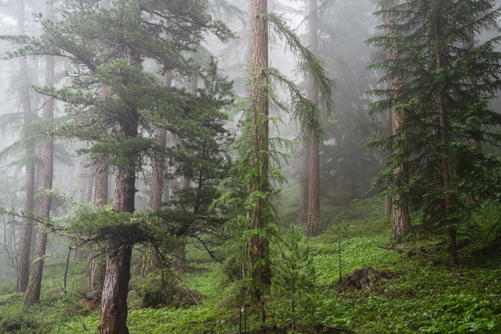
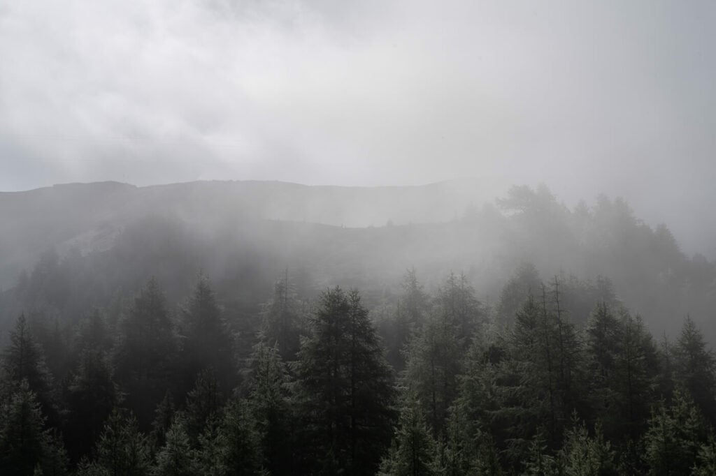
Regardless of which trail you take, you will have to get above the tree line first, crossing a beautiful forest. Once you reach The Riffelberg station, you can follow the “Mark Twain Trail” to Riffelalp, which I’d recommend doing as it offers stunning views of the surrounding mountains. The alternative is essentially a dirt/gravel service road. Still nice, but the Mark Twain trail definitely offers a much better mountain hike and views.
Your next stop on this trail will be Riffelsee. There you can enjoy a bit of a break and the view of the Matterhorn reflecting into the (hopefully still) waters of the Riffelsee.
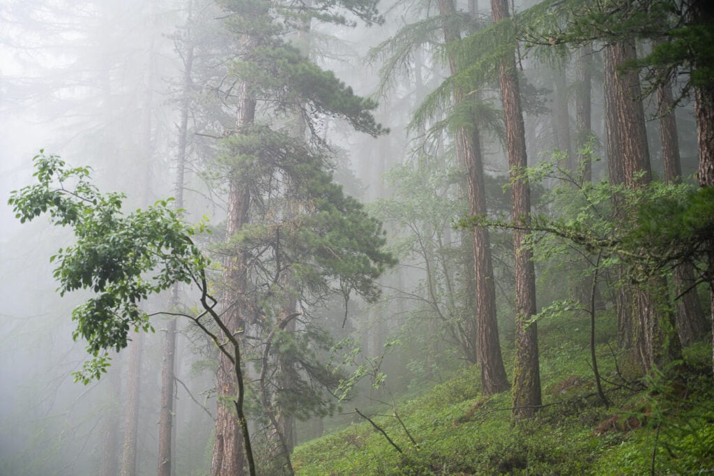
The beautiful forest above Zermatt on a foggy day for a moody landscape.
Riffelsee to Gornergrat Hike
The Gornergrat summit station will be in sight from Riffelsee, so you can easily continue up the mountain to get to the Summit of the Gornergrat at 3,100m altitude.
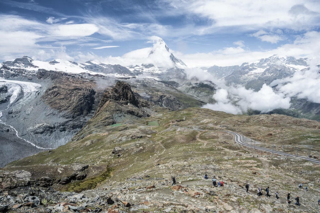
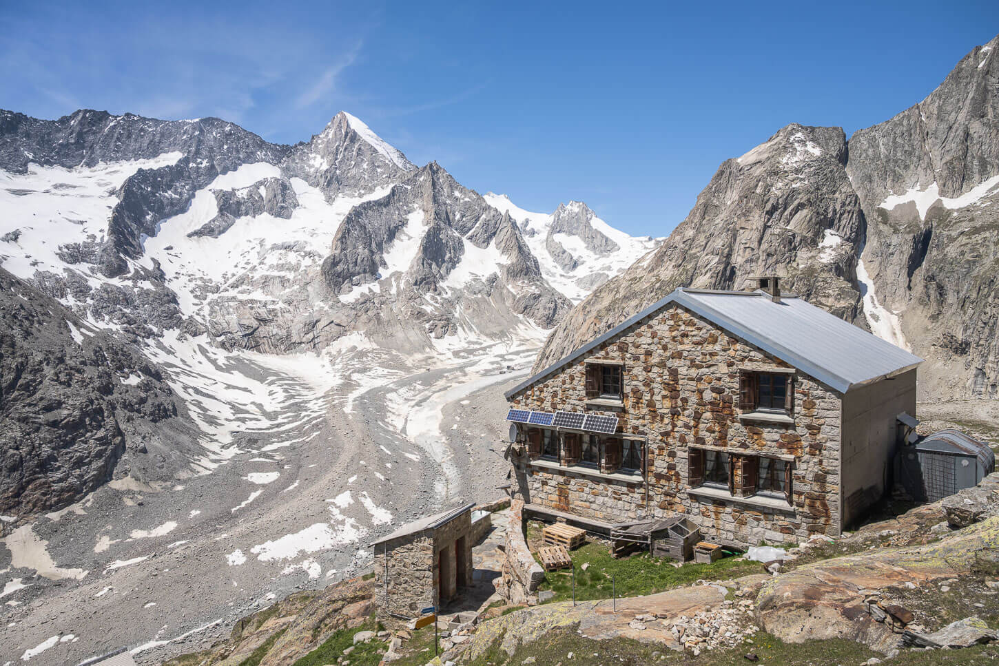
There are a few trails you can follow to get to the Gornergrat. I’d definitely recommend taking the one following the glacier all the way up to the Gornergrat. You will get a stunning view of the Gornergletscher and the Grenzgletscher all the way to the top.
A hiker enjoying the landscape.
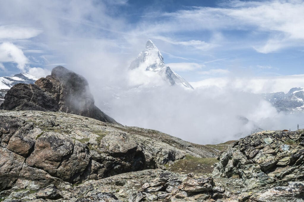
The Matterhorn emerging from the clouds


Easy Hiking options to the Gornergrat and the Riffelsee
Easier hiking options include stopping at any of the stations on the Gornergrat Bahn and starting the hike from there. Here you can find an overview of the stations on the Gornergrat railway.
The Rotenboden station is the closest to Riffelsee, at 2815m of altitude. So you could for instance hop off the train there and hike to the Gornergrat from there (about 45 minutes to one hour, with a 300m elevation gain).
If you are going to the Gornergrat Station directly you can do the easy 360-degree loop Gornergrat trail, an easy walk around the summit with spectacular glacier views.

Summit of the Gornergrat and arrival station (and restaurant/hotel)
The Gornergrat and Riffelsee Hike Photos and Photography Tips
Well, this is a location that could probably keep a landscape photographer busy for a few days at least. Let’s start with the most obvious subject, the Matterhorn. This iconic shot will work as sunsets, sunrises, during the day, with the Milky Way…you name it. It’s one of those picture-perfect locations you can just point your camera at.
Apart from the classic Riffelsee reflection photo, there are two other iconic photo spots. One is the classic view of the red train climbing up the mountain with the Matterhorn in the background. You won’t have to wait too long for this one, as the trains pass by quite frequently. so catch the train :)!
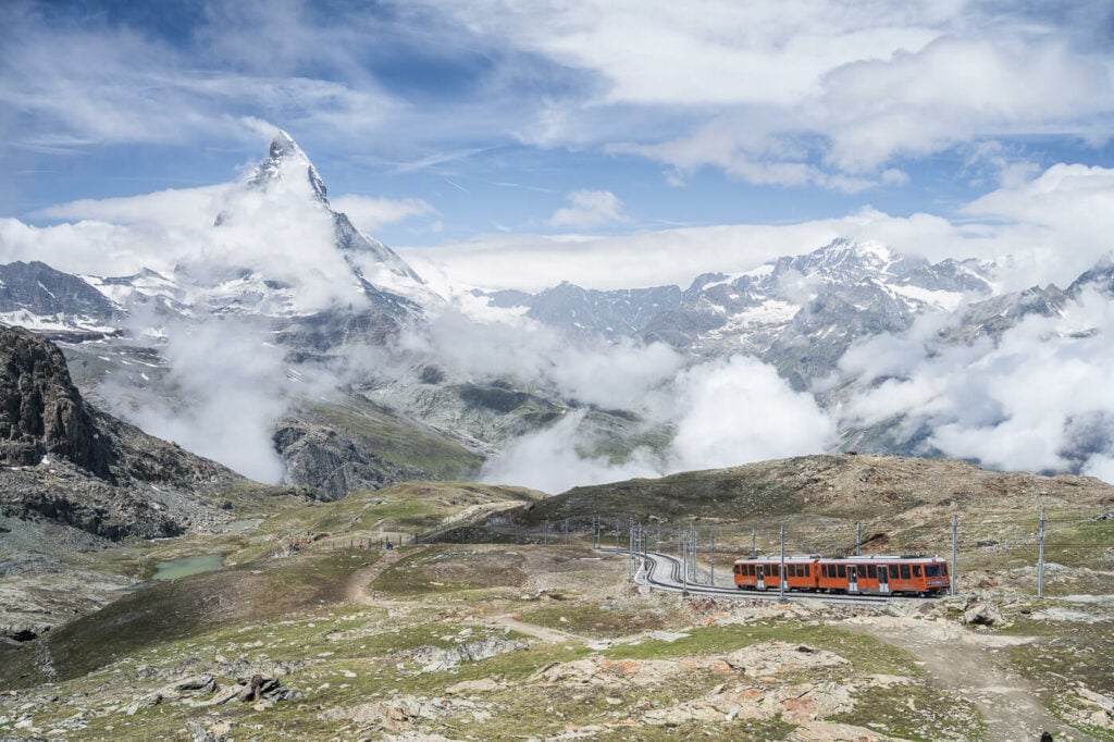
The classic view of the Matterhorn train with the Matterhorn in the background.
The Matterhorn reflecting into the Riffelsee
The other is the view of the Majestic Grenzgletscher. While a lot of it has melted away, it still is a very impressive and unique sight. While it isn’t as massive as the Aletsch Glacier you will still need to make panoramas if you want to fit it all in one image, even at 14mm!
Panorama made with 3 horizontal frames.
Also, with a medium telephoto lens (up to 200mm), you can spend quite some time looking at all the beautiful details of the glacier, as well as trying to find some abstracts. If you’ve been reading my blog, you know I am quite passionate about landscape with telephoto lenses. This is a great location for this type of photography, and had a good deal of fun looking for father away composition through the viewfinder of my camera. If you like this type of photography, you’ll love this location too.

Detail of one of the Glacier’s tongues. Plenty of details when enlarging the image, even an ice cave.


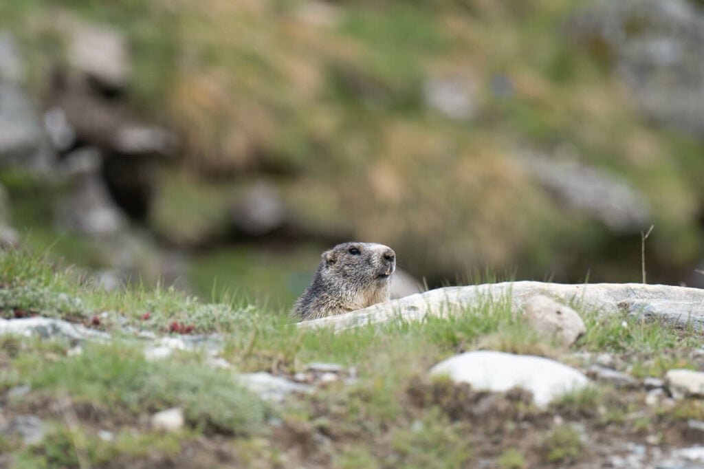
Ibex Marmots on the Riffelsee and Gornergrat trail
If you are into wildlife photography or just want to spot Ibex or Marmots, this is a great place to do so.
However, while I saw plenty of Marmots I had no luck with Ibex this time. Elusive creatures sometimes.
Also, while I am just into the occasional wildlife photography, I’ve had quite some fun trying to take pictures of these furry rodents. If you have a telephoto lens watch out for them :)!
On the technical side, 200m is still a bit wide to shoot marmots unless you can get close. The photos below are cropped at about 50%.
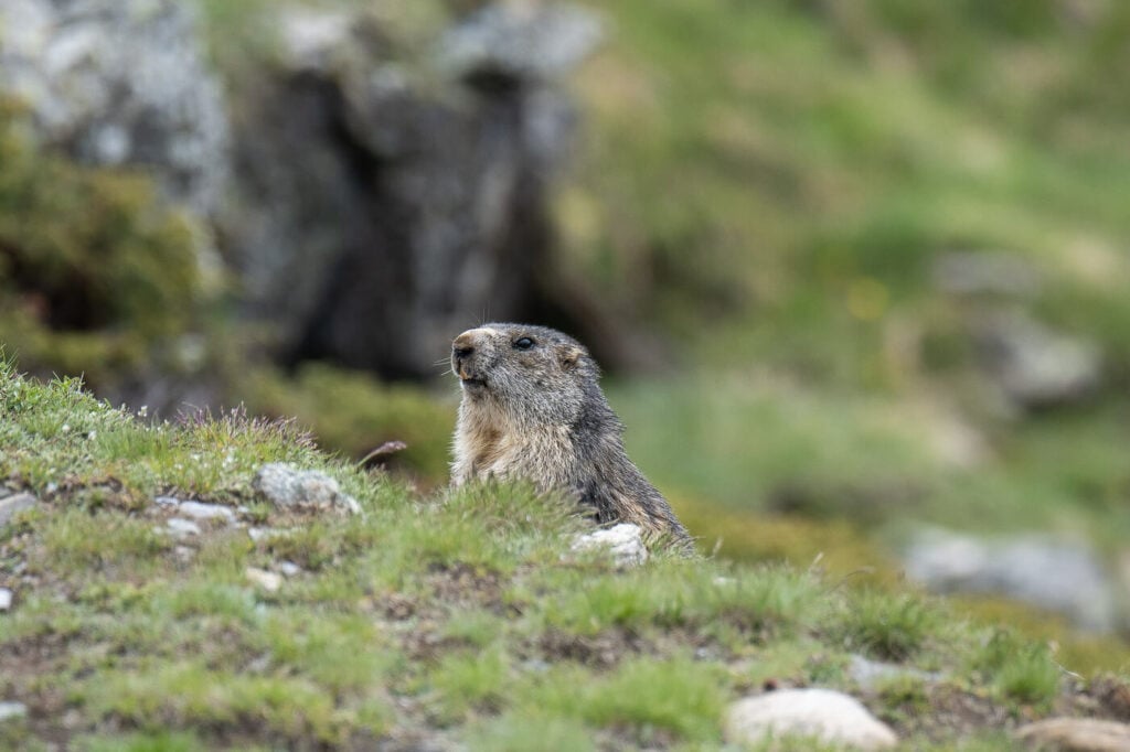
One of the marmots I saw. 200mm shot, cropped (50%)

Map of the Gornergrat and Riffelsee Hike
Here is the map of the Gornergrat and Riffelsee hike in Zermatt. If you want to download the GPS file, you can do so from the Komoot activity linked to it.
Where to stay
Zermatt offers plenty of choices for most types of accommodations. so much so that it almost feels like being in a holiday village, even if it manages to maintain the charm of the alpine villages. If you prefer, you can also spend the night at one of the hotels or huts on the way to Gornergrat.
For a special stay, you could also stay a the Gornergat Kulmhotel, the highest Hotel in Switzerland at 3,100m
You can camp in Zermatt too if you want – there is a basic campsite there, only for tents. Otherwise, there are two more camp sites in Tasch where you could also stay in a van or a camper.
Lastly, Visp is a popular location to stay at, especially if you want to use it as a base to further explore the Valais or the surrounding area.
Additional Resources
- Another hike to consider in this area, the Stellisee and five lakes hike.
- If you are looking for easier hikes with Glacier views, you may want to check out the mighty Aletsch Glacier, Rhône Glacier, or the Sidelengletscher hikes on the Furkapass.
- Check out the main Switzerland page for more hikes and an overview of hiking in Switzerland.
- If you are planning to travel by public transport, consider getting an SBB half-fare card. This is valid on some cable cars and mountain rides, too.


Leave A Comment