The Aletsch Glacier Hike, Valais, Switzerland
The Hike to the Aletsch Glacier is one not to be missed. If you are in Switzerland or planning to visit, this should be high on your list. Definitely one of the best and most scenic glacier views in Switzerland and possibly in continental Europe.
Located in the Valais Canton of Switzerland and part of the Jungfrau-Aletsch UNESCO World Heritage site, this glacier is a true wonder of Nature.
The Aletsch Glacier is also the biggest in the Alps and although it is melting like any other glacier in Switzerland, it still is a very mighty sight.
There are various hiking options around the Aletsch Glacier, and the one I chose for this post is a circular hike. While this is a long hike, it isn’t a particularly difficult one and the views are breathtaking.
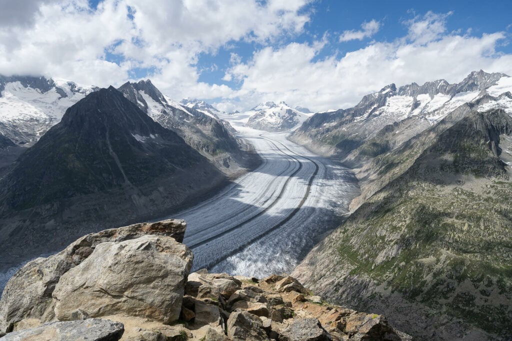
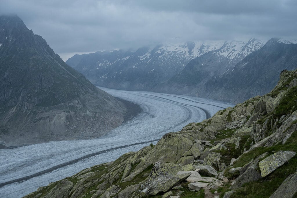
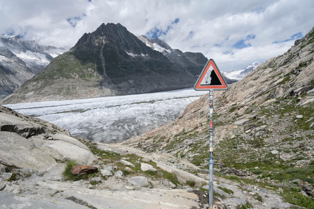
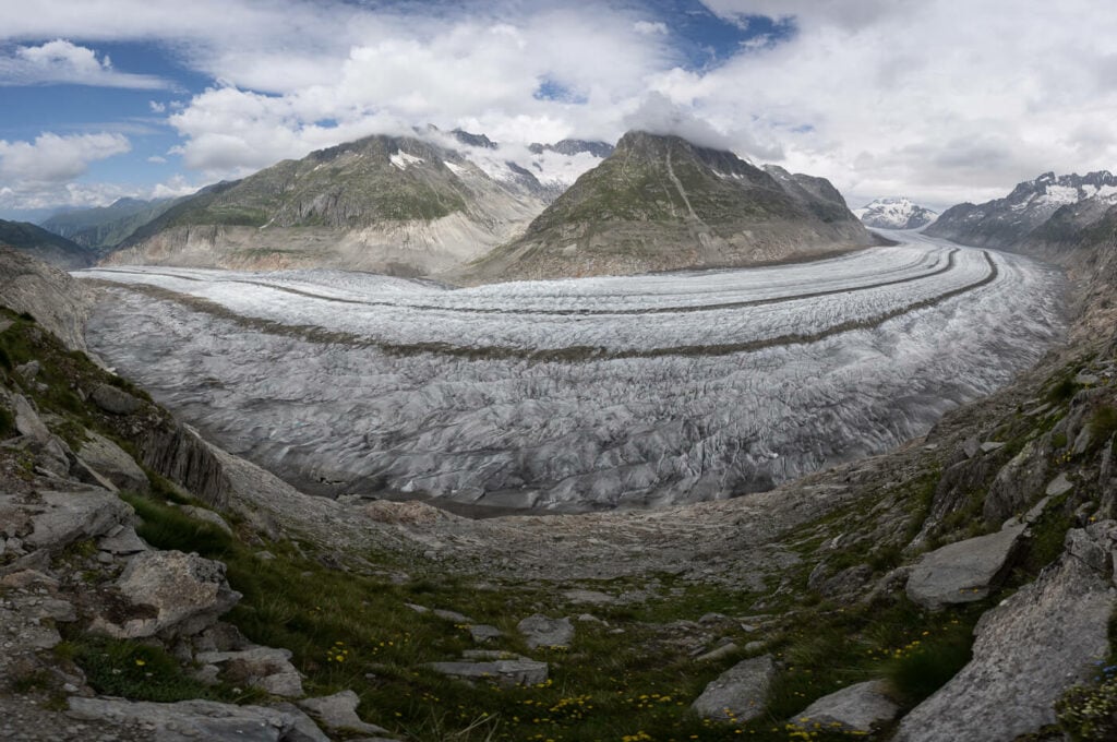
View from the trail.
Table of Contents
Overview of the Aletsch Glacier Hike
While the hike is relatively long, there are no particular difficulties or challenges along the route. Keep in mind the total elevation gain (840m), which isn’t negligible either.
| Max Altitude | 2660 m / 2926 m to the Eggishorn |
|---|---|
| Distance | 16.4 KM |
| Elevation gain | 830m ↑ / 830m ↓ |
| Hike time | 5:30 / 6:30 Hours |
| Hike Difficulty | Moderate |
If you want to make this hike a little more challenging, you can include a detour to the top of the Eggishorn. In that case, you should add an extra 2/3 hours to the hike, with an additional 700m elevation gain. Otherwise, you can also take the Eggishorn cable car, which is what I did in this case.
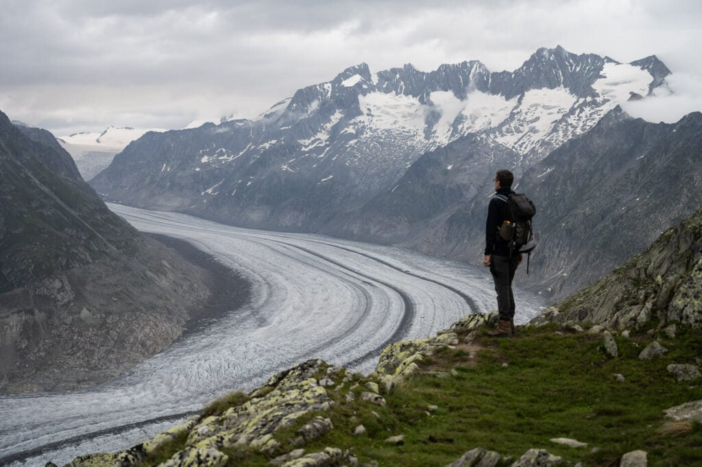
Hiker looking at the glacier.
How to get to the Aletsch Glacier and Parking
The Aletsch glacier is not one you can drive close to. Not even to the start of the hike. You will need to either take a trail or park the car at one of the Cable Car stations in Fiesch, Bettem, or Mörel-Filet.
- Driving Directions: If you are coming from the Zurich/Luzern Direction or eastern Switzerland, you would have to cross a few mountain passes – I usually drive the Furkapass or the Grimselpass as a second option depending on traffic. You also have the option to board your car on a train at Realp and avoid the Furkapass. As of 2023, the price of a single trip of passenger cars is 27 CHF. If you are coming from the opposite direction, you would be arriving via Highway A9, to take road 9 and drive from there to the valley station of your choice.
- Parking: This depends on where you plan to take the cable car. So as mentioned above, you could park at any of these locations Fiesch, Bettem, or Mörel-Filet.
- Public Transport: The Matterhorn-Gotthard Bahn stops at the train stations in the valleys.
From each of these locations (Fiesch, Bettem, or Mörel-Filet) you will then have to take the cable car up where can start your hike.
As an easier option, you can also buy cable car tickets from Fiesch to Eggishorn on GetYourGuide, with free cancellation.
The Aletsch Glacier Trail – or trails
The Aletsch Glacier is a location I had been looking forward to for a couple of years and it did not disappoint one bit. There are many trails up there as you can see from the map below. In this case, I chose a circular hike around the Bettmerhorn and the Eggishorn to see the glacier from its glacier tongue up to its origin.
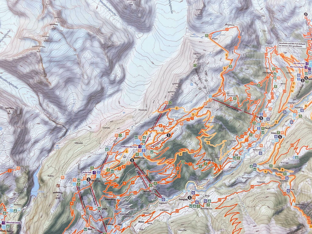
Aletsch Glacier Hiking Map, a real maze of trails and viewpoints.
I started the hike from Fiescheralp in the very early AM, in the hope of catching some good light and colors for sunrise. However, this is what sunrise looked like, despite a promising forecast. I then Hiked up the Bettmeralp viewpoint, where there is a viewing platform.
A “truly” epic sunrise by the Aletsch glacier.
Bettmeralp viewpoint
An hour of rain followed, during which I took refuge at the nearby Bettmeralp mountain station. Classic mountain weather. Once the rain stopped I resumed my circular hike clockwise around the Eggishorn. I’d recommend doing this hike clockwise, simply because you’ll have the best views glacier right in front of you.
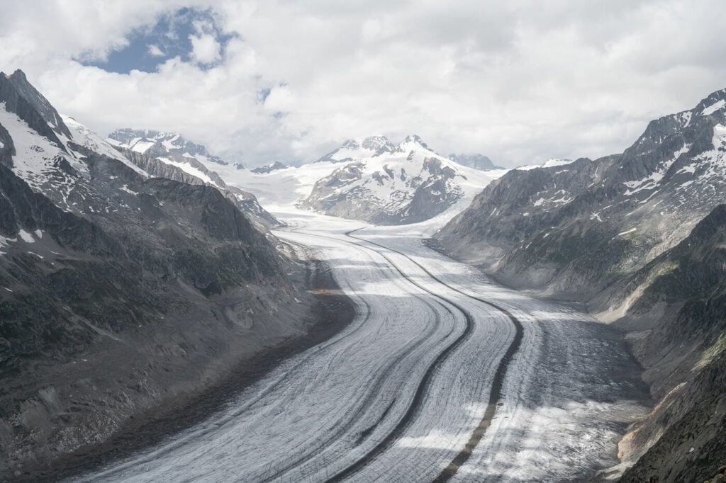
In the beginning, you will only see the final part of the glacier, the glacial tongue. As you progress the views will open up revealing all of the glaciers all the way up to Concordiaplatz and the Jungfraujoch.
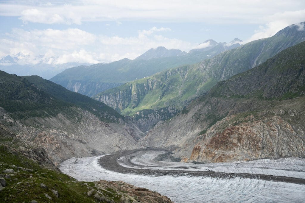
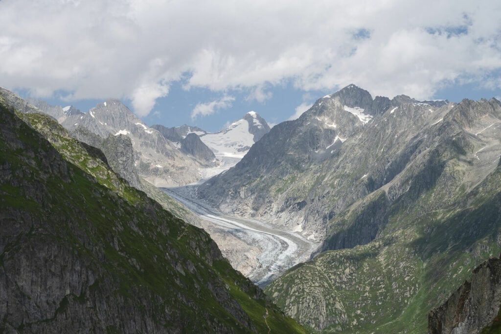
The Glacier tongue of the Aletsch Glacier, looking back from the trail.
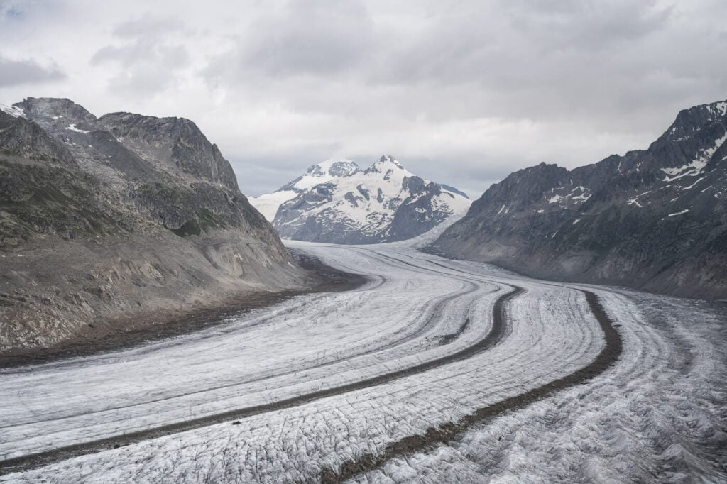
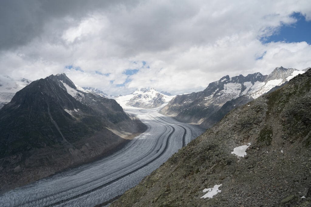
The view toward Concordiaplatz and the Jungfraujoch
You’ll reach a point where you’ll have to turn back toward Fiescheralp, but you can also hike down to the side of the glacier, which I did and recommend doing. You can get close to the glacier and tough the Ice, but I’d recommend staying away from any fractured or unstable chunks of ice. These could collapse without notice.
Start of the trail leading down to the side of the glacier.
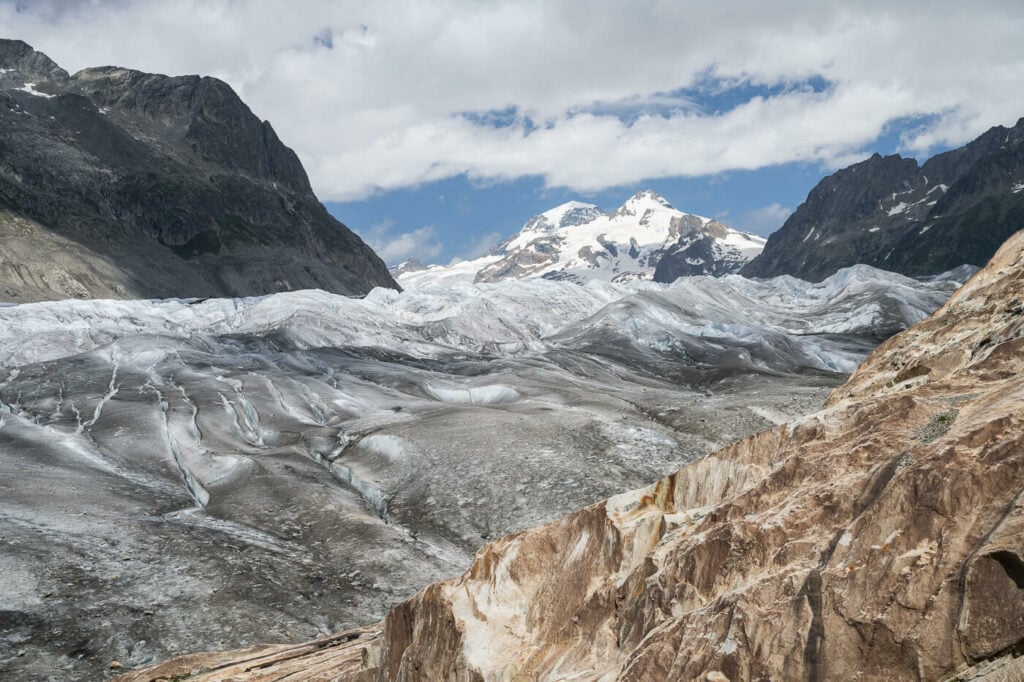
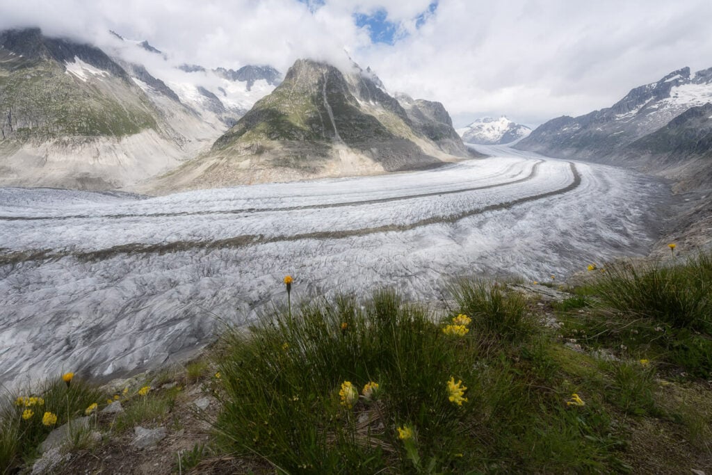
Once you get close to the glacier, you can get a real feel of its impressive size.
From there you can hike back to close the loop around the Eggishorn, through the Tälligrattunnel. You’ll also get a seat view of another nearby glacier, the Fieschergletscher. This is the second-longest glacier in the Alps and a very beautiful one in its own right. So you can definitely say it’s been overshadowed by its largest neighbor, the Aletsch glacier.
The Fieschergletscher.
Hike to Eggishorn
Once you reach Fiescheralp, you can either hike up the Eggishorn or take the cable car. This time I took the cable car ride up to the Eggishorn viewpoint. I originally planned to hike up there but since I was not sure if the trail was open or not. The UNESCO high-altitude trail from Bettmerhorn to Eggishorn was closed so I did not want to risk having to turn back.
However, even if you take the cable car up to Eggishorn, there still is more hiking involved. The cable car will stop at the Eggishorn viewpoint, but the summit is farther away, about 20 more minutes of hiking. The hike is actually quite easy and well worth it in my opinion. It’s a bit rocky by the end but easily passable. And the views are well worth it.
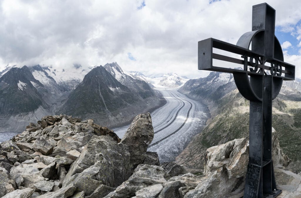
The Cross that marks the summit of the Eggishorn.
The Aletsch Glacier Hike Photos and Photography Tips
There are plenty of fantastic views along the trail. You will find yourself stopping at each new point to take photos. the only downside I realized while looking at the photos back home, is they are kind of monotonous. Yes, several fantastic views, but all are rather similar in a way with a few variations depending on how close or far you are on the trail. no surprise as this is one giant glacier, and it really is a minor downside.
Also, It’s impossible to fit the whole glacier in one frame, it’s just too big. Even at 14mm so you’d have to resort to panoramas if you want to capture it all. For this reason, I’d also recommend getting up to the Eggihorn, where you’ll find the widest panoramic views.
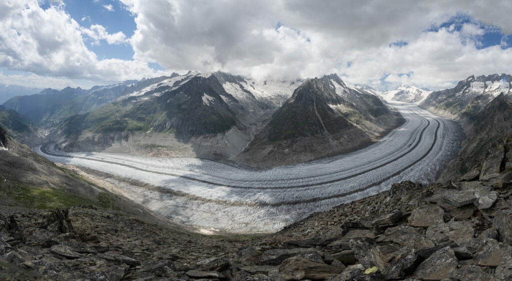
Panoramic view from the lower trail around the Eggishorn.
14mm frame, from the trail.
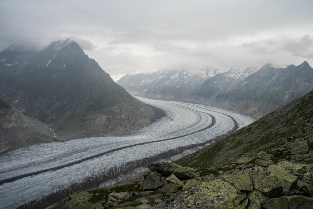
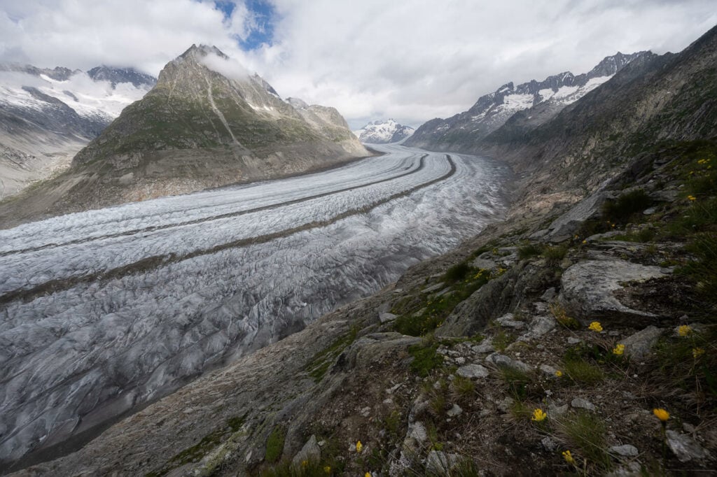
View from the trail.
View of the glacier from the Eggishorn viewpoint.
The far side of the Aletsch glacier, with the Jungfraujoch in the background.
Panoramic view from the Eggishorn viewpoint
View from the top of the Eggishorn
This location would also work for sunrise and sunset, although sunrise is likely better. This is because the sun will typically set behind the mountain in front of you, while sunrise should provide a good sidelight into the valley and the mountains around it.
If you want to shoot sunrise from the Eggishorn, there’s a also shortcut. The Eggishorn Cable Car offers”sunrise rides“, meaning you can take a cable car ride up to the Eggishorn for sunrise. A post-sunrise Breakfast buffet is also included. So this is a great option if you want to shoot sunrise
Video of the Hike
Here is also a short video of this hike, for a better feel for the trail:
Map of the Aletsch Glacier Hike
Here is the map of this hike. You can download the GPS file from the Komoot activity.
Where to stay
The best overnight options are either in Riederalp, Bettmeralp, or Fiescheralp. These are all car-free villages that can only be reached by gondola/cable cars.
I stayed in Bettermeralp because it’s the closest to Eggishorn and the end of the hike. There are also some camping options around each of the towns in the valley.
Additional Resources
- For a more challenging hike, check out the UNESCO High Altitude Ridge Trail.
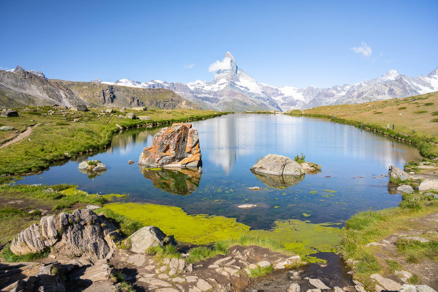
- If you are looking for easier hikes with Glacier views, you may want to check out the Rhône Glacier, the Gornergrat and Riffelsee hike in Zermatt, or the Sidelengletscher hike on the Furkapass. For something a little bit out of the ordinary, check out the Chüebodengletscher and Gerenpass Hike.
- Check out the main Switzerland page for more hikes and an overview of Hiking in Switzerland.
- If you are planning to travel by public transport, consider getting an SBB half-fare card. This is valid on some cable cars and mountain rides too.


Leave A Comment