The Chüebodengletscher and Gerenpass Hike, Switzerland
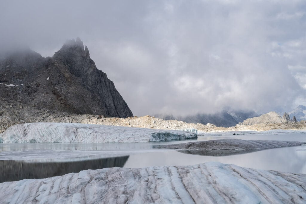
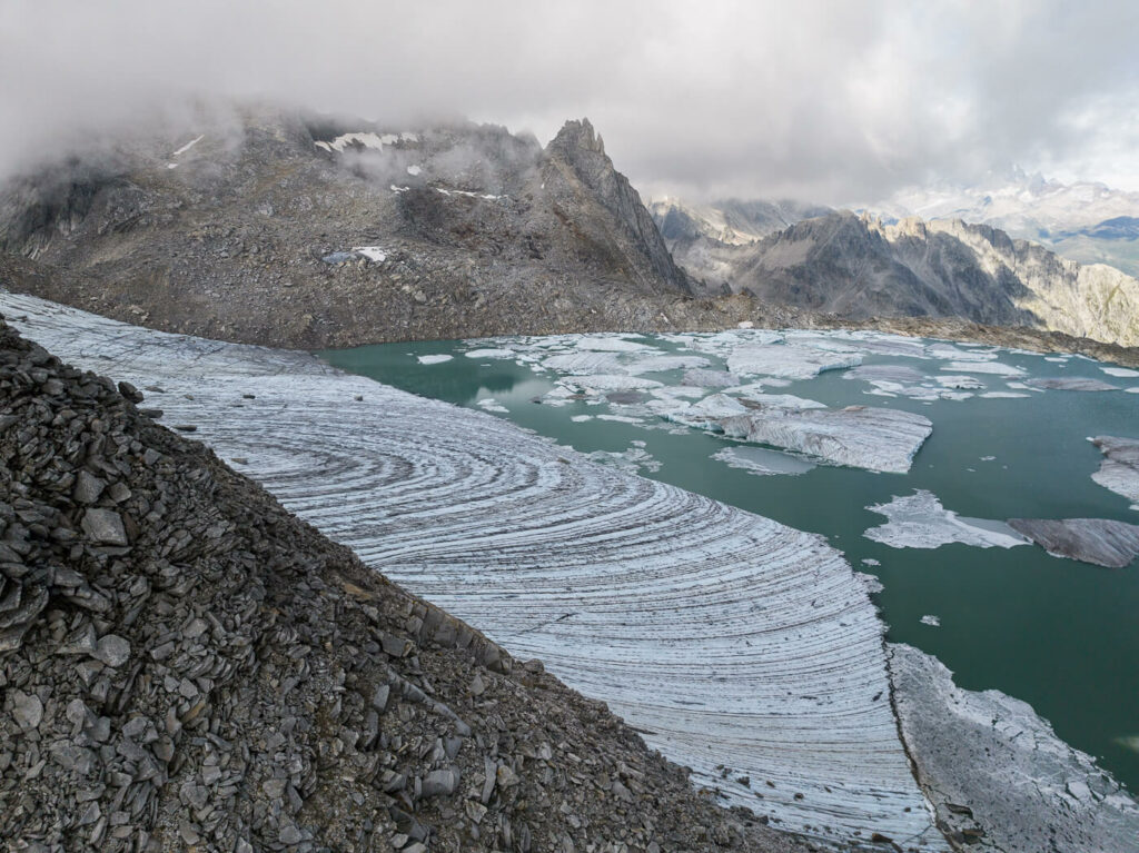
The Chüebodengletscher and Gerenpass Hike is a pretty unique one. Amazing views, glaciers and..icebergs! Wait, what? Iceberg? On the Swiss Alps? Yes, unfortunately, I may add. Switzerland does have a lake with icebergs at an altitude of 2,670 meters.
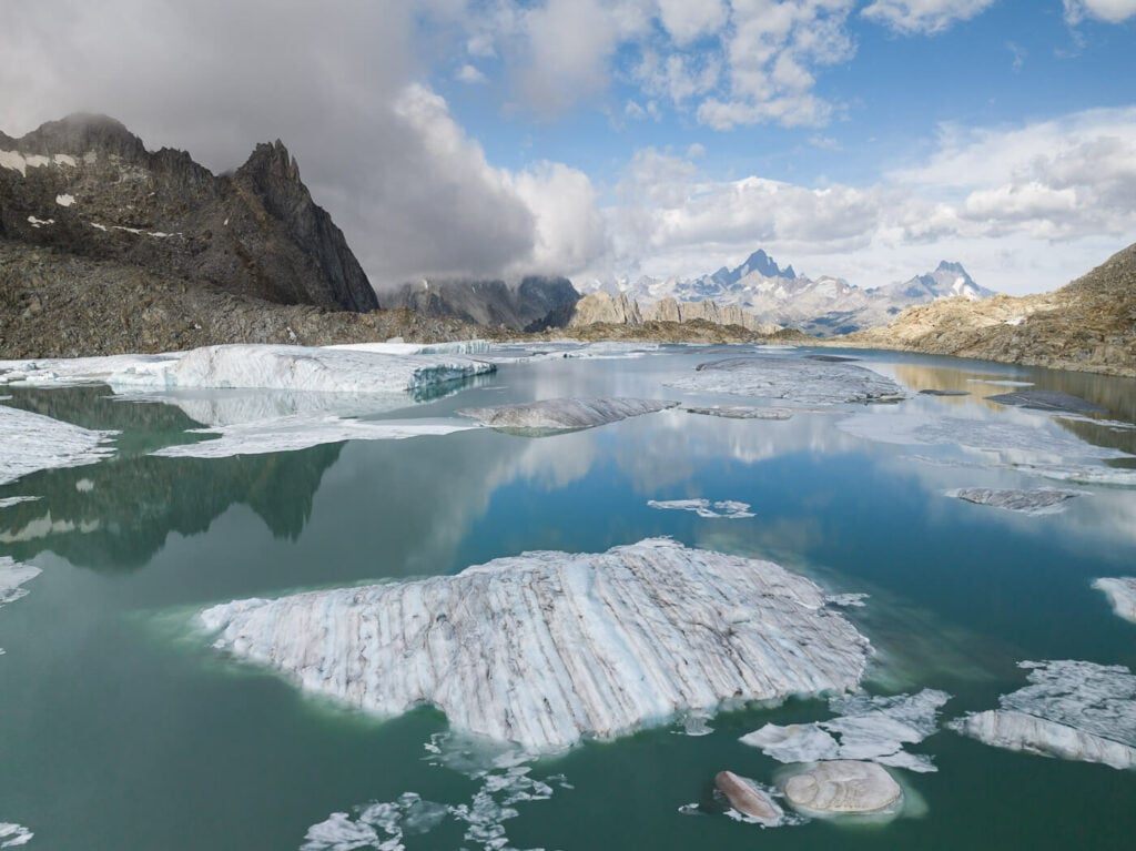
Icebergs on the Alps.
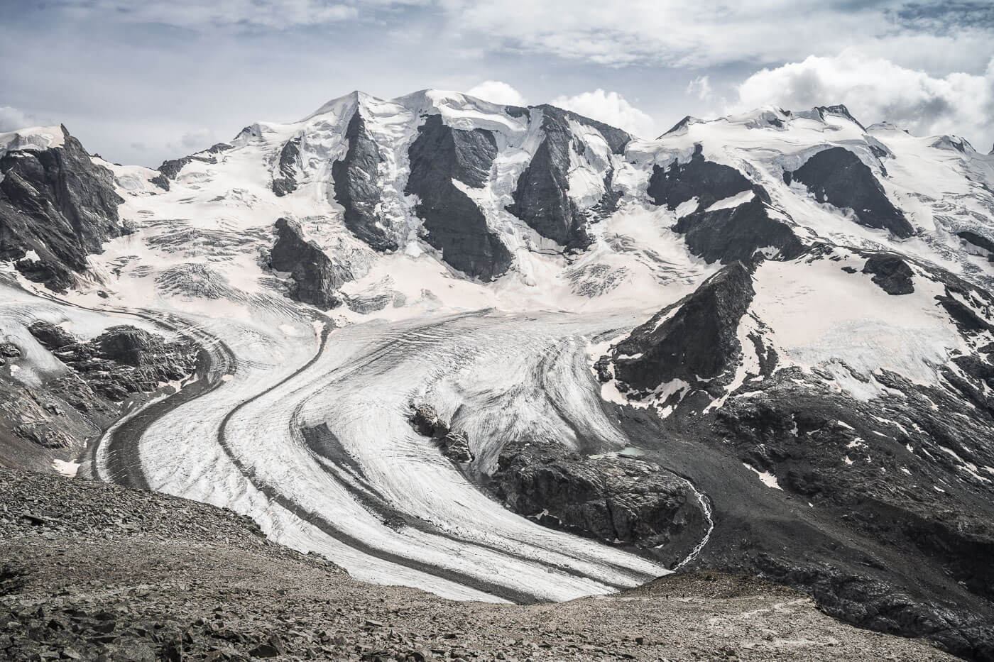
So, how did the Swiss Iceberg Lake form? As a result of warmer weather, the Chüebodengletscher suffered a major loss of ice, like all Swiss glaciers. The melting ice started forming a little lake, that expanded with time. After a few years, that caused the glacier to start calving, so large chunks of ice started to float into the newly formed lake.
Due to the same process that formed the Icebergs, the lake and the Chudeboden glacier are bound to disappear in the next few decades.
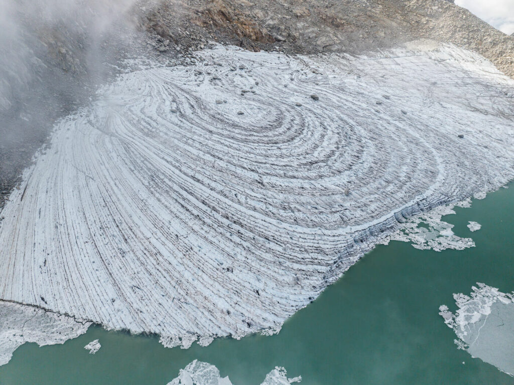
Remains of the Chudenboden Glacier
Table of Contents
Overview of the Chüebodengletscher and Gerenpass Hike
The hike isn’t overly difficult, but there are some hazardous passages due to unstable rocks and potential rockfall. Also, the elevation gain is quite important and there are some passages that require careful foot placement due to unstable rocks. Also, the hike is usually possible between early summer and early autumn, Not sure about ski touring options in winter, but the lake would be completely frozen anyway.
| Max Altitude | 2,670 m |
|---|---|
| Distance | 11 KM |
| Elevation gain | 1,040 m ↑ / 1,040 m ↓ |
| Hike time | 04:30/ 05:30 Hours |
| Hike Difficulty | Moderate, with hazardous sections |
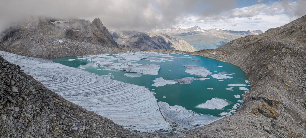
Panoramic Image of the Chudeboden Gletscher.
How to get to Chüebodengletscher and Gerenpass and Parking
The Chudebodengletscher Iceberg Lake is located above the Gerenpass, between the Canton Ticino and the Valais (Wallis). The trailhead is located in Val Bedretto, at a location called All’acqua.
- Driving Directions: If you are coming from the North (i.e. Zurich or Luzern) you would either have to take the Gotthard tunnel or the Gotthard pass to Airolo. From there, follow the directions to the Nufenpass and stop at All’Aqua. From the south (Italy or Lugano): Same as above, you just need to exit before the Gotthat Tunnel. From West of Switzerland; either through the Gotthardpass or via the Nufenpass.
- Parking: free parking is available around the trailhead. However, this is a popular location, not only because of the lake but because there are several other beautiful hikes in the area. So it can get busy in summer.
- Public Transport: Postbus 111/112 stips right by the trailhead. The line runs between Oberwald and Airolo via the Nufenpass.
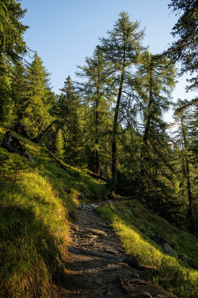
Part of the trail between All’acqua and the Capanna Piansecco.
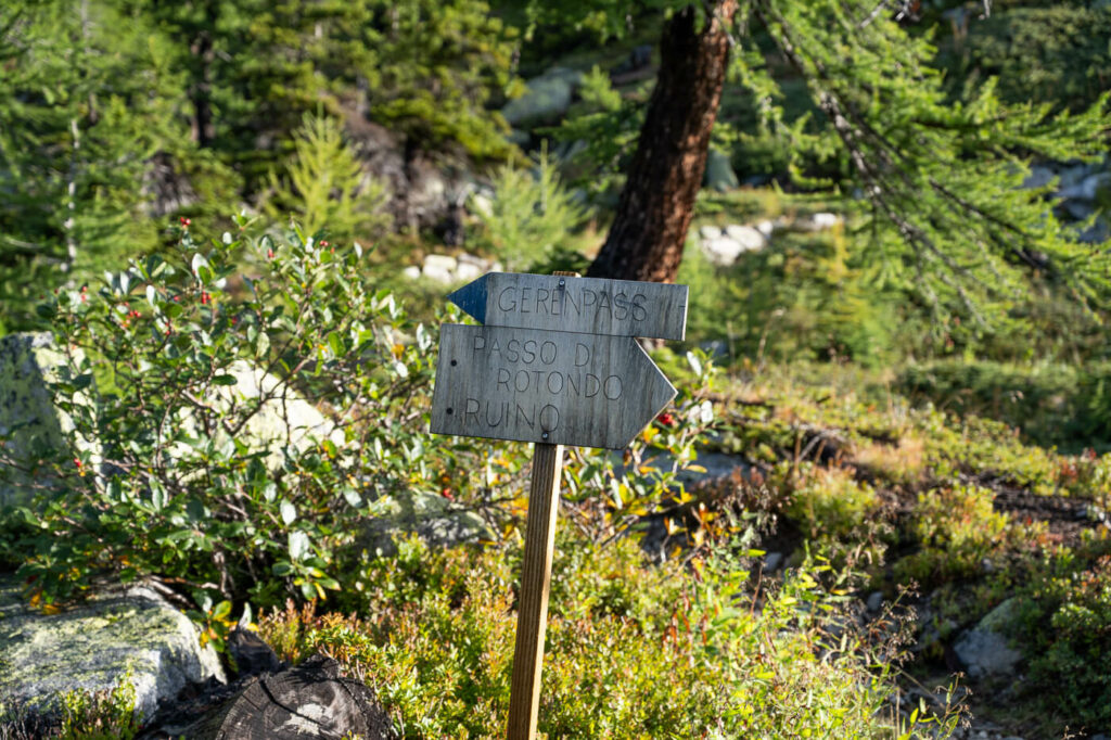
The Chüebodengletscher and Gerenpass Trail
The first part of the trail that starts from the road in All’acqua is easy. The trail is very well-worn and easy to follow, never steep or difficult. Once you reach the Capanna Piansecco you will see the blue signs to “Gerenpass”. From here you can keep following the blue trail marks, which are visible all the way up to the top of the pass. From Capanna Piansecco to the Chudeboden Gletscher it will probably take a good one hour and a half, at least.
The Capanna Pinsecco. The Gerenpsss is on the top left of the image behind the hut.
Once you’ve passed the Capanna, Keep following the Blue trail marks to the Gerenpass
From here the trail becomes a little steeper, but nothing challenging until you reach the debree fields below the Gerenpass. Here is the worst part of the hike, where you will have to negotiate passage with several big and unstable rocks all the way to the top of the pass. Luckily, the blue trail marks are easy to see and evenly spaced every few meters.
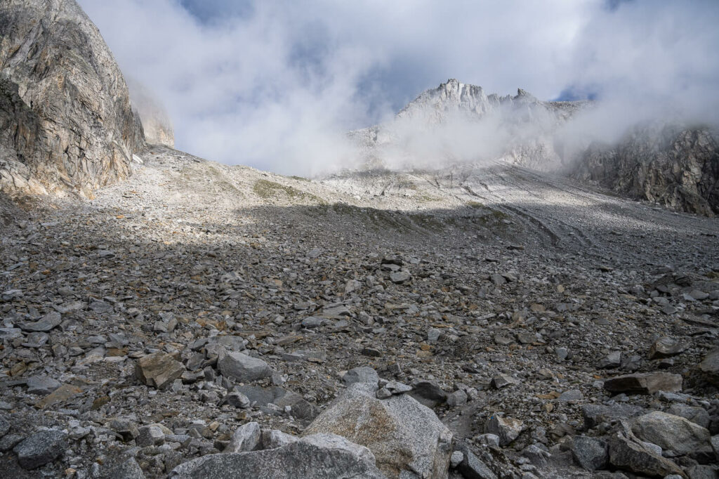
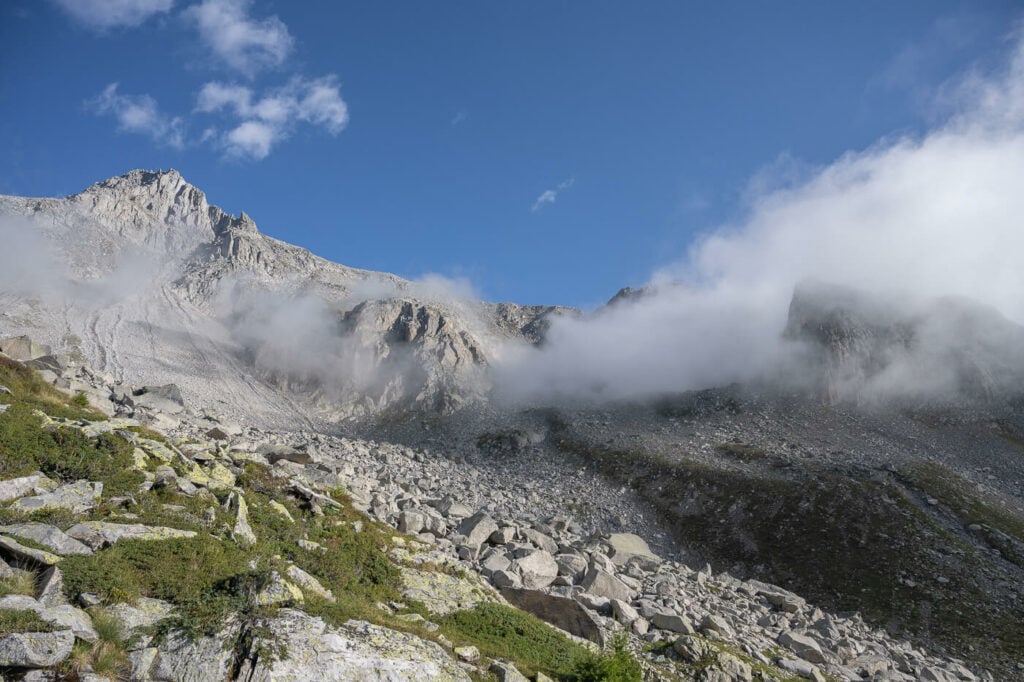
The Gerenpass is up in the middle of the image, where the clouds are
You will need to help yourself with your hands too in some places, however, the trail is never too steep here either, just slow going. Still, pay particular attention to where you set your foot; as mentioned several rocks are unstable.
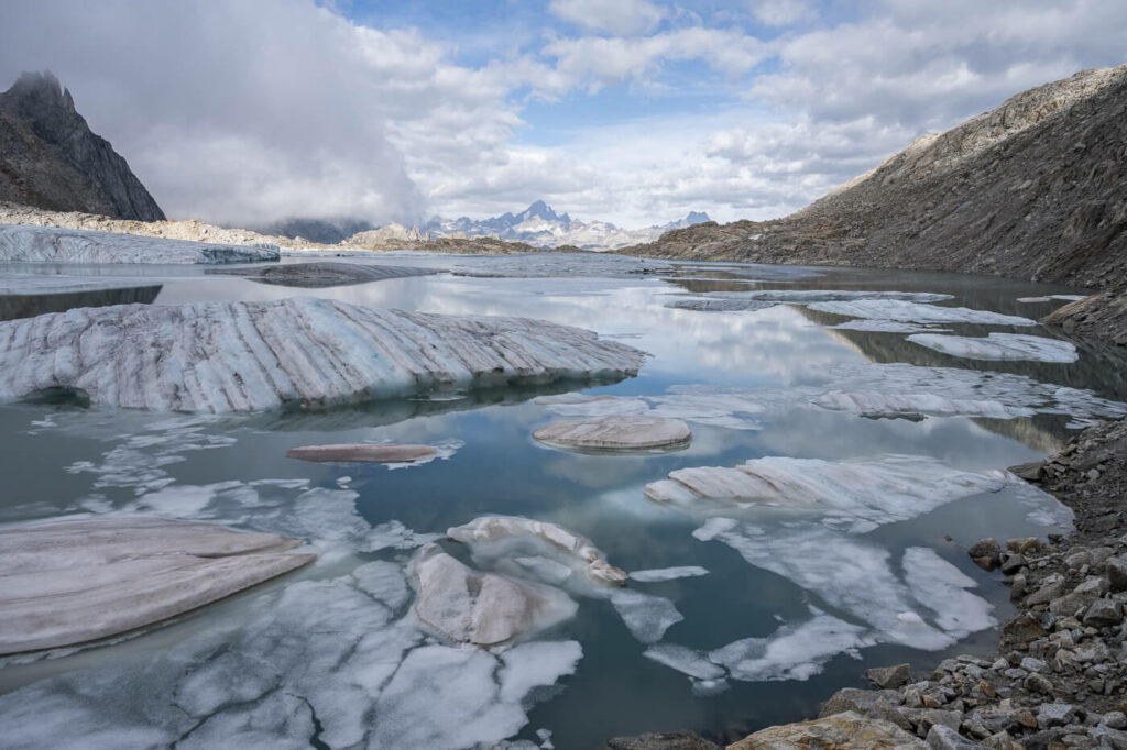
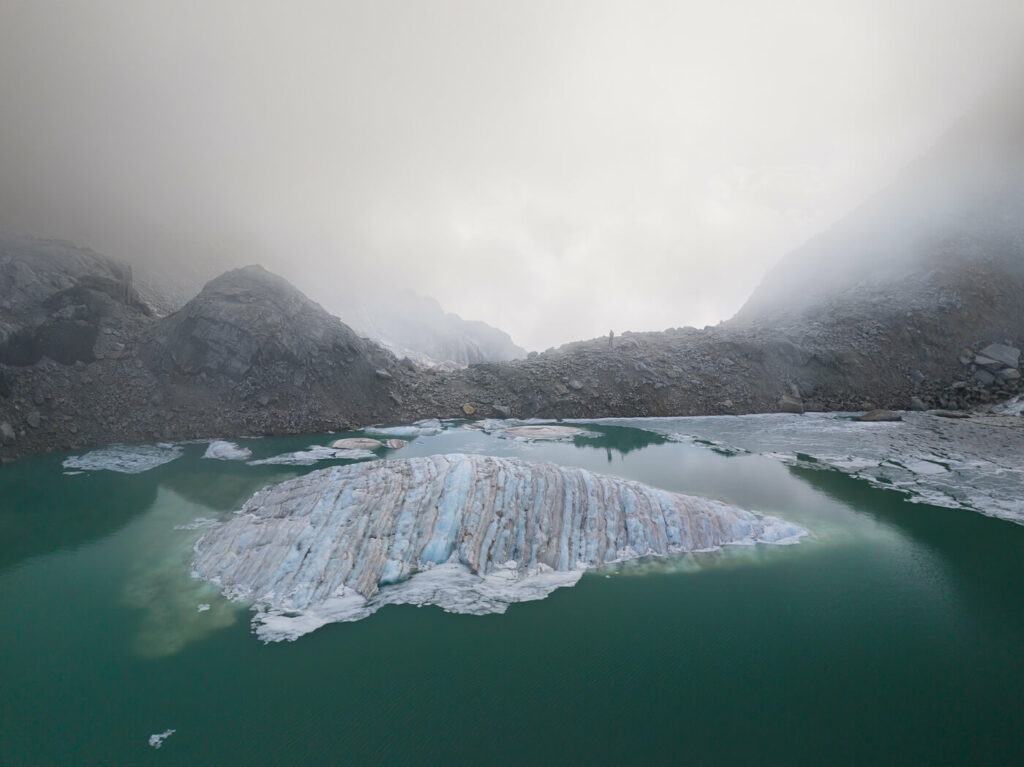
You will not see the lake until you reach the top of the pass. When you do, it will appear in front of you in all of its bizarre beauty; A glacier, Icebers with Alps until the eyes can see in the background.
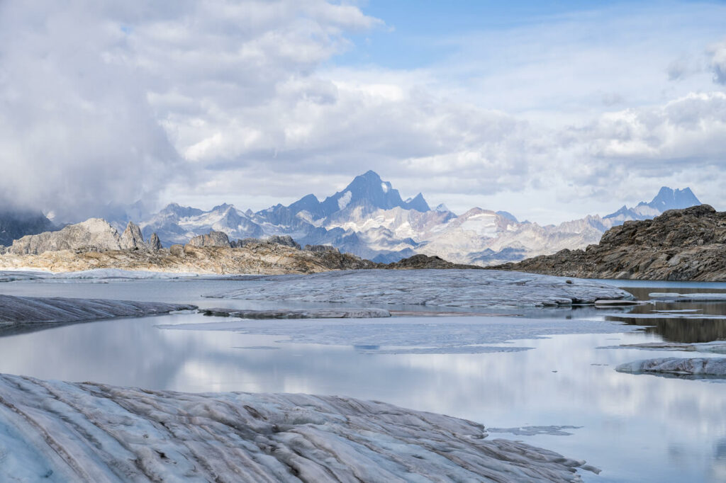
View of the Iceberg lake from the Gerenpass.
The Chüebodengletscher and Gerenpass Photos and Photography tips
Icebergs on a mountain are quite a subject and a rather unique sight. Definitely not one accessible in continental Europe. Also, apart from the Iceberg lake, the area surrounding the Gerenpass is beautiful in itself.
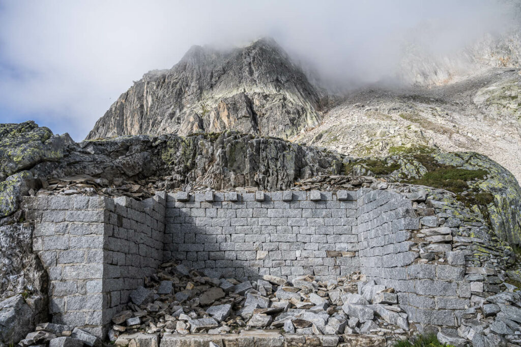
Remains of a old hut below the Gerenpass
Clouds around d the Chüebodenhorn.
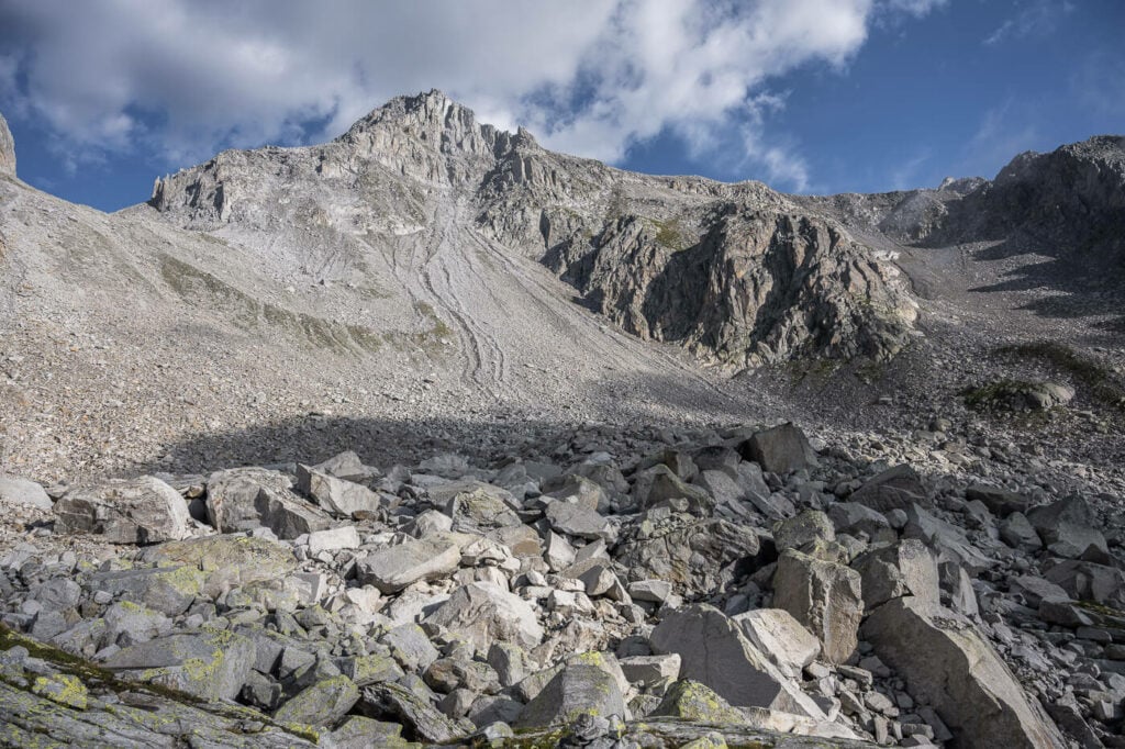
The Beautiful Chüebodenhorn. The Gerenpass is on the left side of the image.
For this location between sunrise and sunset, I would choose sunset. In June/July, the sun sets in front of the Gerenpass in summer so there is a potential for colorful sunsets.
This was my original plan, which I had to abandon on my first attempt due to a sudden thunderstorm. Later in the year, i.e. September, this does not matter much as the sun sets and rises laterally to the lake. So you may have good sidelight light in the golden hours instead.
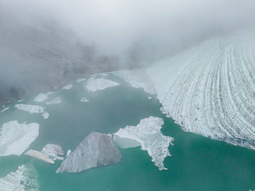
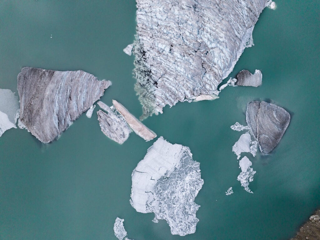
Drone image of the Chüebodengletscher and some of its Icebergs.
Detail of the Icebergs
Chunks of Ice floating.
One of the limitations this location has is the compositional choices. The lake is small and while you can hike around the lake a bit, there aren’t really that many composition choices, so in that sense, this location is a bit limited.
Provided you comply with the Swiss regulations it is also possible to fly a drone here. This can help find different compositions and points of view.
Icebergs floating in the Lake
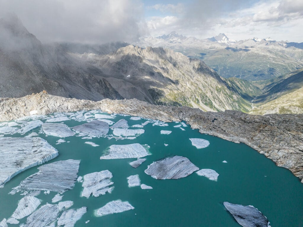
Icebergs with Mountain View
The still water of the lake can create nice reflections on windless days.
What remains of the Chüebodengletscher
Another detail of the Chüebodengletscher
View of the Gerenpass. You can see me, for a sense of scale, just above the ridge.
Video of the Hike
Here is also a short video of this hike, showing the trail and a final drone footage.
Map of the Chüebodengletscher and Gerenpass Hike
Here is the map of the hike. Should you want to, you can download the GPS track from the Komoot activity below.
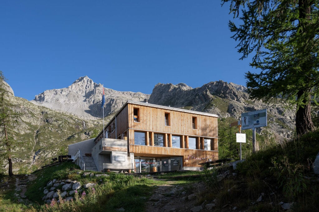
Where to stay
If you want to make this hike easier or break it down into two legs, you could stay at the Capanna Piansecco (Piansecco Hut). You can book online using the provided link. Alternatively, you can sleep at the Hotel Ristorante All’Acqua, by the trailhead.
Additional Resources
- Here are two amazing nearby hikes: The Sidelhorn and the Gelmersee Hike on the Grimselpass, the Gornergrat and Riffelsee hike in Zermatt, and The Sidelengletscher and Albert Heim Hütte Hike on the Furkapass. Also, check out the mighty Aletsch Glacier hike!
- If you are looking for more beautiful locations in Ticino, you may want to check out Foroglio and its massive 110m tall waterfall.
- Check out the main Switzerland page for more hikes and an overview of Hiking in Switzerland.


It would be really helpful to know the date of the tours.
The exact date of this hike was the 26th of August