Staubbachfall Best Viewpoints: Town, Trail, and Train!
If you are in Switzerland and planning to visit Lauterbrunnen, you can’t miss Staubbachfall and the several viewpoints of this amazing waterfall and the beautiful valley it is nestled in.
Some of these best viewpoints are in town, some on the Hiking trail to Wengen, and some on..the train!
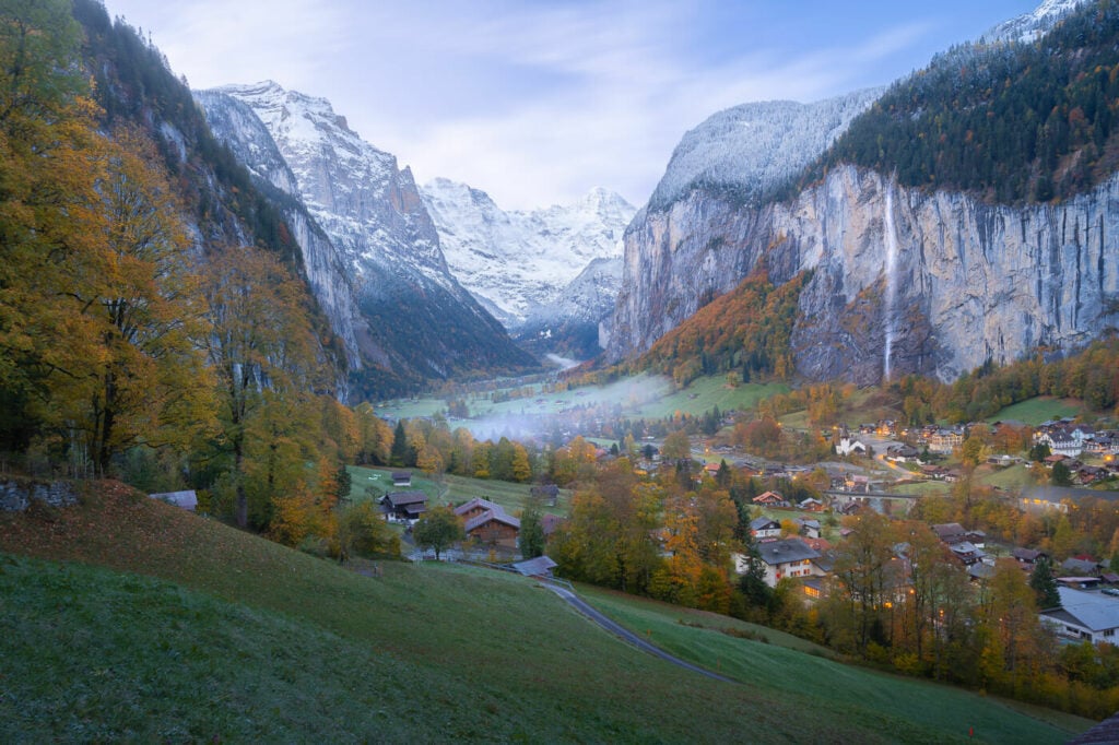
Lauterbrunnen and Staubbachfall shorty before sunrise.
Located in the Lauterbrunnental, this is the place that inspired Tolkien to Rivendell and Bruchtal. It is easy to see why; from some of the viewpoints around the valley, it really feels as if you are looking into a fantasy world.
Also, despite being very popular and tourist-friendly, this location has somehow managed to maintain its charm and its “fantasy” feel. Even more so if you wander around at sunrise or sunset when v very few others are around.
A bit of an interesting fact: at 297 meters, Staubbachfall is the highest free-falling waterfall in Switzerland.
Overview of the Lauterbrunnen to Wengen Hike & Map of the Best Staubbachfall viewpoints
Here is a quick overview of the trail from the station to the best viewpoints across town and on the trail to Wengen. This trail goes from the station to the viewpoints in town and the observation deck behind the waterfall, to then continues up to Wengen.
It’s a one-way trail, so you can take the train down and enjoy the views from the train too, which is what I usually do.
You can expand the map to view where each one of the photos in this post was taken, so you can use it as a guide to get there.
The GPX file is downloadable for free from this activity.
Best time to view Staubbachfall
The best time to visit the Staubbach Falls is from late spring to early autumn. Winter is too snowy/frozen and usually, the water volume of the waterfall is very low.
To have the best chances of seeing the waterfall with a considerable volume of water, late May to early July is the best time to visit Staubbachfall.
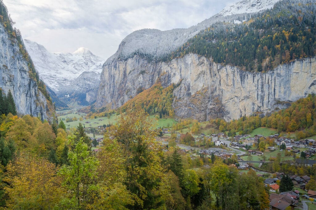
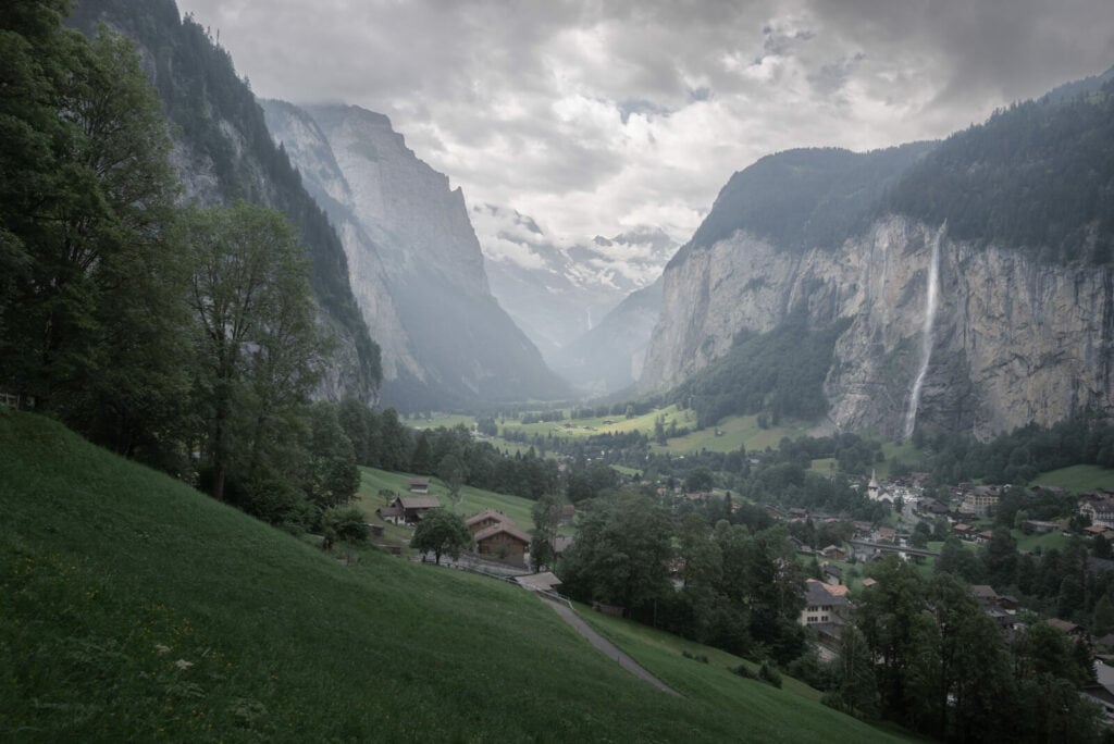
Staubbachfall on a late Autumn day in November. As you can see the waterfall is barely visible, due to the low volume of water at that time of the year.
How to get to Staubbachfall and Lauterbrunnen and Parking
You can easily get to Lauterbrunnen by either car or by train. You can’t, however, drive to Wengen; you can only get there by taking the train from Lauterbrunnen. here are the details:
- Driving Directions: The nearest highway is the A8, which you can easily reach from Bern via the A6 or from Luzern/Zurich via the A2. Then you’ll need to get off the highway at Interlaken to follow the signs to Lauterbrunnen.
- Parking: you have two main options with regards to parking. First, the parking at the train station. It’s big, with several floors. I usually park there and it’s a great option if you are planning to catch the train to or from Wengen. It’s a bit of a labyrinth though! The second option is the big parking area by the waterfall. This is probably best if you just want to visit Lauterbrunnen and view the waterfall as a quick stop. Both are paid
- Public Transport: definitely by train Lauterbrunnen is well connected with all the major towns. Luzern to Lauterbrunnen is two and a half hours by train, each way. So totally doable as a day trip. Add about one hour each way if you are coming from Zurich. Basel is also about two hours and a half. Bern is one hour and a half. Geneva is more than three hours. Interlaken it’s just about 20-30 minutes. Check the SBB planner for more details.
With the basics covered, let’s get to the best Staubbach Falls viewpoints in or around Lauterbrunnen.
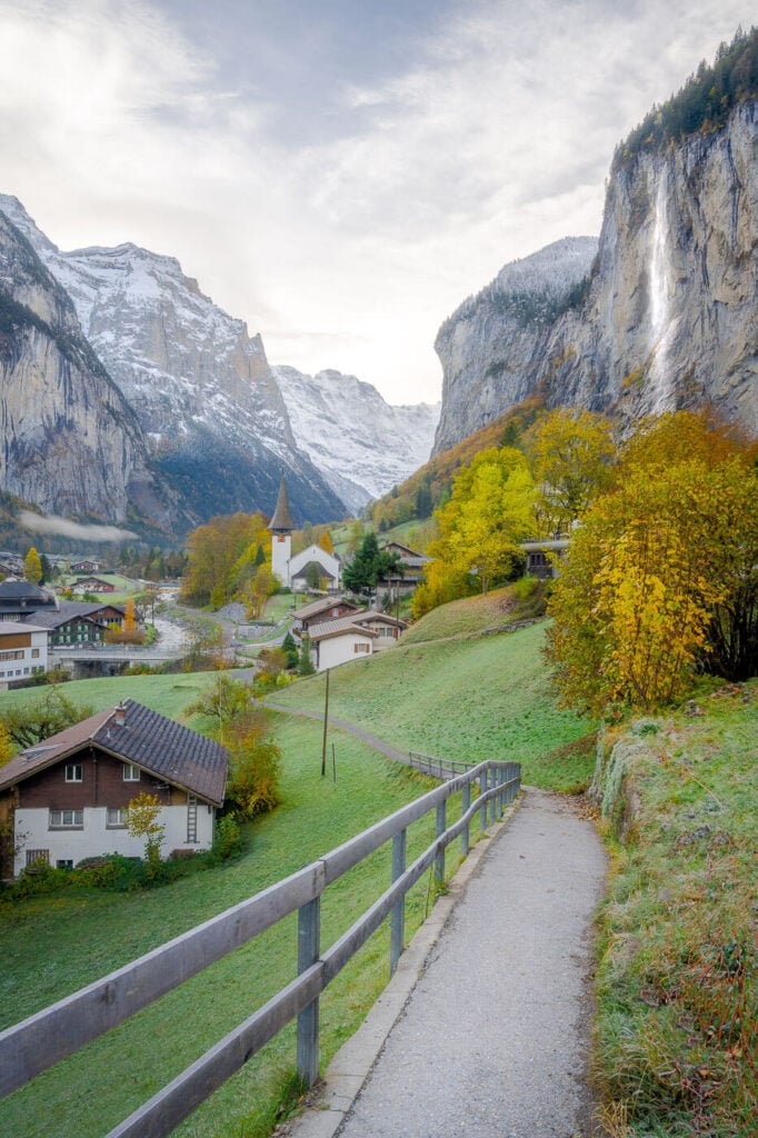
The Path by the Church
This may not be the easiest to find, especially if you come directly from the station. This path isn’t a much of thing for locals, it’s an Instagram thing. So nothing is pointing to it as a “point of interest”. This is the post I’m referring to:

The first time I visited and tried to find it I took several different paths up the hike and around town before finding it. And I found it because I saw other people taking photos there.
This is because if you look at Google Maps, there are photos of this viewpoint all over the place.
Behind the Waterfall
Did you know you can walk behind Staubbachfall? There is a narrow, wet path carved in the rock you can take to view the waterfall from behind:
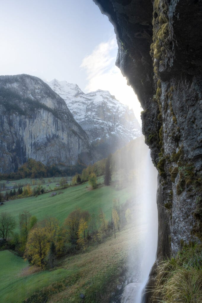
Apart from the views, it’s a fun thing to do. You are essentially hiking up into the mountain on a set of metal stairs into a cave and on the bare rock, with water constantly dropping from the rock face until you are literally behind the waterfall.
The path will be closed in Winter or whenever there are icy/slippery conditions.
Best Staubbachfall viewpoints from the Lauterbrunnen to Wengen Hiking Trail
Next, the hiking trail from Lauterbrunnen to Wengen. The trail is easy, and it’s pretty much a narrow, dirt road for the most part. The first part out of town is quite steep, but well worth the views.
There are three great viewpoints at the beginning of the trail.
The first one is right off the path on a field next to it. This is my favorite view of the valley, b because the Staubbach waterfall is still relatively close, but you also get a great view of the Lauterbrunnental Valley.

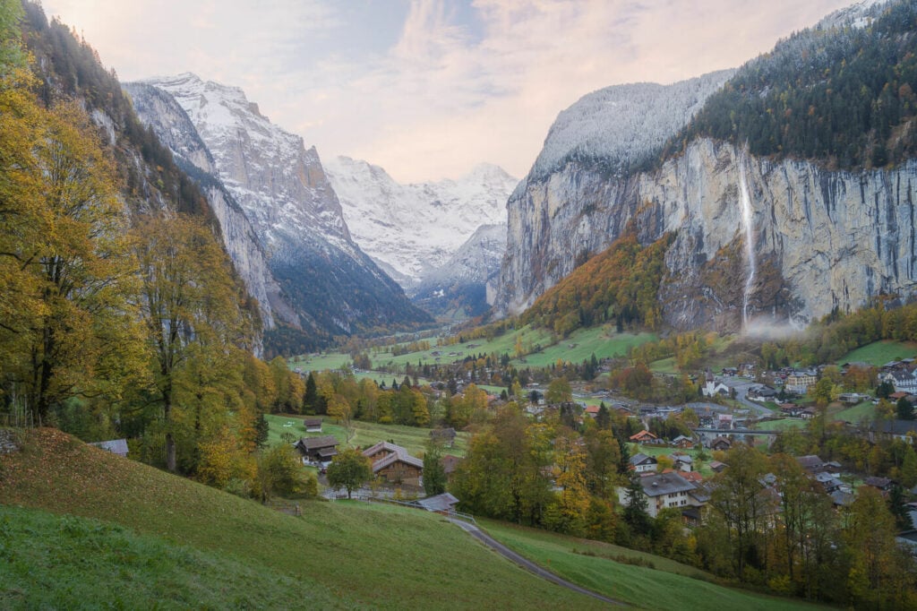
Sunrise at Staubbachfall.
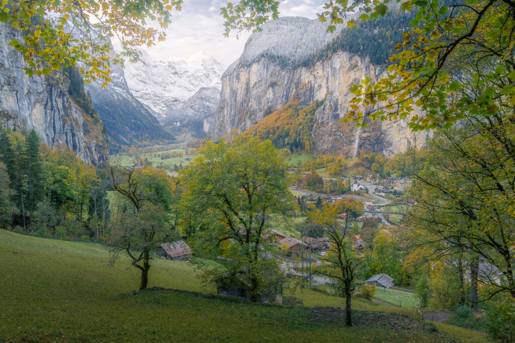
A little further up along the hiking trail, there’s another great sport where trees farm the view nicely. This spot is a three-minute walk uphill from the previous one.
What I like about this viewpoint is how the trees and the branches frame the landscape in
The last viewpoint on the hiking trail is right above the railway tunnel. Again, just it’s a three-minute walk uphill from the previous viewpoint. It’s right on the turn that goes further uphill and you can’t miss it as there is a stone wall.
This viewpoint is a little more elevated compared to the others, and the waterfall is somewhat closer in terms of distance.

Here, again, you can see what I mean when the waterfall is barely visible when the water volume is low.
Anyway, this is the last good viewpoint on the hiking trail to Wengen. So if you are doing it just for the views, you might as well turn back to catch the train – or if you prefer the hike, it would take about an additional 30 minutes to reach winged by foot.
Train to Wengen
One of the best views, and probably the most photographed, is the one from the train. Now if you want to catch it, you need to sit on the right-hand side of the train going up (to Wengen), and on the left-hand side going down (to Lauterbrunnen).
It’s an elevated viewpoint and while the waterfall is somewhat far, but still visible, you get better views of the whole Lauterbrunnental Valley.
This is the view I’m talking about:
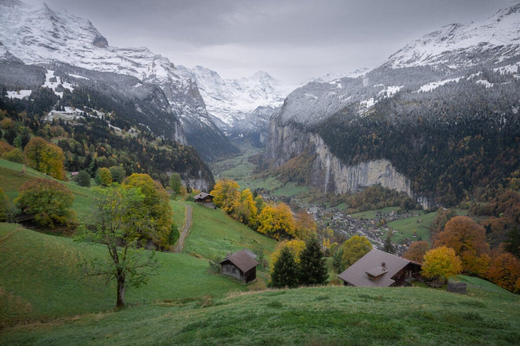
Shot from the moving train.
Be ready with the camera when the train comes out of the last tunnel before the Wengen train station, if you took the train up!
Also, make sure your shutter speed is faster than 1/200, at the very least, or you will get some motion blur. The photo above was taken at 1/200 from the moving train.
This covers the main and best Staubbachfall viewpoints. However, don’t forget to explore the area if you have more time! Especially around Wengen, there are a lot of trains and small roads you can take to find more amazing viewpoints. Keep exploring!
Where to stay around Staubbachfall
There is no shortage of accommodations in either Lauterbrunnen or Wengen – as well as nearby towns. It is a very popular location so unless you are visiting on a day trip, best to book your accommodation well in advance, especially in summer.
Additional Resources
- Check out the main Switzerland page for more hikes and an overview of Hiking in Switzerland.
- For more waterfalls in Switzerland, check out Stäubifall, Berglistüber, the Foroglio Waterfall, or the epic Engstligen Falls.



Leave A Comment