Stoos Ridge Hike – Epic Ridge Hike, Switzerland
The Stoos Ridge Hike between Klingenstock (1,935 m) and Fronalpstock (1,921 m) is undoubtedly one of the best ridge trails in Switzerland.
This is all for good reasons; the landscape is amazing, the trail is nicely maintained and not overly difficult, and the trailhead is easily accessible. No wonder it is such a popular hike, even in a region full of great hikes like Lake Lucerne.
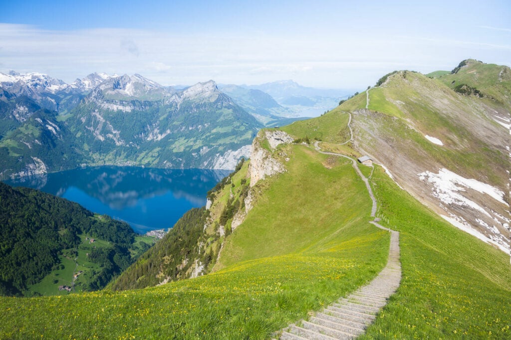
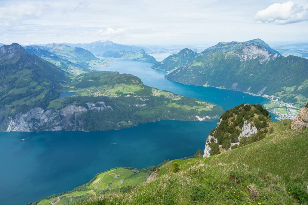
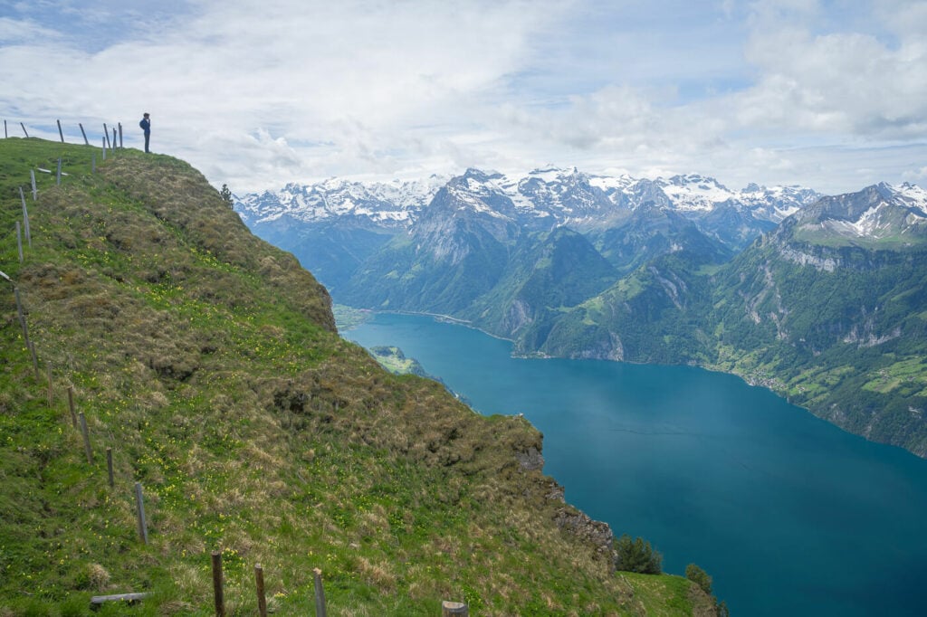
One of the many, beautiful panoramic views along the Stoos Ridge trail, with the southern part of Lake Lucerne on the left.
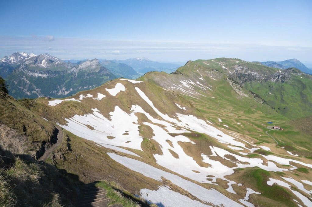
Depending on snow levels, the hike is usually possible from late spring until autumn. The time usually goes from the end of May/early June until late September or early October.
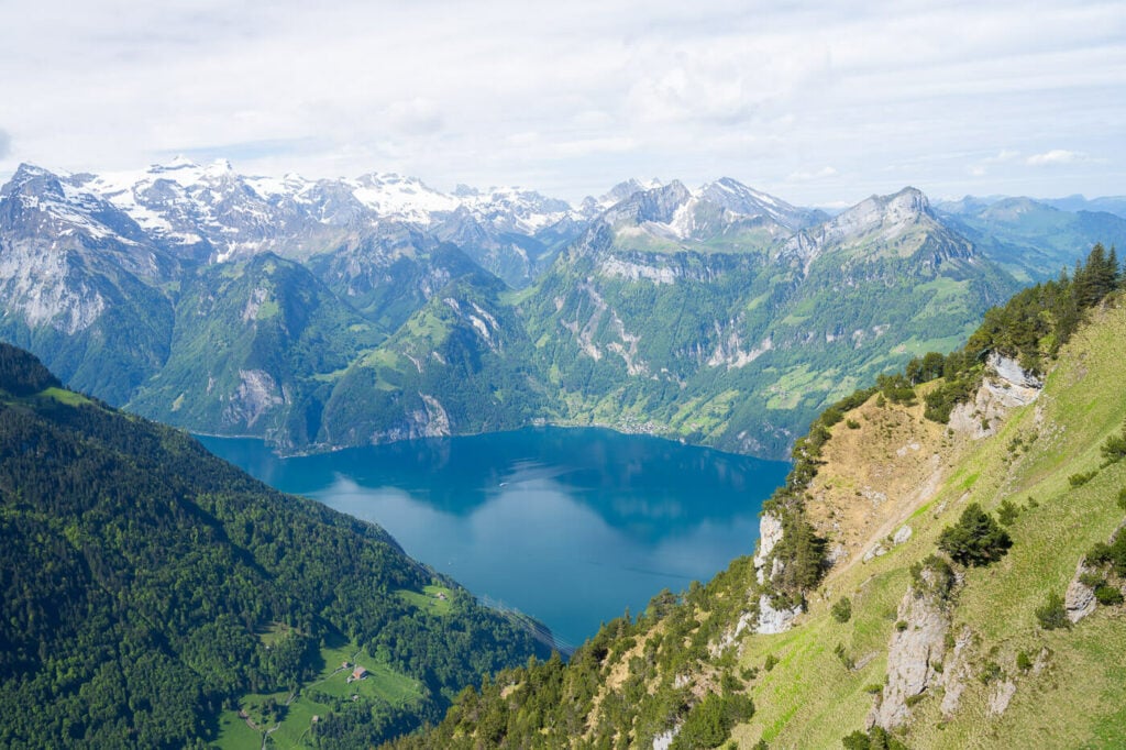
Regardless of the season, however, the epic views from Fronalpstock are always worth the effort.
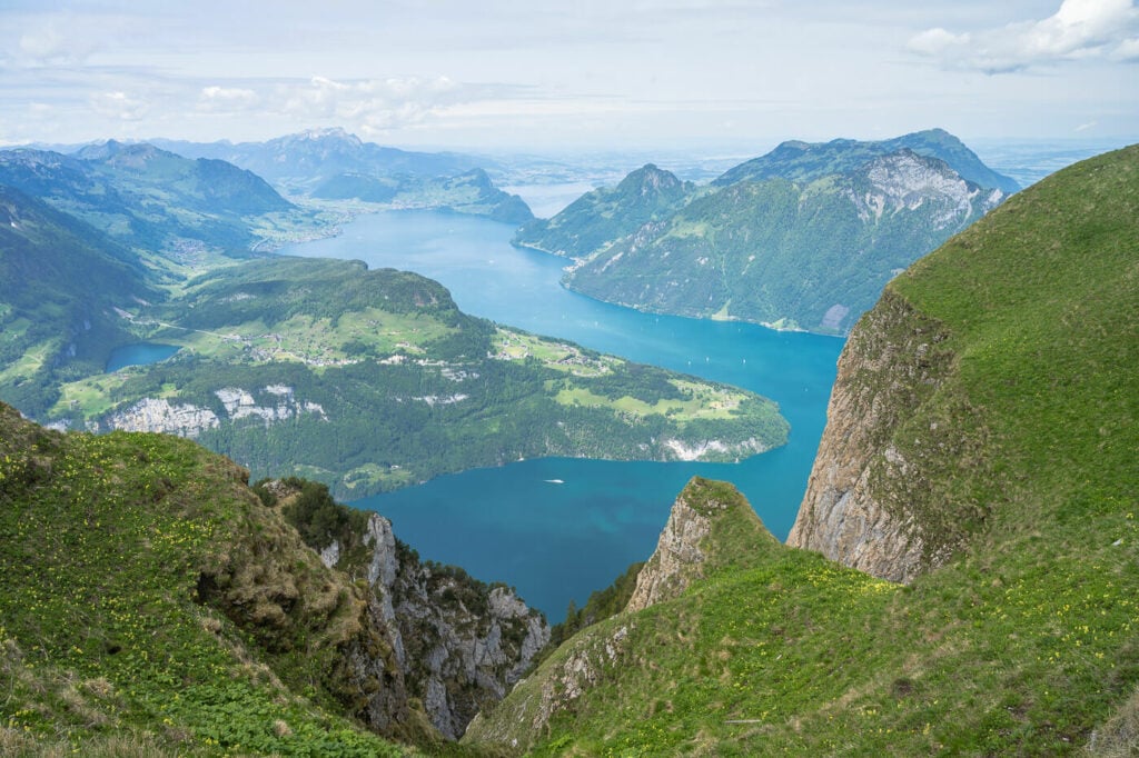
One of the many beautiful Fronalpstock viewpoints.
Tip: if you want to avoid the crowds, starting this hike early in the morning pays off, especially in Summer. You’ll meet fewer people on the trail.
Alternatively, you can do it later in the afternoon or early evening. The Fronalpstock chairlift operates until 10 PM on Saturdays from the 6th of May to the 16th of September.
Table of Contents
How to get to the Stoos Ridge Hike Trailhead
To hike the Stoos Ridge trail you need to get to Stoos first. From there, you can either take the chairlift or hike up the ridge. I’ll describe both hiking options later, in the meantime here is how you can get to the car-free village of Stoos.
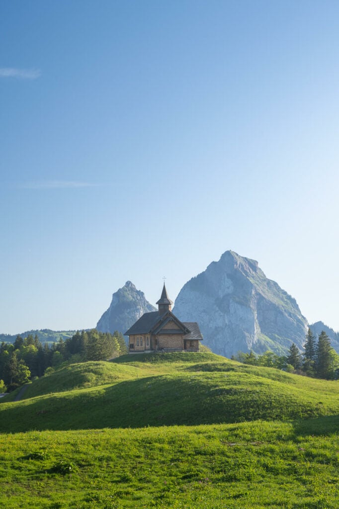
View of the little Church in Stoos, with the Kleiner and Grosser Mythen in the background.
If you are based in either Zurich or Lucerne, you can easily do this as a day trip using public transportation. The one-way trip to Stoos should take about 1:30/1:40 hours. This makes the Stoos Ridge trail a great day-hike option for anyone based in the area.
Tip: the trip to Stoos is included in the with the Swiss Travel Pass,
Stoos From Zurich:
From Zurich, it’s best to take a direct train to either Schwyz or Arth-Goldau. From either of these two towns, take Bus 501 to Schwyz, StoosBahn. That’s where you can take the funicular that will bring you to Stoos.
Stoos From Lucerne:
Similarly, you can take a direct train to Schwiz from Luzern. Then take Bus 501 to Schwyz, StoosBahn, then the Funicular.
You can purchase tickets on the SBB app, or you can use the Swiss travel pass; the trip to Stoos is included too, so that won’t cost you extra.
An alternative to the Stoos Bahn is the old Morschach cable car. You can get there by taking the train to Brunnen and then Bus 504 to Morschach.
By Car:
If you are renting a car or have your own, you can drive to the Stoos Bahn and take the funicular from there. Alternatively, you can drive to Morschach and take the old cable car to Stoos. That’s what I usually do; it’s usually less crowded. The price is the same as the funicular – a little over 10 CHF.
Gratwanderweg Stoos – The Stoos Ridge Trail Hiking Options
The Ridge trail, or Gratweg in German, can be done in both directions. From Klingenstock to Fronalpstock and from Fronalpstock to Klingenstock.
There is no best way to do it though Klingenstock to Fronalpstock is the most common direction of travel and the one I’d recommend too.
That’s simply because of the views from Fronalpstock, which I personally find to be the best view of Lake Lucerne. However, the panorama in front of you toward Klingenstock, isn’t exactly bad either.
View toward Klingenstock.
Stoos Chairlifts to Klingenstock or Fronalpstock
Once in Stoos, you can buy the chairlift ticket to either Klingenstock or Fronalpstock and hike the ridge from there. You can check the timetable on the SBB app or website, although you can only buy the chairlift tickets in Stoos.
At the time of writing, prices for a single trip to or from either Klingenstock or Fronalpstock is 22 CHF. The full overview of prices can be found here.
Here is the overview and the map of the Klingenstock to Fronalpstock:
| Max Altitude | 1,935 m |
|---|---|
| Distance | 4.40 KM (one way) |
| Elevation gain | 220m ↑ / 200m ↓ |
| Hike time | 02:00/ 02:35 Hours |
| Hike Difficulty | Moderate |
Stoos Ridge Hike without Chairlifts
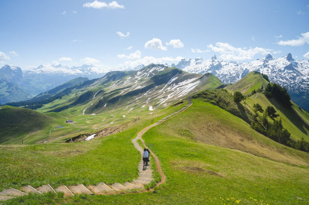
From Stoos: You can also hike directly from Stoos to either Fronalpstock or Klingenstock. That adds about 1/1:15 hours each way and about 700m of elevation gain to the hike. Here is the map of the Hike from Stoos:
Stoos-Klingenstock Trail. Klingenstock is the mountain in the middle, toward the left.
From Morschach: If you prefer to spend a long day on the trail and avoid the funicular or the cable car, you can even hike up and back from Morschach to Stoos and Fronalpstock/Klingenstock; this is the cheapest option, but also the hardest. In total, it would take almost 7 hours for the roundtrip from Stoos, and the elevation gain is about 1,400 for 22KM of Hiking.
I did it myself a couple of times. The hike from Morschach to Stoos is a gravel road on the side of the mountain through the forest, nice enough to justify the effort if you have the time to do it. Here is to the map if the hike from Morschach.
Hiking the Stoos Ridge from Klingenstock to Fronalpstock
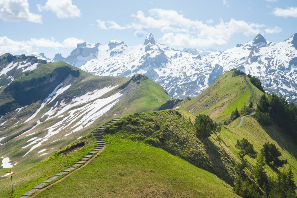
Whether you reached Klingenstock hiking from Stoos or with the chairlift, you now have the most scenic part of the hike ahead of you. The trail is rated as T3, which is still a “challenging mountain hike”.
The trail is not particularly difficult. It’s categorized as T3 probably because of some moderately exposed sections protected by chains anyway.
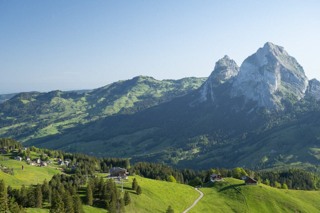
Stoos, on the left and the Grosser and Kleiner Mythen, on the right.
Also, the trail is nicely maintained, and the path is always visible. There are steps on the steepest slopes to help hikers safely get up and down then the trail. Still, the trail is never too steep, except maybe for the last part toward Fronalpstock. Even then, it’s a short climb.
Anyway; if you started your hike in Stoos, completing the section of the trail from Stoos to Klingenstock will take about an hour. In my opinion, the hike from Stoos is worth it just for the view of the mountains just before reaching Klingenstock summit, the photo below.
View of the Ridge – which is not part of the trail, just before reaching Klingenstock’s summit from Stoos.
Most of the trail to Klingenstock is a dirt road, which, after about half an hour, turns into a trail up the side of Klingenstock. The last part is moderately steep. but nothing that requires scrambling.
If you are taking the chairlift from Stoos, the ride takes exactly 7 minutes.
Klingenstock
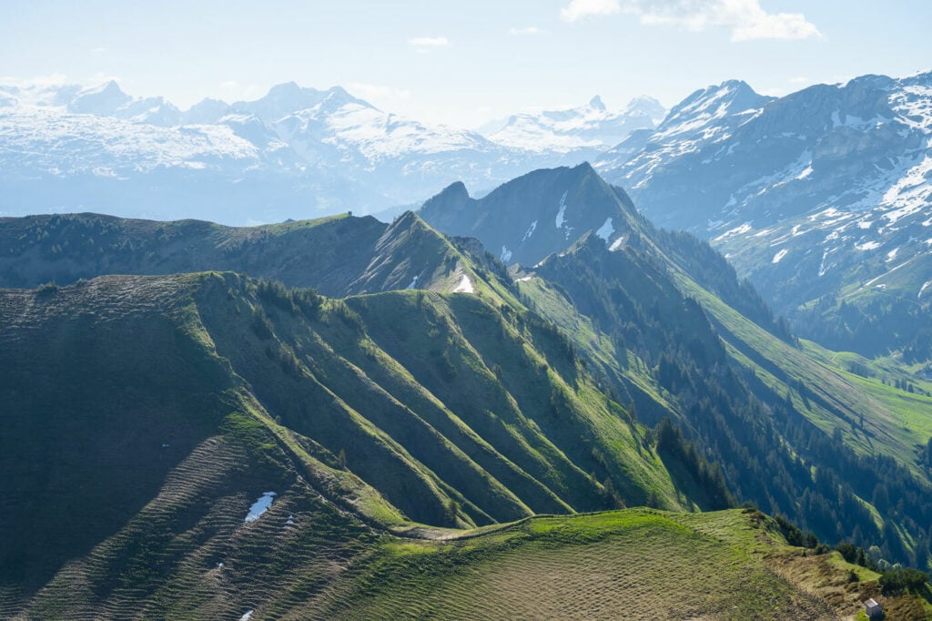
The summit of Klingenstok is equipped with a few benches, tables, and a panoramic board that shows the mane of the countless mountains visible from there. The views of the Alps to the south and the Ridge in both directions are spectacular
You don’t get a view of Lake Lucerne from Klingenstock, but you get a good view of the panorama and the ridge all the way to Fronalpstock.
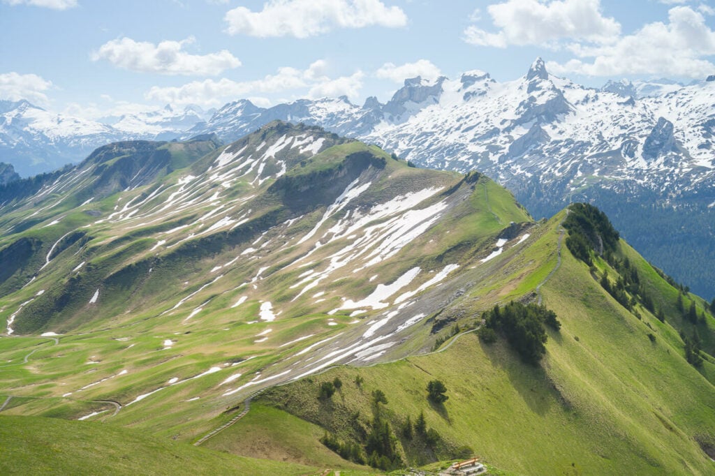
View of the ridge from Klingenstock. Fronalpstock is the mountain toward the right-hand side, so you can almost see the whole trail.
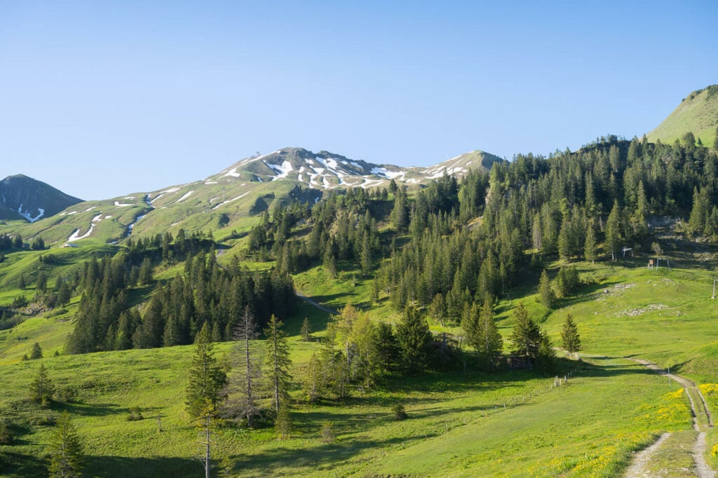
Right past Klingenstock, the trail is mostly flat, at least the first part. As you hike northward, you’ll have the first view of Lake Luzern and the cliffs on the northern side of the trail.
There are plenty of panoramic points along the way and it’s worth stopping at each one of them to soak in the views. You can see all the major mountains around Lake Lucerne, like Mount Pilatus, the Rigi, and the Niederbauen Kulm.
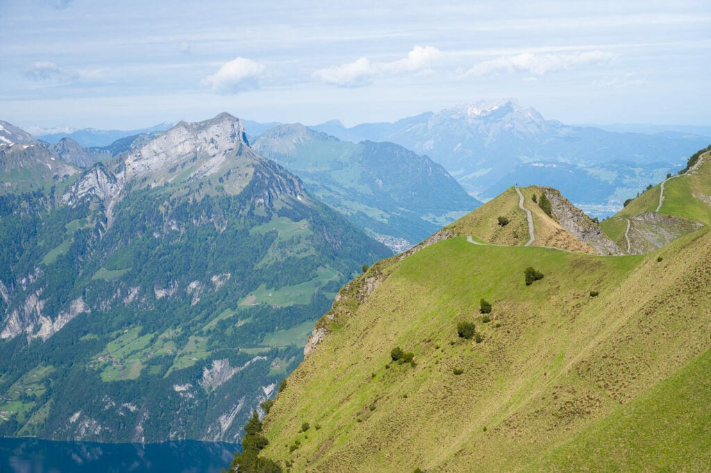
View from the trail, with the Niederbauen Kulm on the left, Mount Pilatus in the background.
Panoramic view looking back toward Klingenstock
Huuser Stock
One of these viewpoints is the top of Huuser Stock observation point. Located at about halfway through the trail, you can reach this peak with a short out-and-back detour from the main trail.
The deviation is signposted, so you’ll come across it. It adds 10-15 minutes to the whole hike, and it’s worth it.
Apart from that, there are several other smaller peaks you can stop at, and all of them offer fantastic views.
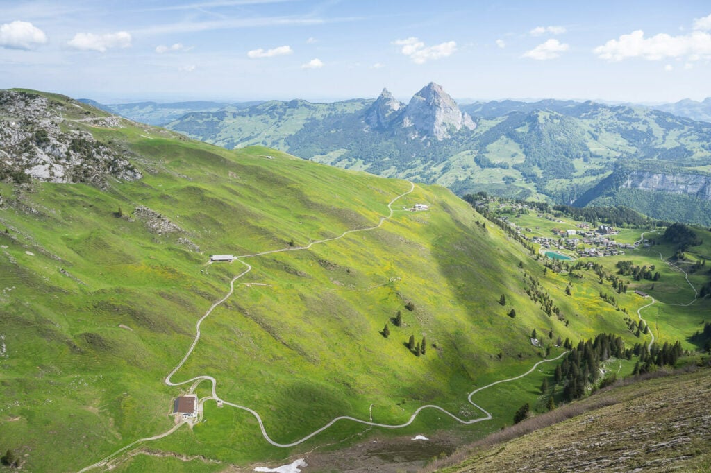
Stoos, the small village on the right.
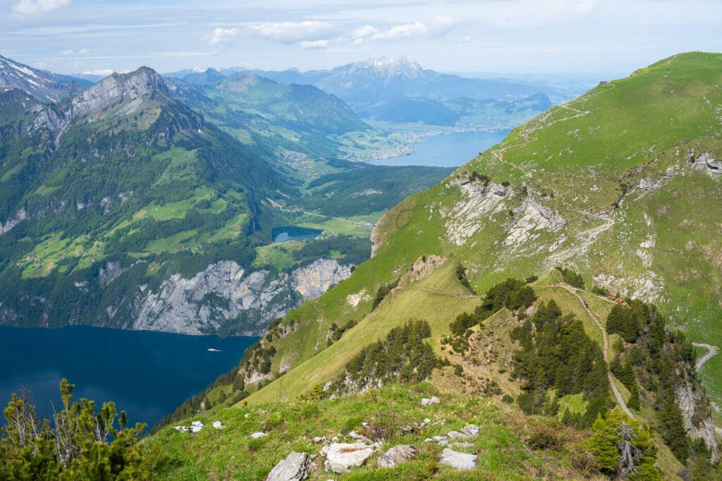
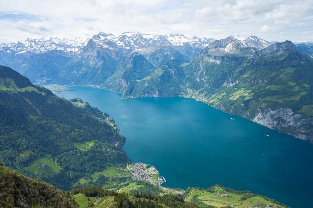
Fronalpstock
I have already talked about Fronalpstock in two previous posts and am happy to do it a third time. This is my favorite view of Lake Lucerne – and I hiked all the mountains around it. I’ve been here five times, even once in snowshoes and each time I spend at least an hour watching the panorama from the viewpoint at the top.
If you are a photographer, you could attempt to catch the sunset from there. I never managed to get good conditions or get there where the conditions were good – despite living a short 40-minute drive away from Morshach.
Anyway in summer the sun will set opposite Fronalpstock, providing ideal conditions to capture epic sunsets, assuming the weather cooperates. I’ll surely do this hike once more, during the afternoon golden hour, to be at Fronalpstock for Sunset.
All the photos in this post were taken with a 24-70mm lens. that range should cover most of the possible uses. A wider lens may be more handy when taking photos from Fronalpostock.
Video of the Hike
Last but not least, here is almost a short video of this hike:
Where to Stay
As mentioned this is doable as a day hike from places around Lucern or even Zurich. However, if you want to spend a night in the mountains, Stoos is the most obvious choice. There are a few hotels there as well as a few bars and restaurants.
You can even spend the night at the Fronalpostock Gipfel Restaurant on Fronalpstock. That would require advanced booking. and it is a great option if you want to watch the Sunset from there, one enjoy the view of a starry night on the mountains when the weather is clear.
Booking.comAdditional Resources
- If you are looking for other great hikes around Lake Lucerne, you may also want to check out the Best Hikes around Lake Lucerne.
- For a broader overview of Hikes in Switzerland and for a general introduction with essential information about hiking in Switzerland, you may want to check out my main Switzerland page.


Leave A Comment